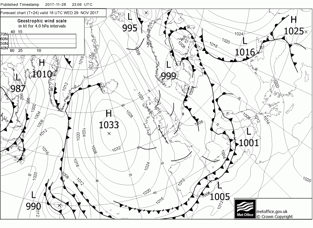
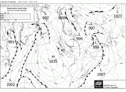
The current synopsis is low pressure to the east centred on southern Norway and high pressure south of Iceland thus today a continuation of the cold northerly winds, perhaps a tad east of north with wintry showers mainly in the north and east . Elsewhere dry and sunny but cold everywhere with an icy start.
Much of the same tonight remaining windy with showers concentrated in the north and coastal areas and another cold night and icy tomorrow morning. During tomorrow a slight change of emphasis as the high pressure tends to ridge north east and the low south to Denmark thus veering the surface wind north east and onshore along the east coast. With the advent of a trough in the flow frequent showers, or longer periods of snow, are quite possible along the east coast down as far as East Anglia and even down to the south east later on.

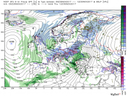
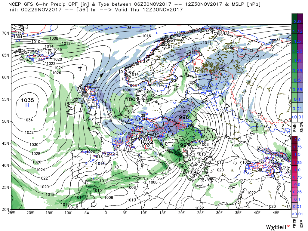
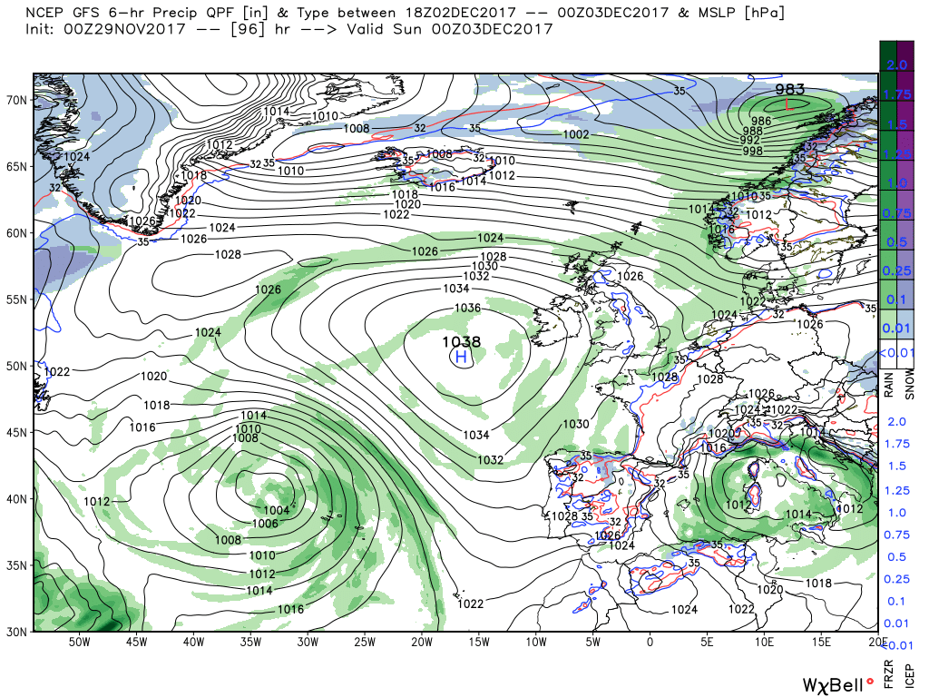
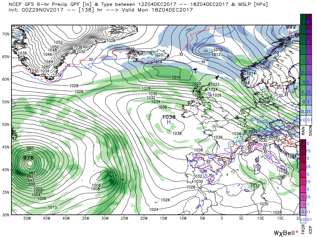
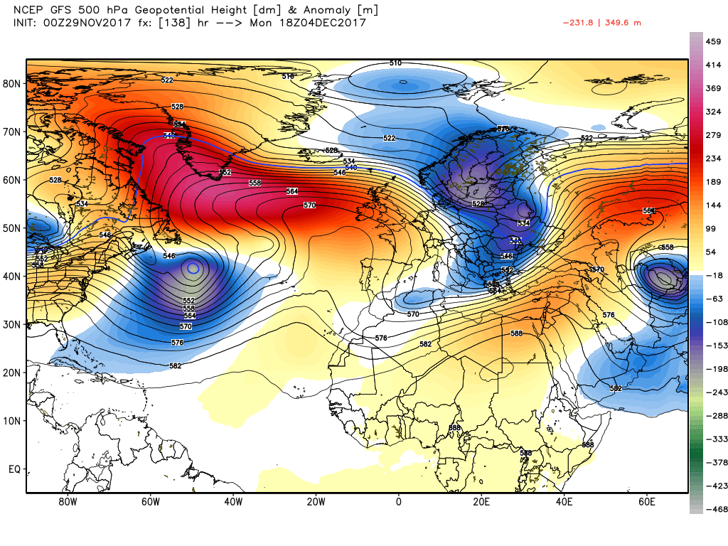
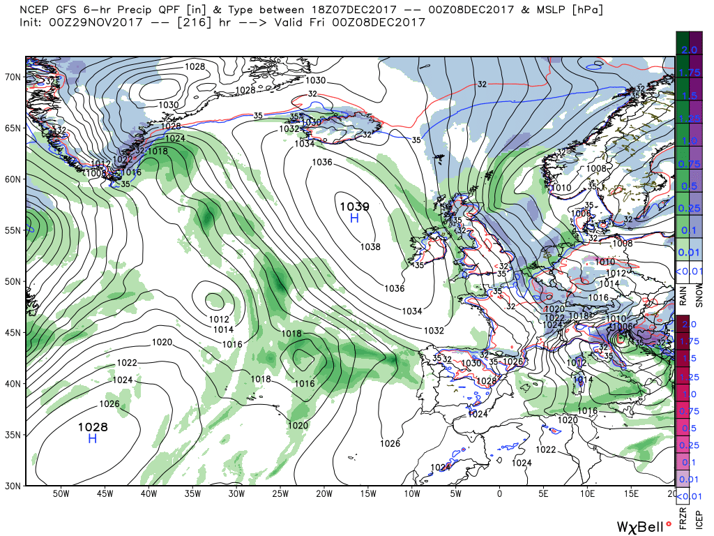
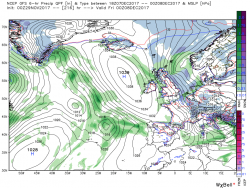
By Friday midday the low has slipped south west and just about lost it's identity with the last of the precipitation clearing the south east as the ridge slips south over the UK cutting off the cold northerly flow and raising the temps to near average. The ridge continues to remain influential over the weekend with the high centred west of Ireland but by late Monday it is coming under pressure from two directions. One from energy/troughs leaving the eastern seaboard to the south west and the other as energy sweeps around Greenland and south east towards the UK all of which has the combined affect of disrupting the high cell and bringing some rain into the north west
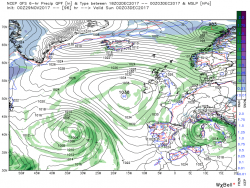
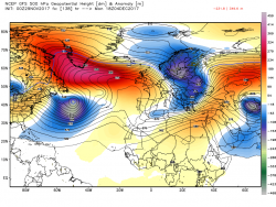
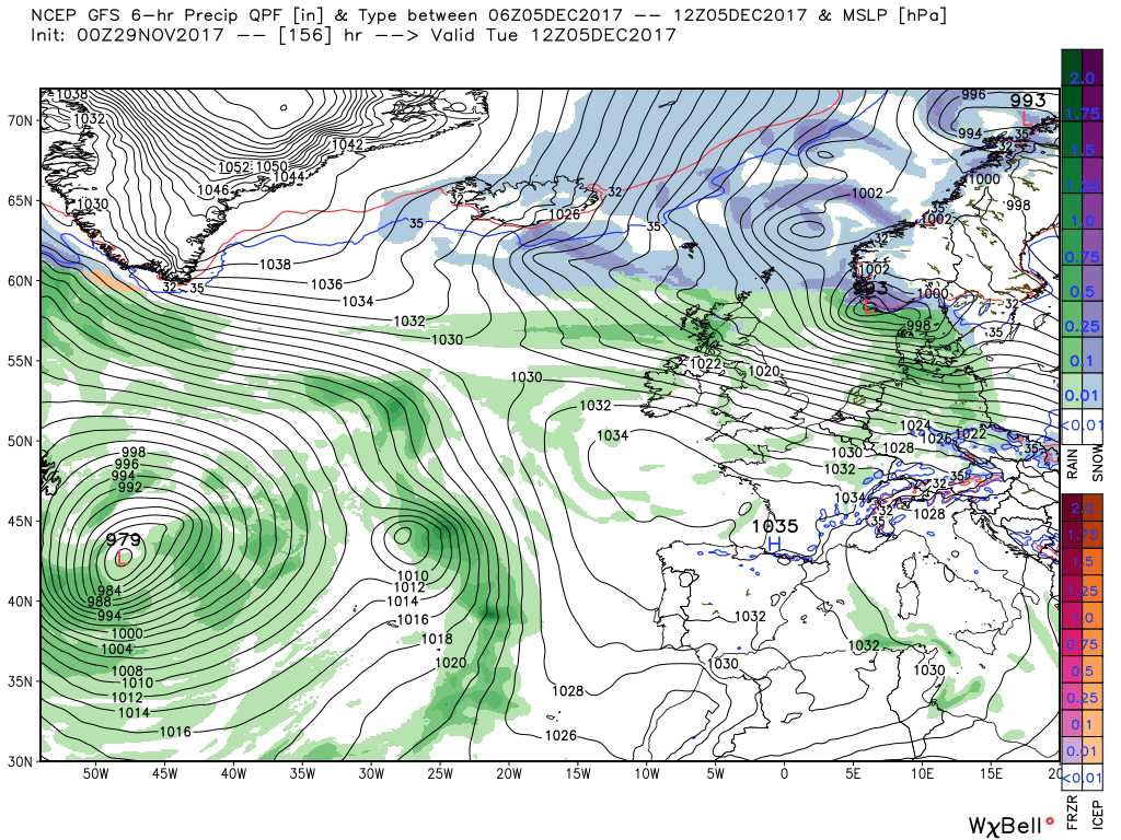
As can be seen by the last chart a shallow wave has formed on the front and this deepens and tracks quickly east be Oslo by 12 Tueday with the front edging south over Scotland. This front represents the delineation between the cold air to the north and the warmer to the south west.from where pressure continues to be exerted on the high.
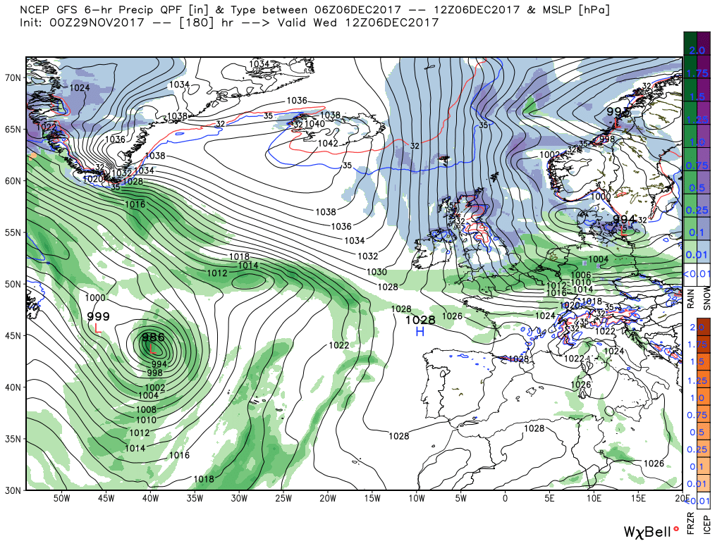
Within 24 hours, by 12 Wednesday, this pressure has split the high with the main centre now over Iceland whilst simultaneously the aforementioned front has cleared the south of England and the surface wind veering bringing the UK once again into a cold, unstable, northerly airstream which lasts until the end of the week. But as always this period is still very much subject to revision.
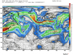
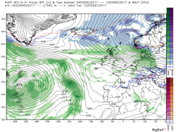
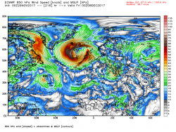
Not surprisingly the ecm also has a trough lying along the north east coast tomorrow with a band of precipitation so quite possible a fair dose of snow showers/longer periods? but it might well be a little knife edgy. Best consult the more detailed models,
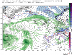
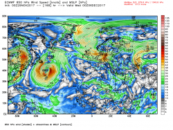
Further afield it starts to diverge from the gfs at the beginning of the week as it has the frontal wave more advanced and further north so that at T144 it is over the coast of central Norway with a second wave and front moving east over Scotland through Monday night into Tuesday. This front is the boundary between the warmer air to the south and the colder air to the north/ It quickly moves east into Denmark leaving much of the UK in cold north westerly airstream by T168 with wintry showers in the north and west.
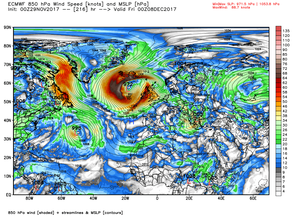
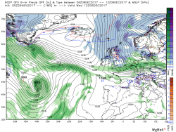
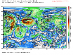
But this is very transitory as the high pressure to the west comes under severe pressure from.troughs tracking from the south east seaboard and the north west and after some brief ridging into the UK at T192 it is swamped by a significant Atlantic low.as gales and heavy rain, not forgetting much warmer air, descend on the UK from the west.


") P
P