UK meteorology

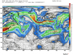
It looks like Felix the cat on acid (the viewer not the cat)
If you follow the fine white lines, those are isobars, albeit they're at the 500hPa level, which is quite high up. They essentially show the the upper flow. As to the shading, it shows geopotential heights, which is a measure of how rapidly the temperature drops with height, or how cold the air mass is at upper levels. It's a roughly a proxy for areas of high and low pressure, so we can say that the output shows an Atlantic longwave ridge and western European trough, with the upper wind generally from the northern quadrant. This is also at the level of the vortex, which can be equated to the red-purple shading.
 
Nothing worn under this kilt ... all in fine working order !

JohnnyO. Zo/

9 yards of wool round the family jewels tends to keep the cold at bay nicely doesn't it? Having said that the first kilt I ever wore was my Dad's WWII army one - going commando was a bit like sitting on a scourer covered in itching powder.

My grandfather used to say they were great to wear in the trenches. Kept you warm, mostly high enough to avoid the mud and worked as an extra blanket; the only problem was when the pleats froze in winter they'd slice the backs of your legs as you walked. Just in case you are planning a bit of reenactment in the back garden if Chris' "snow that may or may not happen" turns up.

@chrisbell I went and had a look on the Earth Wind Map on the strength of the trippy Felix pic, shows it quite nicely.
 
Nothing worn under this kilt ... all in fine working order !

JohnnyO. Zo/
9c2.gif
 
@chrisbell I went and had a look on the Earth Wind Map on the strength of the trippy Felix pic, shows it quite nicely.
For those 500hPa height charts, you'll need to set Earth Wind Map at the same level - anything lower in the atmosphere (700hPa or above) will show influence from surface features such as surface lows and (in the winter over the Eurasian and N. American landmasses) cool pool highs rather than the jet itself.
 
This morning's opinion:
The current synopsis is low pressure to the east centred on southern Norway and high pressure south of Iceland thus today a continuation of the cold northerly winds, perhaps a tad east of north with wintry showers mainly in the north and east . Elsewhere dry and sunny but cold everywhere with an icy start.

Much of the same tonight remaining windy with showers concentrated in the north and coastal areas and another cold night and icy tomorrow morning. During tomorrow a slight change of emphasis as the high pressure tends to ridge north east and the low south to Denmark thus veering the surface wind north east and onshore along the east coast. With the advent of a trough in the flow frequent showers, or longer periods of snow, are quite possible along the east coast down as far as East Anglia and even down to the south east later on.
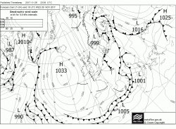
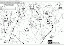
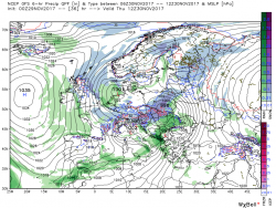
By Friday midday the low has slipped south west and just about lost it's identity with the last of the precipitation clearing the south east as the ridge slips south over the UK cutting off the cold northerly flow and raising the temps to near average. The ridge continues to remain influential over the weekend with the high centred west of Ireland but by late Monday it is coming under pressure from two directions. One from energy/troughs leaving the eastern seaboard to the south west and the other as energy sweeps around Greenland and south east towards the UK all of which has the combined affect of disrupting the high cell and bringing some rain into the north west
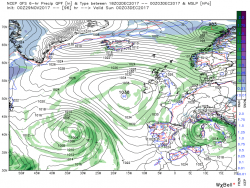
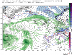
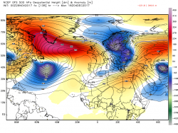
As can be seen by the last chart a shallow wave has formed on the front and this deepens and tracks quickly east be Oslo by 12 Tueday with the front edging south over Scotland. This front represents the delineation between the cold air to the north and the warmer to the south west.from where pressure continues to be exerted on the high.
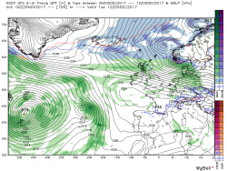
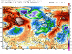

Within 24 hours, by 12 Wednesday, this pressure has split the high with the main centre now over Iceland whilst simultaneously the aforementioned front has cleared the south of England and the surface wind veering bringing the UK once again into a cold, unstable, northerly airstream which lasts until the end of the week. But as always this period is still very much subject to revision.
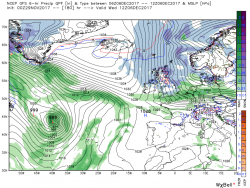
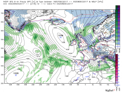
Not surprisingly the ecm also has a trough lying along the north east coast tomorrow with a band of precipitation so quite possible a fair dose of snow showers/longer periods? but it might well be a little knife edgy. Best consult the more detailed models,

Further afield it starts to diverge from the gfs at the beginning of the week as it has the frontal wave more advanced and further north so that at T144 it is over the coast of central Norway with a second wave and front moving east over Scotland through Monday night into Tuesday. This front is the boundary between the warmer air to the south and the colder air to the north/ It quickly moves east into Denmark leaving much of the UK in cold north westerly airstream by T168 with wintry showers in the north and west.

But this is very transitory as the high pressure to the west comes under severe pressure from.troughs tracking from the south east seaboard and the north west and after some brief ridging into the UK at T192 it is swamped by a significant Atlantic low.as gales and heavy rain, not forgetting much warmer air, descend on the UK from the west.
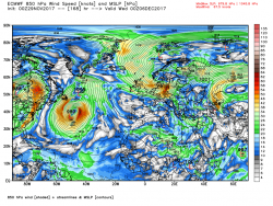
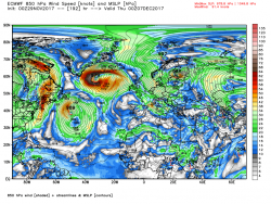
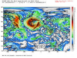
In other words, GFS says cold next week, ECM says warm and unsettled.
 
Interestingly, another member is a retired Met Office meteorologist who specialises in the anomaly charts, which show the probable deviations of pressure and geopotential heights from the mean, and his analysis back the ECM:
No real help from the anomaly charts, see below, no real agreement with one another. The NOAA version has shifted from its meridional pattern to a more westerly type, still with very slight ridging towards Greenland. So I suspect the idea of any deep cold, other than a 24-48 hour type, is not likely in the next 2 weeks, once the less cold type sets in by the end of this week.
 
I know this is lengthy, but I thought I'd post this as a currently-relevant 'lesson' post. I didn't understand the mechanism it discusses until I now read it, so this is one of those lessons where I'm passing-on something I've just learned rather than explaining something I was already familiar with. It was posted in the El Nino Southern Oscillation (ENSO) thread on Netweather in response to a question of why strong La Nina ENSO phases tend to make for zonal Atlantic flows and hence mild unsettles winter conditions in the UK:

In simple terms the equatorial Pacific is the engine room of the entire global weather system. In a Nina the cooler waters encourage less convection and hence less storm activity and this in turn means there is less energy transferred to the northern hemisphere circulation. With less energy this tends to suggest waves of lower amplitude circling the earth... and without sufficient amplitude we end up with a flatter pattern. For us at 55 degrees we are then in a poor position because the normal position of the jet stream will tend to fire systems straight across the Atlantic at us in winter. For a higher lat block to be encouraged to take hold we need a more “wobbly” wave pattern courtesy of Pacific energy and atmospheric momentum.

The current Nina pattern is centred in the eastern Pacific. Pacific convection begins in cycles much further west than this. Those who are forecasting opportunities for cold later in the season are hoping that convection anomalies in Indian Ocean and central Pacific will produce forcing that will be sustained as the convection pattern moves east despite the cold waters in situ currently off Peru. Others think those cold waters will neutralise the pattern just when it hits the crucial eastern Pacific sector which is particularly important for blocking in our part of the world.

I am hoping Nina may fade just as the next cycle (MJO) begins, allowing a crucial input of energy into the system in the heart of winter. The next MJO cycle ought to begin in mid/late December, perfect timing for impacts in mid Jan. But if Nina strengthens.. and the atmosphere has already coupled to the Nina signature that will encourage flat westerlies across the Atlantic, then we will struggle to get blocks high enough. Azores High, or Euro High, influence will likely grow and then our winter sags.

The same Pacific forcing also has an impact on the stratosphere via potential vertical wave breaking of warm air upwards. This is another complex situation, but to maximise the benefits of the next Pacific cycle it wouldn't be w bad thing to see an aleutian low in the North Pacific coupled to a Siberian High. These 2 features, properly positioned, can encourage vertical wave activity by adding energy to the atmospheric circulation via mountain torque and also disrupting the intensity of the vortex by firing broadsides of warmer air into the vortex as part of the torque event. I struggle to visualise the mechanics of this in all situations because these warm air attacks can disrupt the vortex in what seems to be a myriad of different ways, but once disrupted lower zonal wind speeds can also aid in blocks becoming established at high latitude.

Long and short of it is that the Pacific is absolutely key to patterns of weather in the North Atlantic. The obvious final point is that an incorrect seasonal assessment of Pacific patterns means any seasonal forecast for the UK ends up inaccurate. The reality is that the Nina forecast is not carved in stone and therefore, if the starting pacific conditions are incorrect in model calculations, then no matter how great the computer power the resultant forecast is damaged. UKmet forecasts of Nina are on the strong side compared to ECM at the moment, and I think this is important when considering Glosea output. But the last 3 Glosea runs have sequentially suggested less mild and more potential for cold... though the probability maps still suggest mild more likely than cold form the coming season. My interpretation, for what it is worth, of that trend is that all models are seeing a relaxing of the Nina signature as we hit January and so chances for blocking in mid to late winter may be gently increasing. However this is all conjecture at this stage really... but to finish with a direct Nina comment: if we want decent chances of proper cold in mid winter it will help if Nina doesn't drop too deep.
 
Back
Top Bottom