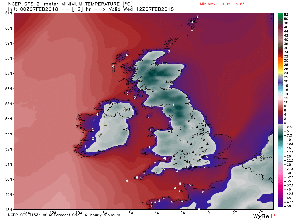
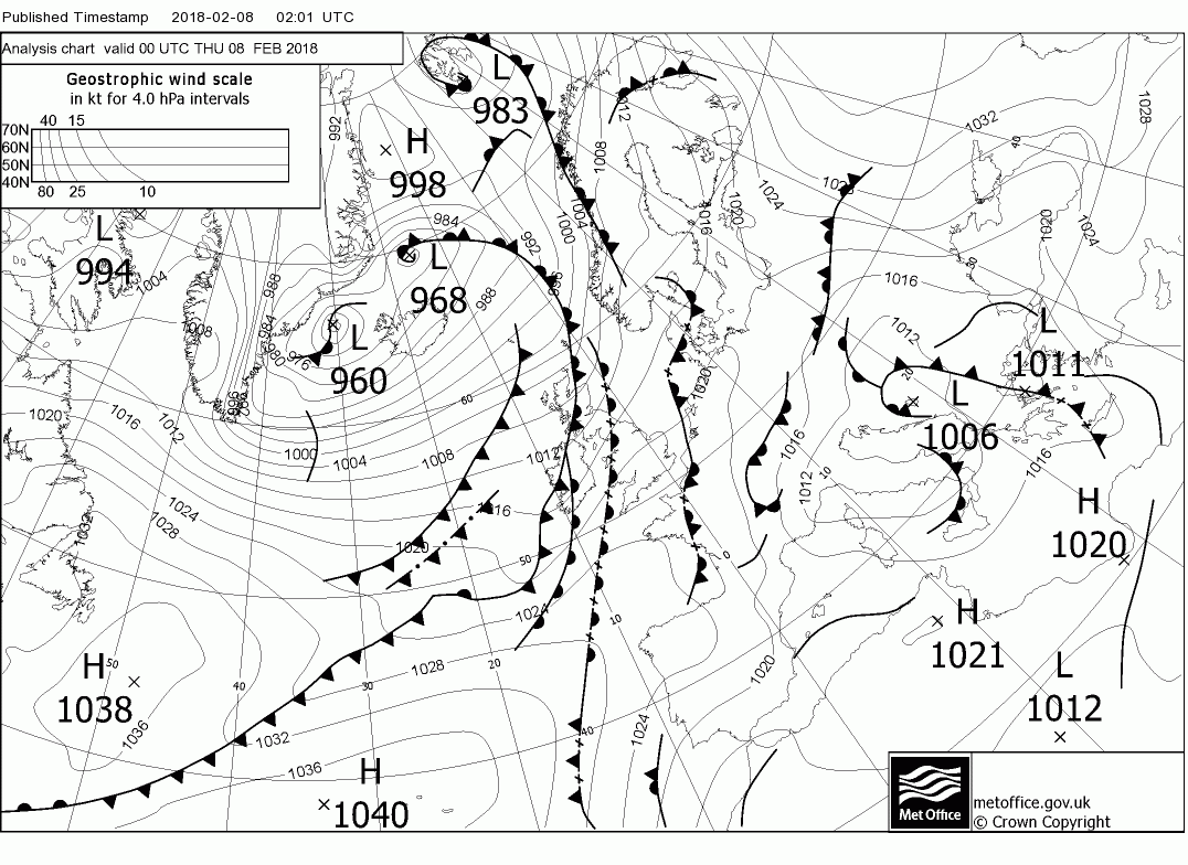
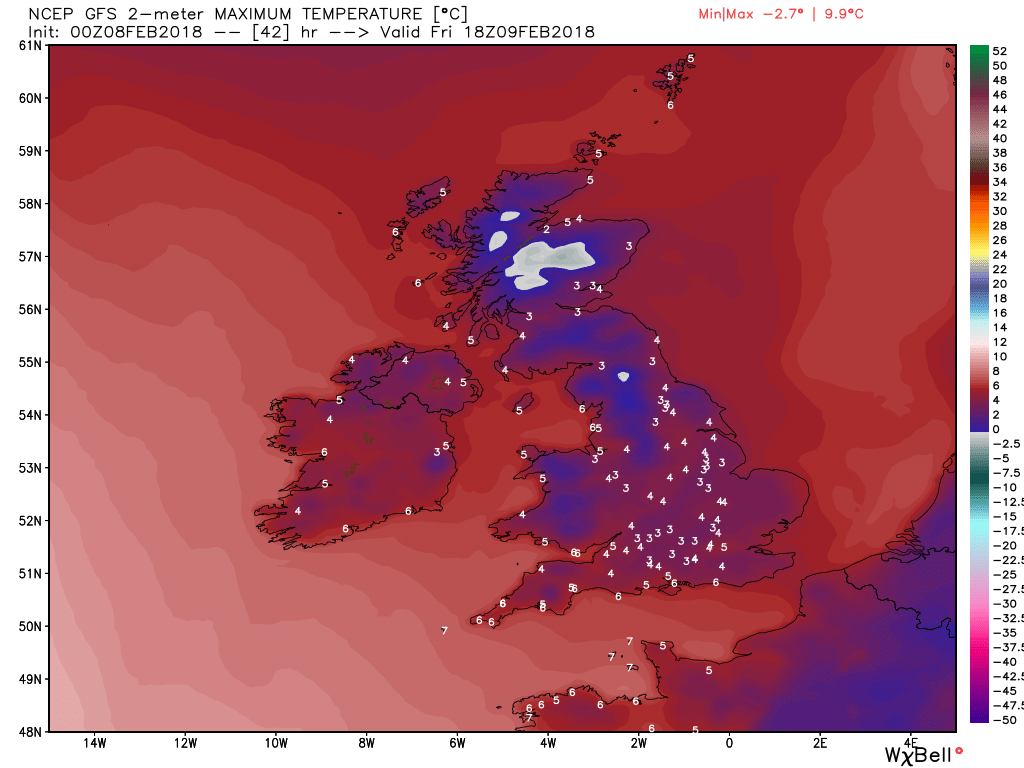
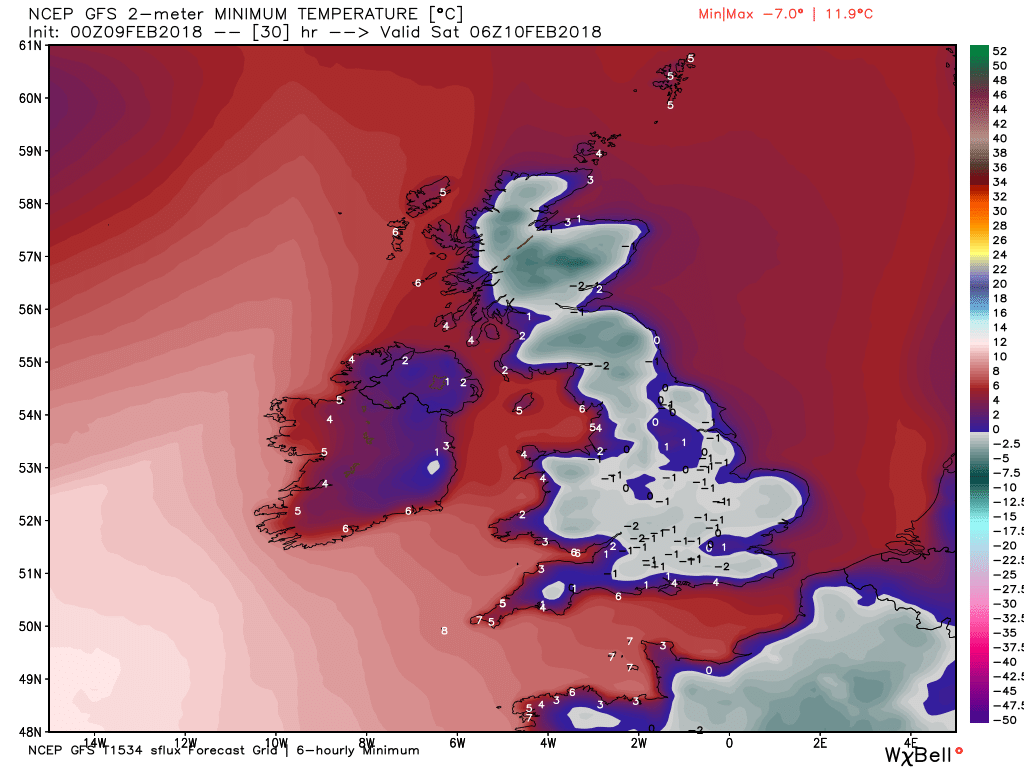
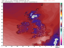
Today is pretty much of a mixed bag but essentially the main front and moderate rain is currently affecting south eastern regions but will clear during the morning to clearer colder conditions. But there is another band of patchy rain, sleet and possibly snow on the higher ground following on behind that will affect the SW, Wales, the Midlands and the north. Behind all of this squally wintry showers in N. Ireland, NW England and Scotland will be more widespread for a while and quite windy in places but later the showers will die out leaving a quiet night. Quite a cold day with a widespread frost overnight.

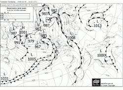

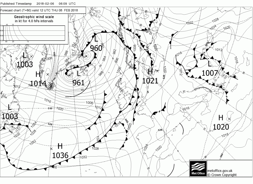
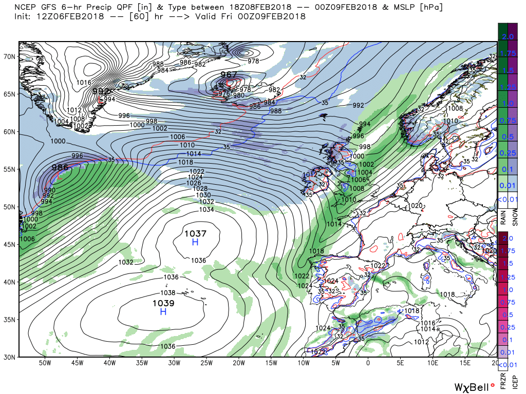
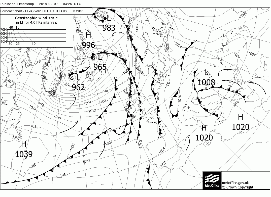
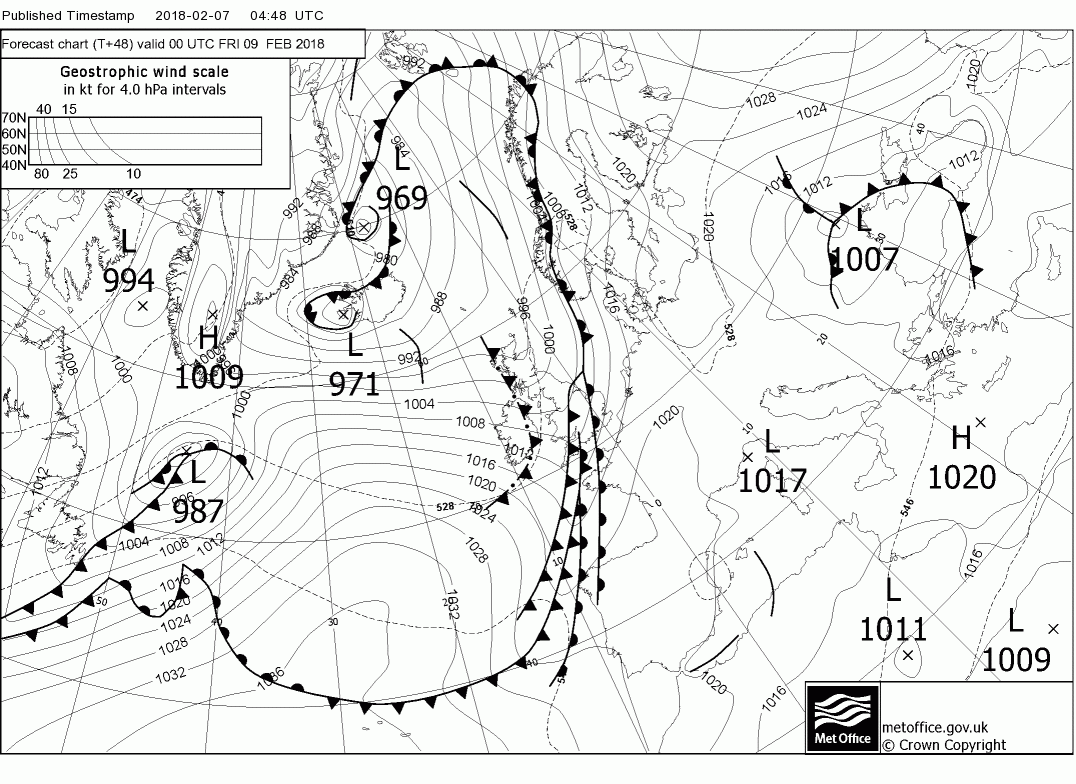
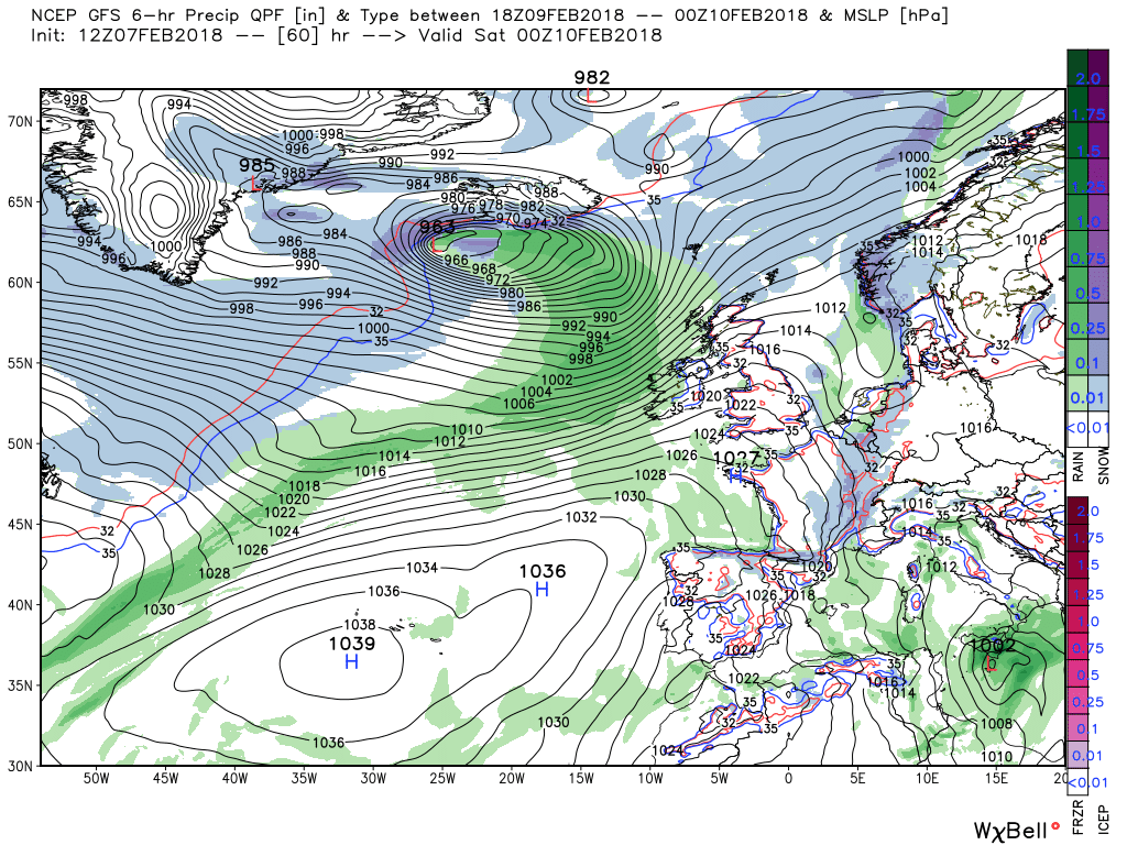
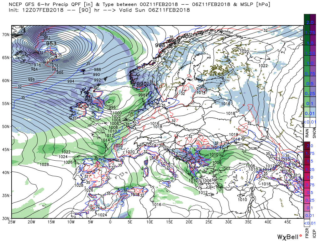
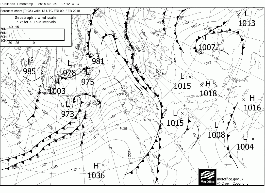
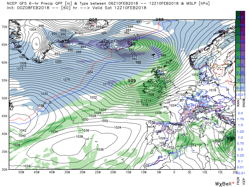
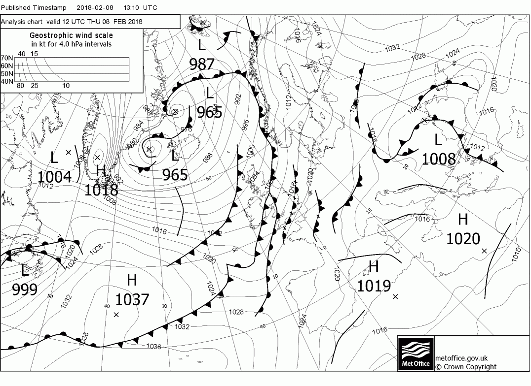
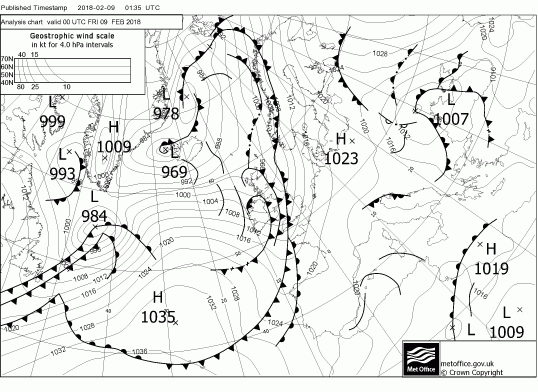
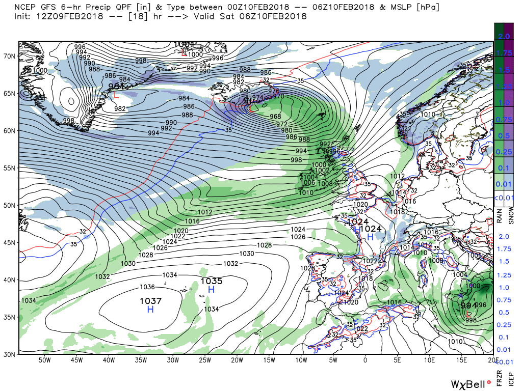
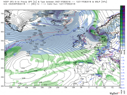
But as can be seen on the last fax the next set of fronts with cloud and rain are just about infringing on western Ireland by 00 and by 06 this has reached N. Ireland, NW England and Scotland where there may well be snow on the higher ground. But as can be seen a wave is forming on the front west of Ireland.
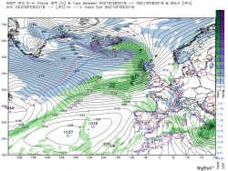
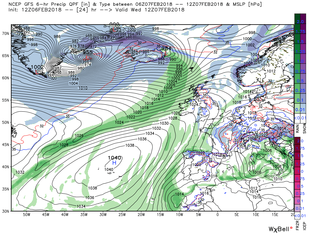
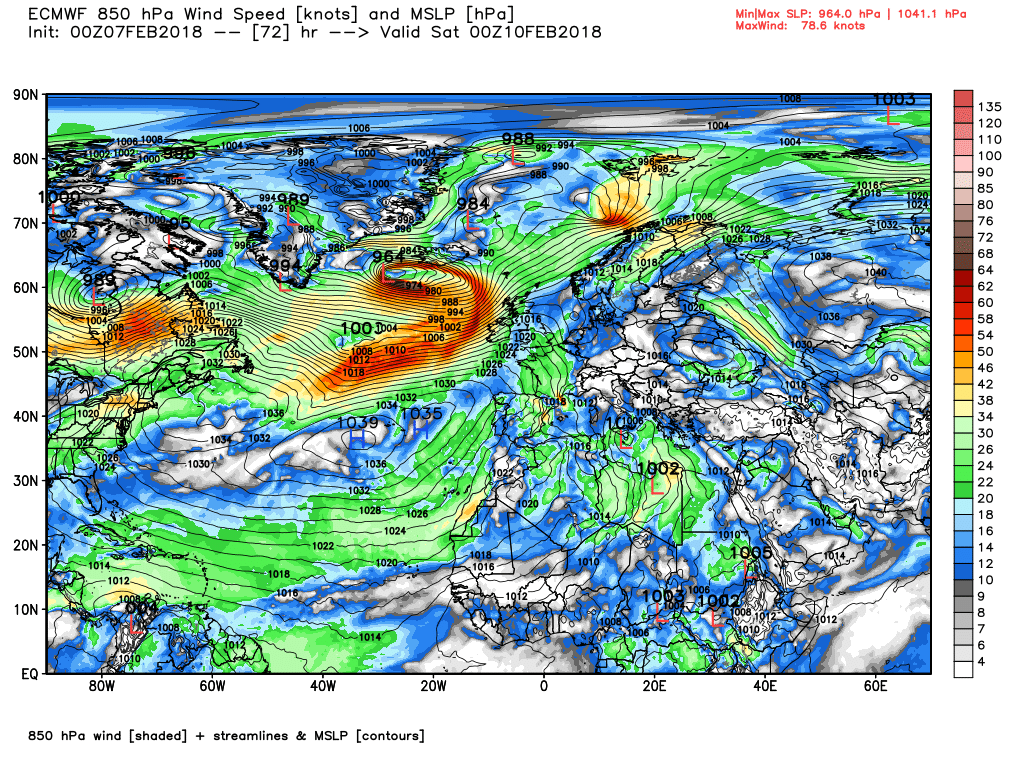
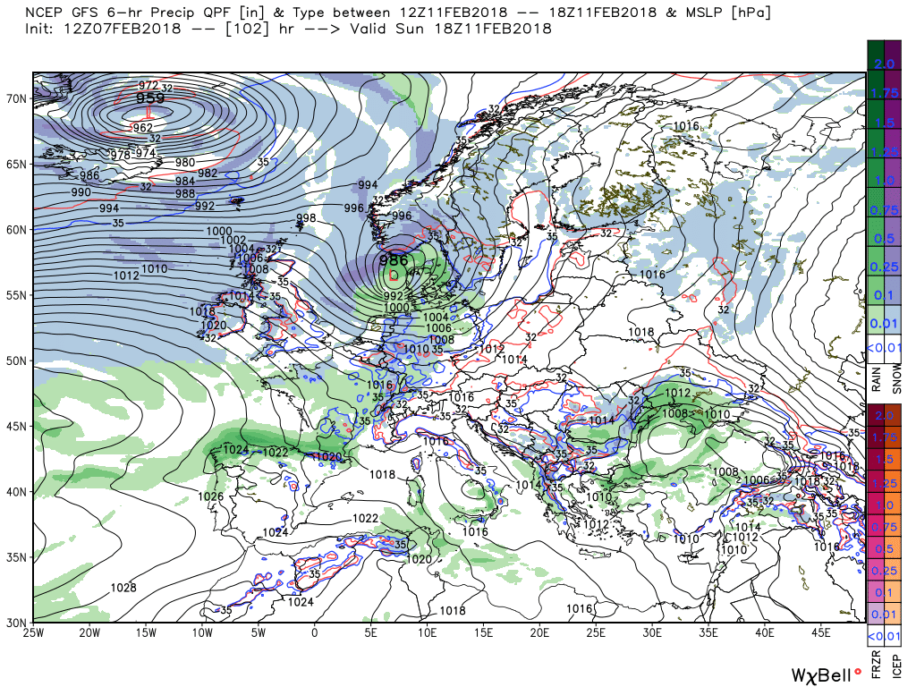
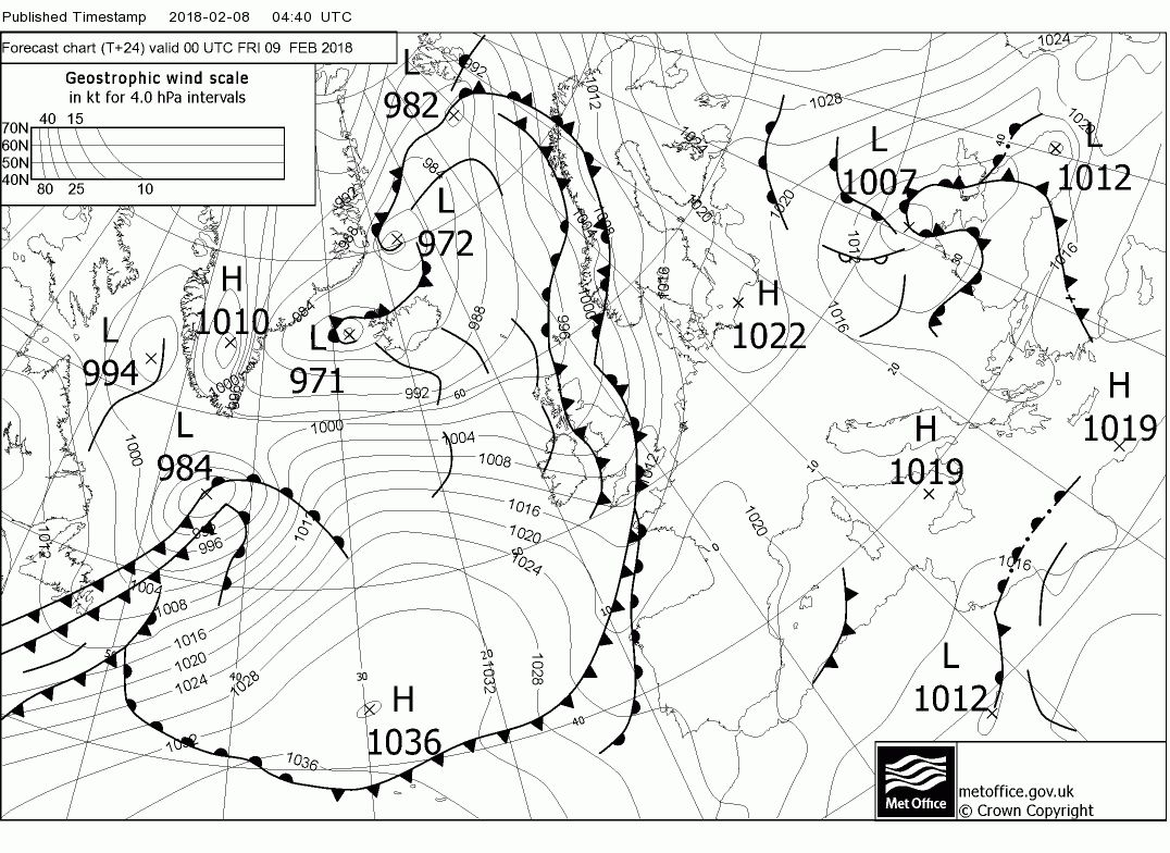
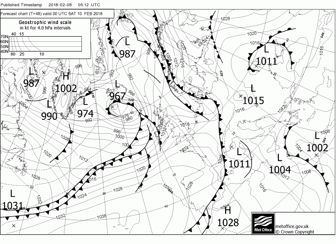
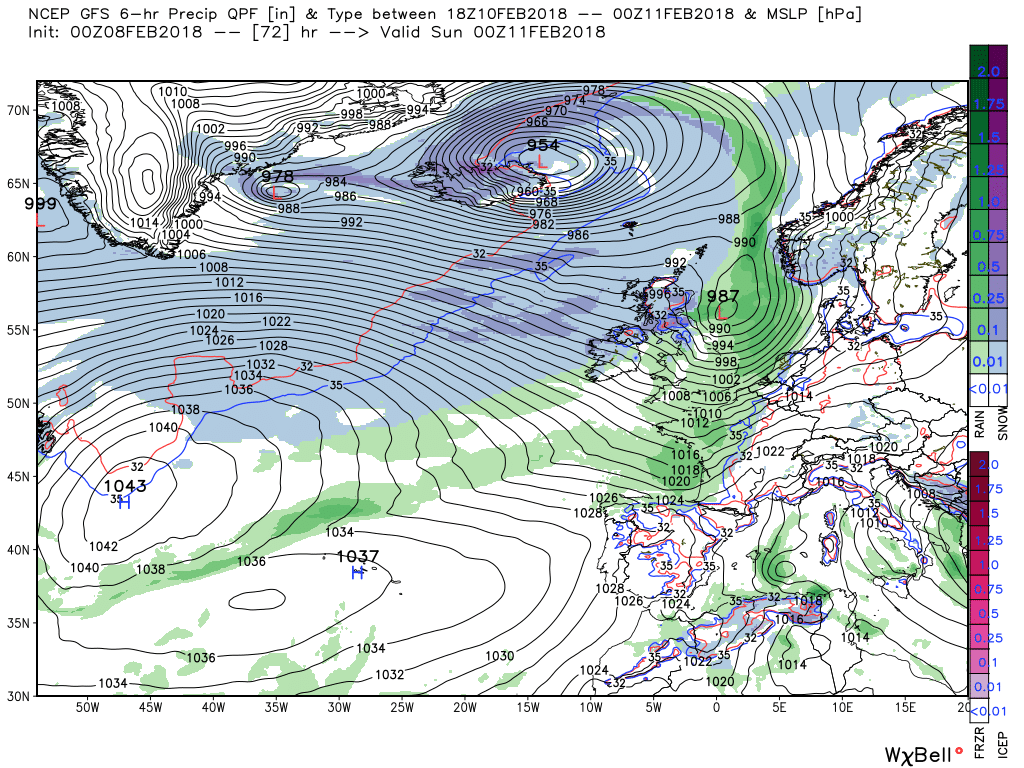
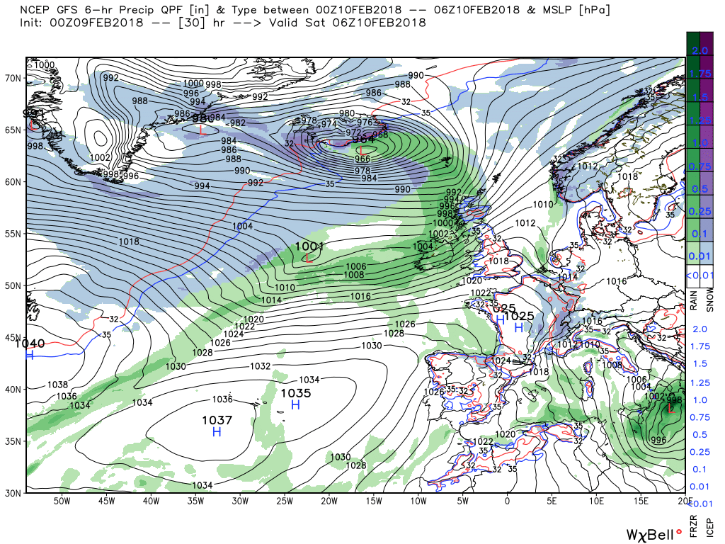
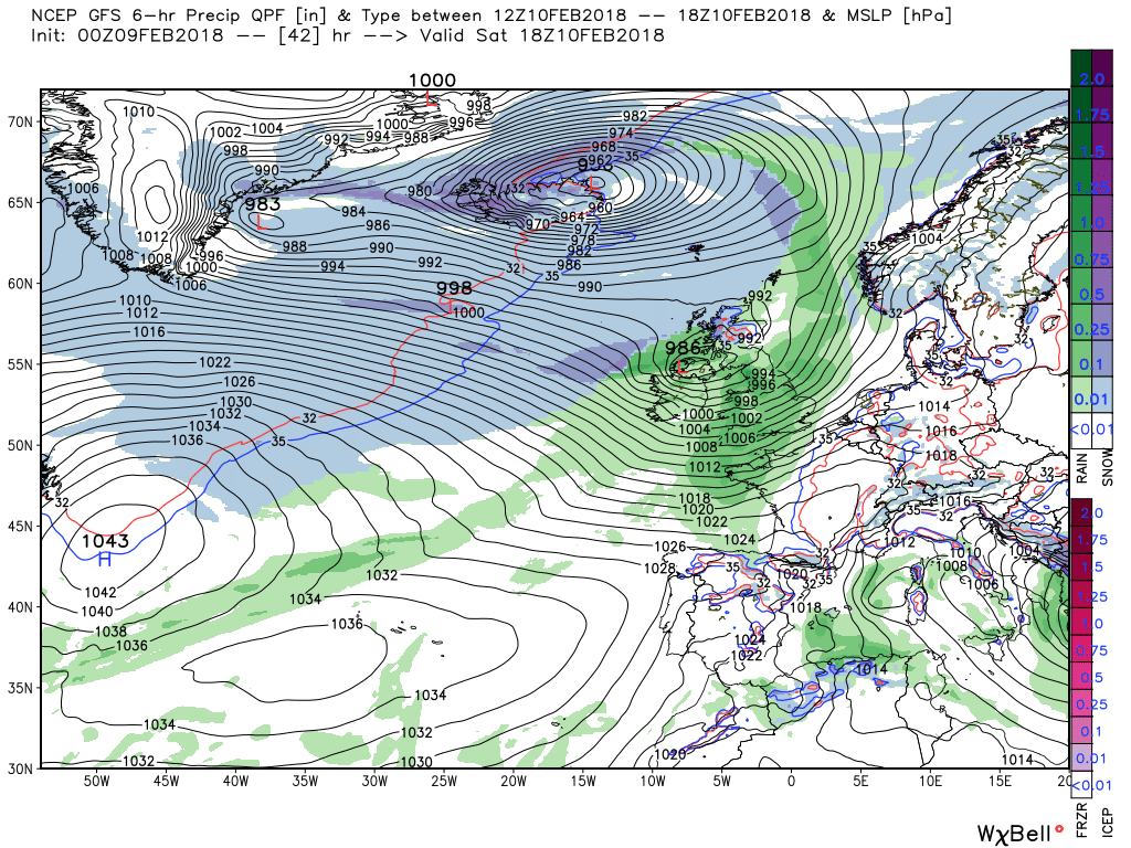
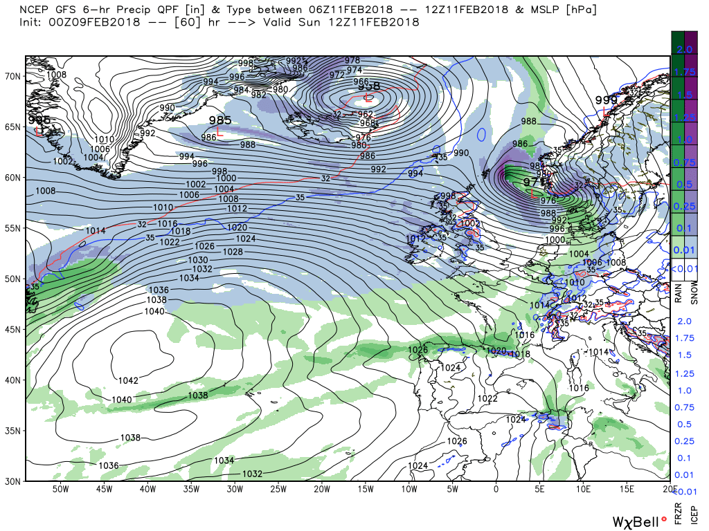
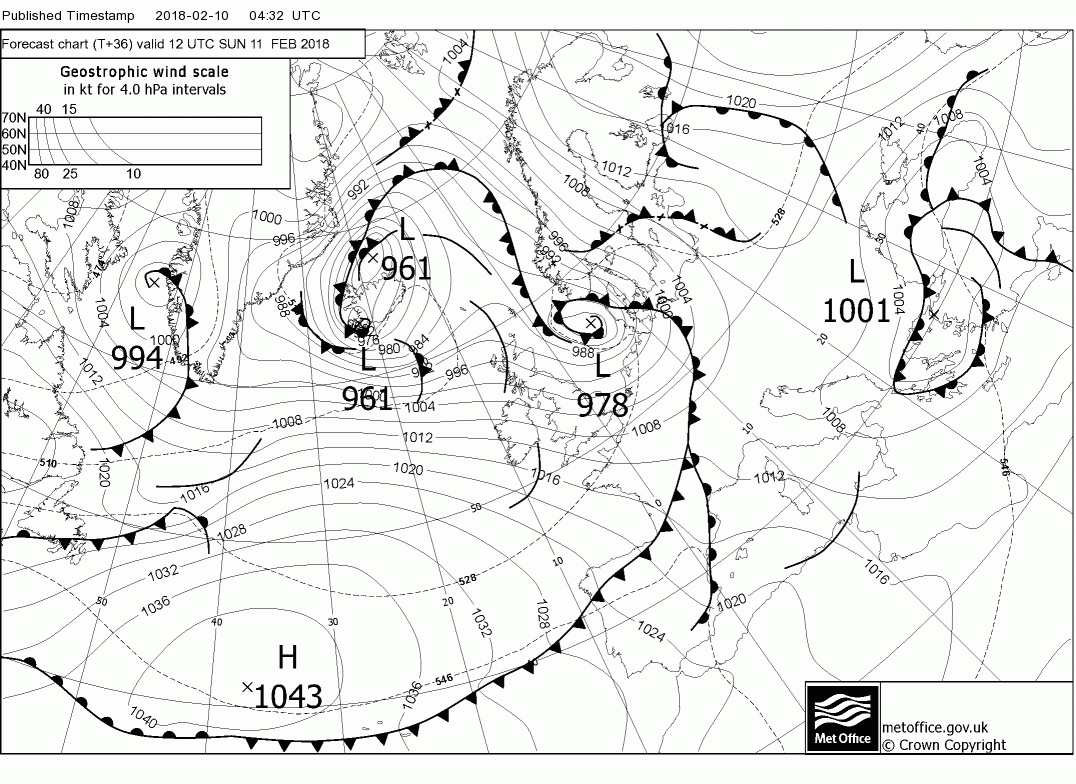
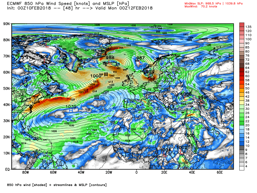
The fronts track south east across the country during saturday bringing rain to most parts accompanied by strong winds, possibly gale force in western areas whilst the wave deepens and tracks north east to be over N. Ireland 986mb by 1800.and then into the North Sea by 00 Sunday. If this turns out to be the precise track then perhaps blizzard conditions for a while in N. Scotland.
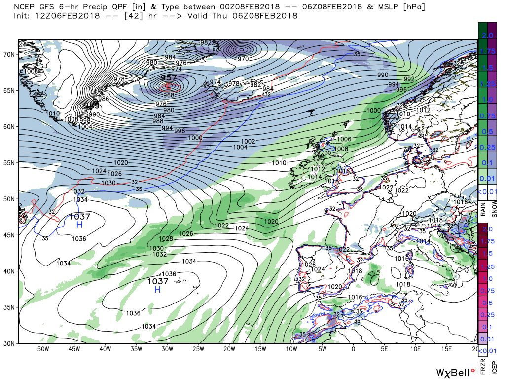
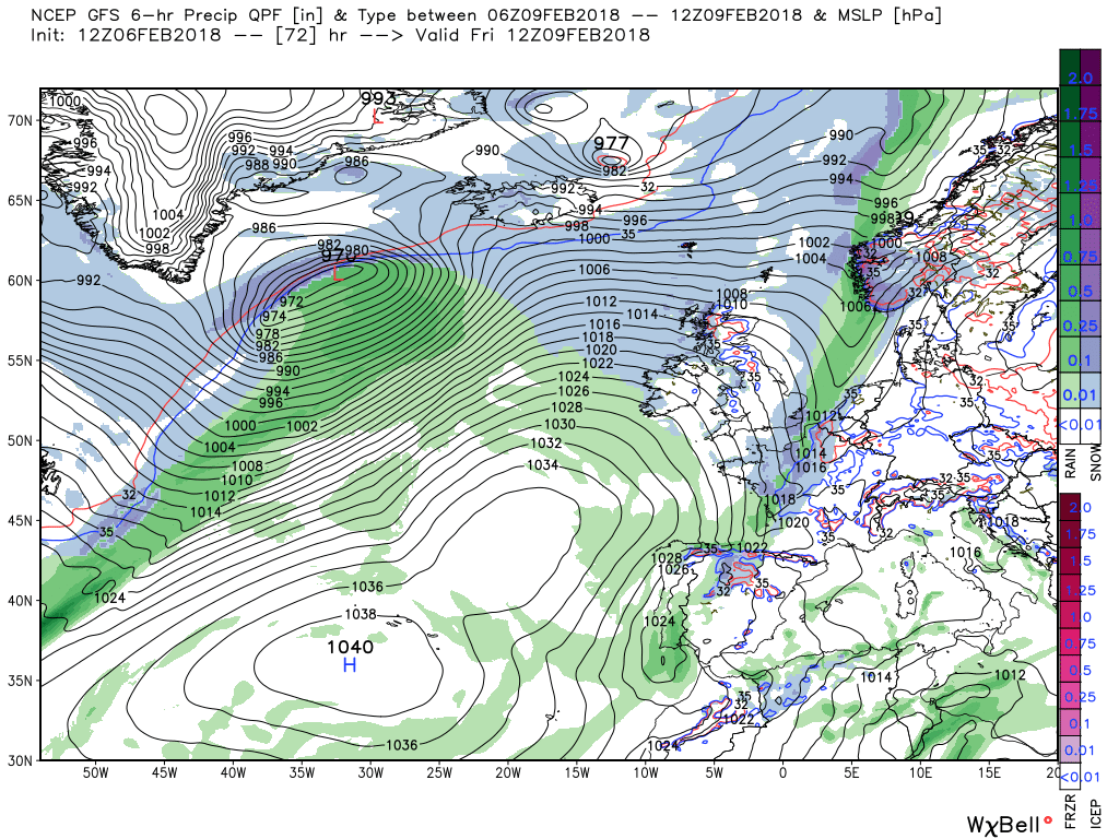
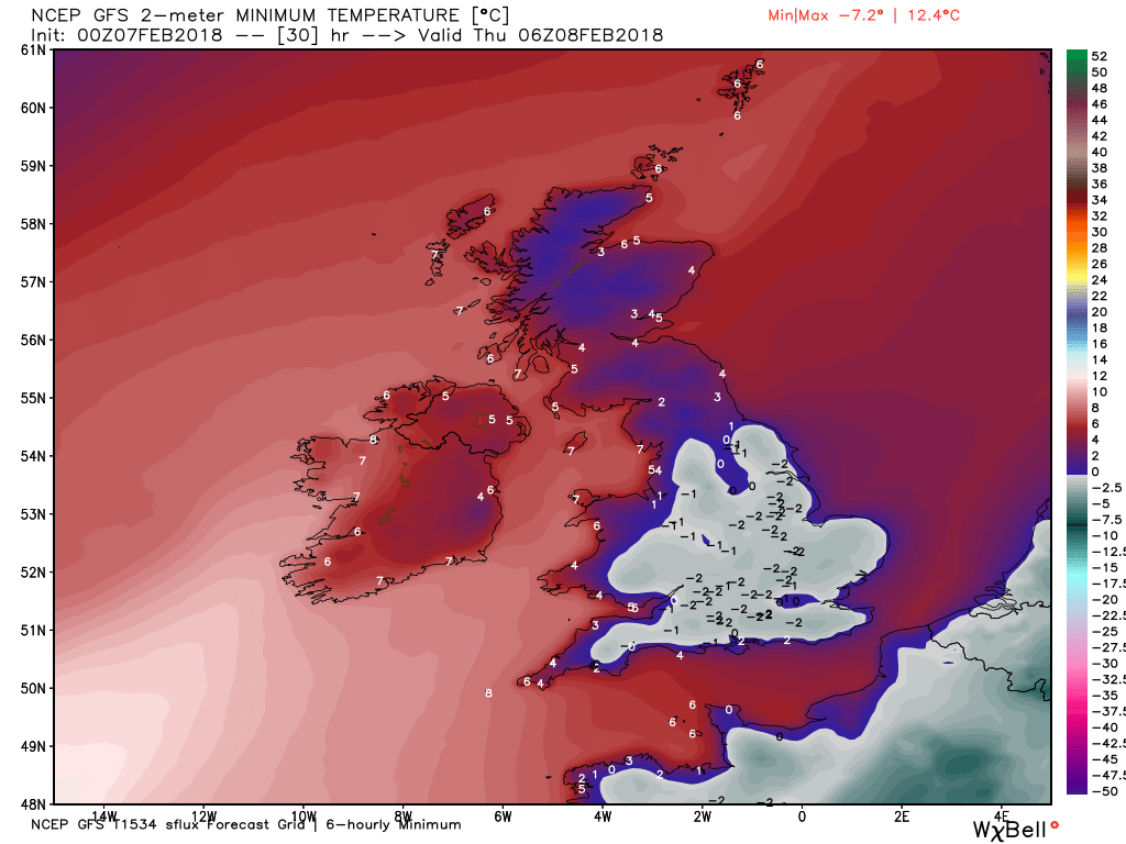
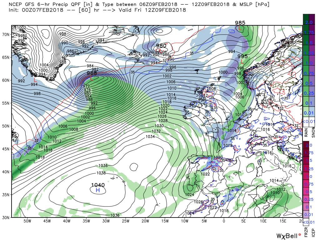
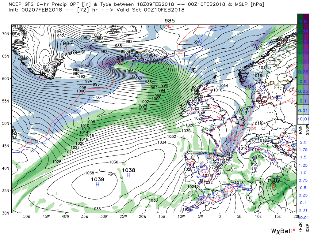
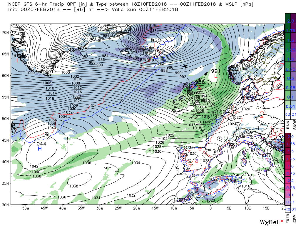
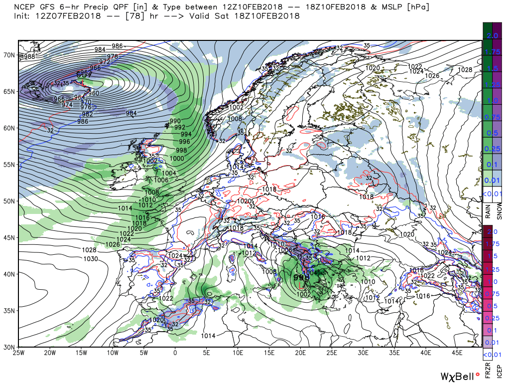
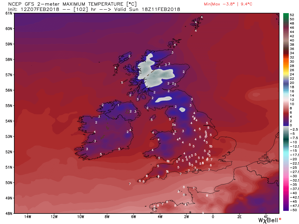
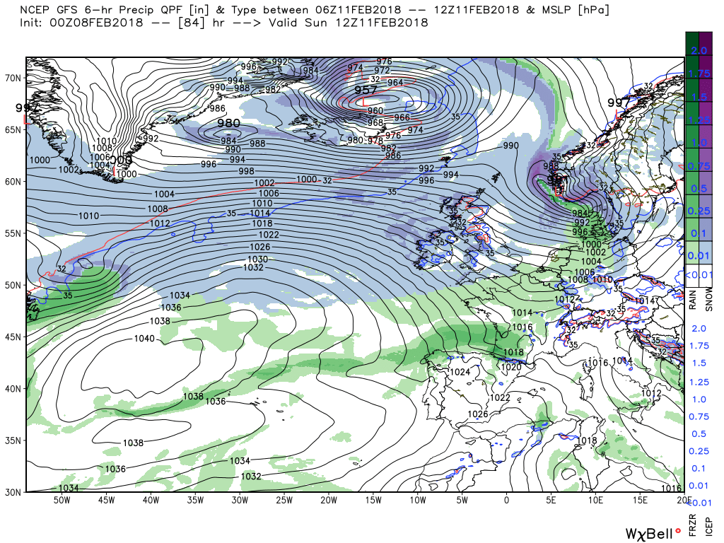
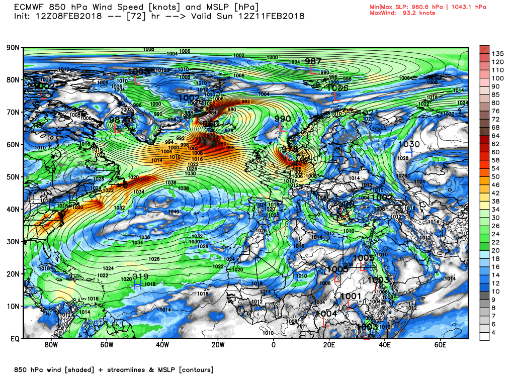
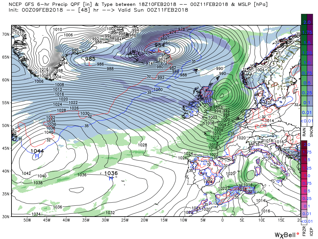
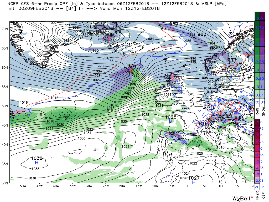
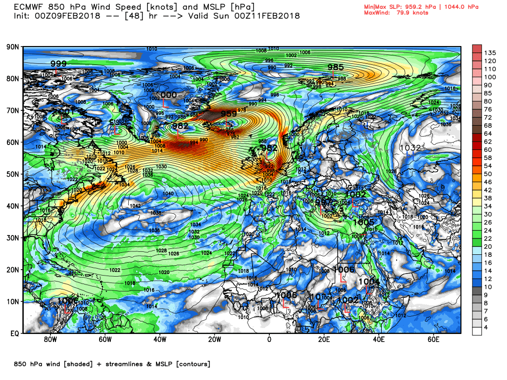
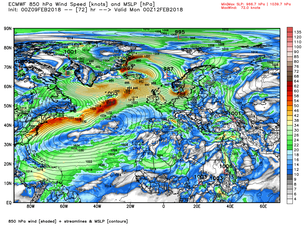
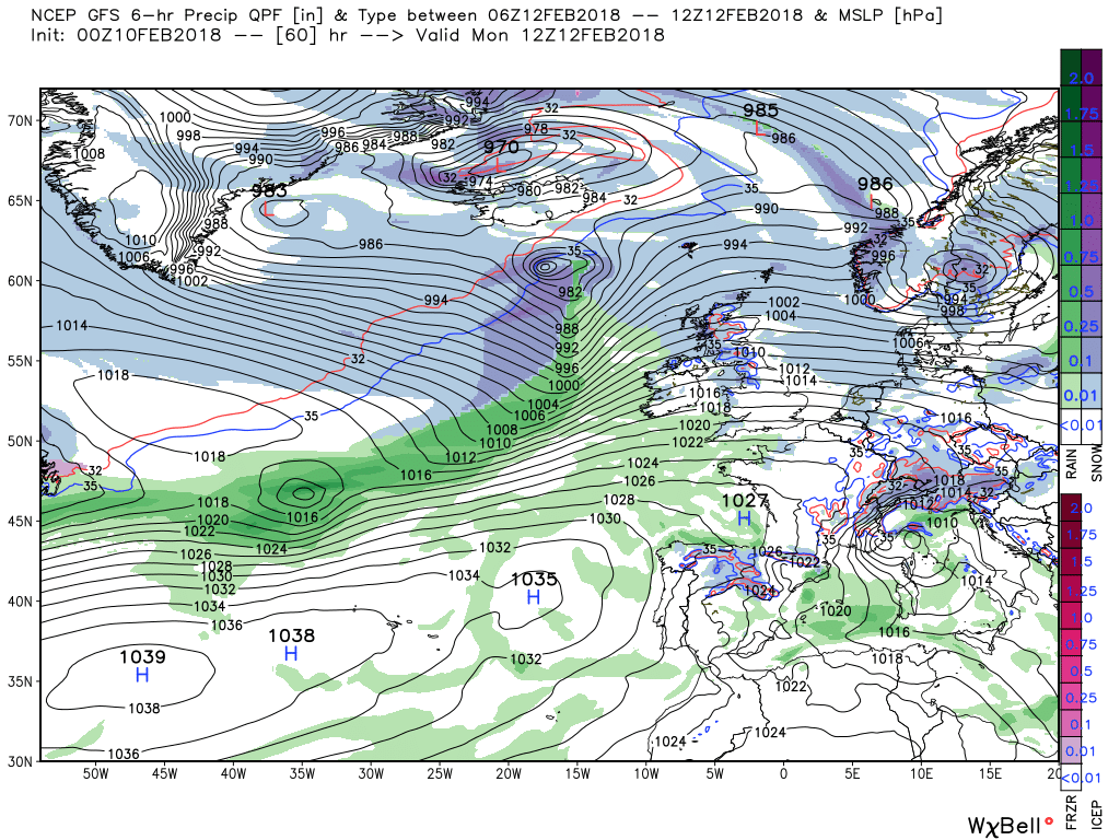
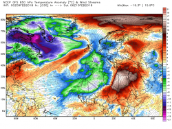
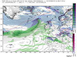
By 1200 Sunday the low is over south west Norway, having brought with it some very nasty conditions in the northern North Sea on it's travels, leaving the UK in a cold north westerly airstream with frequent wintry showers of just about everything in western and northern areas, This continues over the next 24 hours to 1200 Monday although the wind will gradually back westerly
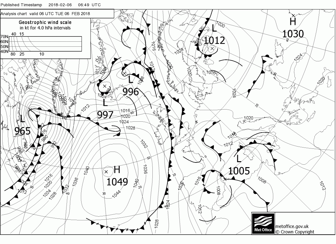
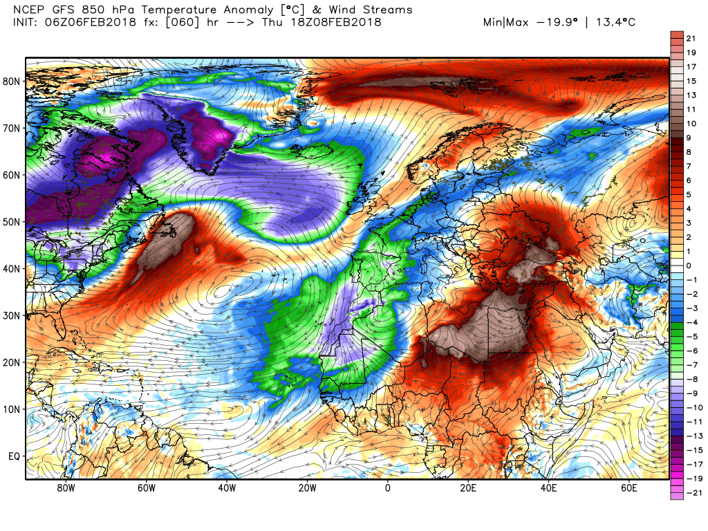
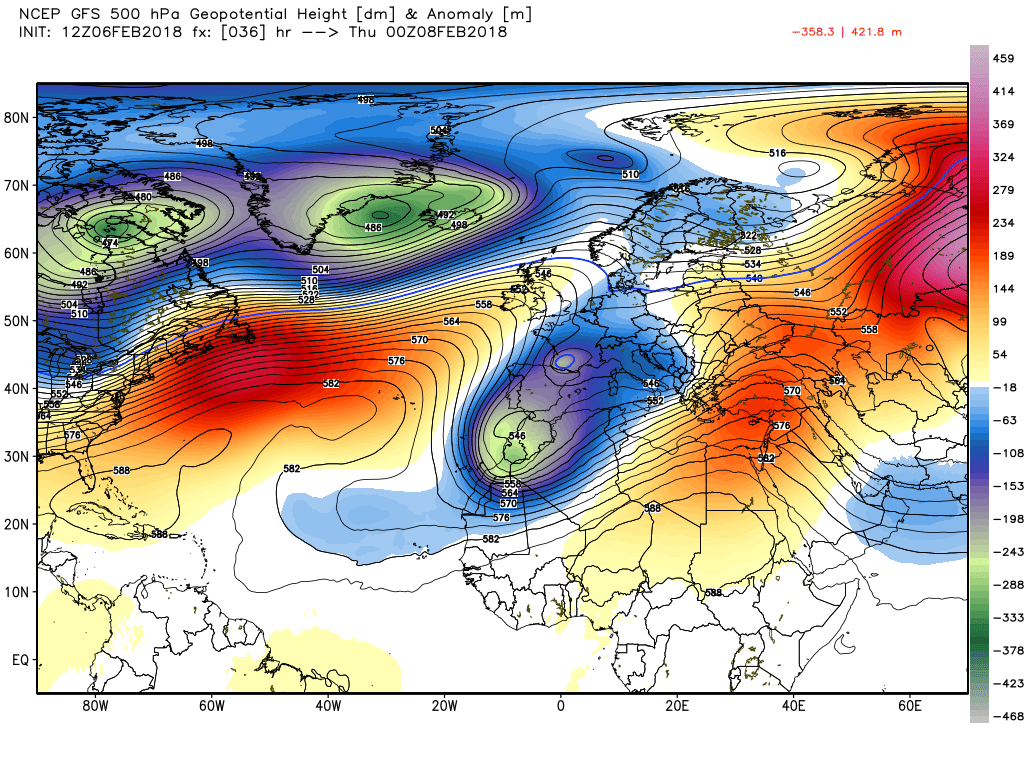
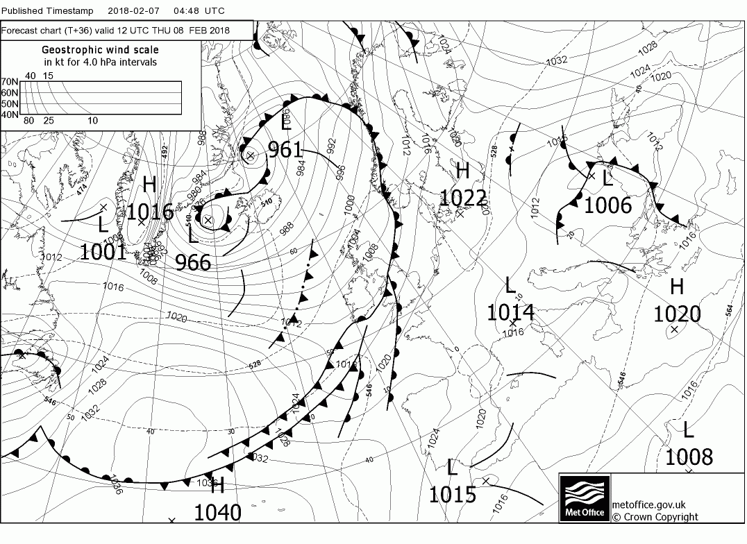
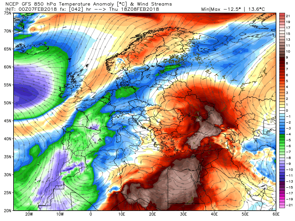
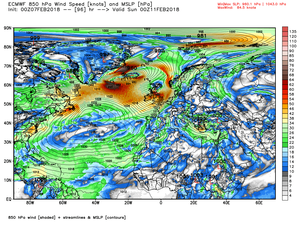
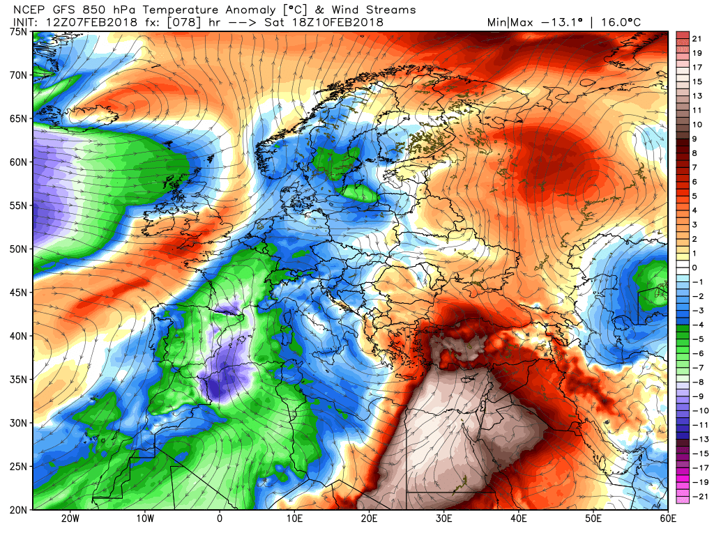
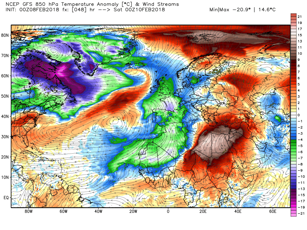
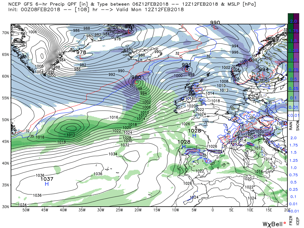
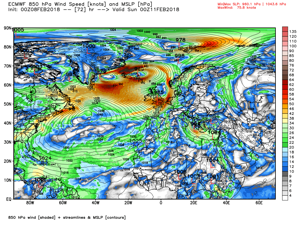
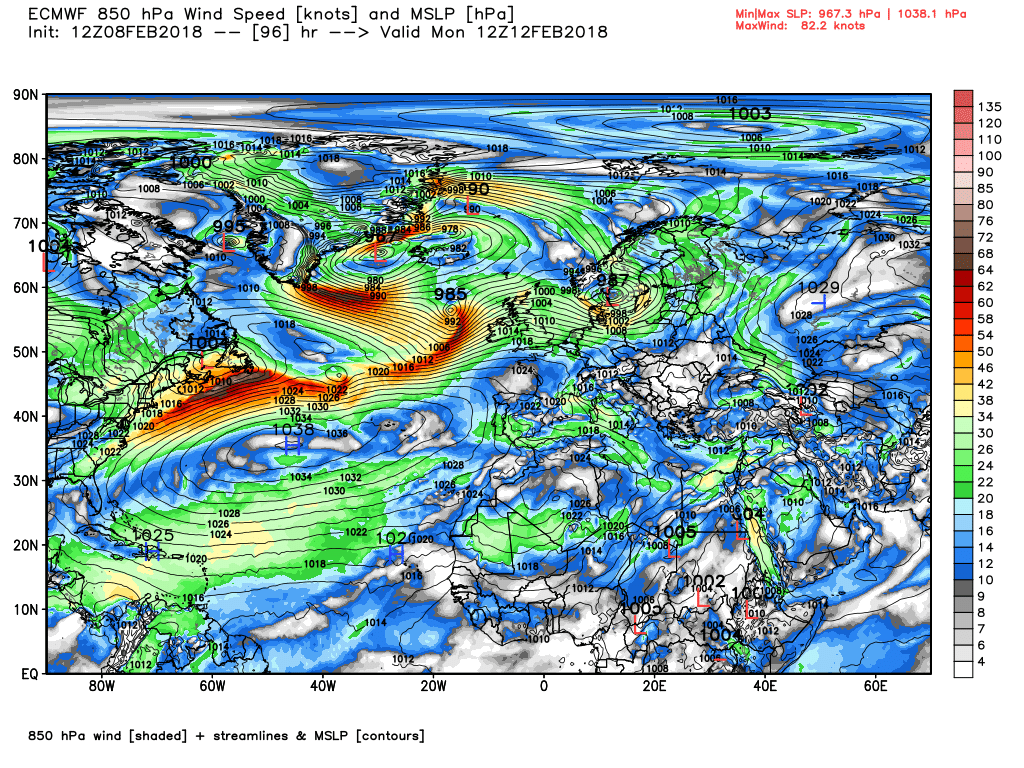
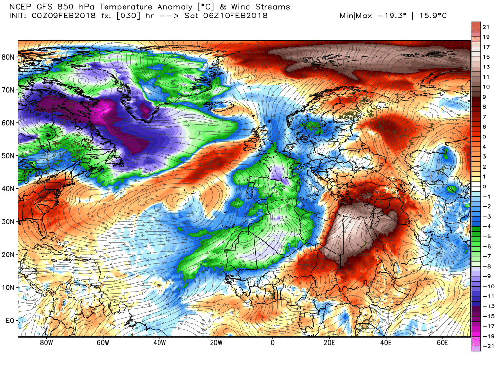
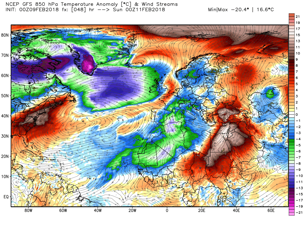
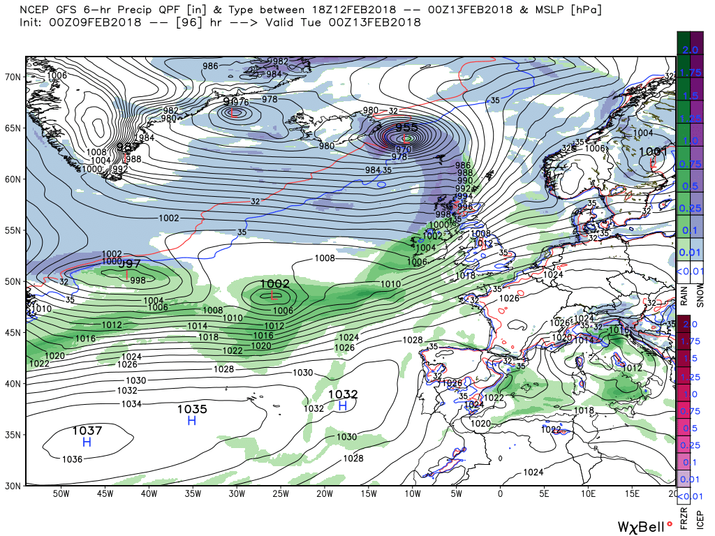
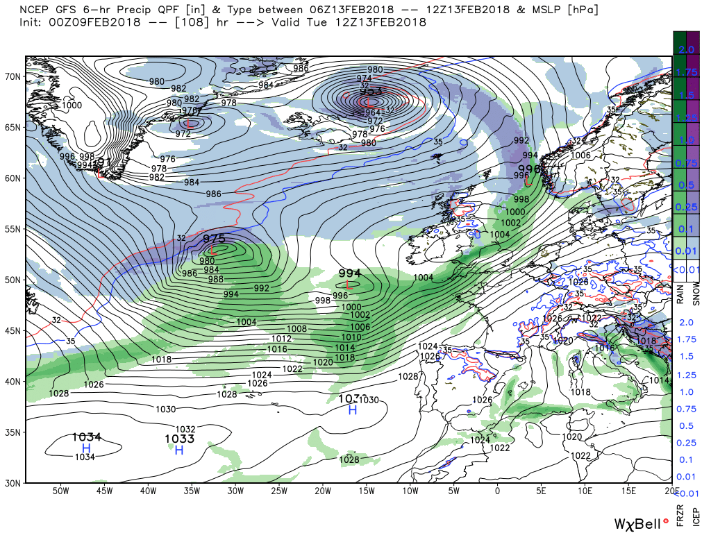
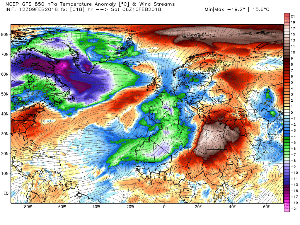
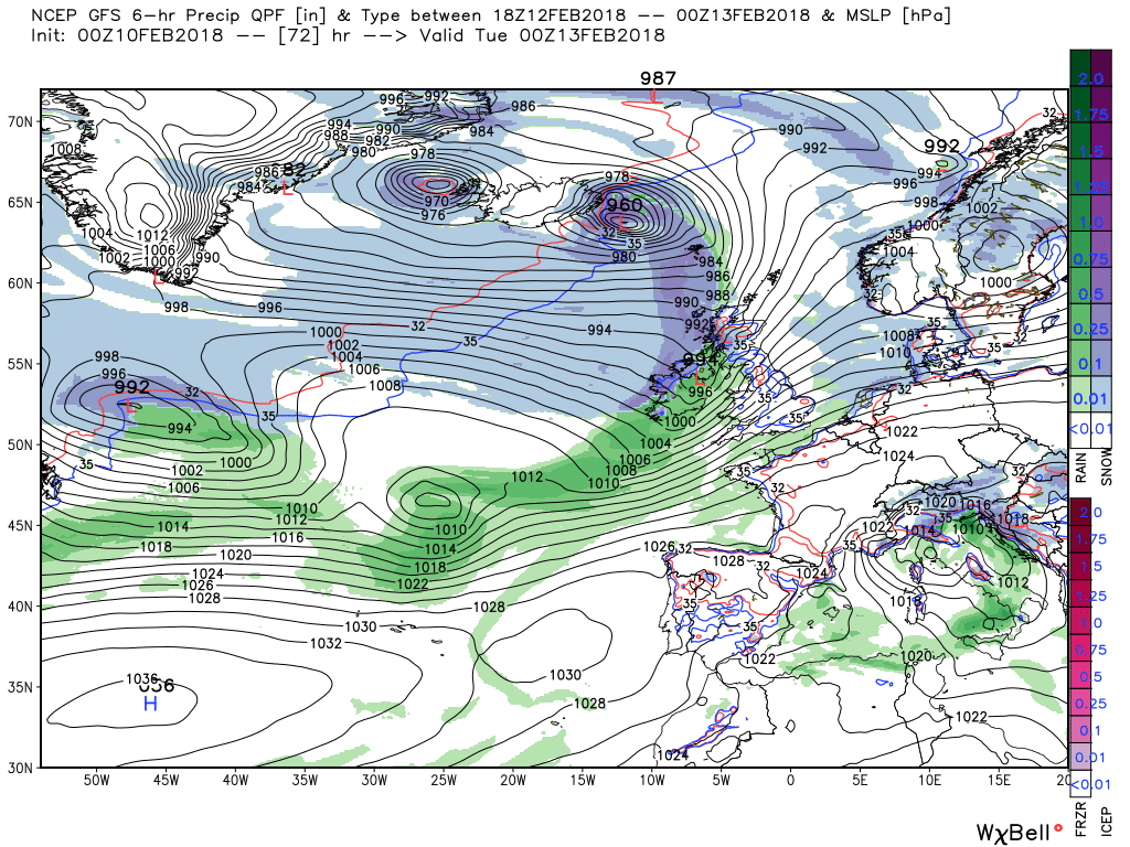
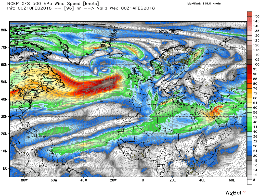
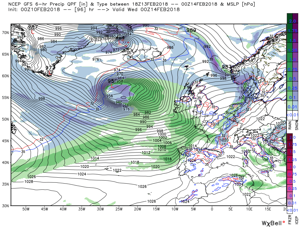
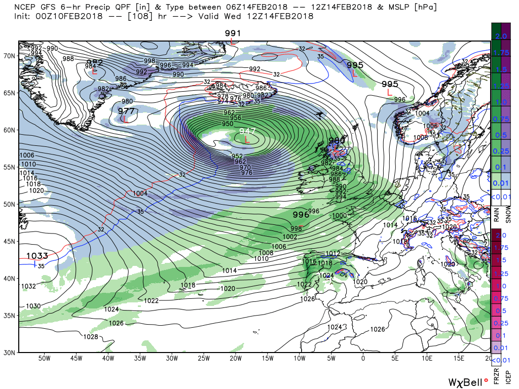
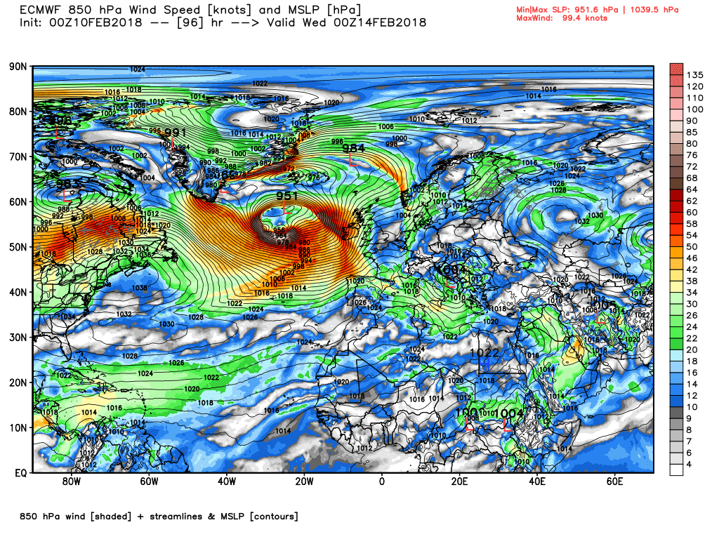
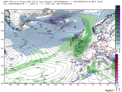
As can be seen on the last chart there is a deep low 975mb south of Iceland with associated fronts trailing south west. The low deepens rapidly to be 955mb east of Iceland by 00 Tuesday with the front already impacting Scotland (where the precipitation could fall as snow) and N. Ireland and again bringing strong winds, possible gale force. But it's quite a complicated scenario with the colder air sweeping east behind the front which actually trails a long way south west along the interface between the colder air ( upper trough) and the high pressure to the south. And along this intyerface, as can be seen, lows are forming.
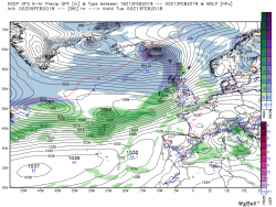
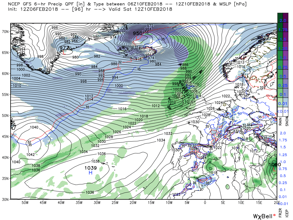
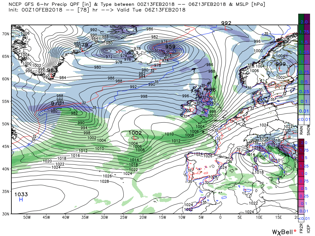
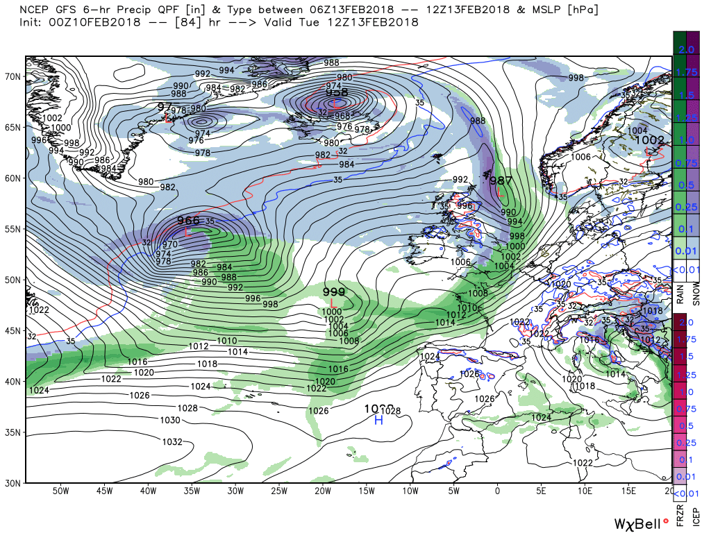
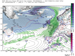
What happens next as the front tracks south east across the UK is not without interest but there we must leave it.
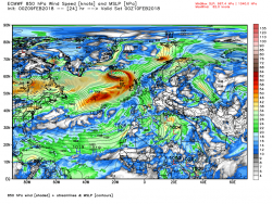
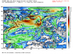
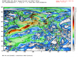
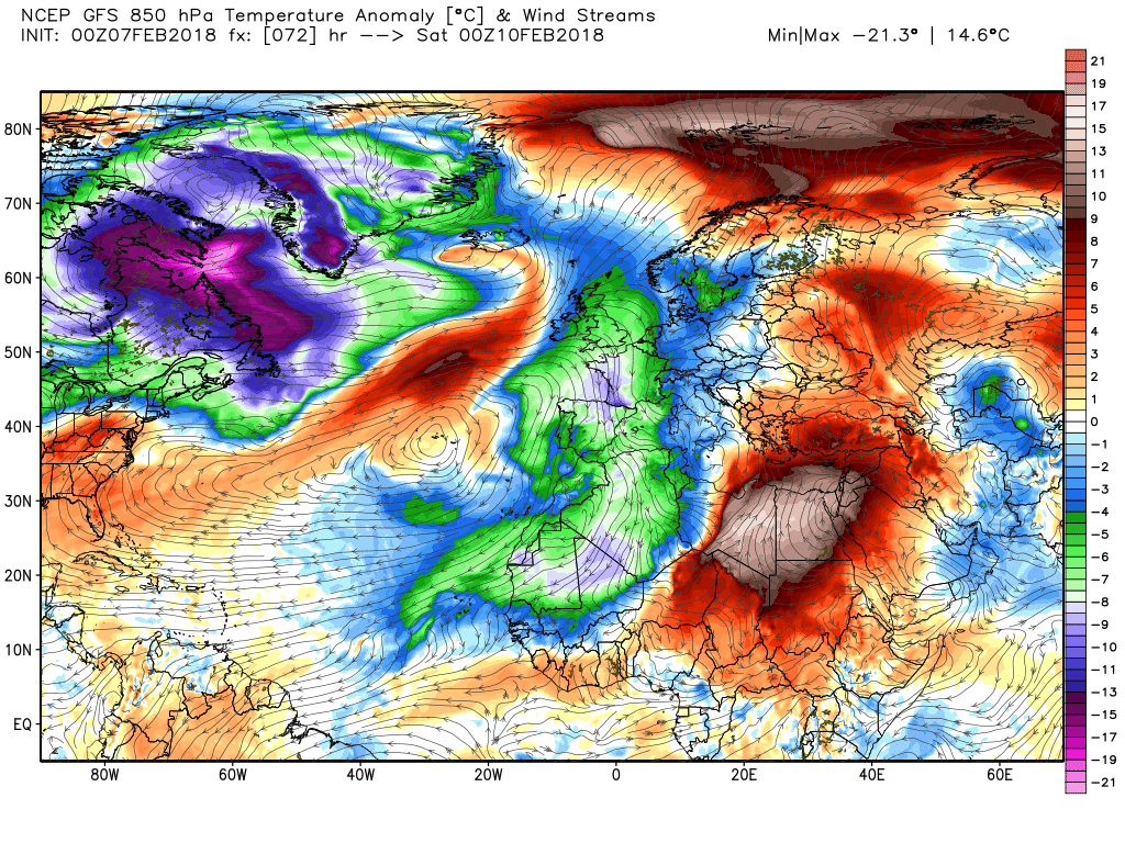
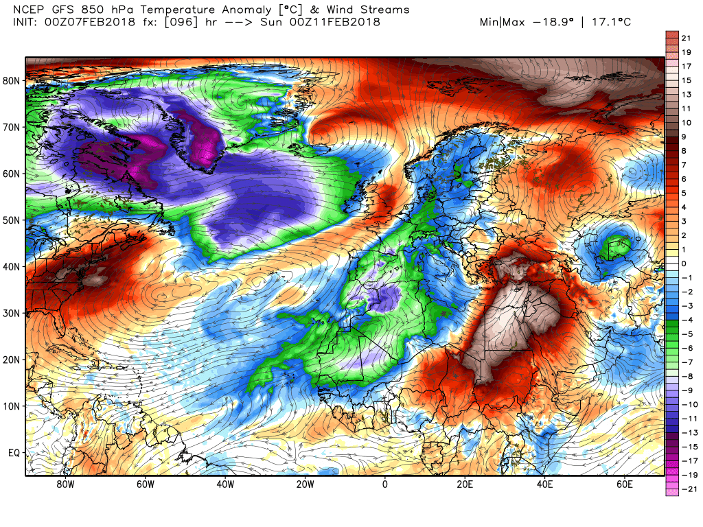
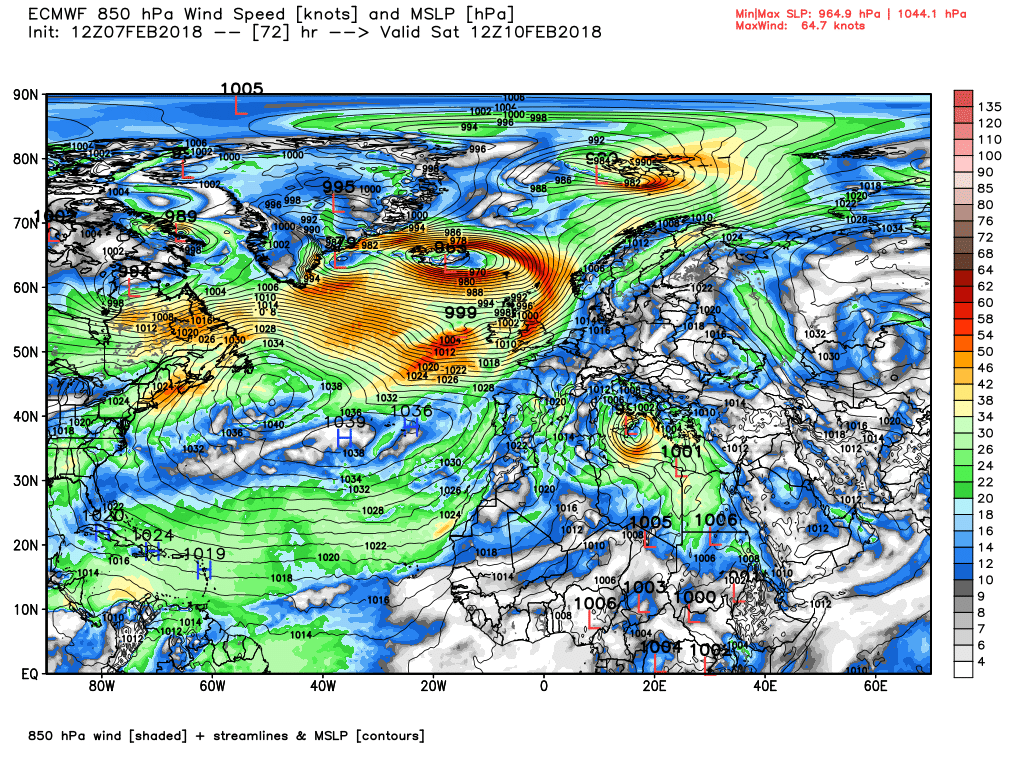
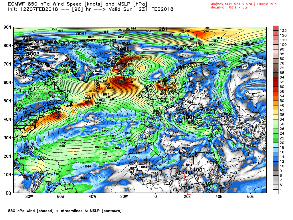
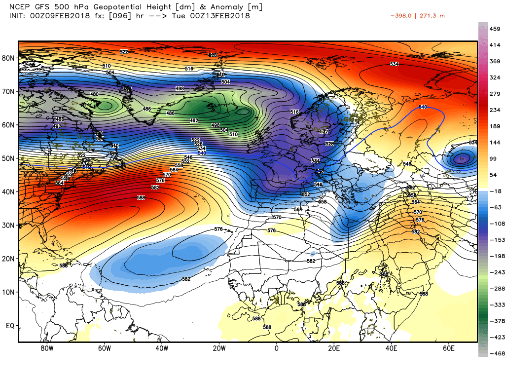
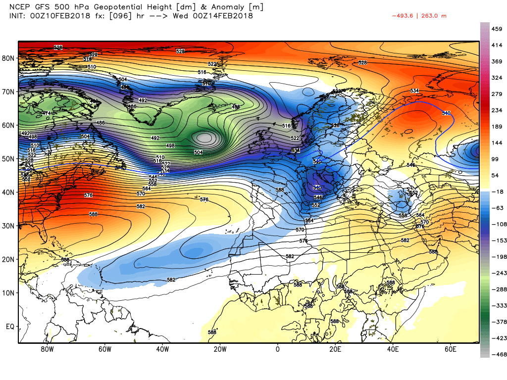
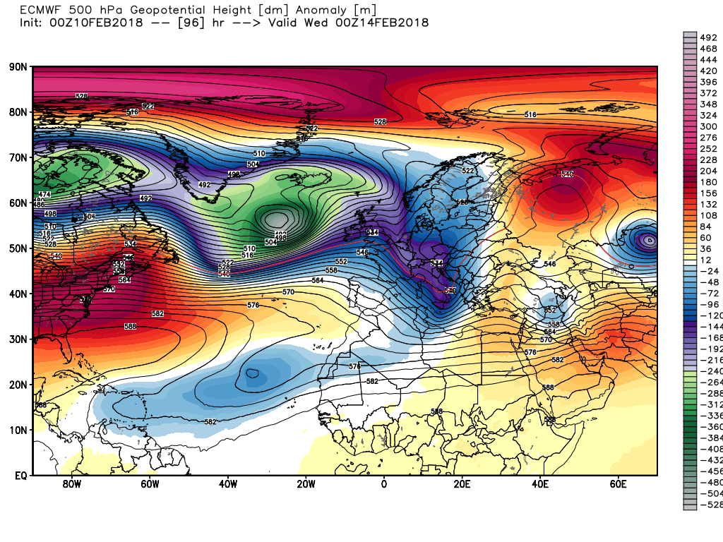
And the ecm charts for T24,48 7 72
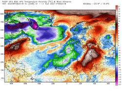
Certainly not looking great tomorrow,