OP
- Messages
- 6,299
- Location
- Norfolk, England
- Thread Starter
- #945
I'm no physicist, Tony, but you're right - he had to have balls to try that manoeuvre.As a self proclaimed man of science surely you can appreciate the impressive G's the pilot accurately pulled for those testicles.

Anyway, my friend on Netweather has posted his latest thoughts regarding the week ahead, based, as ever, on some of the more reliable model outputs:
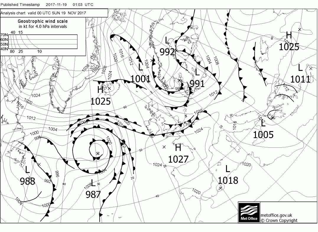
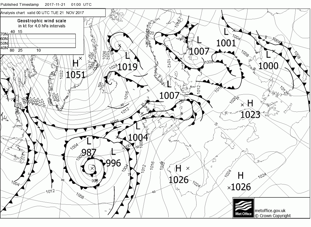
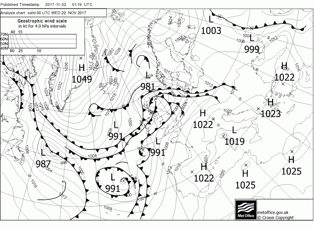
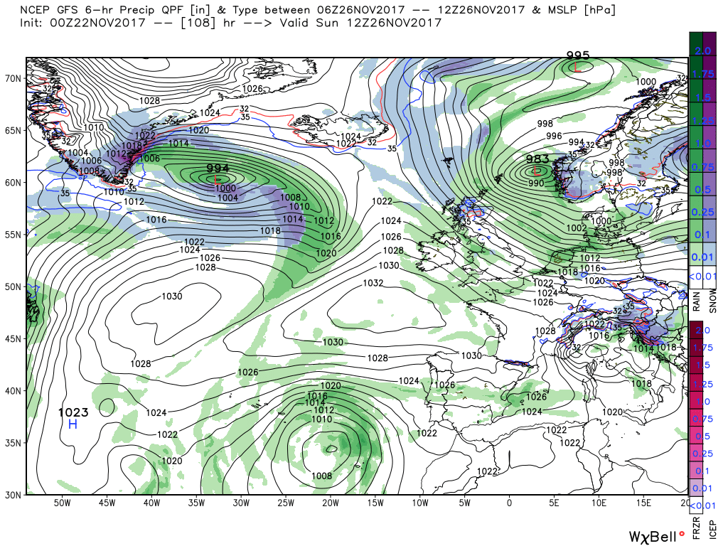
Today. The cloud and rain from yesterday has cleared and with a transitional ridge moving in most places will have a dry and sunny start to the day day albeit a bit nippy in the much colder air. Bur it is rather a brief interlude as the next system is moving east and the cloud from the warm front will start affecting the north west and then the the south west during the day. It wills be accompanied by rain which will as snow over the high ground in the north and particularly Scotland as the warmer air hits the colder air in situ. This will spread to all areas tomorrow as the wave and fronts traverse the country.
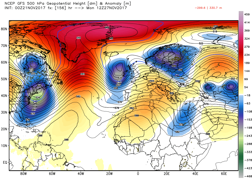
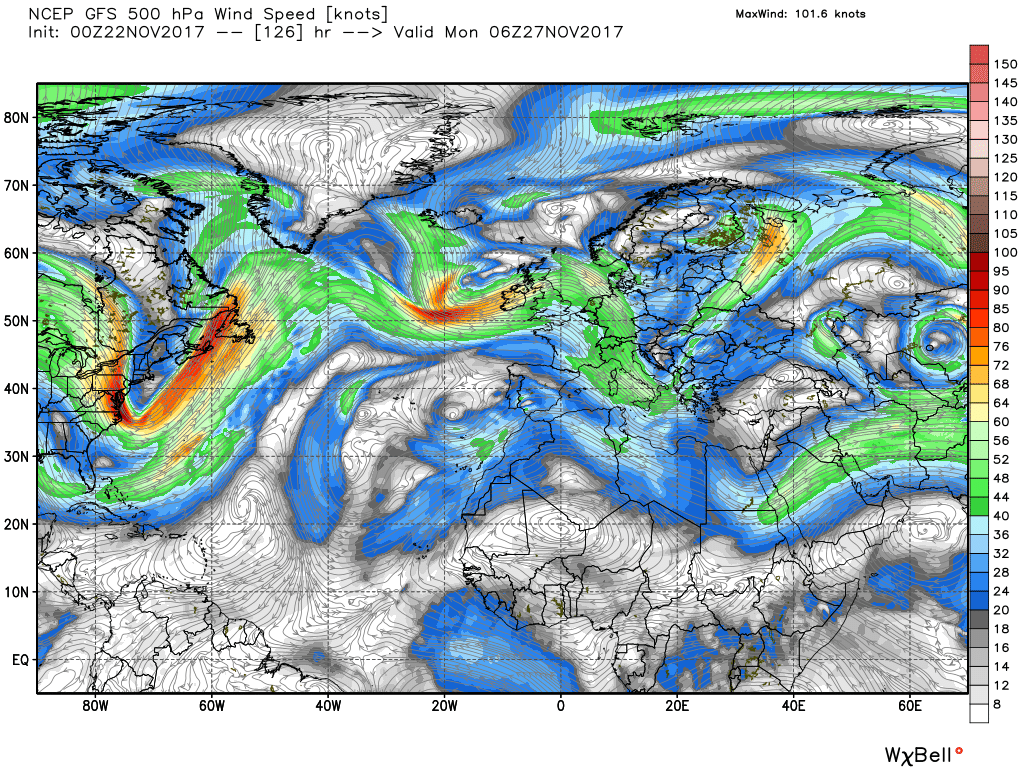
So on to the gfs this morning. First a brief overview. It is looking like being very unsettled this week and the beginning of next so the main concern will be rain and the possibility of gales.
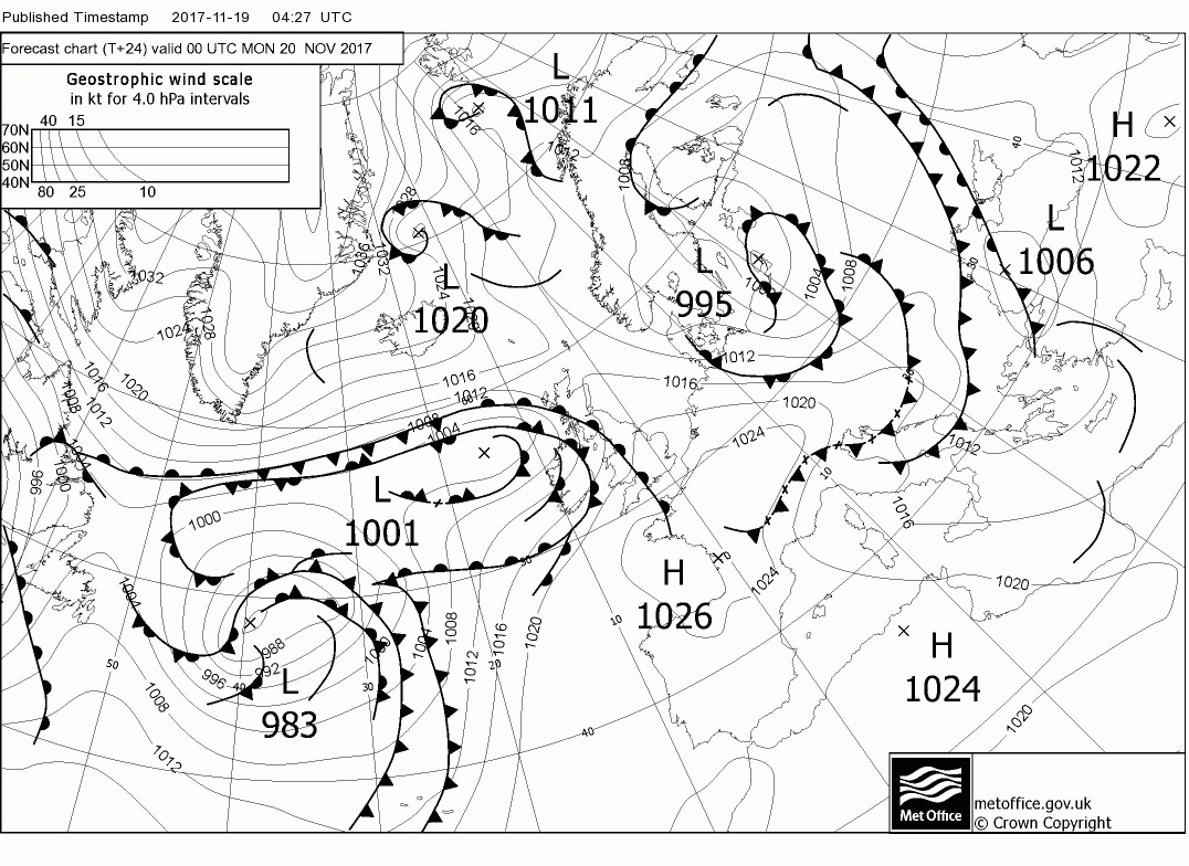
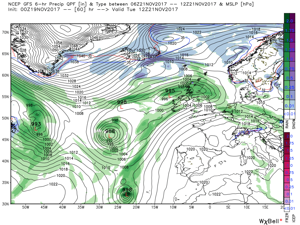
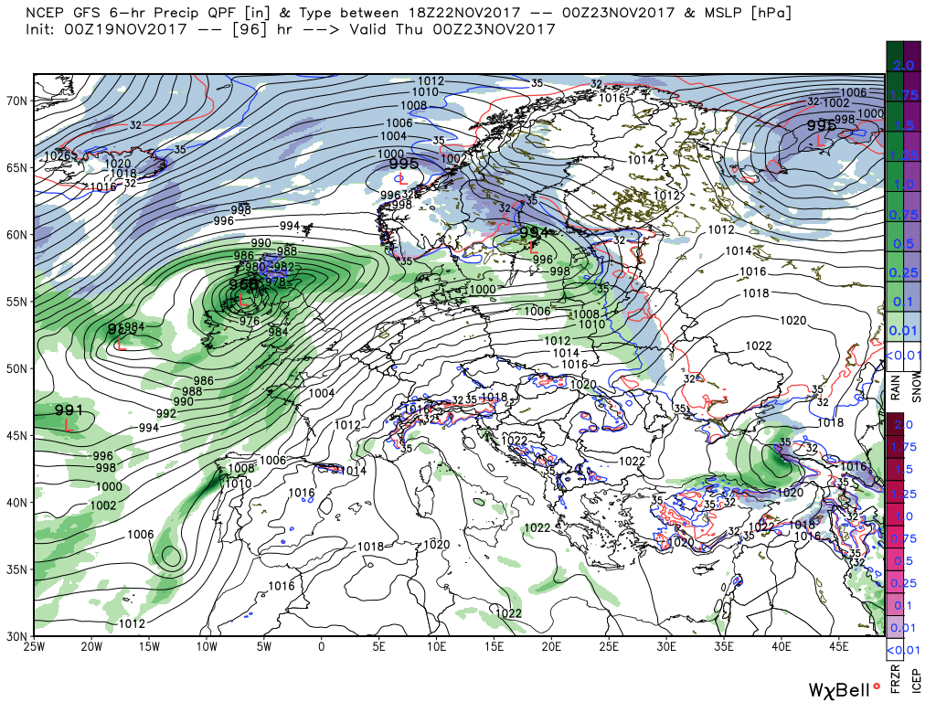
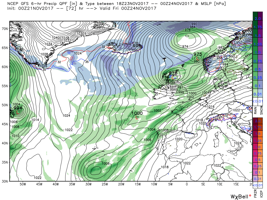
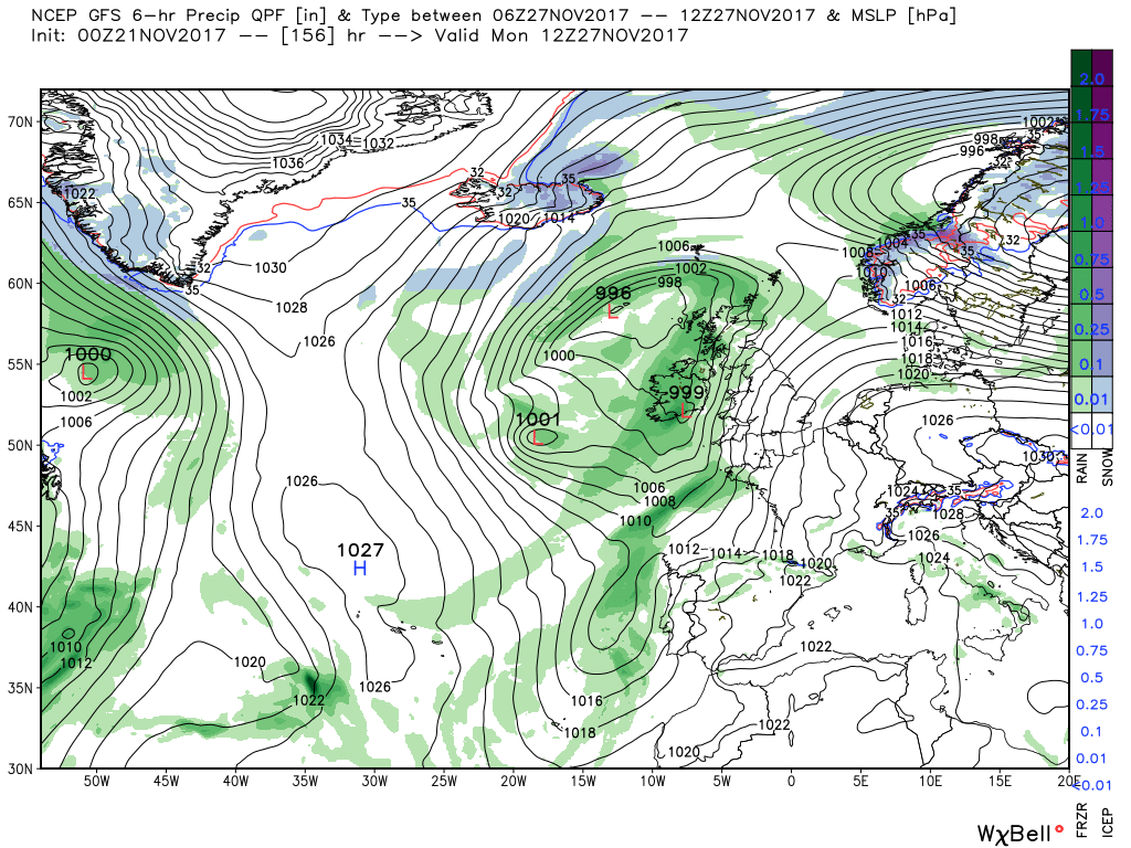
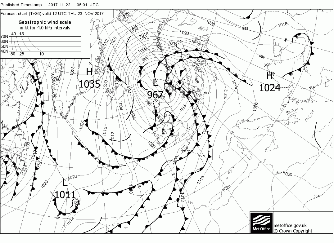
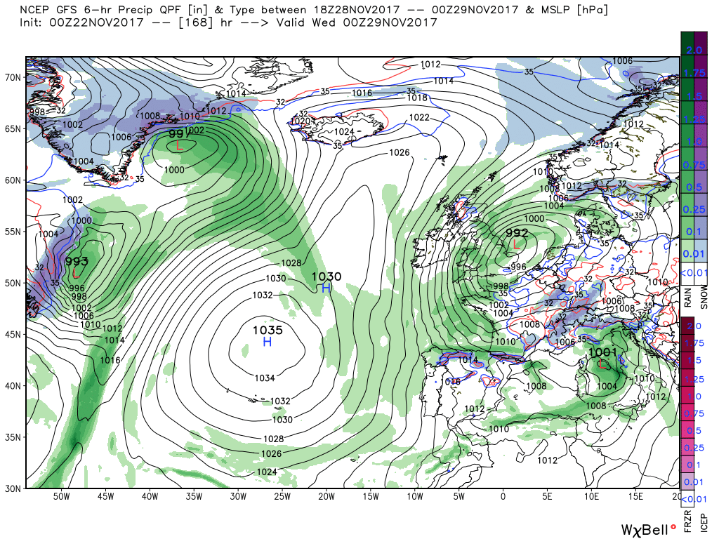
After the above wave has cleared we arrive at the complexities of this week By 12 Tuesday we have a complex upper trough to the WSW running all the way down to north west Africa whilst another trough has slipped south between Iceland and Scotland and is about to phase with it. On the surface this translates to the main depression to the SW with the associated front running from Scotland down to west of the Azores on which a wave has formed to be west of Scotland 995mb at same time. This will bring rain (snow over the hills in Scotland although it maybe too far north) and quite strong winds as it tracks into the North Sea and deepens over the next 12 hours.
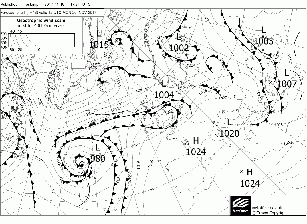
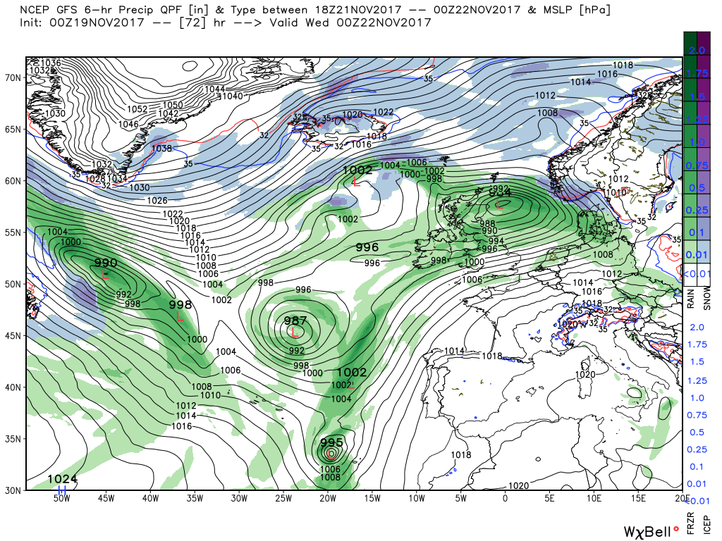
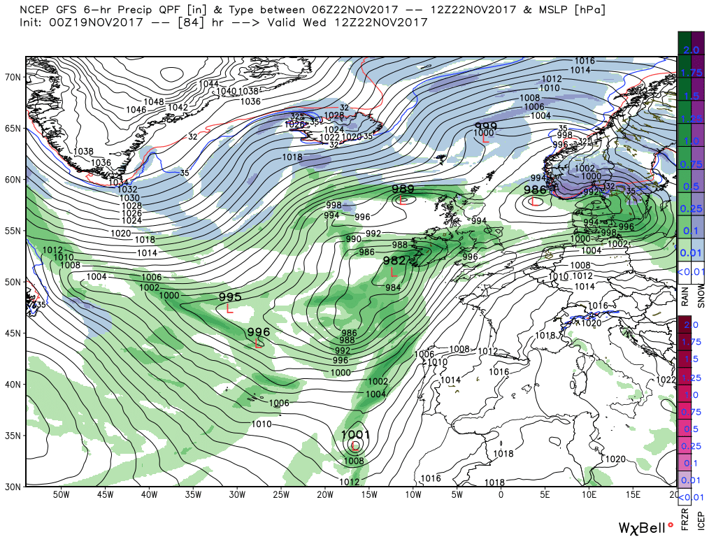
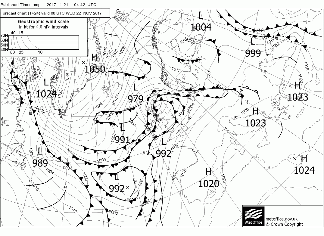
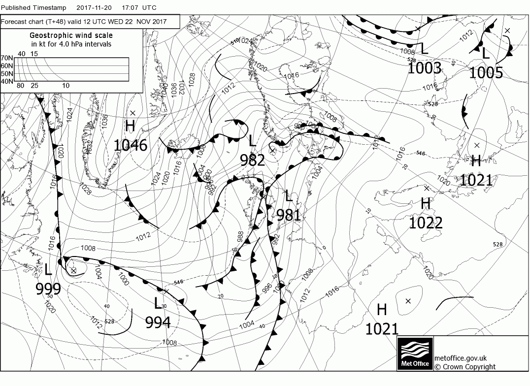
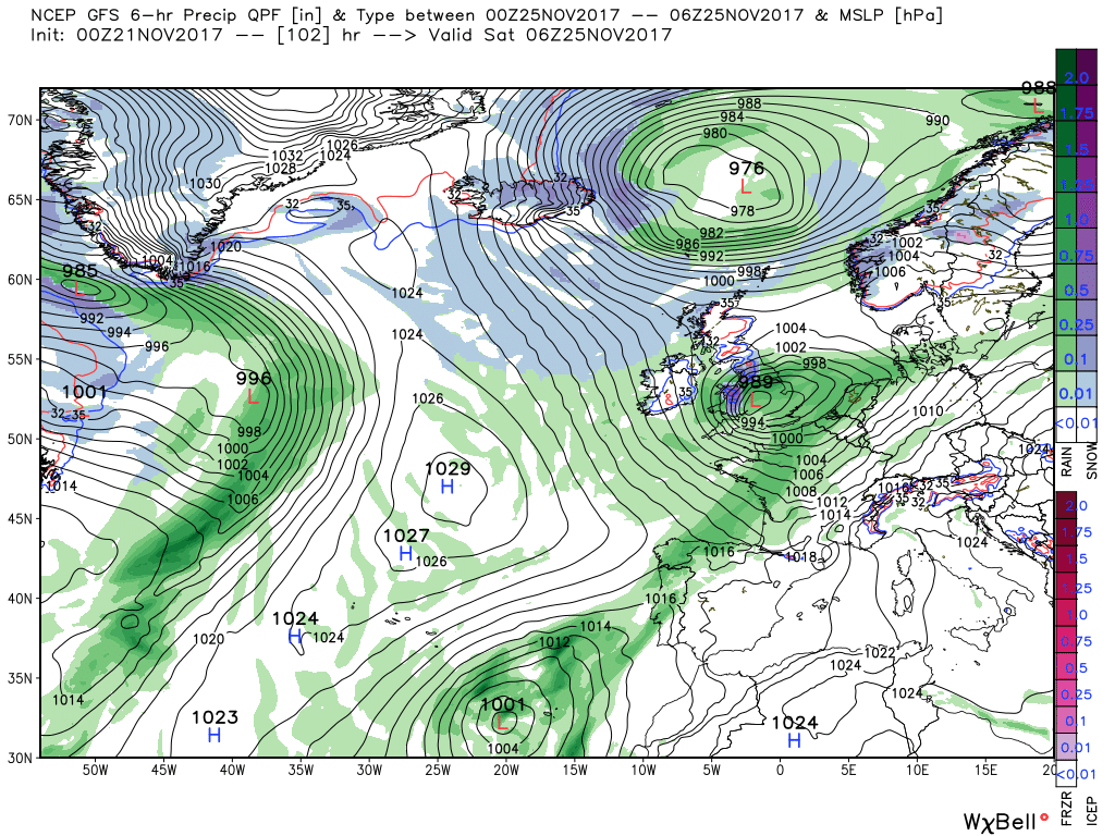
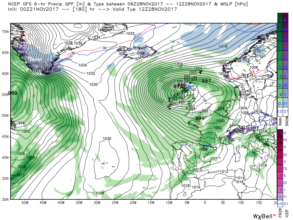
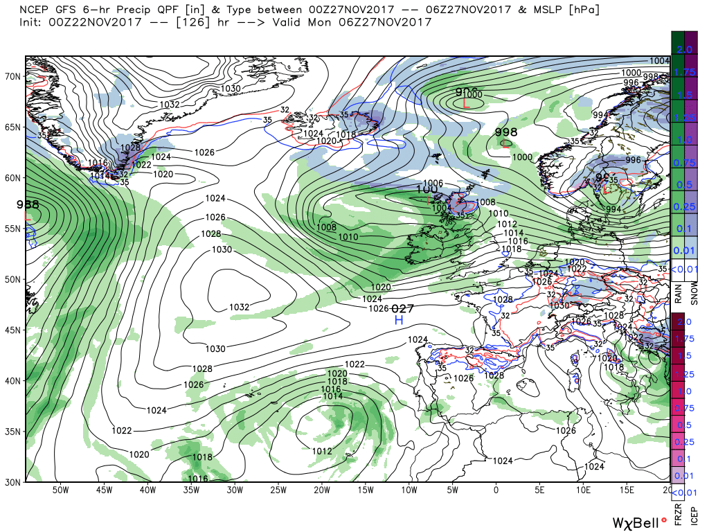
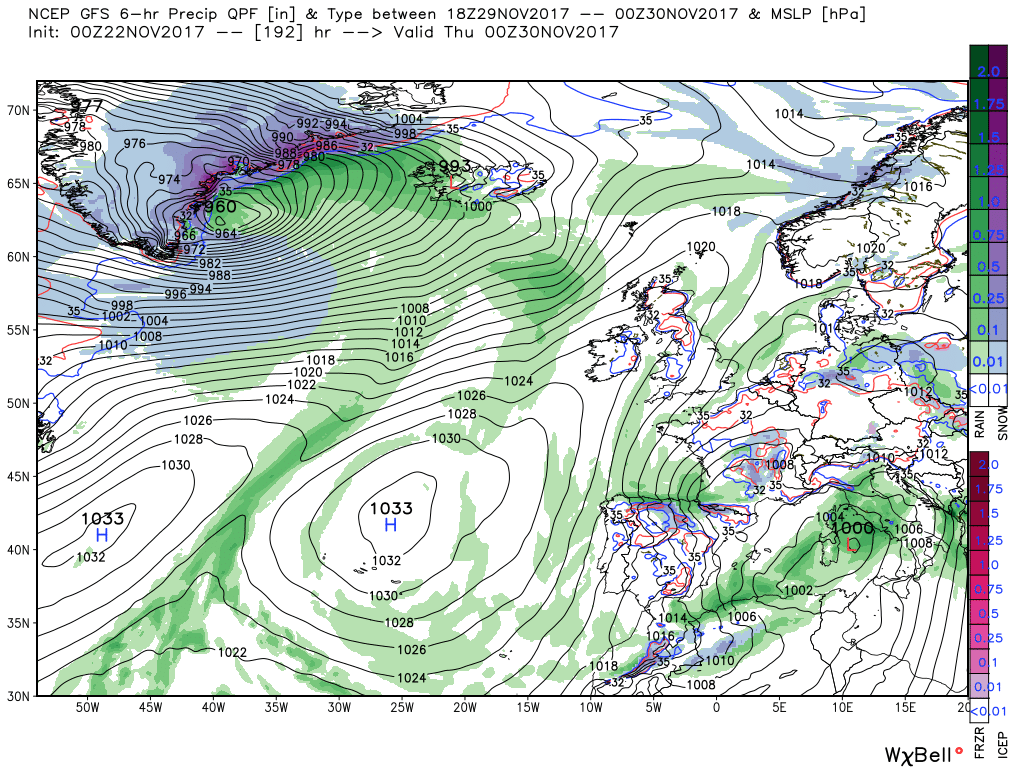
The front make little progress south as it comes up against the high pressure to the south east although far enough to introduce colder air over Scotland. Quite important this as another frontal low has formed to be 982mb just off the SW tip of Ireland by 12 Wednesday. Over the next 12 hours this deepens considerable and by 00 Thursday is 968mb over Ailsa Craig with gales and possible blizzards over the high ground in Scotland and strong south westerly winds and rain further south.
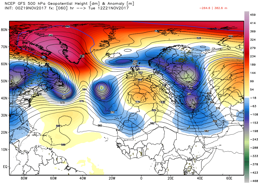
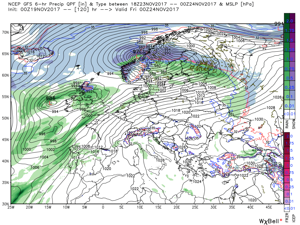
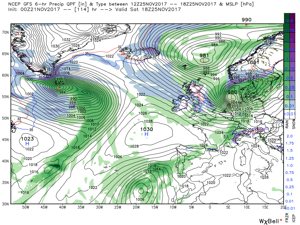
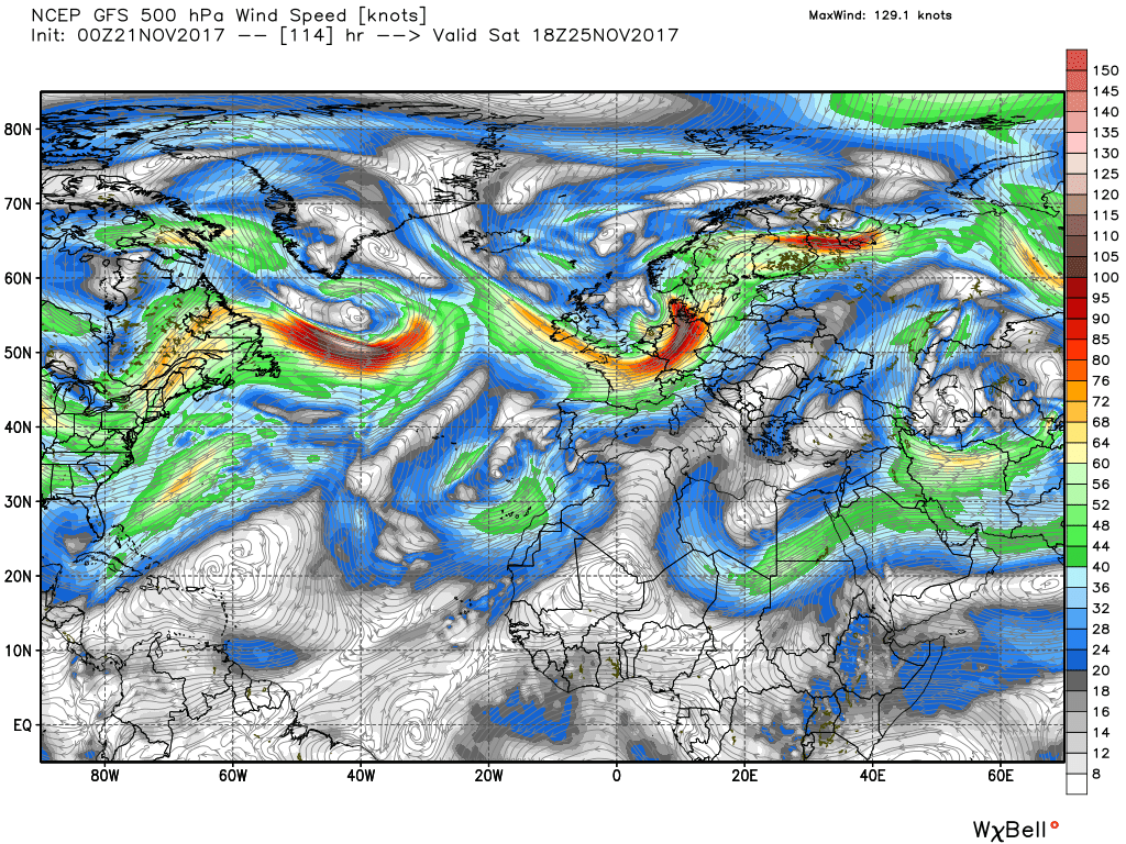
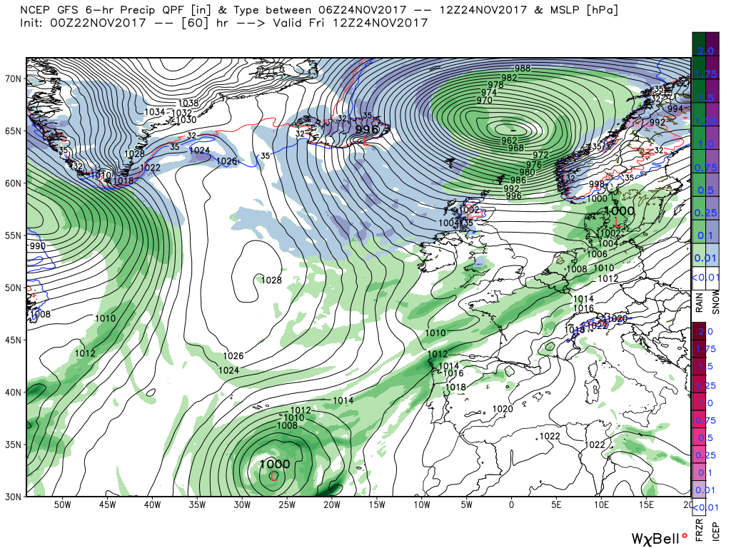
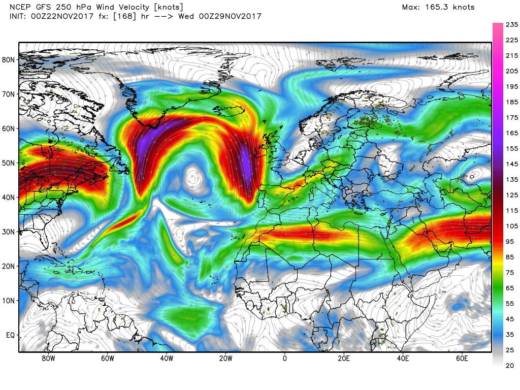
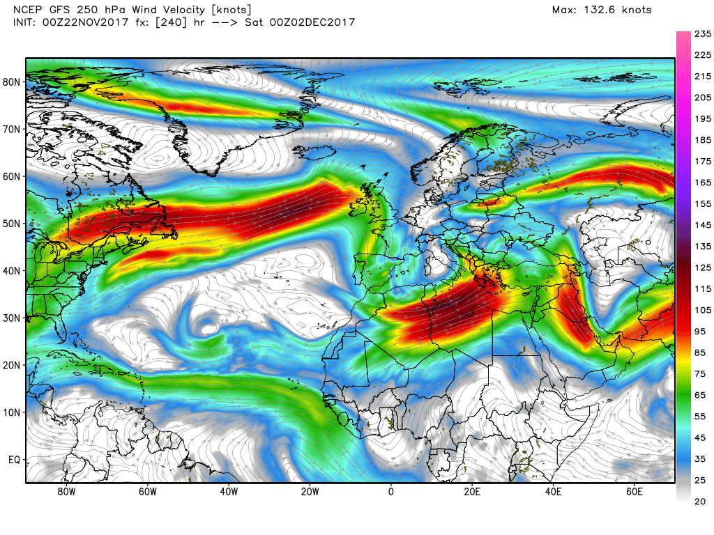
By Friday 00 the intense low has tracked into the west coast of Norway but the cold air behind does not get very far south on this occasion and the next systems that arrive, spawned by the large positively tilted upper trough also track east over Scotland which again could produce snow over the high ground
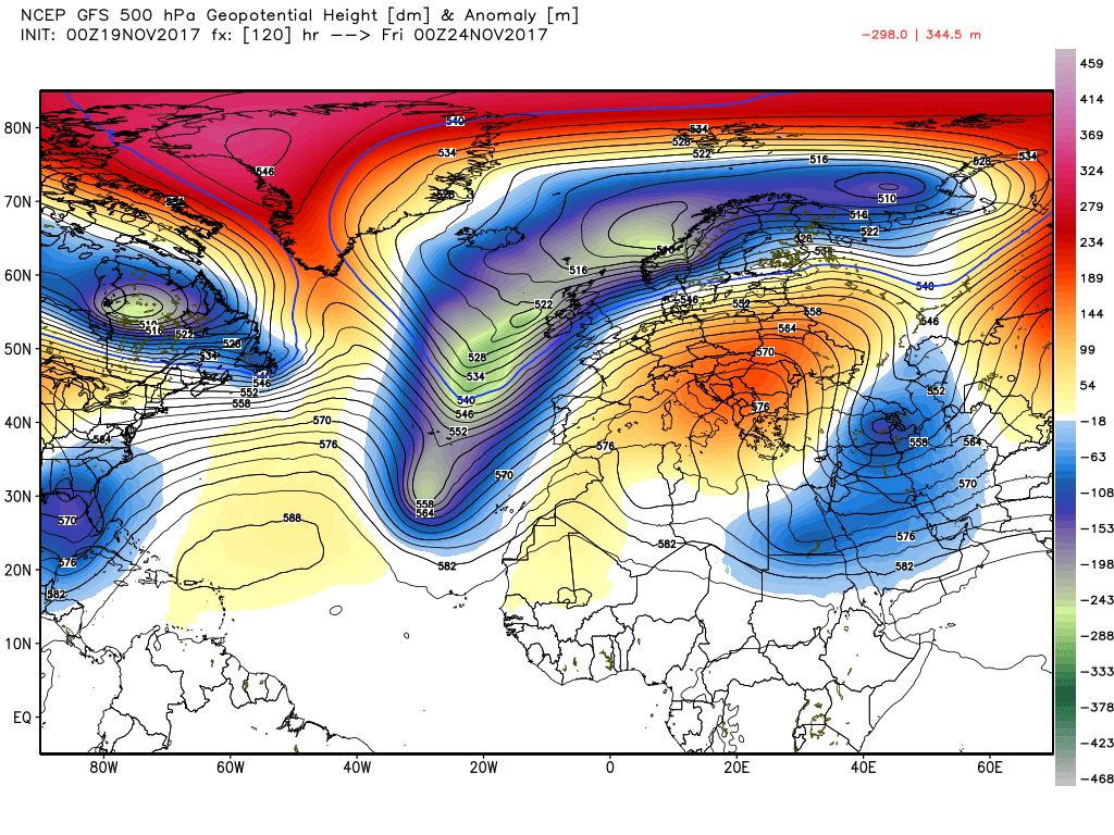
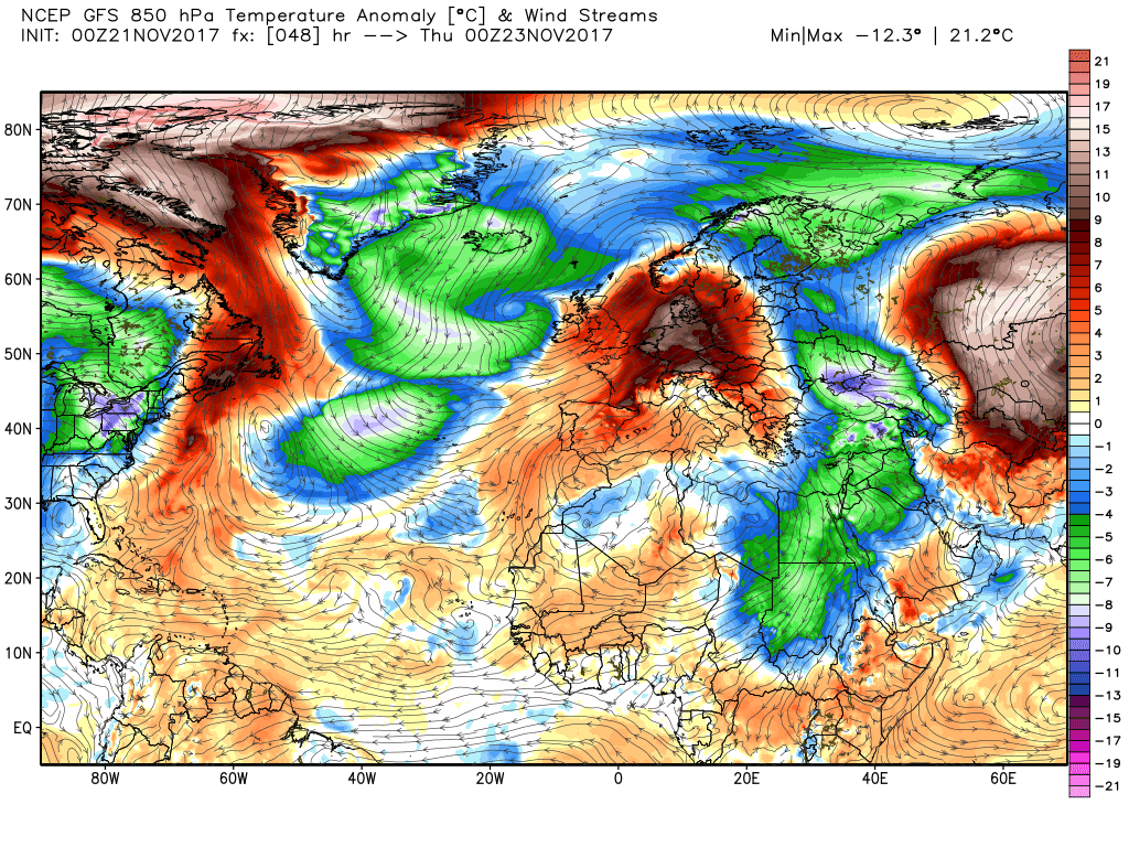
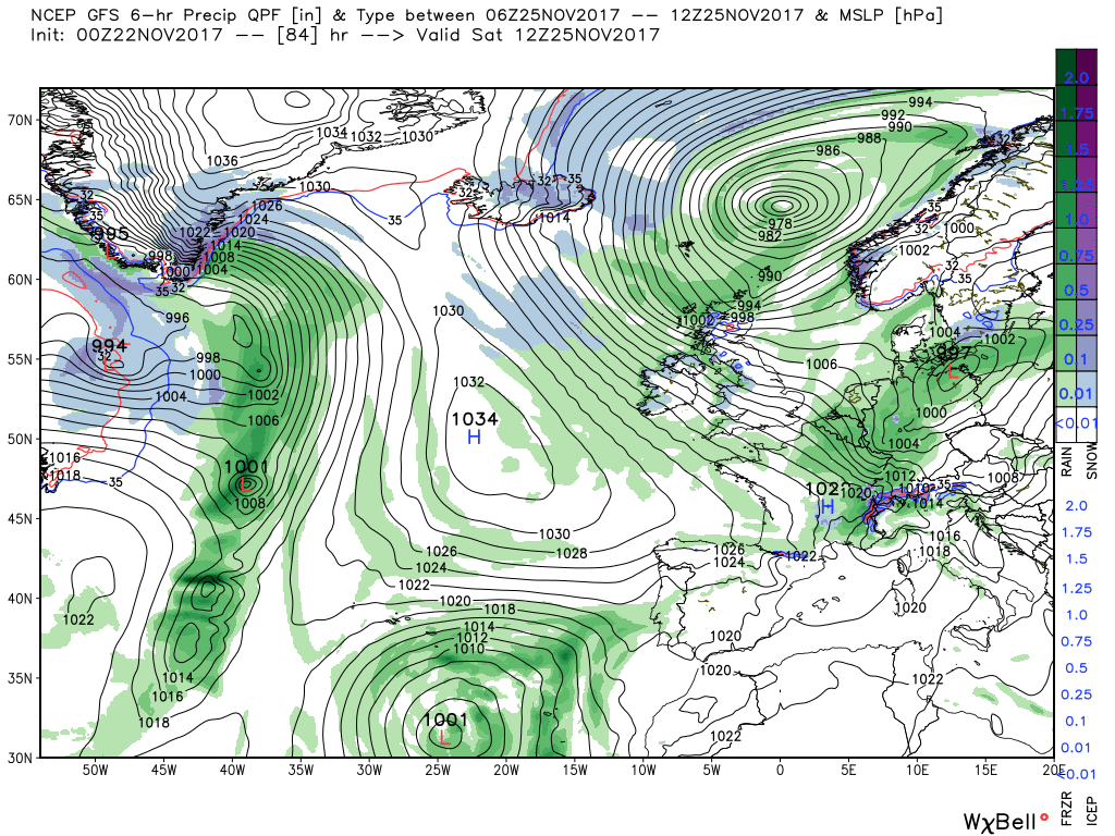
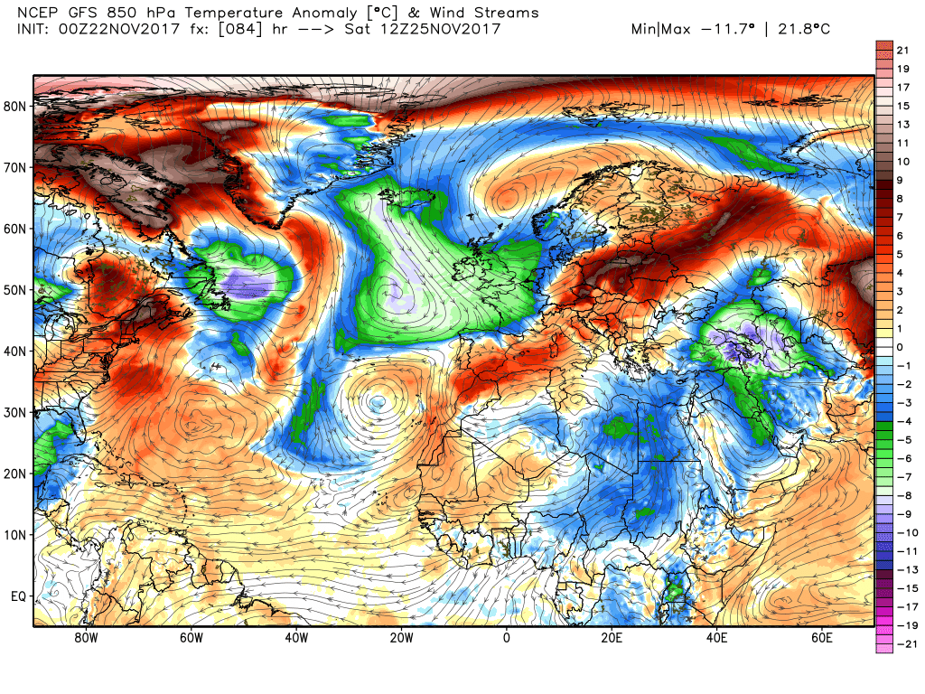
But the main trough continues to edge east and the next intense little surface low tracks across south England which greatly facilitates the ingress of the colder air to all parts of the UK by the weekend. The ecm starts differing with the gfs by Thursday when it is much more progressive with the upper trough which then deconstructs taking the main trough NE into the Norwegian basin and forming a cut off low to the south west of the UK. Thus the colder air is introduced over the UK much quicker in the north westerly gales and wintry weather behind the intense surface low.to the NE