UK meteorology

If no-one else is reading this thread, perhaps I might be informed so I'm not posting things purely for my own amusement, please?

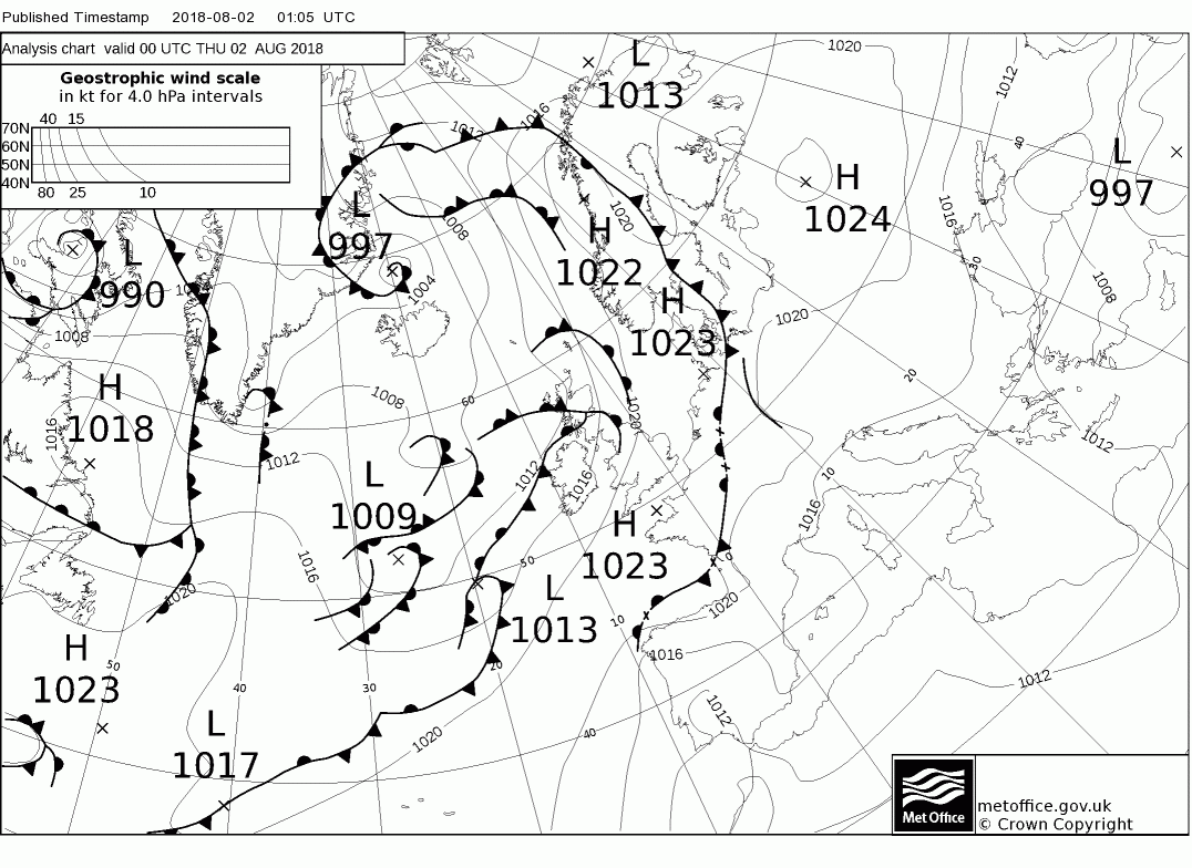
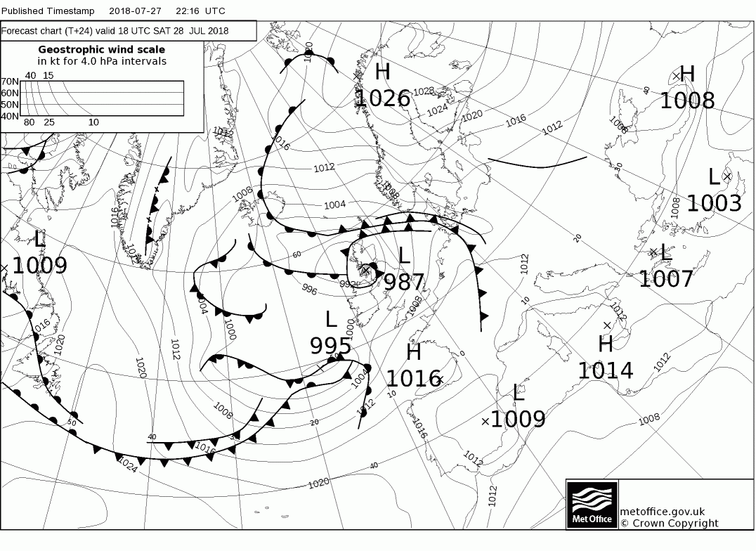
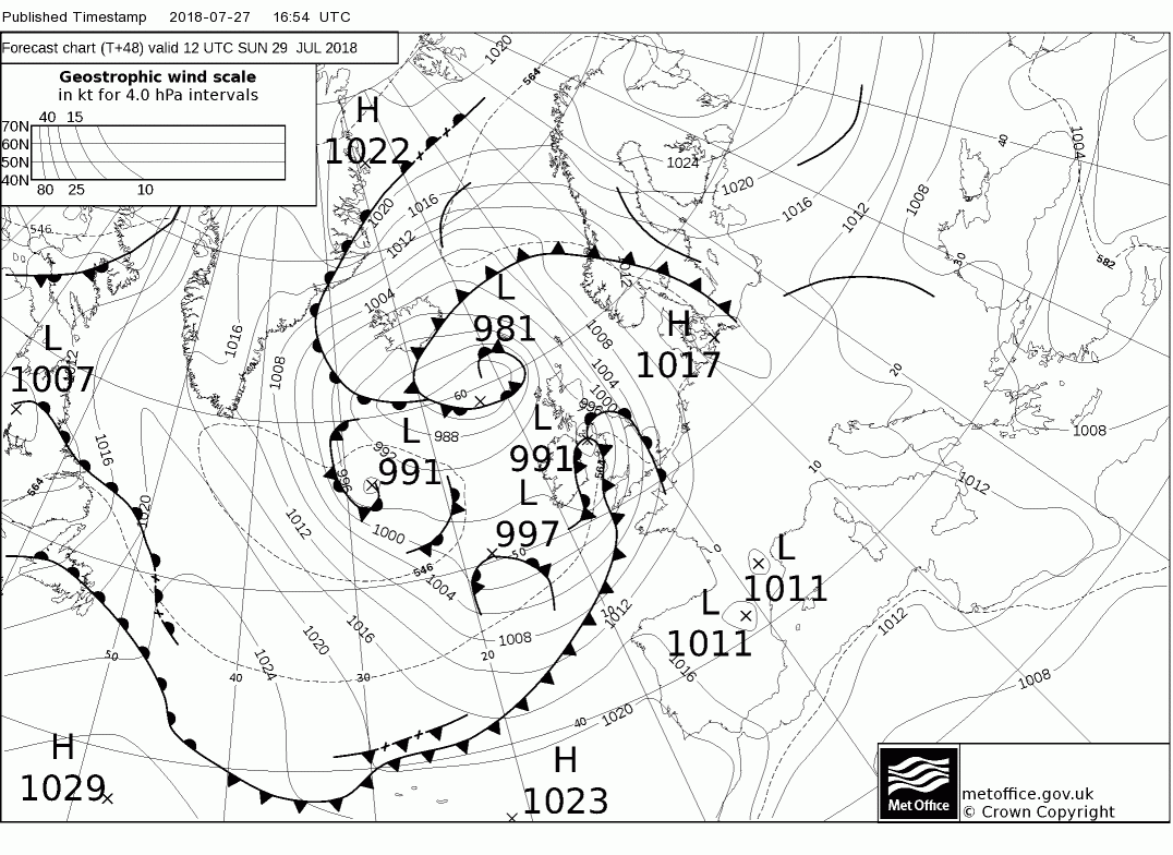
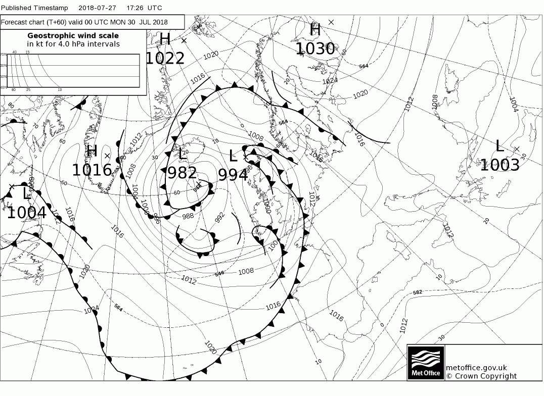
Malcolm's short-range analysis part 1:
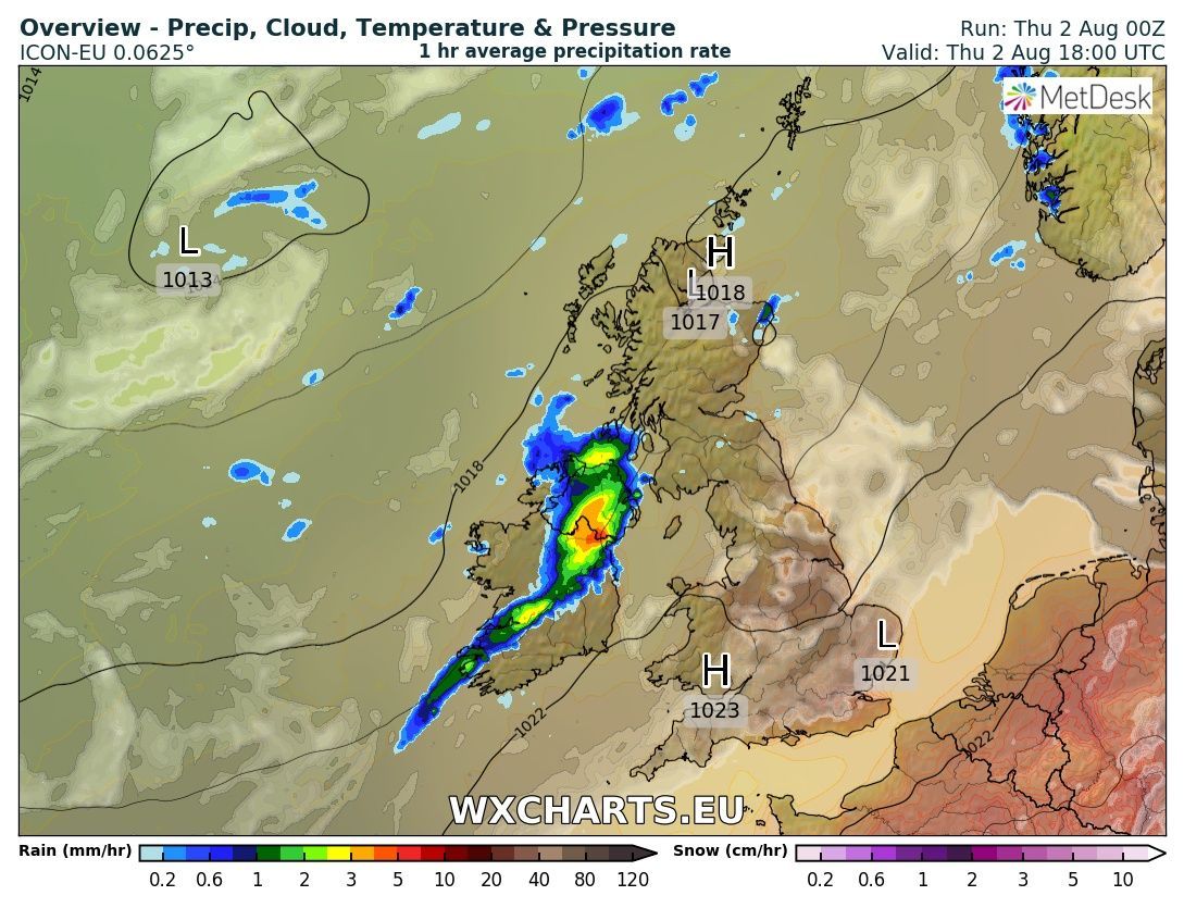
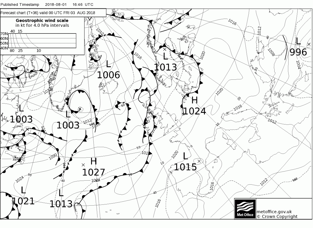
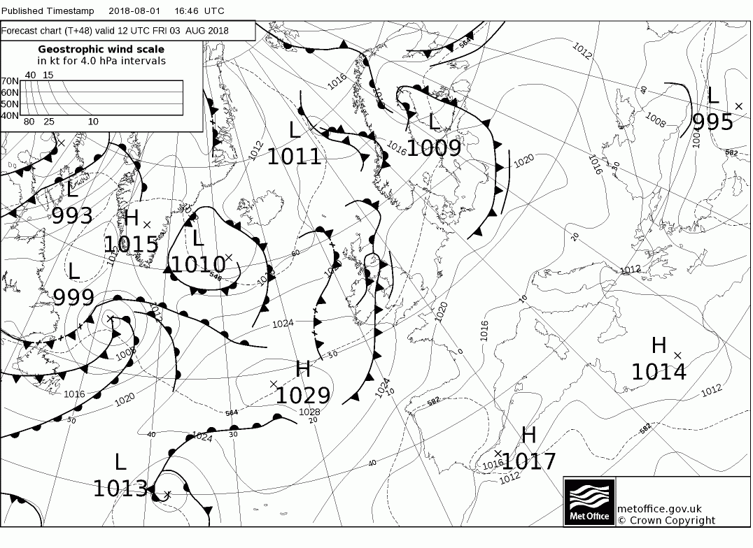
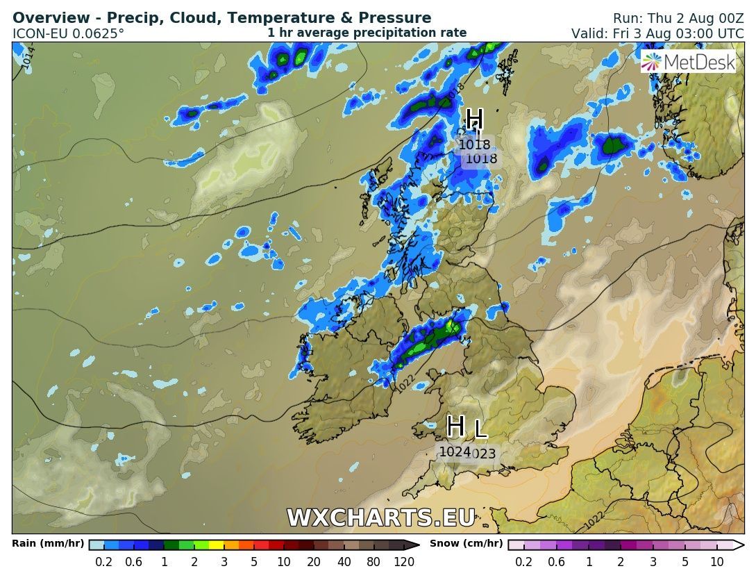
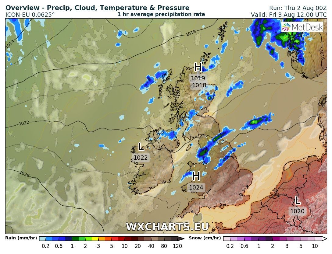
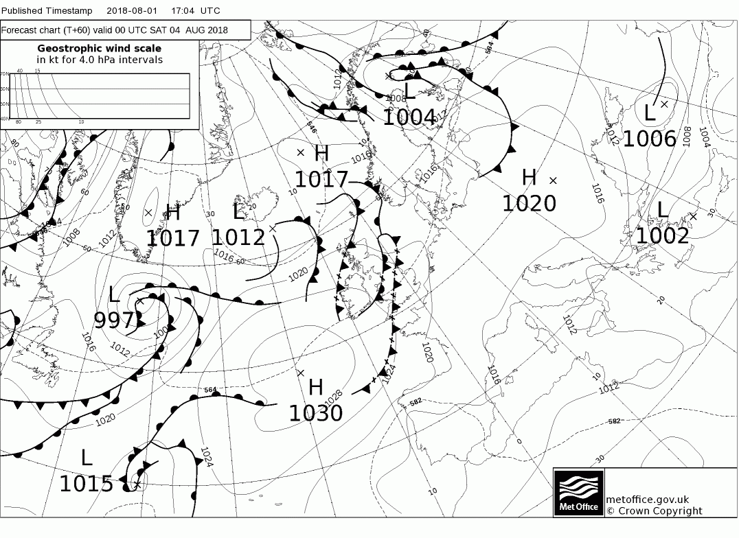
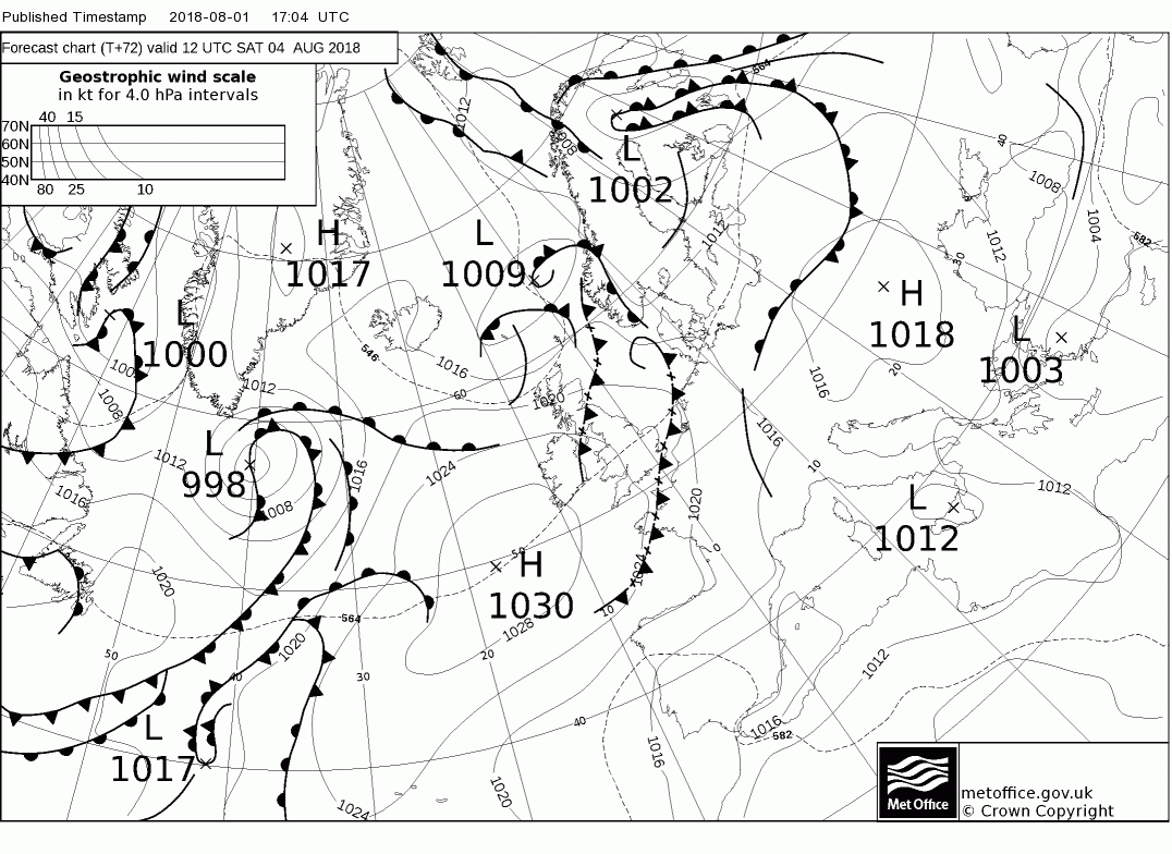
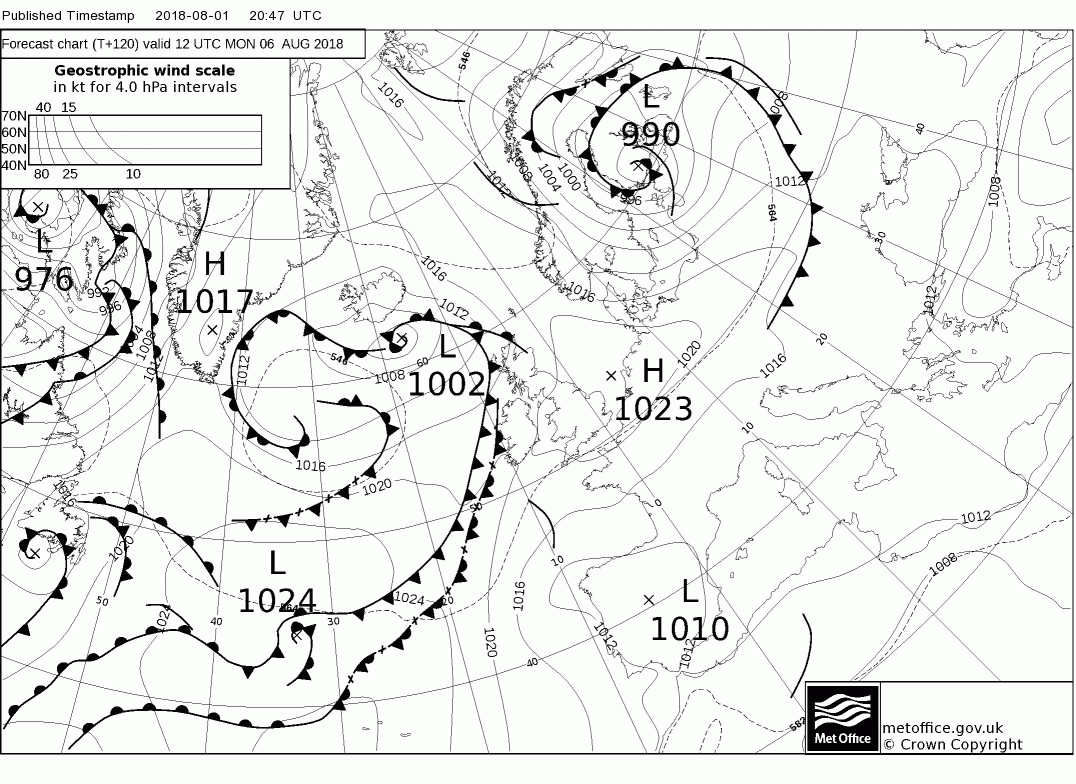
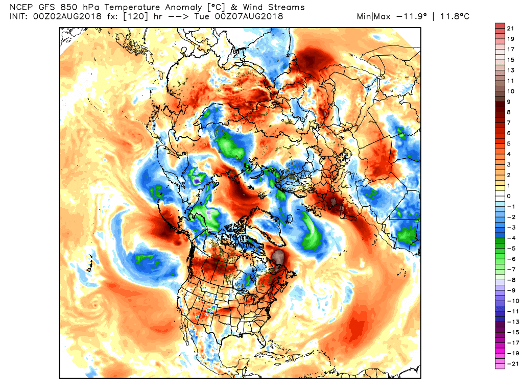
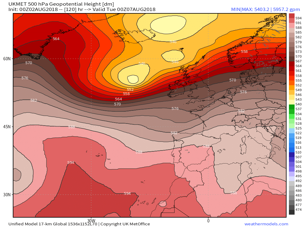
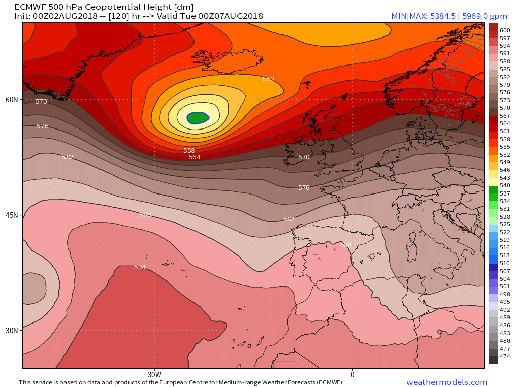
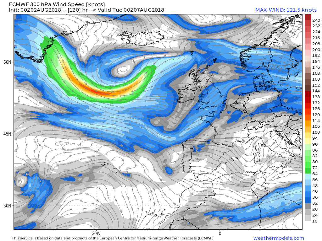
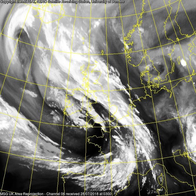
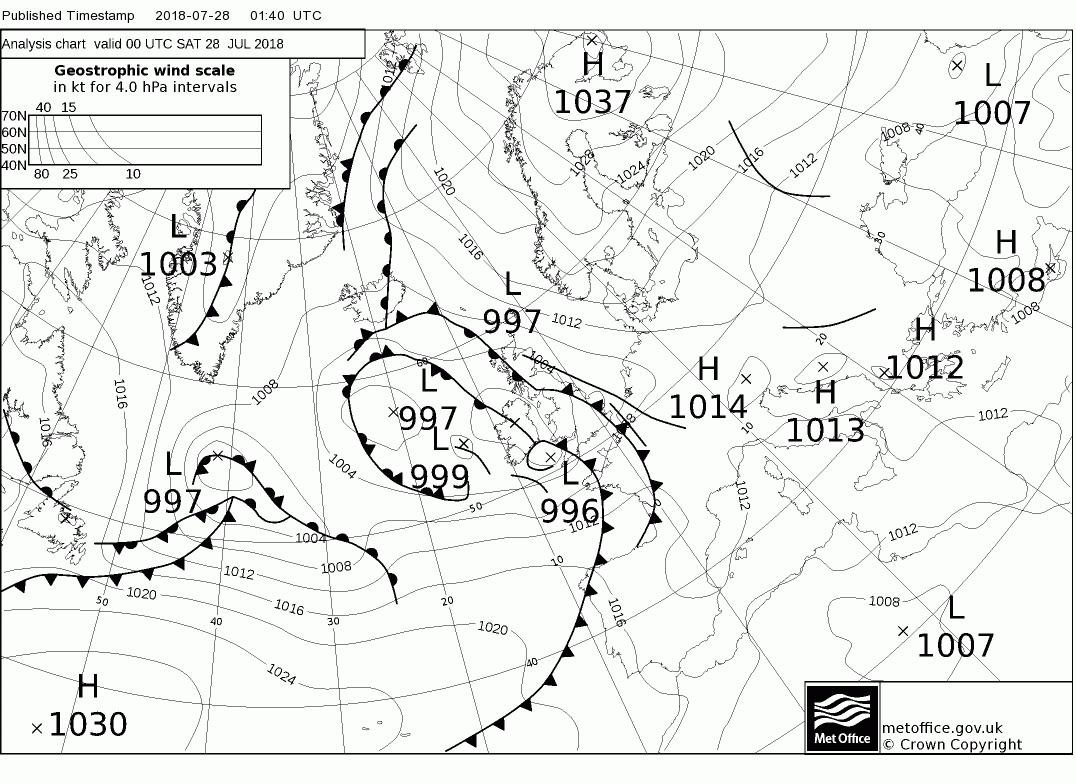
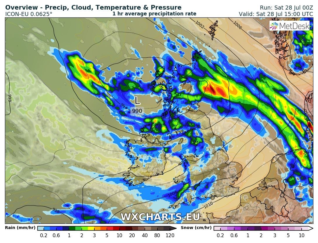
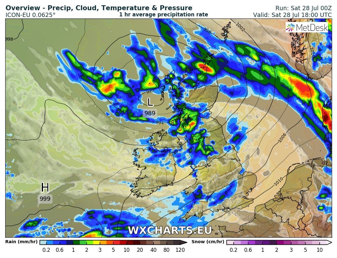
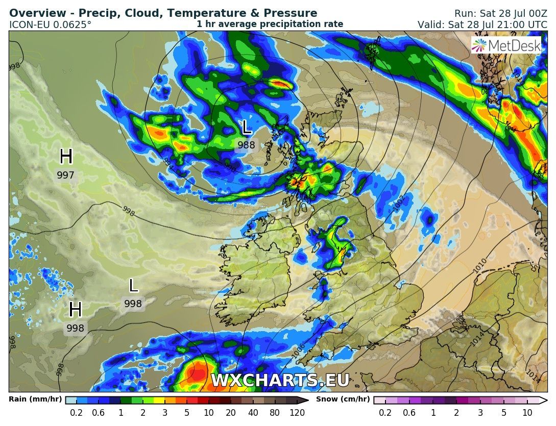
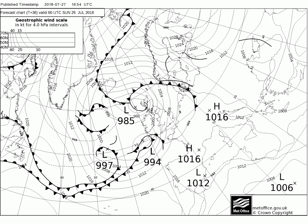
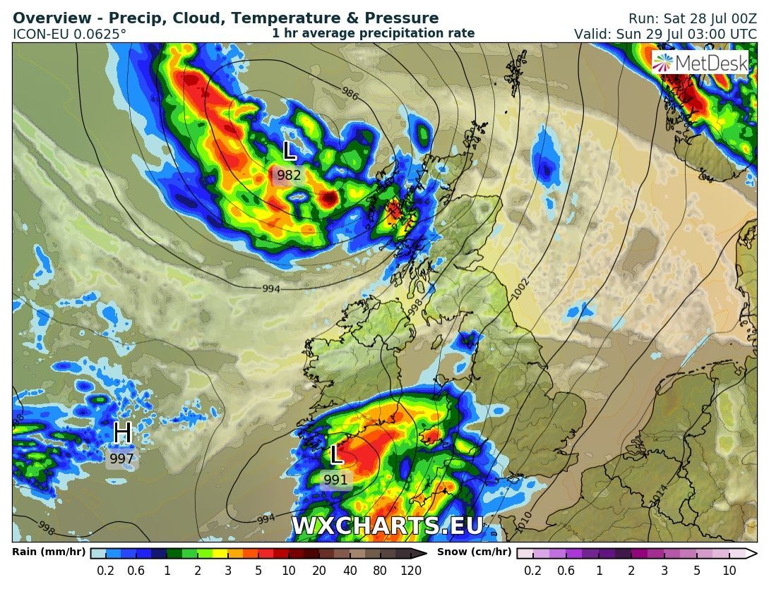
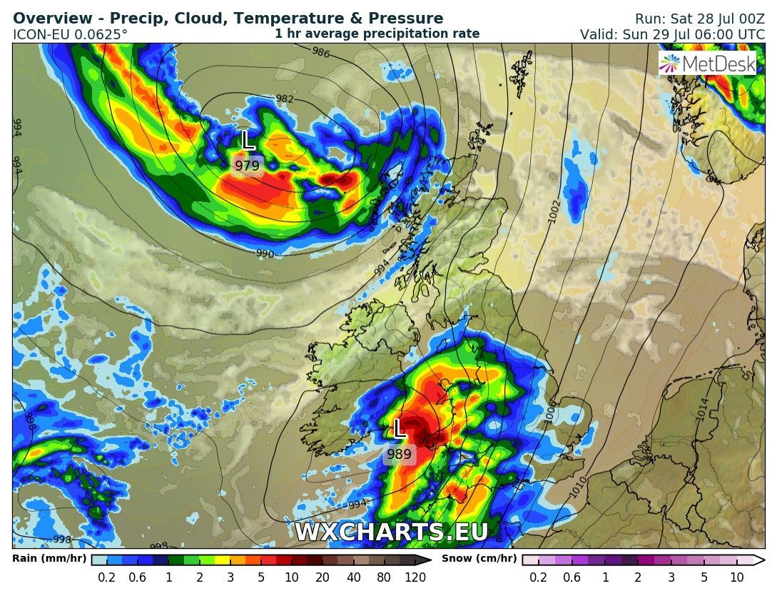
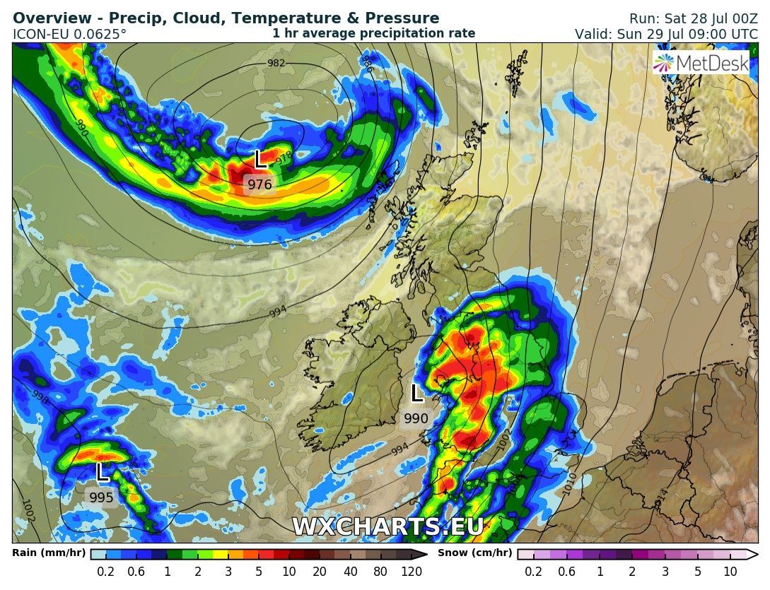
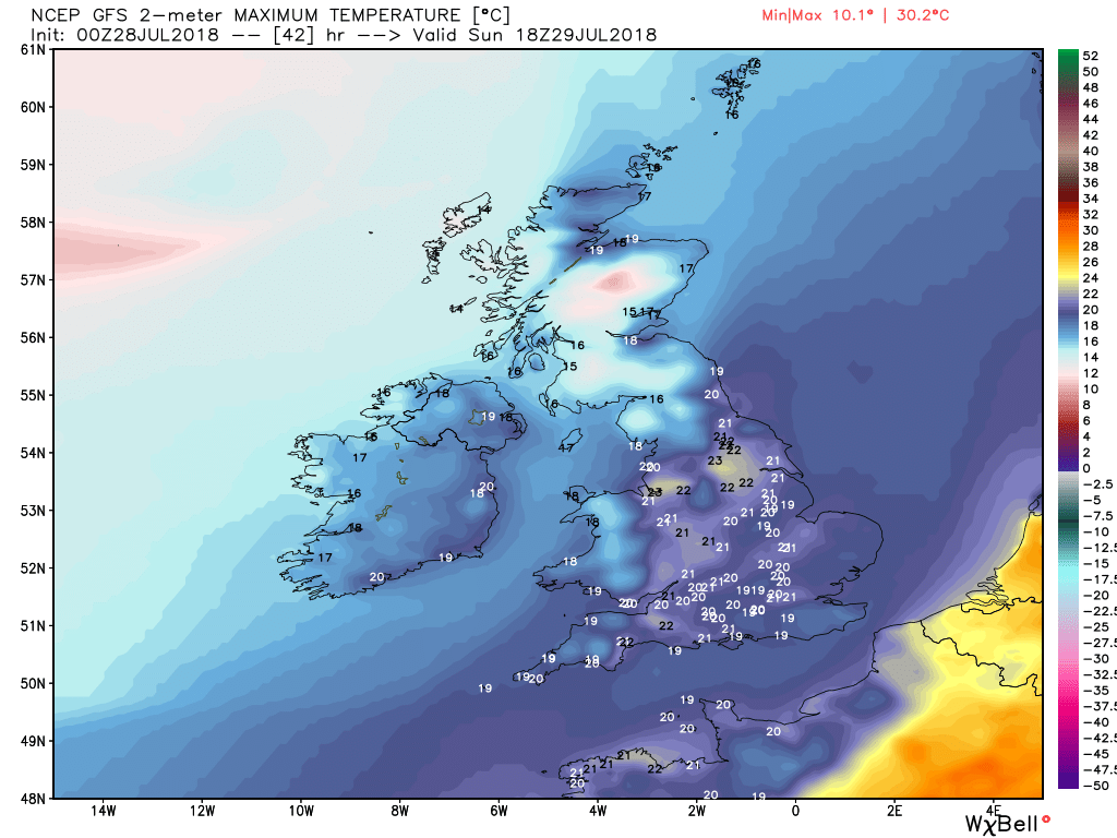
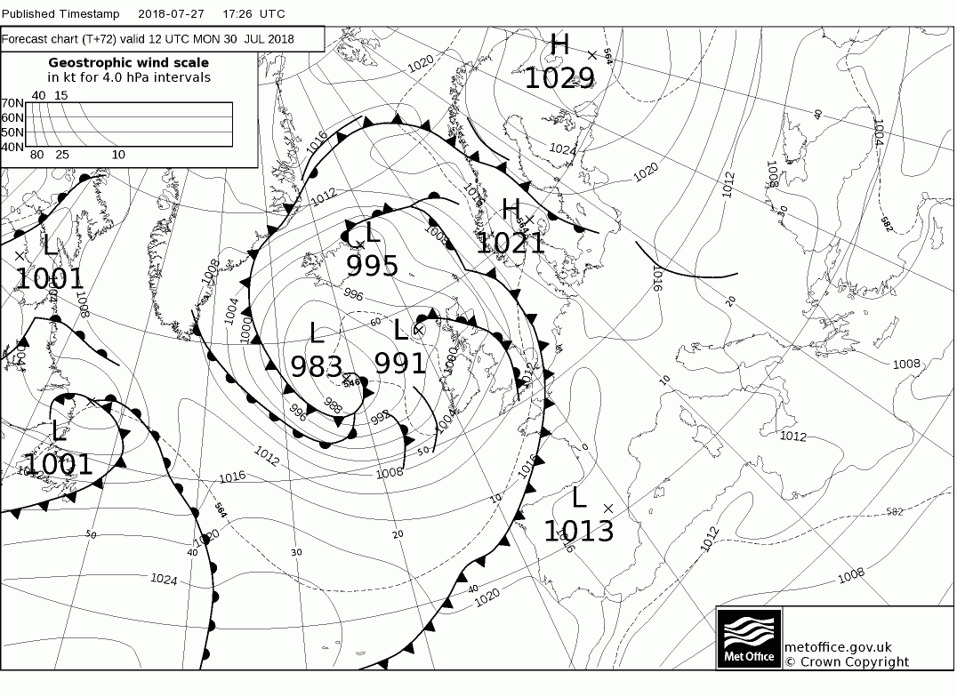
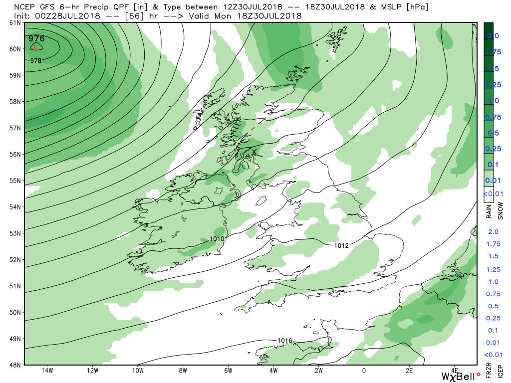
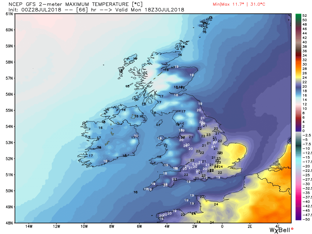
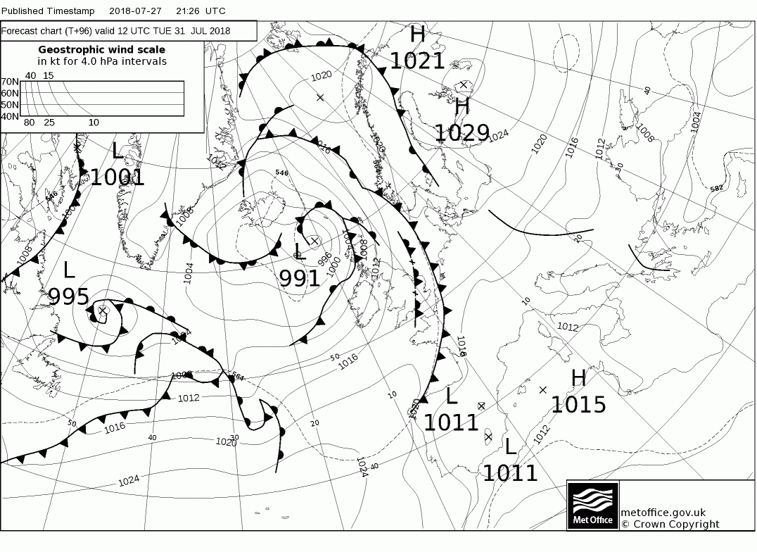
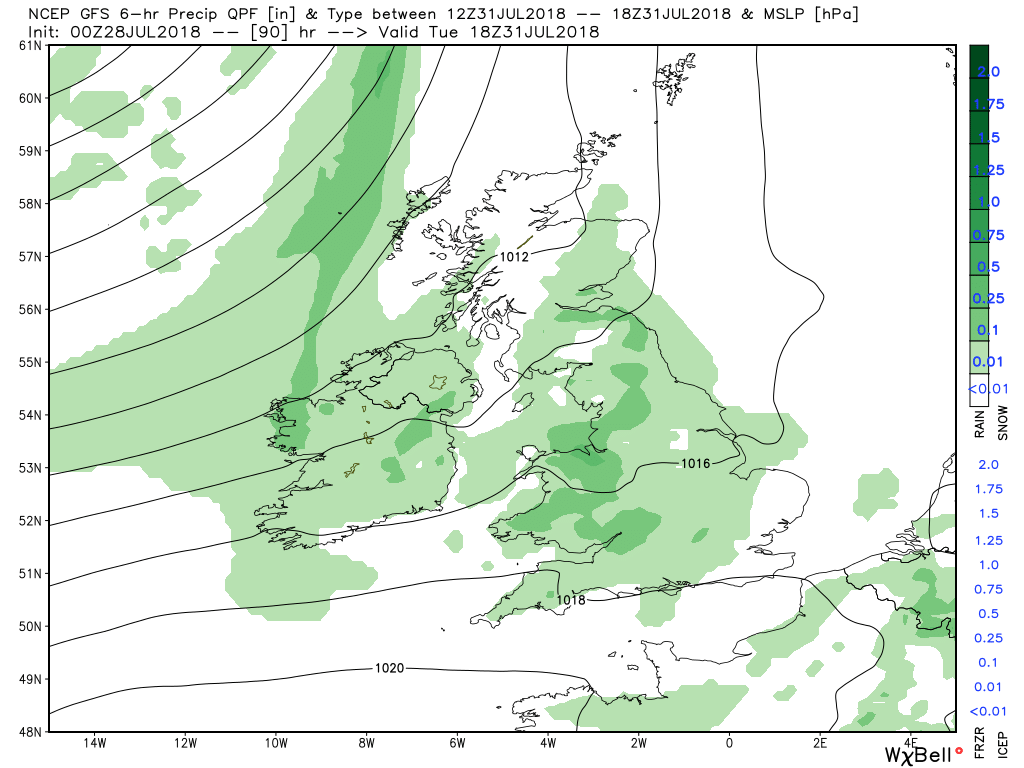
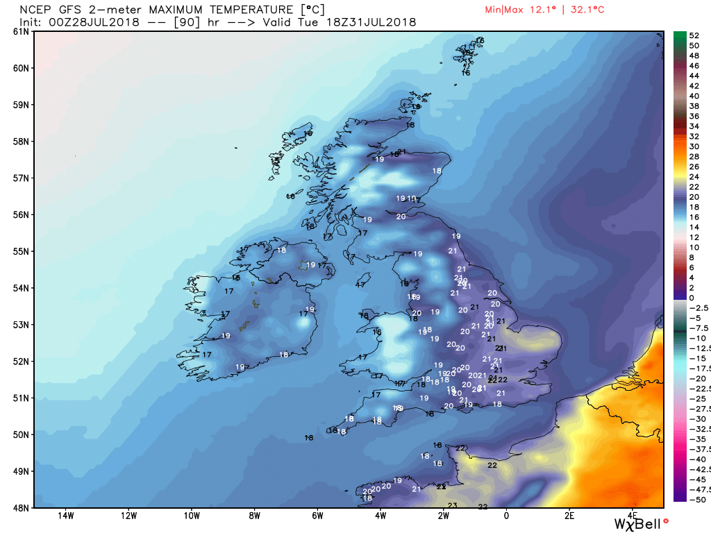
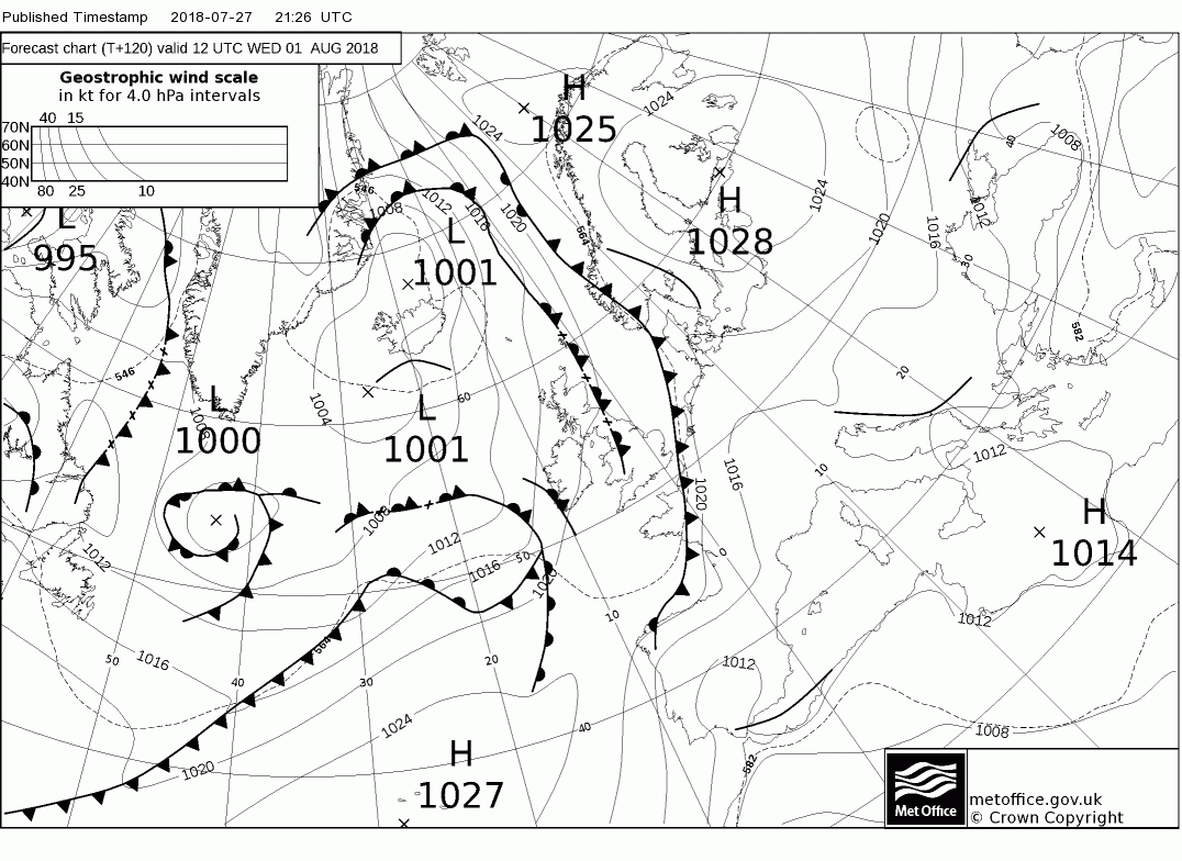
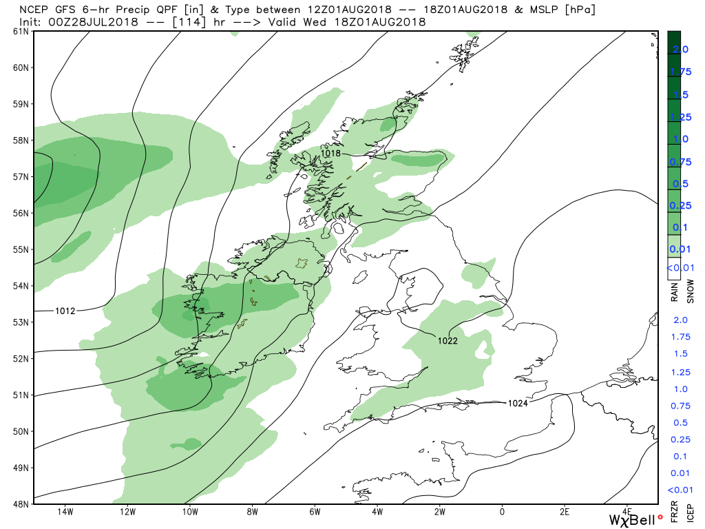
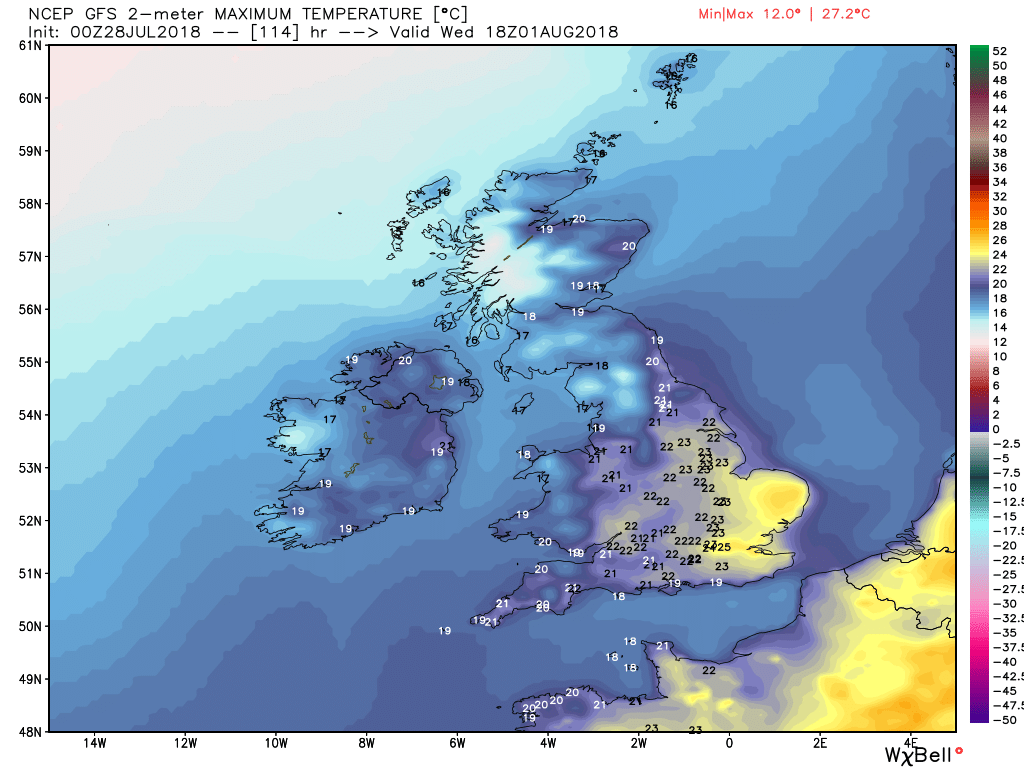
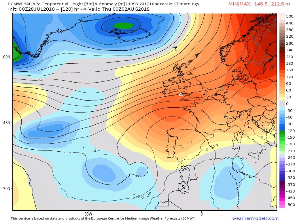
The outlook over the next few days Is certainly different to what we have been used to recently with the cyclonic influence becoming paramount and thus bouts of wind and rain with temps much cooler


Currently the storms of yesterday evening are still effecting the north east and will continue over eastern Scotland as the cold front clears into the North Sea.


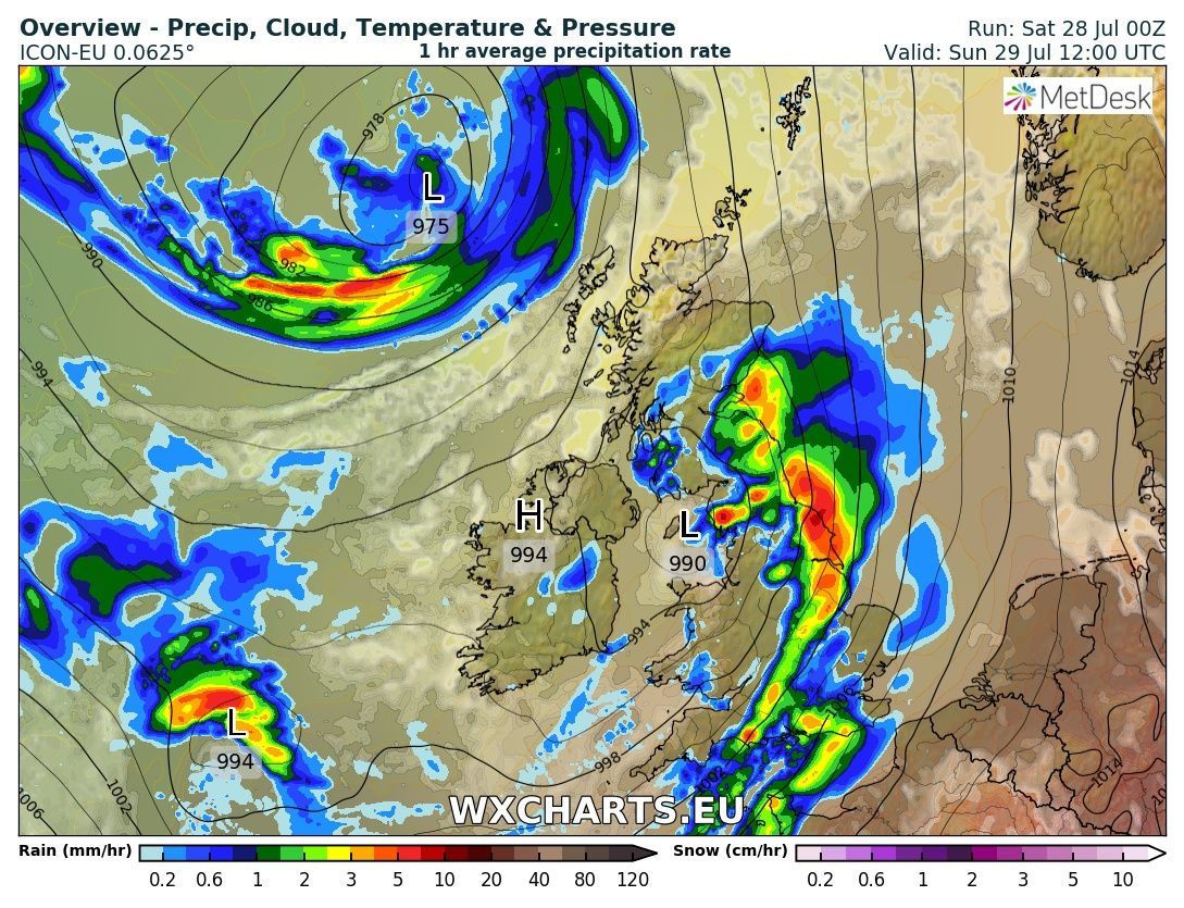
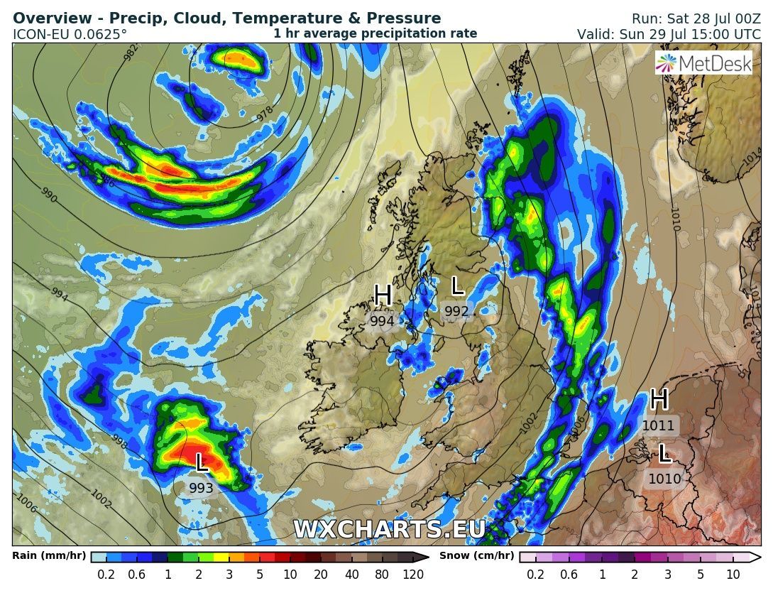
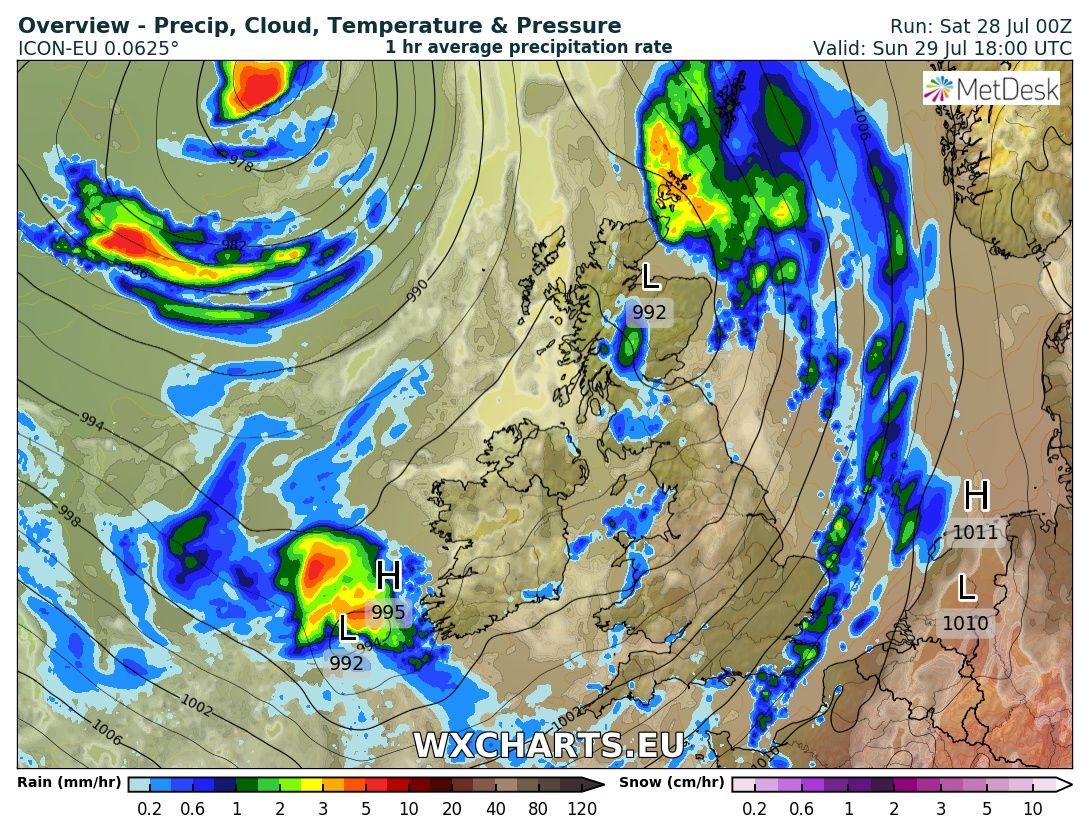
With the center of the low pressure adjacent to western Scotland frequent heavy showers will be the order of the day, particularly in N. Ireland and western areas, in the brisk south westerly wind with temps much nearer average. But away to the south west the next wave with associated fronts is winging it's way north east and more concentrated cloud and rain will effect the south west by evening.


Part 2:
Overnight and through Sunday the low will track NNE across the UK to be north of Scotland 994mb by 00 Monday so Sunday will be a wet and windy day, with gales in some areas, for virtually everyone


by Monday the UK and the eastern Atlantic are dominated by low pressure centred to the west and north west of Ireland with fronts just clearing east into the North Sea so the UK in a brisk south westerly wind with frequent showers, mainly concentrated in the north and west.


A not dissimilar day on Tuesday with temps perhaps even a little below average


Finally, part 3:

Wednesday sees high pressure starting to ridge NE into the south so a tad warmer but systems still swinging NNE bringing some cloud and rain to N. Ireland and western Scotland


And the NH profile at T120


From T96 the ecm starts the process of deconstructing the trough in mid Atlantic which initiates northward ridging of high pressure from Iberia into the southern half of the UK and thus more settled conditions and temps warming.


Most likely scenario over the next few days involves a short-lived period of hot, sultry air in the south on Thursday/Friday and possibly into Saturday before the ridge sinks southwards or if it stays out to the west of the UK, however, if the surface High detaches from the upper ridge and drifts to our east, it will draw up a plume from the currently exceptionally-hot areas of western Europe such as Iberia (GFS predicts a European record daytime maximum of 52C on Saturday!:eek:
 
Malcolm's thoughts part 1:
The outlook is for the temps generally to continue above average, perhaps significantly so at times in the south east, but with conflicting energy flows very much a NW/SE split with the detail on occasion difficult to pin down.


The current NH profile


Today the warm front that brought some rain to the north west yesterday has moved away leaving much of the UK in a humid, warm sectorish, south westerly airstream thus cloudy and misty and maybe some drizzle in western areas but in the clearer south east temps starting to pick up although it is quite warm generally. But during the afternoon the next system tracking up from the south west will bring cloud and rain into N. Ireland and then later into Scotland.


The system will continue to bring patchy rain to Scotland during the night and into Friday and as the cold front pushes south east so will the cloud and rain, albeit that will tend to fizzle out as the front weakens against the high pressure. But it will mark the temperature boundary and south of the front temps will get locally hot.
 
Part 2:


Overnight Friday and trough Saturday fronts continue to track around the strengthening ridge but perforce weakening as they do so so just the odd shower over northern Scotland but still the emphasis on a NW/SE split


Sunday the twin energy flows are entering the picture with the trough to the west getting some traction on the jet but for the time being the ridge is quite resilient and generally it is another warm and sunny day


By Monday the fronts and low pressure will have made some inroads in the north west so some cloud and rain into N. Ireland and Scotland but apart from here generally another very warm day,


The NH profile at T120


Back
Top Bottom