UK meteorology

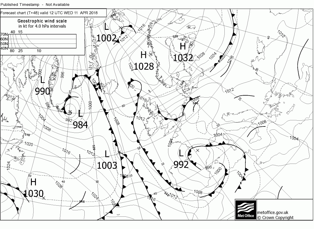
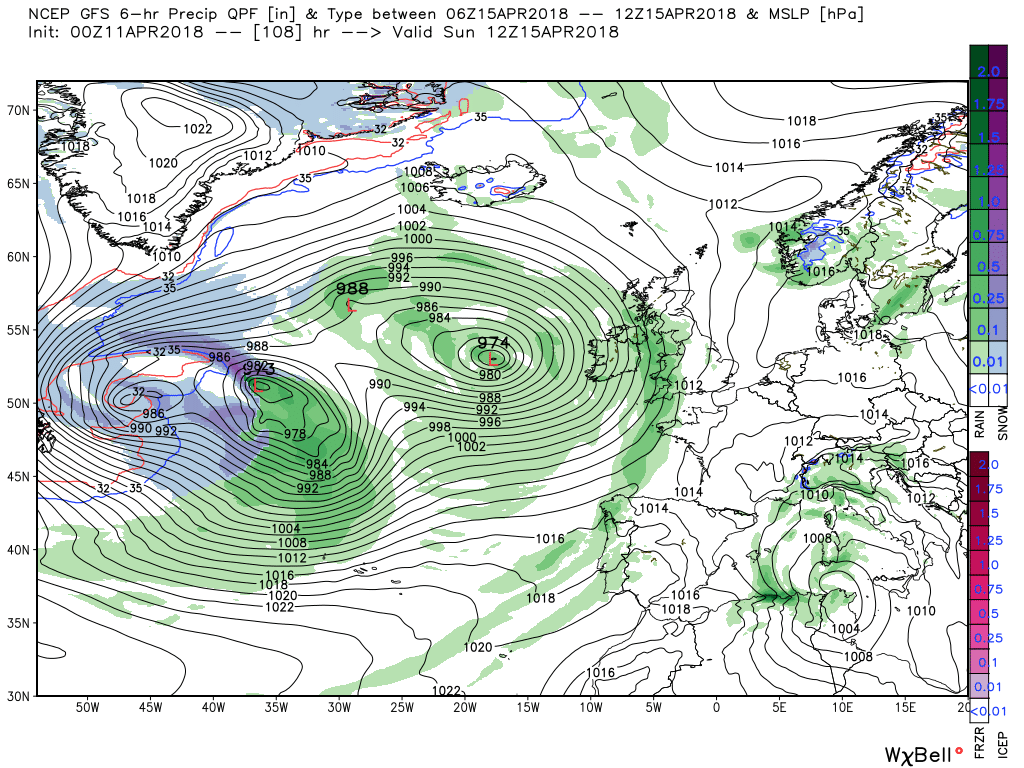
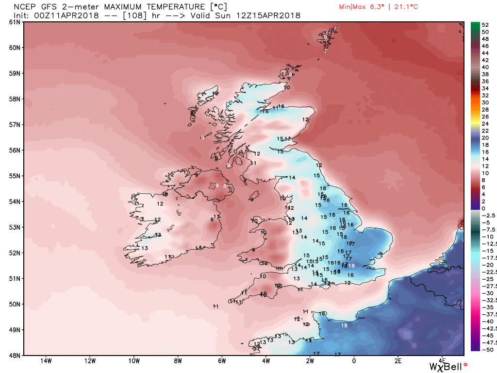
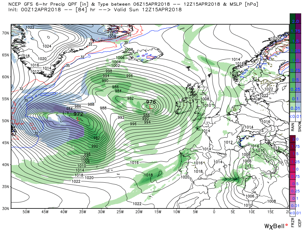
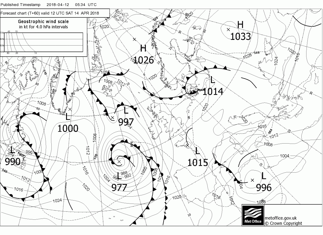
Malcolm's view as of Monday 9th:
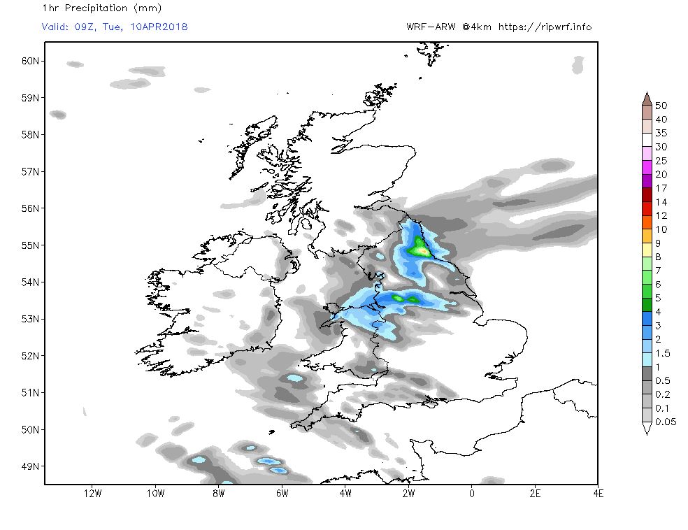
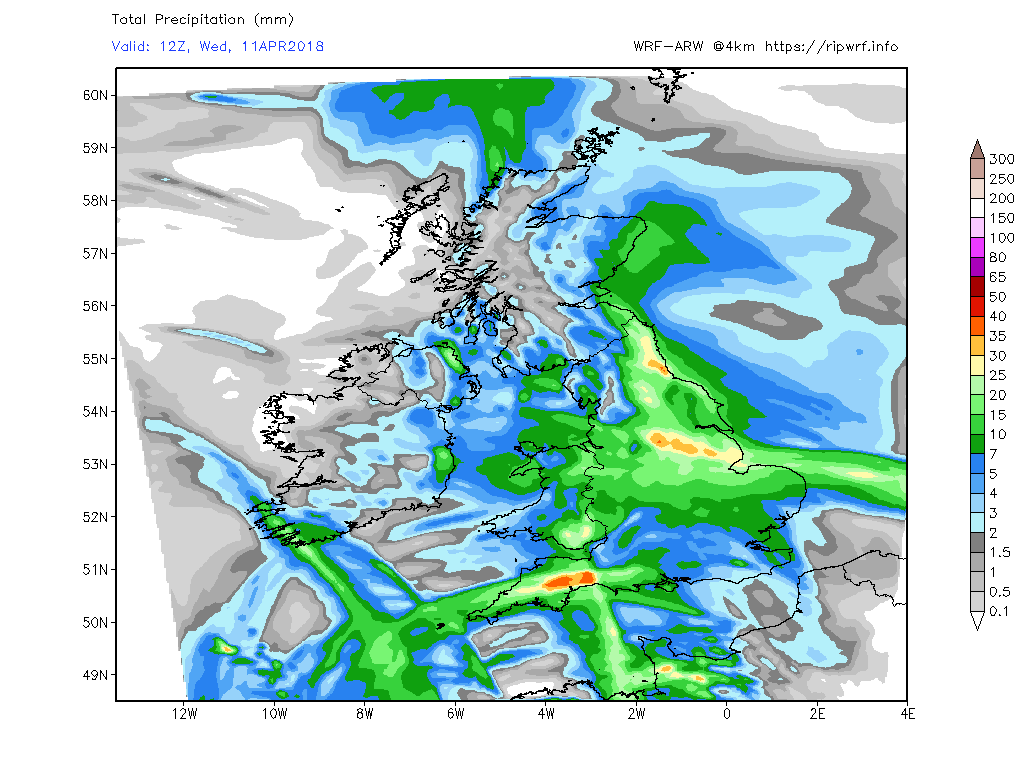
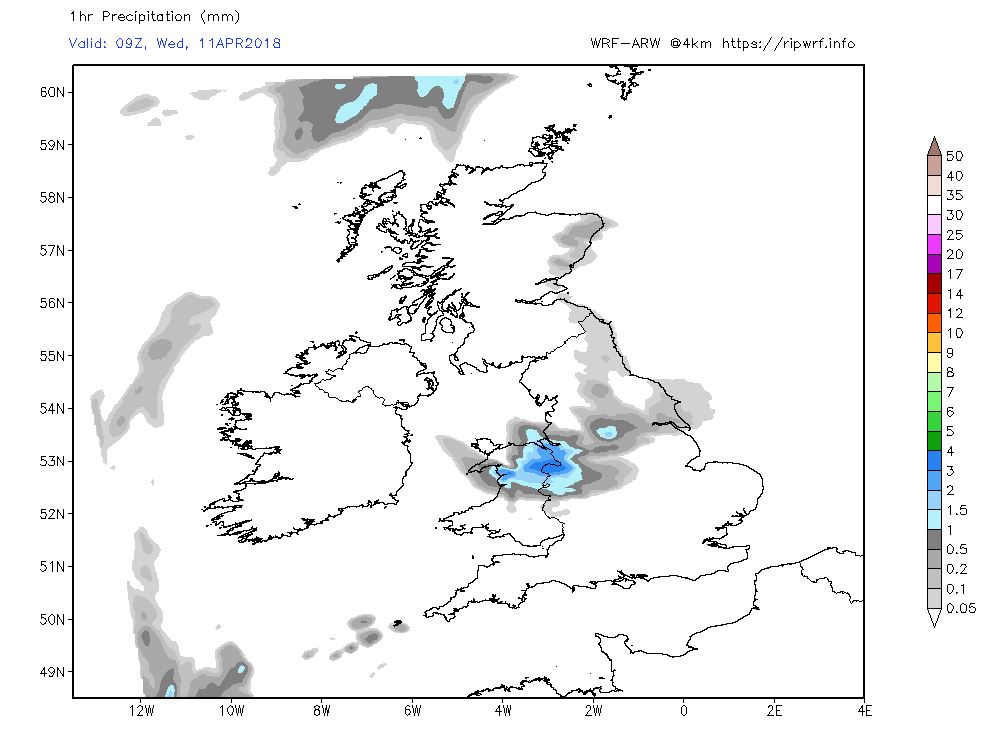
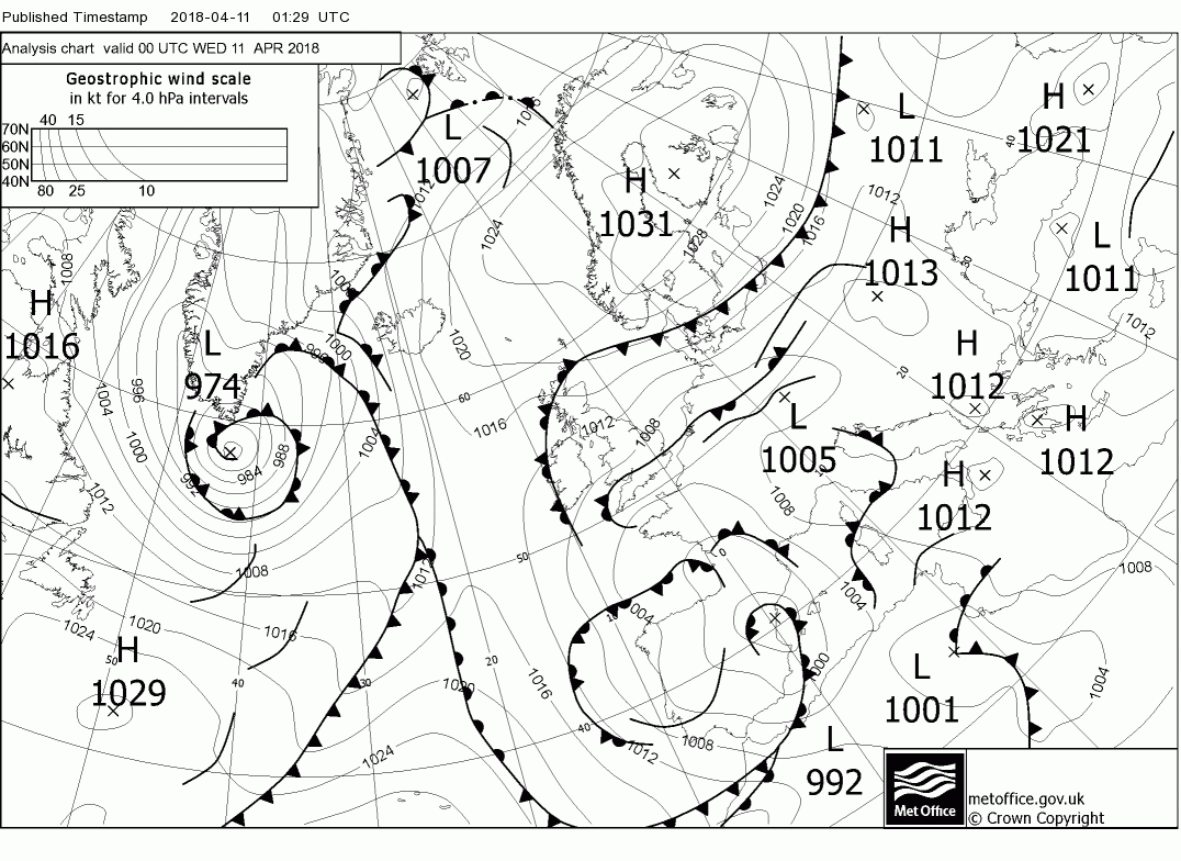
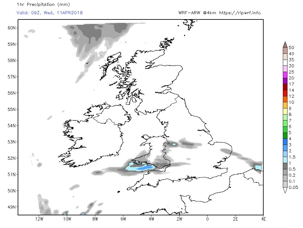
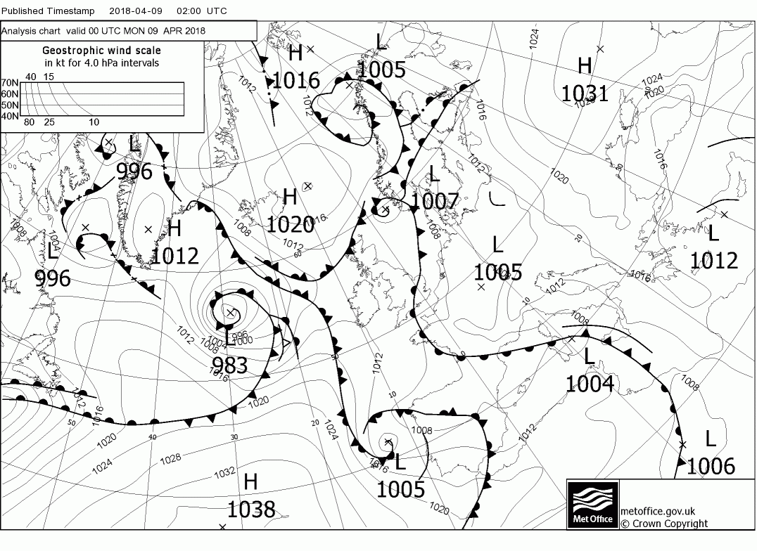
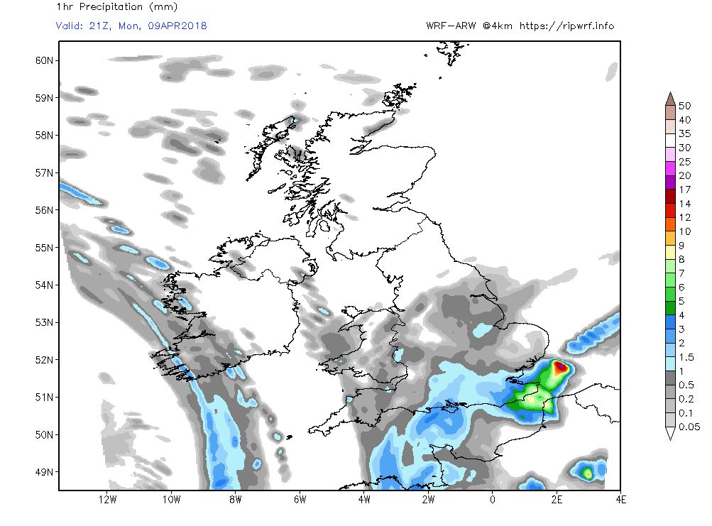
The overnight analysis shows low pressure to the west and south with a front to the south east moving NW during the day. So the UK can effectively be divided into two today and tonight vis the weather with N. Ireland, Scotland and until later N. England getting the best of the sunshine, albeit with a few showers, whilst rain will spread NW from the south east during the period thus cloudy and wet elsewhere.


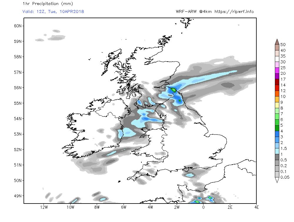
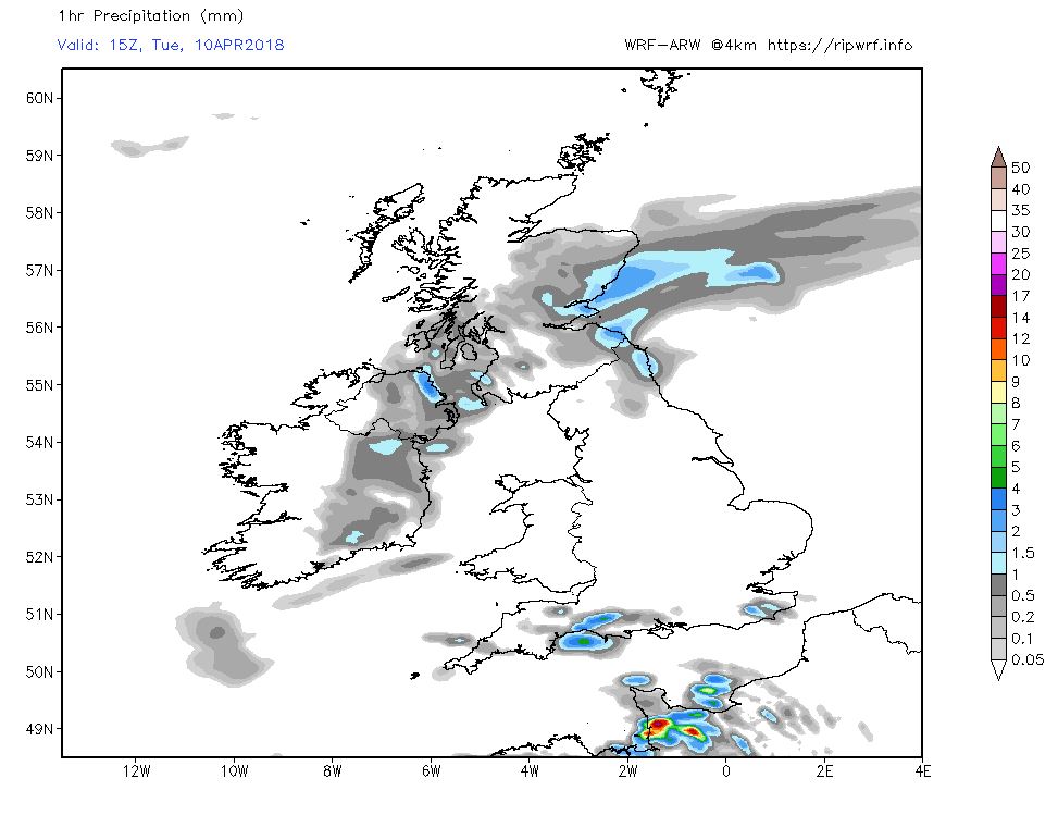
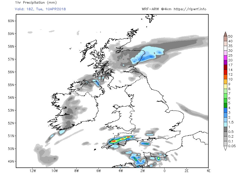
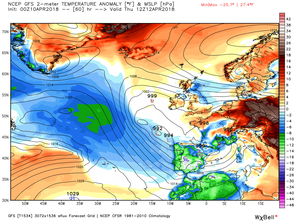
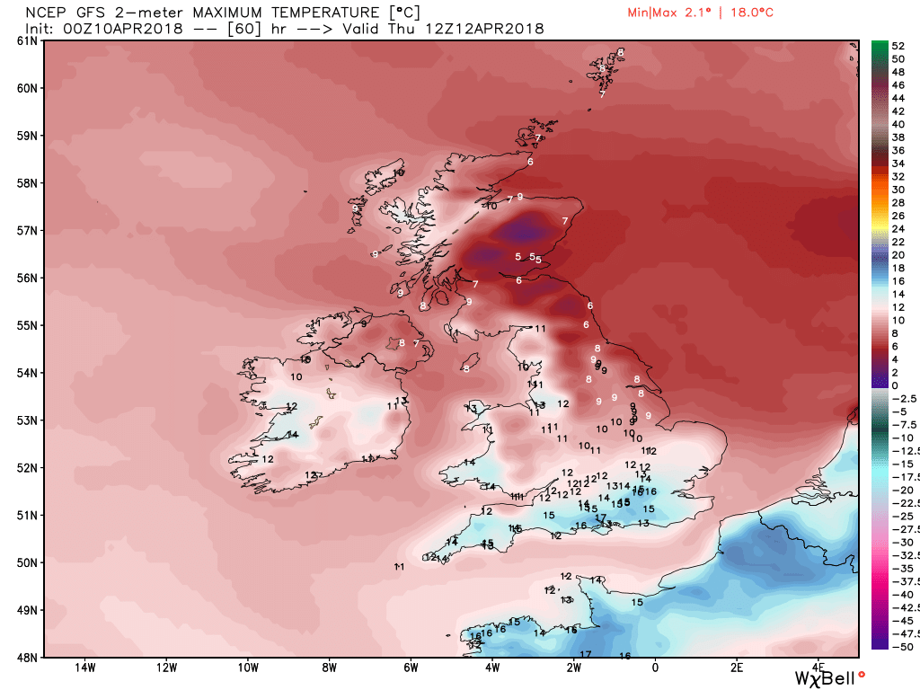
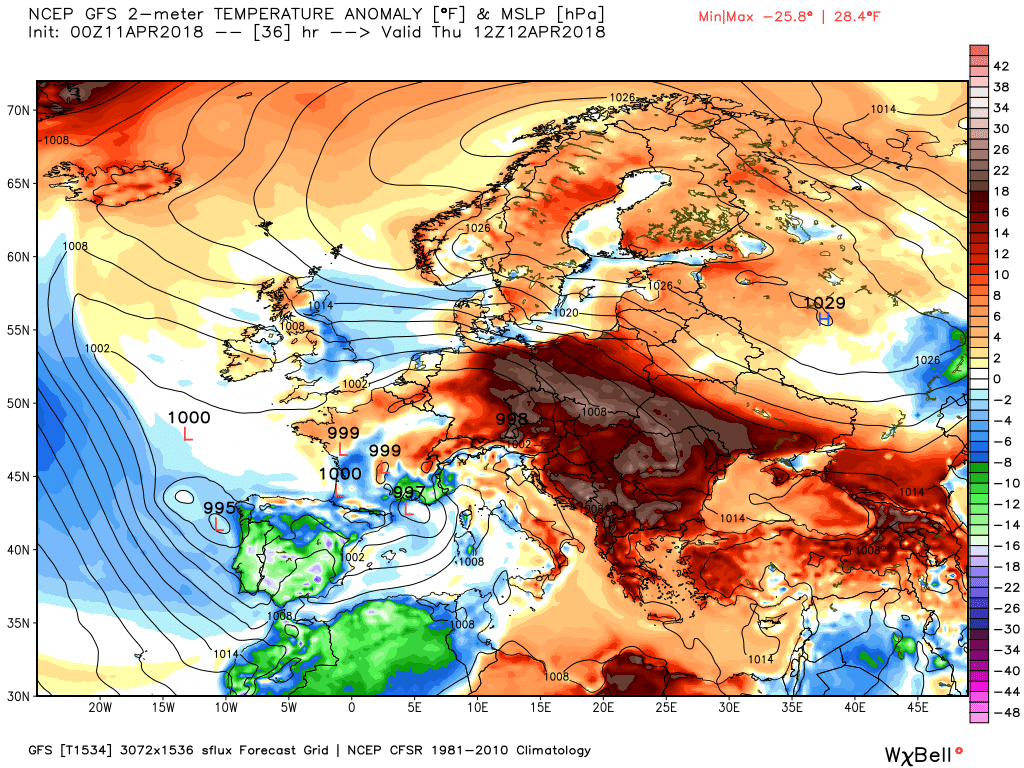
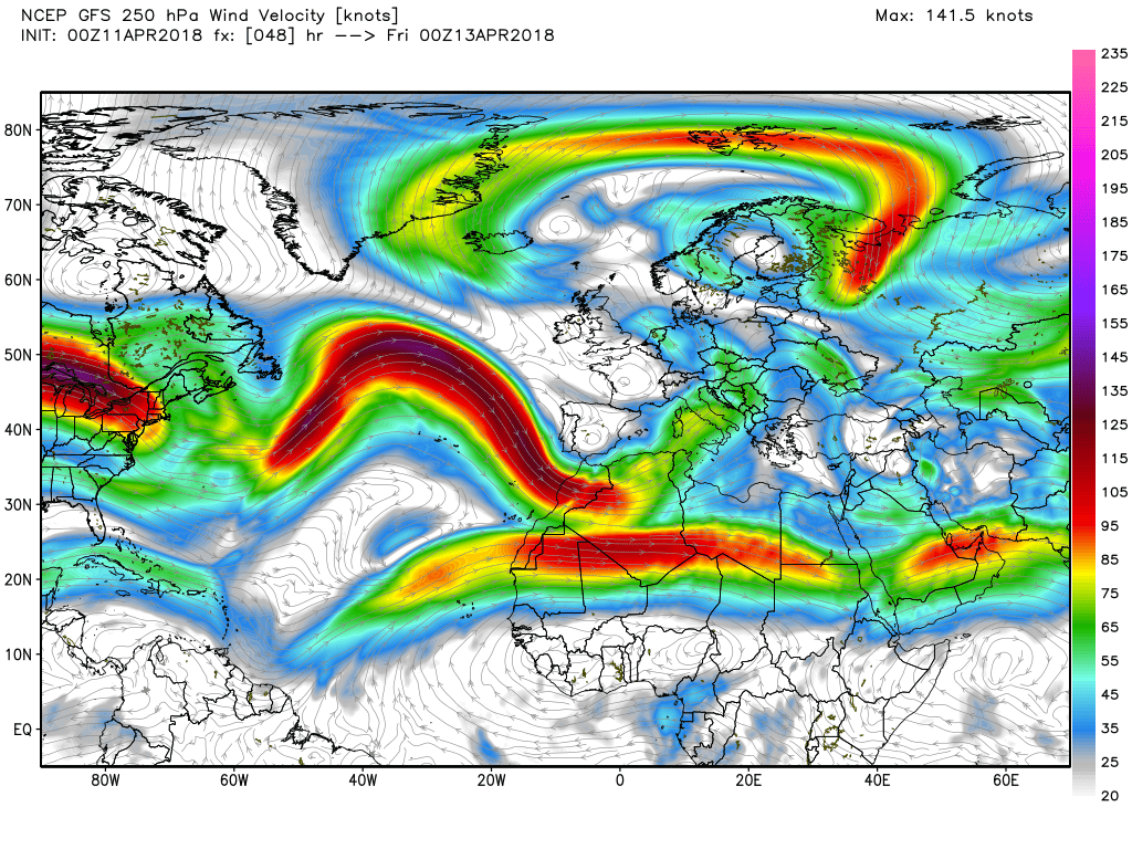
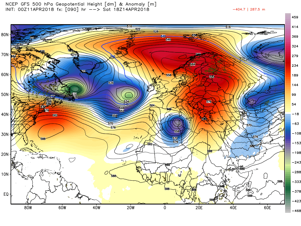
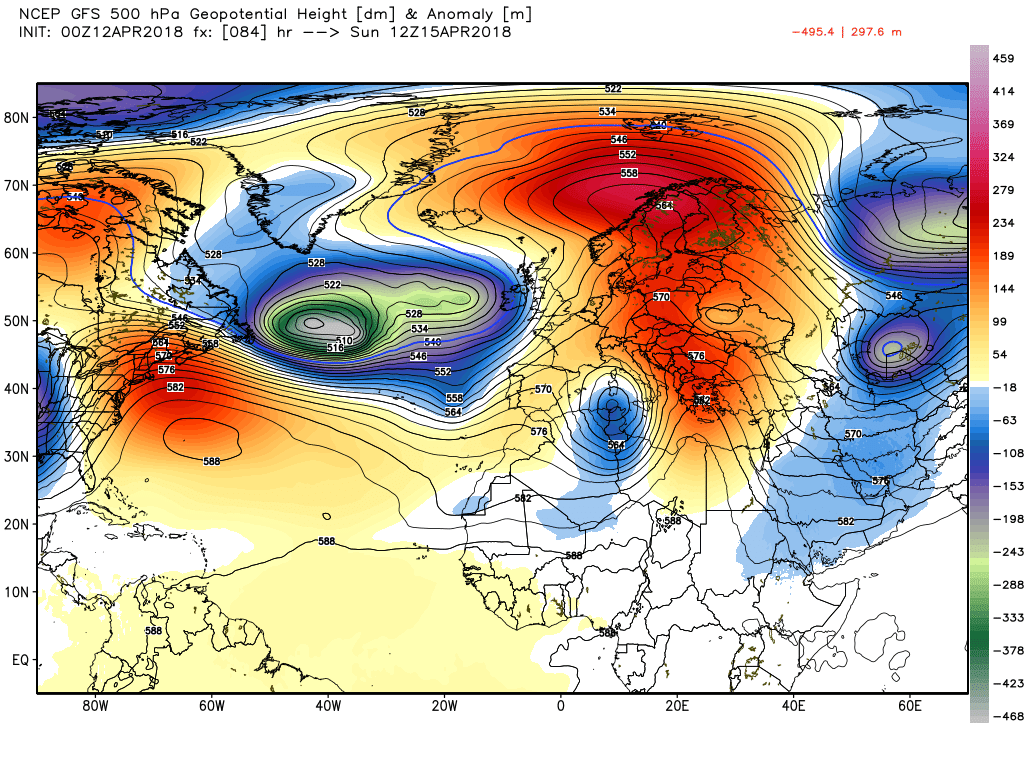
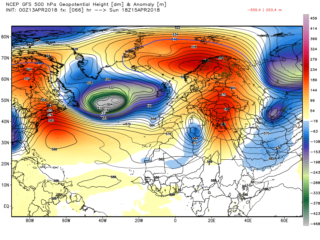
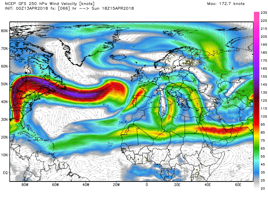
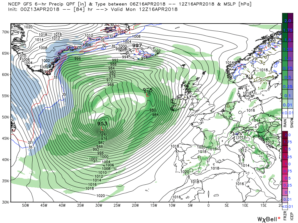
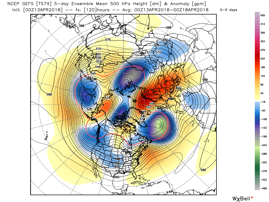
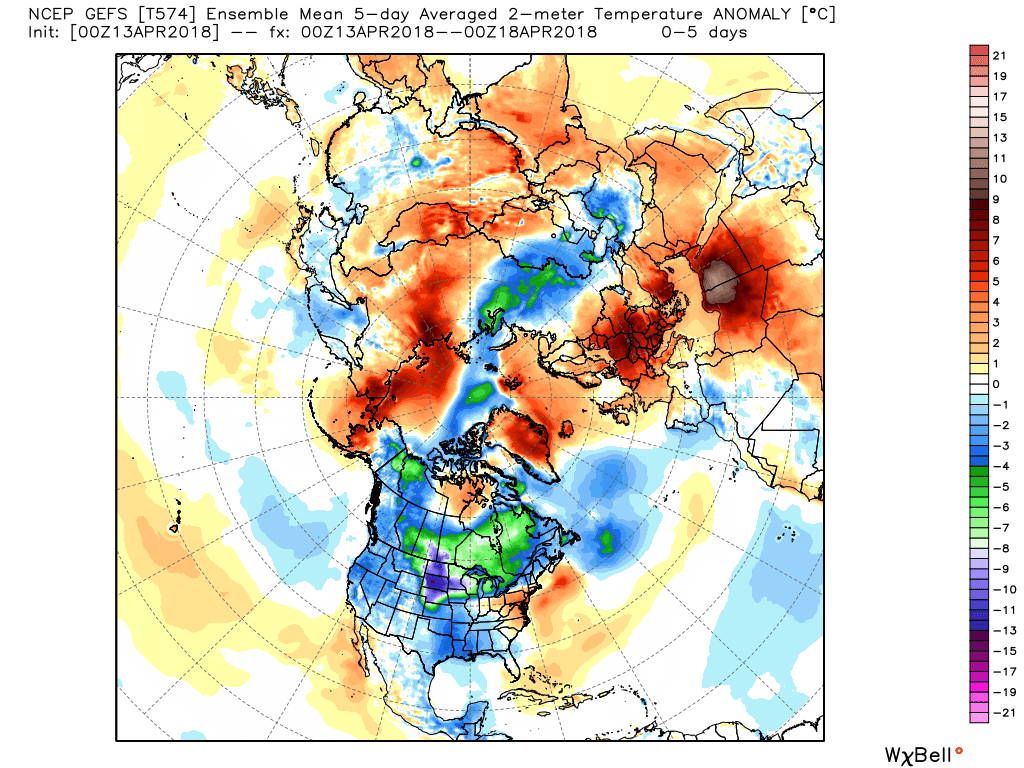
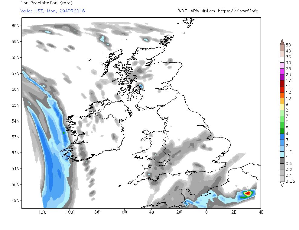
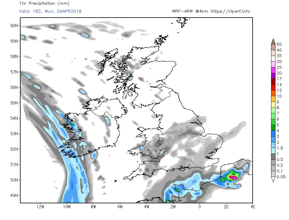
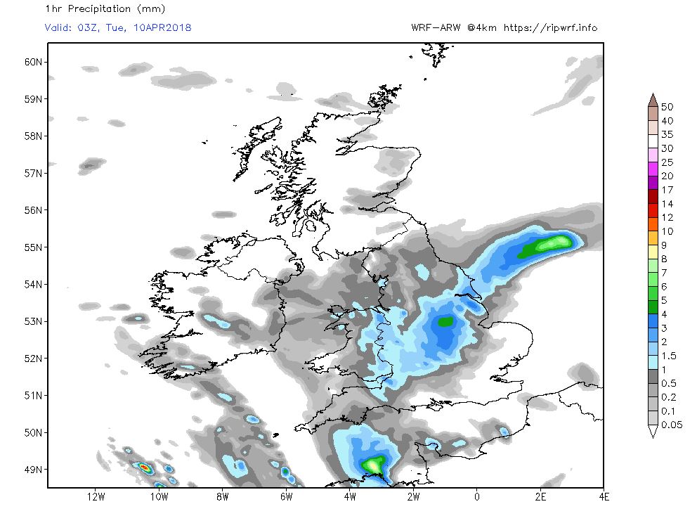
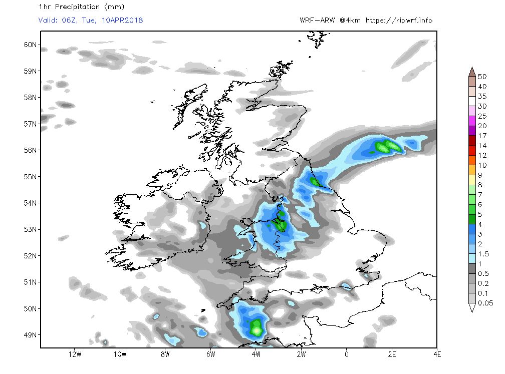
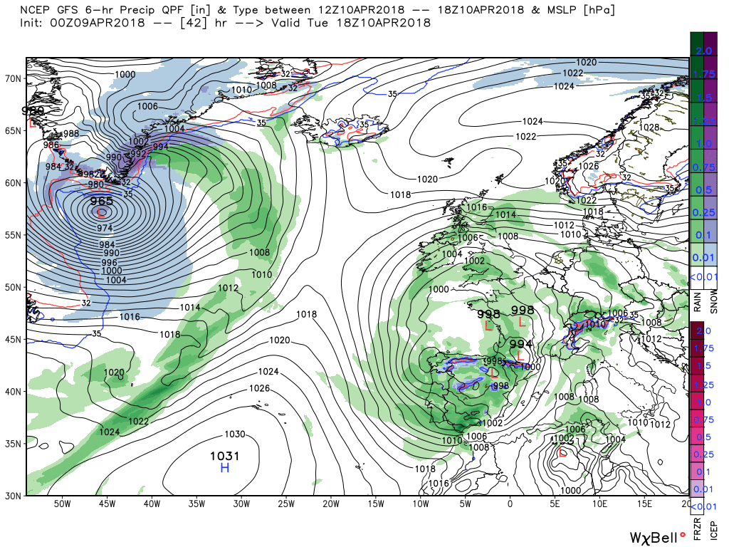
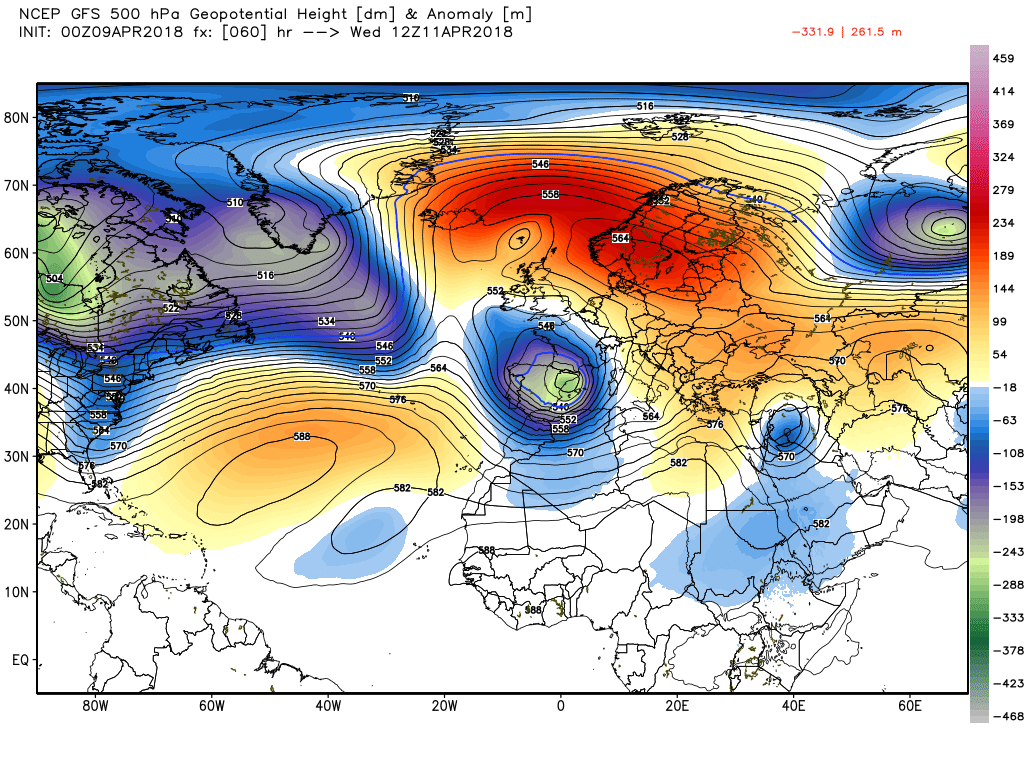
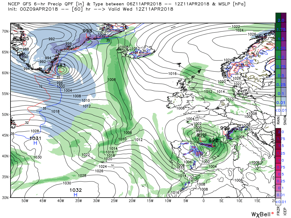
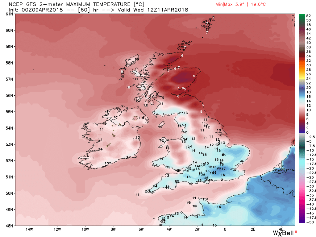
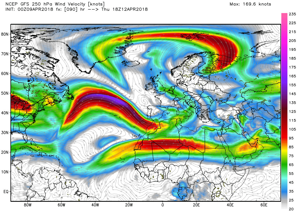
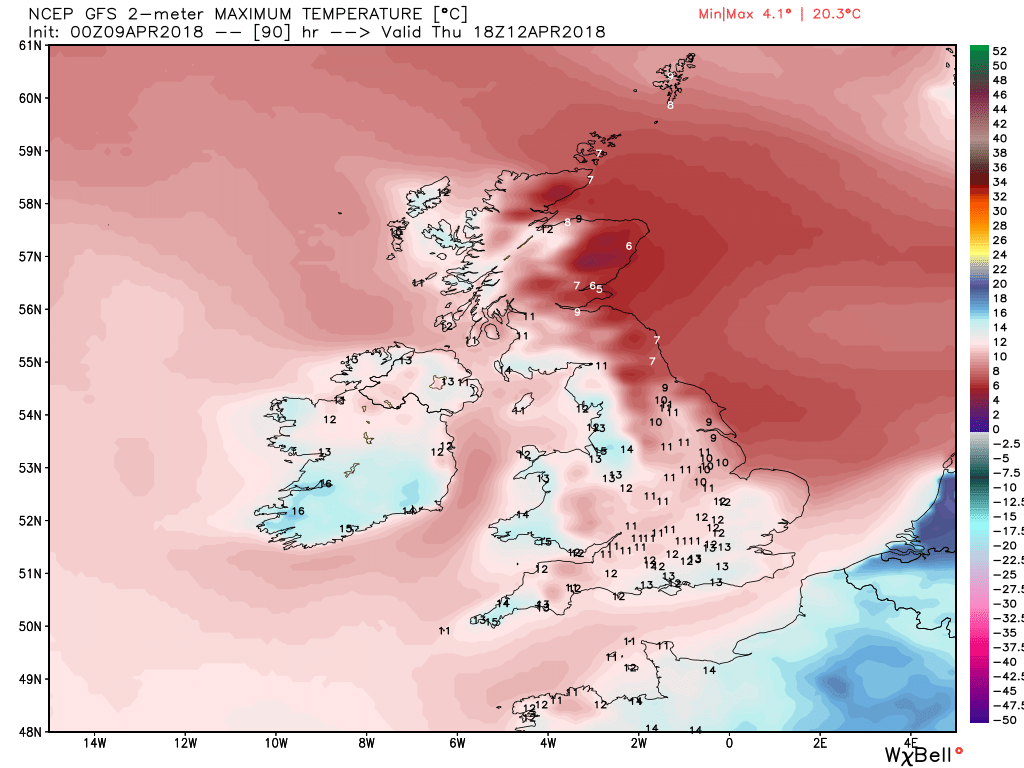
The rain, heavy at times, will continue to push NW overnight and through Tuesday morning Thus bringing N.Ireland. N. England and southern Scotland into the frame but by 1800 the upper low and associated surface feature has been forced south east between the block to the east and amplifying high pressure to the west. A movement that initiates the brisk easterly flow over the UK and which is depressingly going to negatively affect temps along the NE/E coast for a few days whilst elsewhere is quite warm.


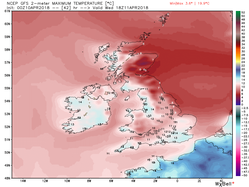
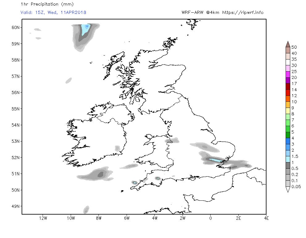
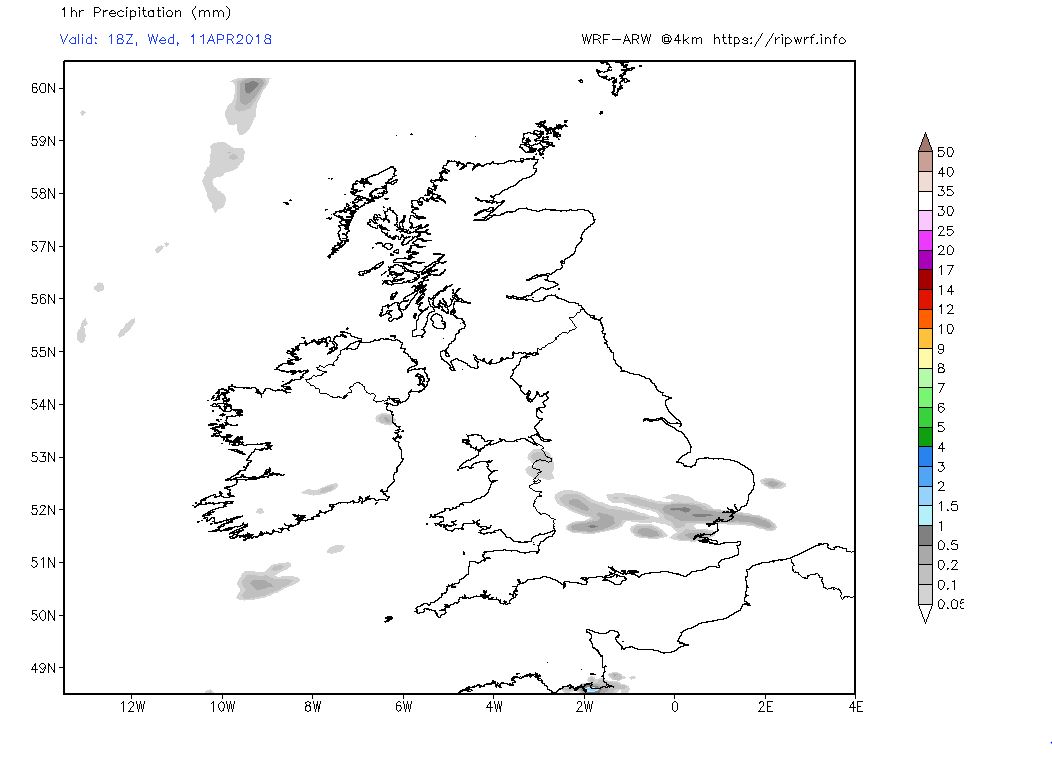
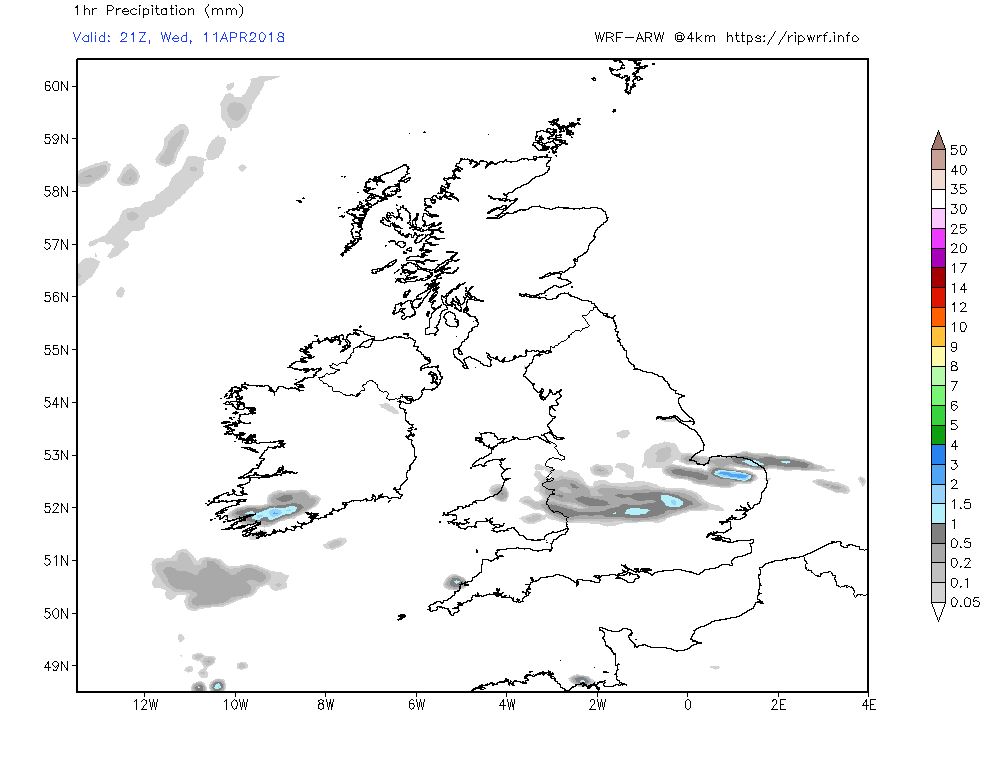
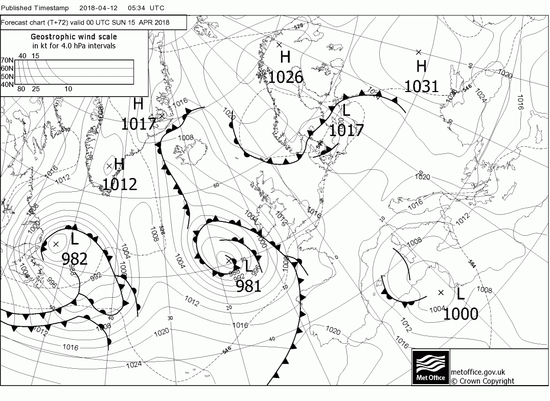
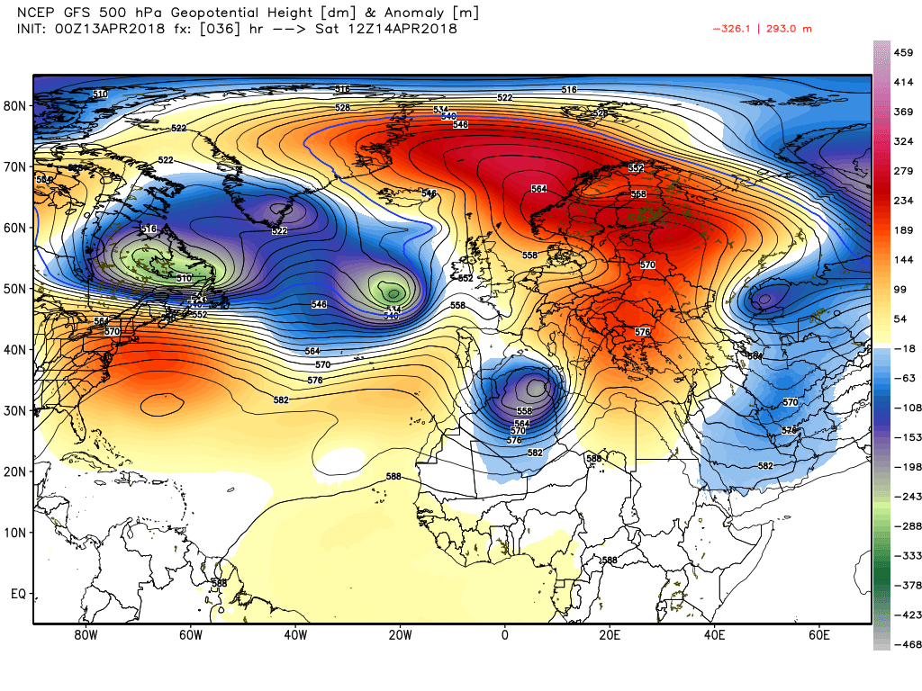
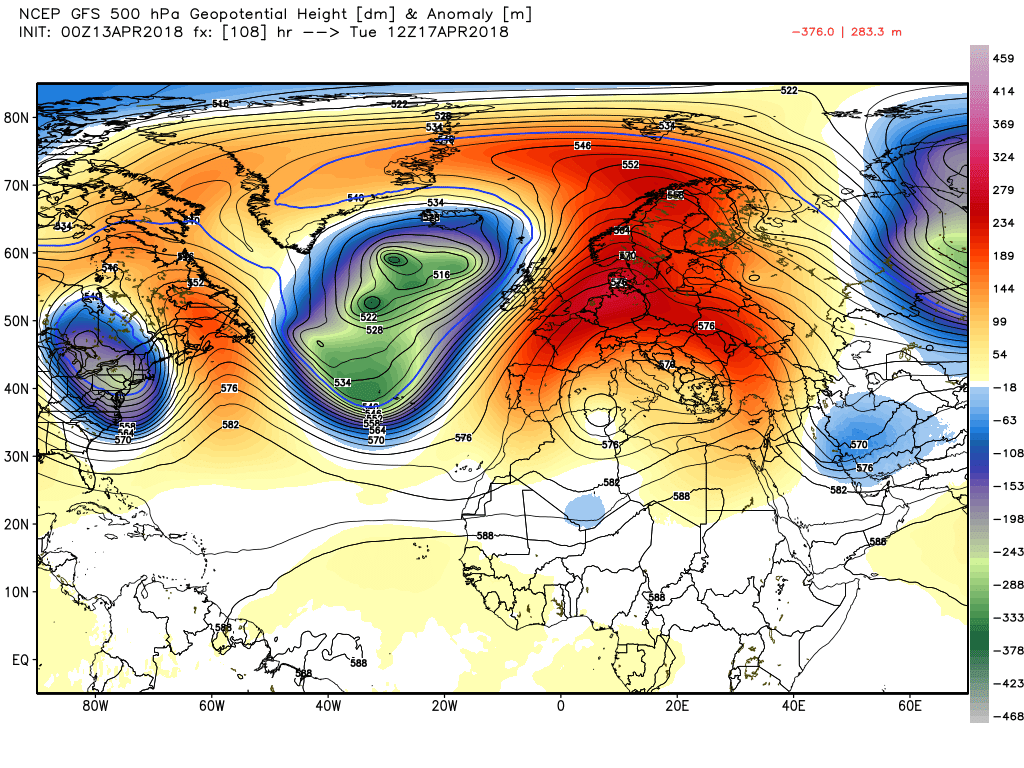
Wednesday sees the consolidation of the high cell to the north east and the upper low over Iberia thus the twin easterly inflows pertaining with cold conditions under leaden skies in the north east north of the Wash whilst remaining dry and warm south and west of there.


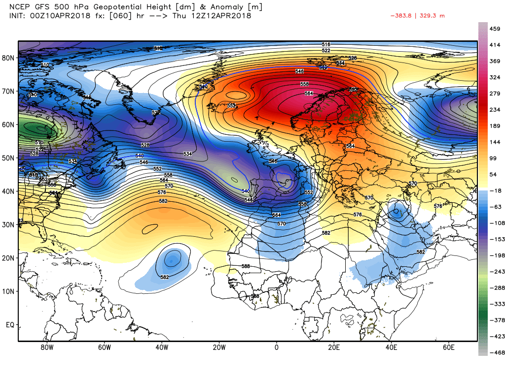
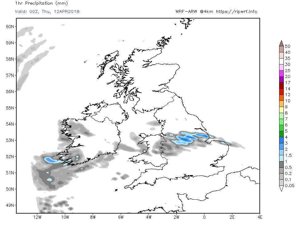
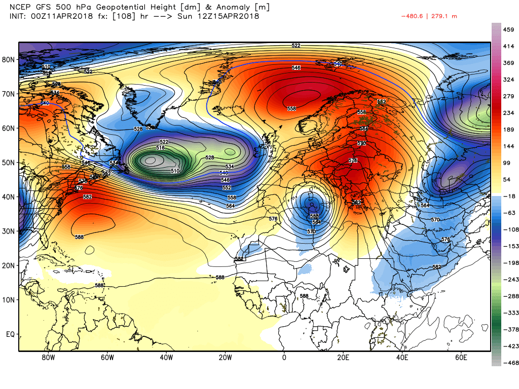
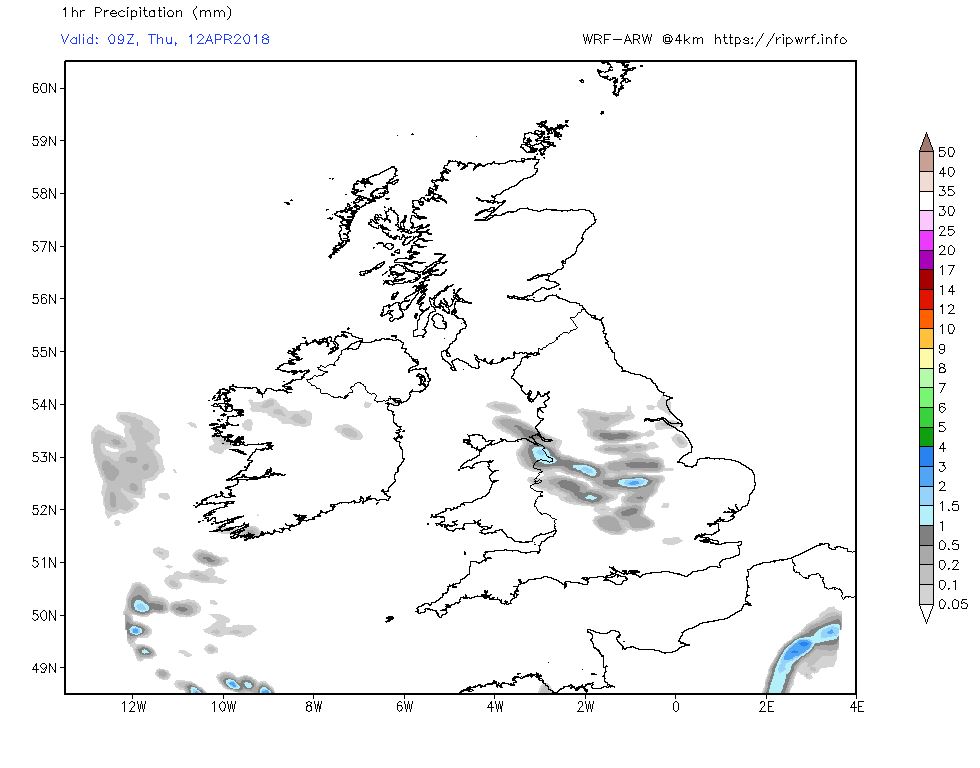
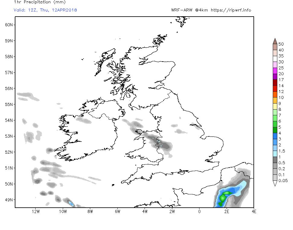
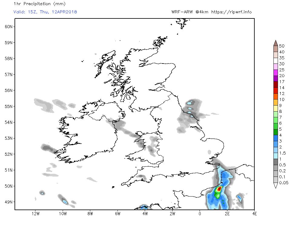
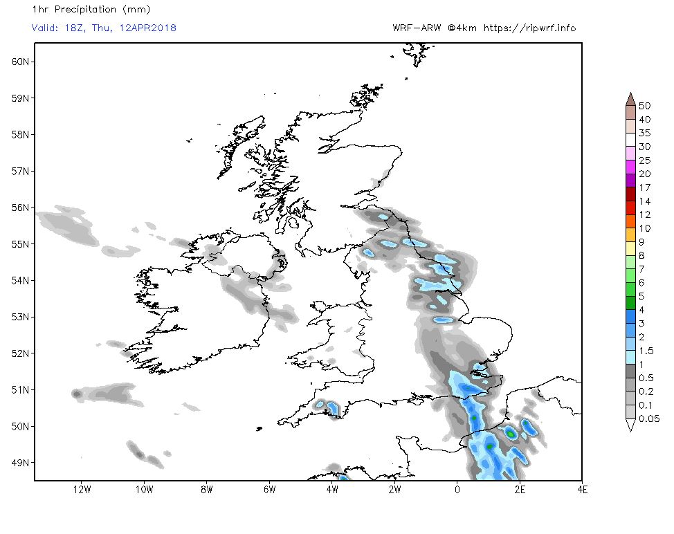
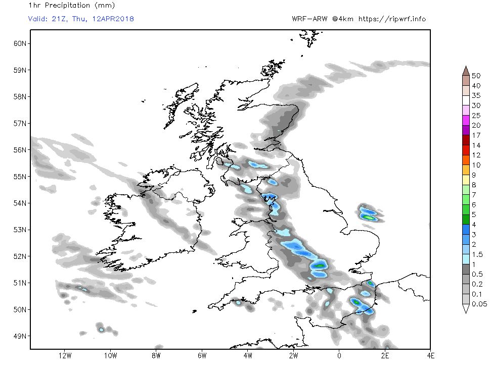
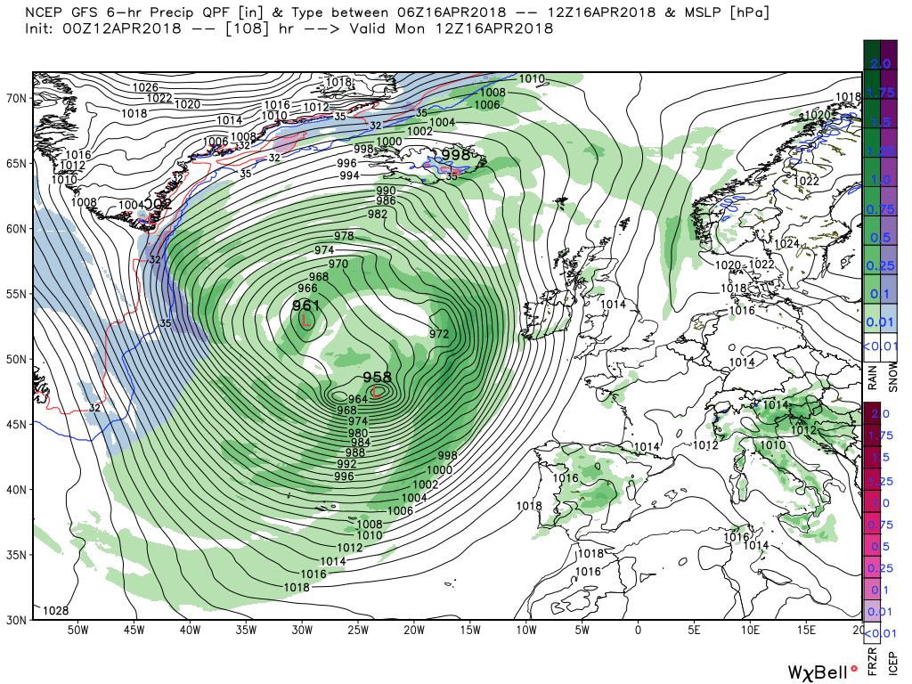
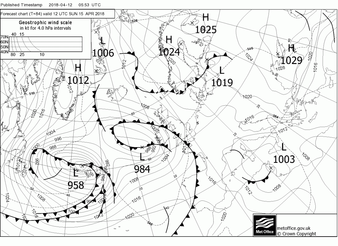
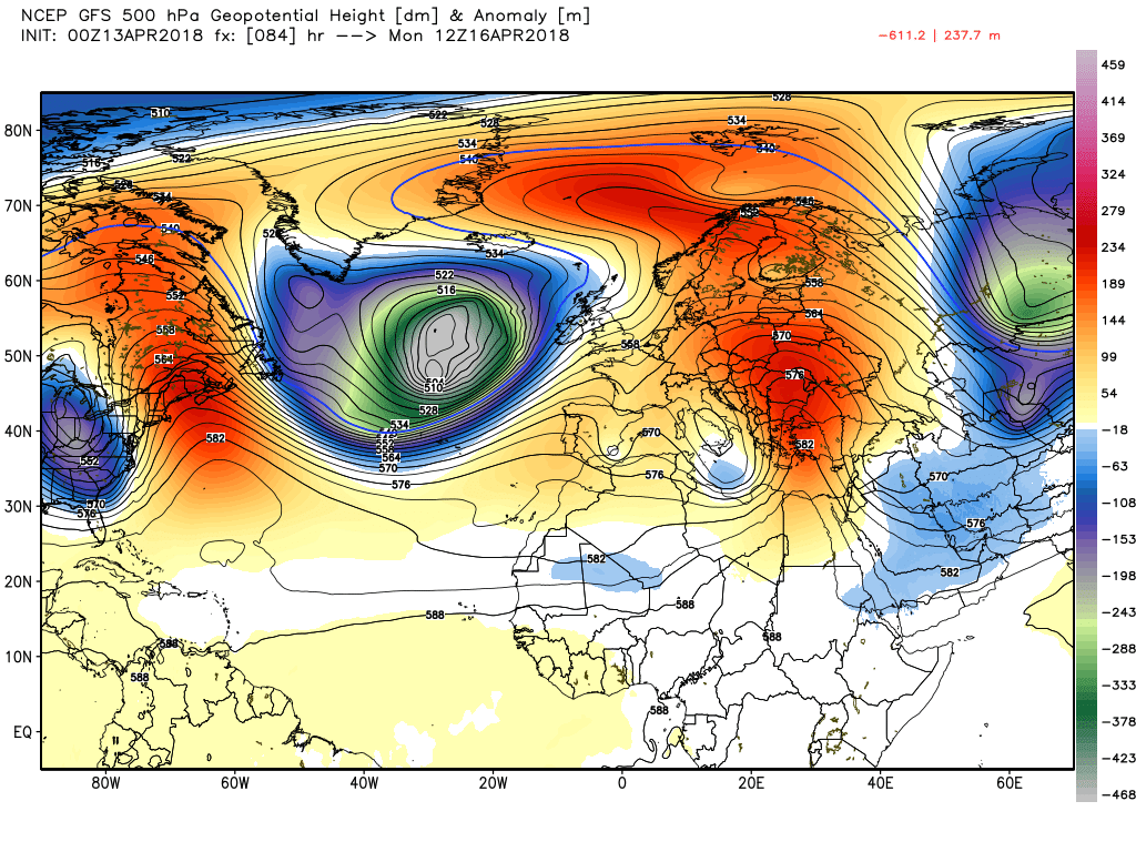
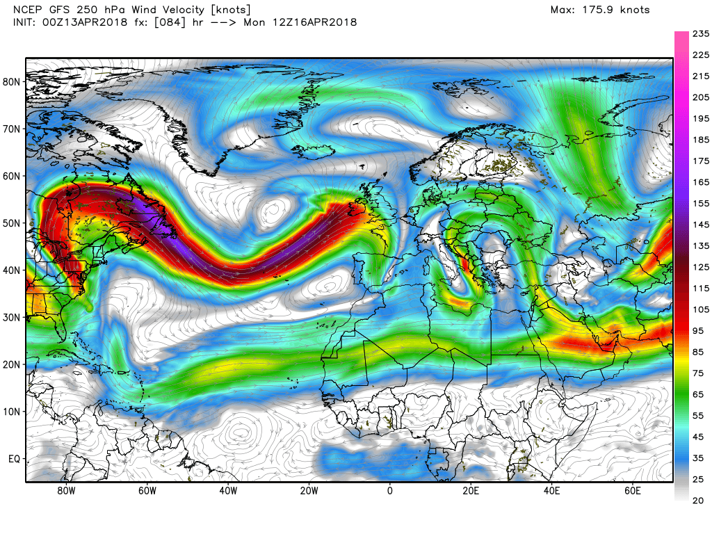
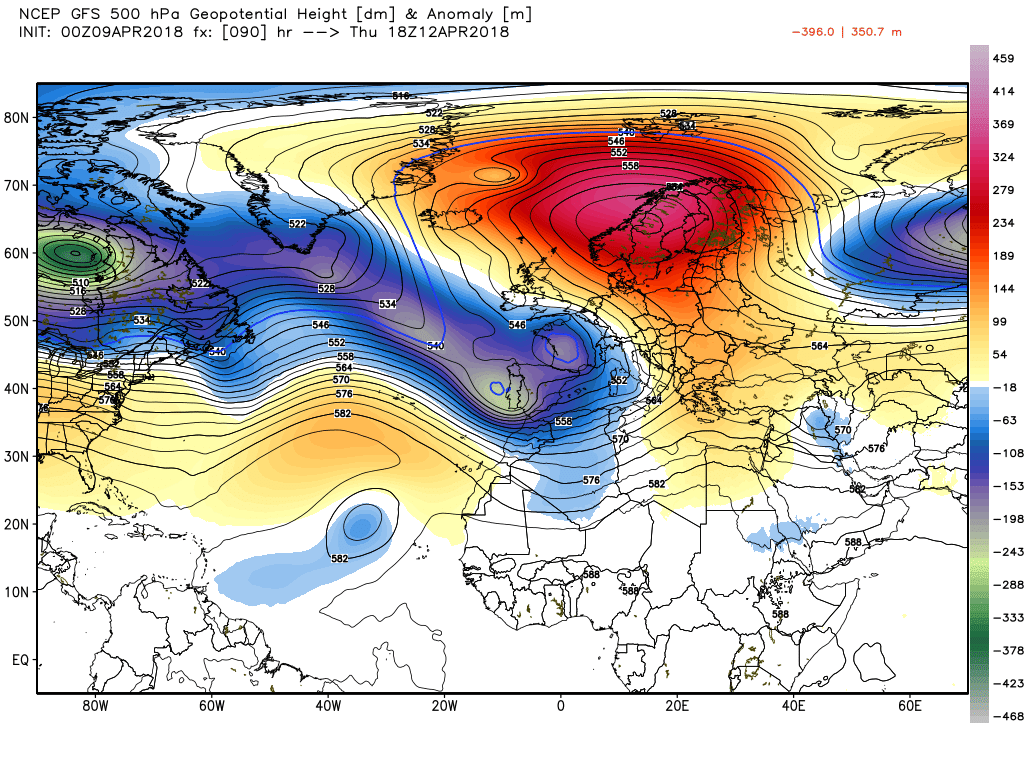
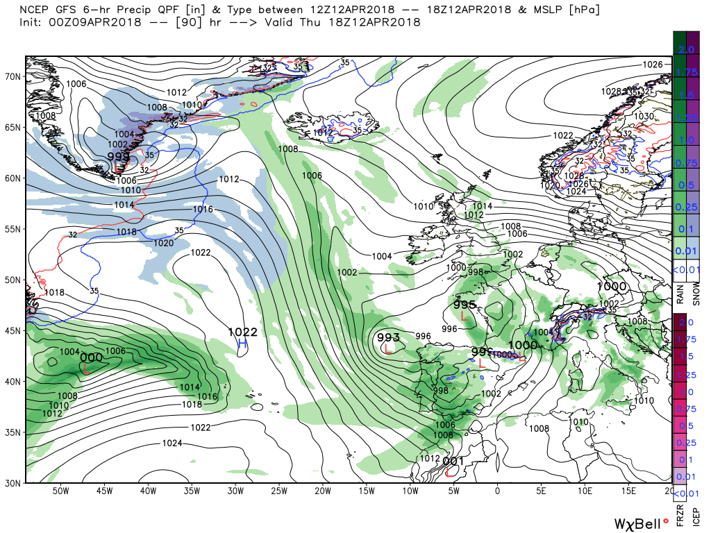
Thursday see the very resilient block coming under increasing pressure from the energy exiting North America which has the affect of boosting the easterly flow over the UK. leveling the temp playing field a tad, whilst at the same pushing low pressure with associated front north into southern England introducing showery conditions with perhaps the odd storm


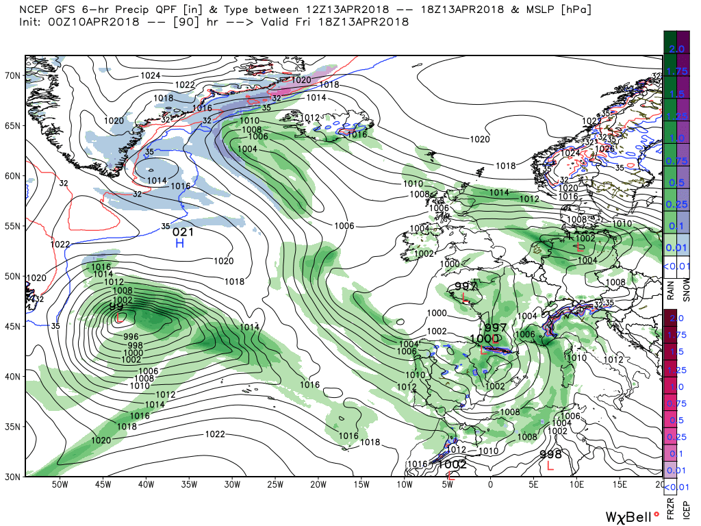
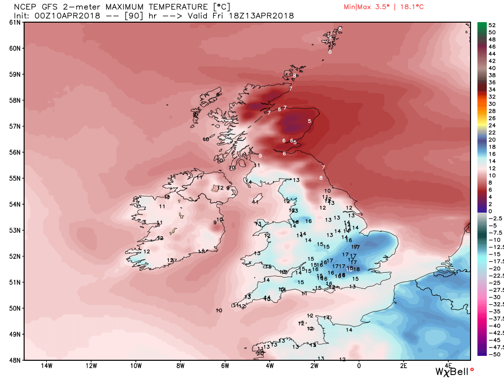
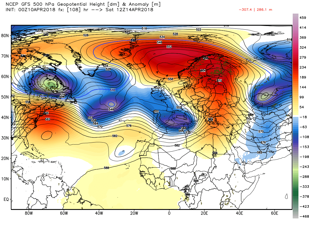
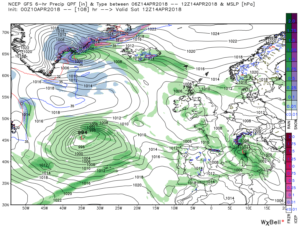
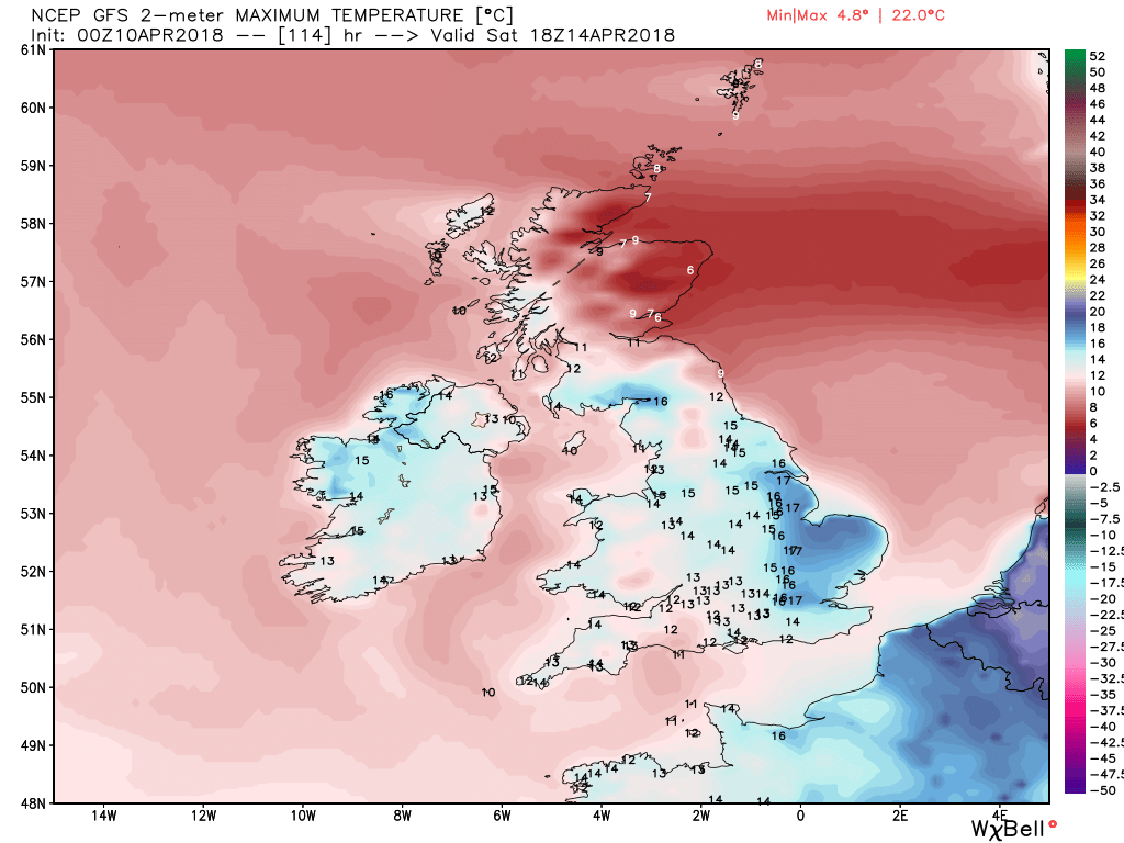
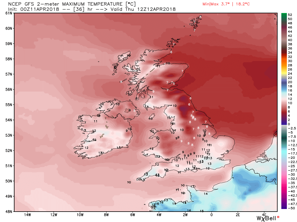
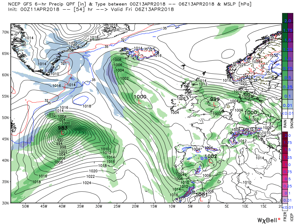
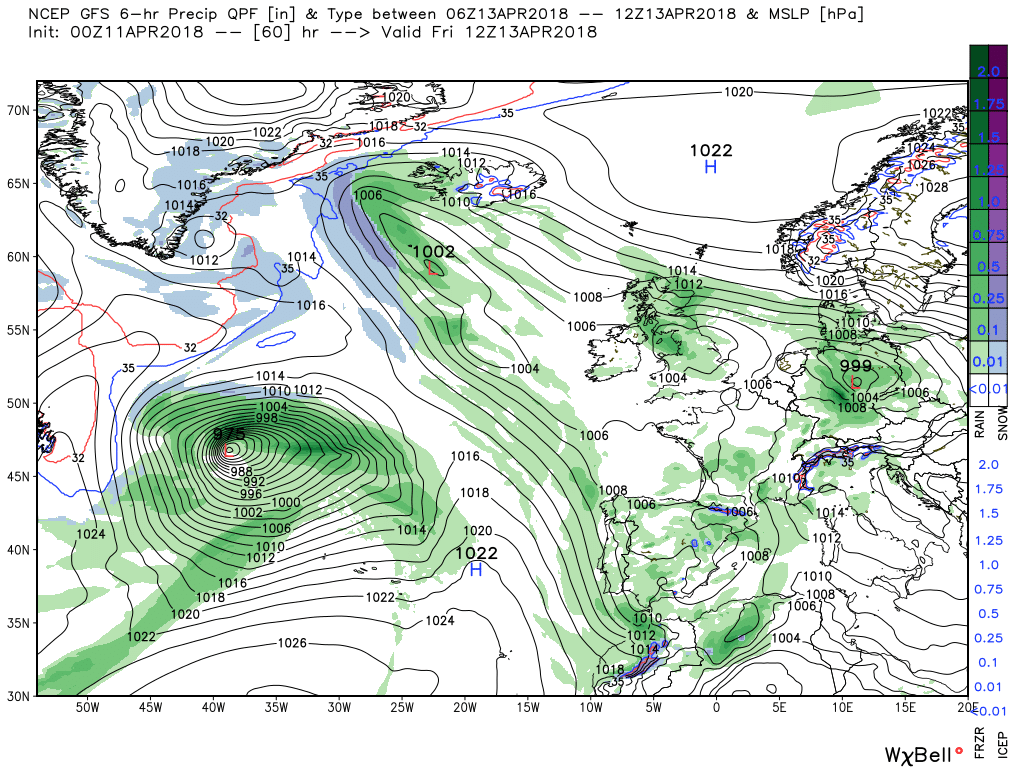
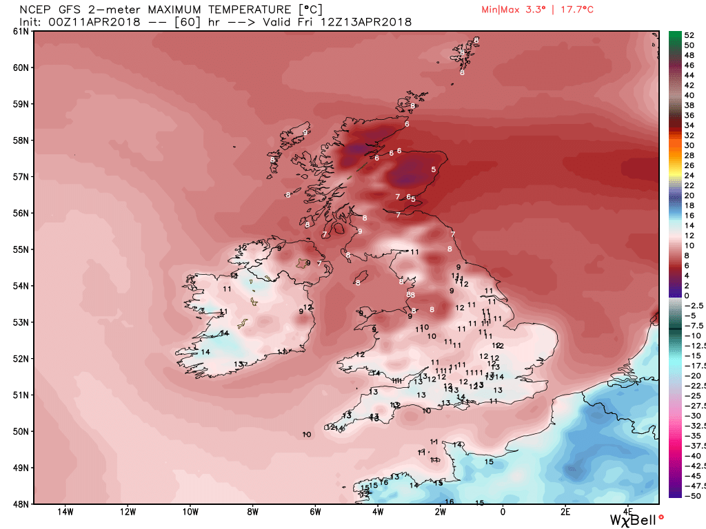
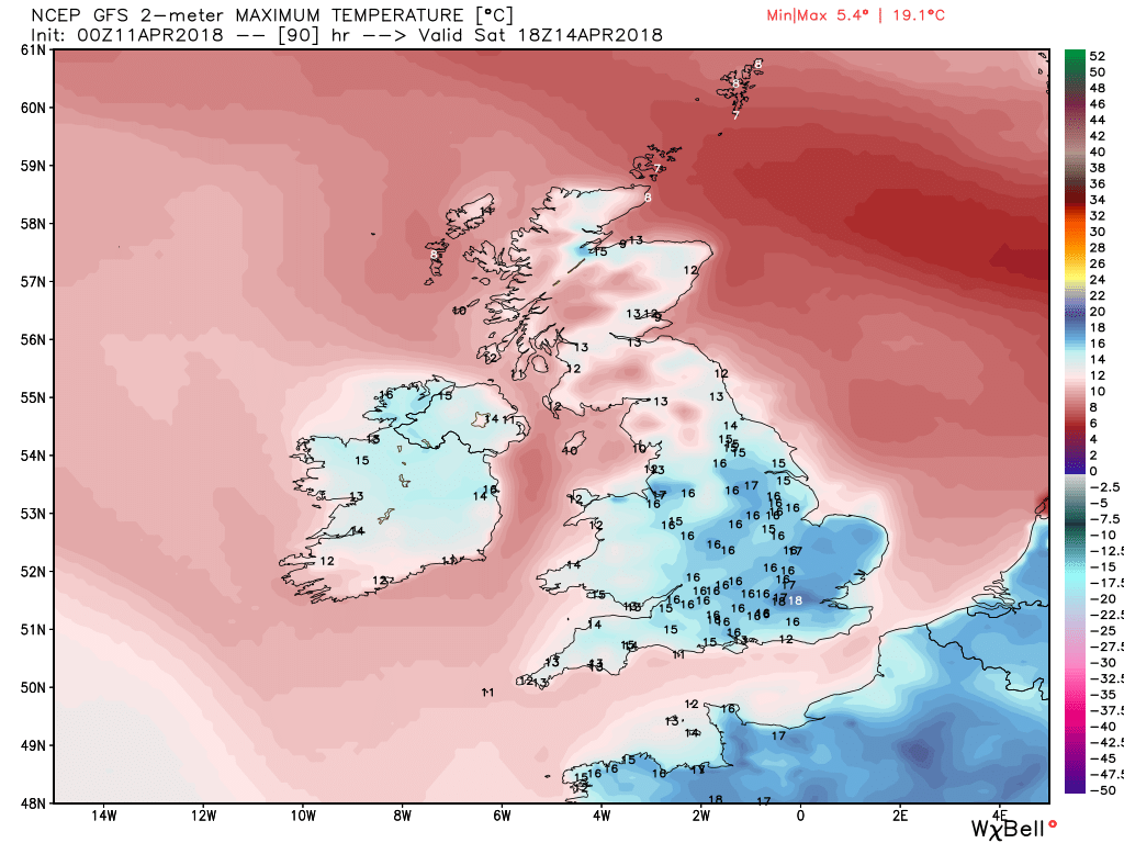
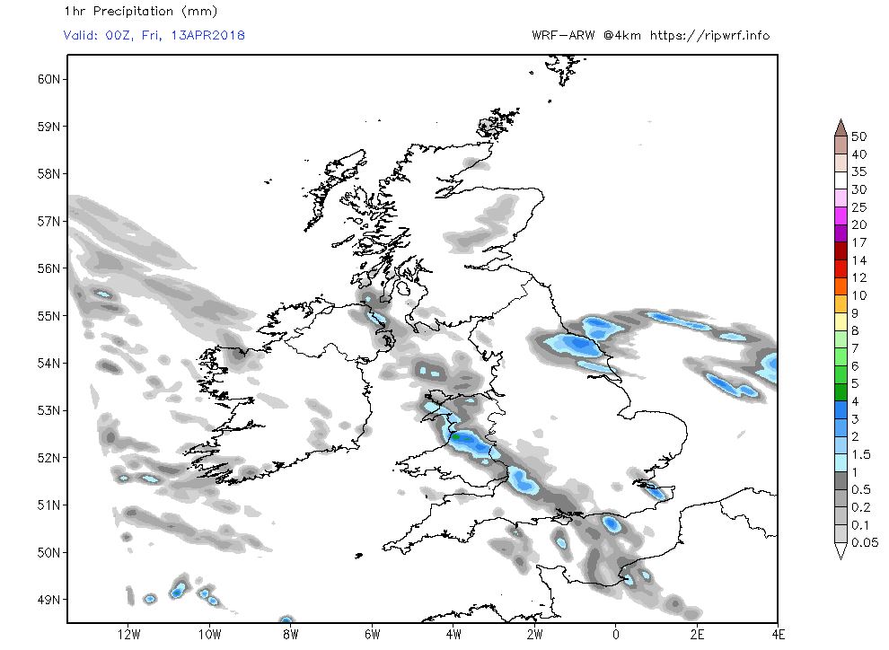
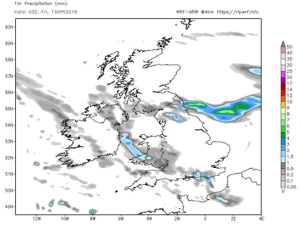
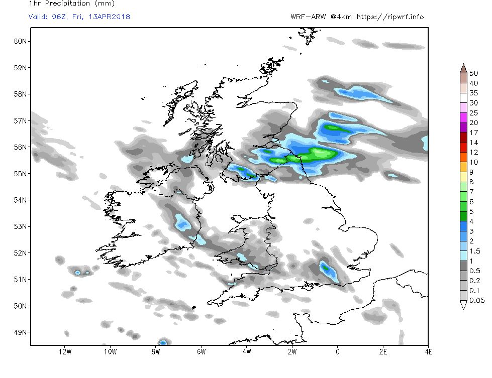
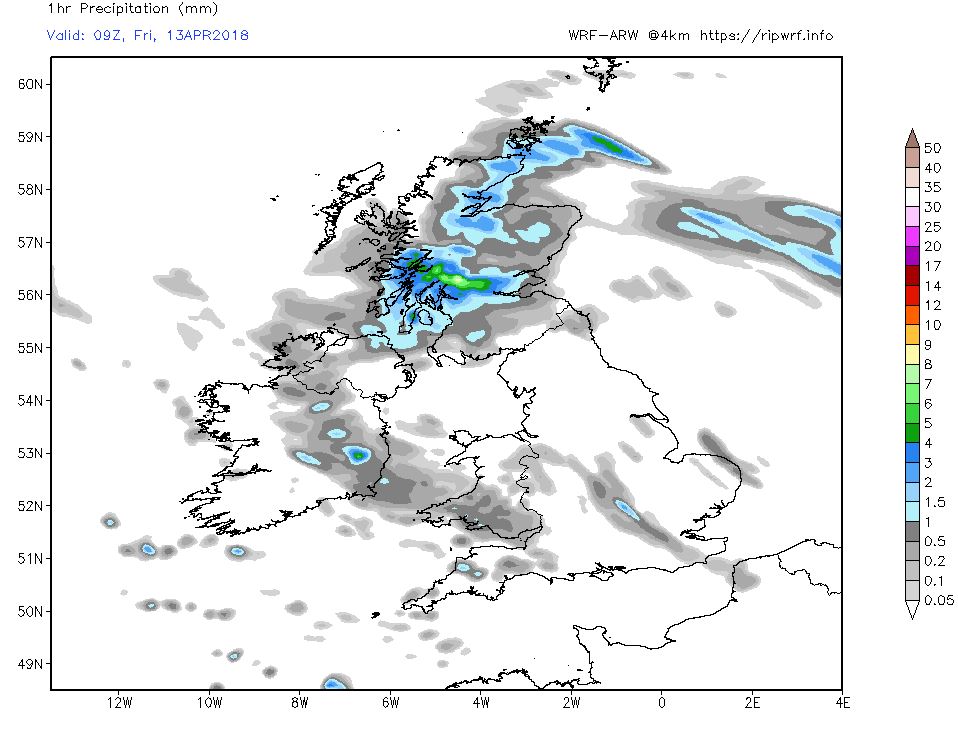
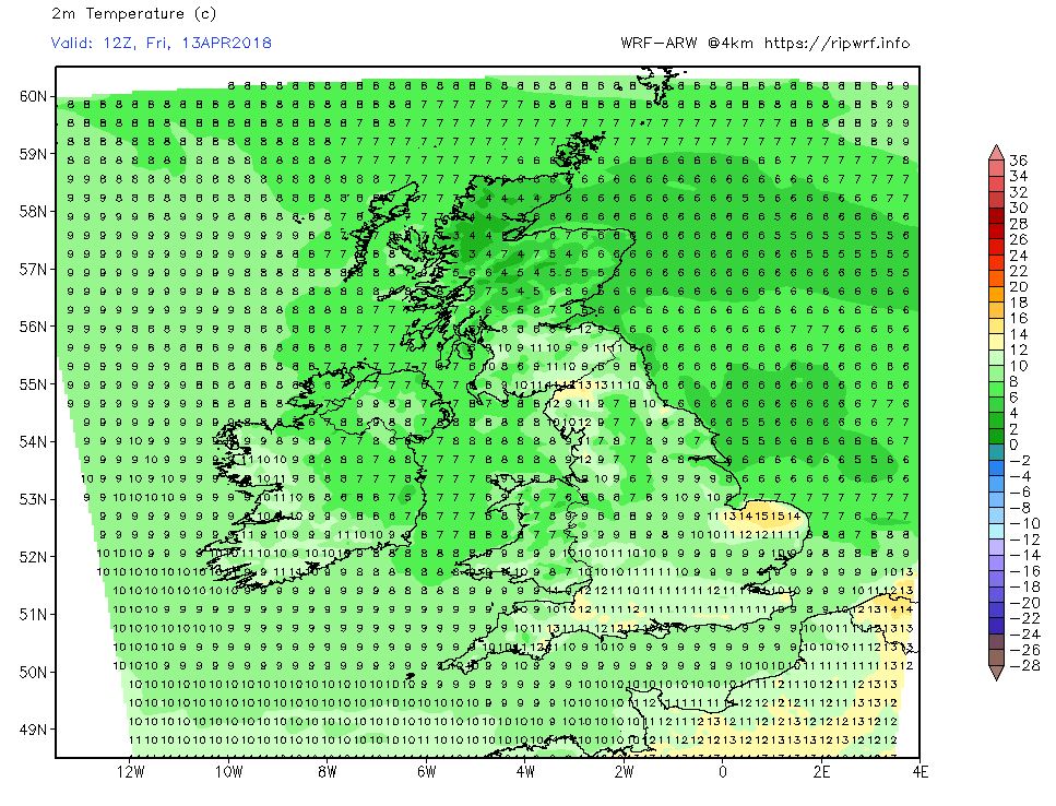
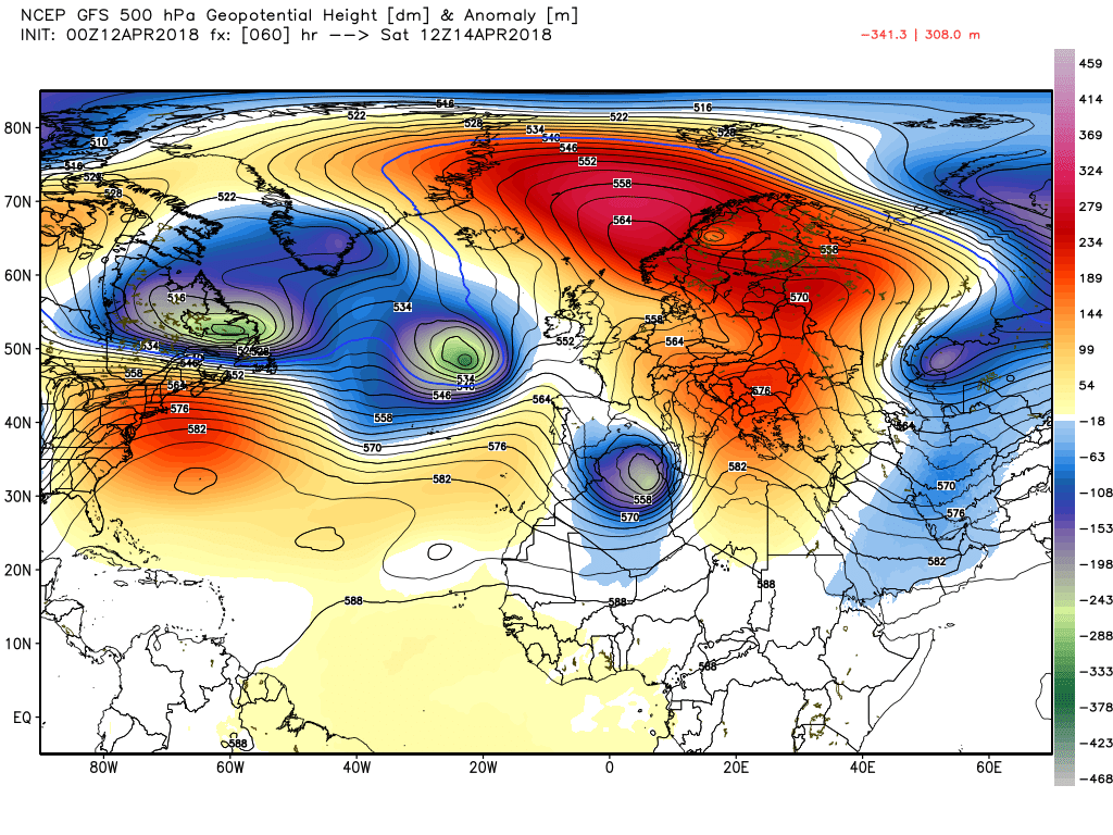
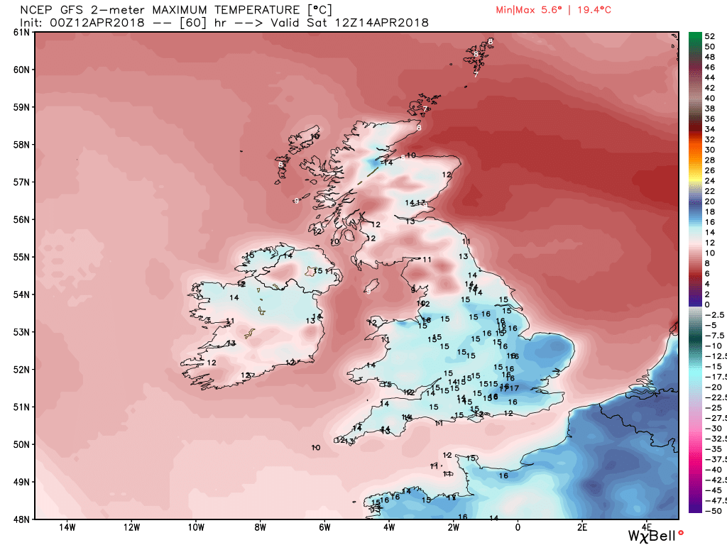
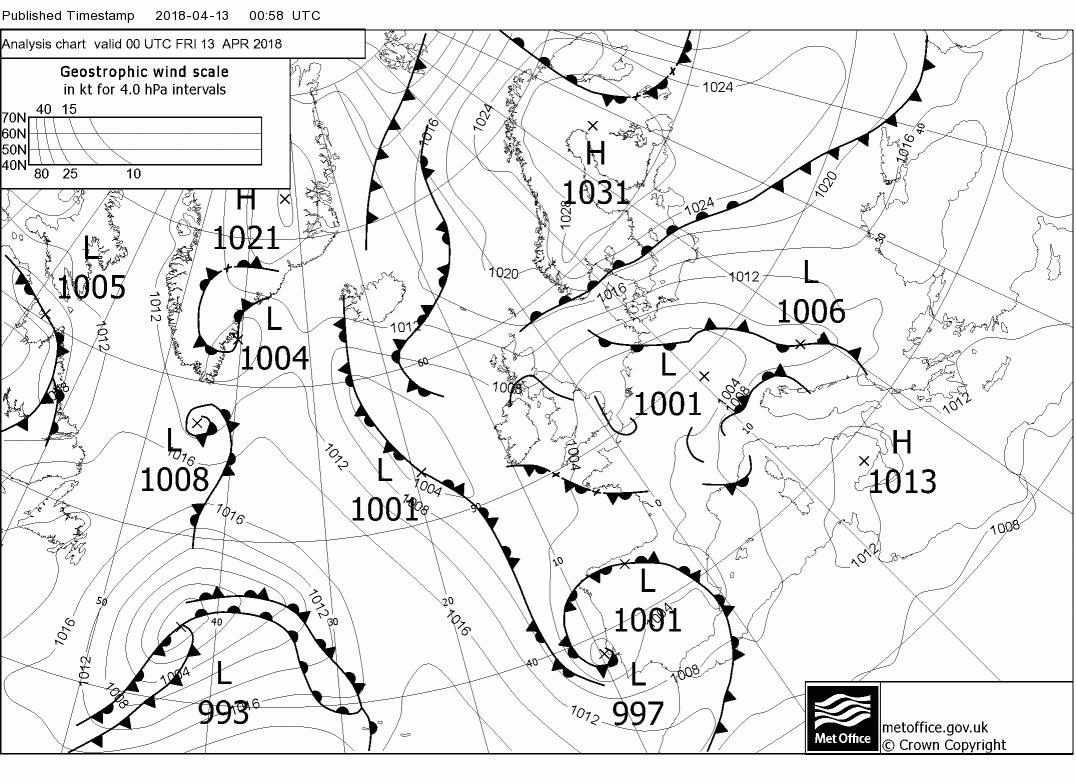
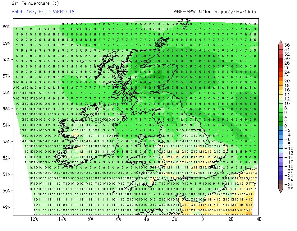
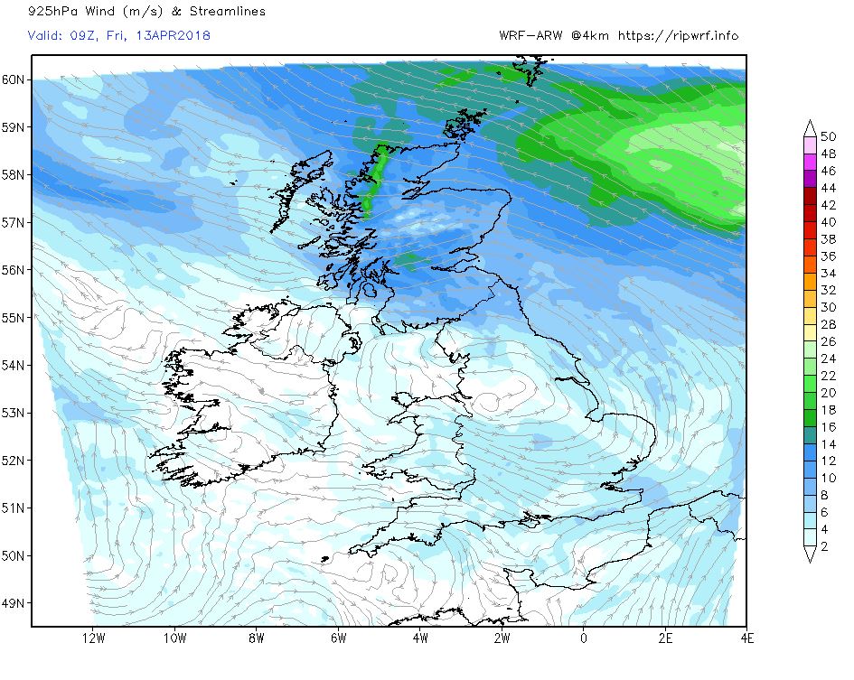
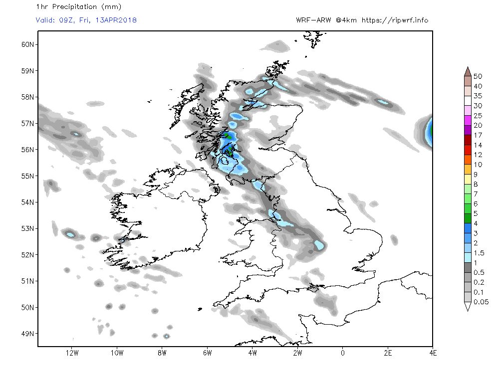
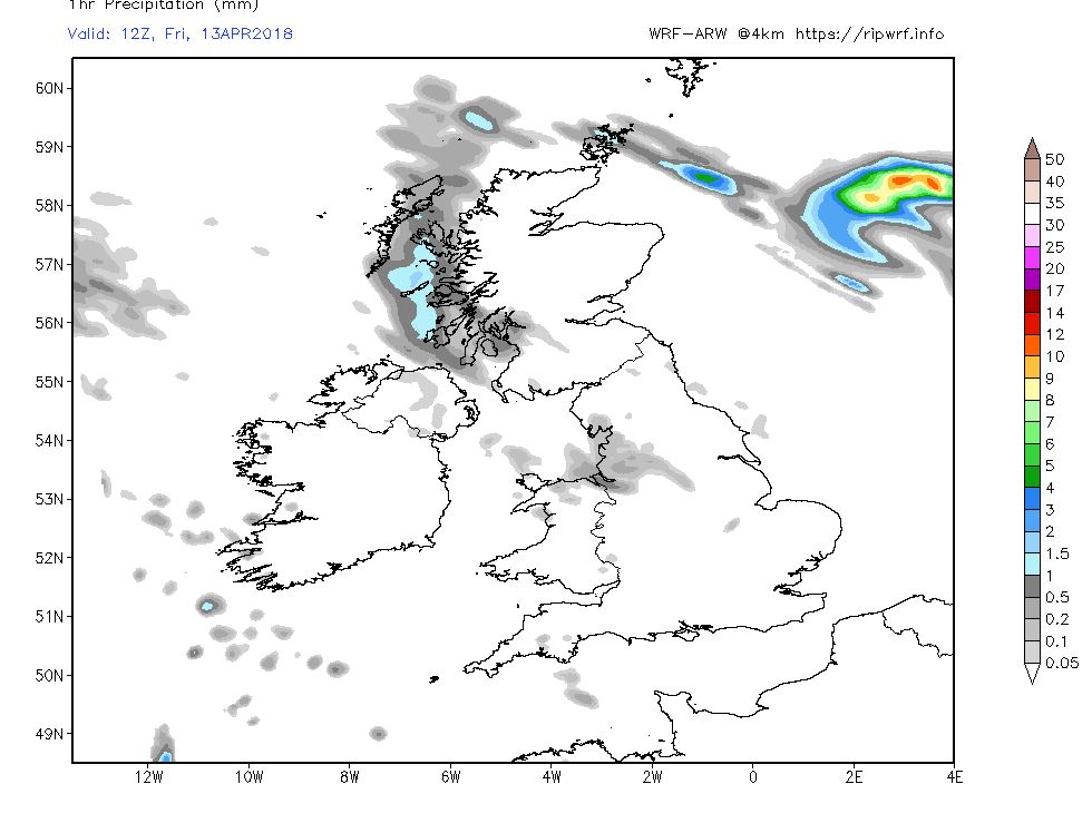
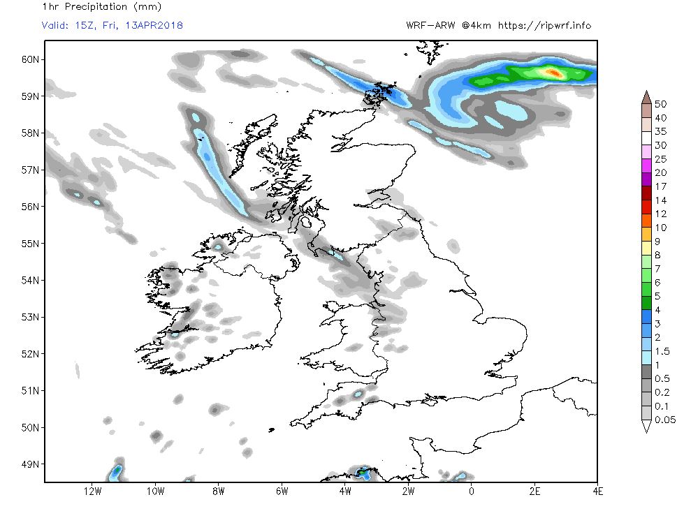
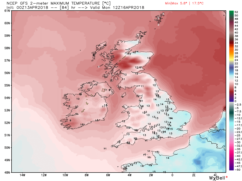
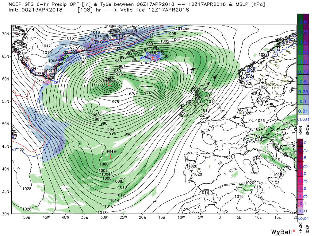
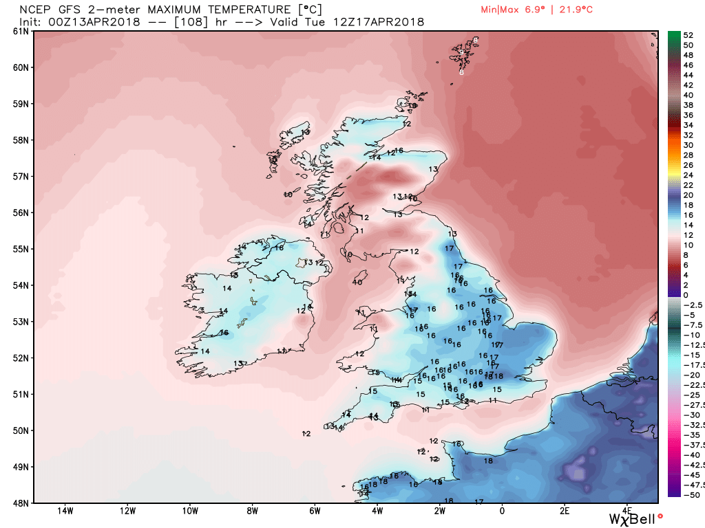
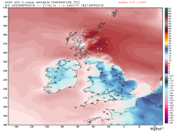
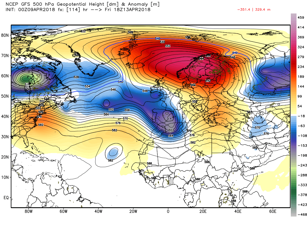
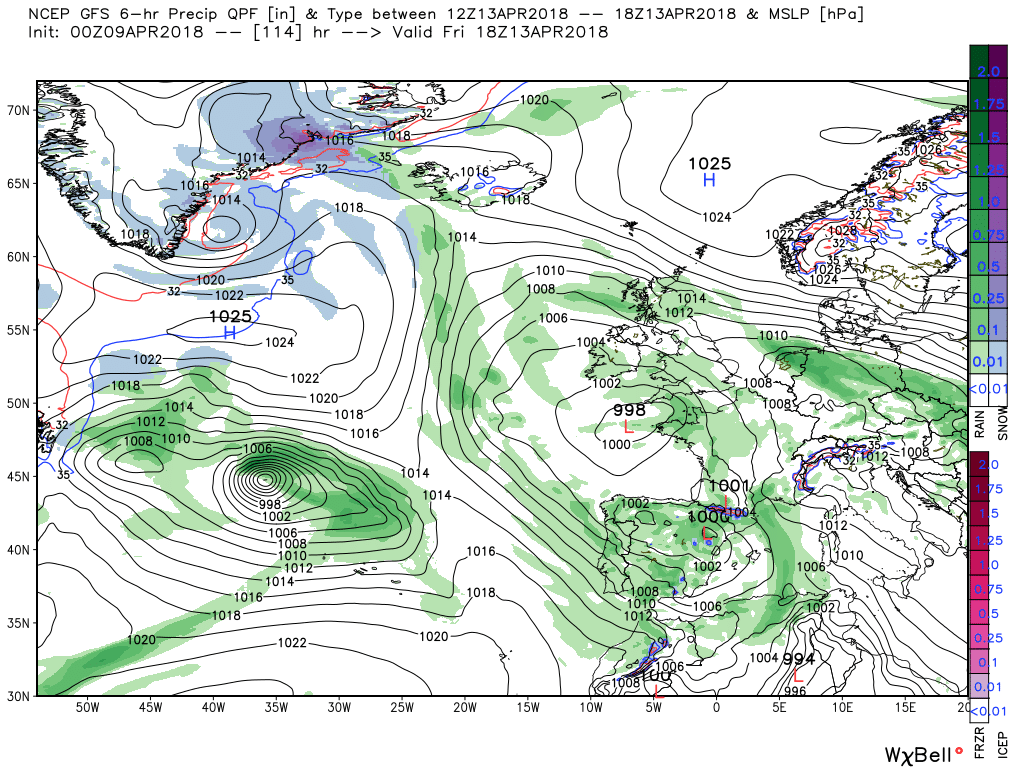
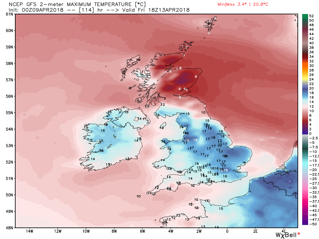
By Friday the pressure from the west has gained a little ground and low pressure has pushed NE over the UK with the associated front bringing patchy rain to Wales, England and N. Ireland. But it also veers the surface wind and cuts off the North Sea influence to a large extent except for the far north east of England and Scotland.(there it may take a tad longer) And as can be seen temps south of the border are pleasantly above average

 
Further to my annotated FAX for today, here's the forecast FAX for tomorrow - note the Atlantic low sliding south-east under the high to the north, thereby initiating an easterly breeze.

PPVE89.gif
 
Malcolm's thoughts:
There is currently a large area of rain affecting most of England and Wales which will gradually move north west during the day. Behind the front drier and brighter weather but the major trough to the west is in the process of tracking south east and troughs within the circulation will swing into the south, bringing, firstly, showery, thundery, outbreaks to the south west this evening and then through tomorrow morning another outbreak tracking west through the Midlands from Norfolk. Thus movement of the trough has initiated the expected N/S temp gradient. Hopefully all of this can be encapsulated within the following.


Weds


Elsewhere on Weds it will be drier but the the murk and colder regime is already in place further north and along eastern coastal areas.


Thus the general analysis by 1200 Thursday is a negatively tilted upper trough running from the tip of Greenland to western Europe under the the block to the north east which has a more positive tilt. The unstoppable force meeting the immovable object. This leads to quite a complex surface analysis with the UK under the influence of two airmasses. HP to the north east and LP to the south west resulting in cold and murky in the north east and Scotland whilst sunny interval and warm in the south albeit with some showers and maybe the odd storm thrown in.


No significant changes on Friday except perhaps the strengthening easterlies have been pushed a little further north by the pressure exerted by the trough and thus taking to murk a tad further north also but essentially the best and warmest of the weather to the south and west.


But by Saturday the low pressure has gained some traction, thank to the upper trough pushing north, and a slack area of low pressure covers the UK largely removing the North Sea influence apart from the far NE of England and Scotland. Elsewhere sunny intervals and the odd shower with temps a little above average. This is of course according to the GFS

 
Part 2:
The ecm more or less in agreement with the GFS with a slack southerly drift in place by Saturday with the North Sea influence snipped, much to the relief of many with the general improvement of the weather and temps in the north east and Scotland as the cold murk north of the Humber persists on Friday.

 
Malcoln's thoughts for the 11th:
Not a brilliant outlook for today and tonight. The northeast will be under leaden skies with the occasional drizzle with the winds off the North Sea, Cloudy in many other areas as well with patchy rain tracking east > west across central England and Wales. The best of the weather will belong the extreme south of England, the north west and western Scotland and this is reflected in the temps.


By 1200 Thursday the easterly regime is well established with high pressure to the north east and low pressure to the south so low cloud, drizzle and suppressed temps for the north east and east coasts and central areas of England remains he order of the day. A bit brighter further south with some showers but the best of the weather will again be north west Scotland.


But changes are afoot courtesy of the upstream energy and the associated negatively tilted trough stretching from Greenland to Iberia exerting more pressure on the block to the north east and facilitating movement of small lows within the complex low pressure area to the west and south of the UK. Thus Friday sees one such low track north west across England and Scotland bringing some wet, and very windy weather in the north, with it. Again the best of the weather and temps in the south.


As the front and rain move north and clear overnight Friday they do at the same time remove the easterly regime so that by Saturday the UK is in a very slack pressure gradient and a pleasant and warm day for most is likely with just the odd shower around. But as can be seen out to west some quite intense upper lows have been riding east on the 160kt jet and there quite a deep surface low 975mb south west of Ireland.


So by Sunday a familiar story is unfolding, east bound energy against the block, and the surface front is just about making inroads in the west of the UK but elsewhere anther fine and warm day portends. But another twist is around the corner but that's outside the remit of the thread.

 
Malcolm's post for 12th:
For much of north eastern and central England today it will be a pretty bleak day with low cloud, poor vis and intermittent drizzle. But by mid afternoon, and through this evening, a more concentrated band of rain will swing across the UK from the south east affecting most areas. The best of the weather in far western areas Temps very poor in the gloom, particularly in the eastern coastal regions, and a fair way inland, and Scotland


Overnight and through tomorrow morning, as the rain above swings across the south west, another more consolidated band of quite heavy rain tracks north west from the North Sea across Scotland clearing by midday. Still cloudy in the north east and maybe some central and eastern areas but the temps are starting to pick up as the passage of the front curtails the easterly. .


By 1200 Saturday, with the front well out of the way to the north, the UK is in a col with an Atlantic low to the west and the blocking high to the north east leading to a quite balmy and welcome scenario, albeit a few showers around, with temps above average everywhere


Twenty four hours later the Atlantic is dominated by an upper trough orientated west > east with a deep surface low west of Ireland and associated front already bringing rain and fairly strong winds into western parts of the UK leading to a W/E temp split across the latter. But perhaps the key issue here is the burgeoning of the Bermuda high pressure to the west and the continuing intensity of the block to east and the impact this has on the orientation and intensity of the Atlantic trough and forthcoming evolution.


So continuing this point on Monday the Atlantic is now dominated by the restructured upper low flanked by amplified ridges which severely curtails west to east movement and initiates some pretty intense WAA into Europe. Thus the above mentioned front fizzles out leaving a warm showery day on Monday


Malcolm part 1:
As everyone will be aware today marks the end of the cold and dismal weather many have endured over the last few days. Currently a shallow area of low pressure is moving north west over England with a band of rain over the Midlands and the north This will clear most areas by mid afternoon leaving brighter conditions with a few showers in it's wake and temps recovering from the south.

Tonight will be dry but probably cloudy in the north


Tomorrow finds the UK in a col so after some early morning mist has cleared a quiet, partly cloudy, and warm day for most but to the west the Atlantic is going through the gears with a lot of energy exiting North America and with a fragment of the Canadian vortex starting it's journey to phase with upper low west of Ireland.


By early Sunday the surface low associated with the aforementioned upper low west of Ireland is 978mb with associated fronts already bringing bringing patchy rain to N. Ireland, south west Wales and Cornwall along with a strengthening wind, This patchy rain will track east during the day but probably not reaching the far east of the country. Meanwhile the vortex fragment/lobe has intensified into a deep upper low as it slips further into the Atlantic as the Bermuda high amplifies to the west.


By 1200 Monday the intense upper low is dominating the central Atlantic flanked by the amplifying ridges over NE North America and Europe which curtails any significant west > east movement thus the fronts, and any perturbations in the flow of the massive surface low. are struggling to make inroads across the UK. So much so that by 00 Tuesday any frontal rain is confined to N. Ireland and the north west. Still quite warm in the strengthening south west surface wind.


The frontal rain makes little progress overnight and into Tuesday as the European high amplifies again and in the process positively tilts the upper trough in the west and strengthens the south westerly flow but temps still above average.

 
Back
Top Bottom