OP
- Joined
- Saturday January 15, 2011
- Location
- Norfolk, England
- Thread Starter
- #1,569
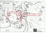
Malcolm's comments:
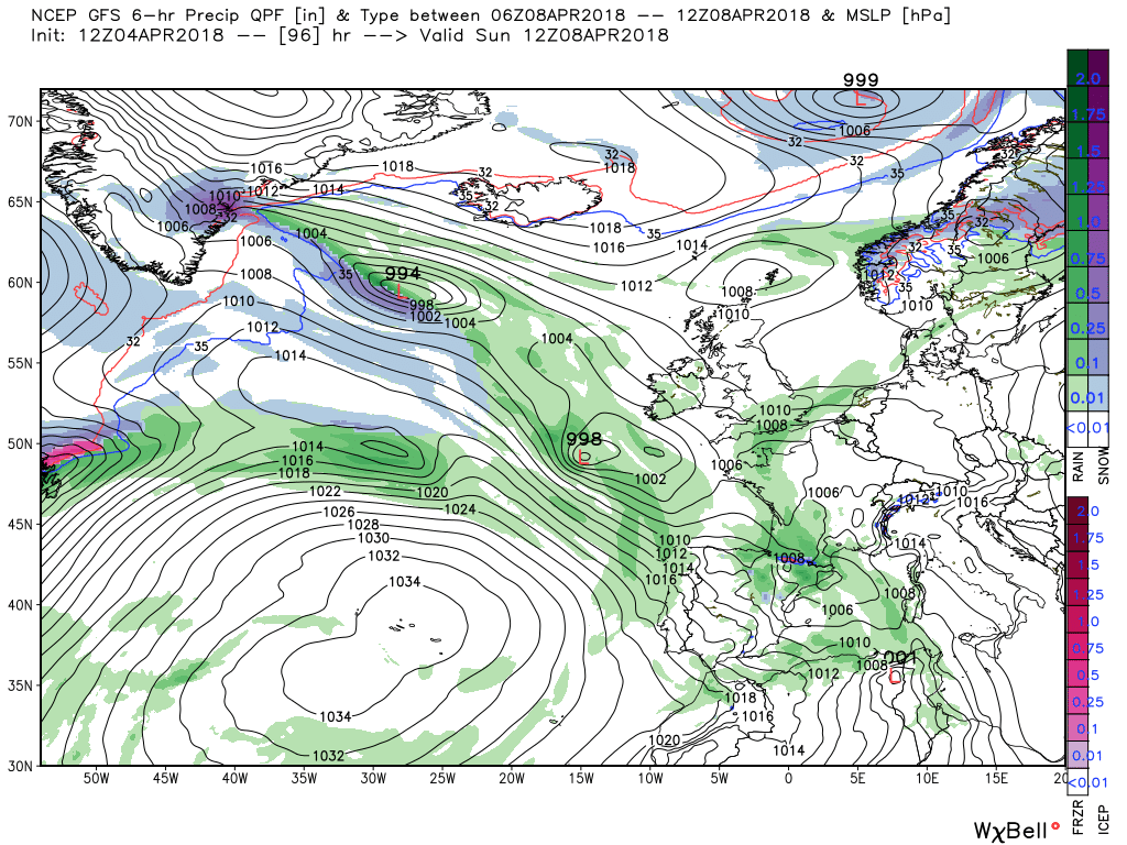
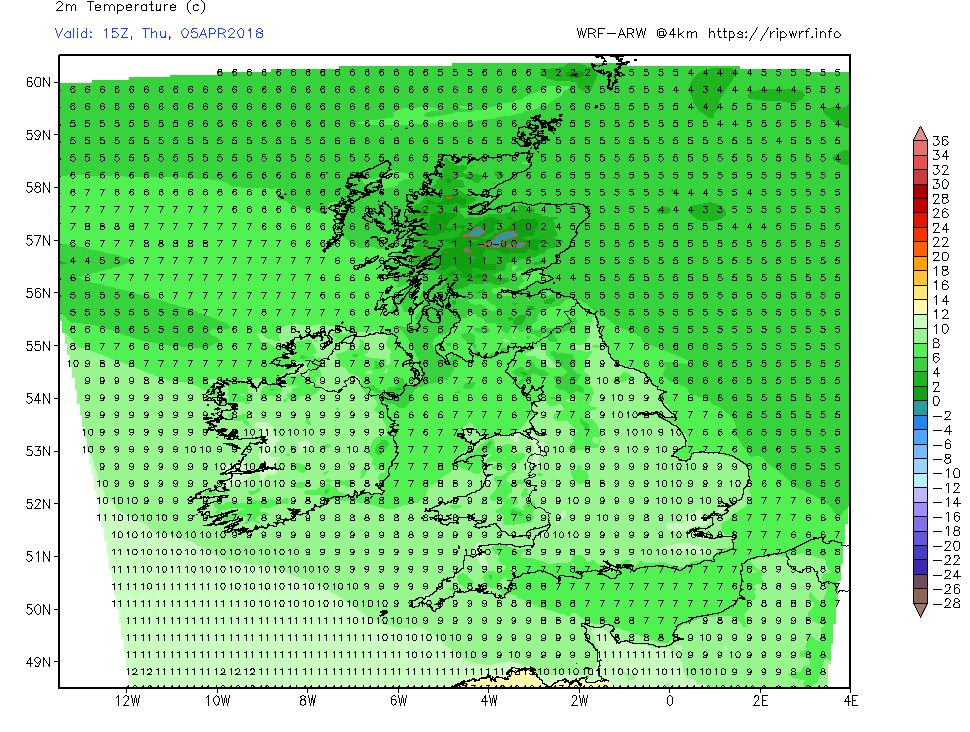
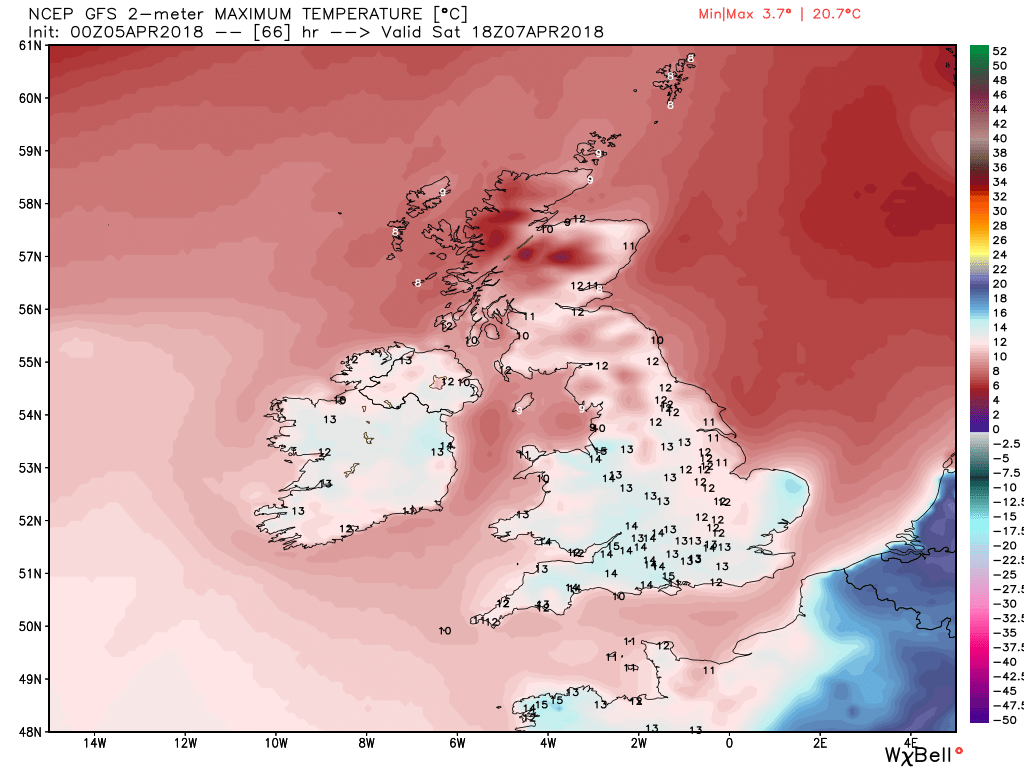
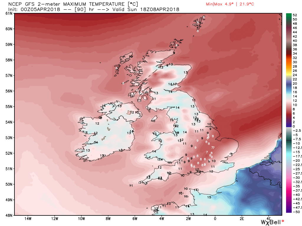
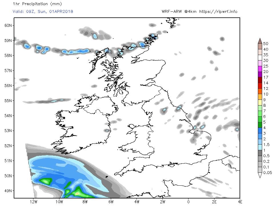
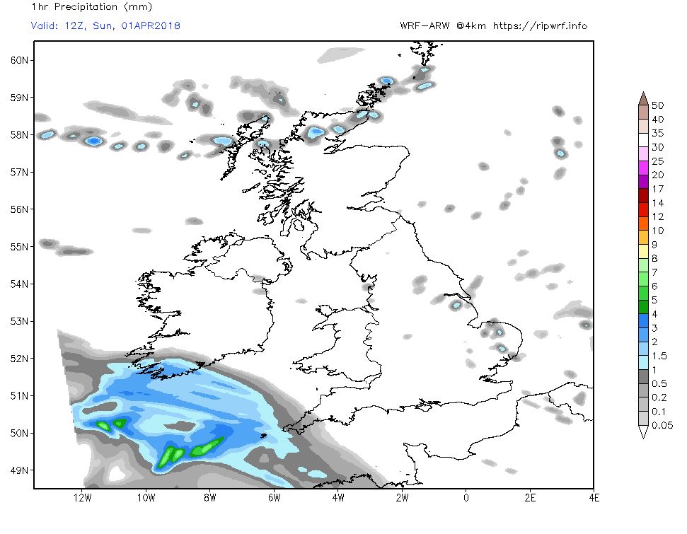
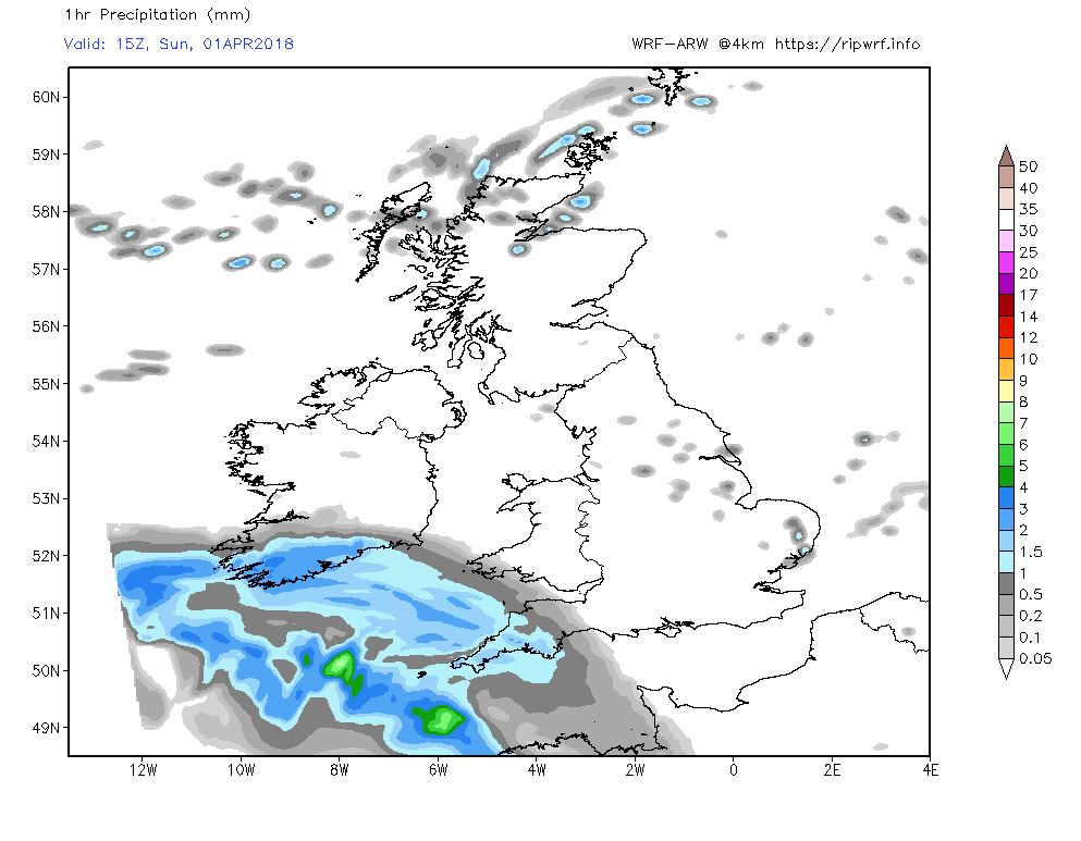
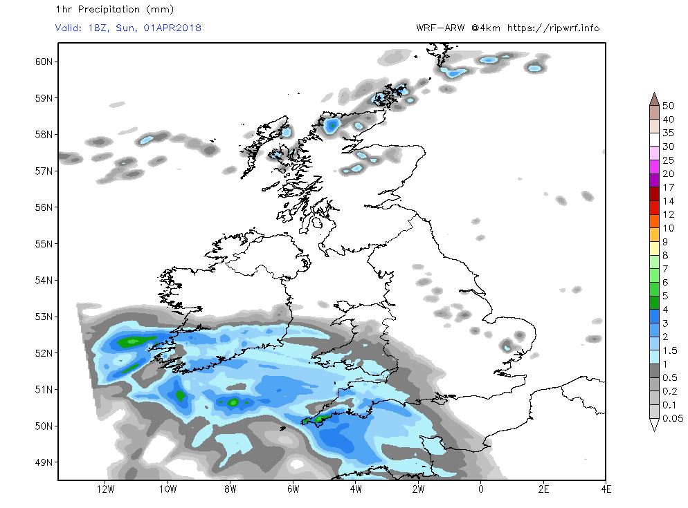
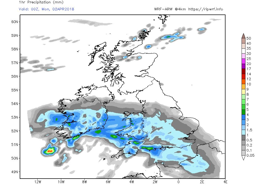
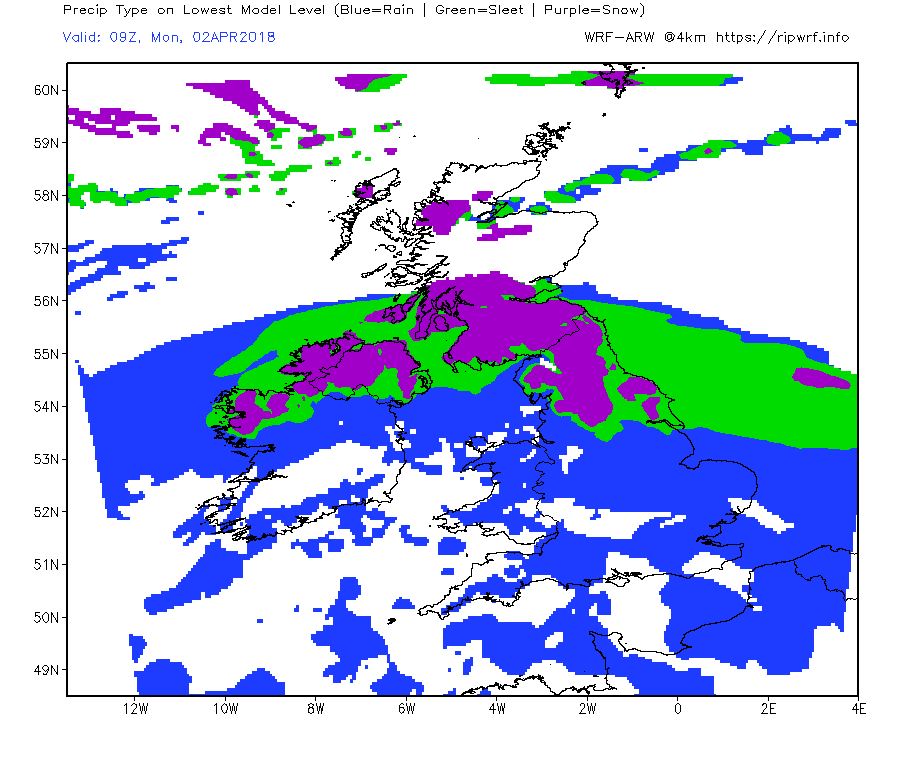
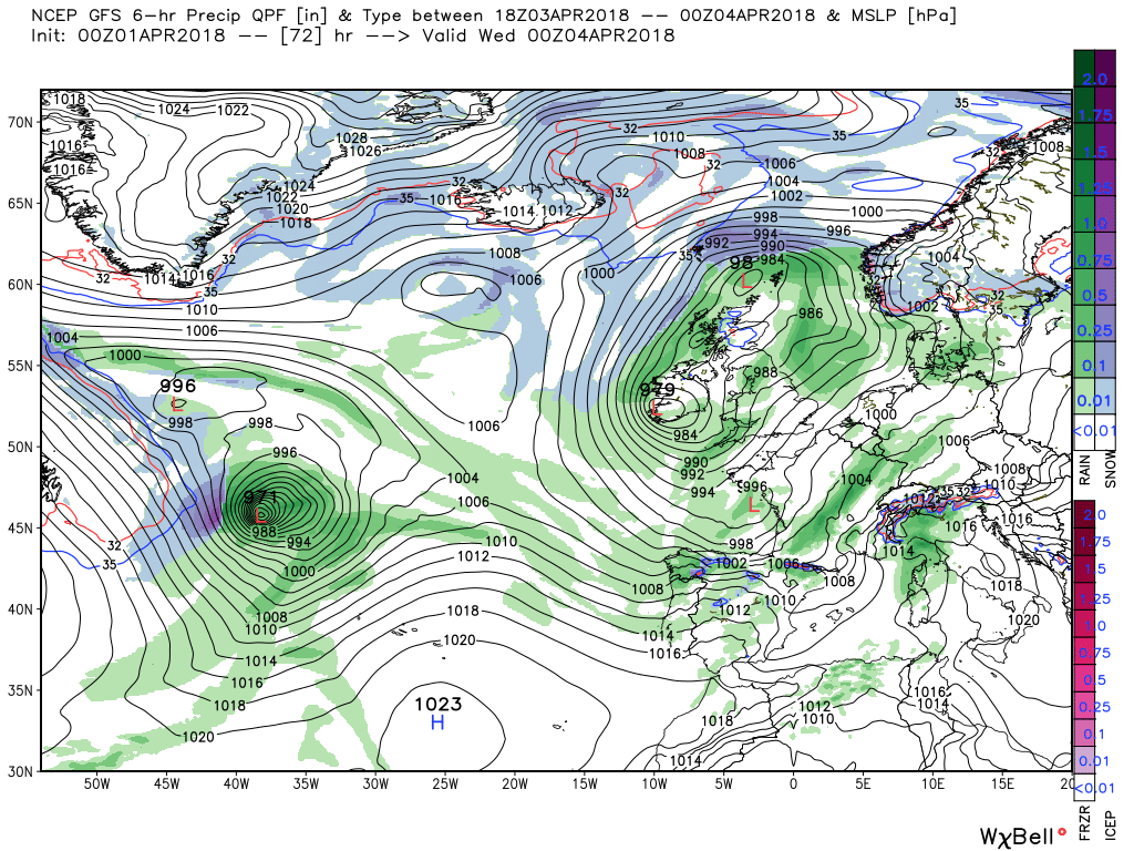
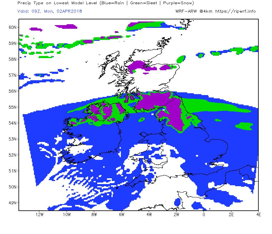
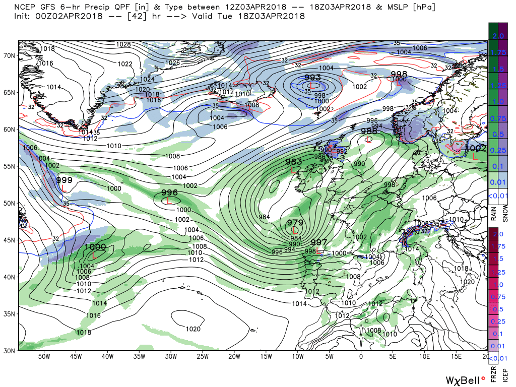
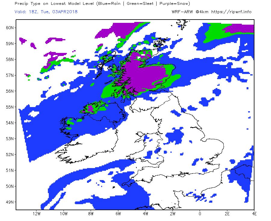
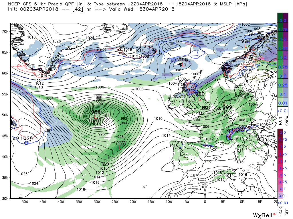
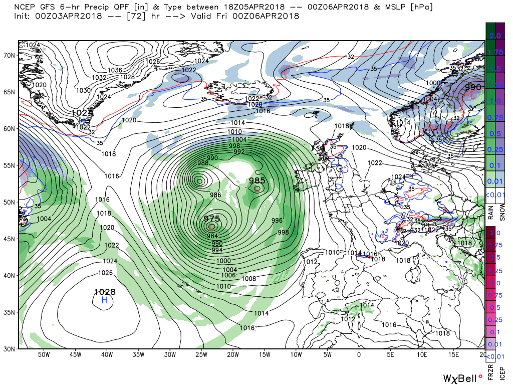
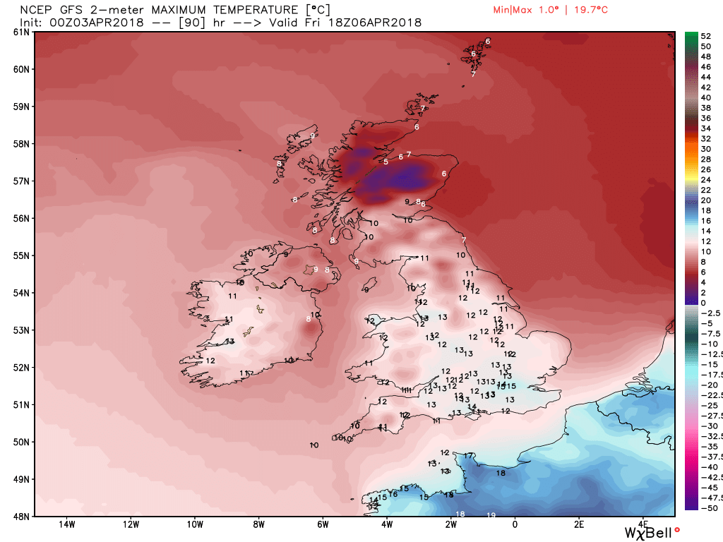
Today with fragments of fronts still lying about will be cloudy in east, central and northern England with still some wintry showers in the north of Scotland. Elsewhere sunny intervals.But dry with light winds so not unpleasant but by midday cloud and rain, which will become heavy at times, will affect the far south west as fronts from the low pressure area to the south west track north east. The rain belt will make steady progress during the day and by 00 Monday will be over Wales and the Midlands.
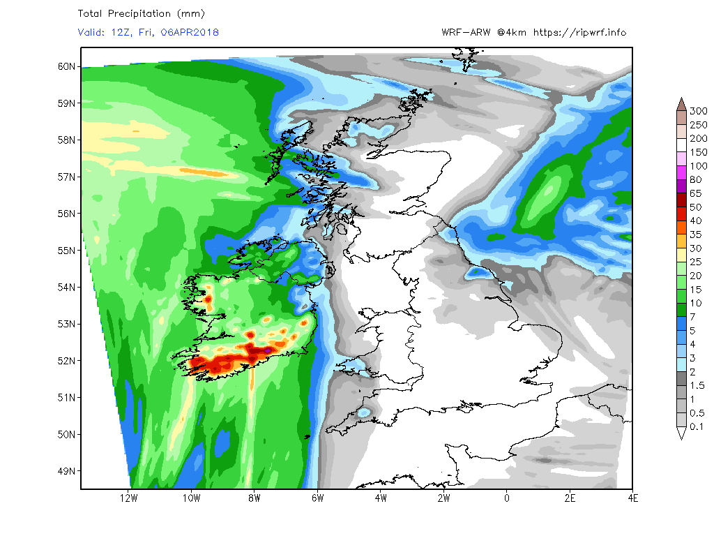
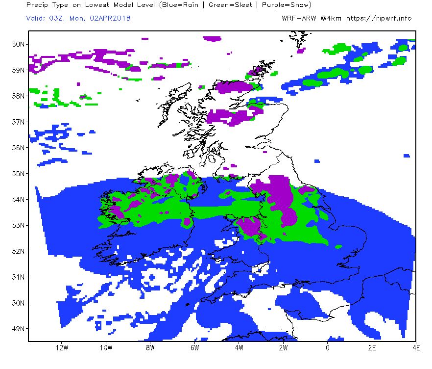
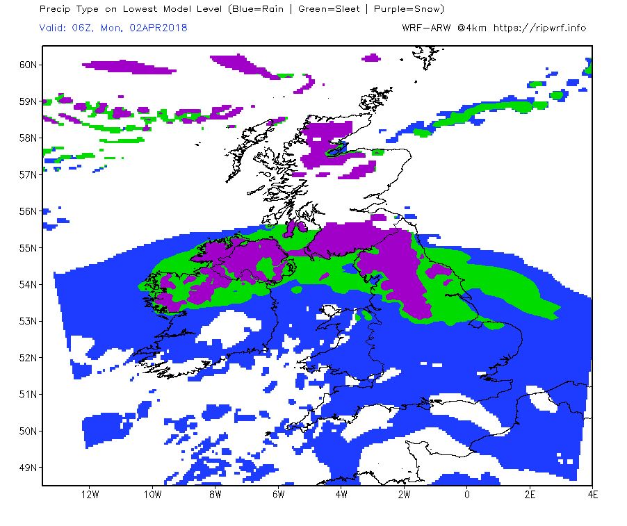
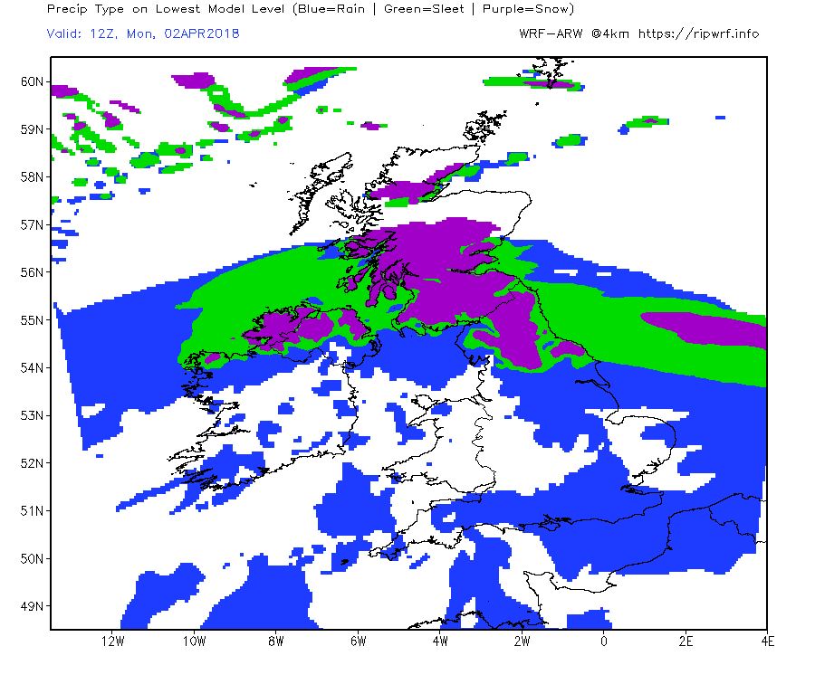
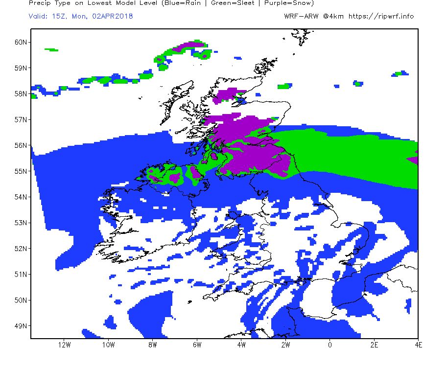
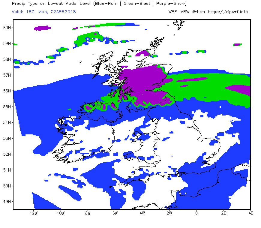
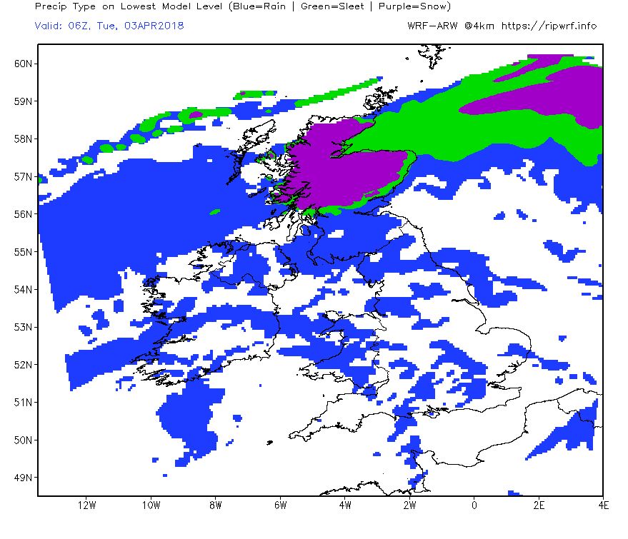
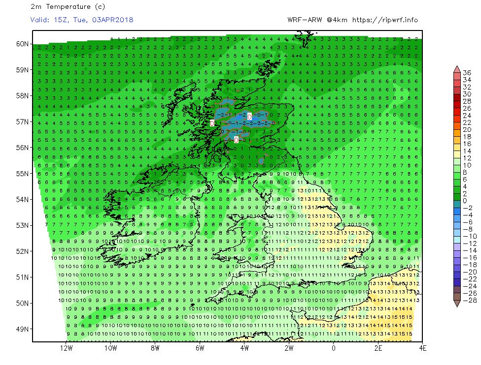
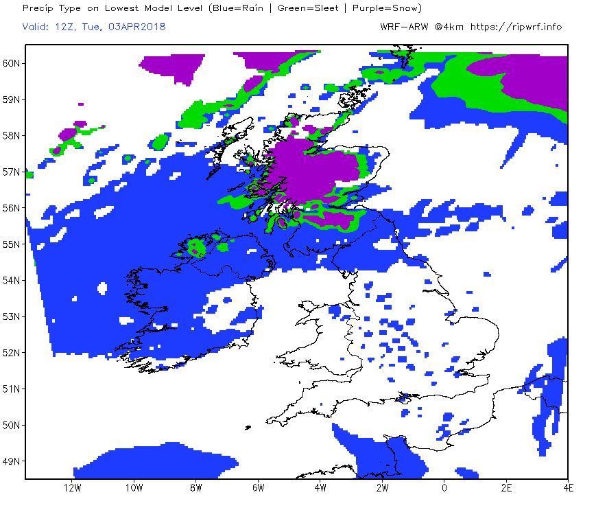
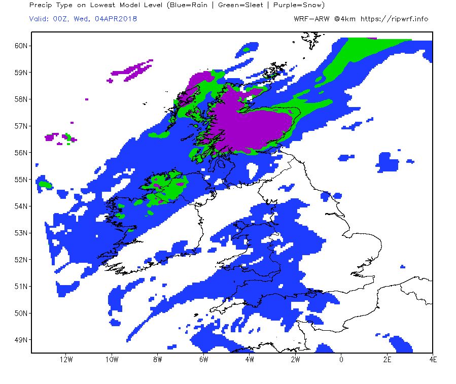
As the rain continues to move north through the night and Monday morning it will increasingly turn to snow but as ever in these marginal situations the heavier falls will favour higher ground but significant falls at lower levels cannot be ruled out.
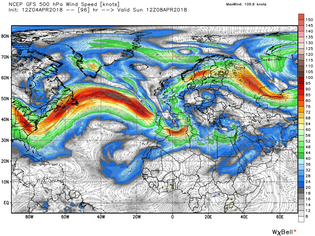
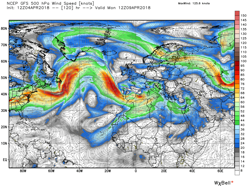
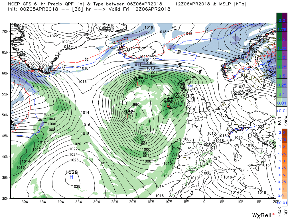
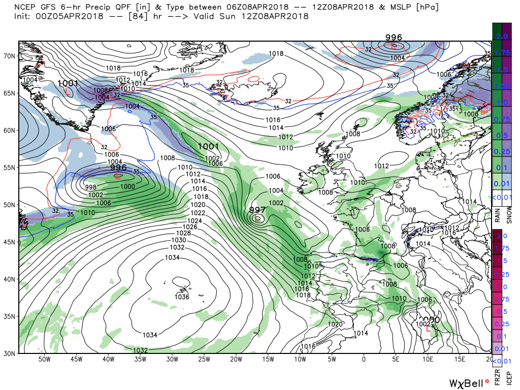
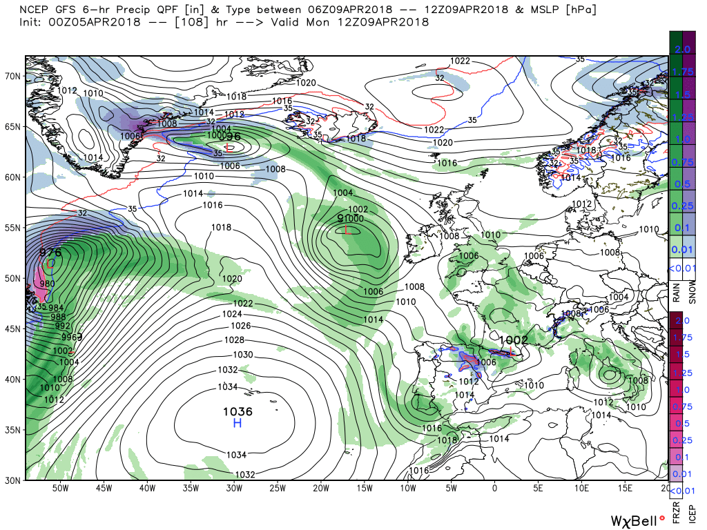
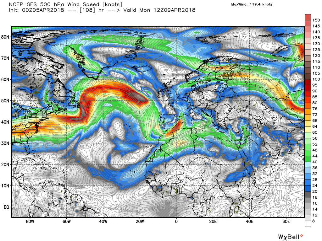
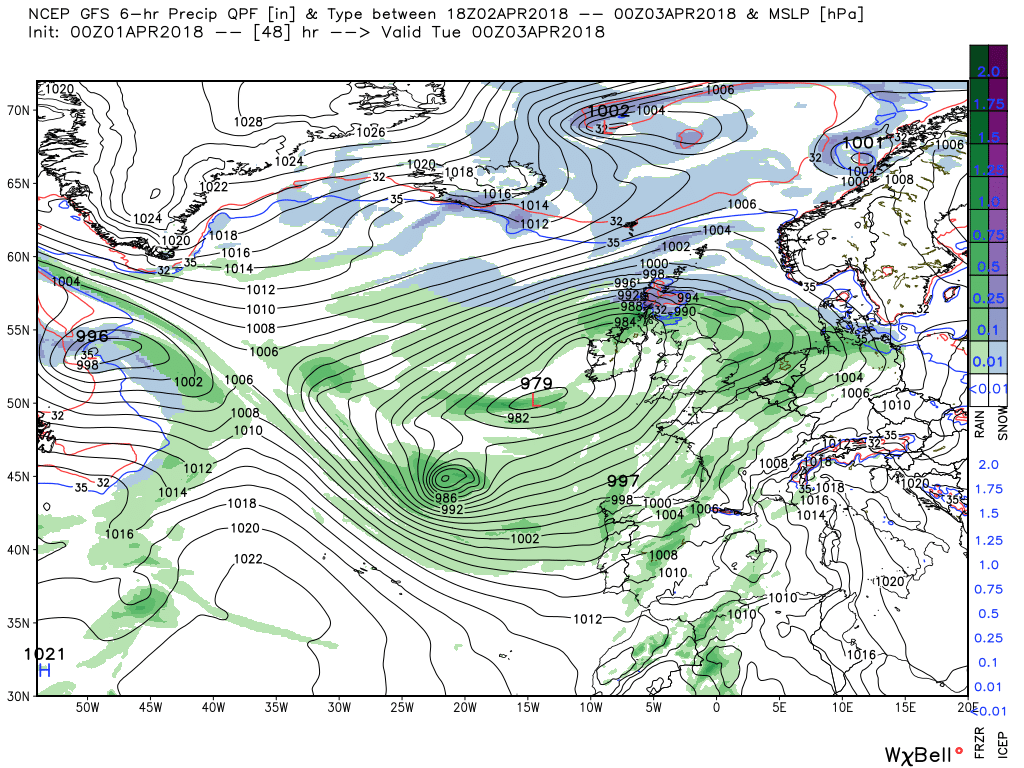
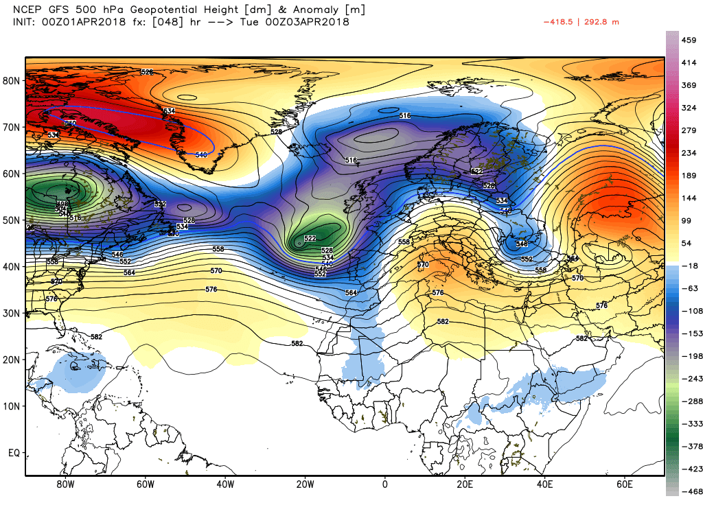
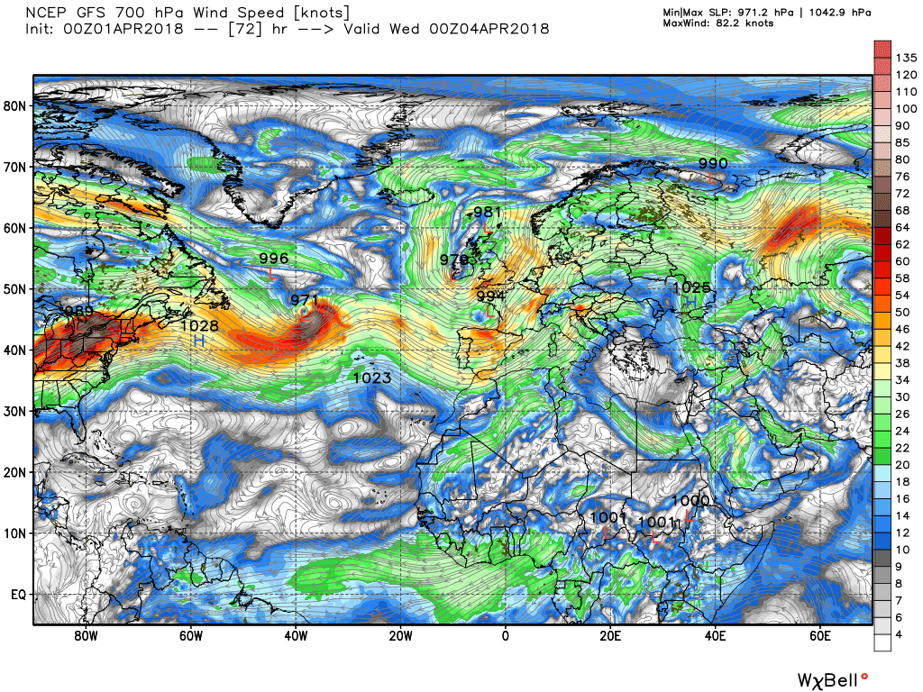
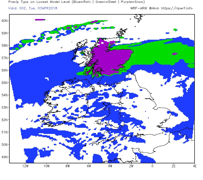
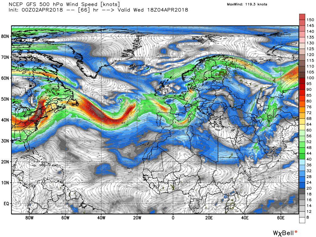
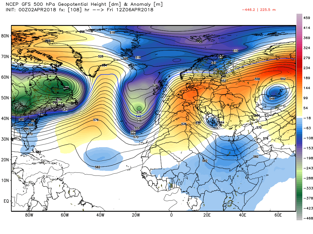
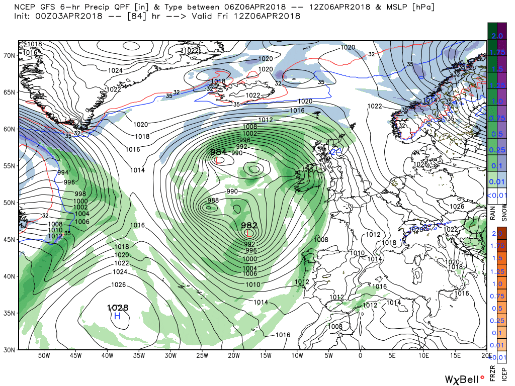
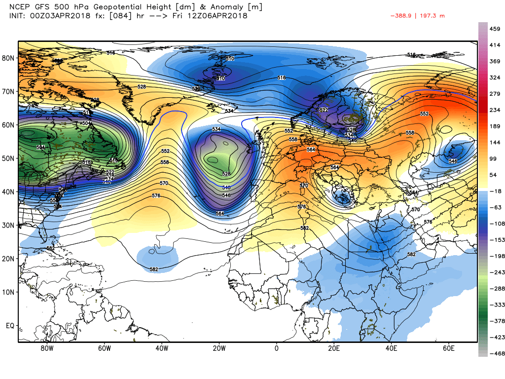
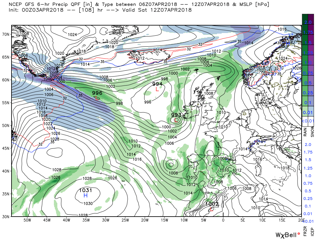
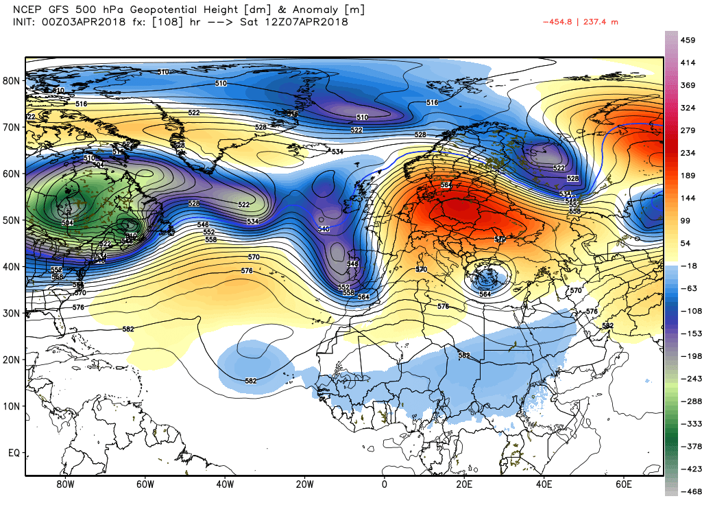
So by 00 Tuesday the snow belt is over northern Scotland with perhaps blizzard conditions pertaining in the strong ESE wind with low pressure covering the UK with centers to the south west. But as can be seen there is still a fair amount of energy exiting Canada and the south east US with more toughs tracking east putting the trough to our west under pressure.
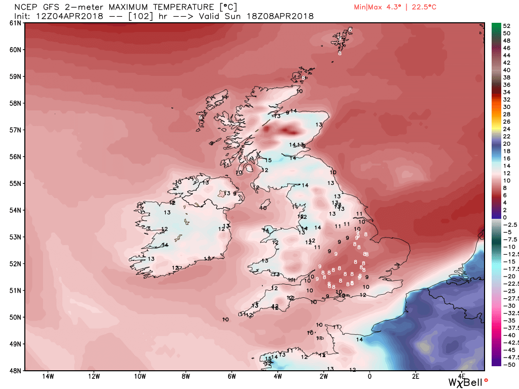
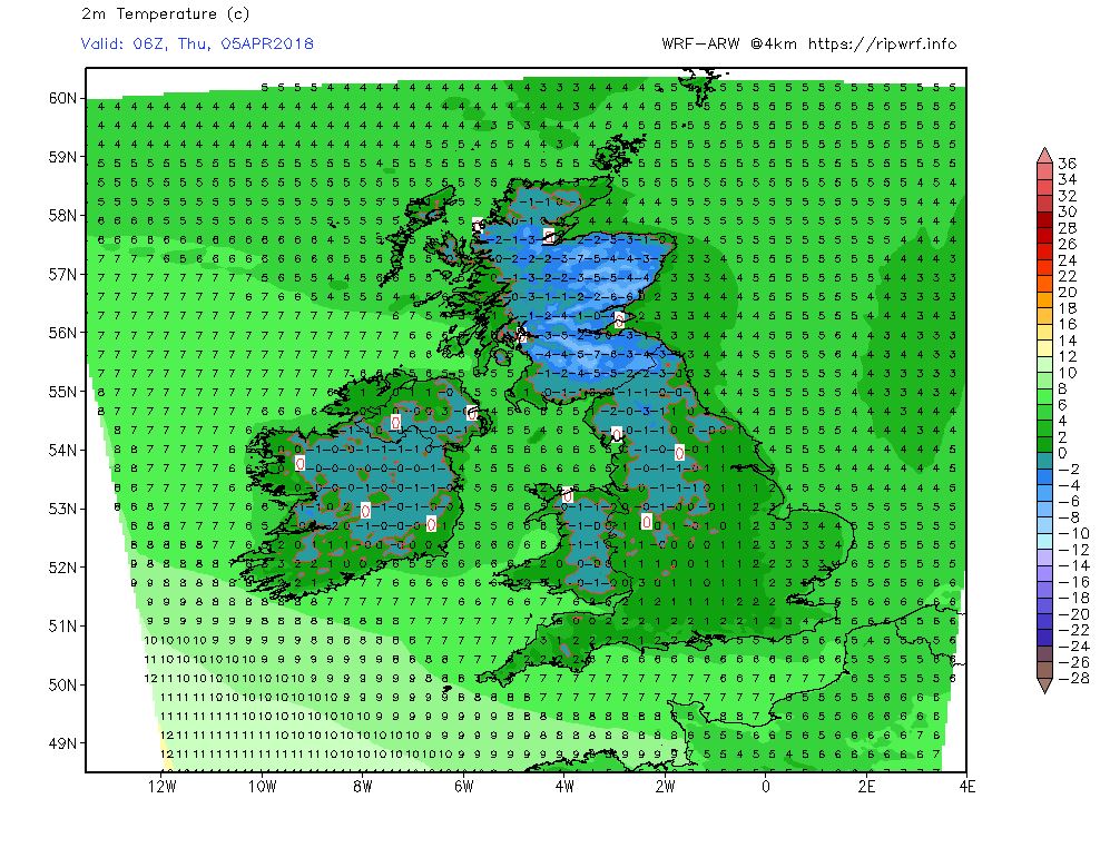
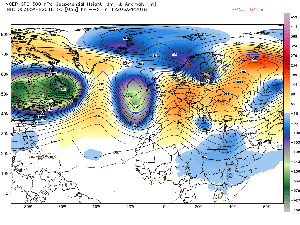
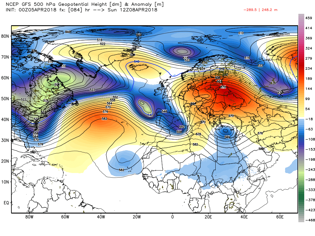
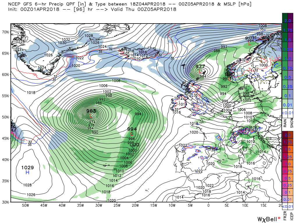
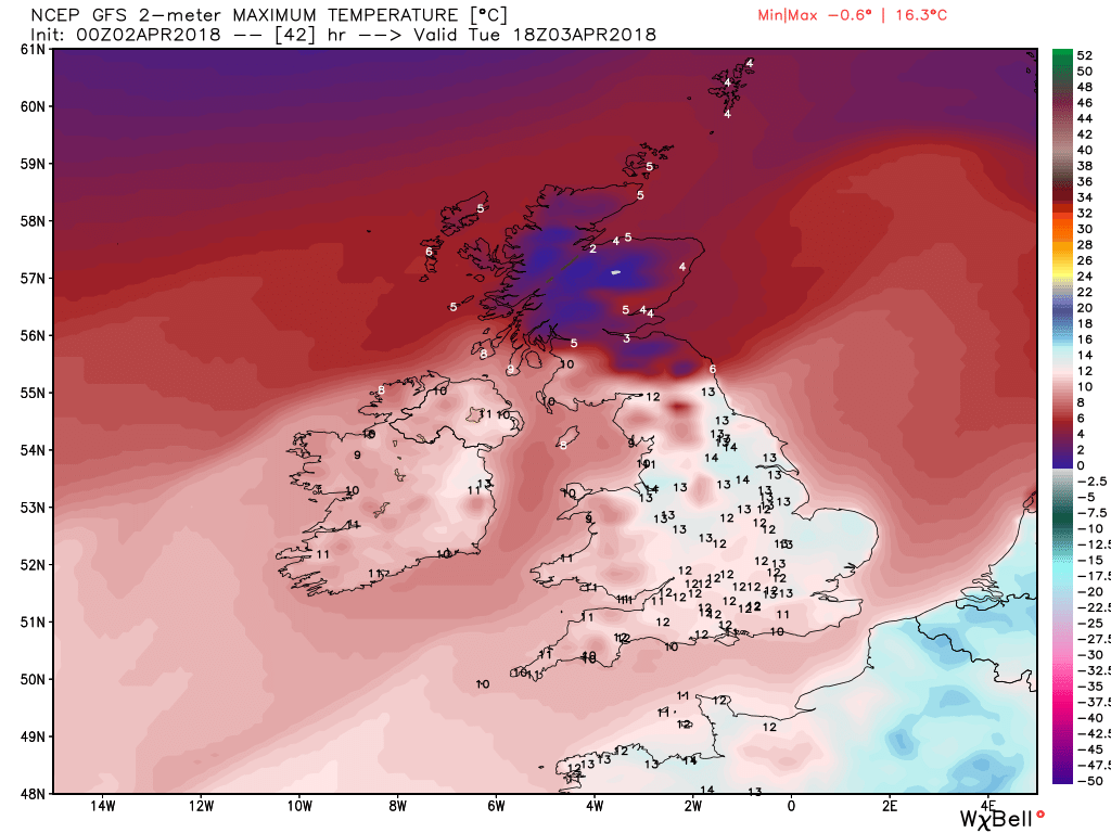
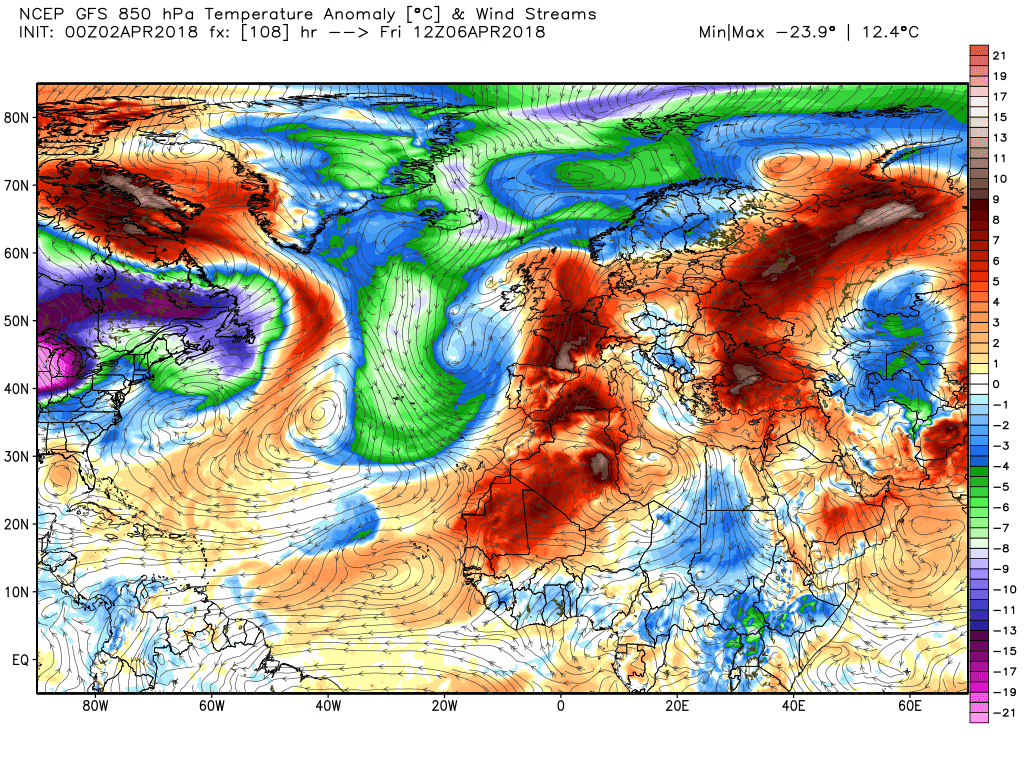
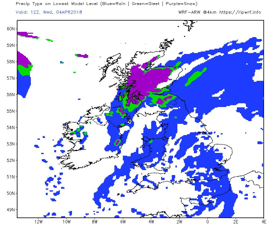
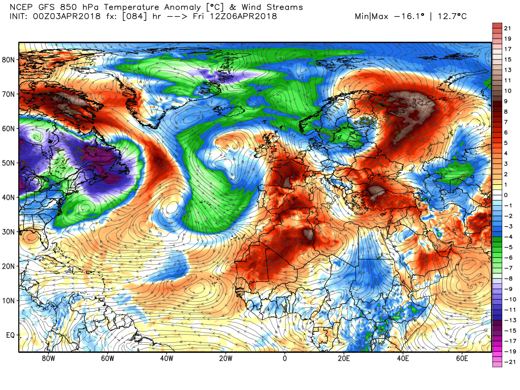
Through Tuesday, and Wednesday, under this pressure,, the configuration and orientation of the low pressure area over the UK adjusts and with low centers and the odd trough dotted about within the general circulation unsettled showery conditions, with the odd longer period of rain thrown in,is the order of the day. Quite a temp gradient by the evening on Wednesday a the wind veers north westerly
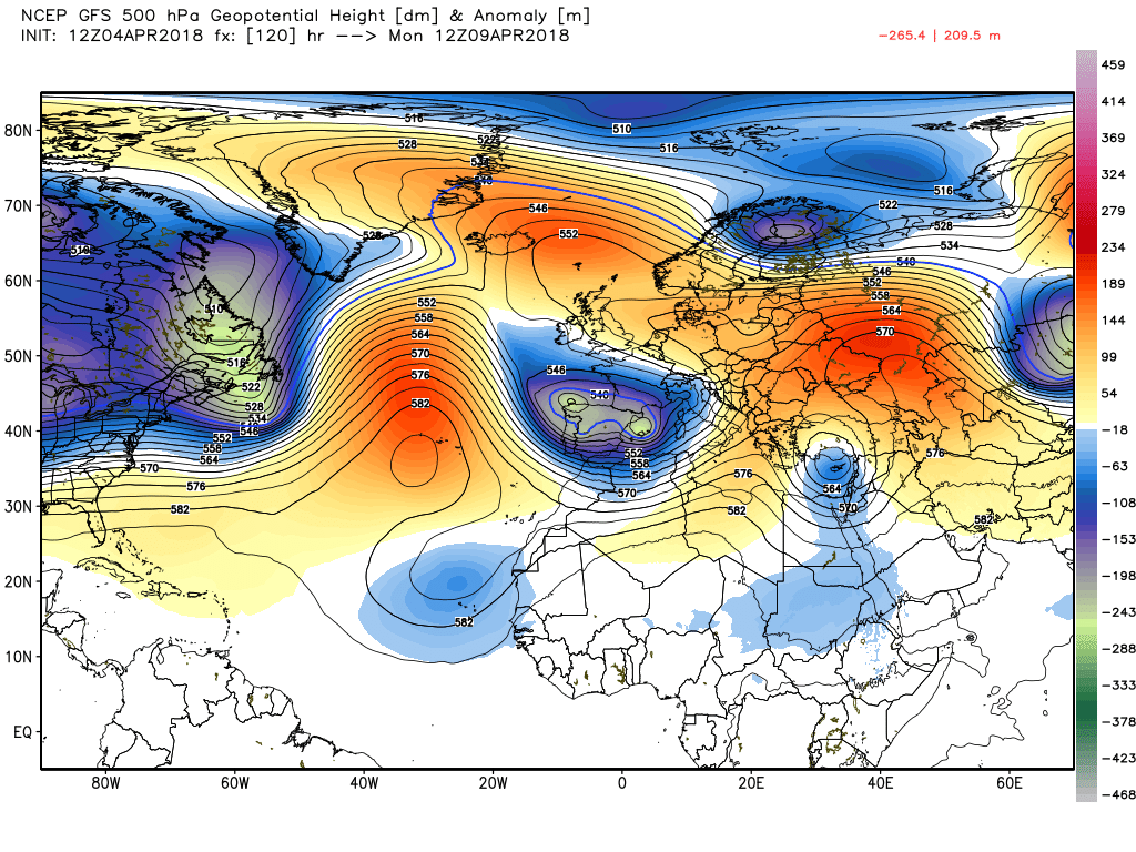
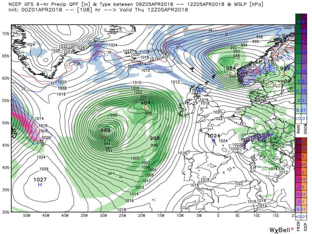
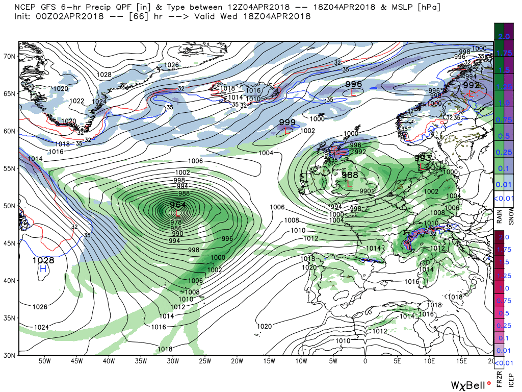
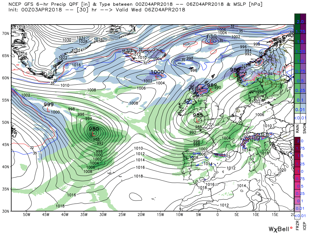
But this is but a brief regime as the low area moves quickly north east and the next trough approaches from the west but changes are afoot with high pressure beginning to amplify so best left here with Thursday looking a quieter and drier day.
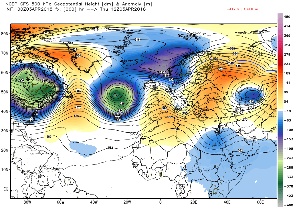
And the fax for 1200 Thursday
Edited 5 hours ago by knocker


") P.
P.