OP
- Joined
- Saturday January 15, 2011
- Location
- Norfolk, England
- Thread Starter
- #1,809
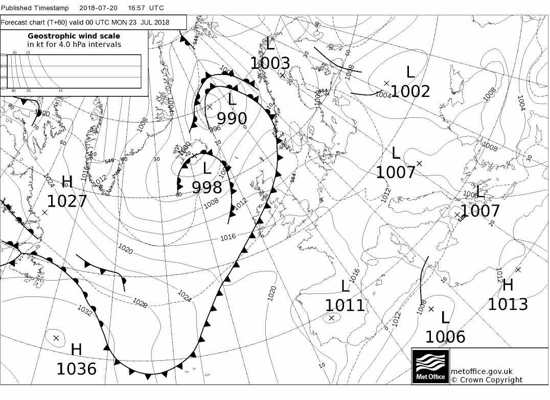
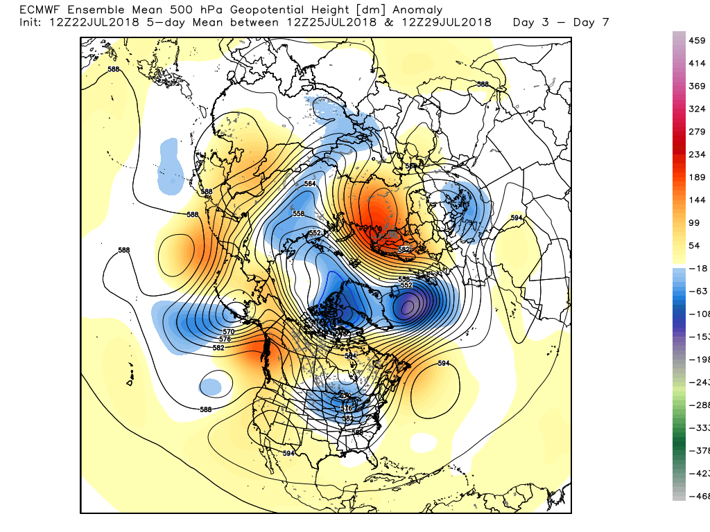
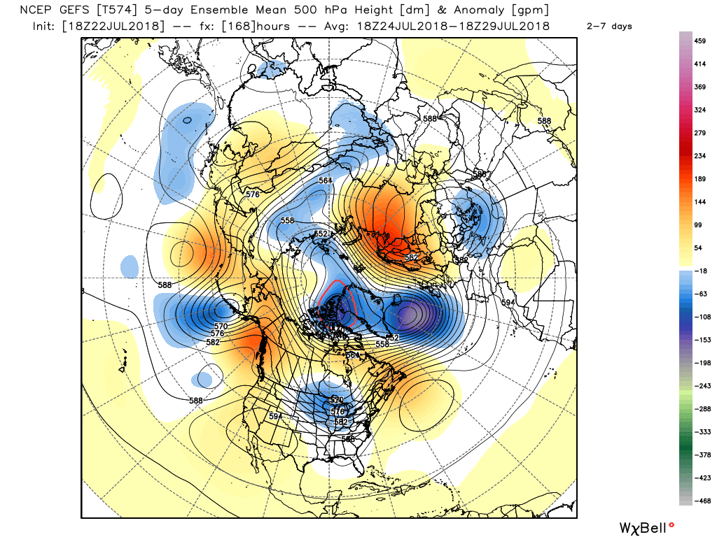
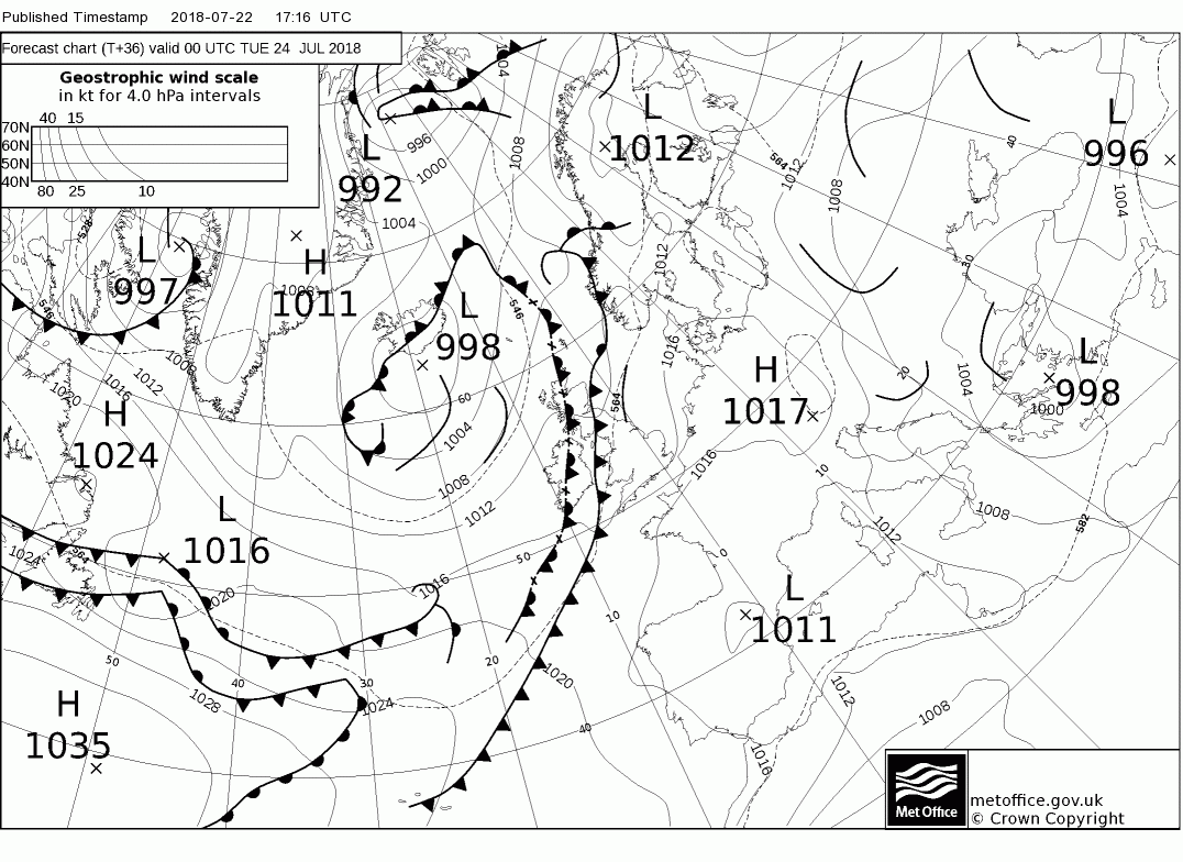
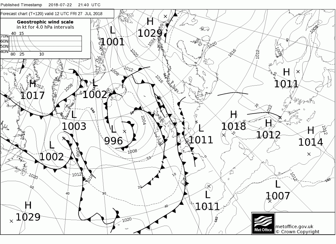
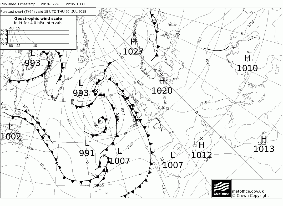
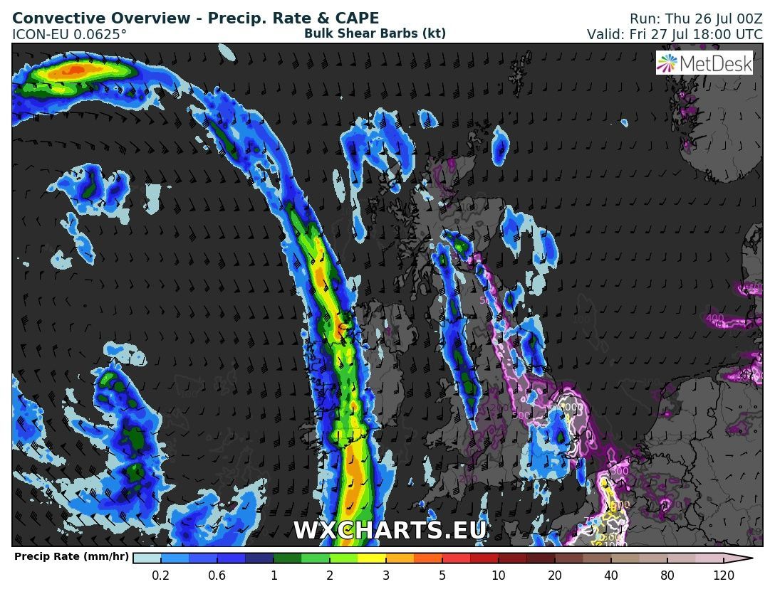
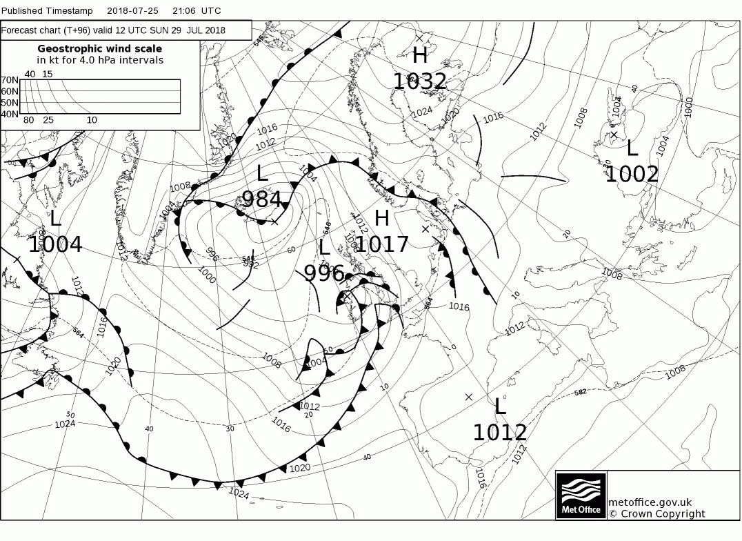
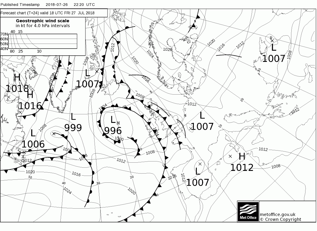
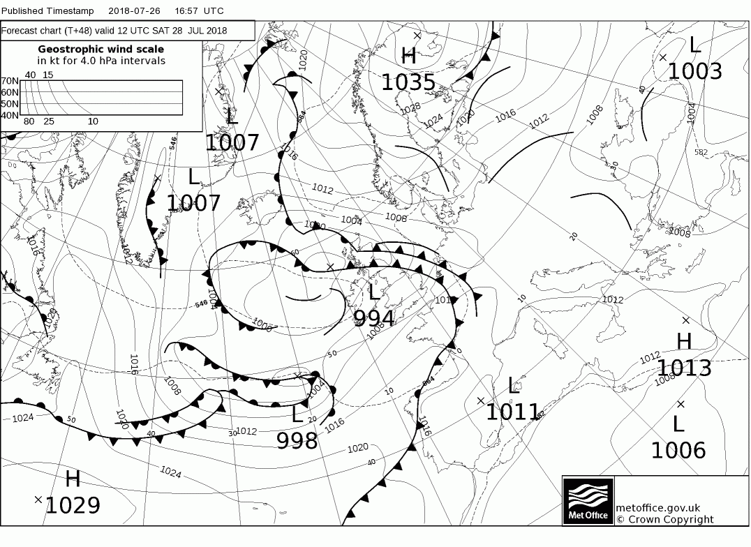
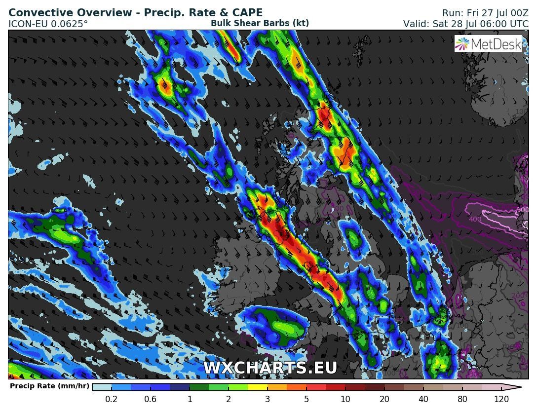
Malcolm's thoughts part 1:
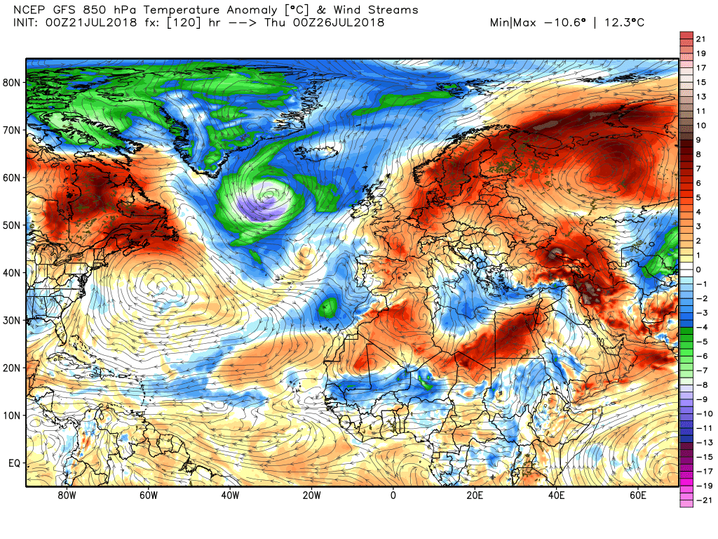
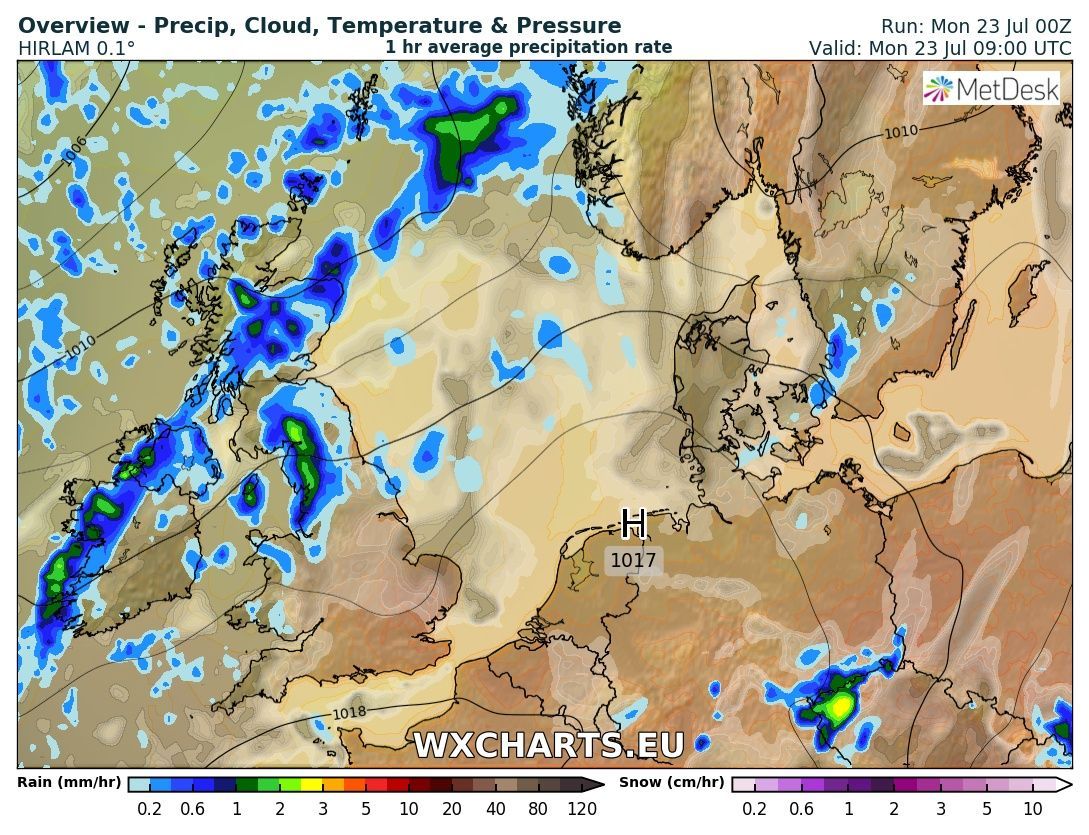
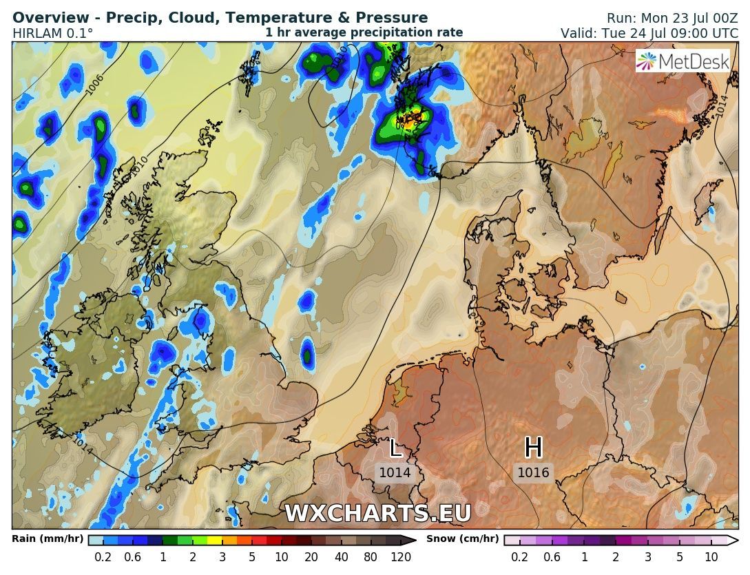
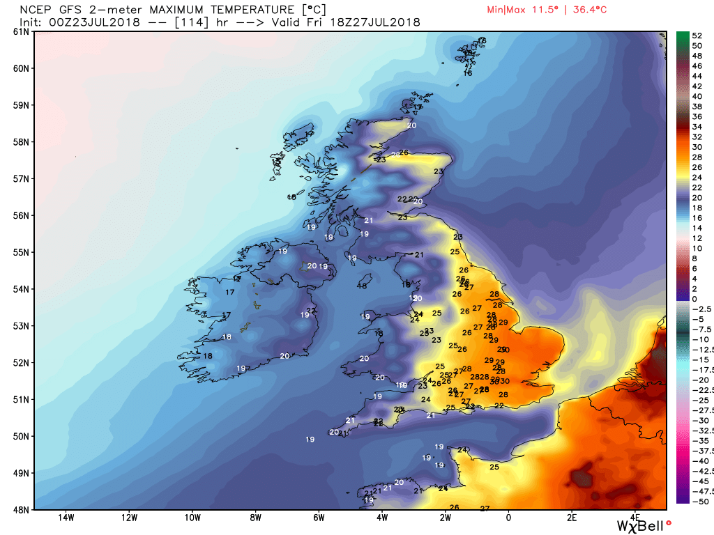
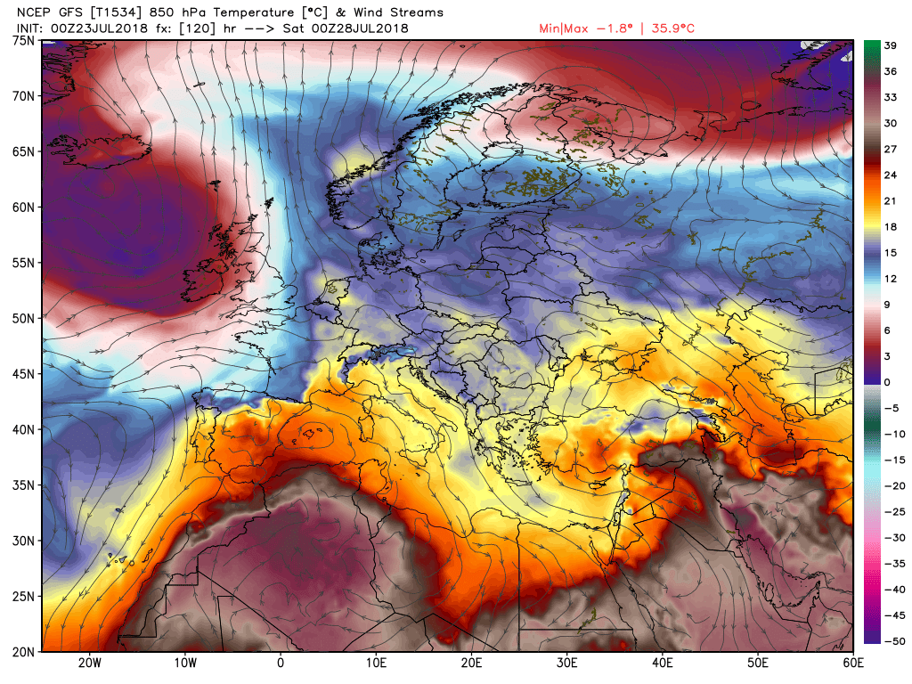
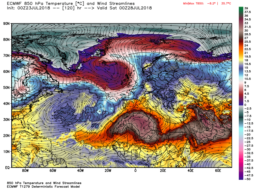
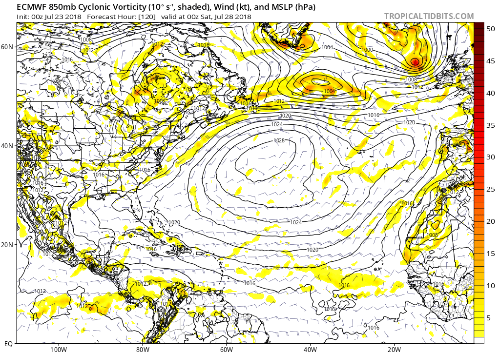
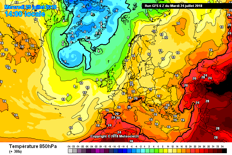
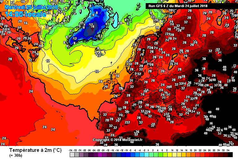
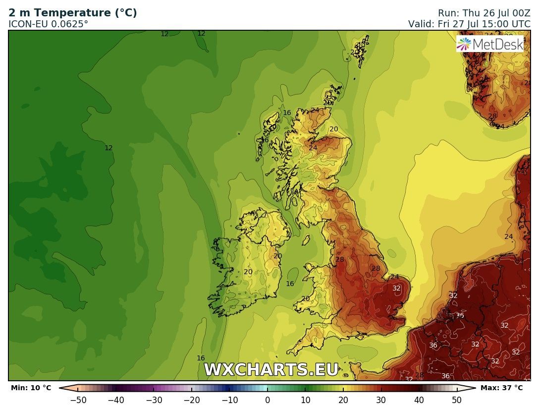
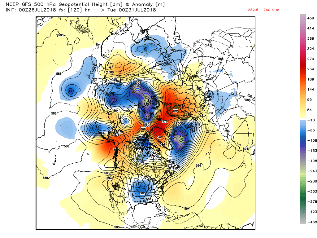
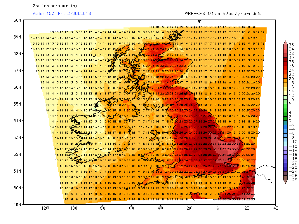
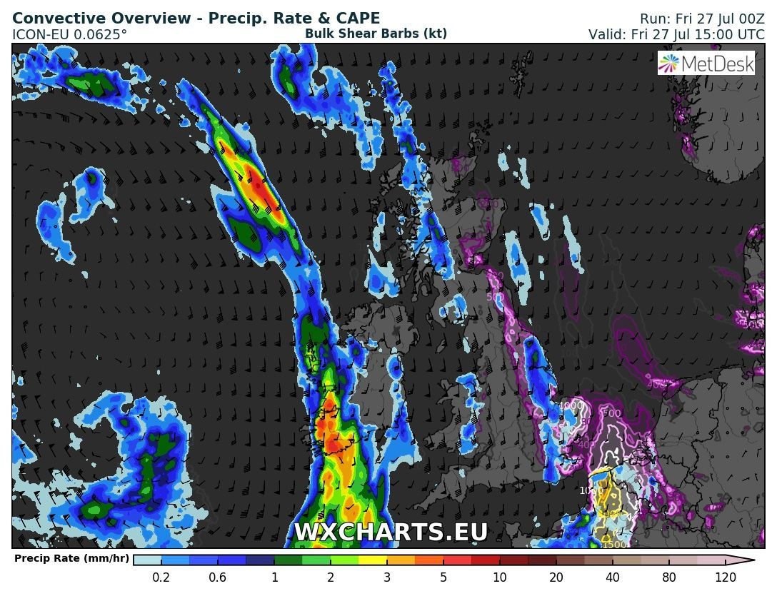
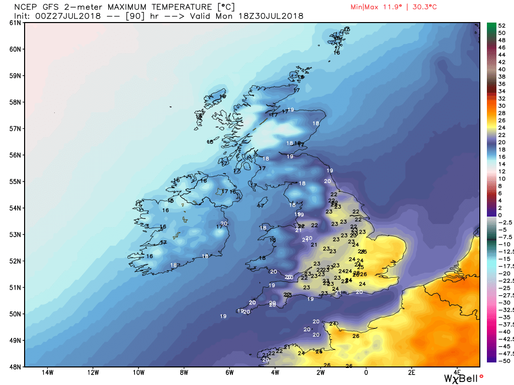
Little to add to the outlook that hasn't been said before. The battle between the energy out west and the block to the east continues apace resulting in very marked regional variations of weather and temps which can generally be summed up as a NW/SE split.
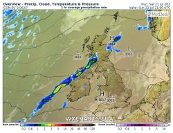
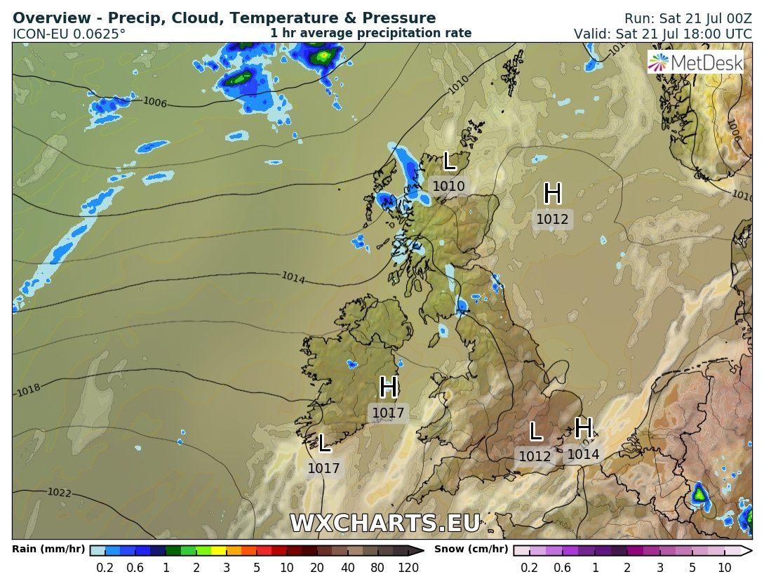
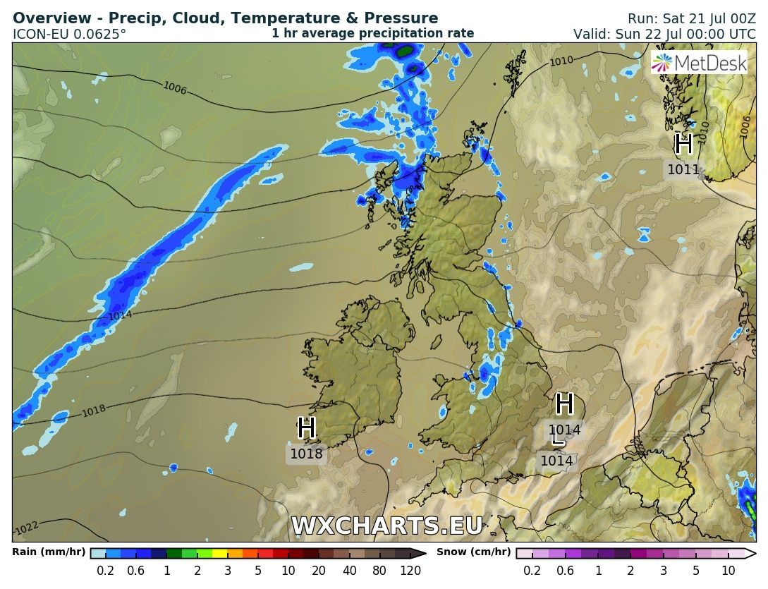
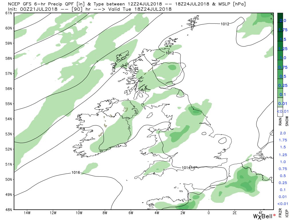
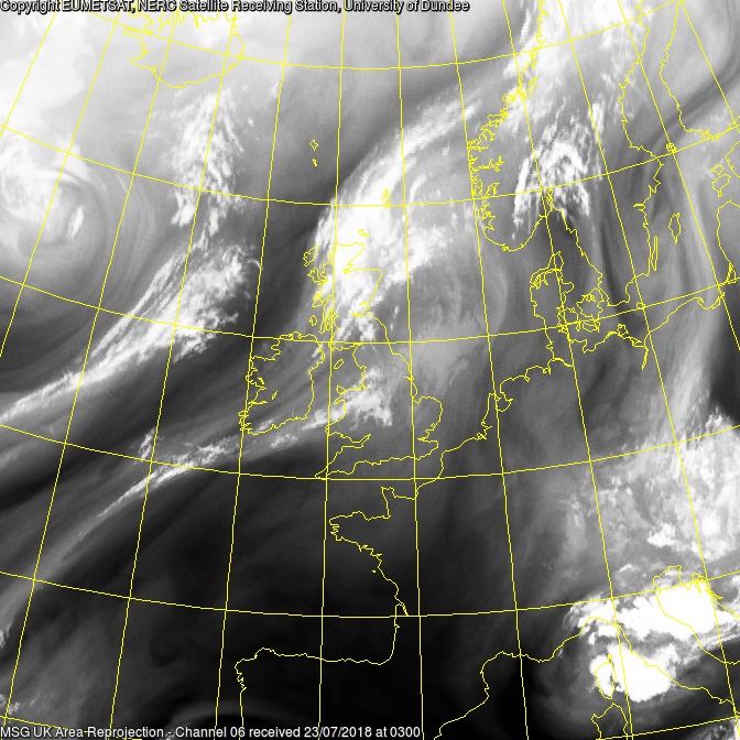
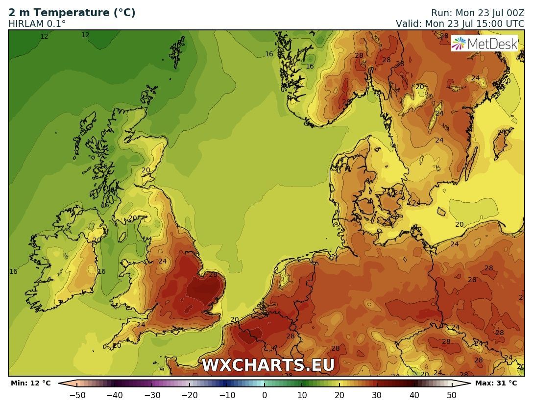
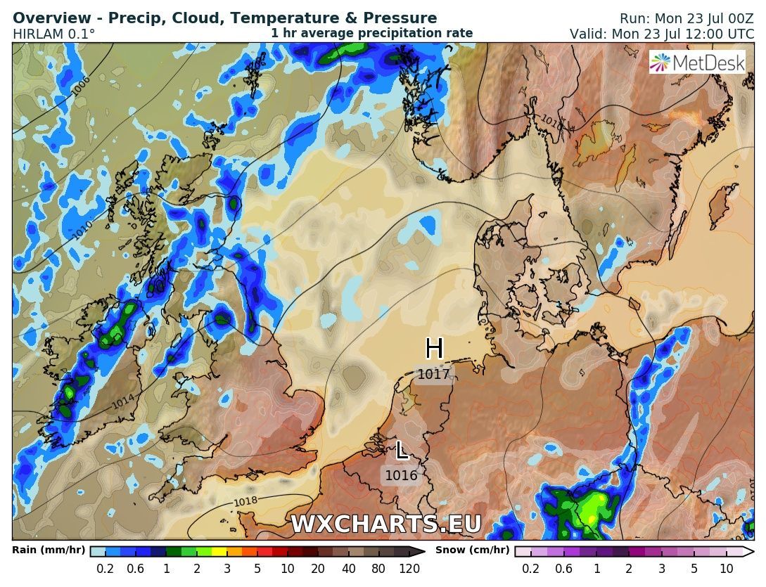
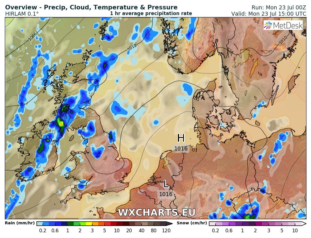
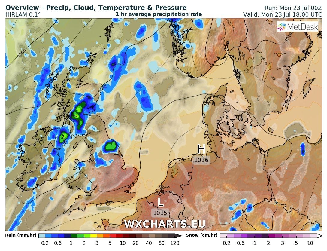
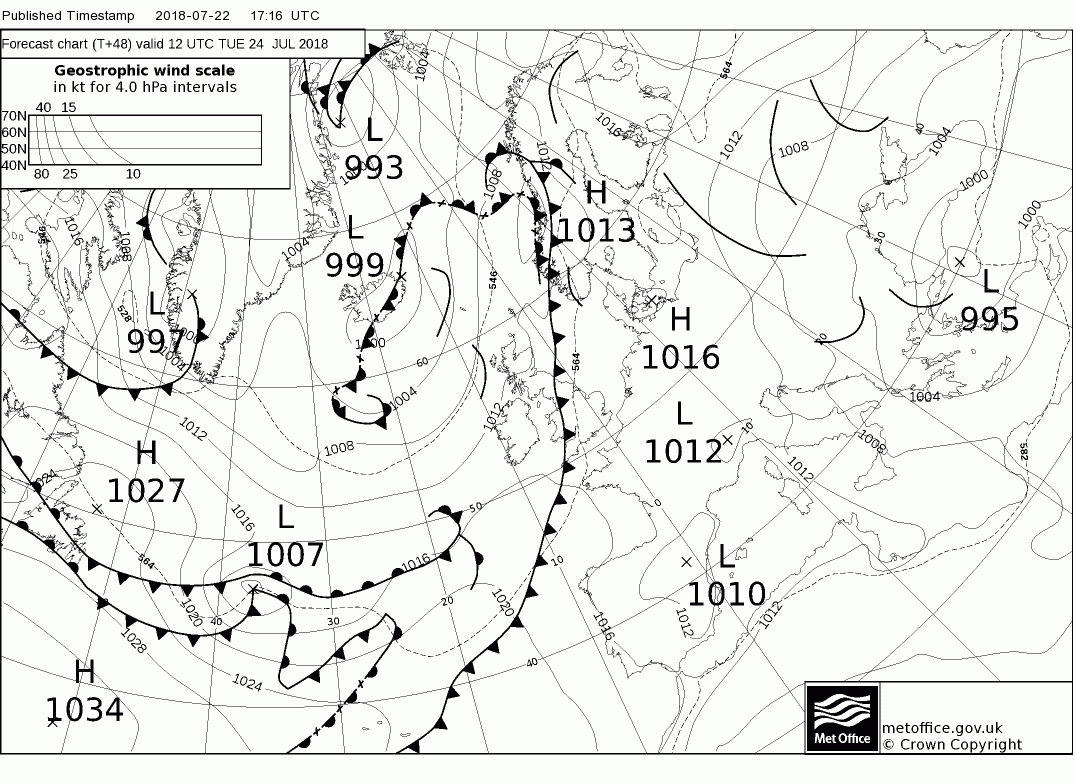
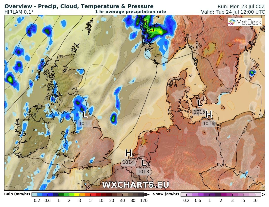
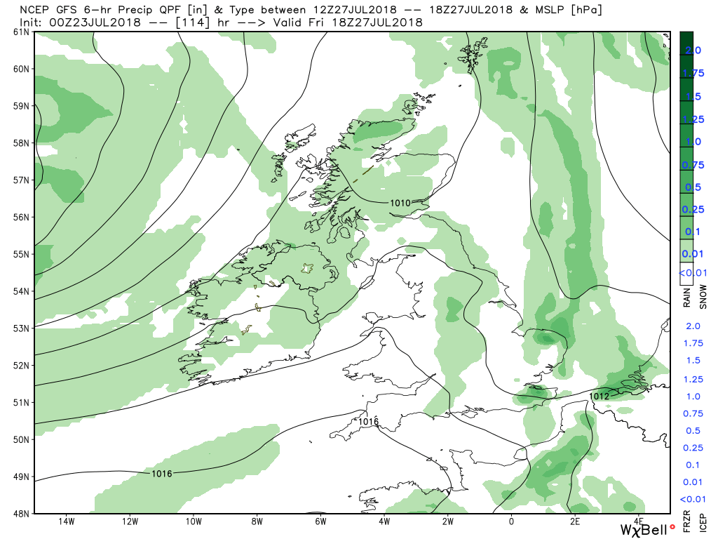
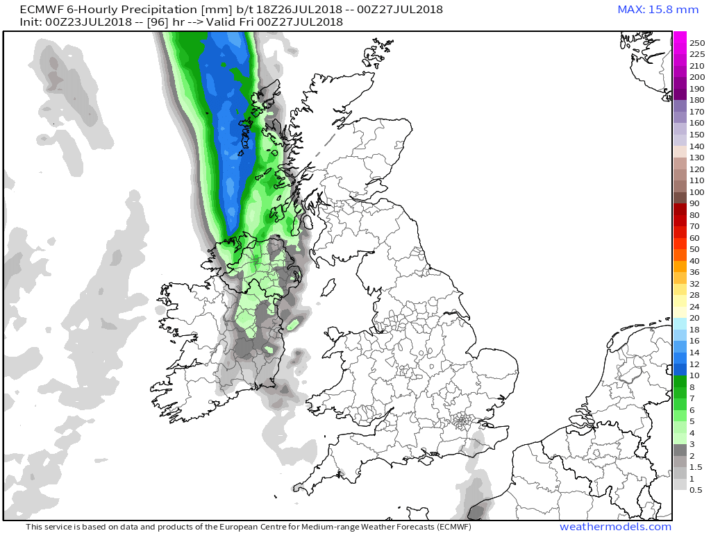
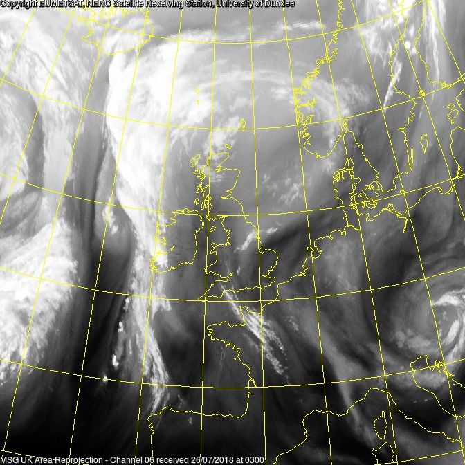
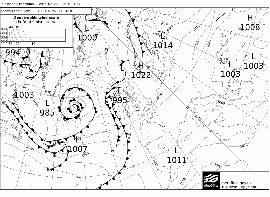
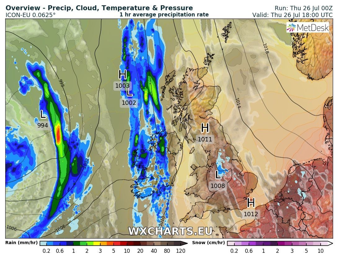
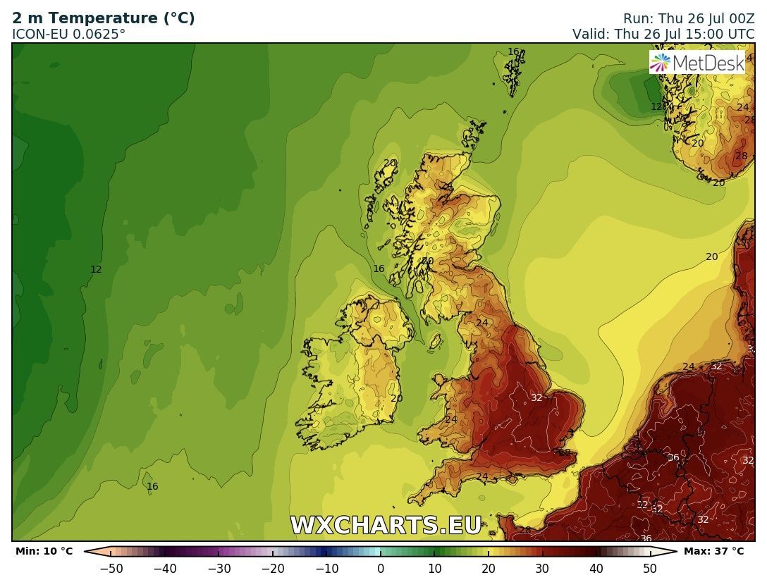
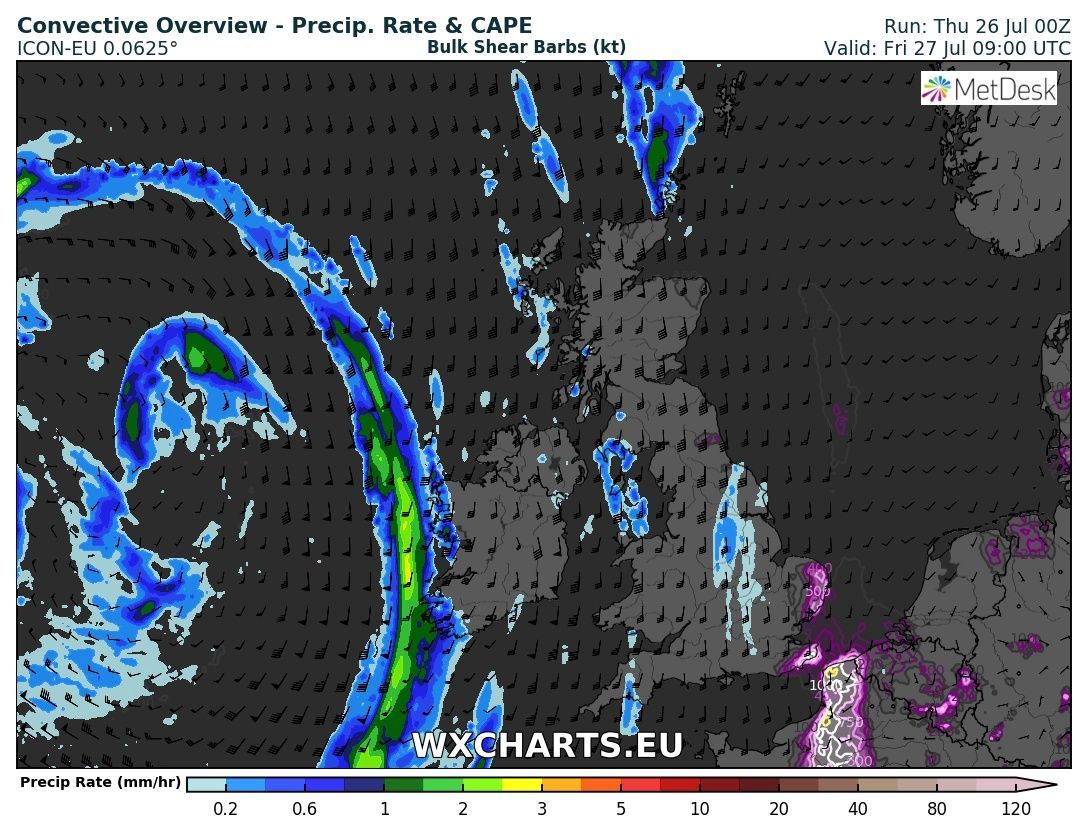
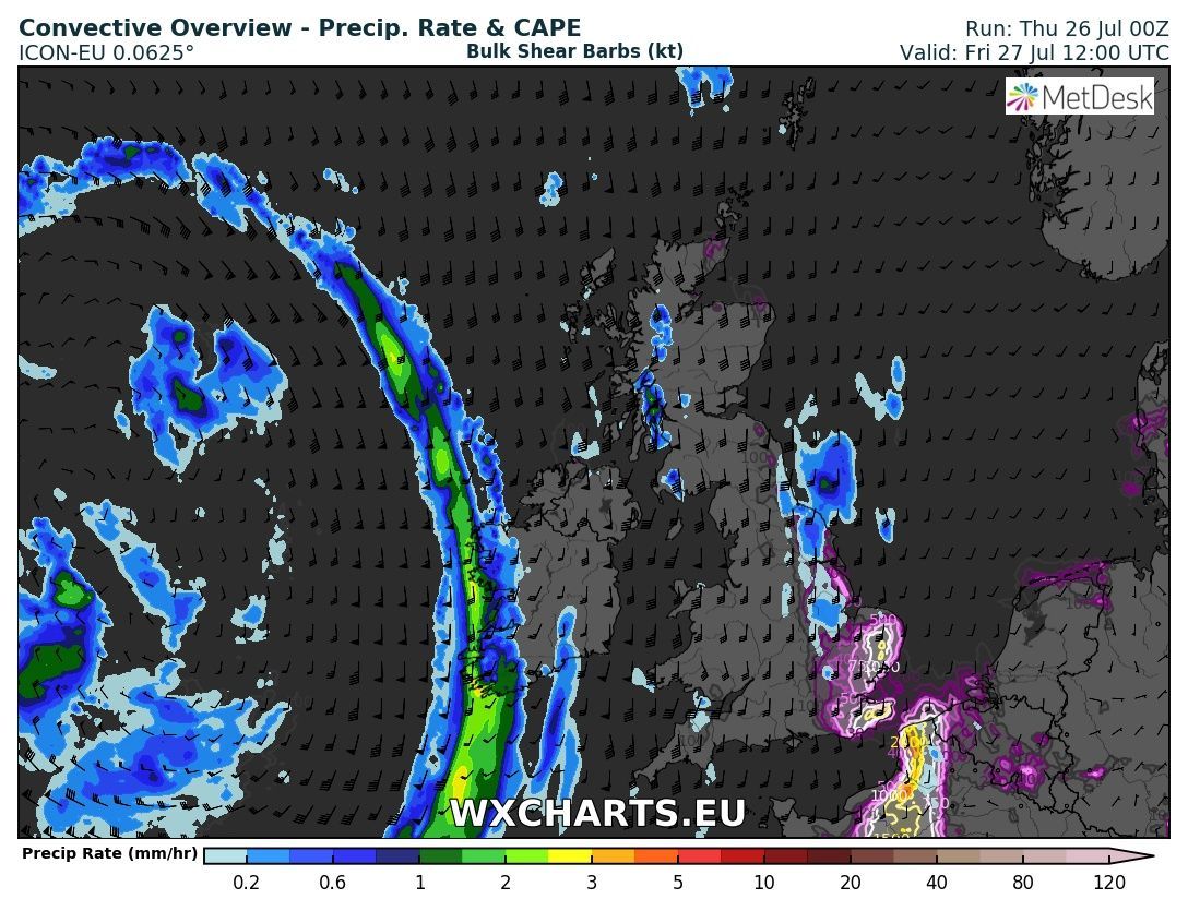
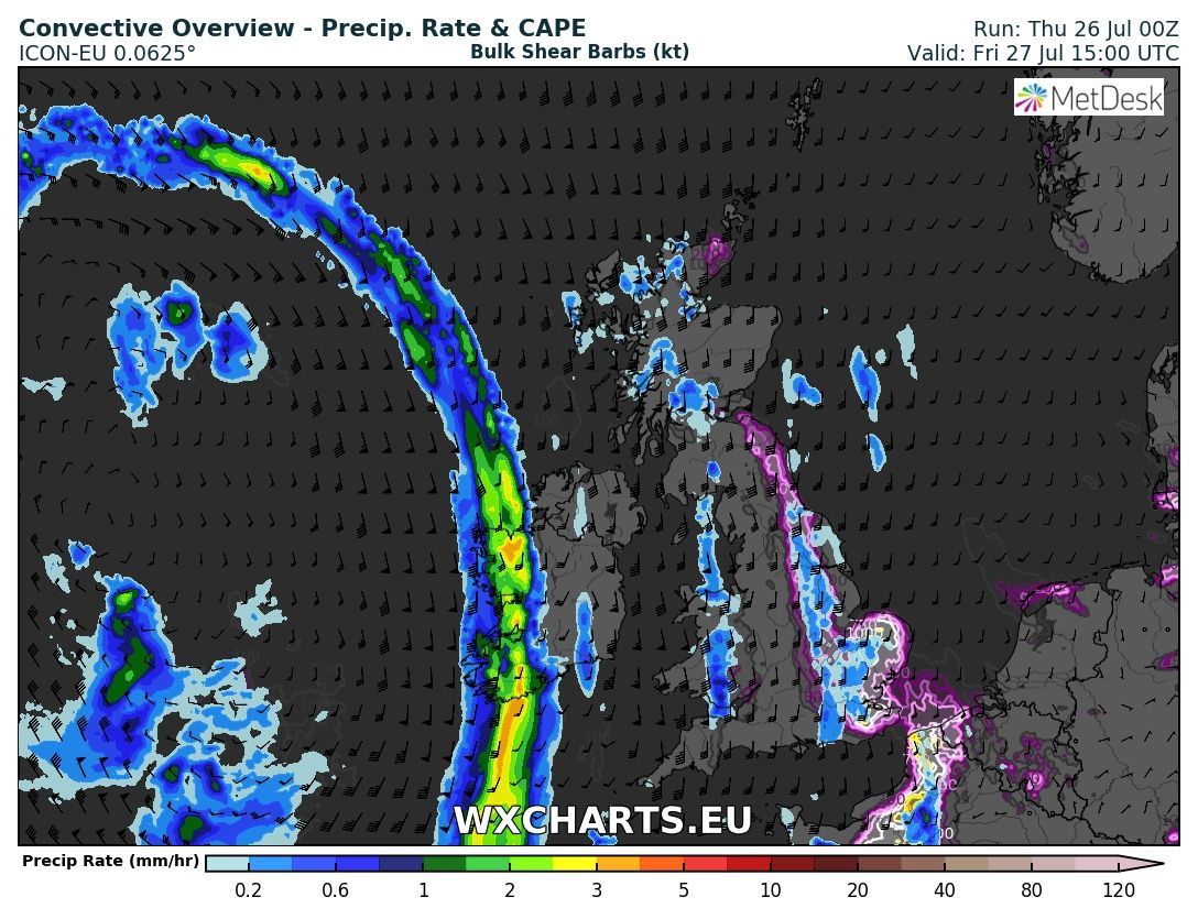
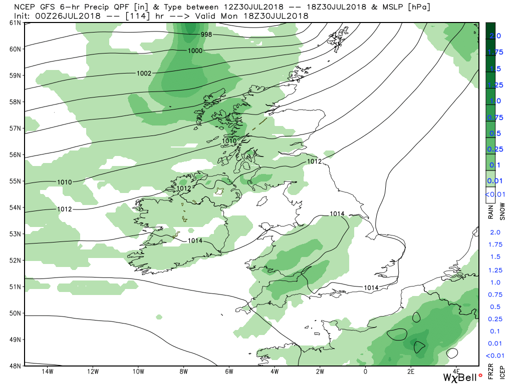
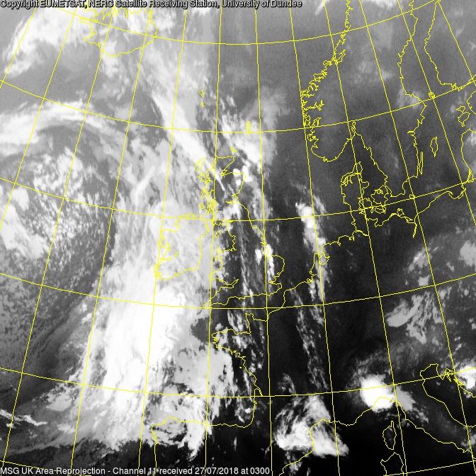
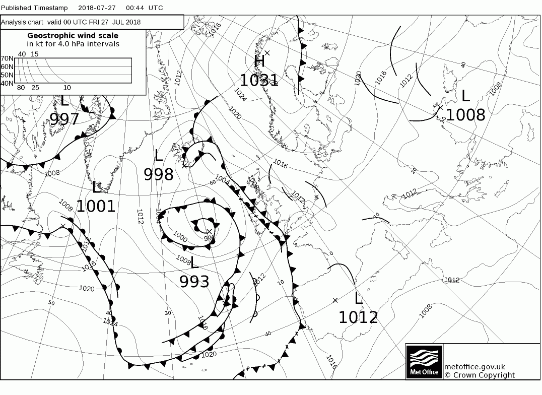
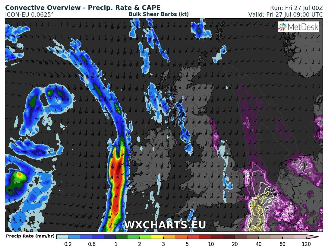
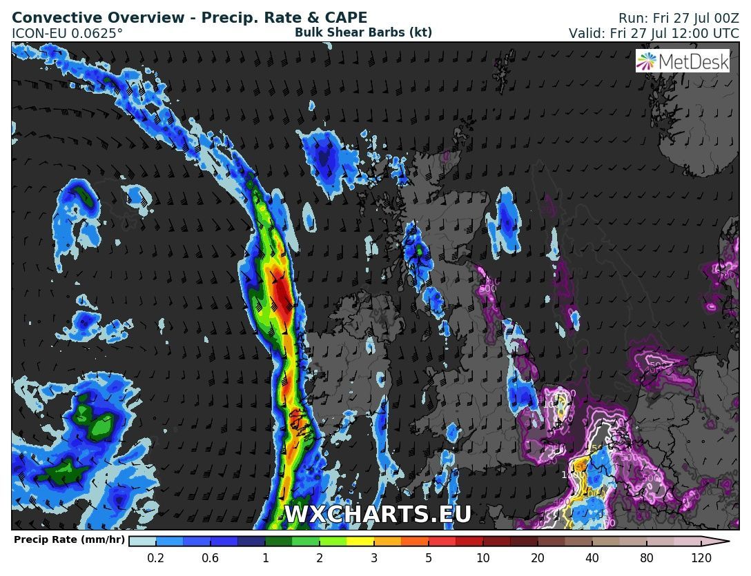
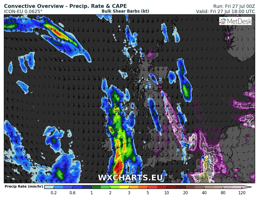
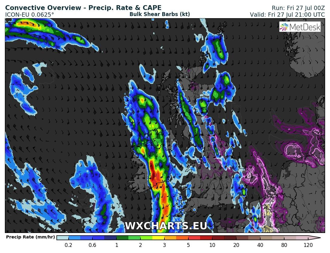
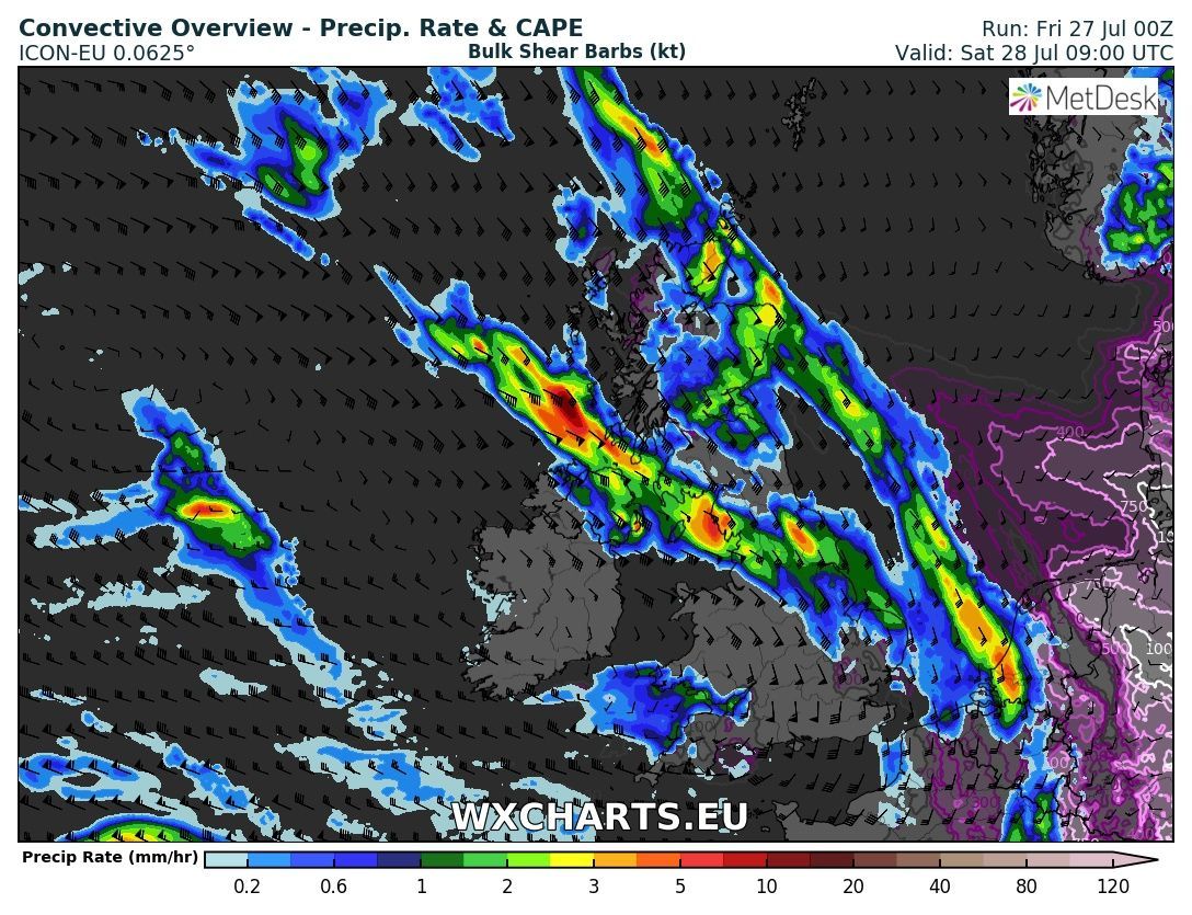
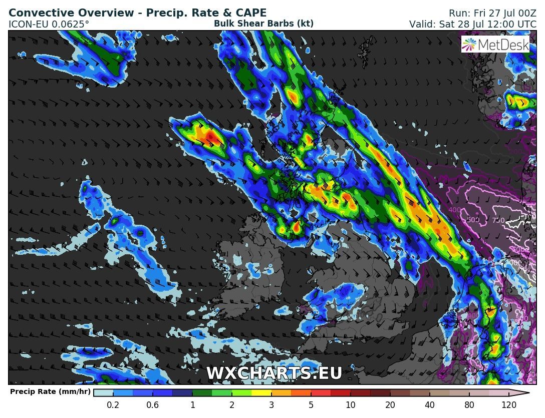
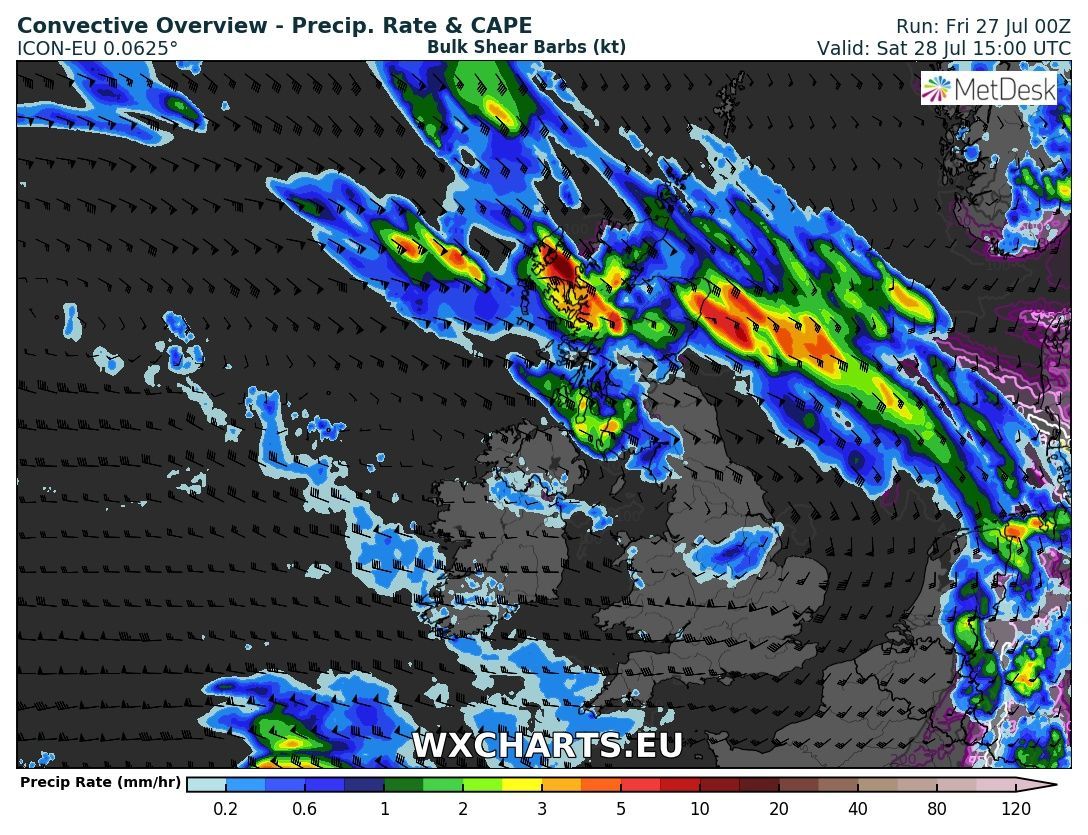
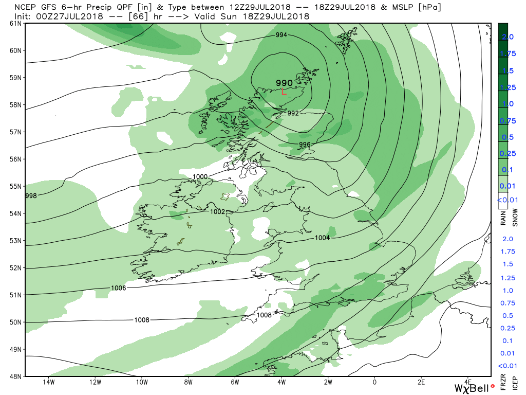
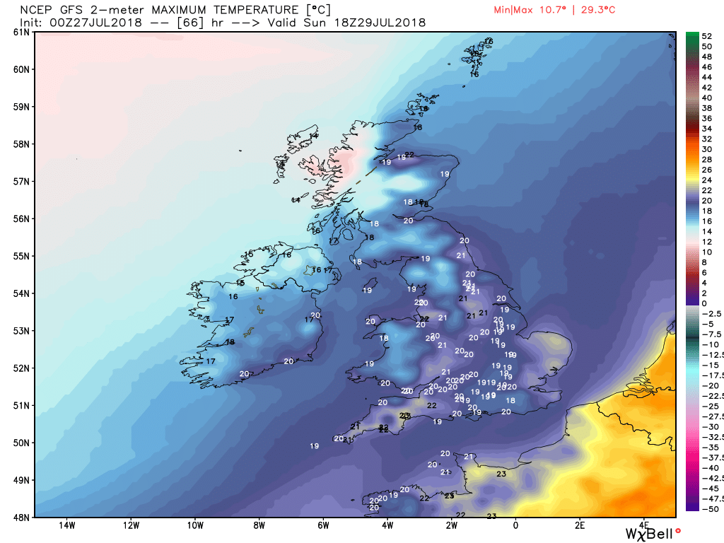
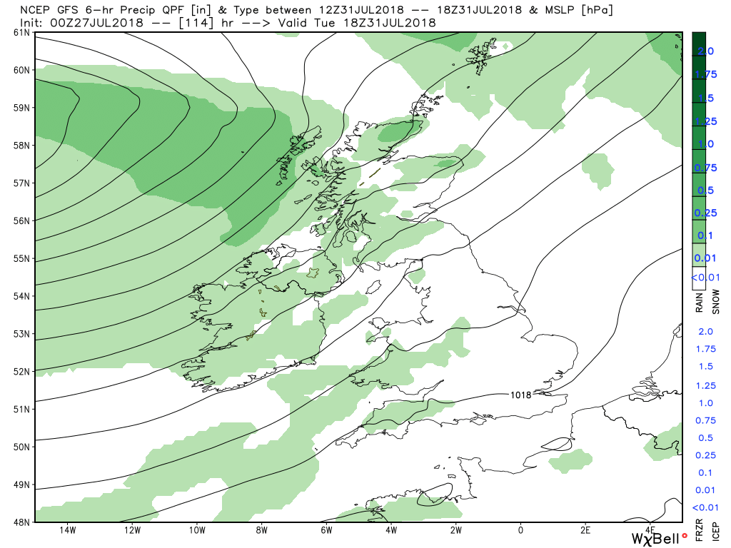
Meanwhile...................Cloud associated with yesterday's front is still lingering in places, mostly from south east Scotland down through the spine of England, with still the odd patch of showery rain around, but this will tend die out and the cloud to thin as the day progresses. Elsewhere it will be sunny, fresher and cooler in the north west but becoming increasingly very warm in the south east. This may well trigger the odd storm again. By evening more cloud and some patchy rain will effect north west Scotland as a warm front, associated with a low over Iceland, approaches.
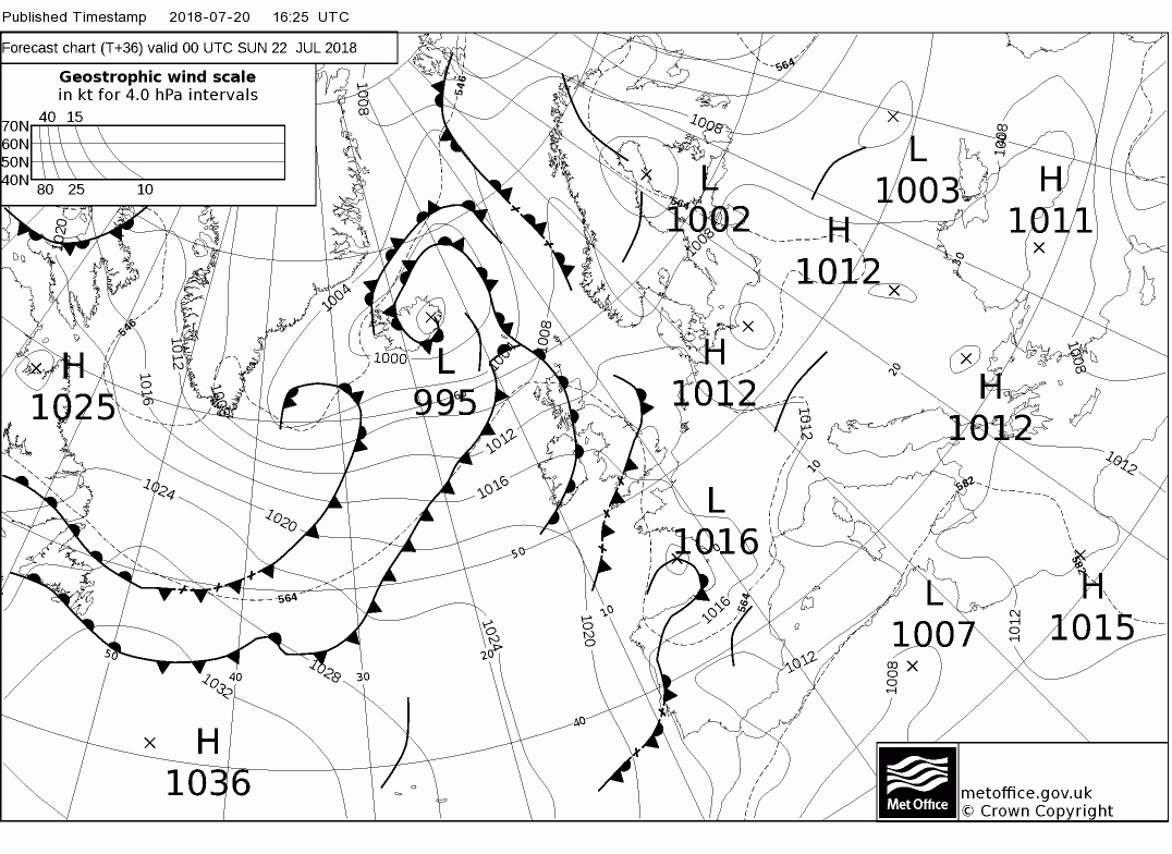
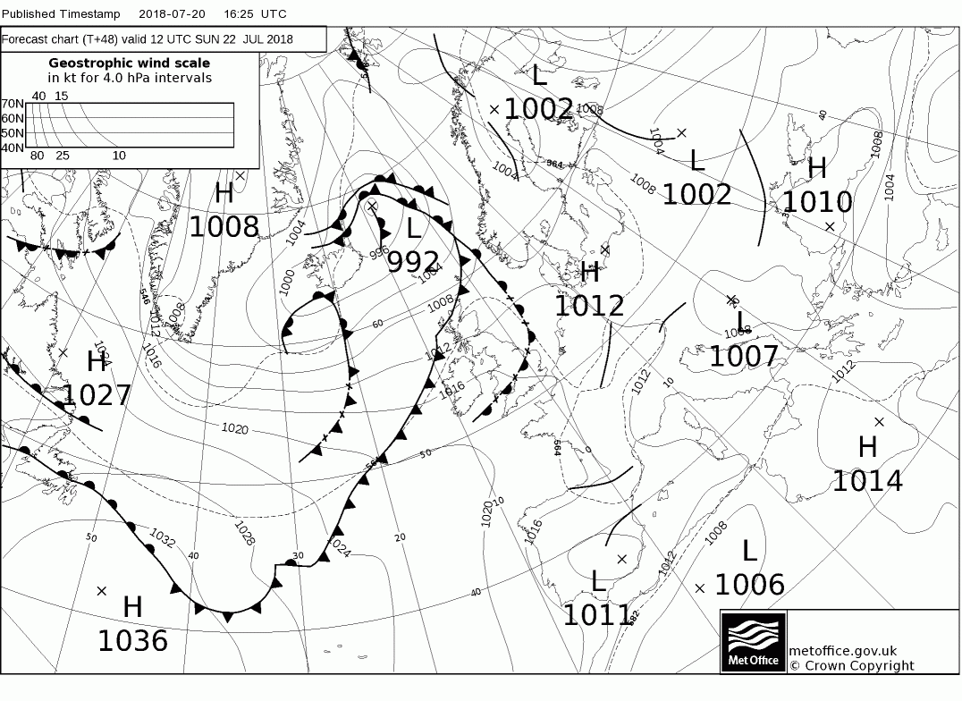
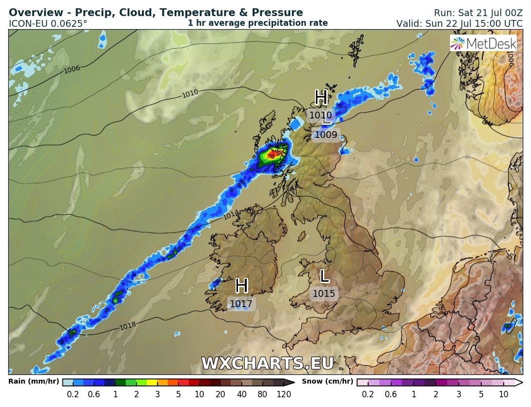
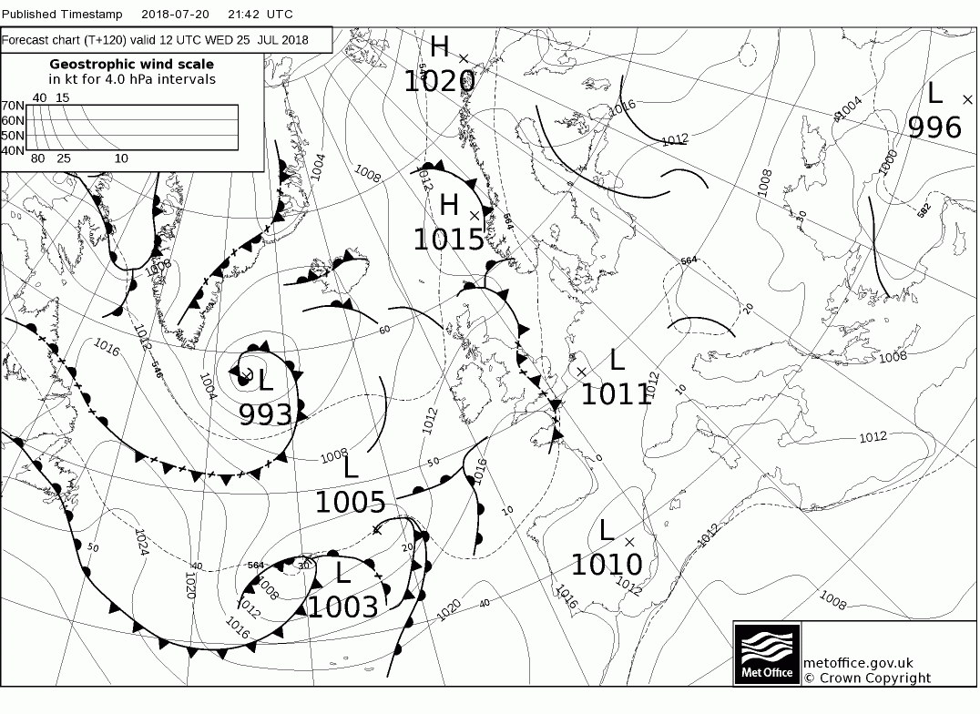
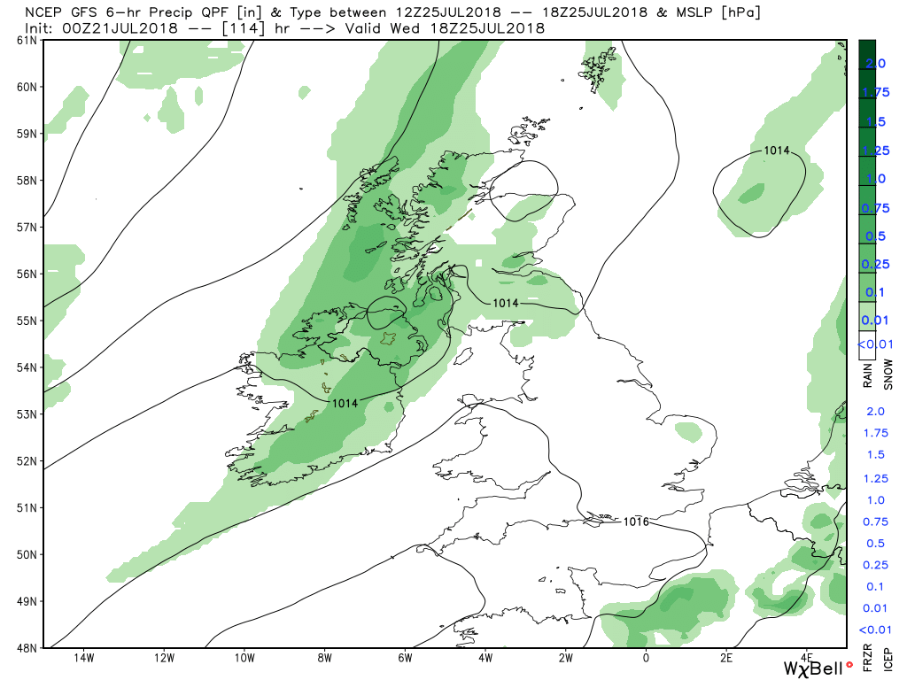
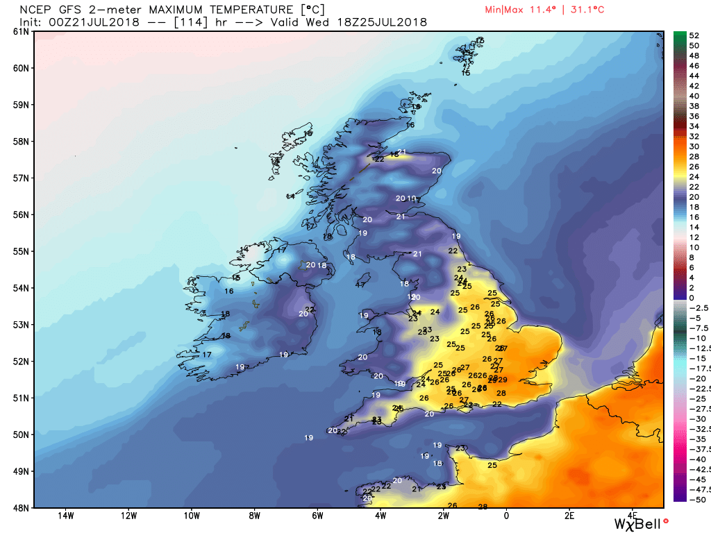
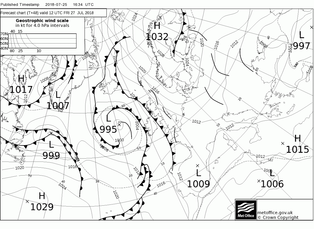
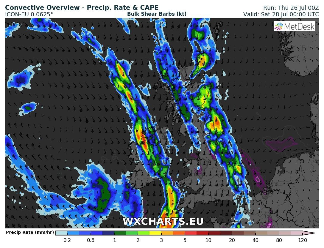
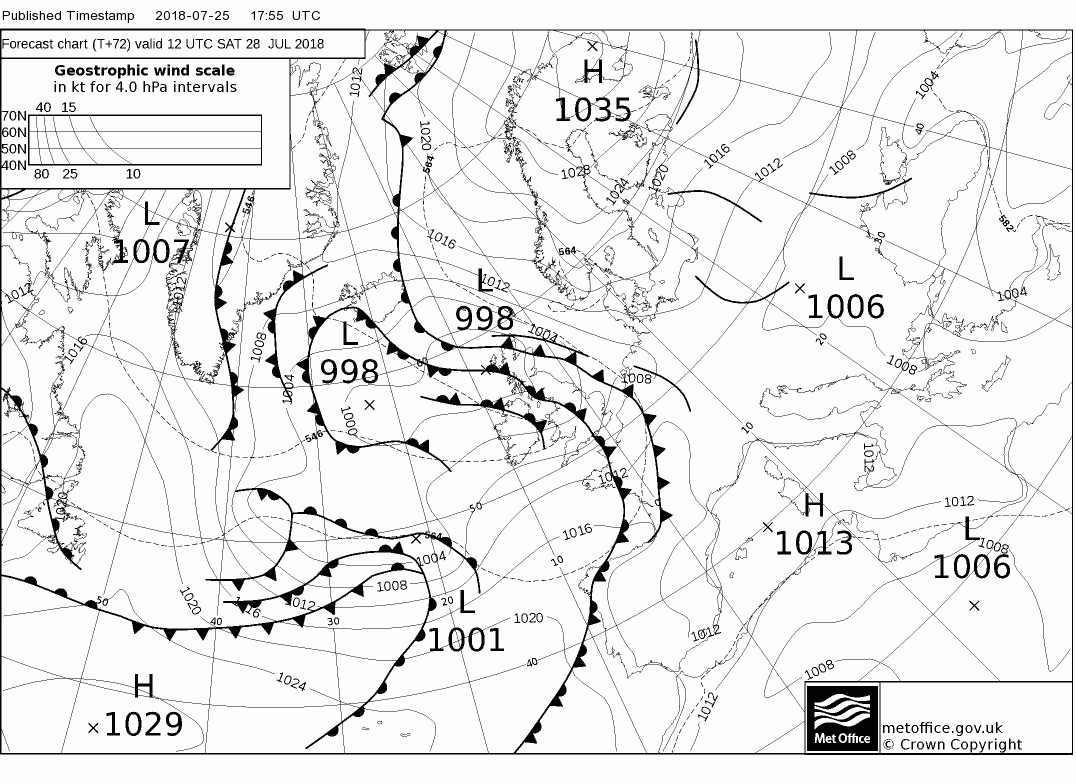
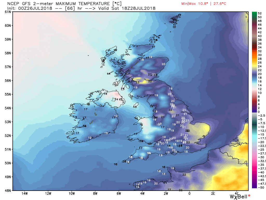
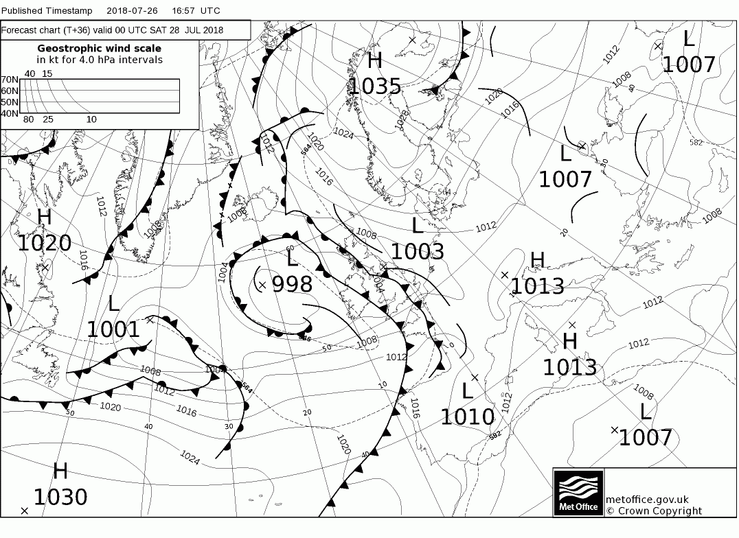
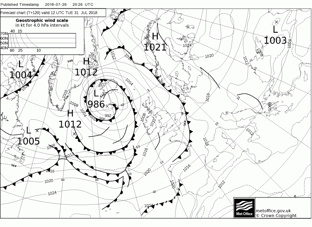
Over Saturday night and through Sunday the warm front will track south east, fizzling out as it goes, so not much rain on it but cloudy and humid and misty conditions prevail behind it in the warm sector until the cold front clears the far north west later, Meanwhile in the south the temps will once more climb and it will become very warm.