- Messages
- 2,549
Well the cold snap and snow this coming weekend sounded alright till it was qualified with 'sleet and rain".

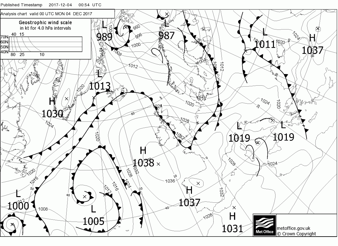
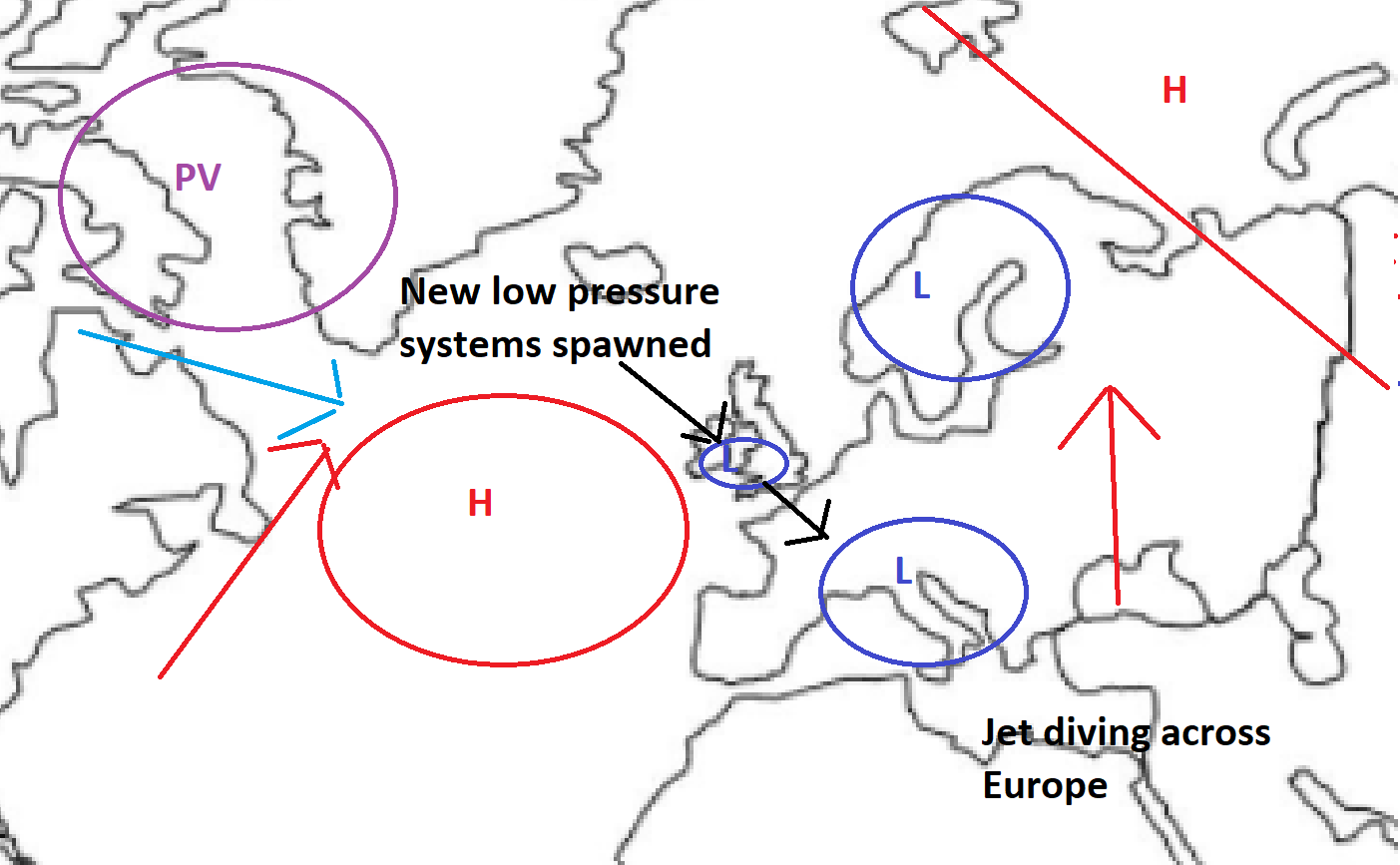
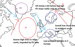
Today with the high pressure centred to the south west a generally quiet day, cloudy after early morning patchy fog has cleared. with sunny intervals in most places A bit windier in the north west with the odd shower floating around. along the west coast. This will continue into tomorrow in many places but it will become windier with heavy rain in Scotland, which clears during the day, as fronts approach from the west and from the north with the latter marking the boundary between the warmer and colder airmasses.
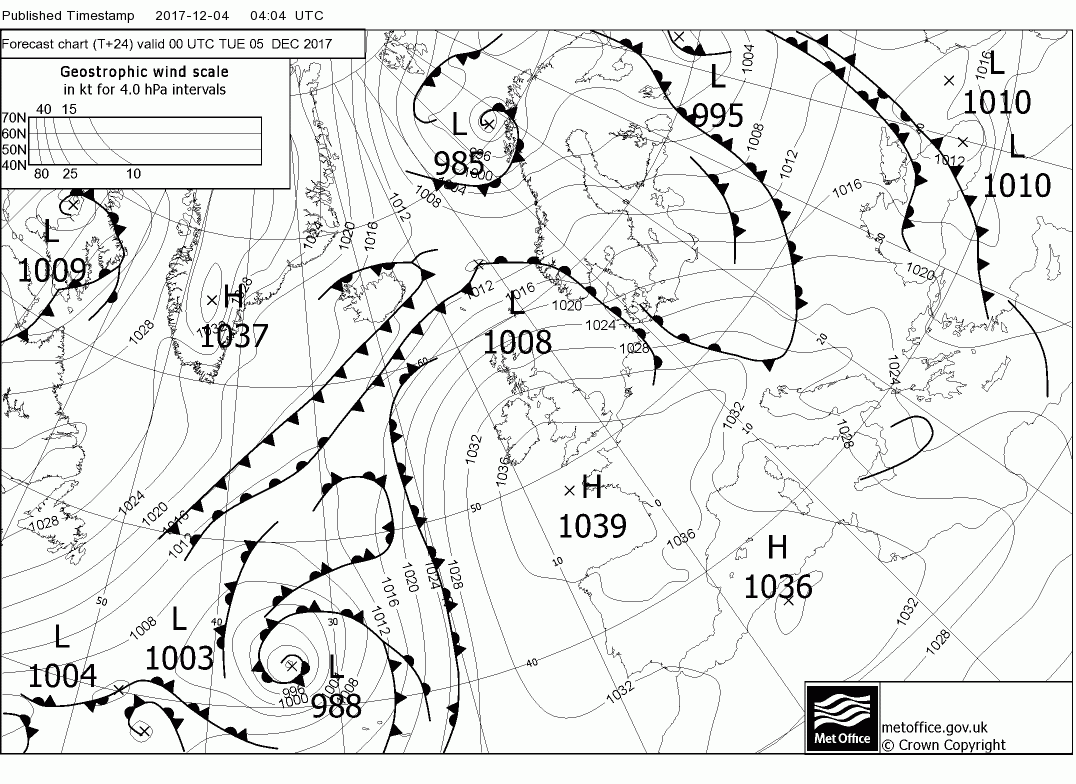
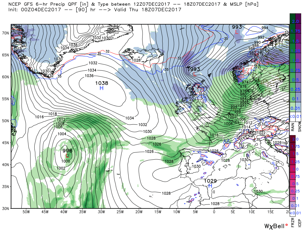
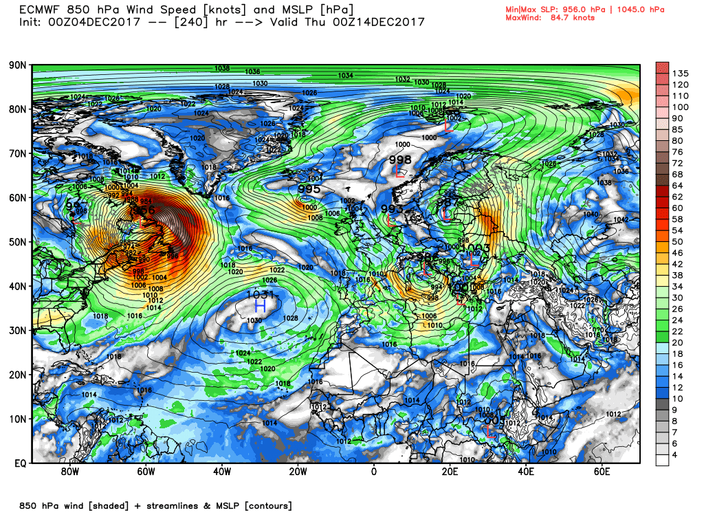
By 12 Wednesday there is a complex area of low pressure to the W/NW with a front pushing into the north west heralding the arrival of rain and strong winds which traverse the country overnight and through Thursday when by 1800 the front has cleared the south east and the whole of the UK is in the colder Arctic airstream with strong north westerlies/northerlies and plenty of wintry showers in the north
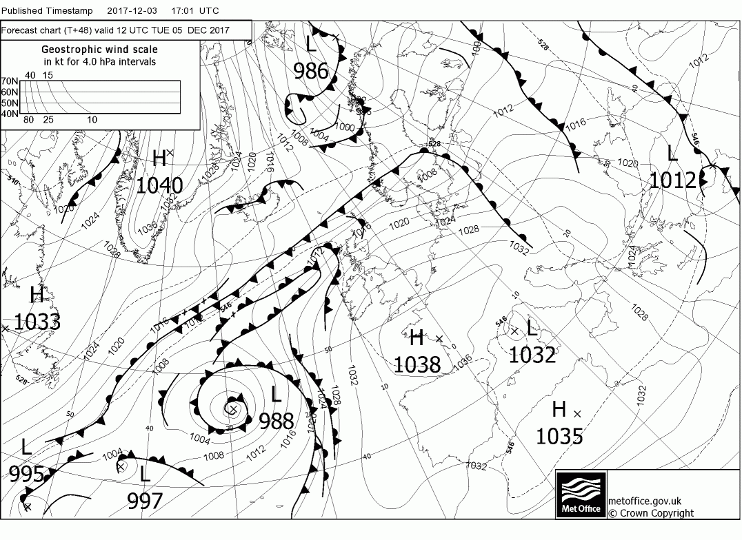
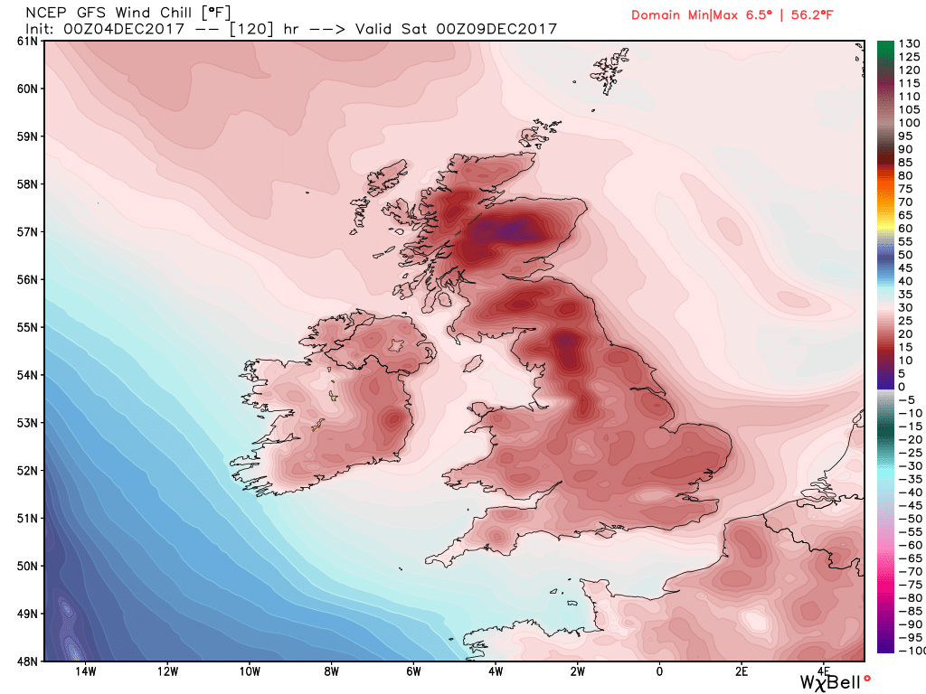
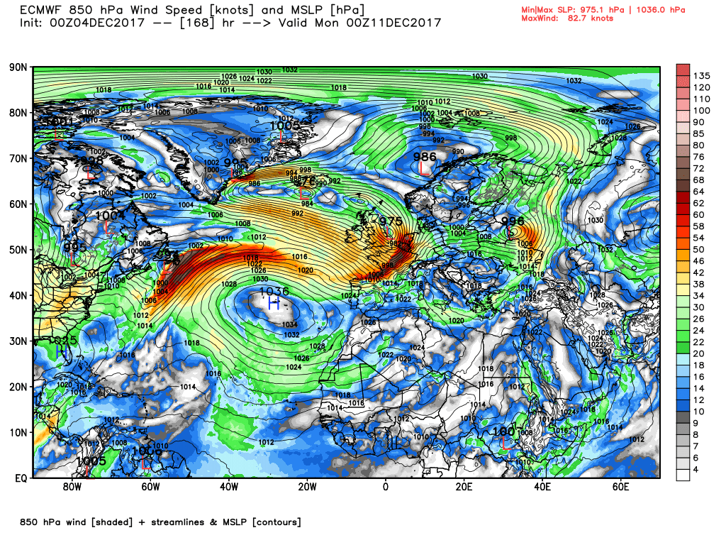
As can be seen in the last chart a little shortwave has developed in the flow to the north of Scotland and this tracks down through Scotland and into the North sea overnight and if this materializes could bring a fair amount of snow with it. But in any case there will be frequent wintry snow showers in the strong northerly wind during the day, concentrated more in the north and along the coasts and feeling very cold with max temps around 5c in England but the wind chill must be factored in
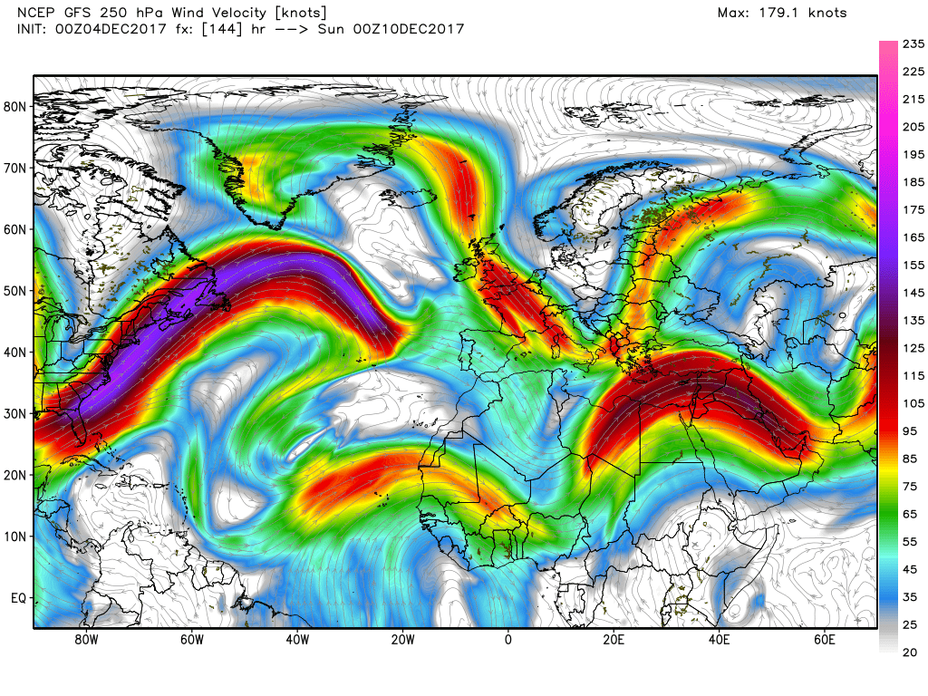
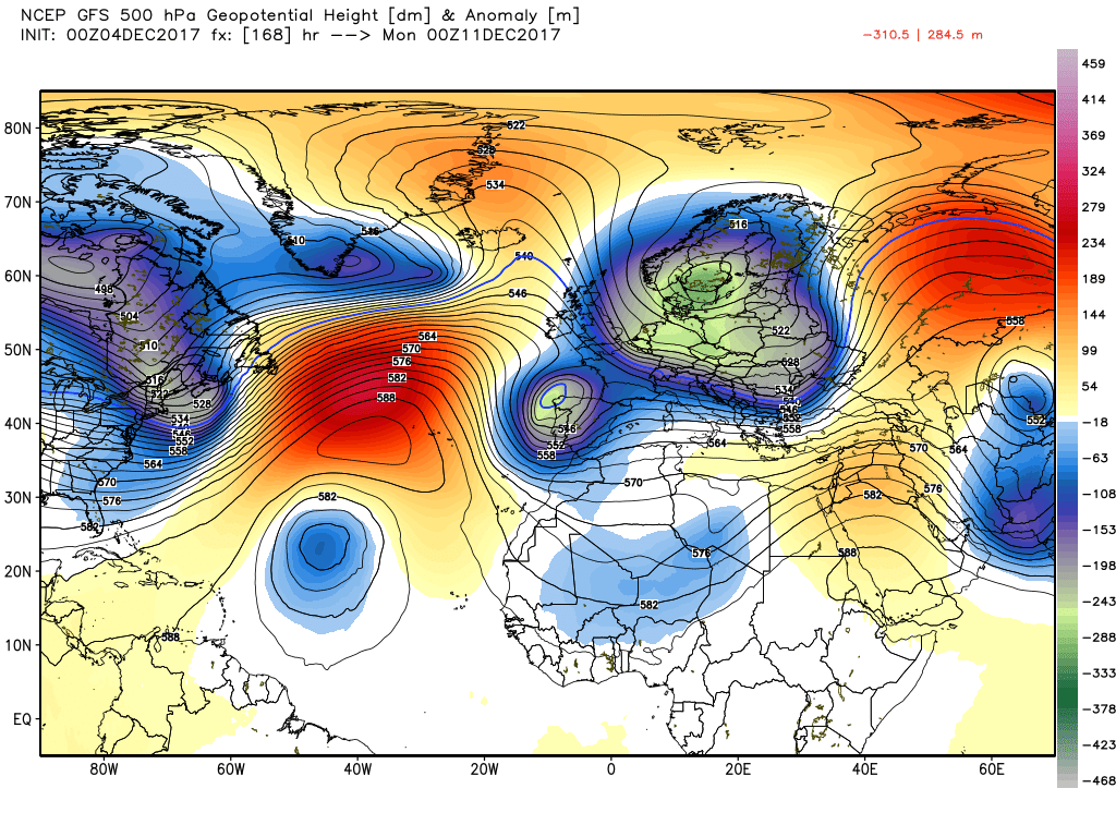
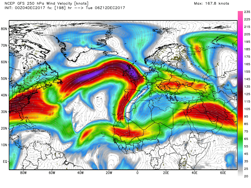
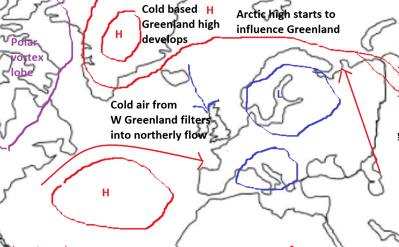
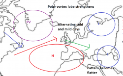
Over Saturday a weak ridge moves east thus the wind abates but it remains very cold with max temps around 3C in England but the ridge is very fragile and is quickly dissected by a trough that has been emitted by the Canadian vortex and is being rapidly transported south east on the 160kt jet and thus by T144 we have this position.
But wait the plot thickens as this is nipped in the bud by the Bermuda high pressure once more briefly surging north east. I say briefly advisedly as this appears quite quickly to subside opening the door to a flatter flow and for systems to arrive from the west. Best if this upgrade is left here I feel
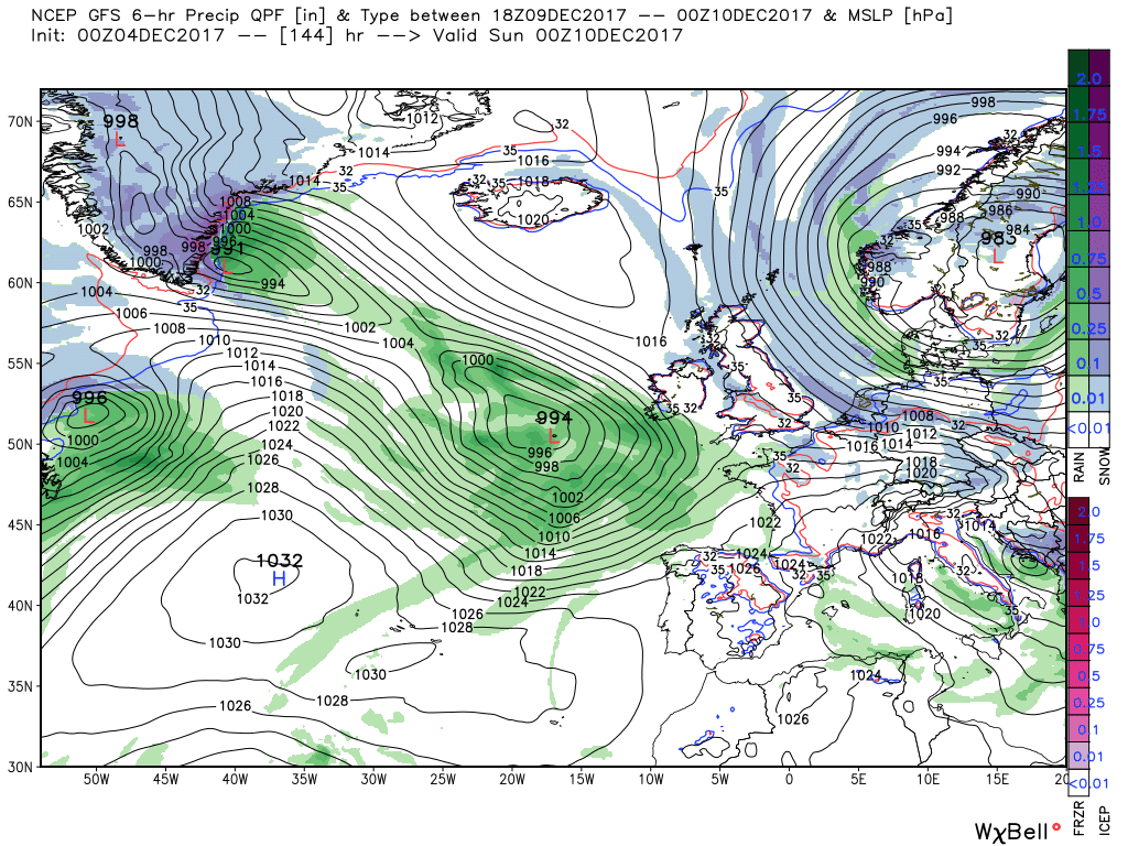
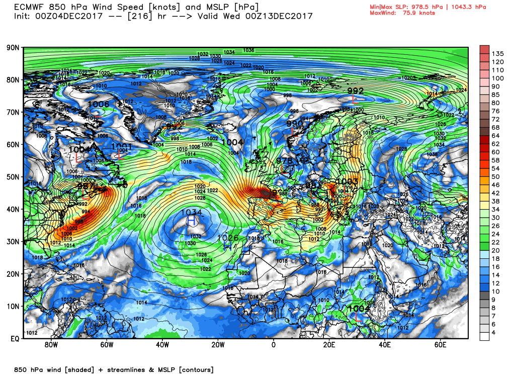
The ecm engages the high pressure and the block with more intent next weekend thus the jet keeps a flatter trajectory and pushes the trough through the UK on Sunday bringing heavy rain to most places. Once cleared perhaps the Azores HP ridging weakly north east next week awaiting the next trough from the north west
Norwich you say Chris .. wish I had a life !
JohnnyO. o/

Weather Warning
Issued by the Met Office
YELLOW WARNING for WIND across NORTHERN SCOTLAND
Updated at 10:35 Tues 5th December
Valid between 08:00 Thu 7th and 23:55 Thu 7th
Storm Caroline is expected to bring a spell of very windy weather to northern Scotland on Thursday. Gusts of 60-70 mph are expected quite widely, with gusts to 80 mph possible near north facing mainland coasts and across the Isles. Road, rail, air and ferry services may be affected, with longer journey times and cancellations possible. Some short term loss of power and other services is possible. It is likely that some coastal routes, sea fronts and coastal communities will be affected by spray and/or large waves.
The strongest winds will reach the northwest early on Thursday, extending to the Northeast and Northern Isles in the afternoon. Winds will start to ease in the west by then with the strongest of the winds becoming confined to the Northern Isles in the evening. Snow showers will turn increasingly frequent and heavy across northern Scotland during the evening.
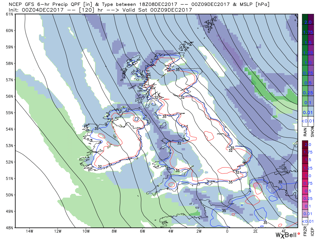
YELLOW WARNING for SNOW and ICE for SCOTLAND, NORTHERN IRELAND, WALES, NORTH WEST ENGLAND, SOUTH WEST ENGLAND and MIDLANDS
Updated at 11:45 Tues 5th December
Valid between 00:05 Fri 8th and 18:00 Sat 9th
Snow showers are expected to become increasingly frequent over northern Scotland late on Thursday and are expected across many other parts of Scotland, Northern Ireland, Wales and western England on Friday. 2-5 cm of snow is likely for some, with 10-20 cm possible over high ground, mainly Scotland, Northern Ireland and Wales. Icy surfaces are also likely to be an additional hazard, especially overnight. Strong northwest winds may cause drifting of the snow in places with blizzard conditions possible at times across northern Scotland. The heaviest and most frequent of the snow showers will progressively.
During winter weather which brings snow showers, it is not uncommon for snow amounts to vary considerably across short distances. On Friday and Saturday, the snow showers could lead to snow accumulations which vary markedly across the warning area.
More like the other way around. Snow to the north and north-east of the secondary low,and, given that it seems likely to take a fairly northerly path...Rain for Johnny and snow for me! Yay!
So a lot of posts mentioning a slider but what is a slider? and why is it mentioned so much?
Well newbies let me try to explain.
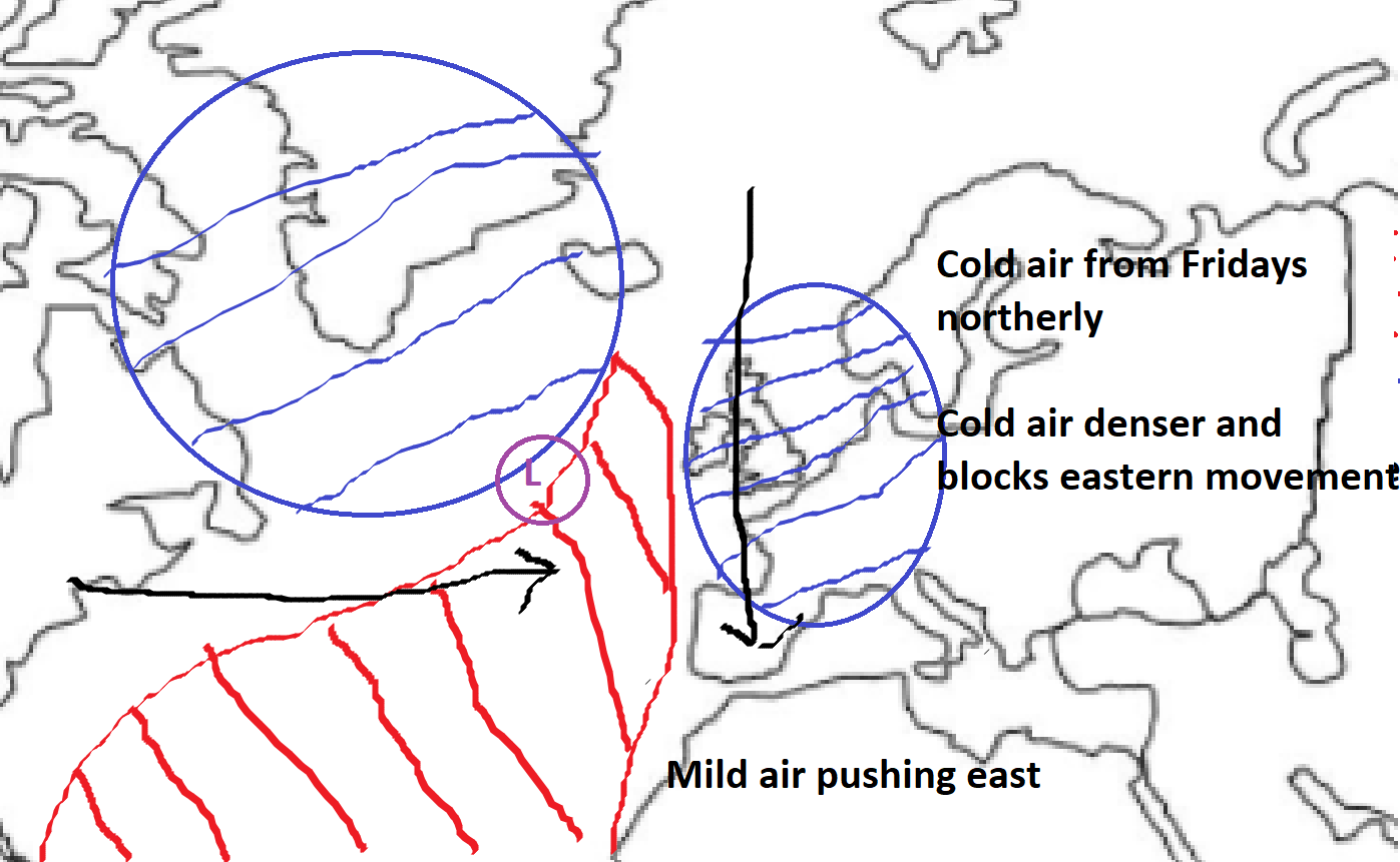
So on Friday we have a very cold North-westerly over the UK, leaving it in a cold air mass.
Milder air over the Atlantic however is moving east towards us, leading us to this point
Coming up against our cold pool, we see a fight put up against the milder air. From here things get really complicated as tiny changes really have a profound impact on UK snow potential. The path the low pressure takes appears now dependent on the strength of the low shown below.
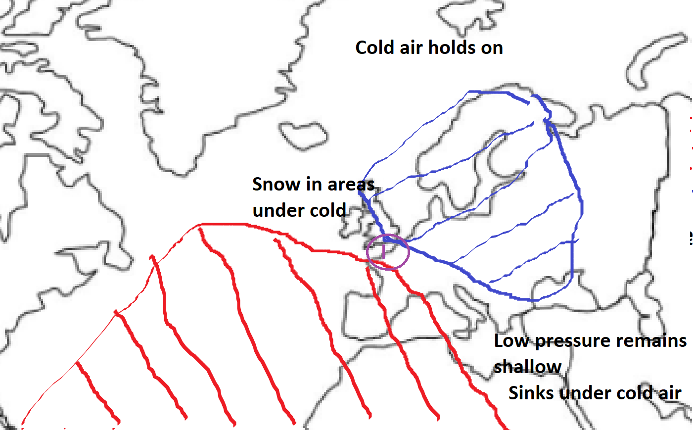
In the first scenario, the low is shallow and can't put up much of a fight against the colder air, therefore sinks much further south and not really displacing the cold air mass much. This would leave the south or the midlands in the firing line for snow.
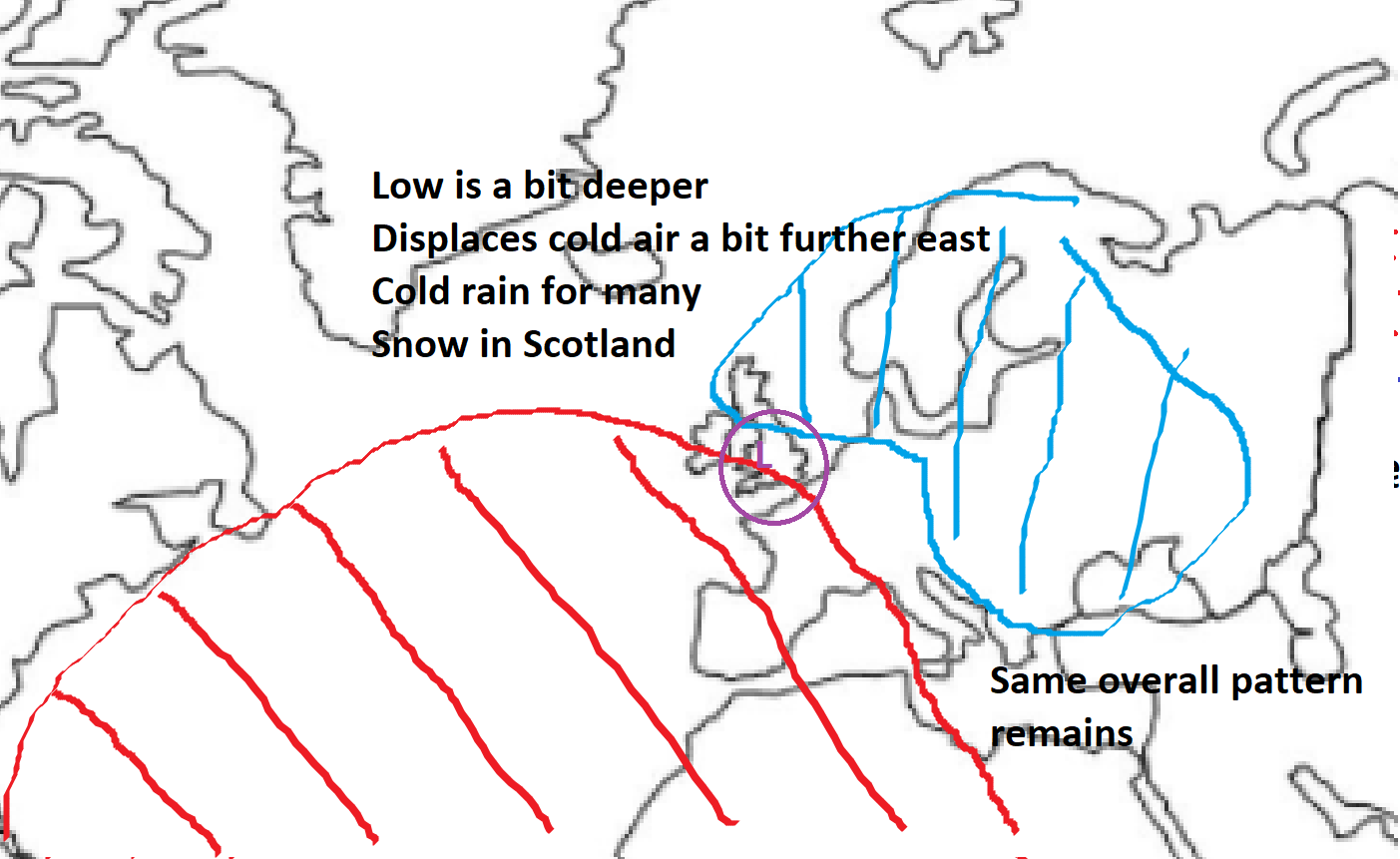
The right hand depiction shows the low a bit deeper and is therefore able to push against the cold harder. Scotland would be more in the firing line here. As for what I think will develop... well difficult call but the signs are at may cross the centre of the UK. This could very easily change though given its a couple of days away. Temperatures would be a little colder then average still but we would see cold rain for many.
Now lets remind ourselves of what the general pattern is
Low pressure zipping from NW to SE, how do the scenarios play out potentially? Most likely options
20% 40% 30%
Now all in my opinion are equally plausible, given northwards ridging seems to be a theme so far I'm leaning towards the middle option. However another scenario which may appear (though less likely):
10% (should say cold air from E Greenland)
A less likely option admittedly but a plausible one still, keep an eye out on it, quite similar to the middle option but we get uppers that would be a bit colder.
So in the end a tricky one for forecasters, too early to ramp but too early to dismiss. Lets see what happens.
More like the other way around. Snow to the north and north-east of the secondary low,and, given that it seems likely to take a fairly northerly path...
Poop!More like the other way around. Snow to the north and north-east of the secondary low,and, given that it seems likely to take a fairly northerly path...
He might even let me have some later on Sunday.According to the Met Office update I have received Johnny is generously sharing the chance of snow with me!