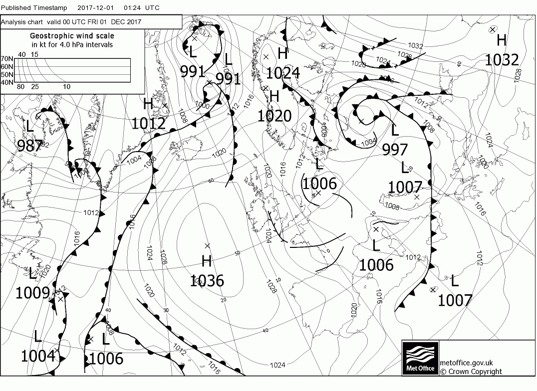
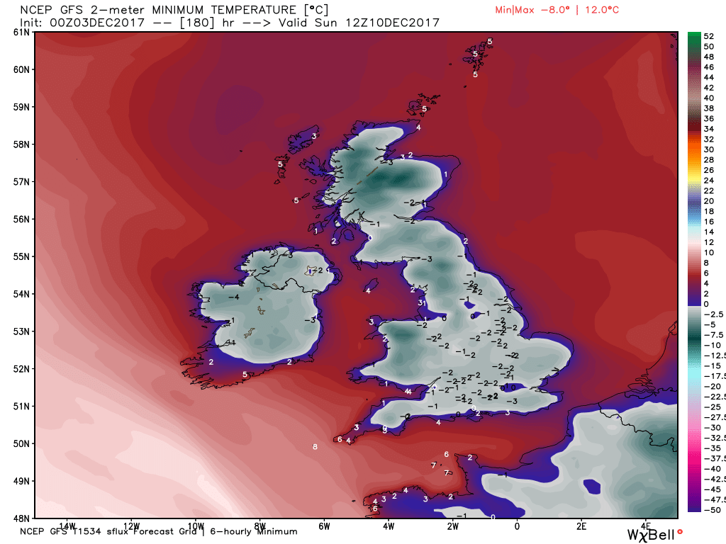
Today sees the start of the transition away from our recent cold northerly showers regime into the next phase of the evolving pattern. A cold, clear, icy morning for many with still some lingering showers in the east which will eventually die out. It will remain that way over most of England and wales but a front will bring cloud and light rain to N. Ireland and Scotland during the day. This will track south east overnight into tomorrow so that cloud and light rain/drizzle wll affect more or less everywhere.The result of this will be temps much nearer average than of late.


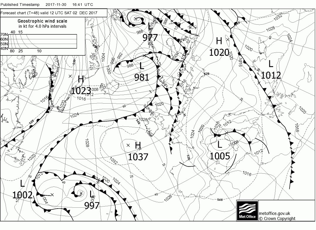
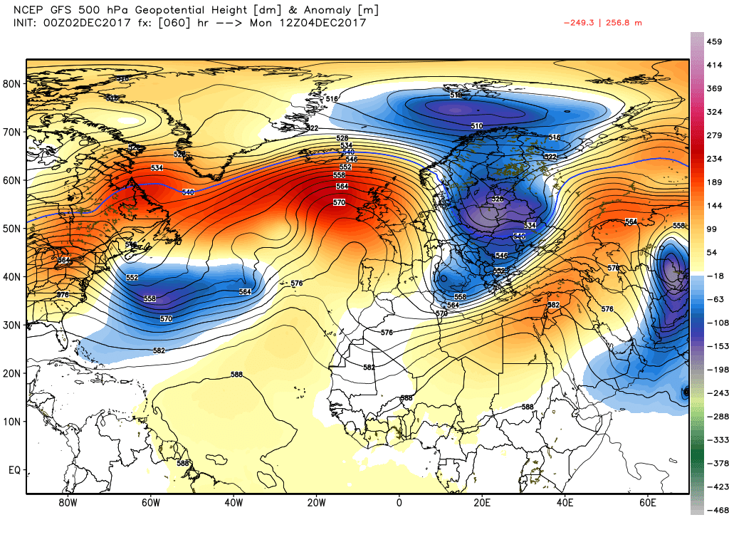
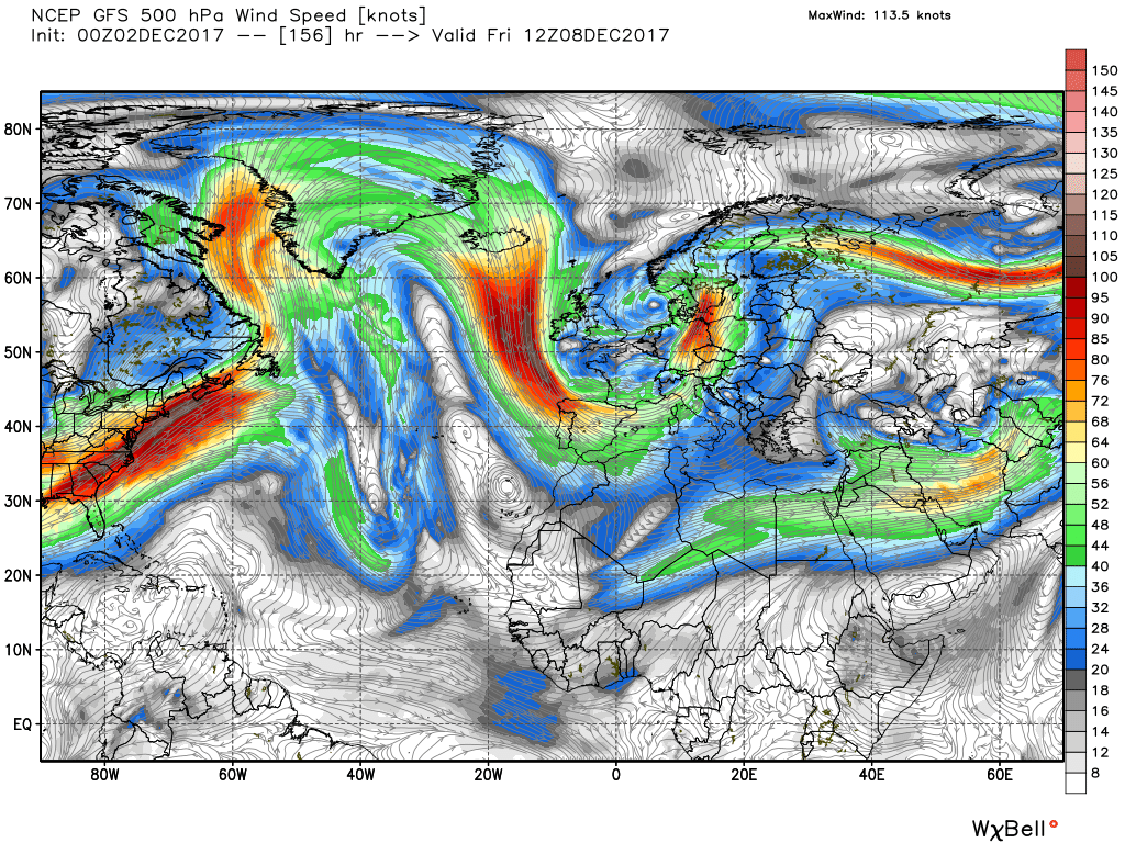
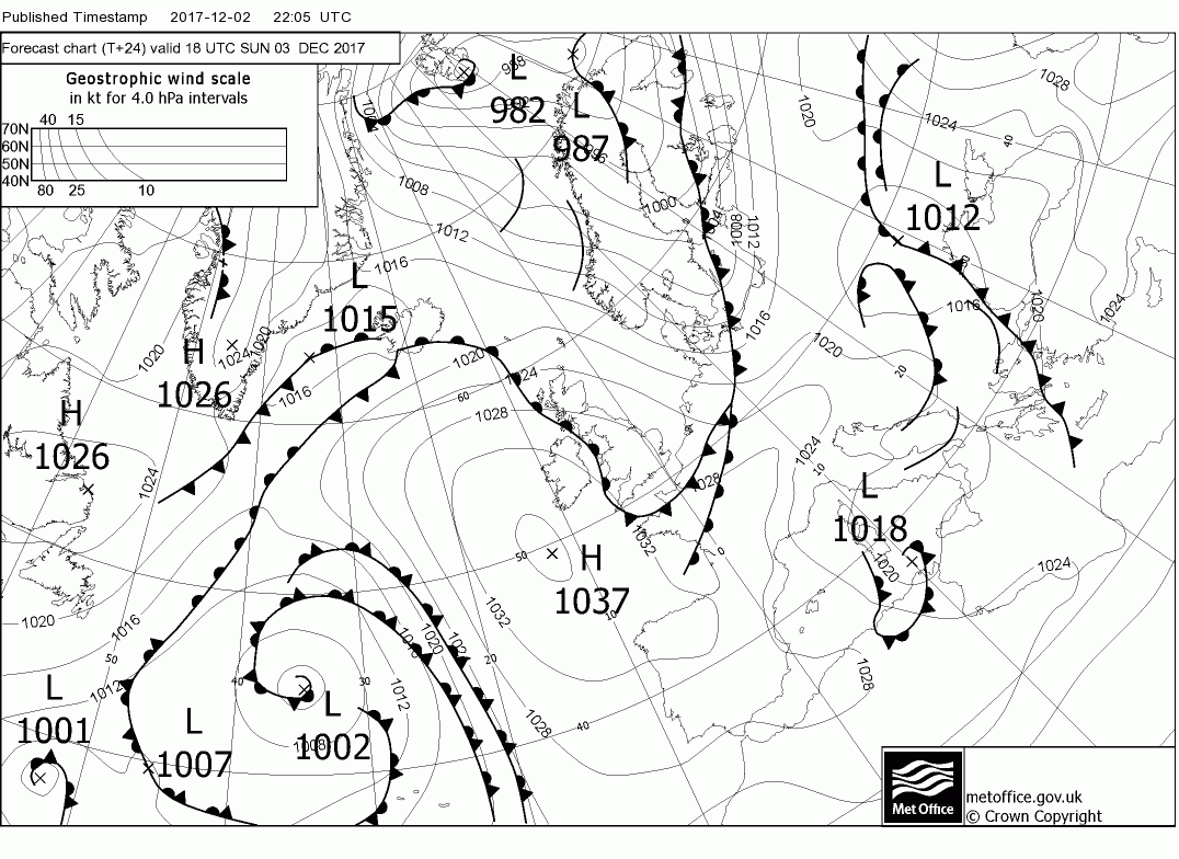
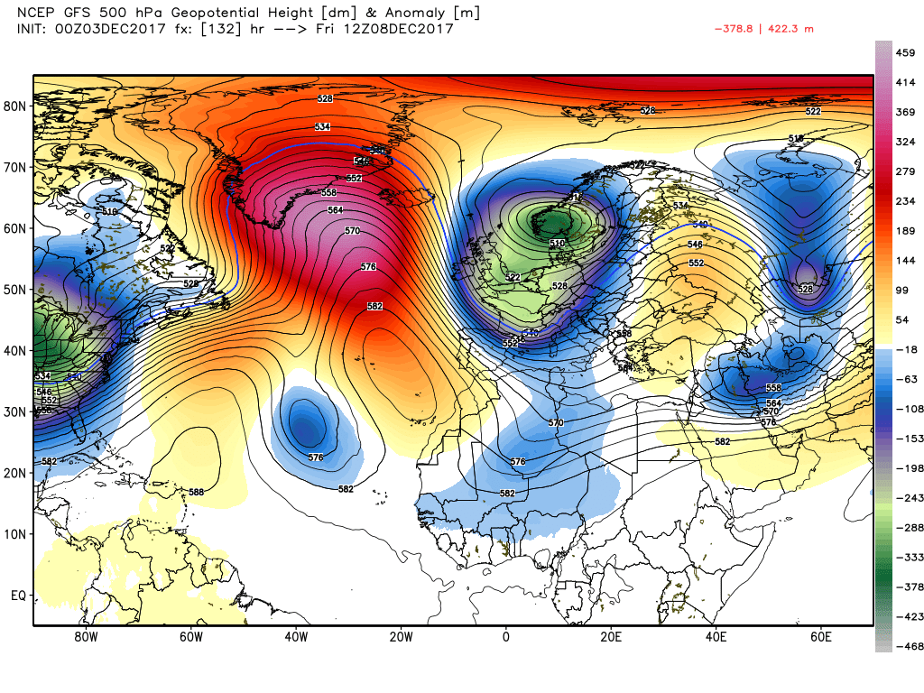
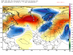
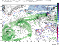
On to this morning's gfs. Over the weekend the UK remains under the high cell centred just to the west thus a dry NW airflow pertains,perhaps some showers in Scotland. But a glance at the overall pattern at Monday 00 does begin to indicate which way the pattern is going to evolve during the week. We still have the two upstream energy flows. one from the Canadian vortex around Greenland north of the UK and the other from the eastern seaboard tracking north east. It is this upper trough which appears to play the key role initially.
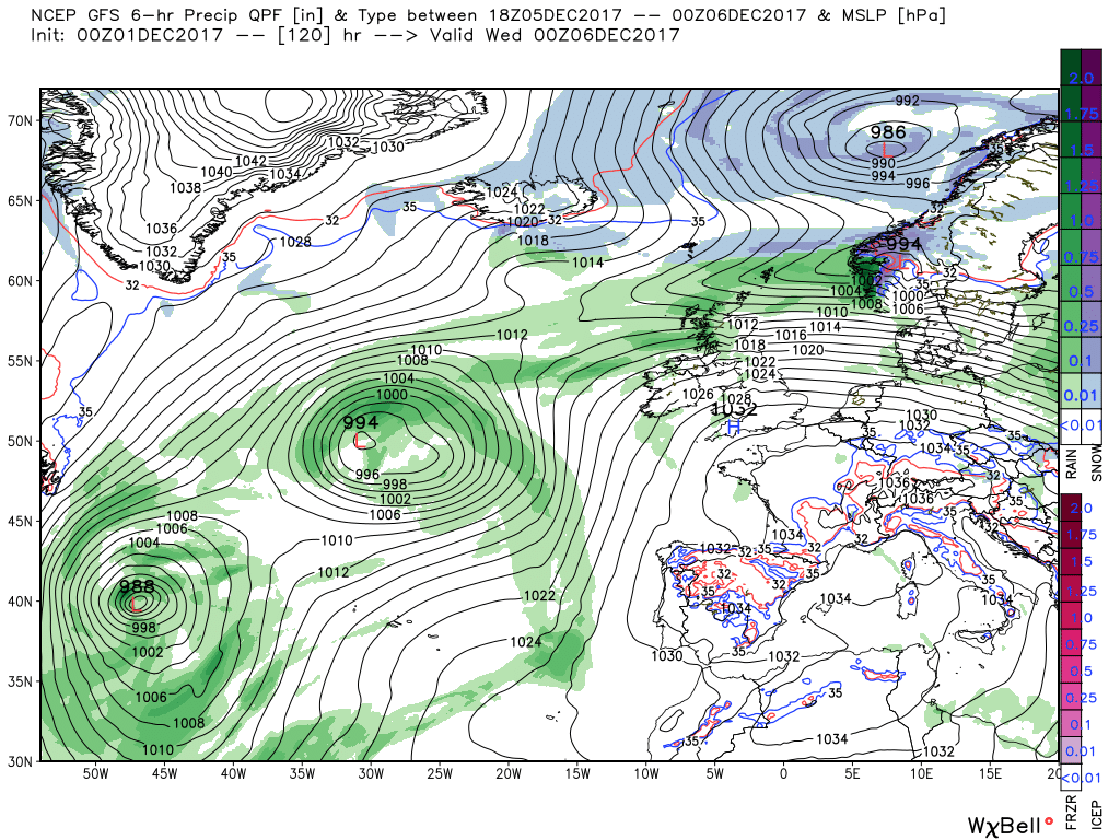
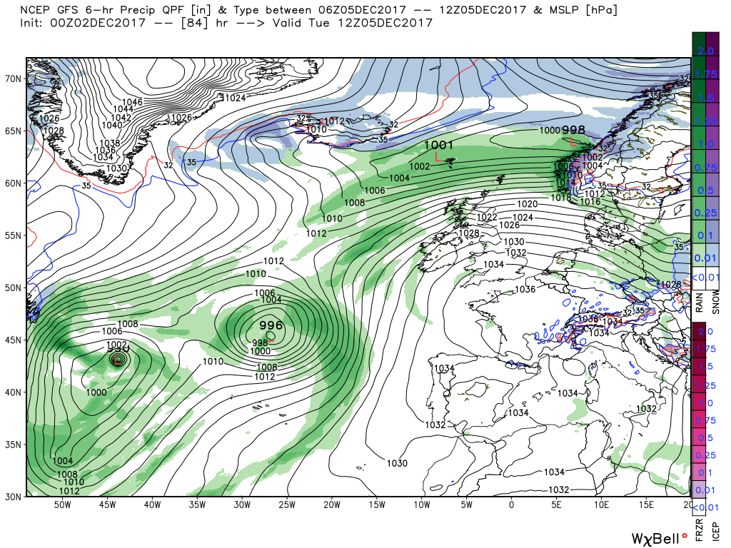
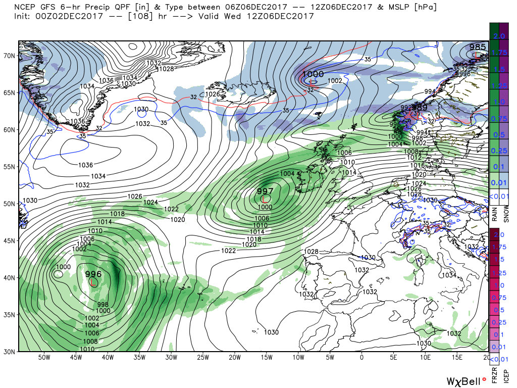
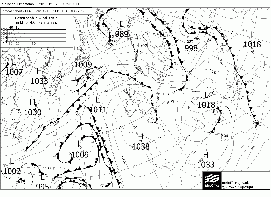
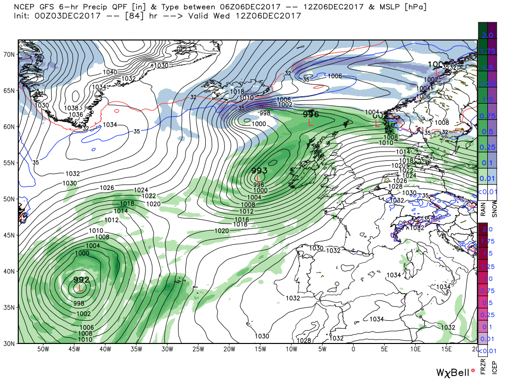
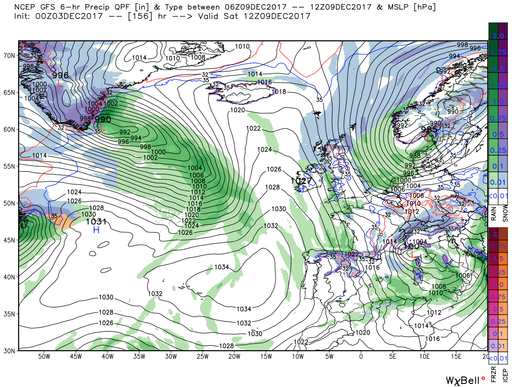
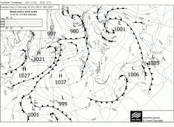
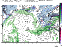
As can be seen the upper trough to the south west initiates a complex surface low pressure area with centres dotted around whilst sending energy around the high pressure and by Tuesday 00 there is a front lying south of Iceland on which wave depressions are forming Over the next 24 hours one such tracks east into southern Norway whilst at the same time the front moves south to bring strong winds and ran to Scotland and the main trough to the south west is still moving steadily north east putting the high cell over the UK under pressure. All of this maneuvering does bring the other energy flow into play as the front marks the boundary between the cold and war air.

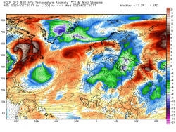
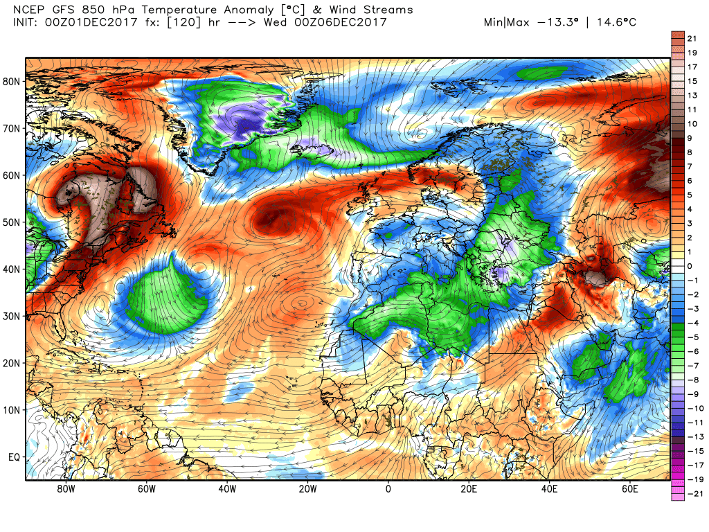
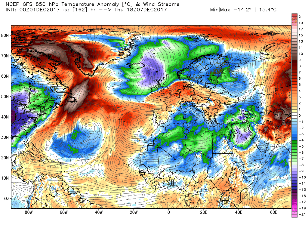
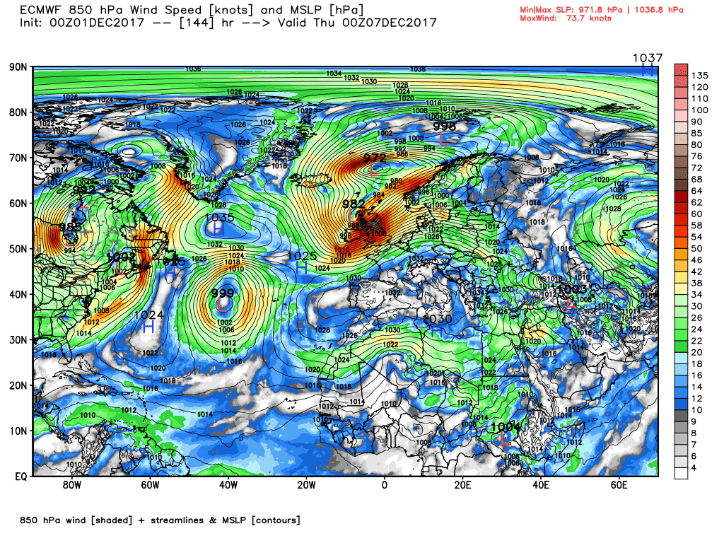
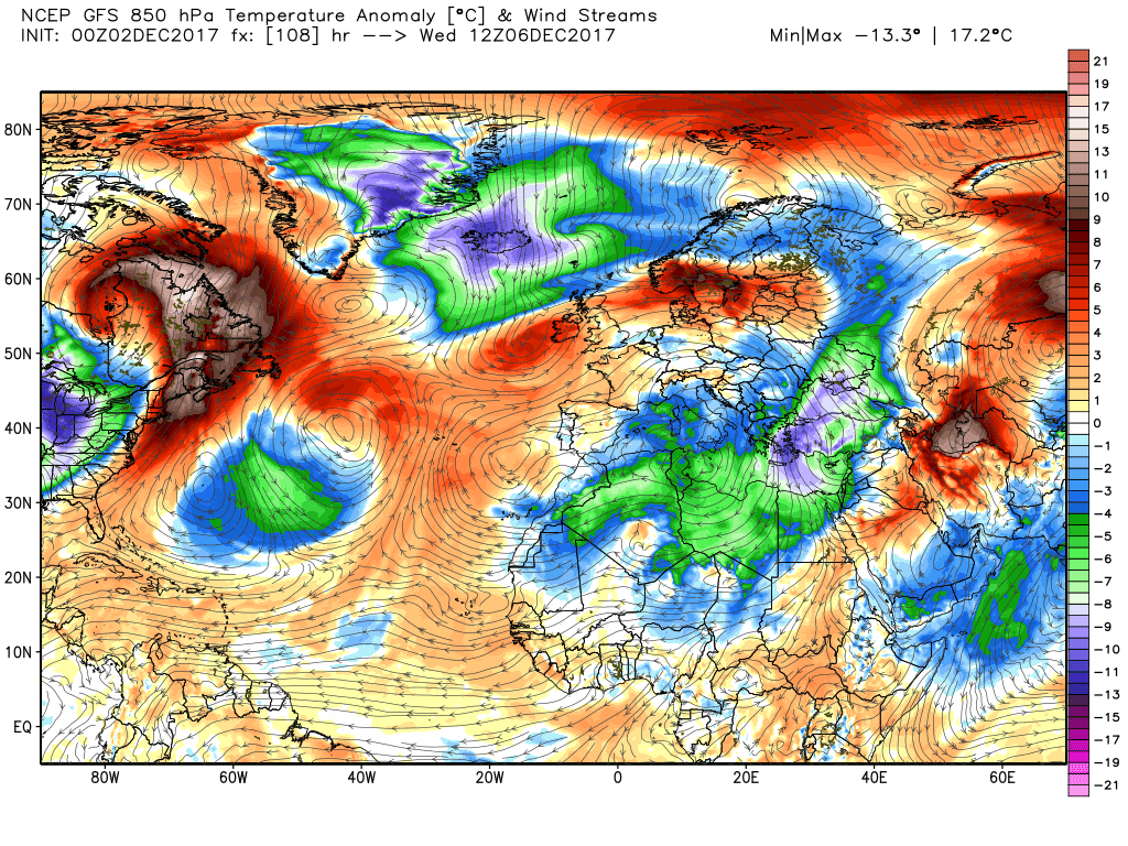
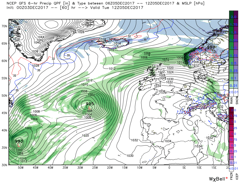
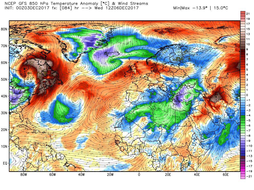
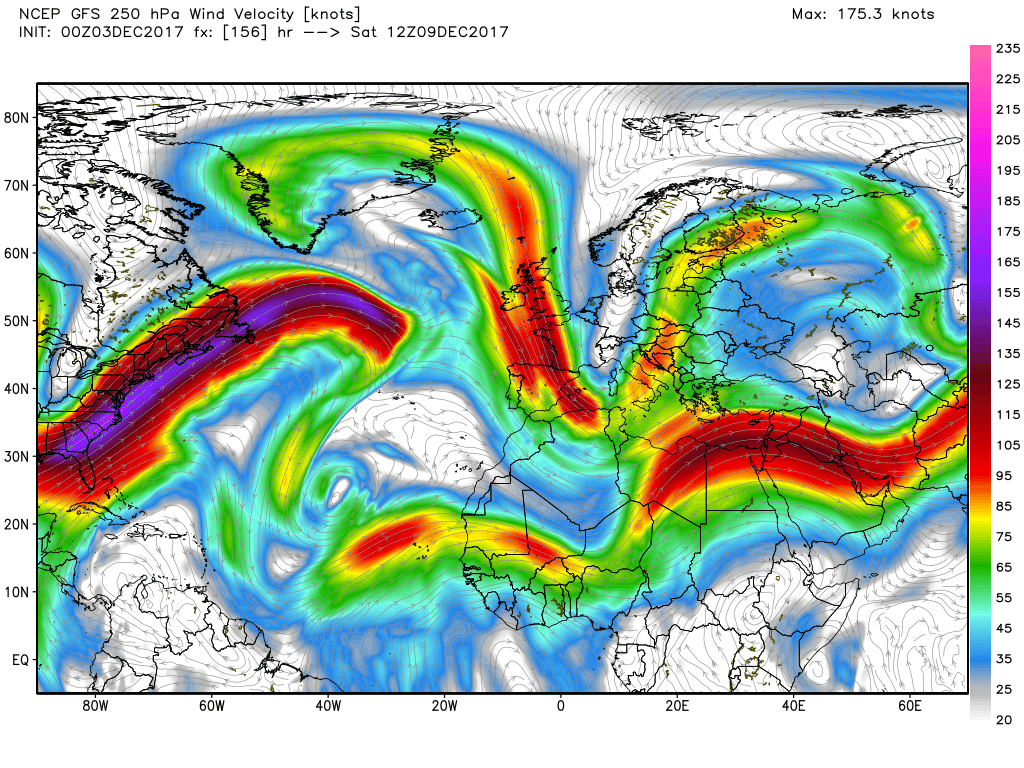
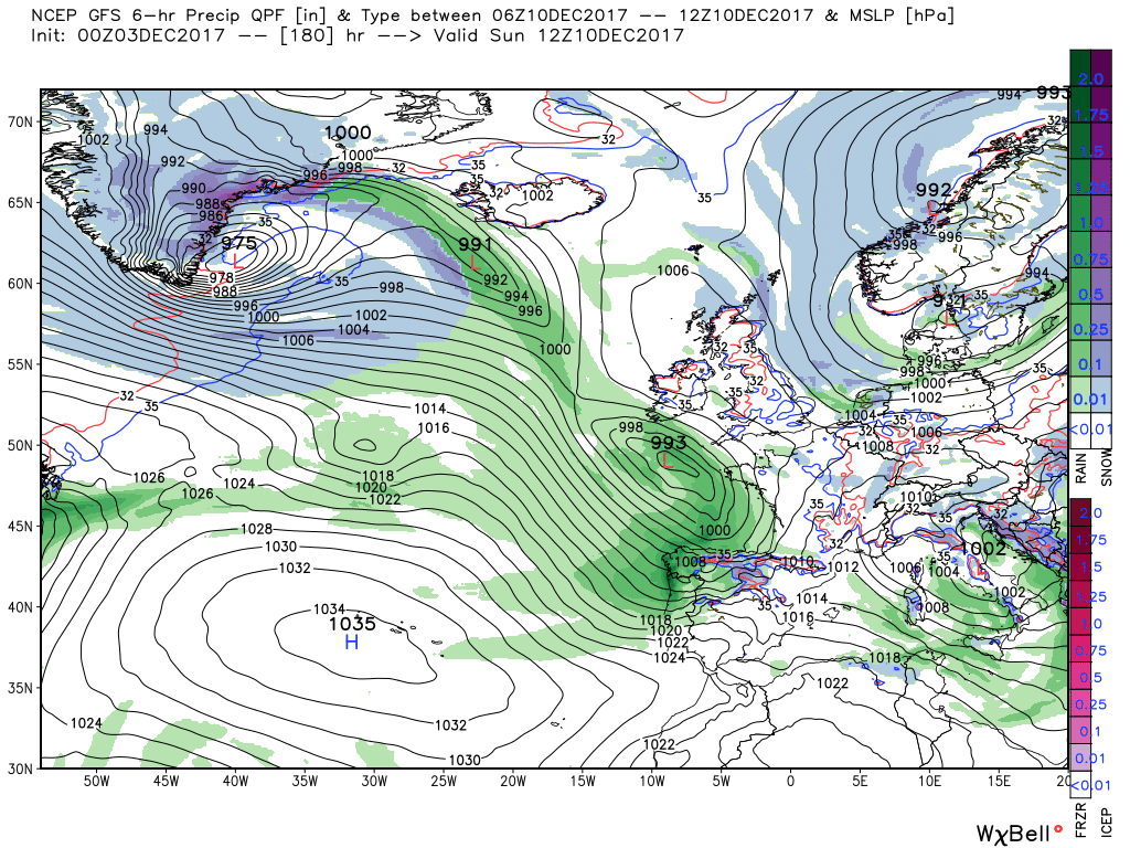
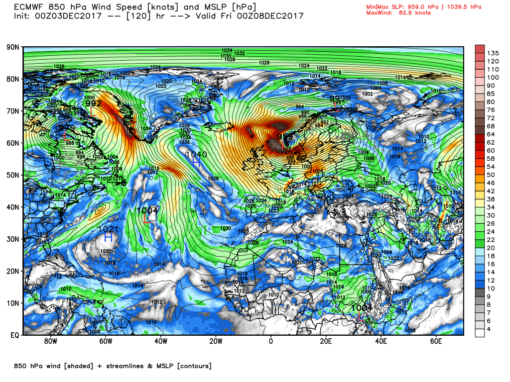
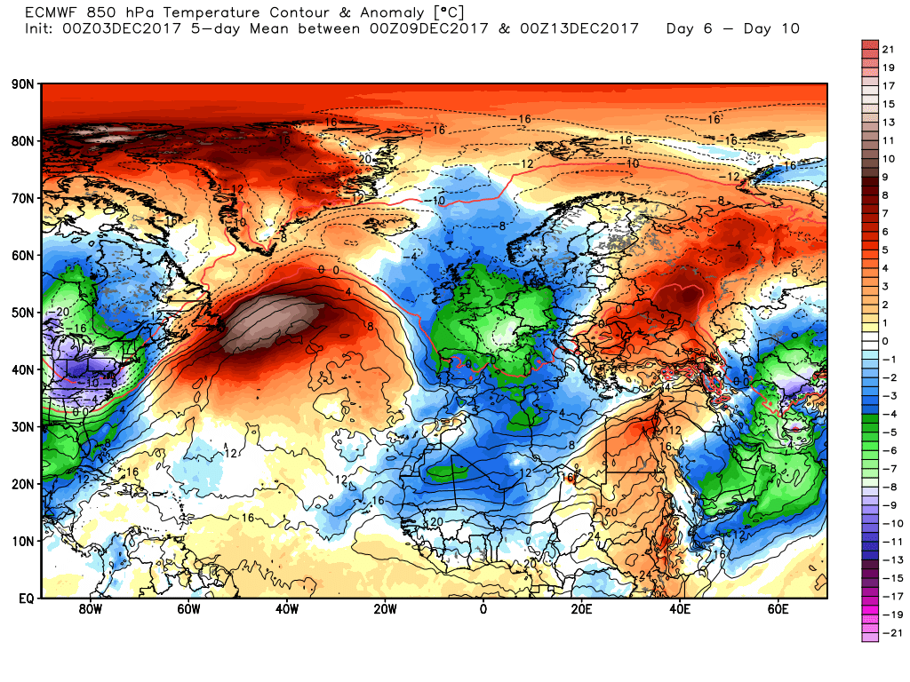
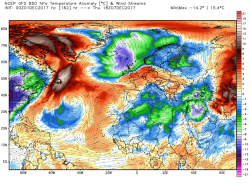
By 00 Thursday the front has moved a little south bringing Scotland into the cold air but far more importantly the low to the west is revving up and beginning to track east with the associated front and rain already into western parts of the UK. Over the next 18 hours the low crosses the UK into the North Sea, splitting into two centres as it does so, which not only brings rain and gales, perhaps severe, to many parts of the UK but north easterly blizzards into Scotland as the cold air is now dragged further south. The delineation is quite marked on the 850mb chart.
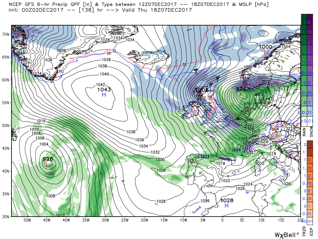
From here the UK is plunged into a cold showery transient northerly but is certainly best left here because any subsequent evolution is very dependent on what has just been described as happening precisely as detailed which is very unlikely
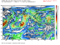
At the beginning the general theme of the ecm is much along the lines of the gfs but it quickly varies into what does appear a much 'cleaner' evolution.
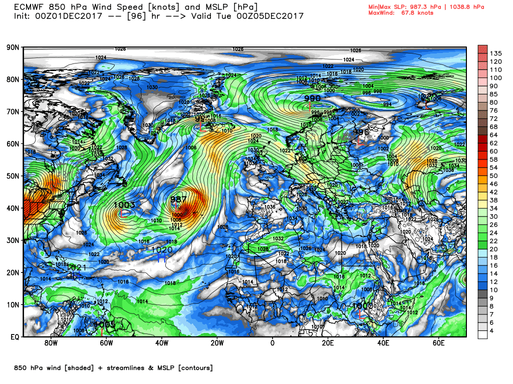
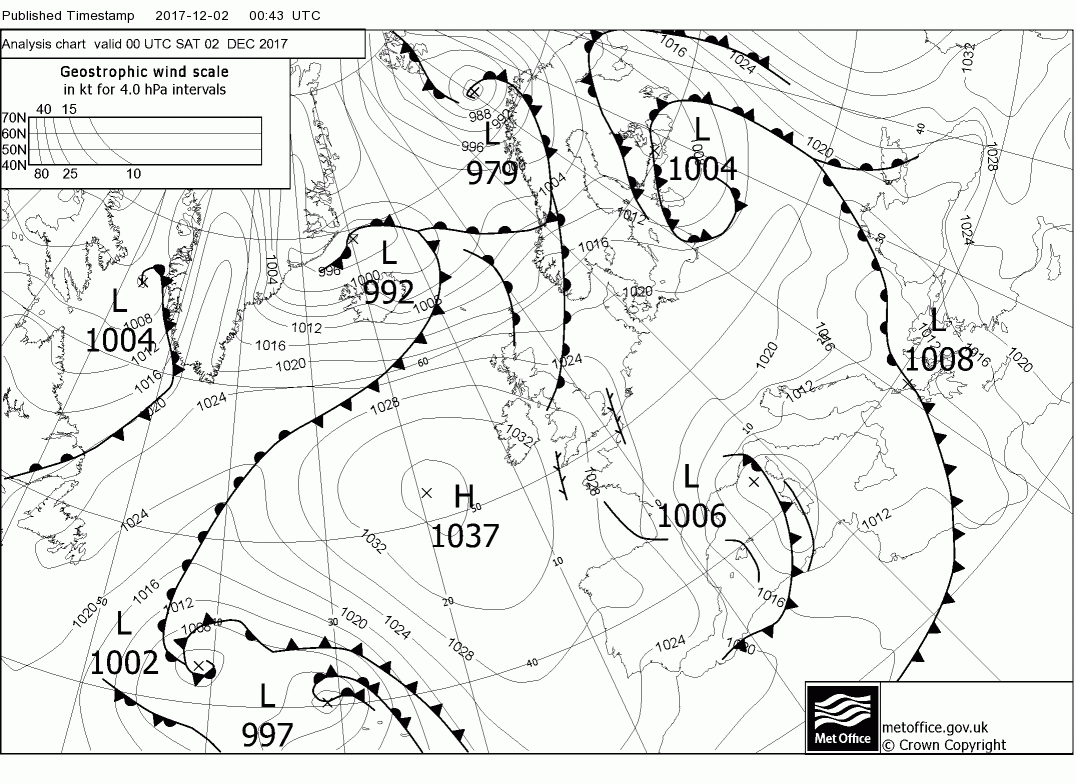
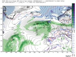
At T96 it has the front and well developed wave over Iceland with the high cell firmly over the UK.
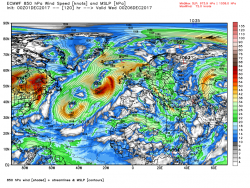
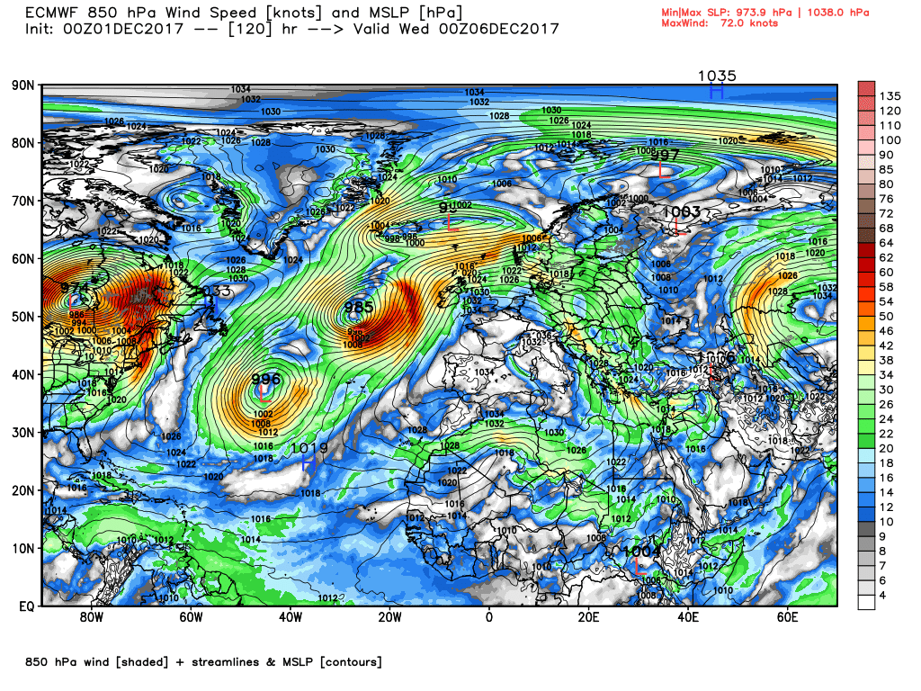
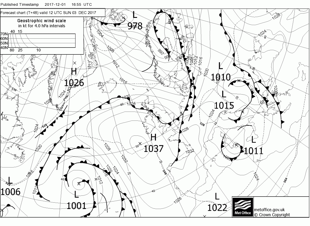
By T120 the elongated wave stretches to the shores of Norway whilst the front has moved south over Scotland and phased with the main low west of Ireland whose associated front is orientated N/S west of Ireland, This has tended to engage the colder quicker and drag it south in mid Atlantic
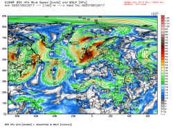
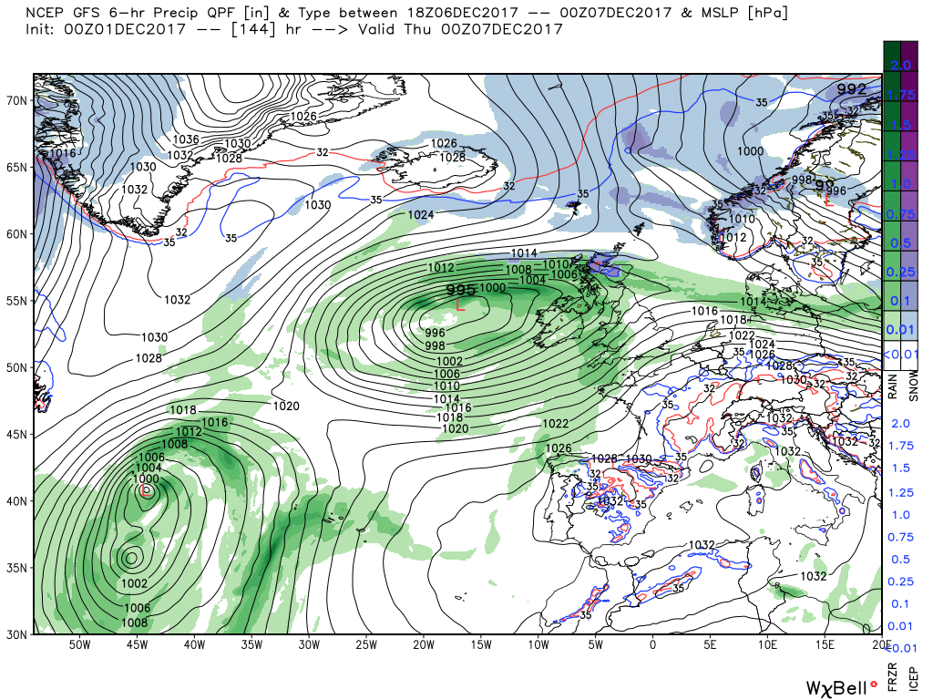
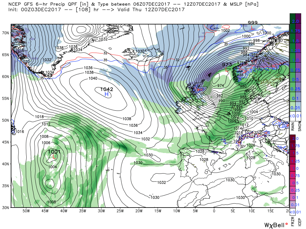
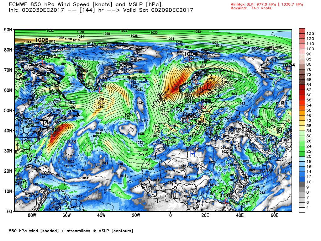
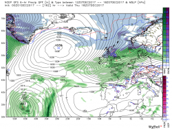
By T144 the front to the west has traversed the country and the low is now centred over Stornoway which brings heavy rain the Scotland and N. Ireland with severe westerly gales in many areas..
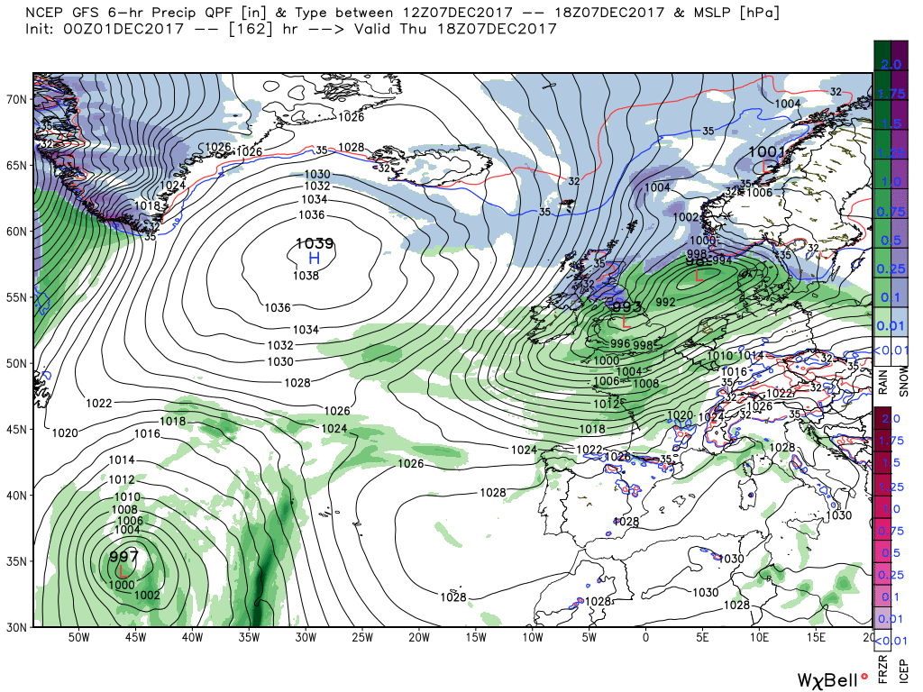
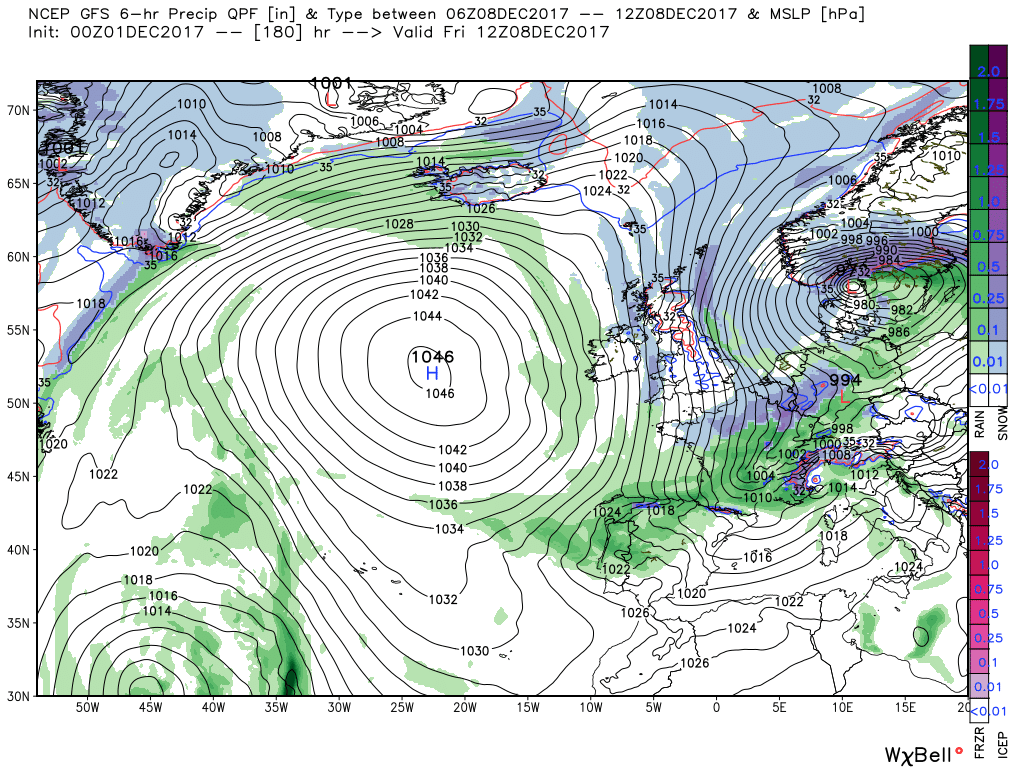
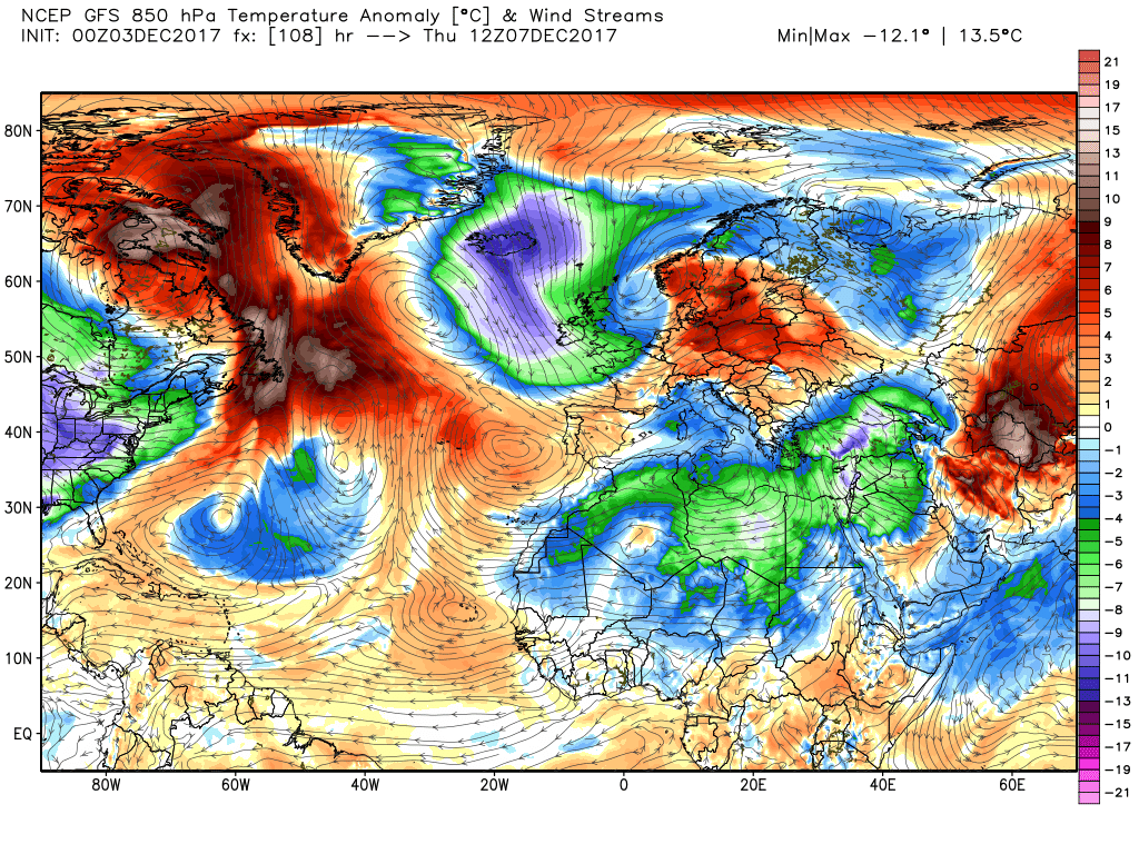
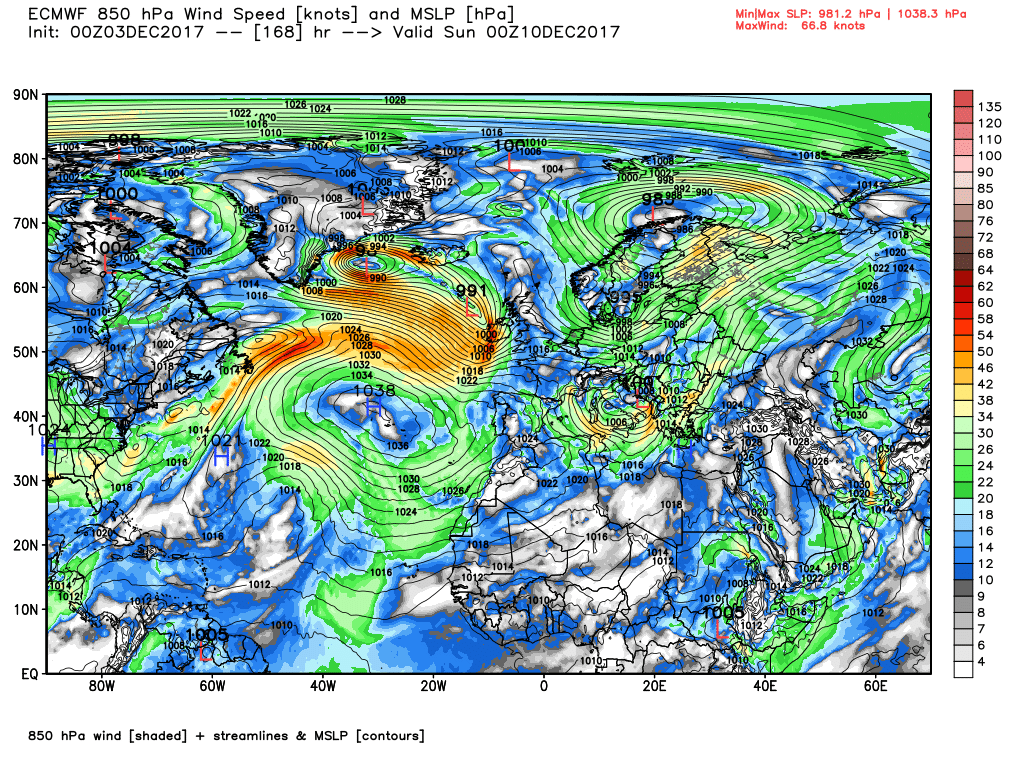
During Thursday the low tracks into southern Norway veering the gales NW then N and initiating wintry showers in many areas in the cooler airstream.
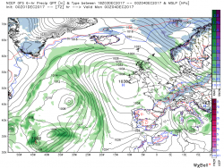
Meanwhile while all of the has been going on the Bermuda high pressure has been surging north east (courtesy of the cold trough in eastern N. America) and so by T192 we have another high cell the west of the UK waiting to be zapped by the east bound energy and 170kt jet. But I'm getting ahead of myself