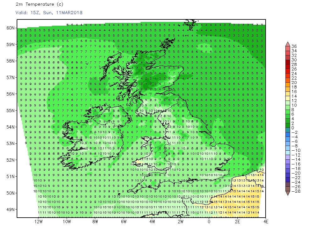
- Messages
- 6,299
- Location
- Norfolk, England
- Thread Starter
- #1,457
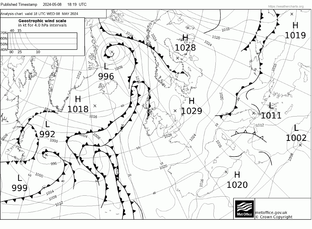
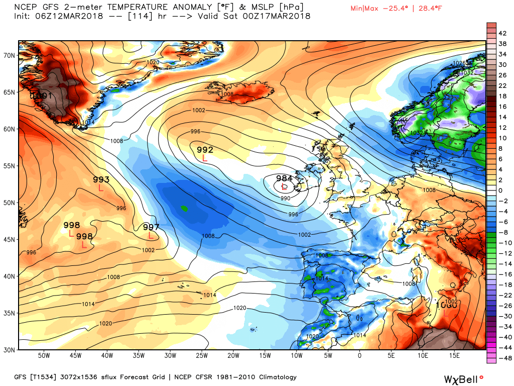
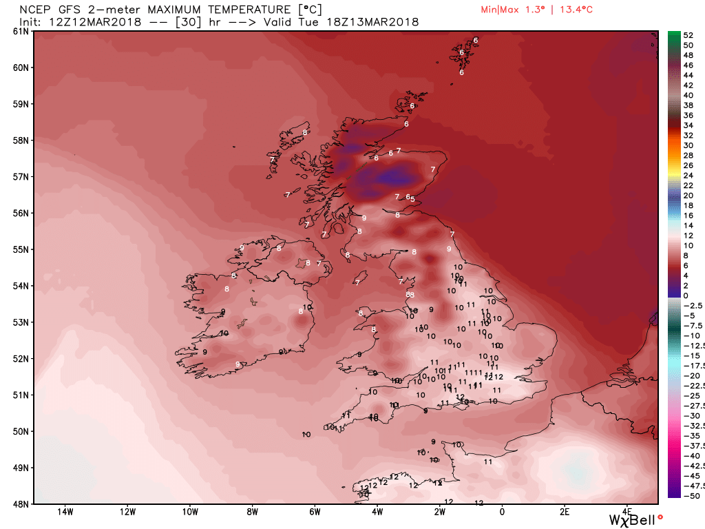
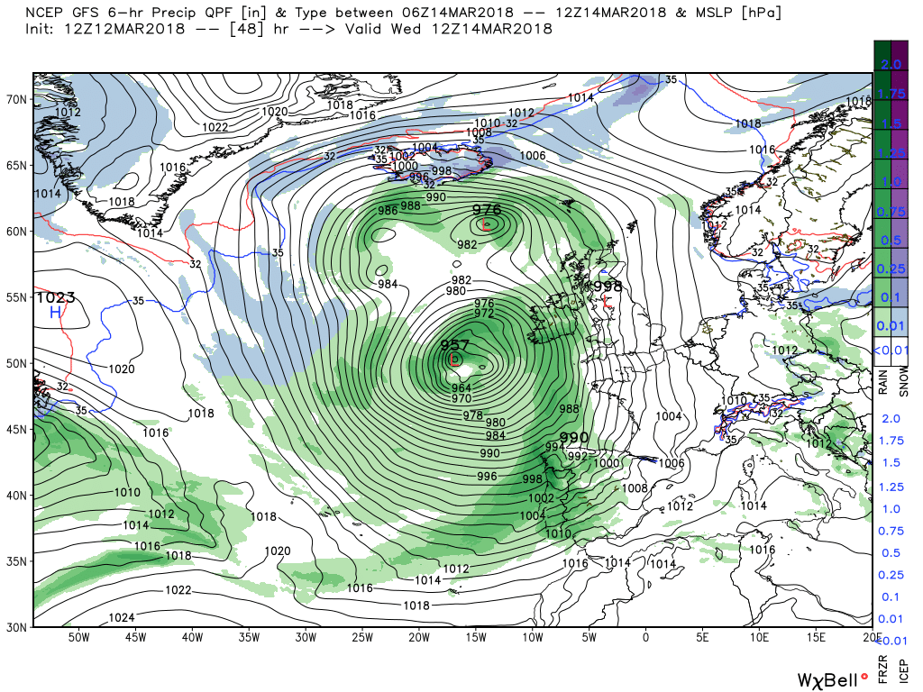
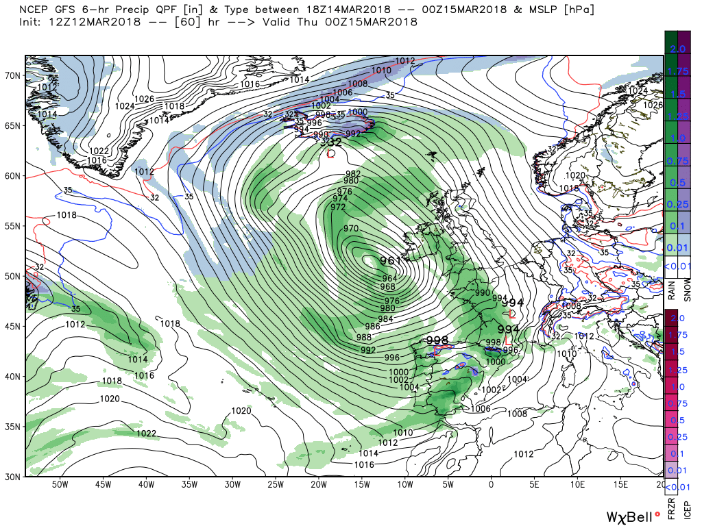
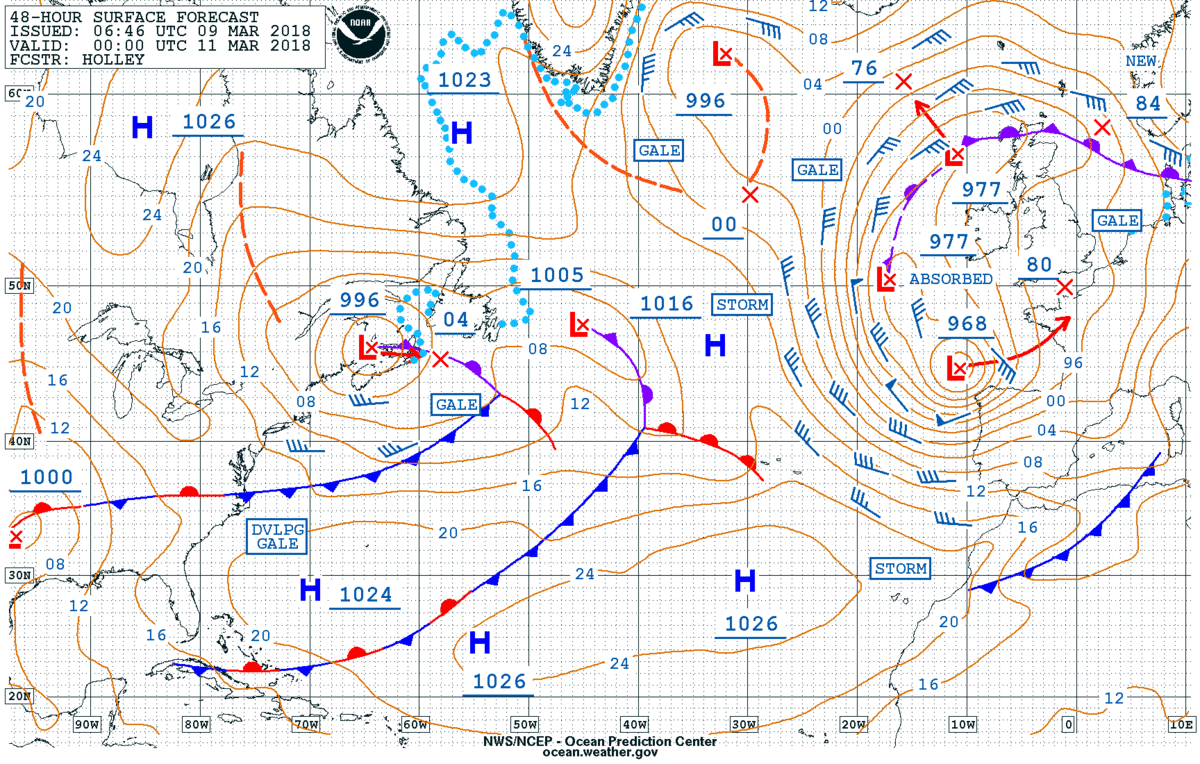
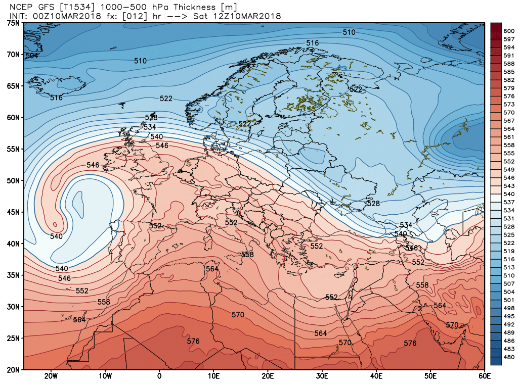
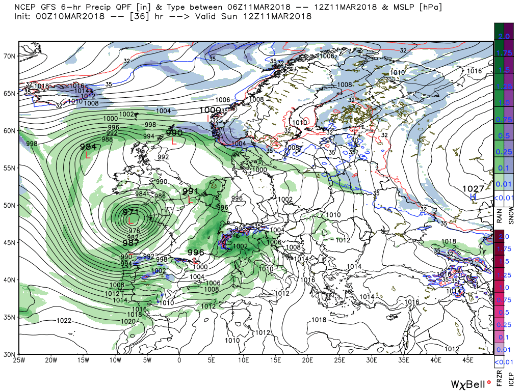
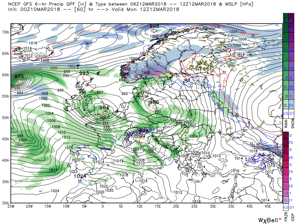
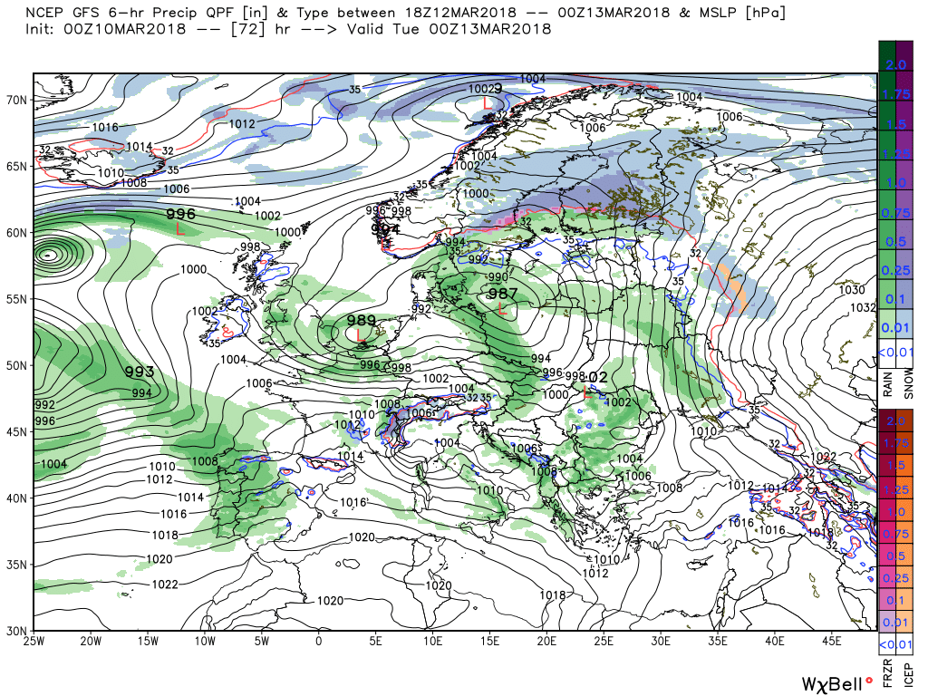
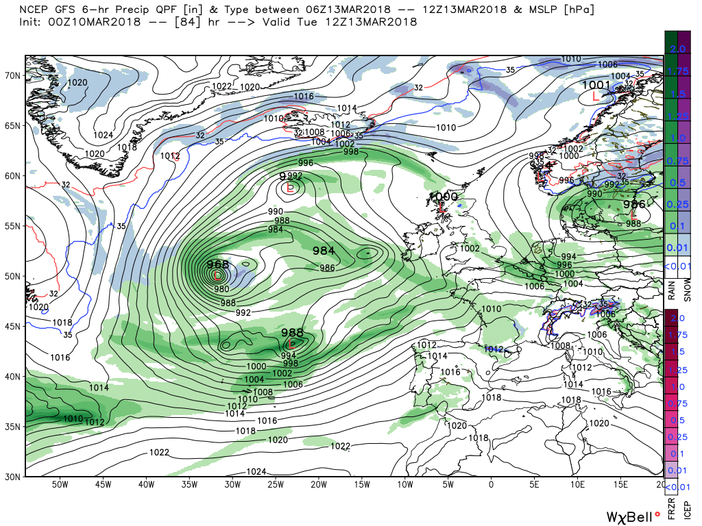
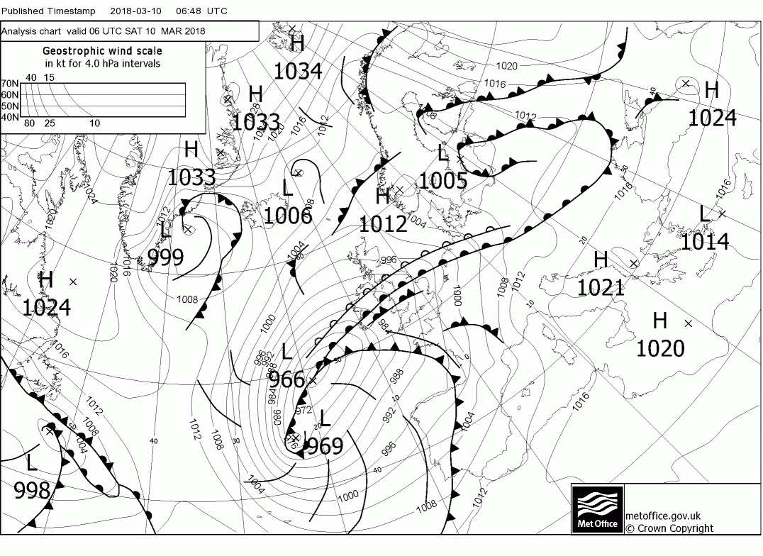
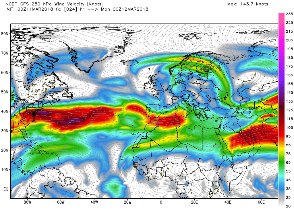
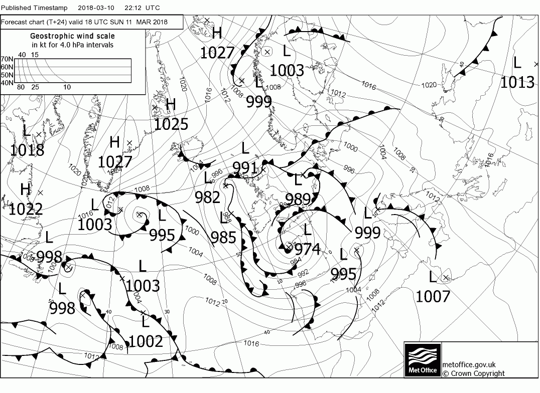
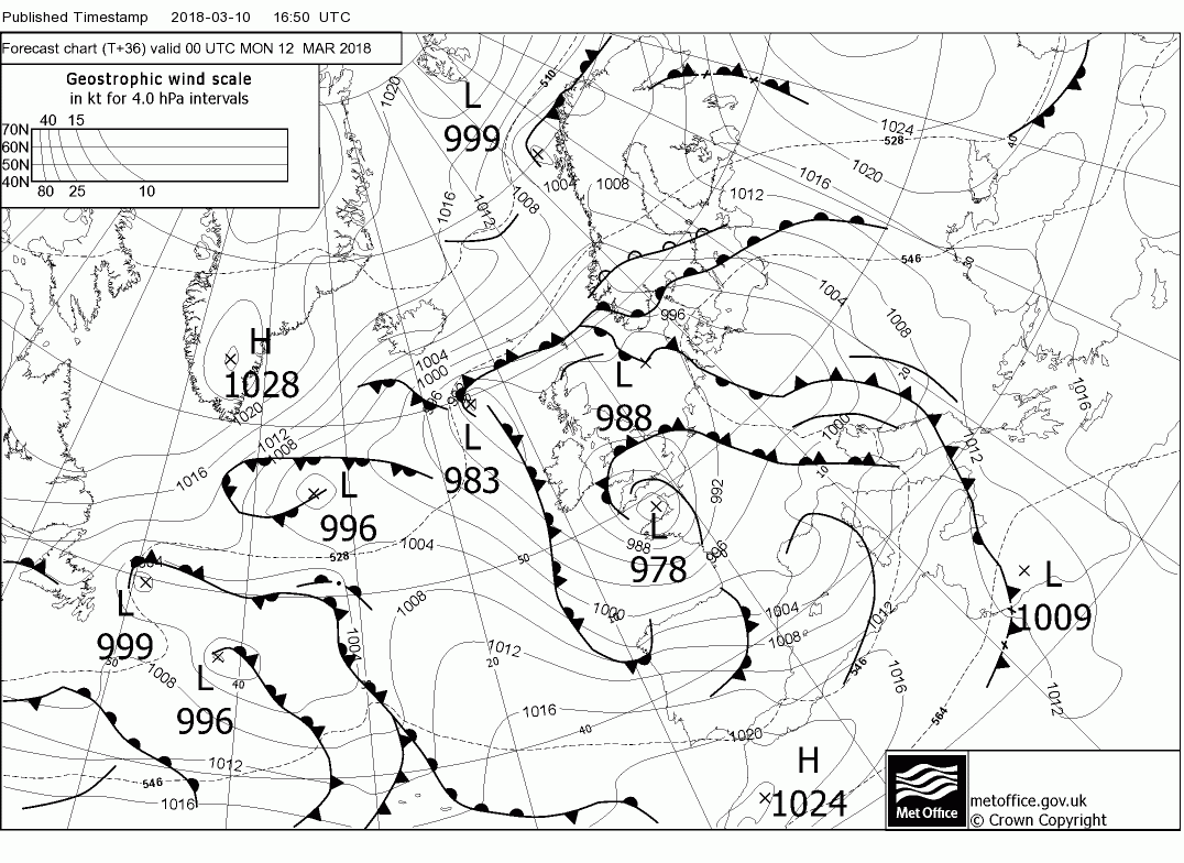
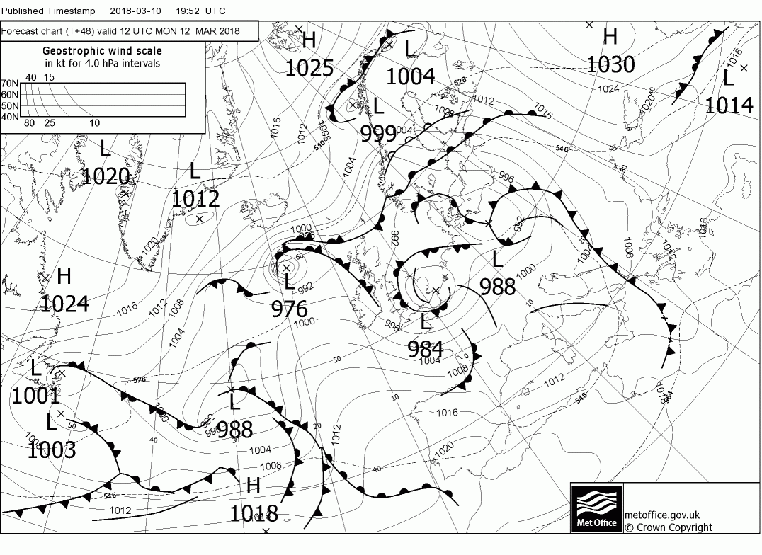
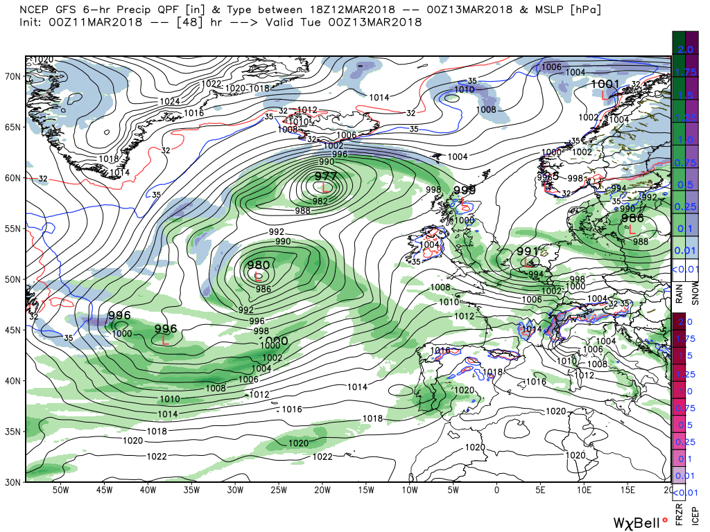
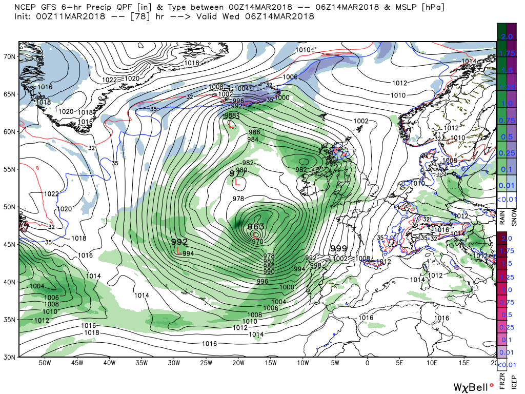
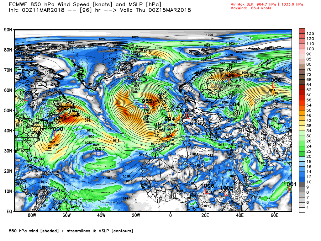
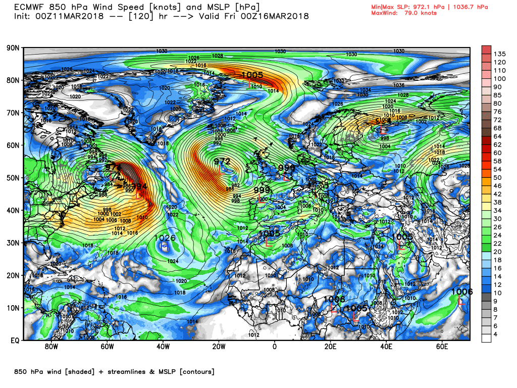
Malcolm also included the following 48 hour surface forecast chart from the States, showing the current positions of depressions and where they are expected to end-up in 48 hour's time:
I imagine the main areas of interest today, and a lesser extent tomorrow. will be precipitation, when and where, and the transient advection of much warmer air, courtesy of the large trough to our south west. that results in an unfortunate temp disparity between Scotland and further south.
So on to the detail
Fronts and associated bands of rain will continue to track north during the day so mainly cloudy but clearer eventually behind the cold front in southern England and Wales.but, as already mentioned, a marked temp contrast between Scotland and further south.
Overnight the rain will take it's time clearing the far north of Scotland whilst elsewhere it will be rather benign with some mist and fog patches forming that quickly clear leaving a pleasant sunny day for many but the trough to the south west is still flexing it's muscles and the surface low impacts the south south west/south bringing some patchy rain by midday. The low continues to loiter in the Channel and the area of rain spreads further north and east.
Through Monday the low continues to track east into the southern North Sea so intermittent rain still a features in much of the south of England whilst for a change Scotland remains reasonable dry and by now temps more or less just showing seasonal differences.
Tuesday could well be the best day of the week as the UK finds itself in a col and a quite familiar pattern with the upper trough to the west, a block in the Labrador Sea area and the strong jet exiting the south east US and running a fair way south. This results in inertia in the eastern Atlantic with the complex surface low pressure area associated with the upper trough very slow moving.
Thus Wednesday becomes unsettled with wind and rain as a deep low tracks slowly east and the associated fronts traverse Wales and England.
The key features in the short term continue to be the block in the Labrador Sea area, and the upper trough to the west of the UK being 'topped' up by energy exiting the eastern seaboard/
Thus over today and tomorrow the surface low associated with the trough tracks ENE up the Channel.
The fronts associated with the low bring patchy rain into the south west early this morning whilst at the same time rain associated with yesterdays fronts finally clears northern Scotland. This patchy rain will spread north and east during the day and overnight with eastern England and Scotland staying dry. Temps not bad but still depressed in northern Scotland.
Through Monday as the low continues east along the Channel further outbreaks of rain, some heavy, will affect mainly southern England and Wales and by 00 Tuesday the low is in the southern North sea.
Tuesday will be the best day of the week with a transient ridge bringing a dry ,quiet, day to all but by evening the upper low/trough to the west has been 'topped' up and, to risk an understatement, the associated surface area of low pressure is somewhat complex with low centres dotted around all over the place.
One of these centres then proceeds to deepen quite rapidly with a strong low level jet running to the south of it and tracks clowly north east to be 957mb south west of Ireland with the associated front already impacting the south west by 1800 Wednesday
The front does struggle north east across the country overnight Wednesday through Thursday but eastward movement of the low ceases and it drifts north to be west of Ireland as the pattern change gets underway involving amplification east and west which diverts the energy even further south and constrains any eastbound movement. A good place to leave it.
Spot on for today C. P.Malcolm's post for Sunday:
He knows his stuff; that's why I rate his posts so highly.Spot on for today C. P.
Changes continue this evening with the anomalies. Now an Aleutian ridge and trough in the SW United States and still the dual vortex lobes over Ellesmere Island and NE Canada. Thus a dual upper flow across North America exiting the south east seaboard as a strong westerly jet.
Meanwhile the block has transformed and moved east in the form of a ridge orientated Scandinavia to southern Greenland resulting in the eastern Atlantic trough becoming negatively tilted and slipping south with the aforementioned jet doing the same.
All of this leaves the UK in a very slack low pressure area with little or no lateral movement portending an unsettled period but the detail liable to be a little tricky to sort. Temps again variable but not a million miles away from average generally.
The key features in the short term continue to be the block in the Labrador Sea area, and the upper trough to the west of the UK being 'topped' up by energy exiting the eastern seaboard/
Thus over today and tomorrow the surface low associated with the trough tracks ENE up the Channel.
The fronts associated with the low bring patchy rain into the south west early this morning whilst at the same time rain associated with yesterdays fronts finally clears northern Scotland. This patchy rain will spread north and east during the day and overnight with eastern England and Scotland staying dry. Temps not bad but still depressed in northern Scotland.
Through Monday as the low continues east along the Channel further outbreaks of rain, some heavy, will affect mainly southern England and Wales and by 00 Tuesday the low is in the southern North sea.
Tuesday will be the best day of the week with a transient ridge bringing a dry ,quiet, day to all but by evening the upper low/trough to the west has been 'topped' up and, to risk an understatement, the associated surface area of low pressure is somewhat complex with low centres dotted around all over the place.
One of these centres then proceeds to deepen quite rapidly with a strong low level jet running to the south of it and tracks clowly north east to be 957mb south west of Ireland with the associated front already impacting the south west by 1800 Wednesday
The front does struggle north east across the country overnight Wednesday through Thursday but eastward movement of the low ceases and it drifts north to be west of Ireland as the pattern change gets underway involving amplification east and west which diverts the energy even further south and constrains any eastbound movement. A good place to leave it.
Given that the GFS and ecm diverged quite early this morning a quick early glance at the gfs 0600 det, run and it is still at odds leading up to the weekend
The GFS surface and charts for 00 Friday and Saturday and the 500mb and 850mb anomaly
The ecm for 00 Saturday
clearly this pattern change is causing some problems
Time to relax tomorrow as the transient ridge promises a reasonable day.
In fact Wednesday may well be not a bad day either for most to start with but heavy rain and strong southerly winds will slowly take over as the front associated with the major trough to the west struggles east.
A similar story on Thursday although the strong winds will abate apart from the north east.
Still unsettled on Friday but changes are afoot with the trough to the west becoming negatively tilted (forcing the jet south as Interitus mentioned earlier in a much more detailed and complex post) whilst the high cell amplifies in the north east.
You take out as much time as is needed C. Best wishes to you Dad.My dad's health continues to be a concern, and it isn't helping my anxiety either. It's therefore possible that I might not be around for a while, or my contributions might be intermittent. To complete my 'lesson' posts on areas of low pressure, U thought I'd post a diagram of a Cut-Off Low (abbreviated in the diagram to COL), which is a low which ends up to the south of the jet, usually as a result of the jet streak accelerating and, rather than curving to the south of the low centre, cutting straight across the north of it.
Here is a simplified chart for an actual cut-off low over southern California in 2005:
Cheers, he's taking antibiotics and new medication and he has an appointment with a urologist. He's OK during the day but he struggles to get much sleep at present.You take out as much time as is needed C. Best wishes to you Dad.