- Messages
- 2,549
Yay maybe SNOW!

No snow Yay!For your area, possibly. Johnny, probably. Me and BM, no!
P.No guarantee, but I think it's unlikely. Plenty of squally showers, though.No snow Yay!
Not unheard of down here but not common place unless you're up on the moor, squally showers I can live withNo guarantee, but I think it's unlikely. Plenty of squally showers, though.
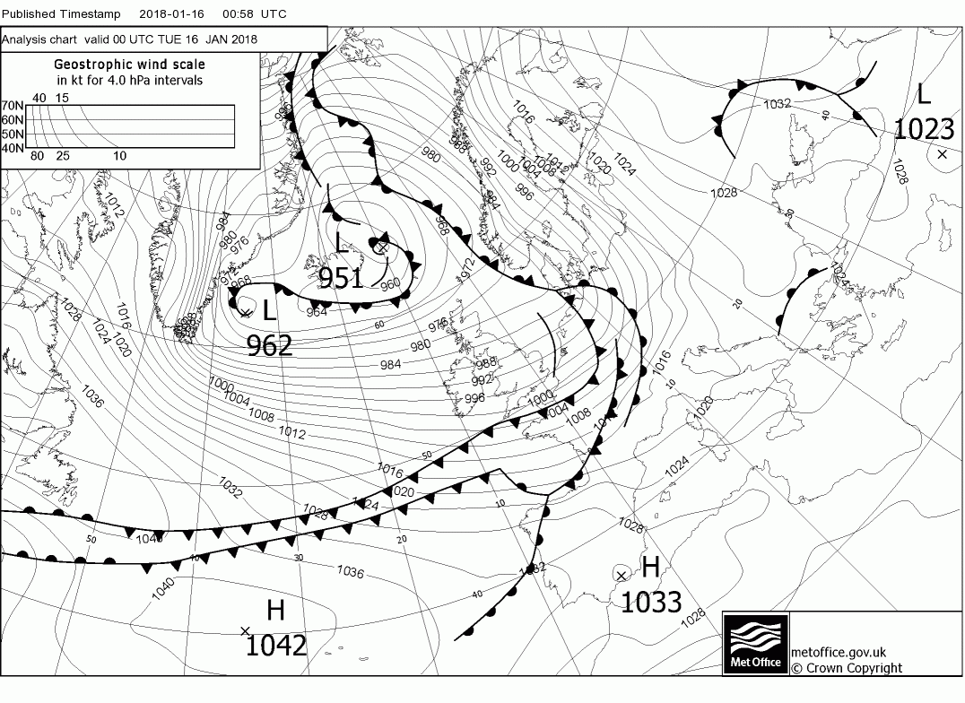
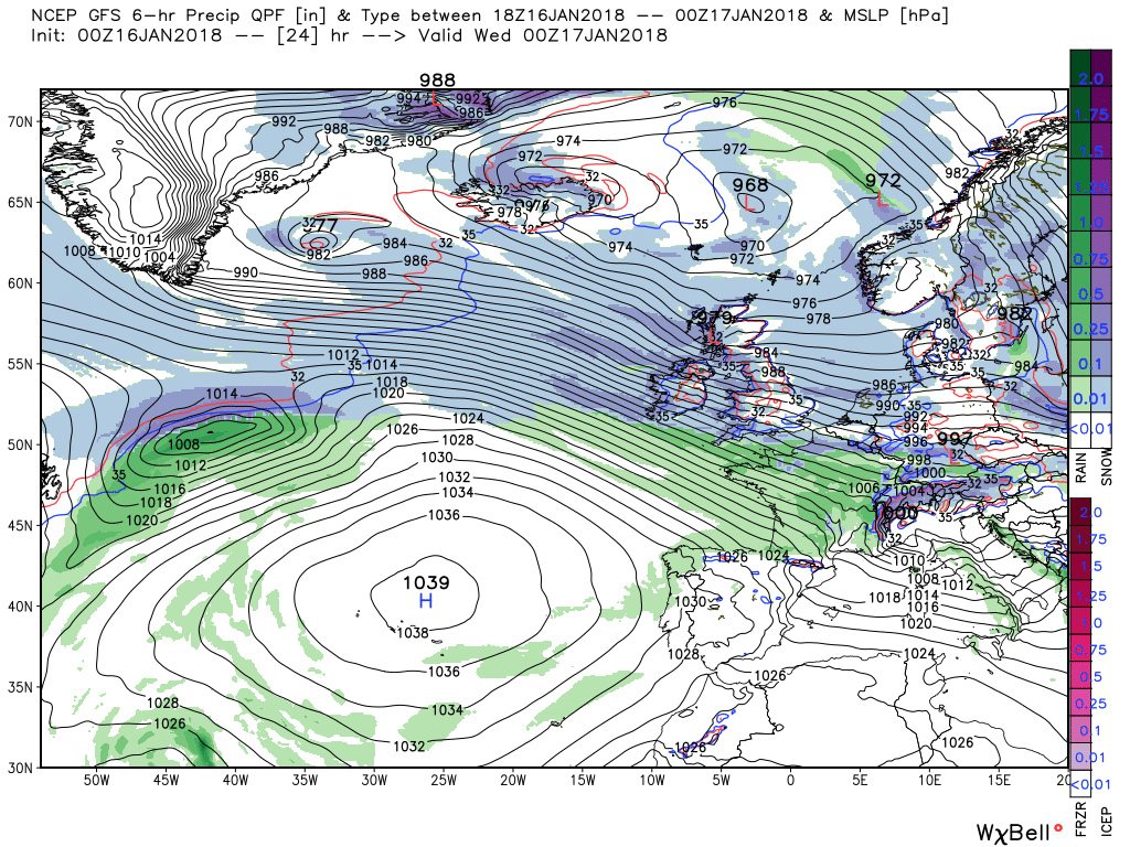
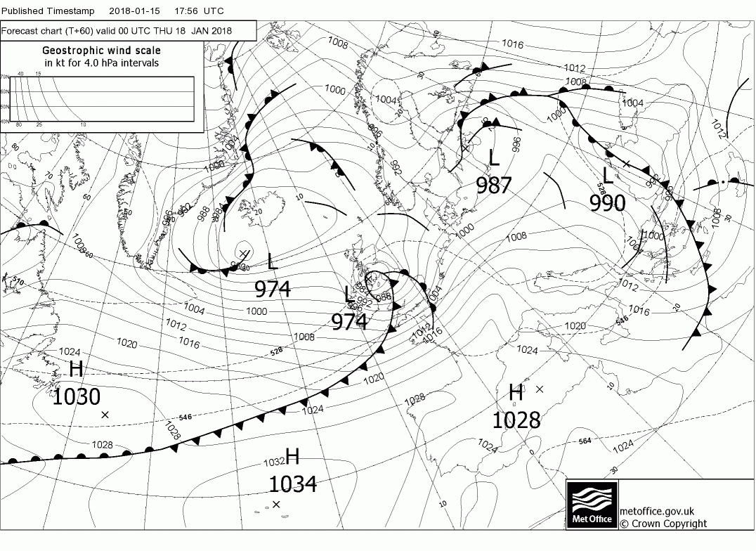
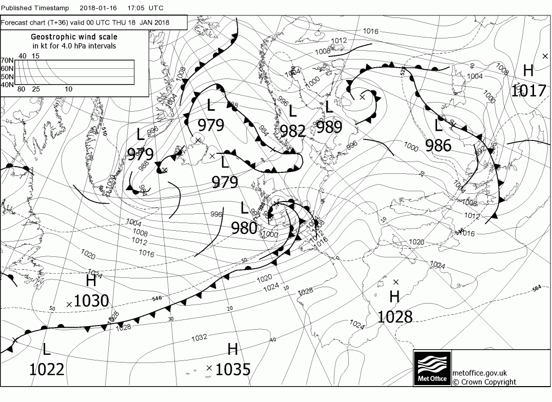
P.Today and tonight can be generally summed up fairly briefly. A complex area of low pressure is situated to the NW/N and the UK is in a strong WNW/NW airstream with gales in many places along western coasts. .
This cold unstable air will initiate frequent squally wintry showers down the western side of the UK (Spreading a little inland) of just about everything. Snow, hail, rain, thunder, but particularly prevalent in Scotland, N. Ireland and NW England where the snow showers will be more frequent and lying snow may well accrue.
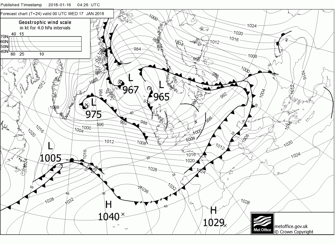
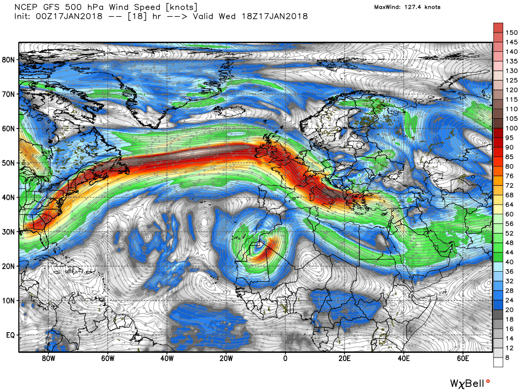
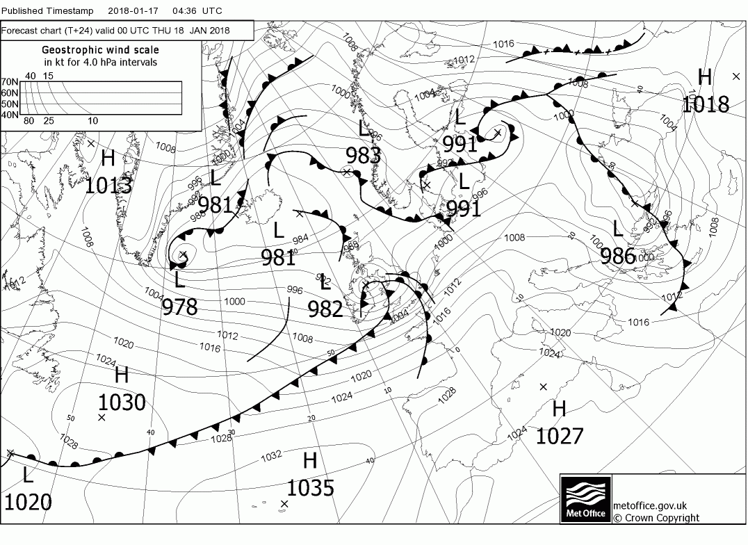
Tomorrow brings a slight lull, relatively speaking, before our wave depression gets in on the act and brings some wet and stormy weather Wednesday night into Thursday. I think it worth while just following the storm as indicated this morning by the gfs just to show how tricky it is to nail down the precise track and intensity, even over short time scales. And probably worth mentioning this still is not nailed down. So at 0300 this morning it is just developing off the eastern seaboard and at 00 is still a shallow feature north east of Newfoundland.
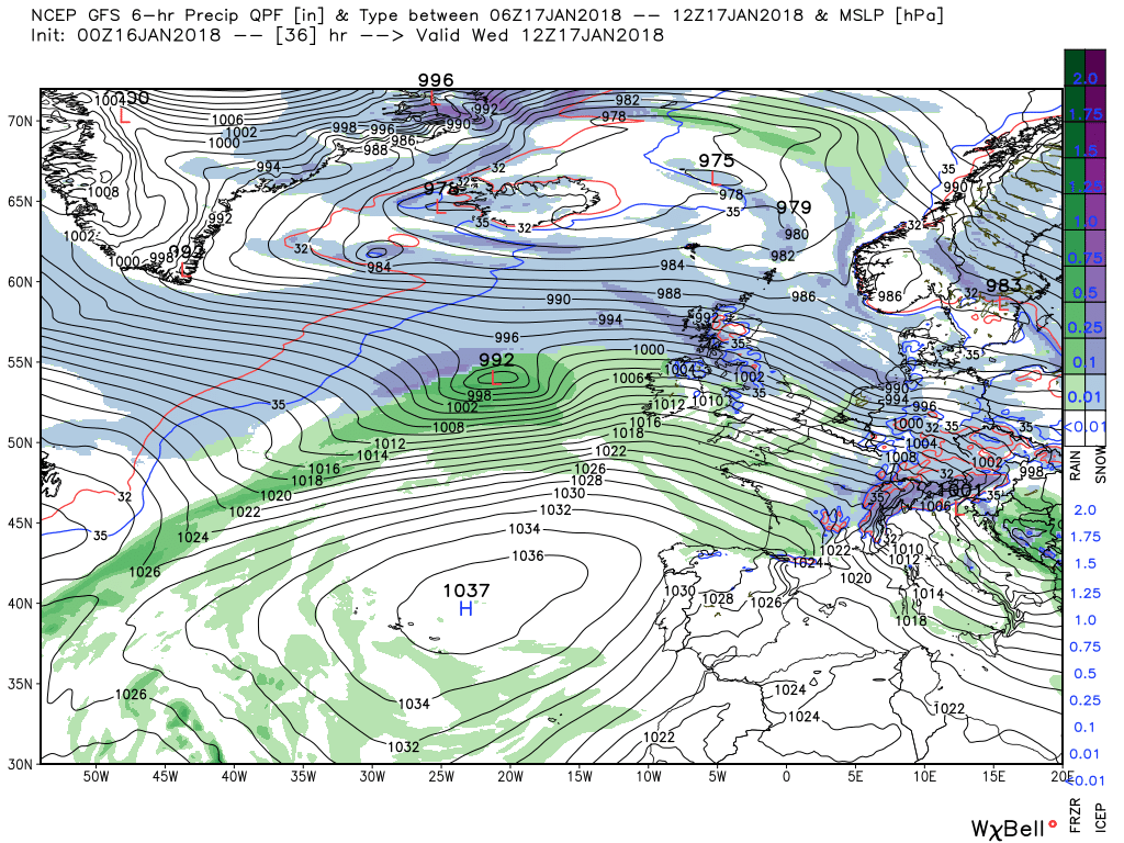
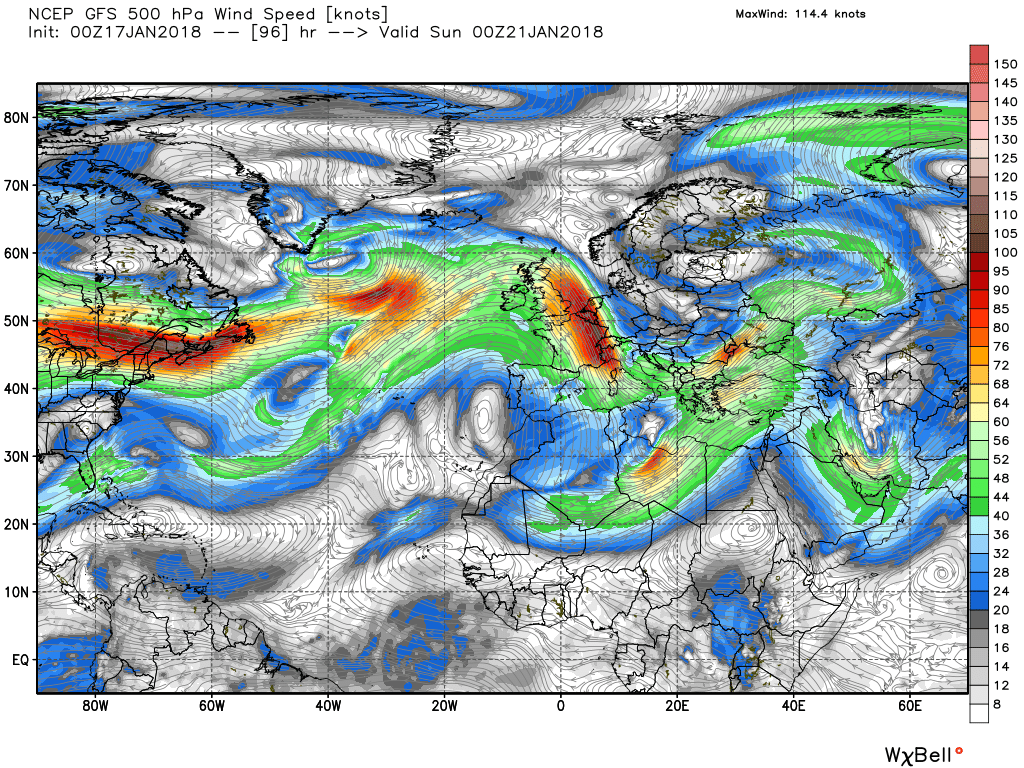
In the next 24 hours it nips across the Atlantic on a very strong ENE jet (in the 100kts region at 500mb) to be in the north Irish Sea 982mb by 00 Thursday. As it then quickly crosses the north of England into the north sea it will generate some very strong winds south of it's track, gusts in the region of 60-65kts accompanied by rain which may well be of snow along the northern edge in southern and central Scotland.
But as mentioned this is still not set in stone and the latest fax (It was 1800 yesterday) has it 8mb deeper. The low quickly tracks into eastern Europe and the UK is back in a cold, unstable, NW regime by 00 Friday.
The ecm has the low a little further SW in the Irish Sea and not quite as deep at 988mb at 00 Thursday. By 0600 just east of Hull 986mb and certainly not so enclosed and active as the gfs. Gusts south of this in the 45-55kt range. So still major differences all round which is not a major surprise and this probably will not pinned down until later.

Yay! I got snow! nearly gone already mind but it was enough to cover the car park.
Take care, Johnny, and get yourself something from here:Can send you plenty down Count. Had to turn back from the dog walk today, stumbled into a real whiteout when I got half a mile or so up the farm road end and even the gumboots and stick couldn't afford a safe footing. Still drifting down across the moors and settling gently over our surroundings.
JohnnyO. o/

Bring it on JohnnyO! Though if you could wait until I get the kids back next week that would be better - bit sad running around in the garden at 51 making snowmen on your own...now I've got a neighbour that is.
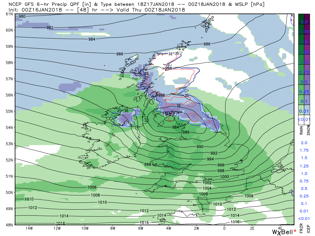
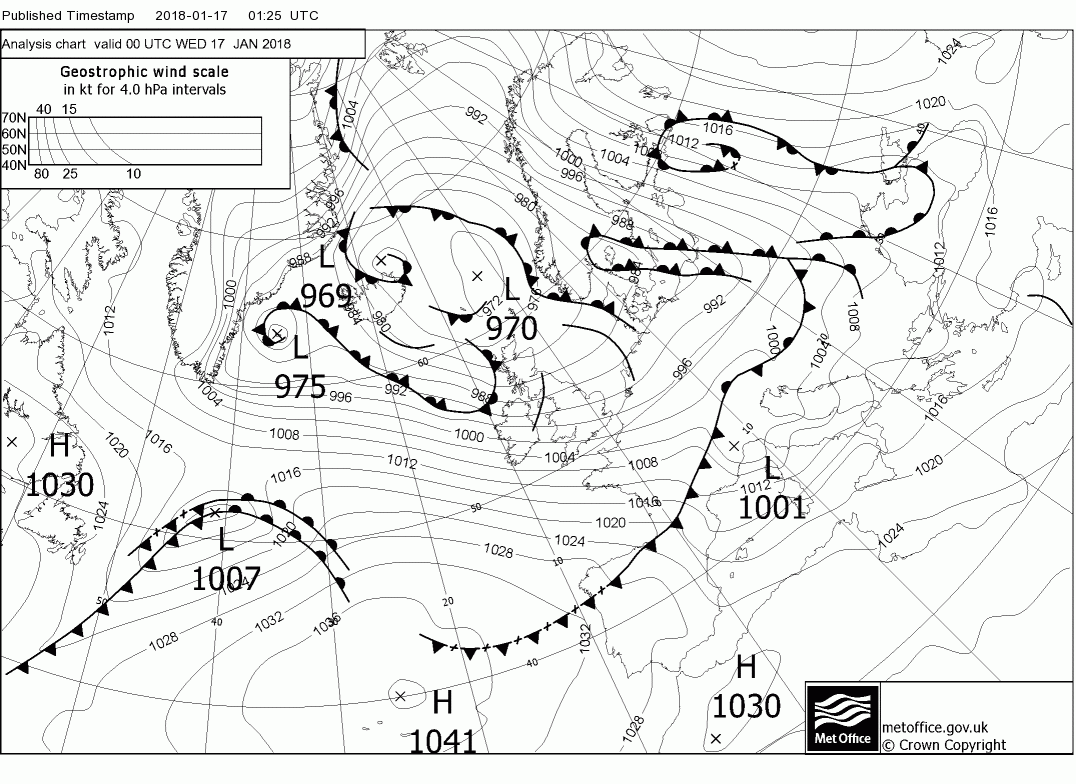
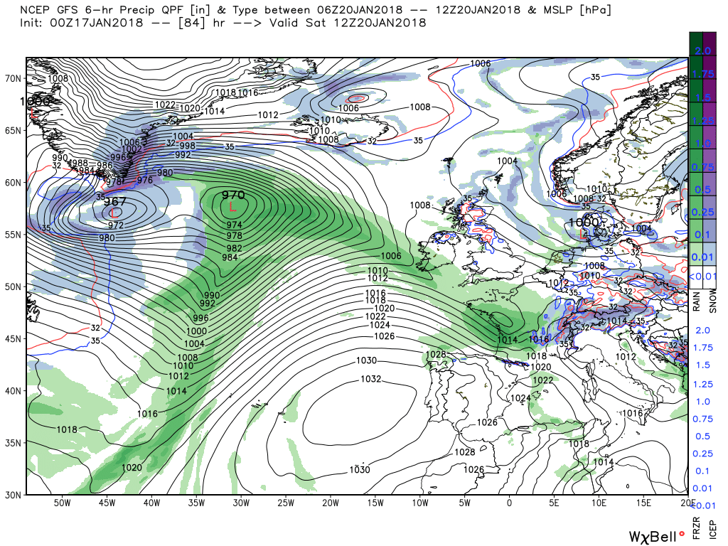
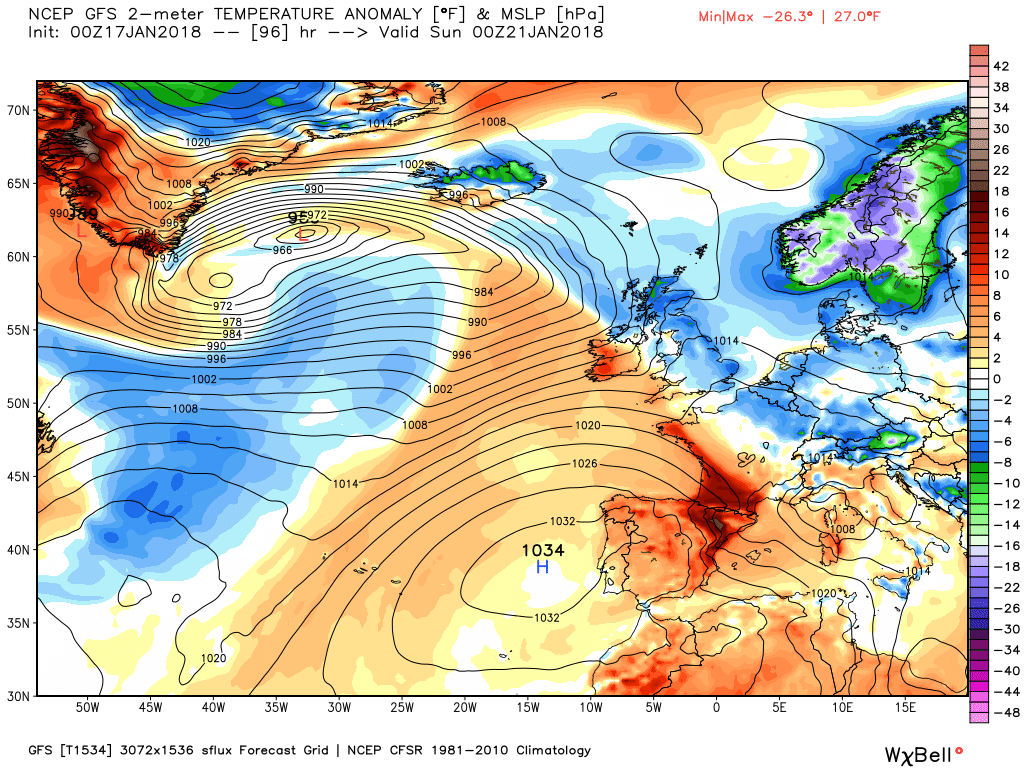
Not to spend too much time on tonight's storm as I'm sure it will be covered in detail in the regional threads so I'll settle for posting the latest fax charts (the update later to the 00 Thursday will be interesting) and this morning's Icon and to note that some adjustments may well still be made on the precise depth and location of the impacts vis wind and snow as it still has a long way still to travel today.
Regarding to day the winds and showers will abate, which is some relief as it was pretty wild down here during the night gusting 60mph., albeit the UK will remain under the influence of the complex low pressure to the north and thus still in a cold north westerly.
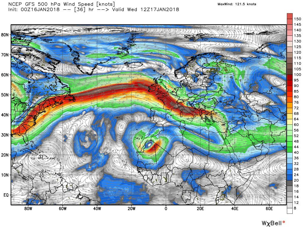
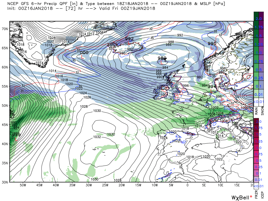
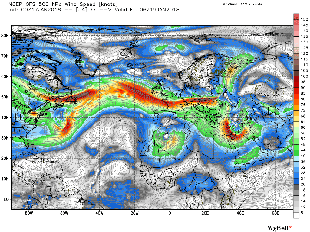
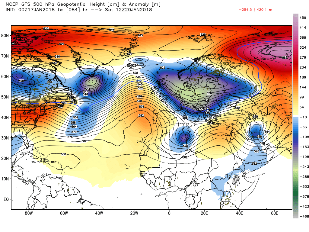
So on to possible events post the passage of the low which is really a follow on from yesterday's post. By T54 the upper trough over the UK is slipping South east whilst out in the western Atlantic the next troughs are leaving North America driven by the two energy flows, one from the Canadian vortex lobe and the other from the southern United States. This can clearly be seen on the 500mb and surface charts as the transient ridging of the Azores HP comes under pressure.
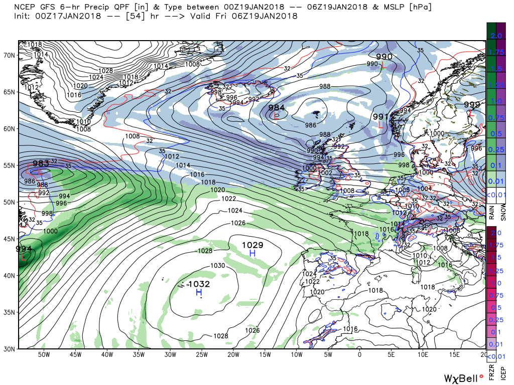
From this point the low to our north fills and slips down into the North Sea whilst out west the complex upper low/trough is edging east as is the associated surface wave depression (rather more north east) and the warm front which is lying NW/SE across southern Ireland by T84
The continuing pressure from the eastbound energy, particularly from the vortex lobe, continues to push the front(s) towards the UK upon which little waves are forming, and as the warm front meets the cold air then there could be a fair amount of snow in the north of England and Scotland over the weekend.
At T96 the ecm has the warm front across southern Ireland/south west England with a very marked dew point transition so agreeing on snow along the northern edge.
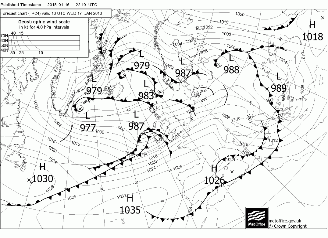
The updated fax chart. Perhaps a little slower and a tad further south.

No drifts here just really treacherous slurry on the roads, interesting slide to work this morning.
Blanket, shovel, snow chains and a ridiculously thick bright red down jacket are my standard winter kit when snow is in the offingBetter you had this mornings adventurous slide than our local drivers 7 hours trapped in cars on the M74 last night Count. Make sure you pack a thermod of tea and some sandwiches ... just in case m8.
JohnnyO. o/