You are using an out of date browser. It may not display this or other websites correctly.
You should upgrade or use an alternative browser.
You should upgrade or use an alternative browser.
UK meteorology
- Thread starter chrisbell
- Start Date
- Messages
- 2,549
I say I think there is some sort of mistake, I believe I have JohnnyO's weather instead of my own...
OP
- Messages
- 6,299
- Location
- Norfolk, England
- Thread Starter
- #1,267
I say I think there is some sort of mistake, I believe I have JohnnyO's weather instead of my own...

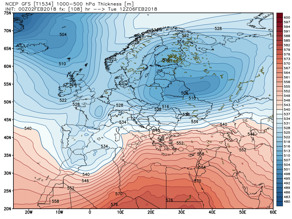
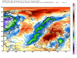
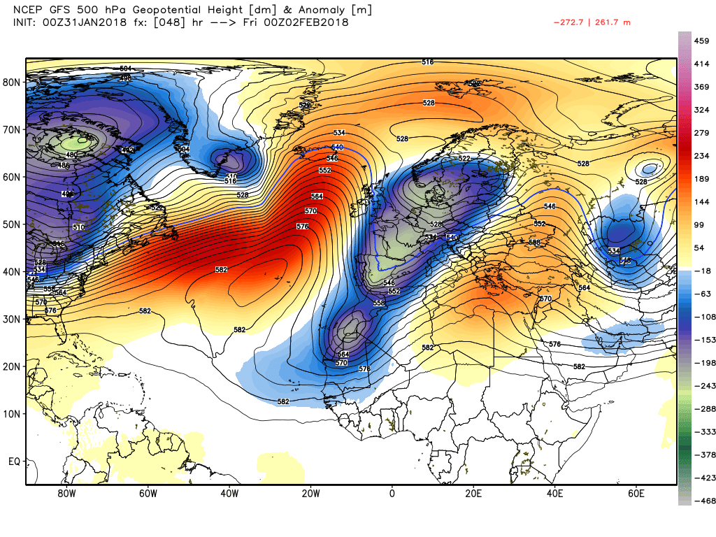
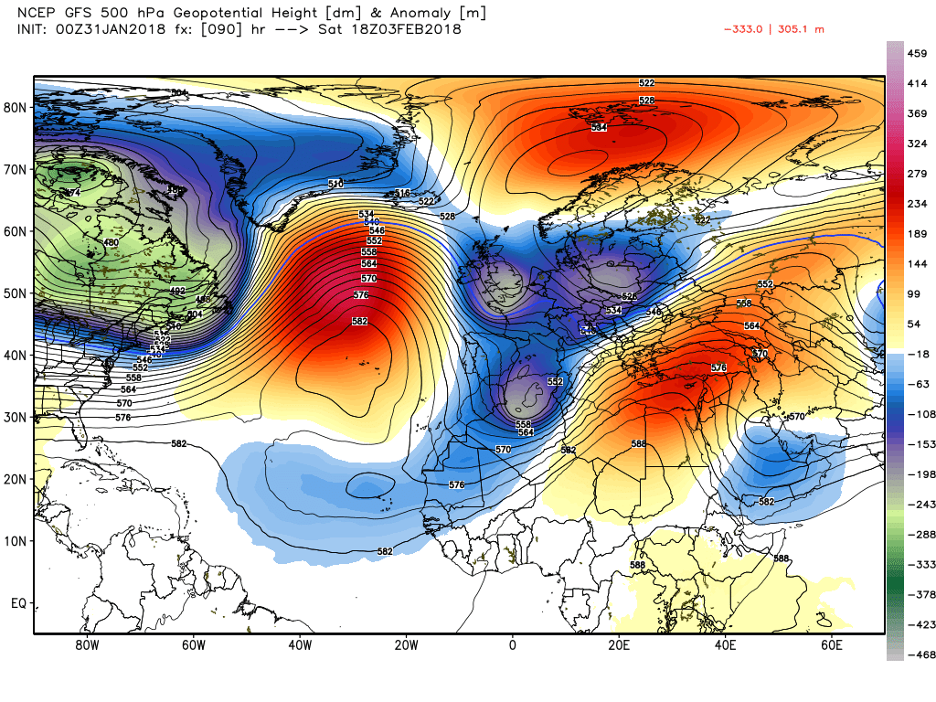
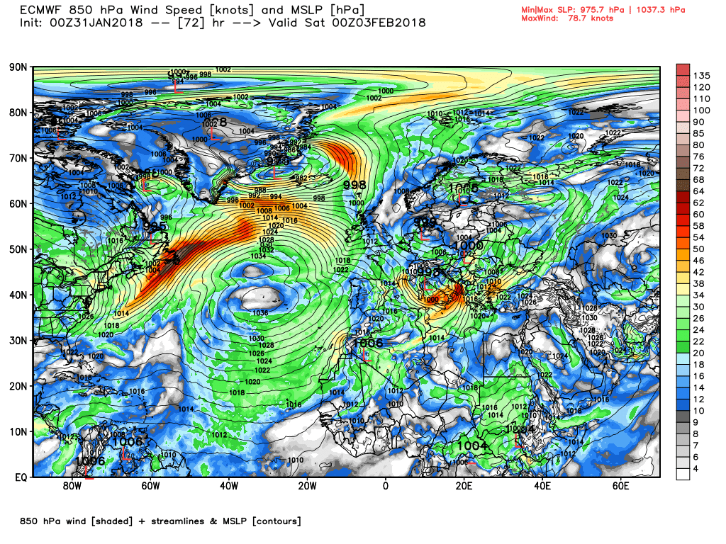
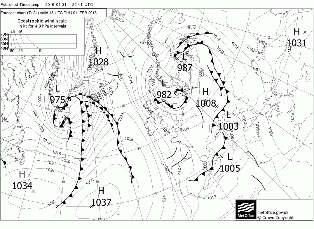
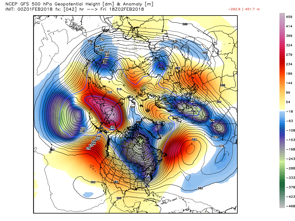
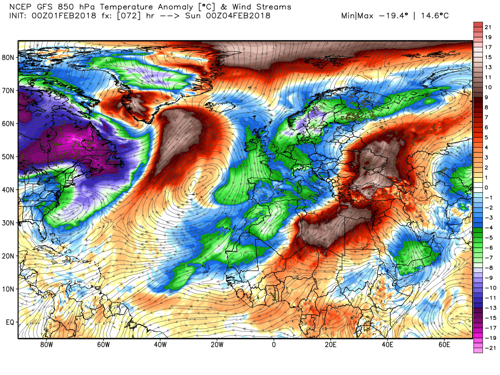
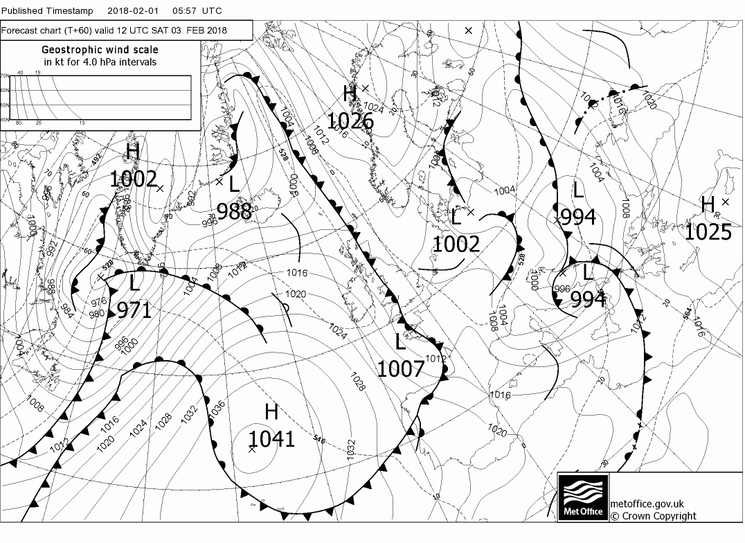
Anyway, here's a longer than normal post from Malcolm, where he goes briefly beyond the 72 hour limit for the thread he posts these thought in, and discusses the likelu setup further out using the 500mB/hPa height anaomaly ensemble mean. Don't try to understand it for now; his discussion describes what it indicates:
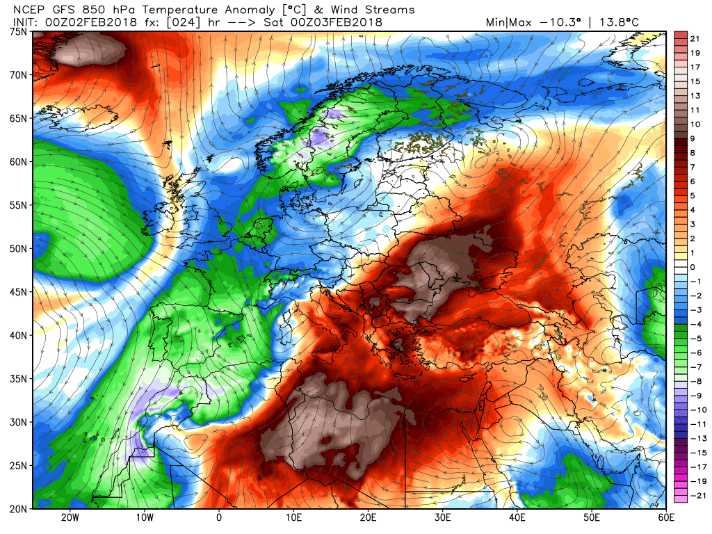
The overiding theme in the short and medium term remains unsettled and can be summed up with periods of rain, sleet or snow generally in the north, followed by squally wintry showers.Because of the expected pattern that develops temps will be below average. A brief word regarding this pattern in the medium term.. There was good agreement last night between NOAA and the GEFS and EPS anomalies and upstream the key players vis the UK weather are the intense Canadian vortex with associated troughs down N. America and ESE through Iceland. Thus a very strong westerly upper flow leaving the eastern seaboard which diverges in the eastern Atlantic courtesy of some positive anomalies and ridging in northern Scandinavia and, in particular, the combination of the Azores high pressure and the trough positively orientated to the SE/S of the UK Thus the westerly flow abates somewhat and veers north west very close to the UK. This fairly long preamble was me leading up to saying worth keeping an eye on this this morning as the short term should start leaning in this direction. Just the NOAA chart to illustrate this.
Back to the short term.
Once yesterdays fronts have finally cleared today the UK is left in the very windy north westerly circulation of the intense low situated north east of Scotland thus frequent squally wintry showers, particularly in the west and north where they will be of snow, even down to the low ground, A perturbation in the flow may bring more concentrated showers as it tracks down the western coasts.
Essentially these cold and showery conditions pertain though tonight and tomorrow although by 00 Friday with the low slipping down the North Sea and the Azores ridging to the west the surface wind will have veered northerly and thus shifting the main area of the showers to the north and the east coast.
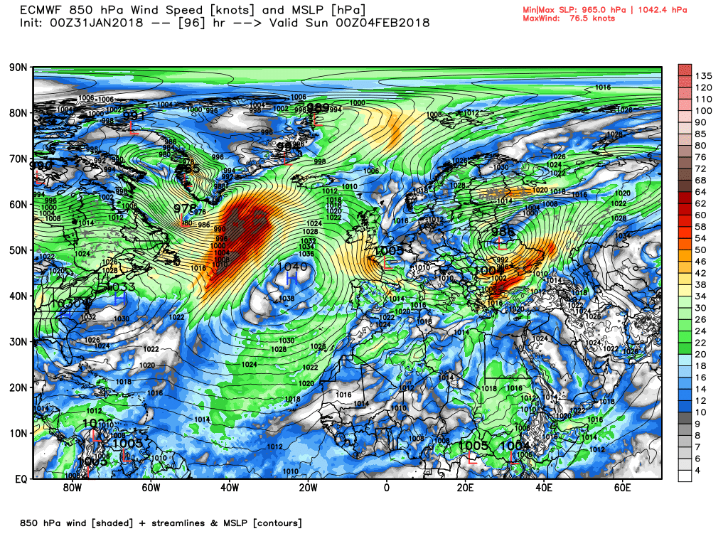
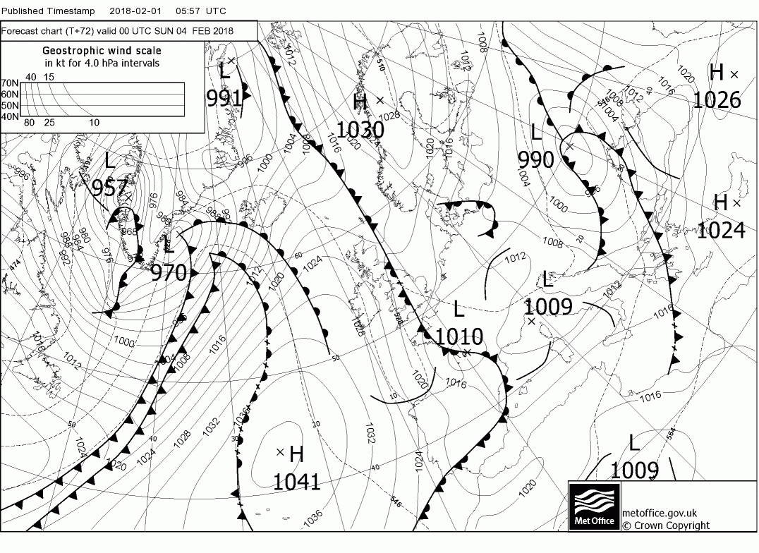
Friday could well be the best day of the week as the ridge moves in portending dry and sunny with lighter winds, albeit maybe a frosty start, But by 00 Saturday a rather complex picture is emerging with an upper trough over Greenland stretching towards the UK with it's associated surface fronts already impacting N. Ireland and Scotland, with another upper trough positively aligned to the south east of the UK.
The front and rain, snow on the higher ground in the north, track south east through Saturday but the upper trough is in the process of deconstructing under pressure from renewed ridging by the Azores and waves are forming on the front and by 1800 an enclosed low has formed and is over Yarmouth.
By 1200 Sunday the low has drifted SW into northern France and with the Azores ridging north east the UK is in two airmasses but the latter is under intense pressure from much energy eastbound from the eastern seaboard. But here we must leave it.
The ecm has the frontal wave a little further west over the weekend thus the low is forming over south west England by 12 Saturday.and by midnight is over central France with the Azores ridging north east. So in fact not dissimilar to the gfs in the end
OP
- Messages
- 6,299
- Location
- Norfolk, England
- Thread Starter
- #1,268
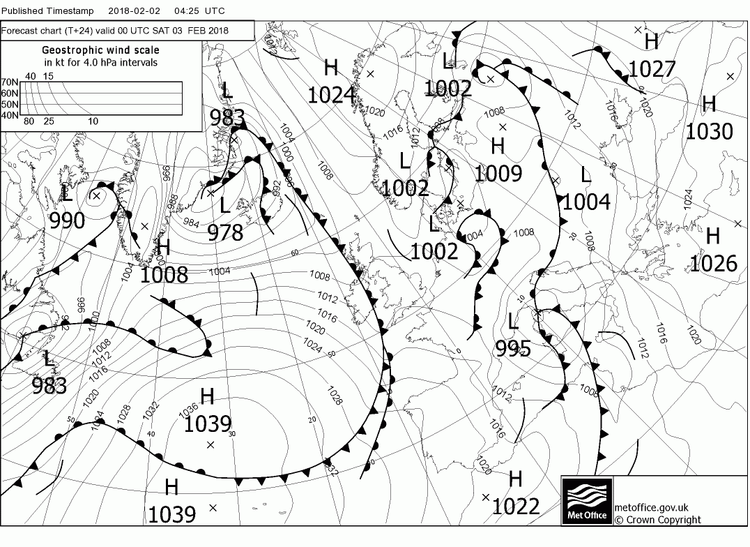
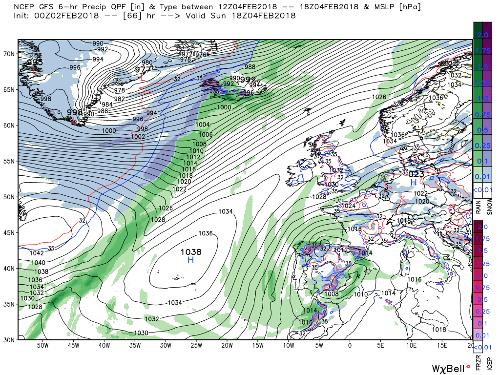
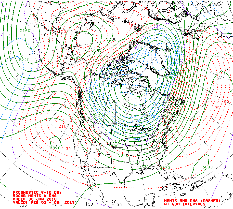
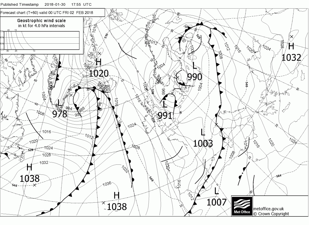
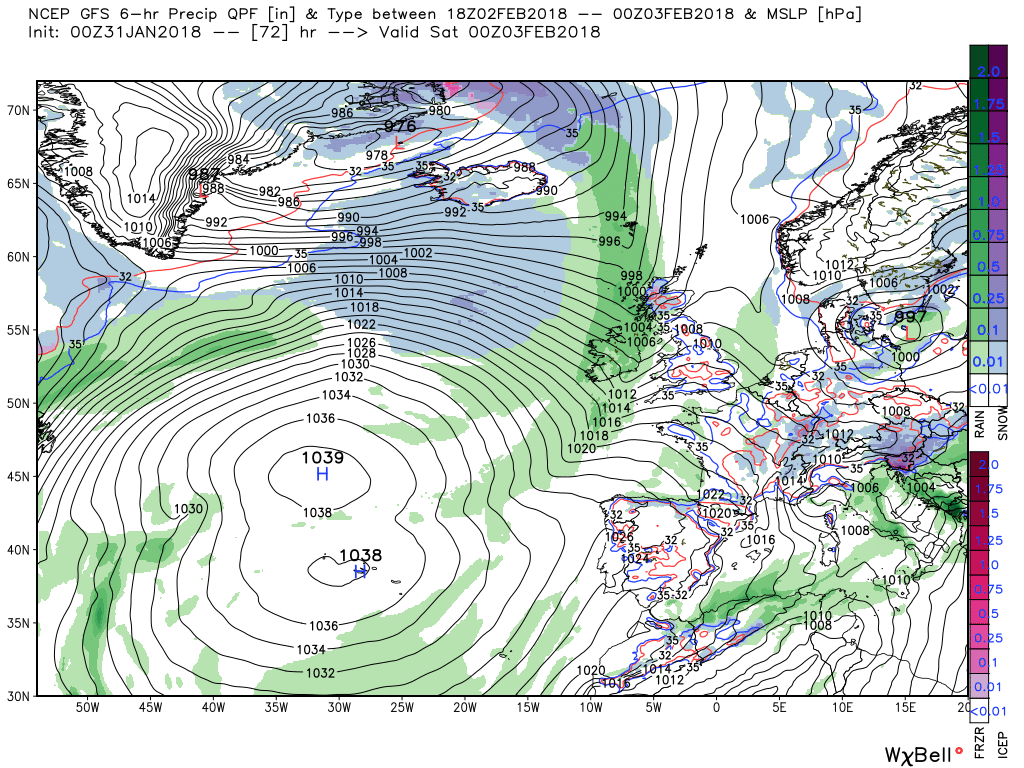
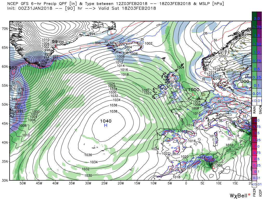
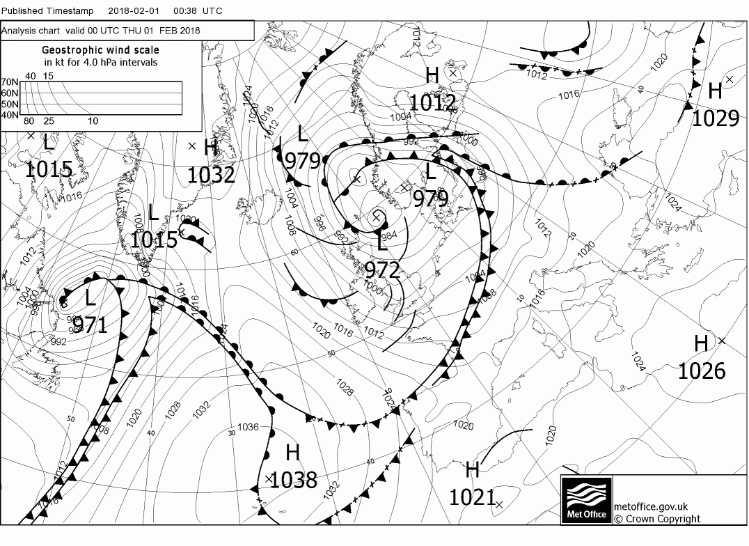
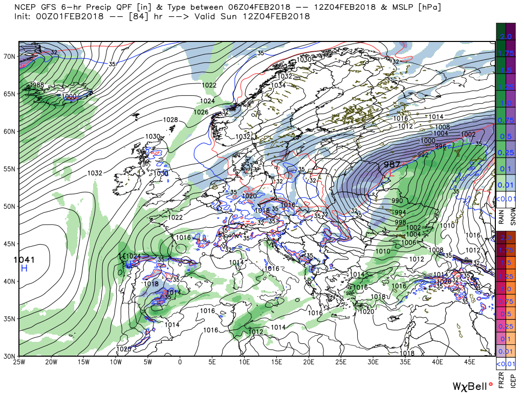
He's also posted a surface analysis chart (which I have yet to be able to fully interpret) and a precipitation chart which shows what the Count has been having so far today:

OP
- Messages
- 6,299
- Location
- Norfolk, England
- Thread Starter
- #1,269
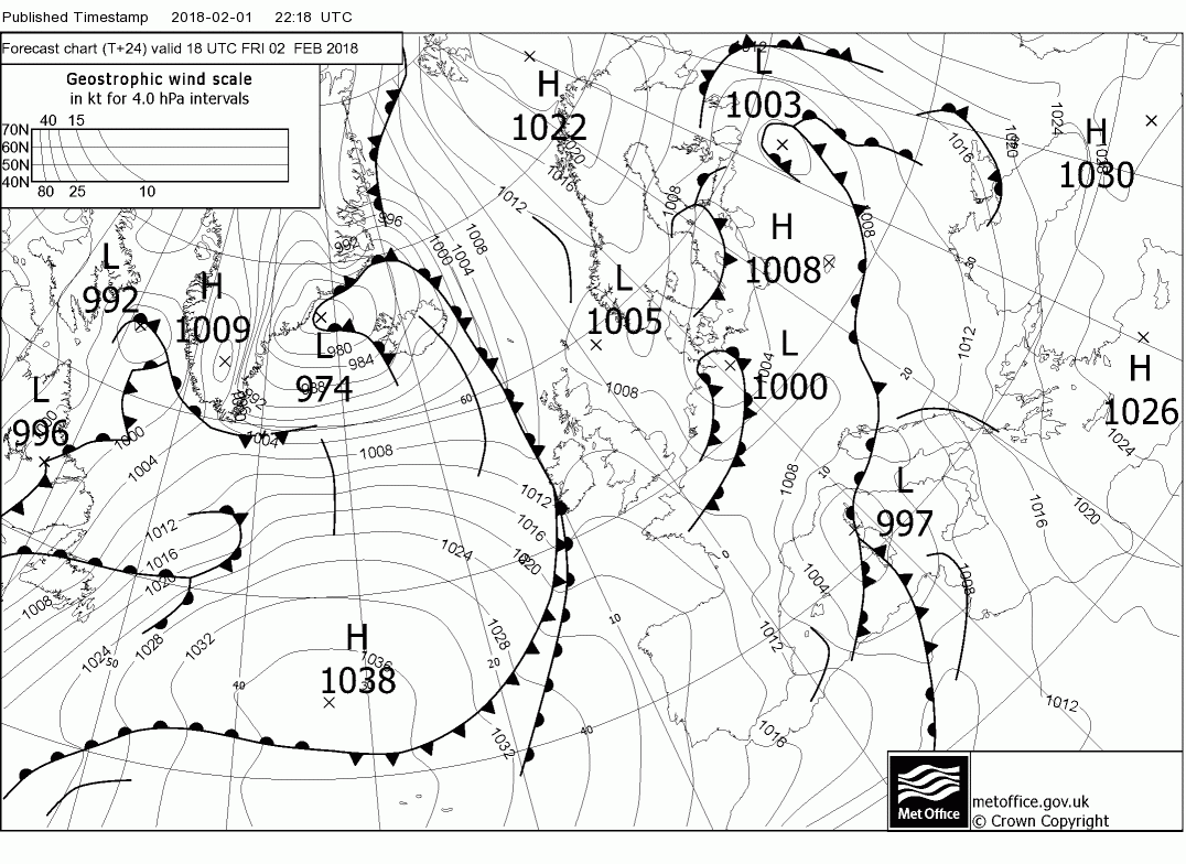
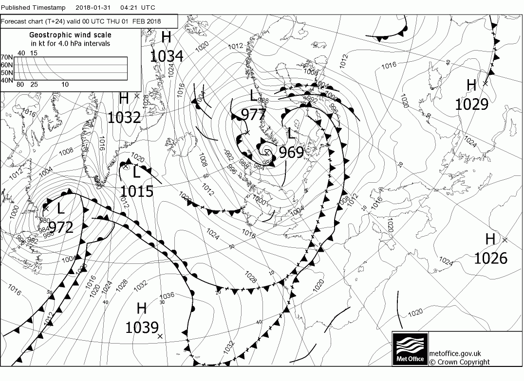
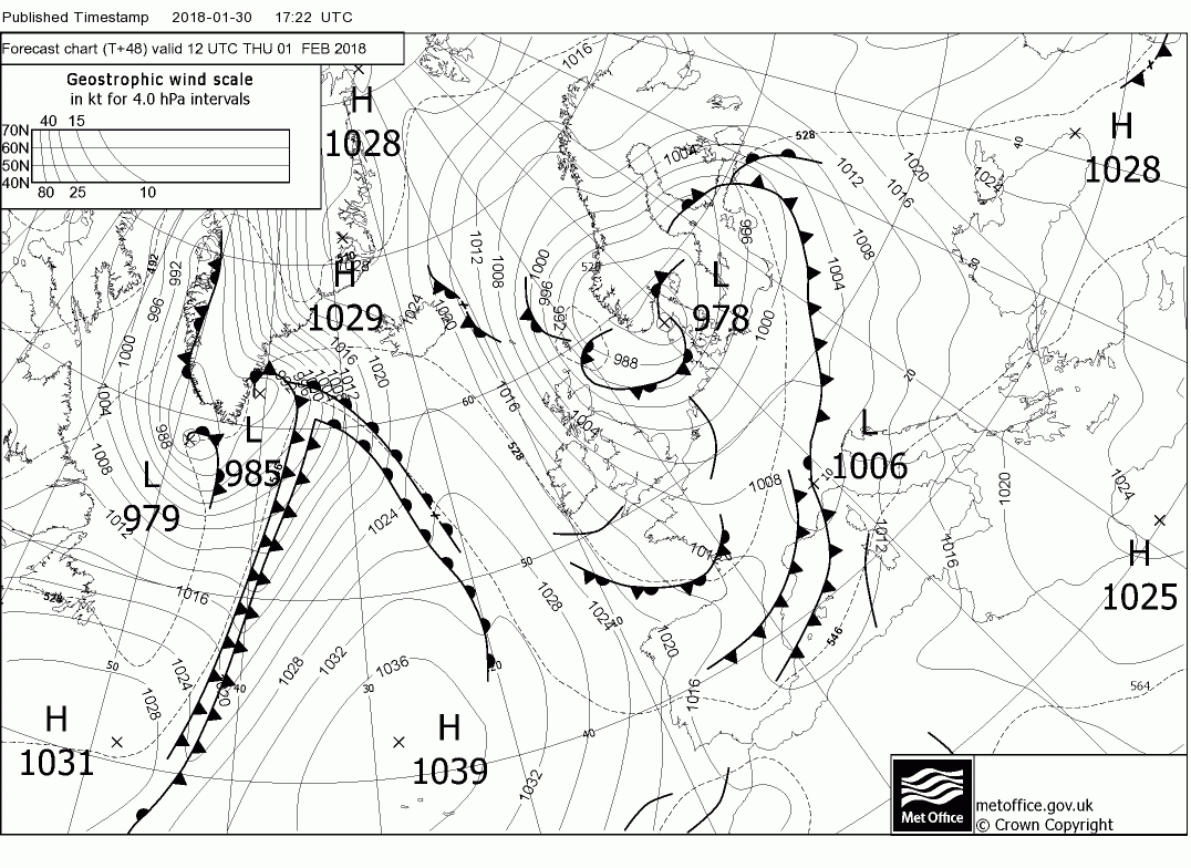
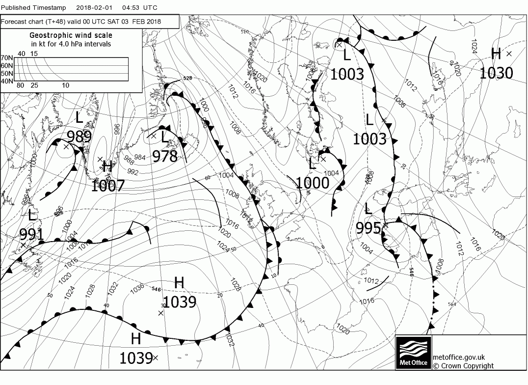
Finally, I thought I'd post the current Met Office FAX chart, produced by a combination of model output and intervention by forecasters using data from various systems which can be found here:
https://www.metoffice.gov.uk/public...#?tab=surfacePressureColour&fcTime=1517313600

https://www.metoffice.gov.uk/public...#?tab=surfacePressureColour&fcTime=1517313600
Last edited:
- Messages
- 2,549
Snow is definitely further East than shown in the precipitation chart. Veering between sun and wintry showers and sodding cold too!
OP
- Messages
- 6,299
- Location
- Norfolk, England
- Thread Starter
- #1,271
As can be seen from the data on the chart, it was s short-range model run from 0600 this morning valid for 1300 hours, so it won't necessarily be 100% accurate. Did the rest of what I posted make any sense? I'm trying to find a site I had saved on my old computer which showed what all the lines etc., on FAX charts represented - if I find it I'll link it here.Snow is definitely further East than shown in the precipitation chart. Veering between sun and wintry showers and sodding cold too!
OP
- Messages
- 6,299
- Location
- Norfolk, England
- Thread Starter
- #1,272
I can't find it for now, but here's a video from the Met Office explaining the version of the synoptic chart I linked to earlier:
Last edited:
OP
- Messages
- 6,299
- Location
- Norfolk, England
- Thread Starter
- #1,273
Further thoughts from our Camborne ex-Met Office chap:
The wintry showers will continue overnight and into tomorrow but become mainly concentrated in the north and western coastal areas as the wind veers northerly as the low drifts down the North Sea and the Azores ridges to the west. Still windy in the north but abating later.
Friday not a bad day after a frosty start with sunshine and light winds as the ridge drifts across. But by late Friday evening the front approaching from the west is already over western Scotland and Ireland. It will move steadily east during Saturday with rain,sleet and snow affecting most areas, It is going to marginal for snow so best left to a later time as it quite possibly could end up being a nowcast in some areas.
Last edited:
- Messages
- 2,549
Didn't get chance to go through it all yet so I can't really say if it all made sense, performance review time at the moment so a bit busy busy. I'll let you know when I've had chance.As can be seen from the data on the chart, it was s short-range model run from 0600 this morning valid for 1300 hours, so it won't necessarily be 100% accurate. Did the rest of what I posted make any sense? I'm trying to find a site I had saved on my old computer which showed what all the lines etc., on FAX charts represented - if I find it I'll link it here.
OP
- Messages
- 6,299
- Location
- Norfolk, England
- Thread Starter
- #1,275
Good luck with your review!Didn't get chance to go through it all yet so I can't really say if it all made sense, performance review time at the moment so a bit busy busy. I'll let you know when I've had chance.
Malcolm's thoughts (my notes in bold):
Today a low north east of Scotland will drift south and be 982mb in the Denmark area by 1800. Thus the UK in a strong NW/NNW airstream, perhaps gales force in exposed areas in the north and accompanied by squally wintry showers, of snow on the high ground in the north, which will be mainly confined to to western coastal areas. These will continue through the night and also affect eastern coasts as the surface veers northerly. Elsewhere it will be clear with frosts by Friday morning
Tomorrow will probably be the best day for a while with the ridge nudging in from the west and the low continuing to fill over norther Germany most of the UK will be dry and quite sunny and feeling not too bad in the light winds, Any showers confined to the east coast and the south west,
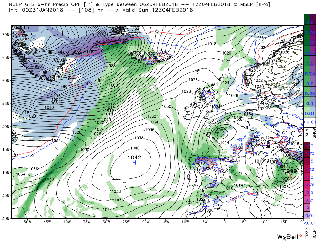
But complications are afoot. The amplification that is taking place with the Azores high pressure ridging strongly north east and the trough to our east dropping south, which incidentally sets up the conduit for the colder air, is temporarily interrupted by a trough driven east by the energy leaving the eastern seaboard resulting in the associated front being over Ireland and just west of Scotland by 00 Saturday.
The front will slowly tracks east but with little waves forming along it it doesn't get that far and by 00 Sunday one such wave has formed a small over low western France and the front has dissipated, The $64, 000 question is will it bring rain or snow on it's travels? Even at this stage difficult to be definitive about this as it's going to be very marginal
Sunday a quieter showery day, albeit quite cold, as the ridge reasserts itself and this renewed amplification produces some very intense thermal gradients with strong WAA (Warm Air Advection, the movement of air parallel to the Earth's suface) into the Arctic east of Iceland and CAA (Cold Air Advection, the movement of cold air parallel to the Earth's surface) down the east of the UK courtesy of the aforementioned conduit. But there is still a huge amount of energy to the west but it must be left here.
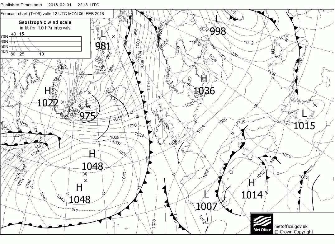
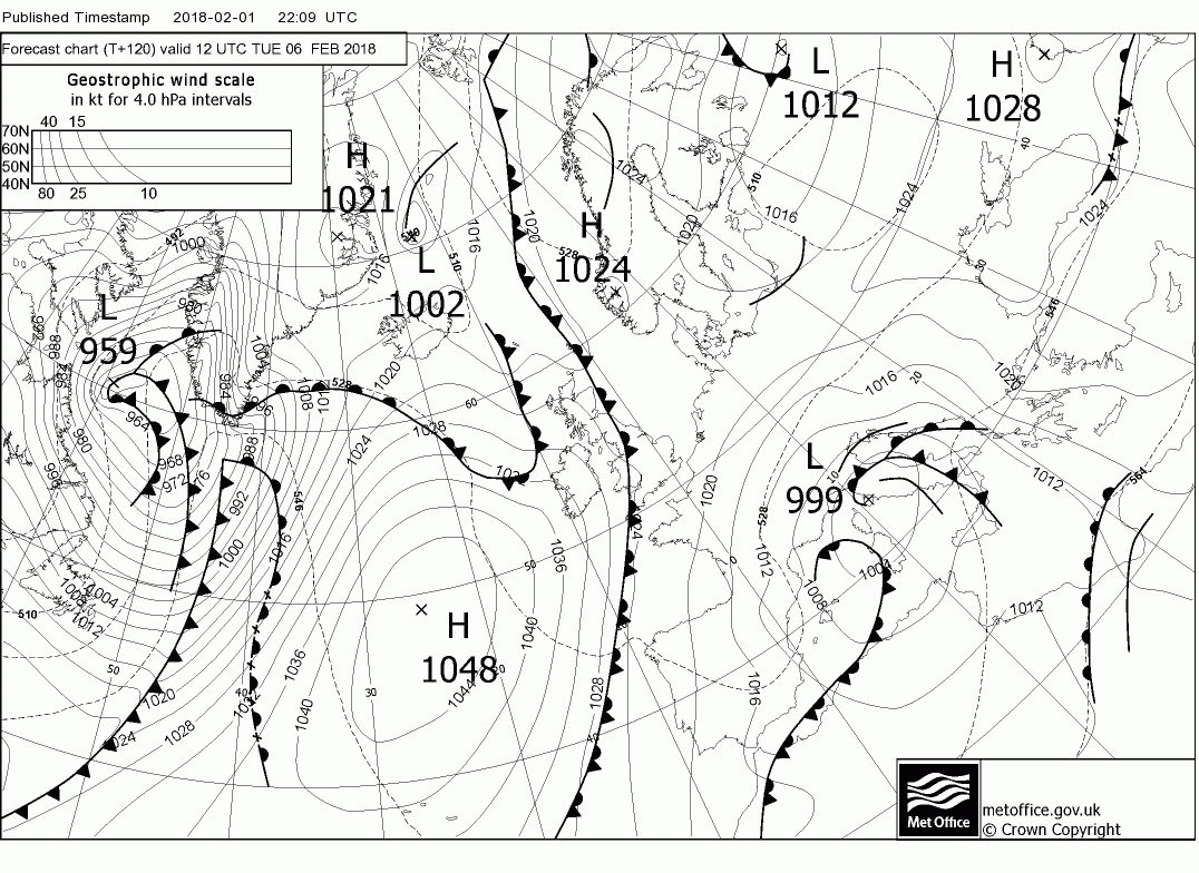
The latest fax reaffirm the front making little eastward progress on Saturday

- Messages
- 17,593
- Location
- Sunny Cornwall
Clear sky's albeit a little cool in the wind, a good start to the month!
- Messages
- 2,549
I'm reviewing my chaps, mine comes later. Some just love the opportunity for a whinge.Good luck with your review!
Malcolm's thoughts (my notes in bold):
OP
- Messages
- 6,299
- Location
- Norfolk, England
- Thread Starter
- #1,278
Ah I see. Don't be too harsh on them!I'm reviewing my chaps, mine comes later. Some just love the opportunity for a whinge.
- Messages
- 2,549
Nah, all sunshine and light me.Ah I see. Don't be too harsh on them!
OP
- Messages
- 6,299
- Location
- Norfolk, England
- Thread Starter
- #1,280
Apologies for the extreme delay in posting today's view - my anxiety has been awful today. Anyway, here are Malcolm's thoughts from this morning:
Today, all things considered, will be quite pleasant for most and after a frosty start in places sunny and light winds will be the order of the day as the transient ridge briefly influences proceedings. Showers will be much less frequent and probably confined to the east coast and the tip of SW Wales and south west England. By early evening the front that is approaching from the west will be along the west coast of Ireland and will move gradually east during the evening bringing some rain to N. Ireland and western Scotland, Wales and Western England
Overnight and through Saturday morning the front will move slowly east bringing patchy rain to Scotland Wales and western England and falling as snow on the higher ground in the north (this is not definitive as it will be marginal in some areas) but the front is starting to fragment as a wave forms on it and the eastern parts of the UK will remain dry. Thus by evening precipitation has largely died out and the shallow wave is over north west France and the southern half of England is a NE surface wind.
Sunday will be dry for most as the Azores ridges north east to the high pressure over Scandinavia but with low pressure to the south of Britain the southern half of England will remain in a fresh NE wind which could produce some wintry showers in the south east. Temps generally in the 3-5C range.
This remains the situation early Monday but by 1200 the next front is approaching NW Ireland and over the next 24 hours it will track south east across the western half of Britain bringing rain sleet and snow. This is going to be another tricky one regarding where and how much snow so no point in me attempting detail at this stage
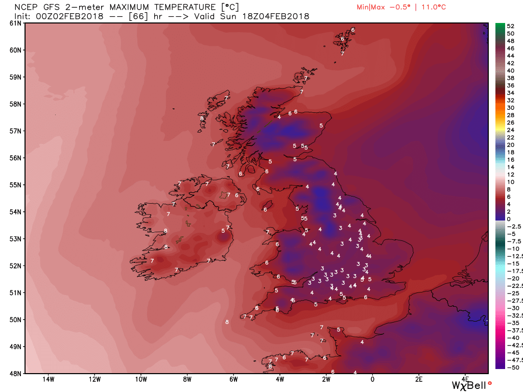
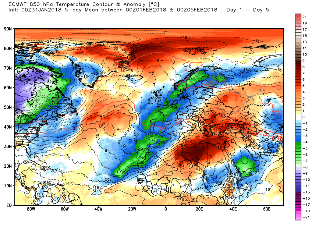
The ecm max temps on Sunday generally in the 4-5C range, 7C in N. ireland.
Monday generally in England 3-4C but 0-2C Wales, northern England and Scotland.
Tuesday 1-3C in England and Wales. 0-2C in Scotland, 3-4C in N/ Ireland and 5c in Camborne. But dew points are very low this where the marginality is evident.