UK meteorology

Beyond the mild and (in the south at least) dry conditions between now and Christmas, the festive period itself and the immediate susequent period appear to be likely to be wet and windy, however, there seems to be increasing evidence that the unseasonable warmth may not last for long once this unsettled period becomes established.
 
I'm struggling with anxiety again, but I thought I'd post this from the Netweather forum as it discusses a newly-emerging possibility in the models forb something colder around Christmas:
Hello

Haven't posted in a while given the model output had been fairly repetitive. However the 06z offers a route to colder weather. An interesting run that could have a lot of potential with a few tweaks.

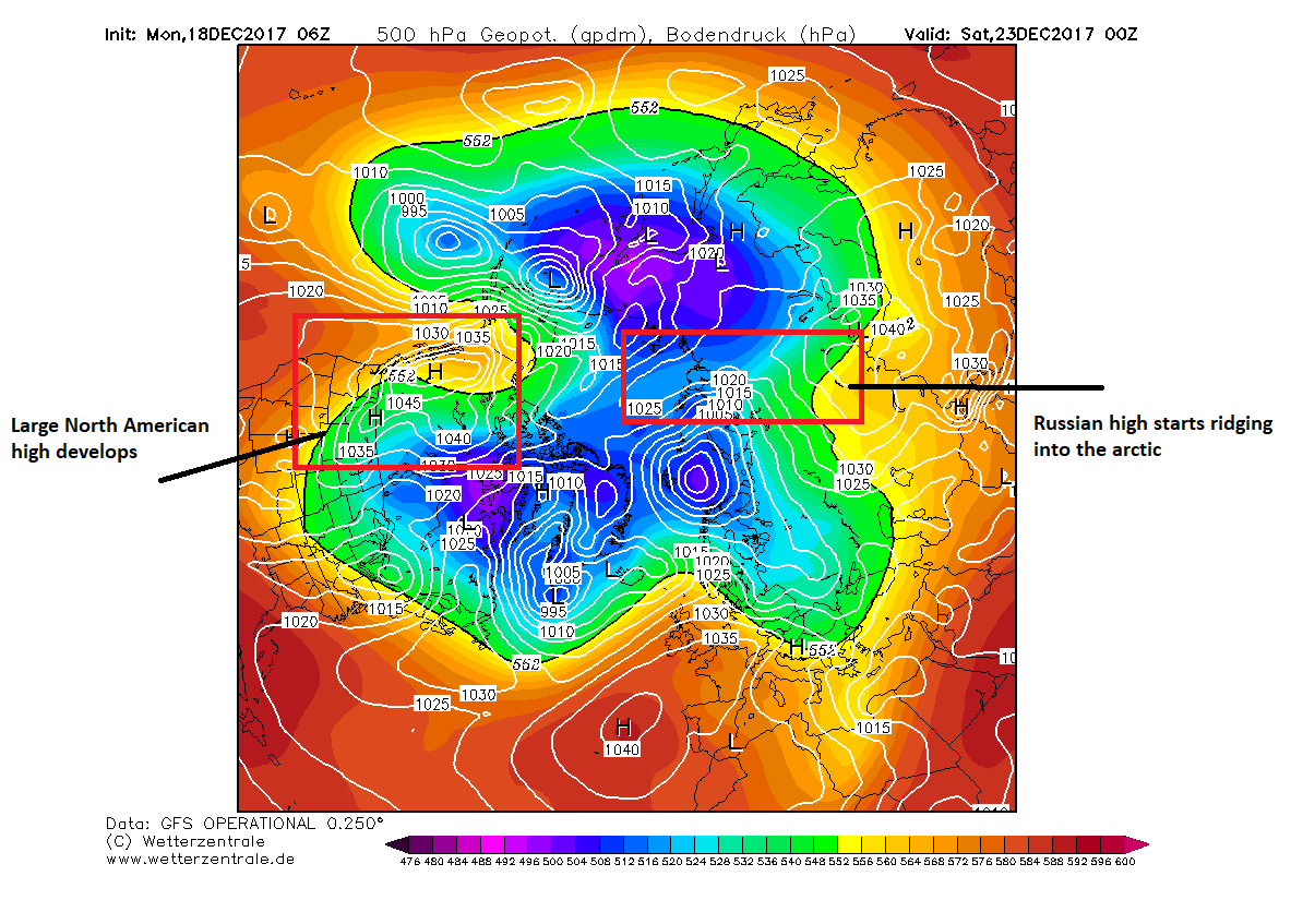
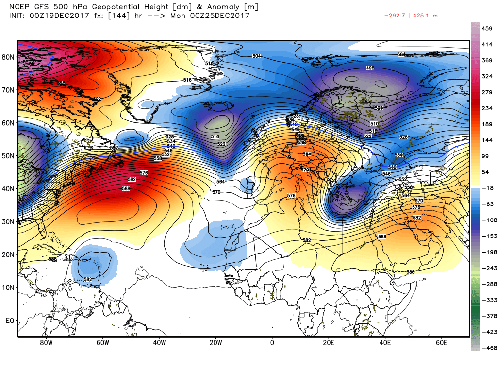
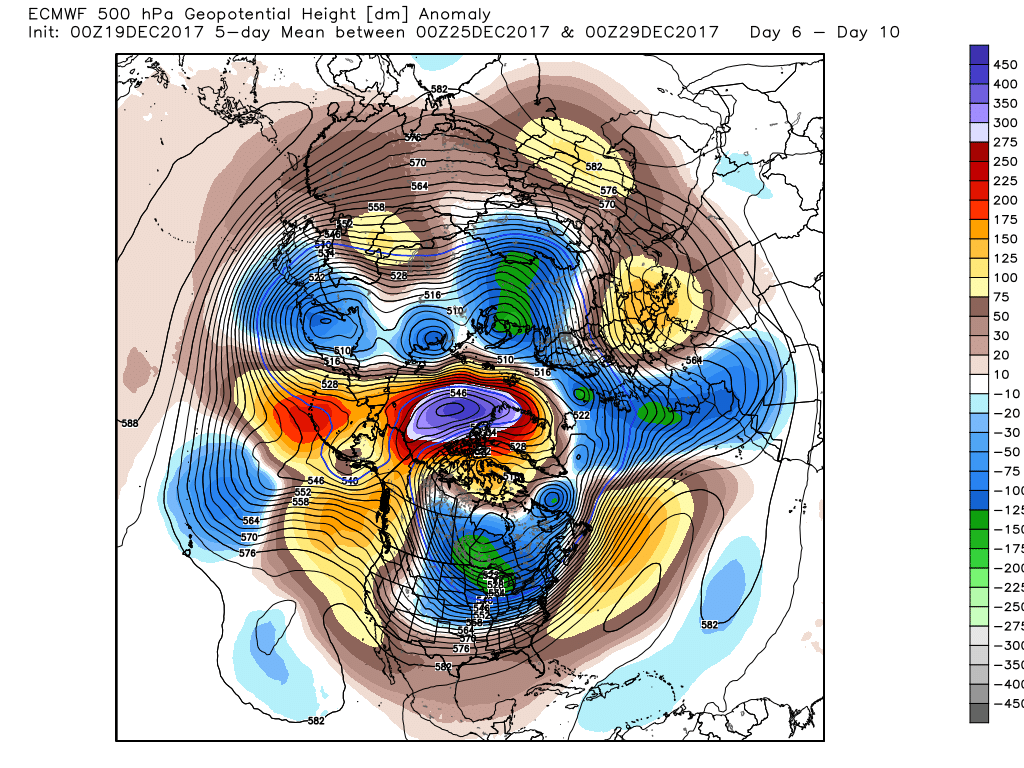
So the thing that has been notable with recent output is the development of a very strong area of high pressure around western Canada. Some recent output has seen some quite remarkable SLP values, with yesterdays 06z seeing SLP values of ~1070mb across NW Canada!

I don't think the high will get that strong but it does look like being quite a powerful anticyclone.

We see its development quite early on after T+96. Here is the view at T+114:


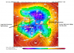
Again situated over NW Canada with a cold plunge over Central and eastern North America looking likely. This may fire up the jet, though a split in the Polar Vortex is still possible if the Russian/Arctic high links up with it.

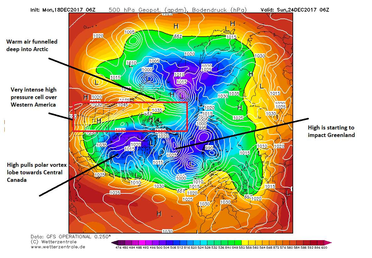
This is shown quite clearly at T144, so the North America high increases even further in its influence.


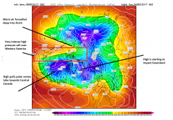
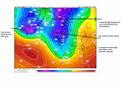
Interestingly the ECM and UKMO offer some support for this. This high starts to have a knock on effect around Greenland.

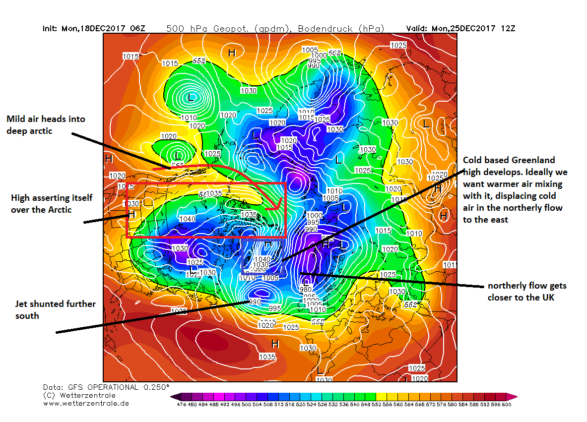
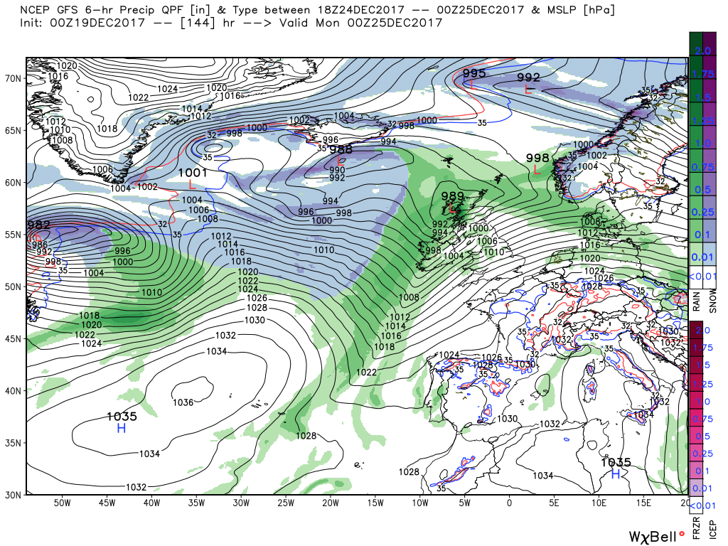
At T174 high pressure starts building around Greenland. Given the cold polar air isn't shifted this becomes a very intense cold based high. The ECM and UKMO are not as bullish on Greenland height rises but in recent weeks I've noticed the GFS has done quite well with it. Transient northerlies have been a persistent theme of this winter so far. So the GFS may be onto something.


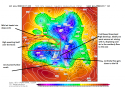
The development of this high helps split the polar vortex. It is now shunted away from the south of Greenland somewhat and is split to our North and over NE North America. This shunts low pressure systems further south.

Cold air starts building to the North but the Greenland high isn't strong enough to keep the cold air moving south over the UK persistently.


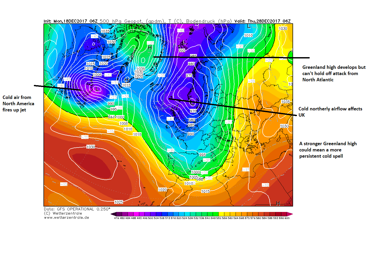
Though this may change. It could be very easy for the warm air being pumped up into the arctic by the North American high to reach Greenland and therefore helping develop a more stable block. Also the GFS after T240 tends to flatten a pattern anyway.

In the end our potential to avoid a euroslug high would be increased if the link up between the arctic high and American high occur with ridging over Greenland.

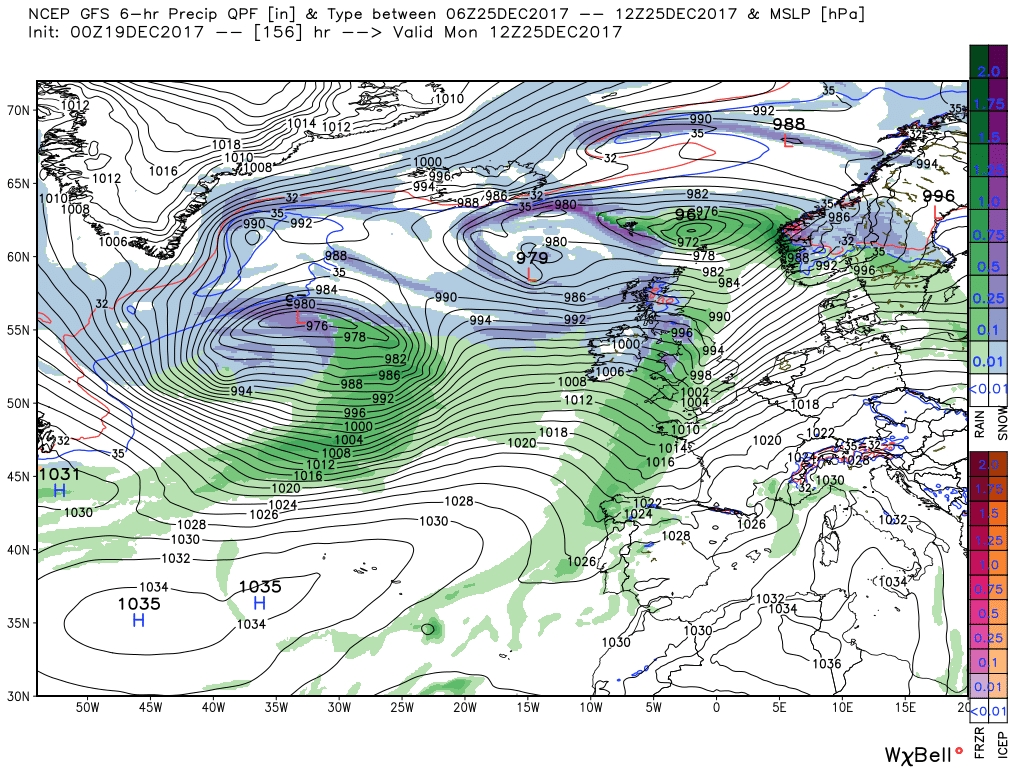
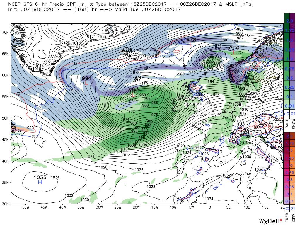
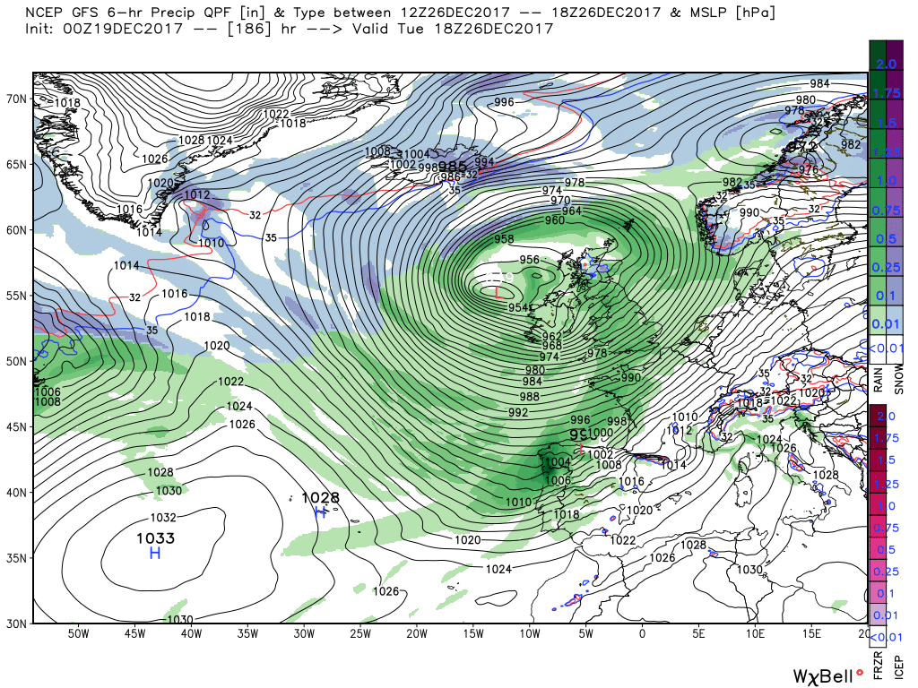
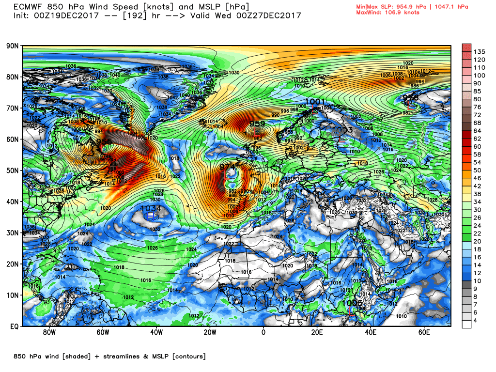
It may not happen but its worth watching. Also some stormy weather on boxing day seems to be a recurring theme…
 
The shock'll take its own time to pass Chris, I've seen it take up to 10 or 11 months to truly hit home when I was doing family liason work after fatal or life changing road traffic incidents. And it may be worse for you because you have experienced serious down periods on occasion.

JohnnyO. o/
I didn't really see much of here of recent years thanks to her declining health and the fact that her home was inaccessible to me in my wheelchair, so I'm not sure I'm going to have that massive hit of sadness. I think just after Christmas will be hard as I always used to call her to thank her for my card, and we used to have a nice chat. I'll miss that more than anything else, I think. Thanks for your thoughts, though.

Back to the weather, the usual Netweather member I quote has reappeard with this post:
A quick run through this evening's ecm.

Thursday 12z sees HP dominating but there is a shallow low to the west of Ireland with an associated weak front straddling the country bringing some sporadic light rain.

This clears the south coast by 12 Friday whilst the jet swings around it via Iceland before dropping south into eastern Europe.

But 24 hours later the energy being emitted from the eastern seaboard is suppressing the high cell and with the jet now just north of Scotland and a frontal wave is skimming the same bringing quite strong winds and some rain to the north

This shallow low tracks quickly east and over the next 24 hours the high continues to hang on in there to the south so that by 12 Sunday the next front is only impacting Scotland as it trails away to the west of Ireland leaving the rest of the UK in a brisk WSW wind with temps a little above average.

But the energy is piling up to the west and by midday on Xmas day the aforementioned front is now orientated down the west coast of the UK as a wave develops on it and has tracked to be just north of Scotland at the same time. The front quickly traverse the country bringing some rain to all areas and veering the strong winds westerly.

This is the cue for the Atlantic to take centre stage so the detail best left.


The overall picture for the end of the run is not dissilar to this morning with the Alaska ridge temporarily displacing the vortex with a strong jet leaving the eastern seaboard with low pressure dominating the eastern Atlantic portending a few unsettled days.
 
This morning's opinion...
Today

With high pressure centred to the south a generally quiet day with light winds and any early morning fog in places will clear most quite quickly, but with a weak front hanging around some areas will turn cloudy with intermittent light rain.

Later as a cold front approaches more persistent rain will push into western Scotland and track south east overnight and through Wednesday, with clearer weather behind whilst most of England and Wales will remain cloudy and quite mild with temps a little above average.


So on to this morning's gfs. During Thursday and Friday the UK remains under the influence of the high pressure centred to the SW/S thus a generally benign couple of days with most places remaining cloudy with temps around normal or a tad above. But by 12 Saturday the trop. vortex lobe has dropped south over central North America under pressure from the Alaskan ridge and the very strong jet running around it and across the Atlantic is beginning to suppress the high over the UK.and a front is orientated from Scotland to the west of Ireland.


Over the next 36 hours the high pressure stands firm to the south under pressure from the east bound energy resulting in a a fairly strong and warm (relatively) south westerly flow over most of the UK with temps maybe touching 13C. Whilst at the same time a wave develops on the slow moving front and deepens and tracks north east to be 989mb over Stornoway by 00 Monday with the front now orientated down the west coast of Ireland/


During Xmas Day it all gets very complicated with a deep and complex upper trough over the eastern Atlantic initiating explosive cyclogenesis as the aforementioned low 'bombs' as it continues to track north east whilst another deep depression approaches from the west. All of this would portend a very wet and windy Xmas Day


By late Tuesday the next deep depression duly arrives to the NW bringing more rain and gales but this is best left here as I'm sure the detail of all of this will be subject to much revision although a very unsettled period is certainly the percentage play at the moment.


Predictable the ecm is not copying the complex, apocalyptic, scenario of the gfs next weekend and after although it is also very unsettled and very windy at times

It does have a trailing front impacting western Scotland by 12 Saturday and then tracks a shallow frontal wave ENE overt the next 24 hours to impact the same area by 12 Sunday whilst the rest of the UK is under a brisk, quite moist westerly airstream.

By midday on Xmas Day the front and another developing wave are over Ireland with the surface wind backing south west. By midnight the wave and front with associated rain have pushed east over the UK

By 12 Tuesday the wave has continued to deepen as it tracks north east and another deep depression is approaches the south west. All of this under the auspices of a complex upper low that covers the eastern Atlantic and the UK


Shame, I actually got a pretty good view of the Orion Nebula through the binoculars and was hoping to get the telescope out later in the week.
Unfortunately, the temperature inversion and resultant cloud isn't likely to clear until stormier conditions arrive around Christmas. It's the sort of weather I hate at this time of year - damp, grey and gloomy but without the interest or invigorating effects of strong winds or even heavy rain.
 
Interesting an, thankfully, short post on Netweather:
In projected mobile periods always worth keeping an eye on the jetstream, and the latest forecasts are for it to trend south next week, so whilst unsettled looks the theme it could be a cold unsettled spell, at least in the north increasing chances of some wintry precipitation to low levels at times with frost, further south more average conditions. Indeed secondary low, and sudden trough development looks likely to happen, making forecasting each day ahead quite difficult, timing of fronts and low pressure and path not easy to forecast. I too am not expecting a particularly stormy spell, windy yes, but nothing remarkable, jet will have some oomph but the wind will be taken out of it so to speak.

Until Christmas Day - one of those miserable murky grey descents into christmas, that has plagued the UK for the seventh year in a row now, maybe next year will bring something different, very very uninspiring, but at least nothing to interfere with pre-christmas travels.

ECM showing a arctic high developing next week thanks to pacific ridging, UKMO going for a more NW influence for christmas day, and GFS trending colder once we get to christmas day.
 
Boxing day is always stormy in Glasgow ... oh, and the weather is often fairly wild also.
JohnnyO. o/
LOL! I wouldn't have suggested that as I'd have been concerned that I'd be accused of being a racist Sassenach!
Just thought I'd post the following short comment from NW's senior forecaster:
Quite seismic differences between EC and GFS at only t+144: with EC making a lot more of the -EPO ridge across the arctic into Greenland by raising heights here.

EC seems to be the first model to perhaps start to truly grasp the effects of the highly anomalous -EPO ridge and wave breaking on the height fields over the arctic, but will it be sustainable height rises over Greenland? Perhaps we really can't trust models past t+144. Interesting times ahead if this is a start of a new trend to see cross polar ridging effecting the height fields over Greenland, but not totally unexpected by some of us on here.

What this means is that, as 144 hours out from this morning, the output from the main deterministic US and European models differed in the extent of the ridge generated by a predicted negative phase of the Eastern Pacific Oscillation (EPO). If high pressure is able to ridge from the North Pacific across the Pole and into Greenland, it seems likely to divide the Polar Vortex and encourage blocking in the mid- to upper latitiudes, which would, in turn, increase the chances/risk of cold conditions in Western Europe due to the Jet being distorted and the Atlantic flow weakening. Here's a link that descrbes the EPO:
https://www.theweathernetwork.com/news/articles/epo-what-you-need-to-know/43796/0
 
Last edited:
Back
Top Bottom