- Messages
- 17,593
- Location
- Sunny Cornwall
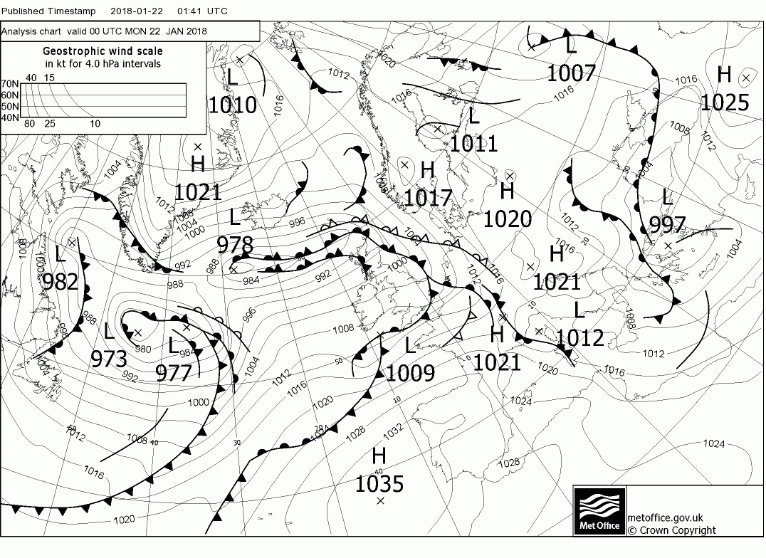
Well you was spot on about the rain last night Chris, proper heavy and lasted all night, the river 100mtrs behind the cottage was looking dangerously high this morning when I walked Taz, but the rain has stopped for now, thankfully! ") P.
P.
P.