OP
- Joined
- Saturday January 15, 2011
- Location
- Norfolk, England
- Thread Starter
- #1,489
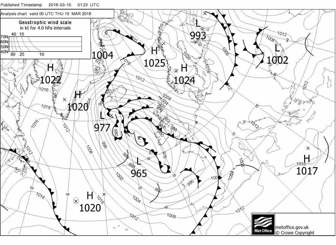
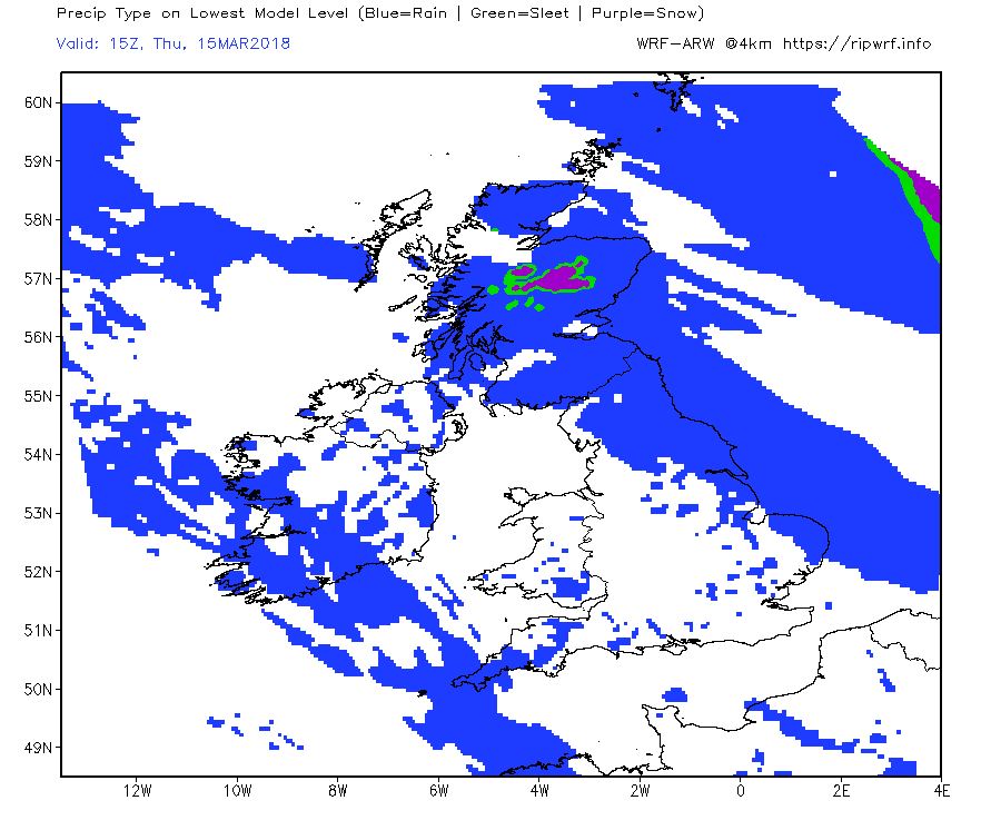
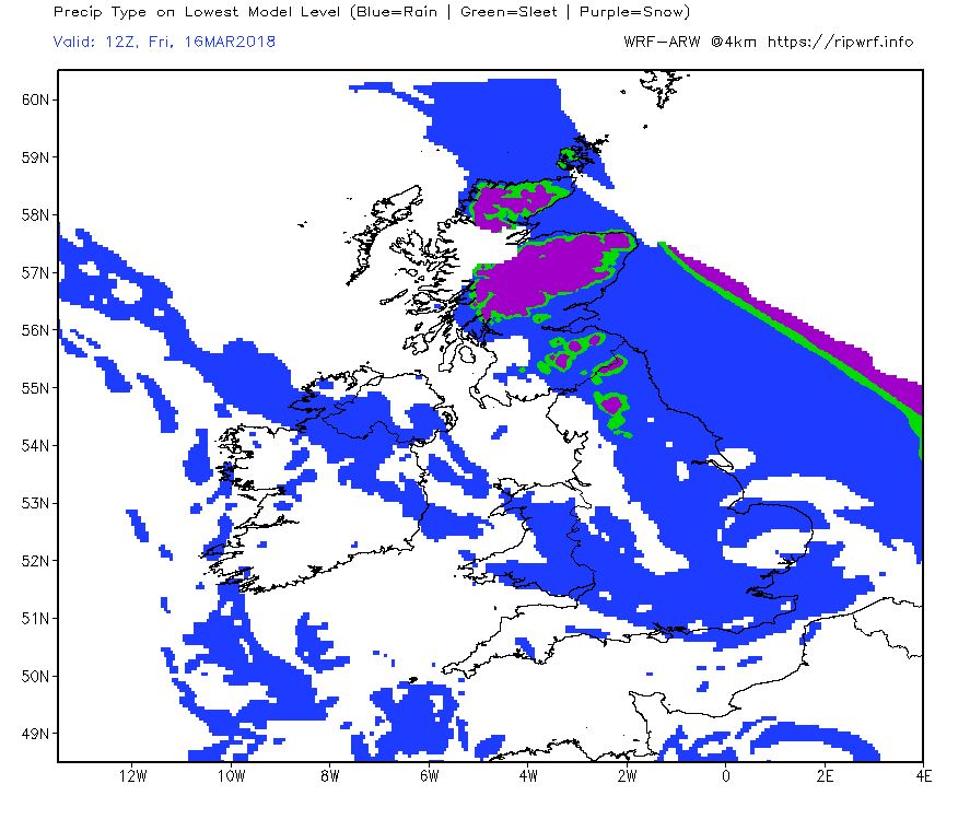
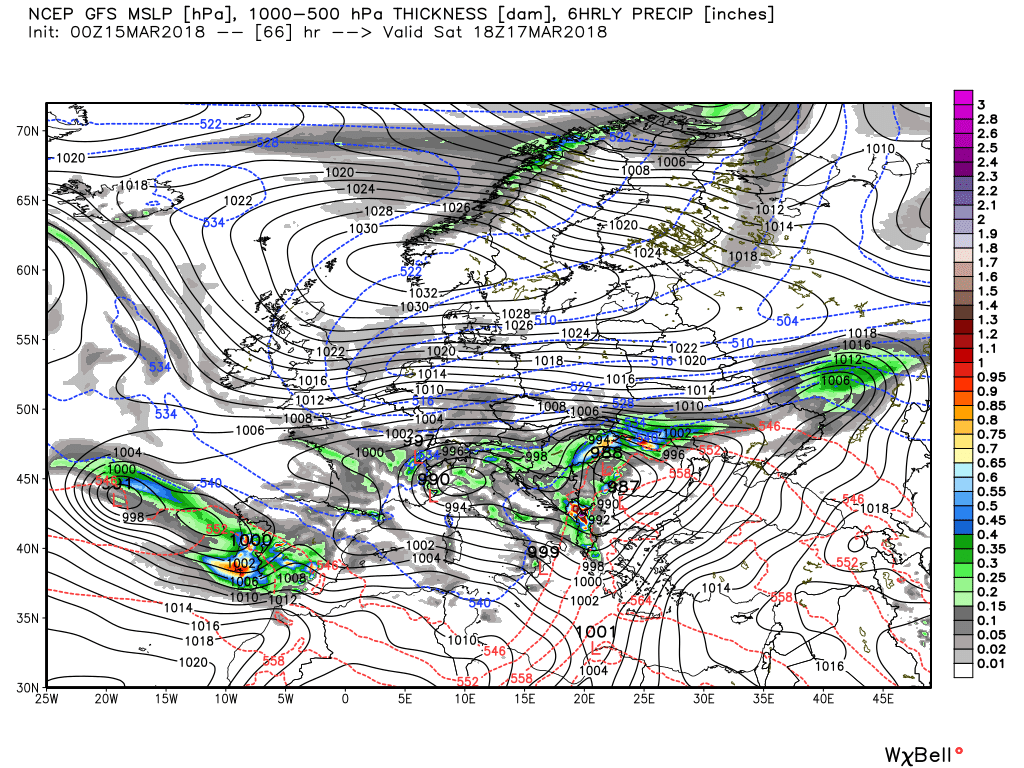
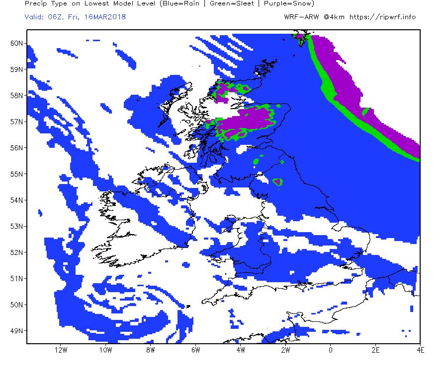
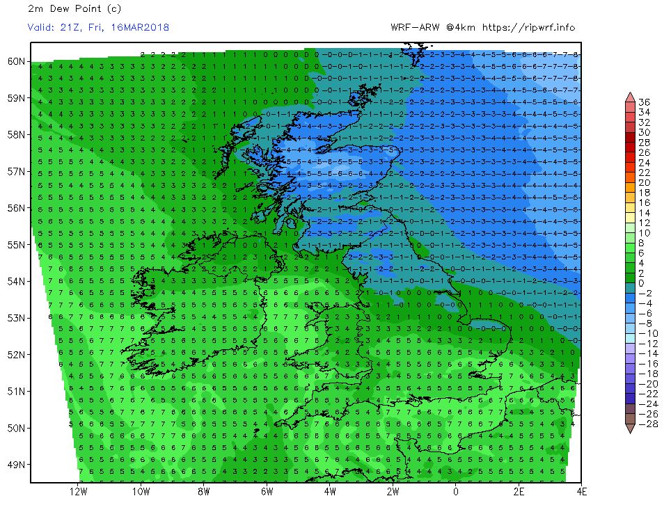
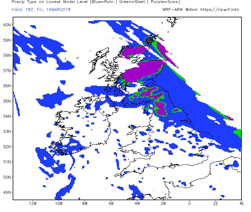
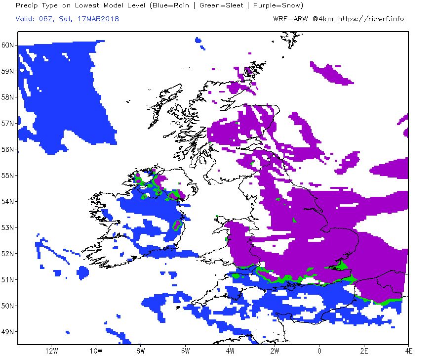
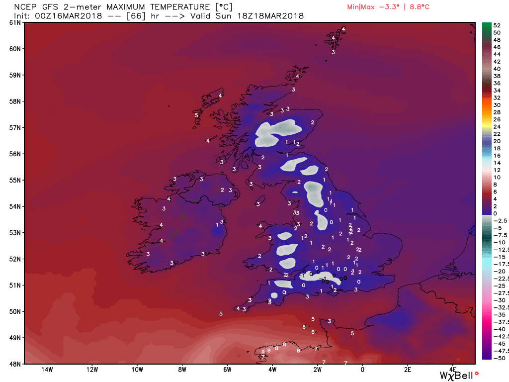
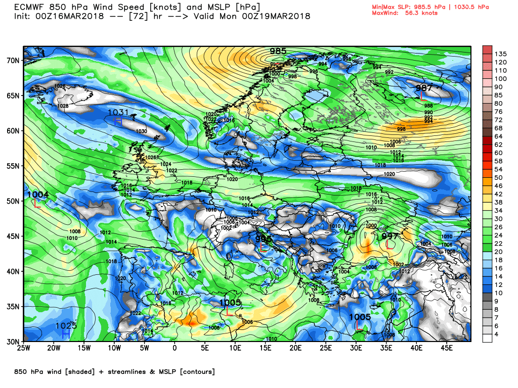
This morning's post from Malcolm:
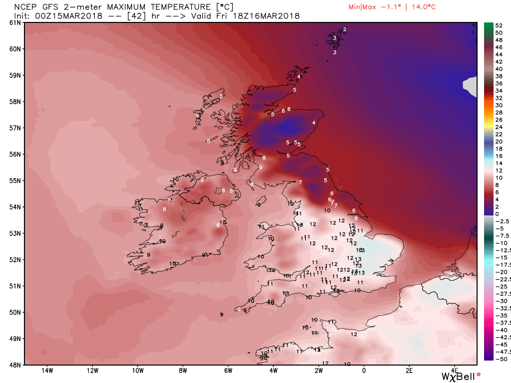
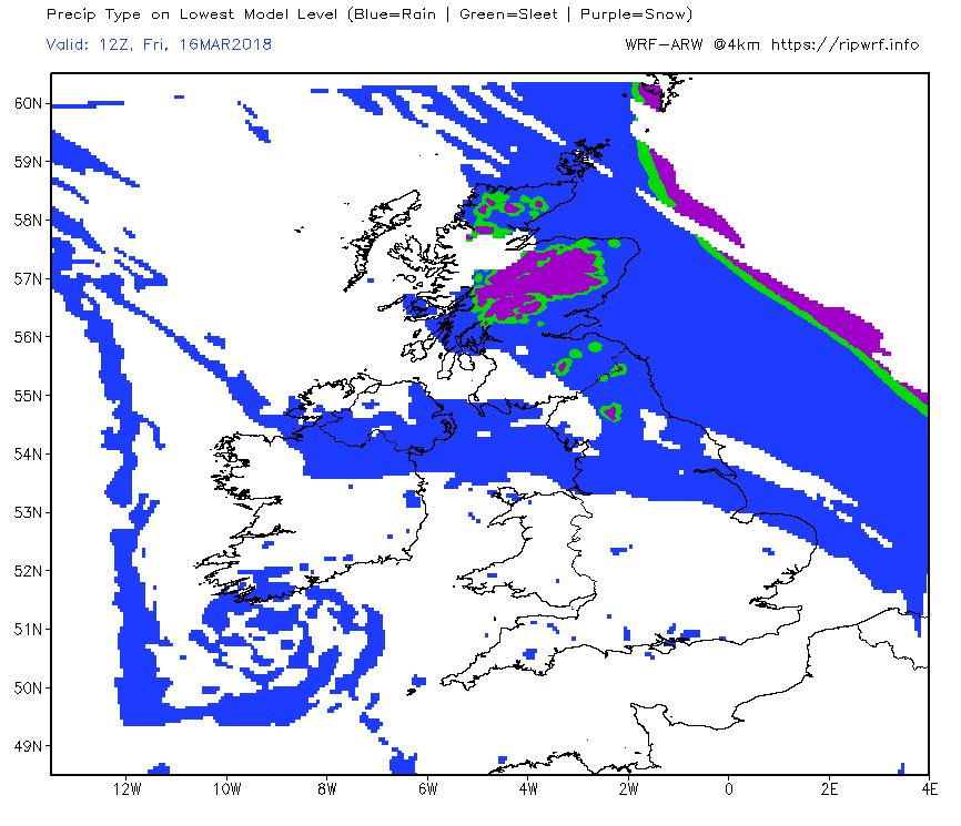
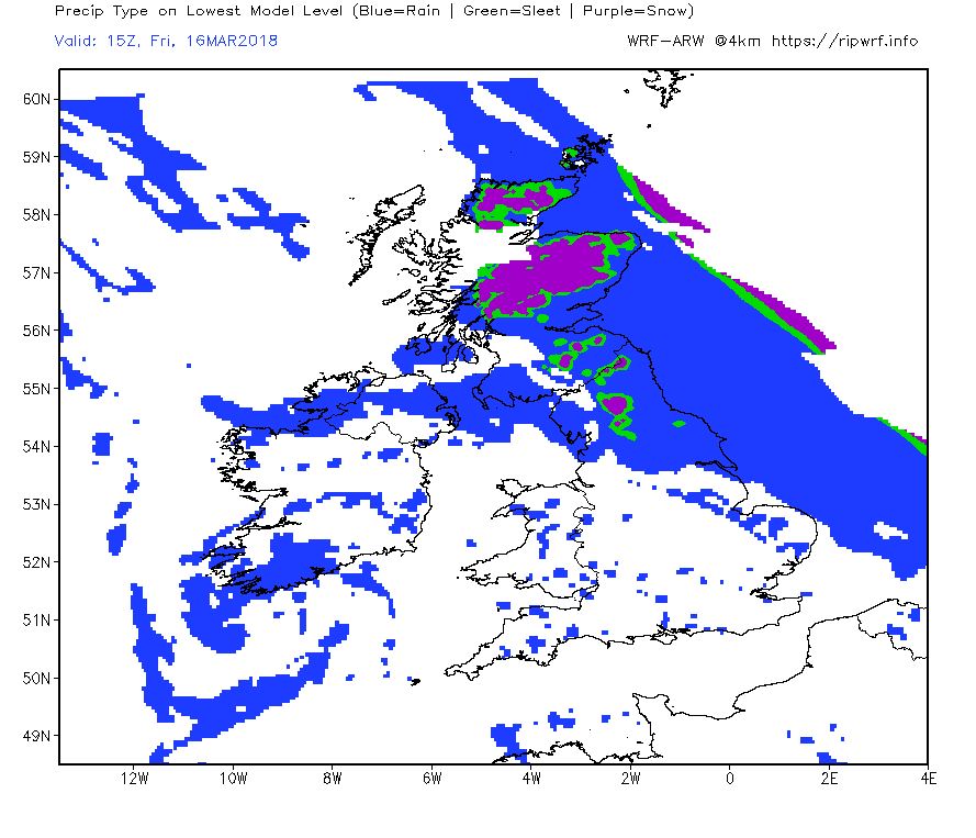
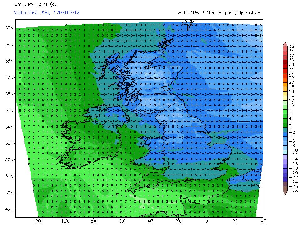
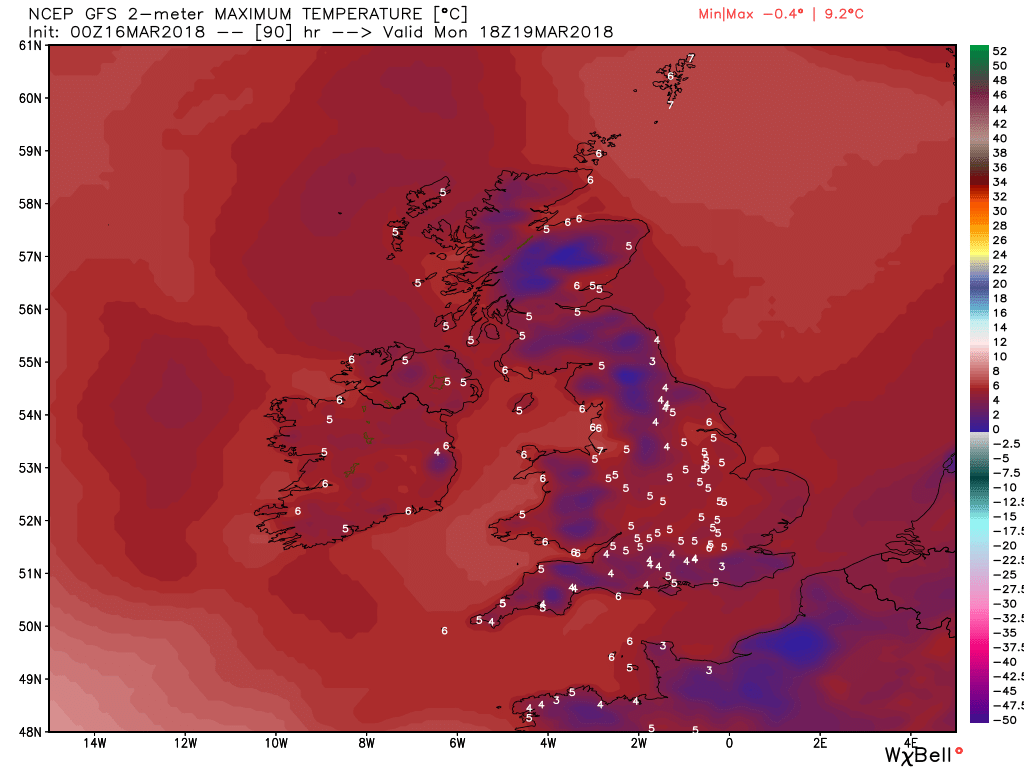
The front and rain will continue to track north east through today leaving sunny intervals and the odd shower in it's wake. The rain will fall as snow on the high ground in northern and eastern Scotland where it will become increasingly windy. Later in the day another belt of rain will affect the south west and also track north east. Temps continuing above average in most of England and Wales but cooler in the north and Scotland.
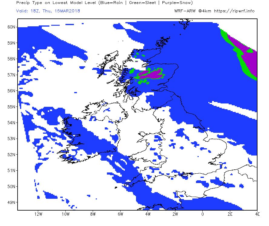
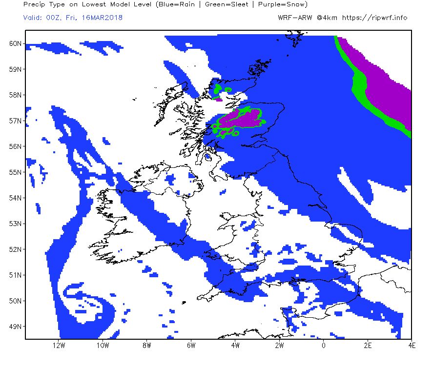
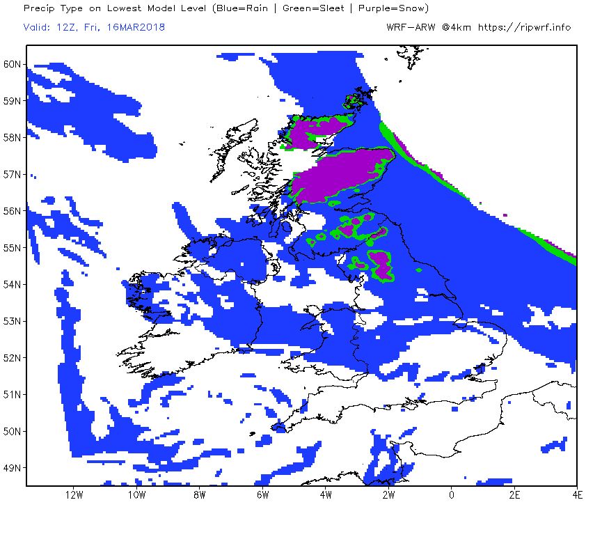
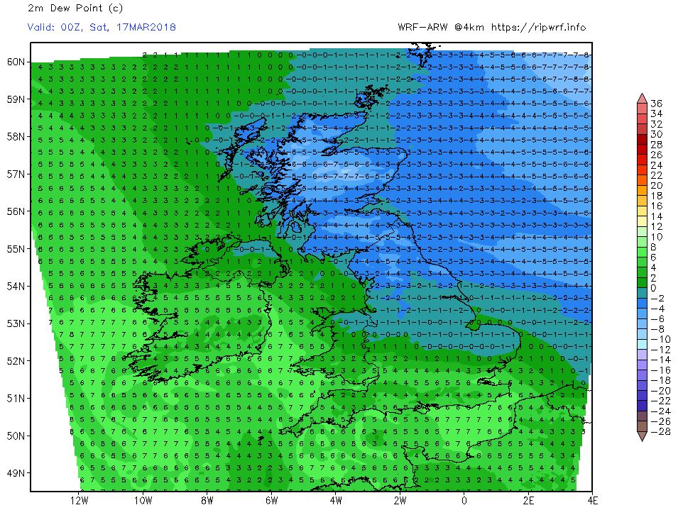
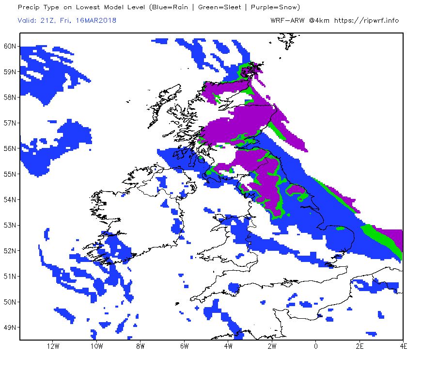
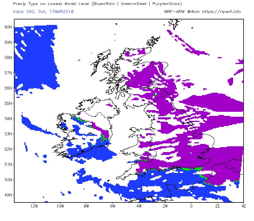
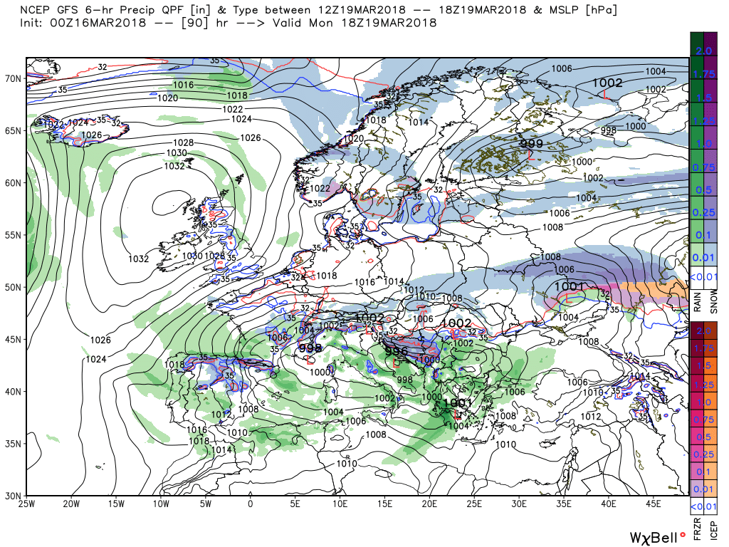
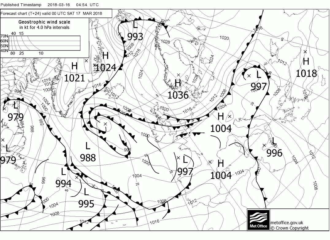
Through tonight and into Friday the wet and windy weather will continue in the north east and Scotland where accumulations of snow on the higher ground are likely whilst elsewhere sunny intervals but perhaps frequent heavy showers around the aforementioned belt tracking north east. Still temps holding up in the south but quite a N/S gradient and by 1800 the withchimg hour is upon us with a front approaching the north east coast preceding the colder air behind which is about to track south west.
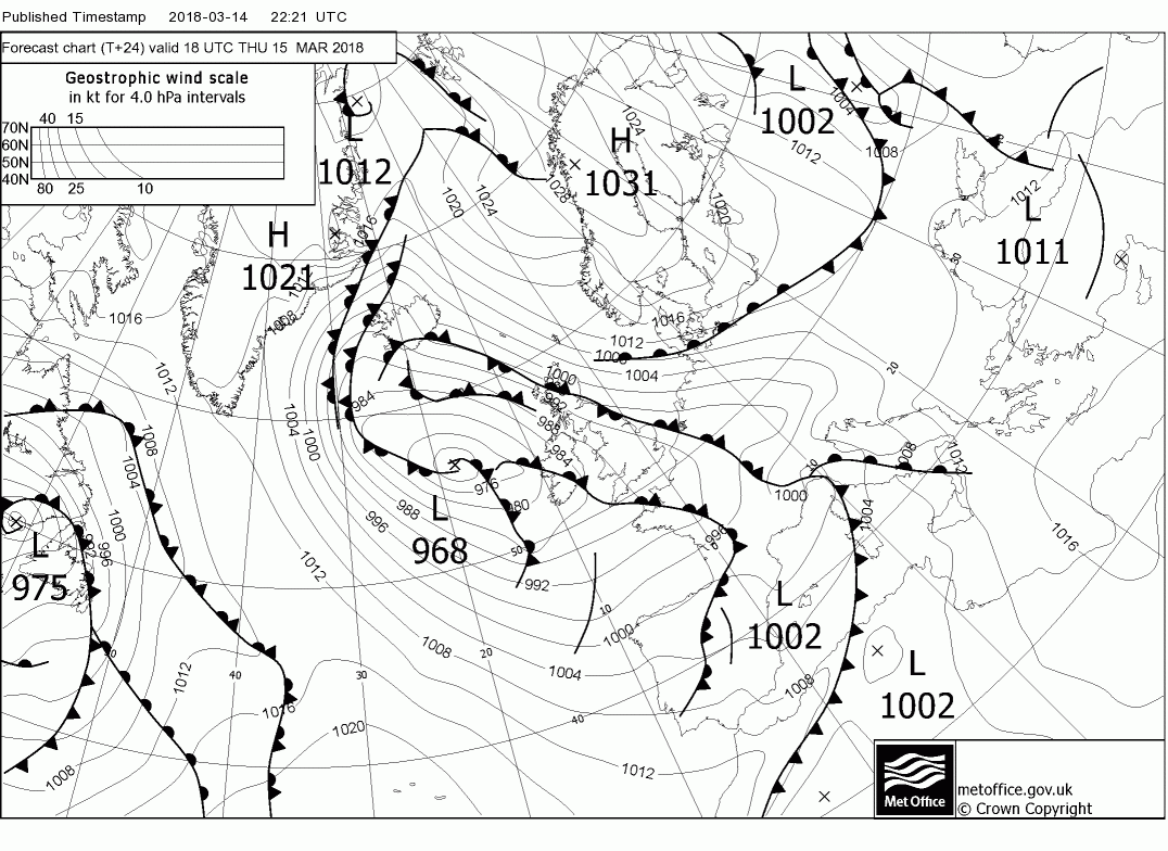
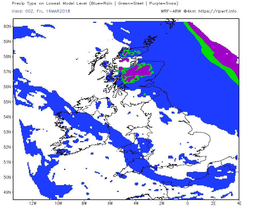
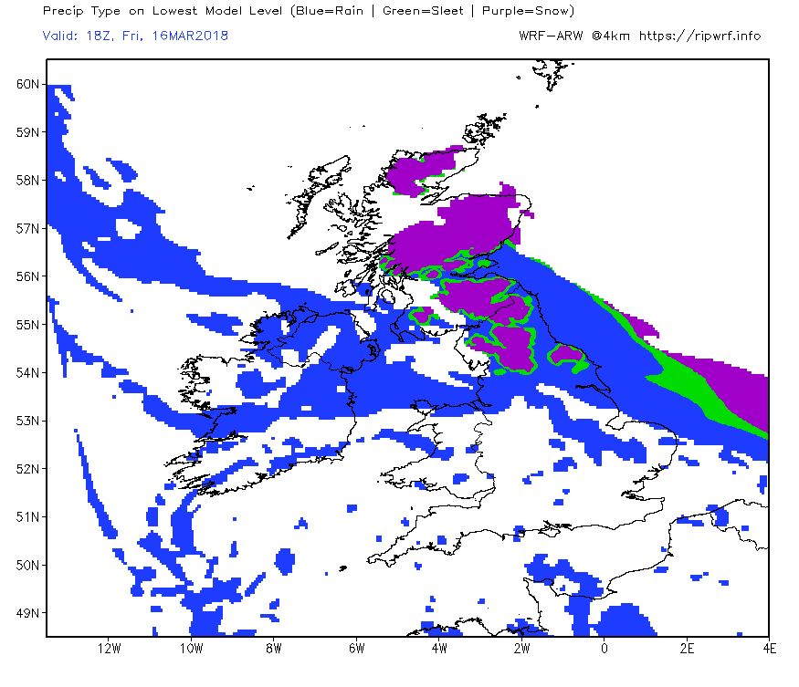
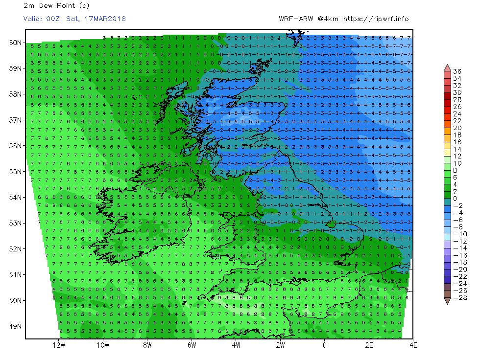
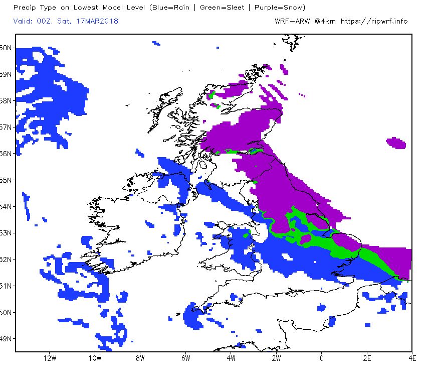
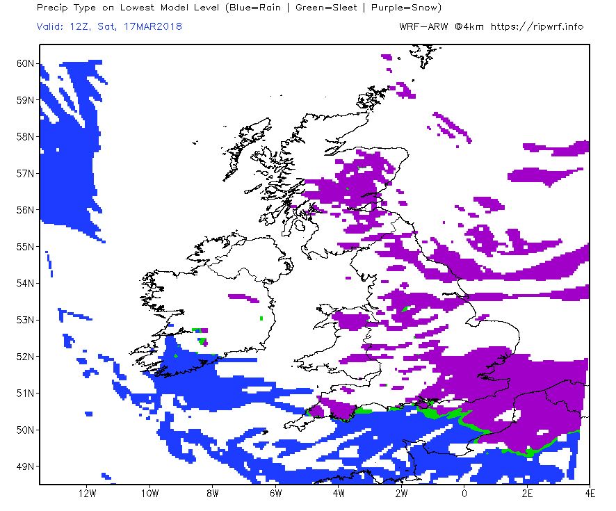
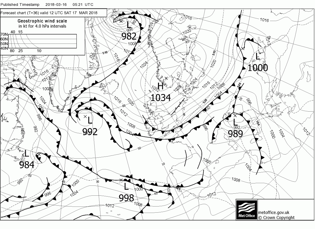
Over the next 12 hours the front does travel south west perhaps accompanied by light snow in places and clearing by early morning which then establishes a very cold and quite strong easterly wind over all of the UK with snow showers in the east.
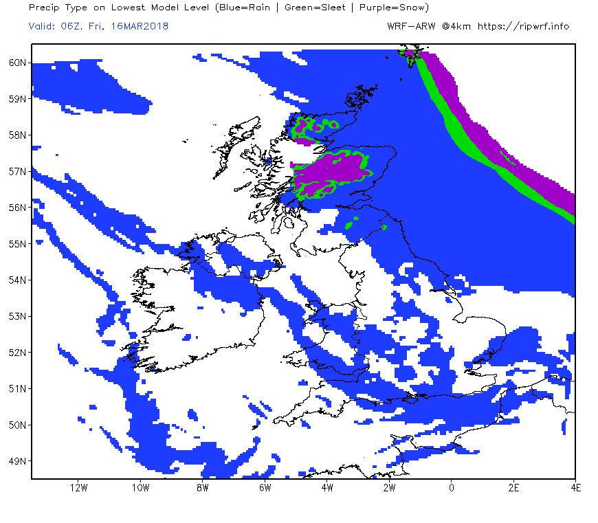
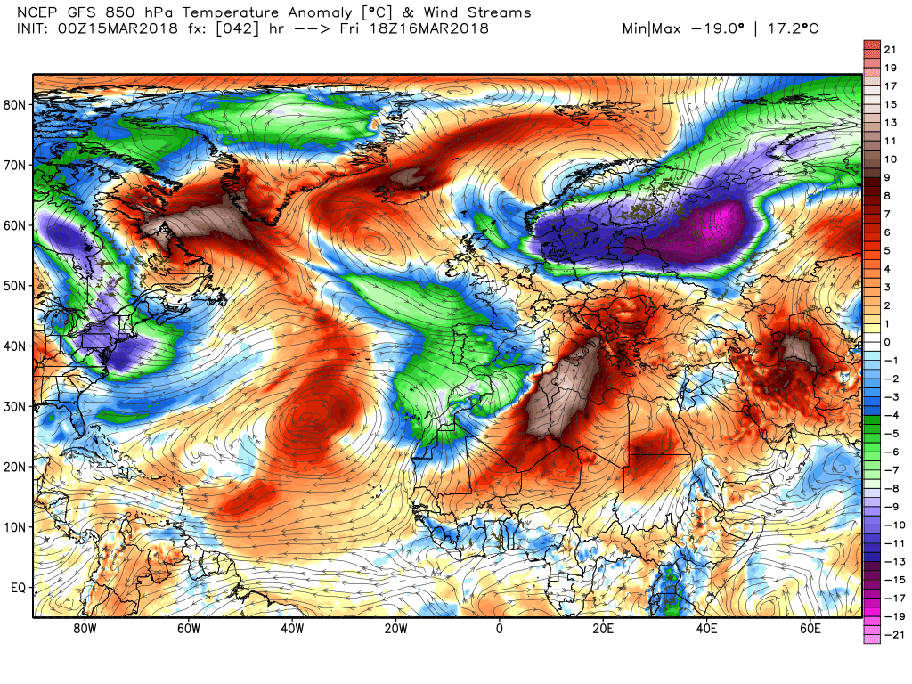
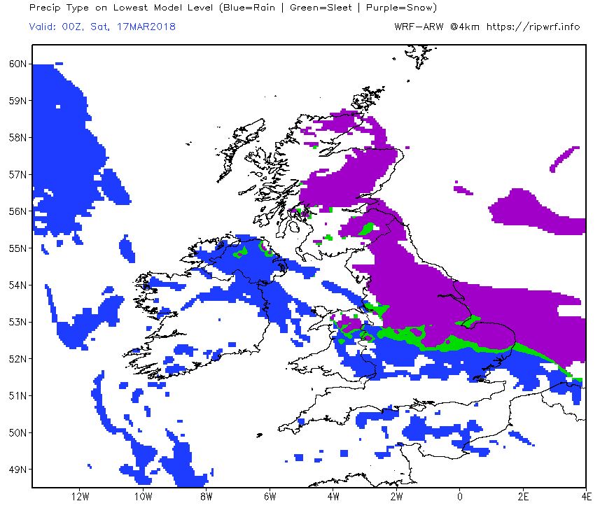
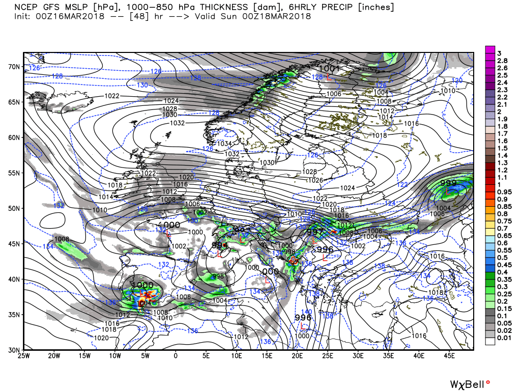
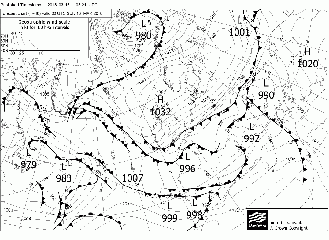
This scenario quickly becomes more complicated over the next 12 hours with the arrival of the upper low from the east to be over northern France accompanied by a cold pool. So now we have the continuation of the showers further north ingressing inland but also snow moving west from Kent along the Channel coast. Fine lines here and the detail certainly not set in stone at the moment,
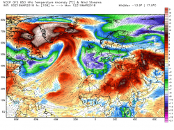
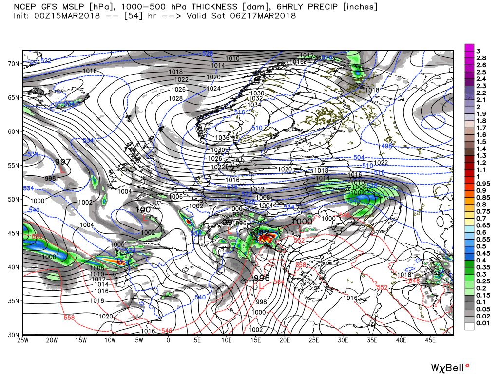
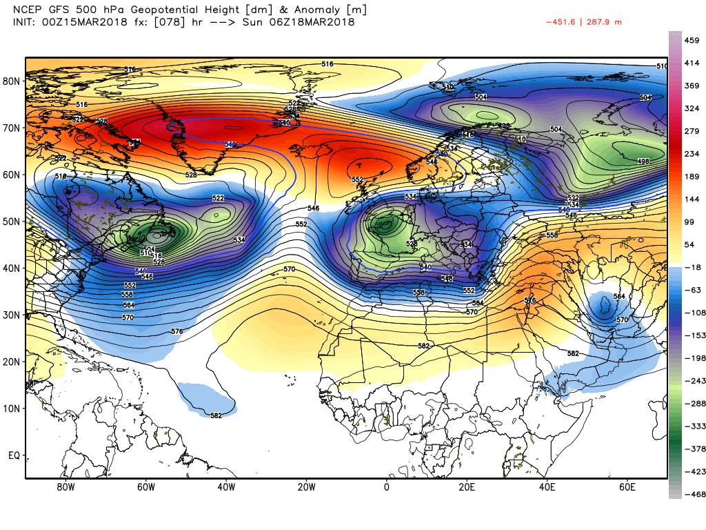
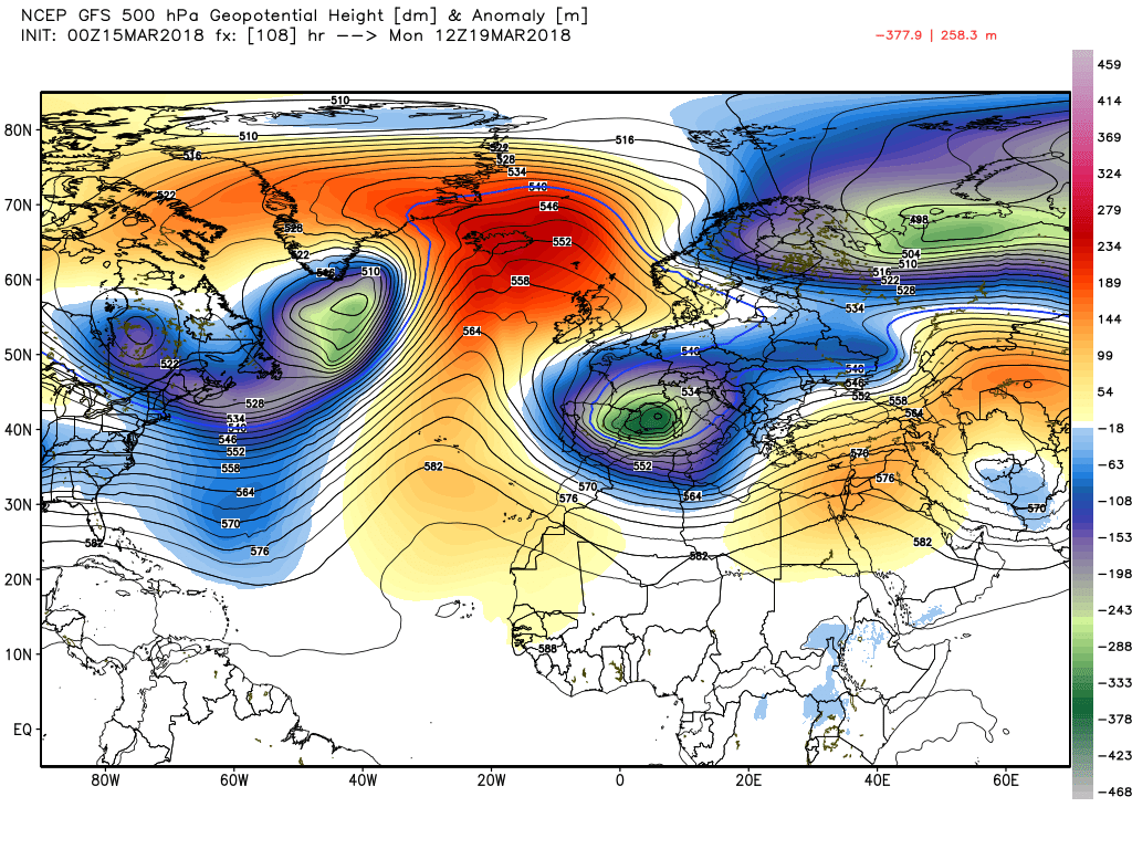
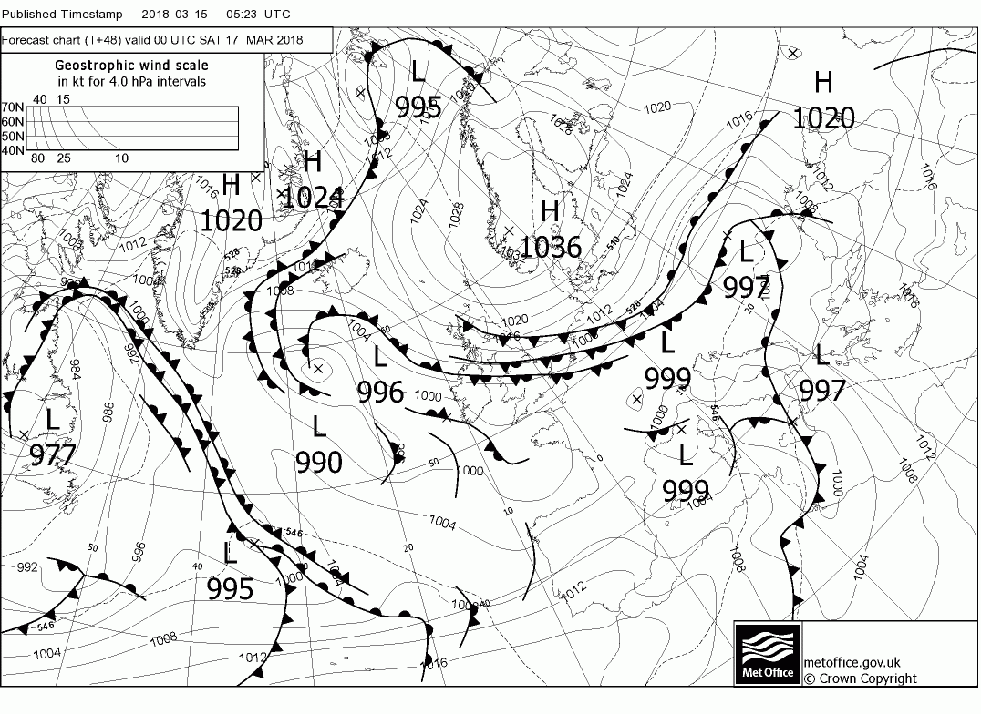
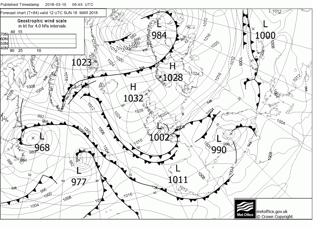
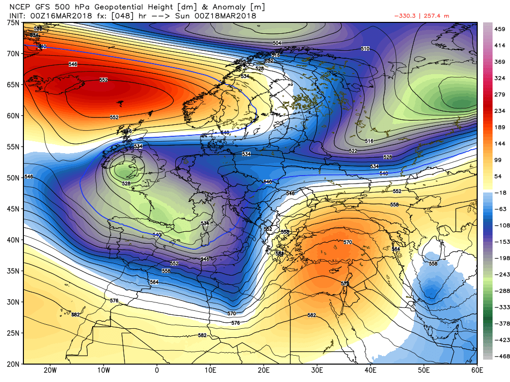
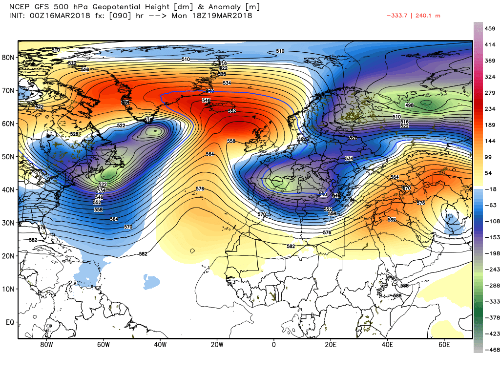
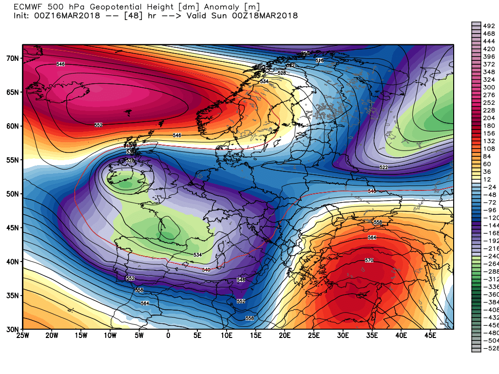
As can be seen from the last chart the Azores is starting to ridge in the west towards the high cell and this continues into Monday shunting the very cold air south, note the WAA into Iceland and Greenland but there we must leave it.