OP
- Joined
- Saturday January 15, 2011
- Location
- Norfolk, England
- Thread Starter
- #1,441
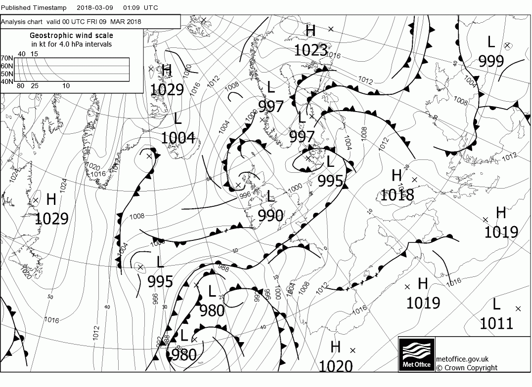
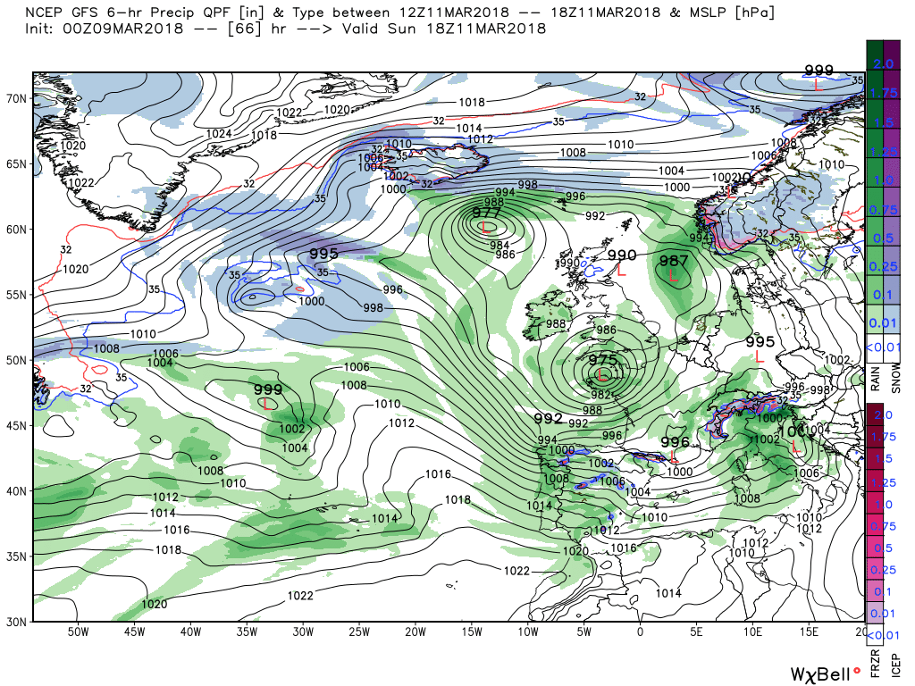
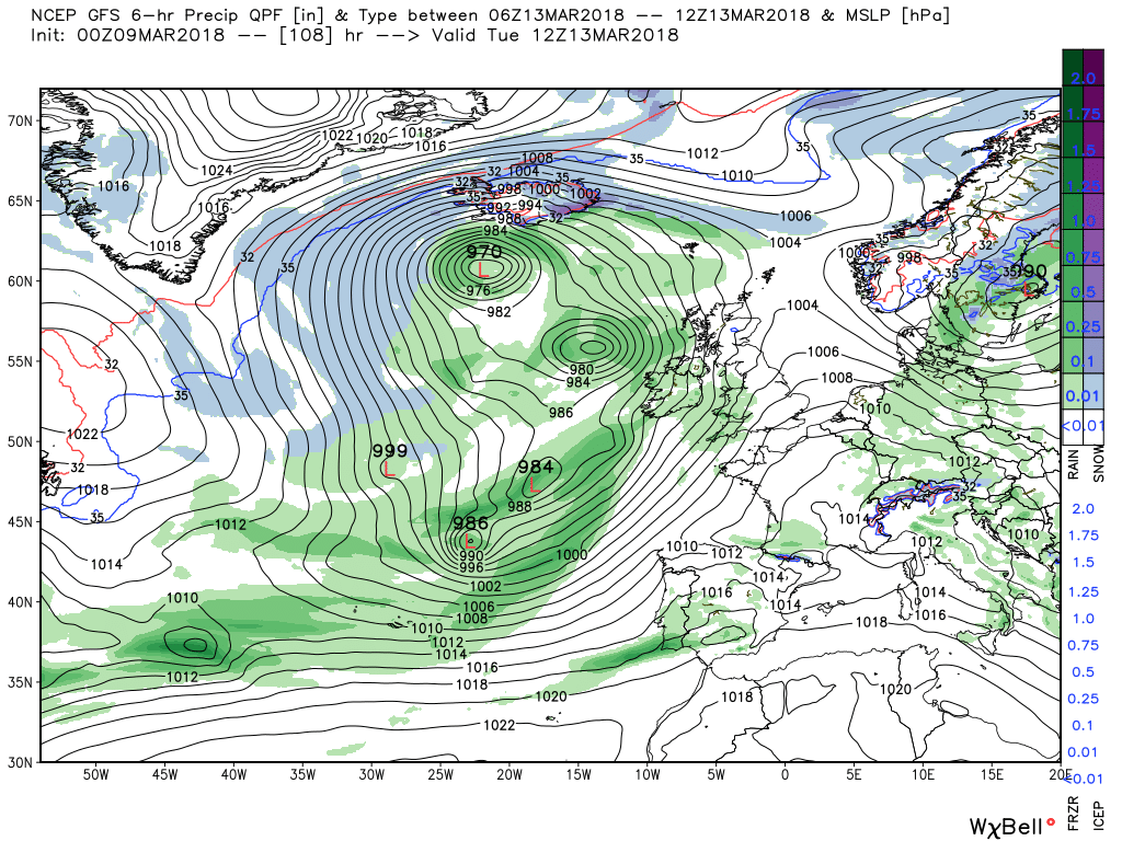
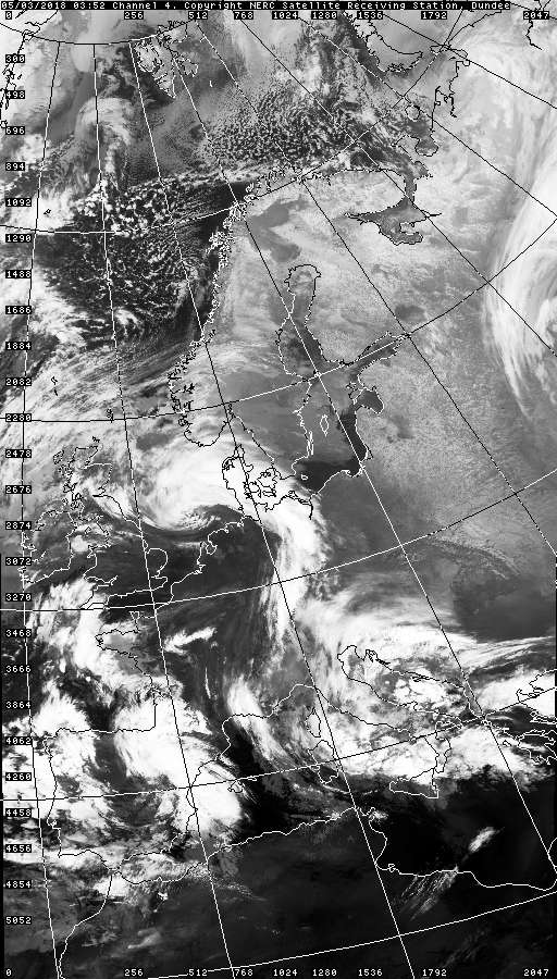
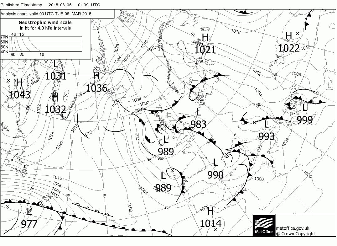
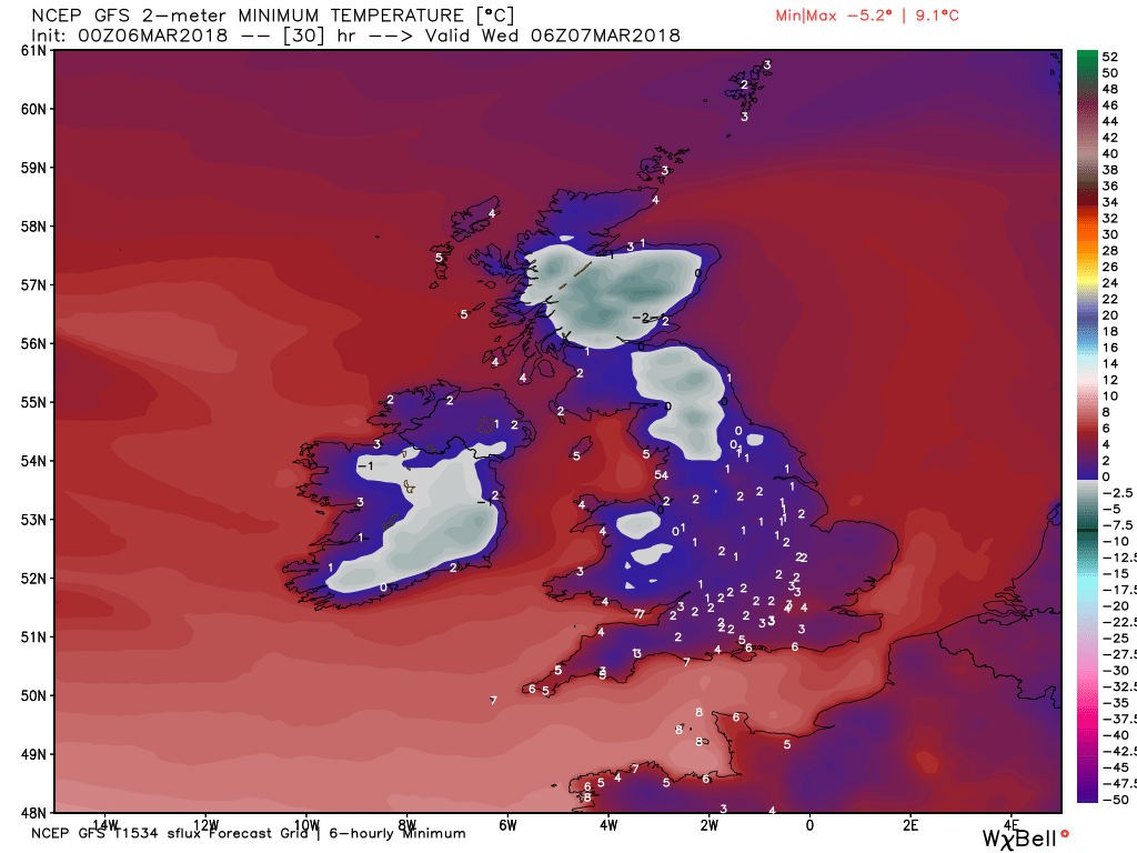
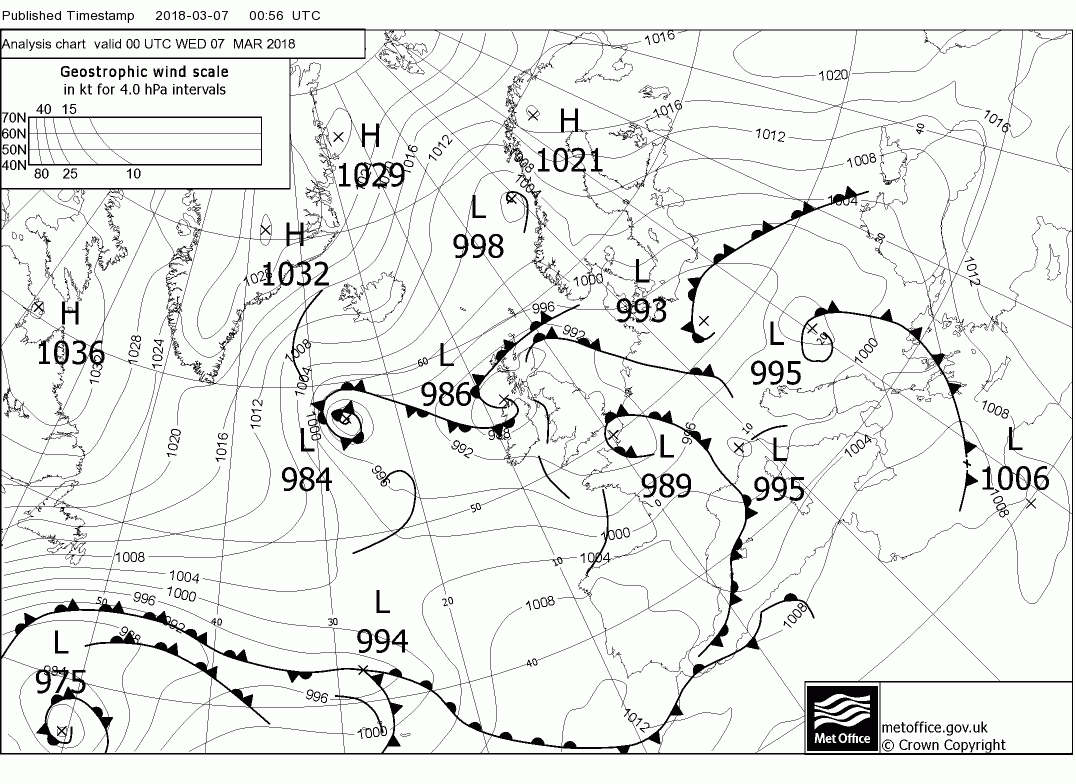
Today's view:
Today and overnight.
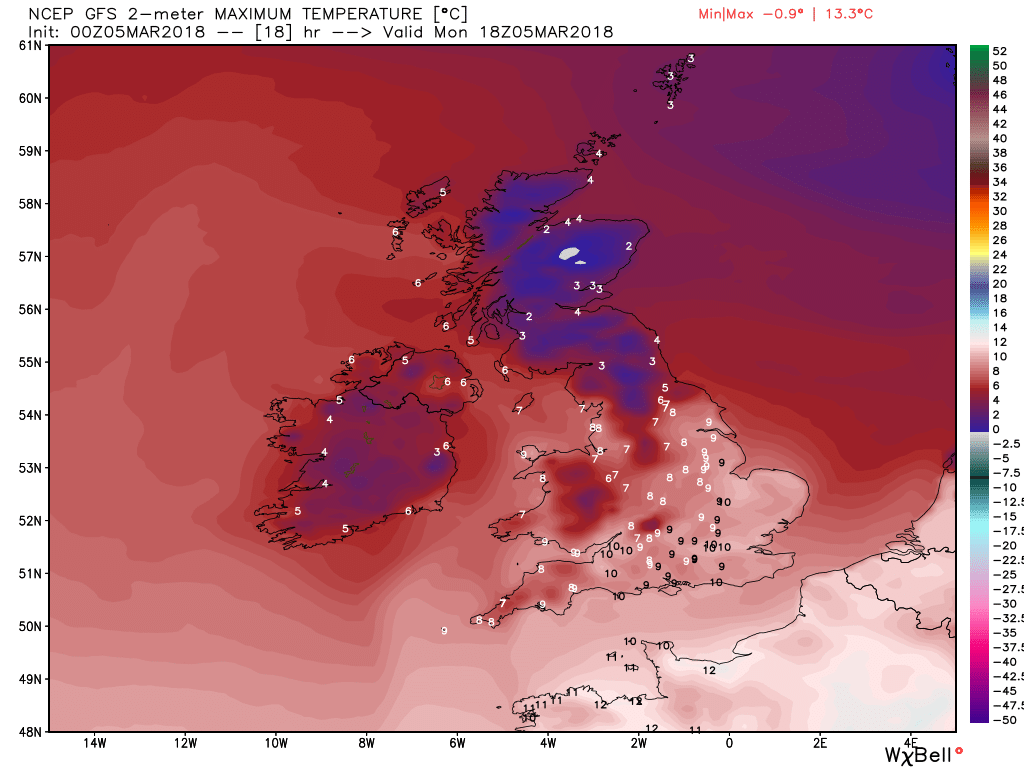
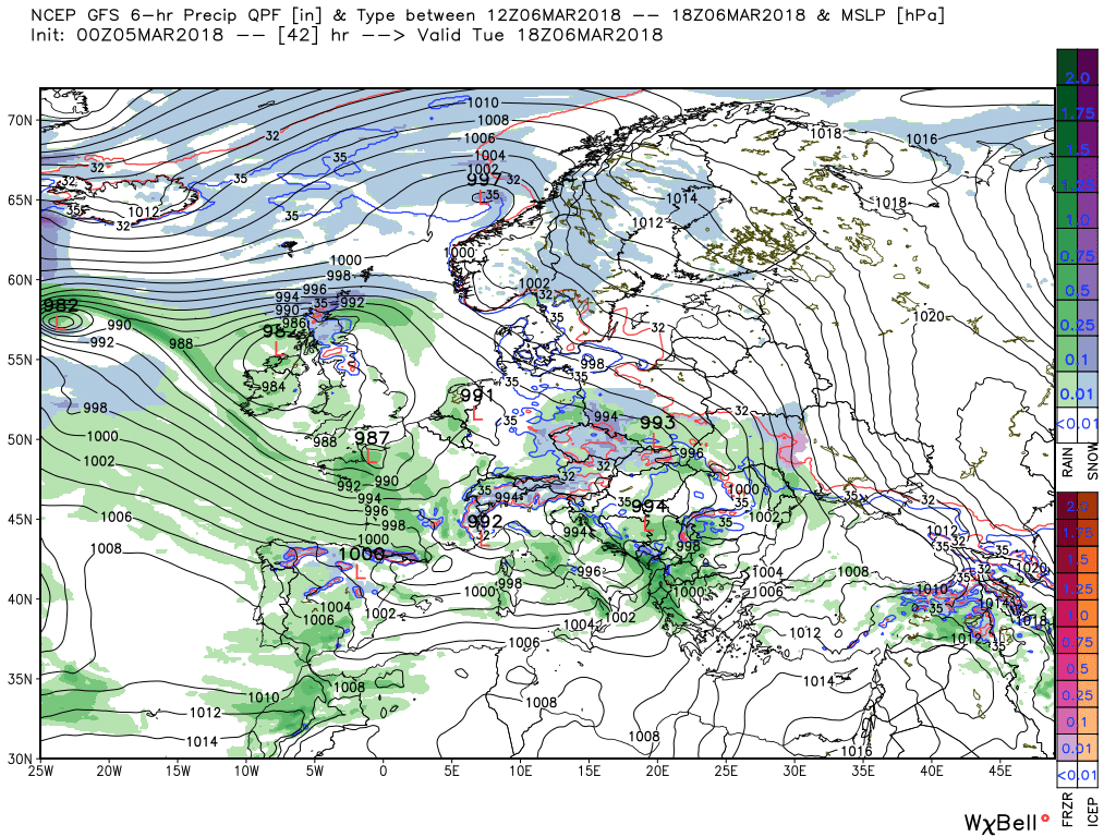
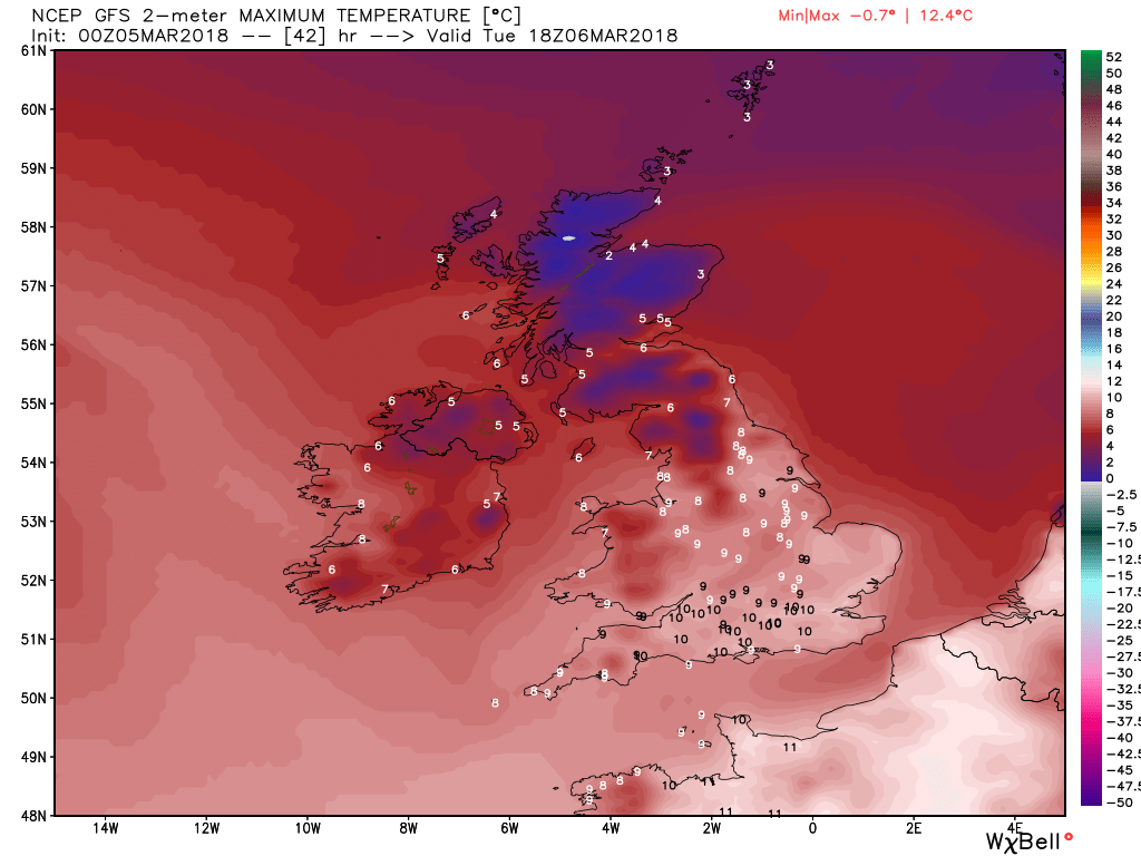
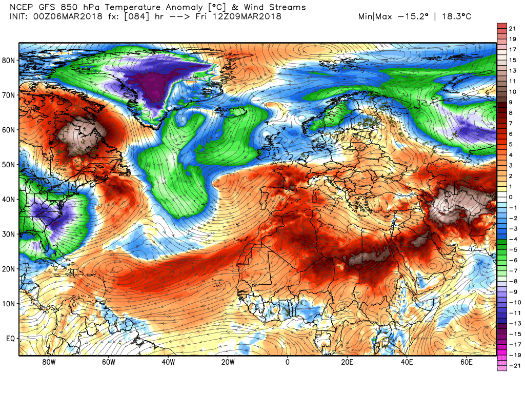
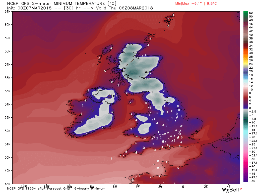
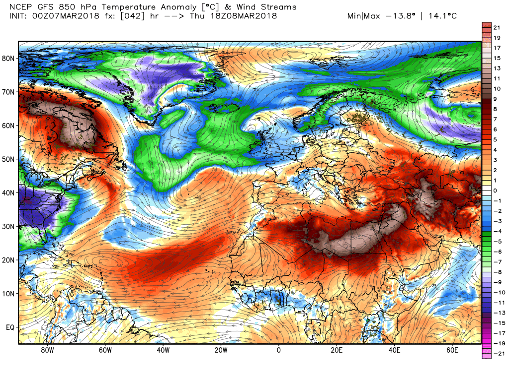
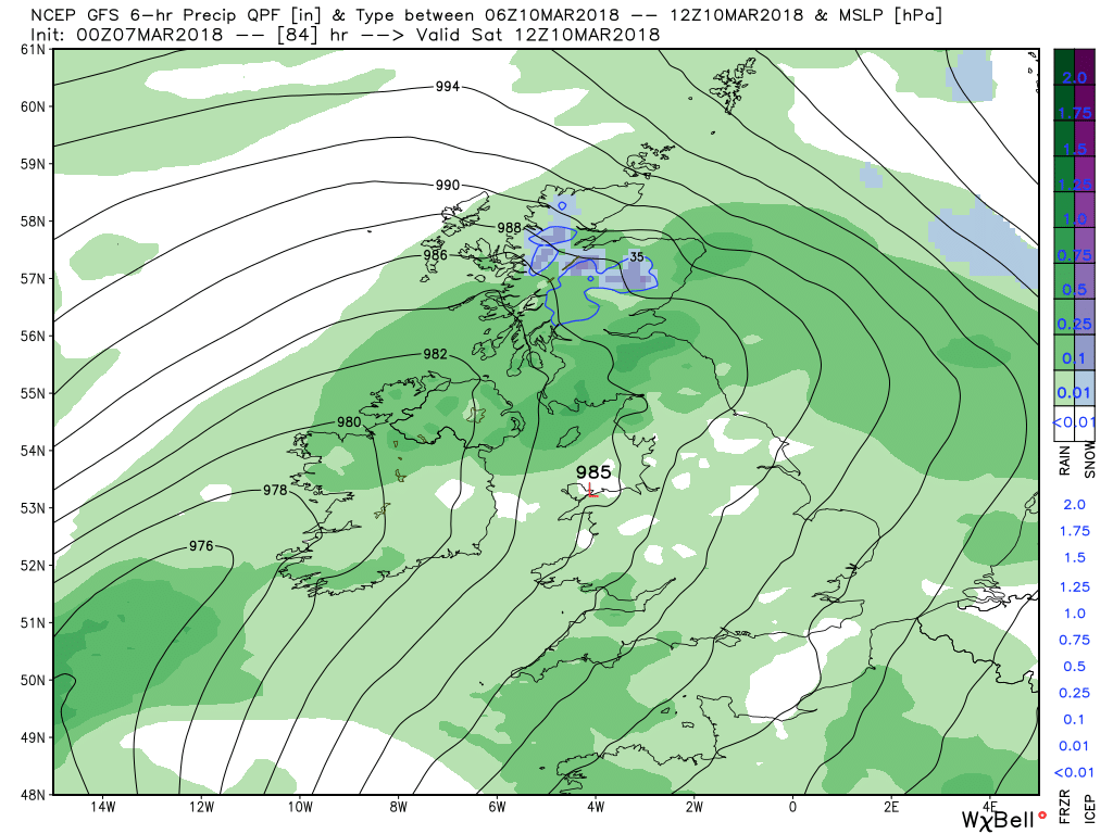
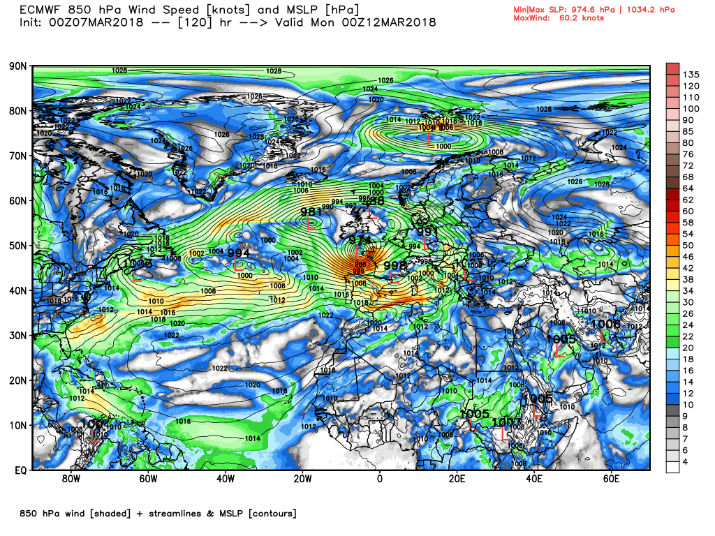
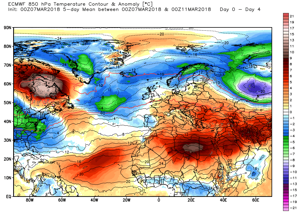
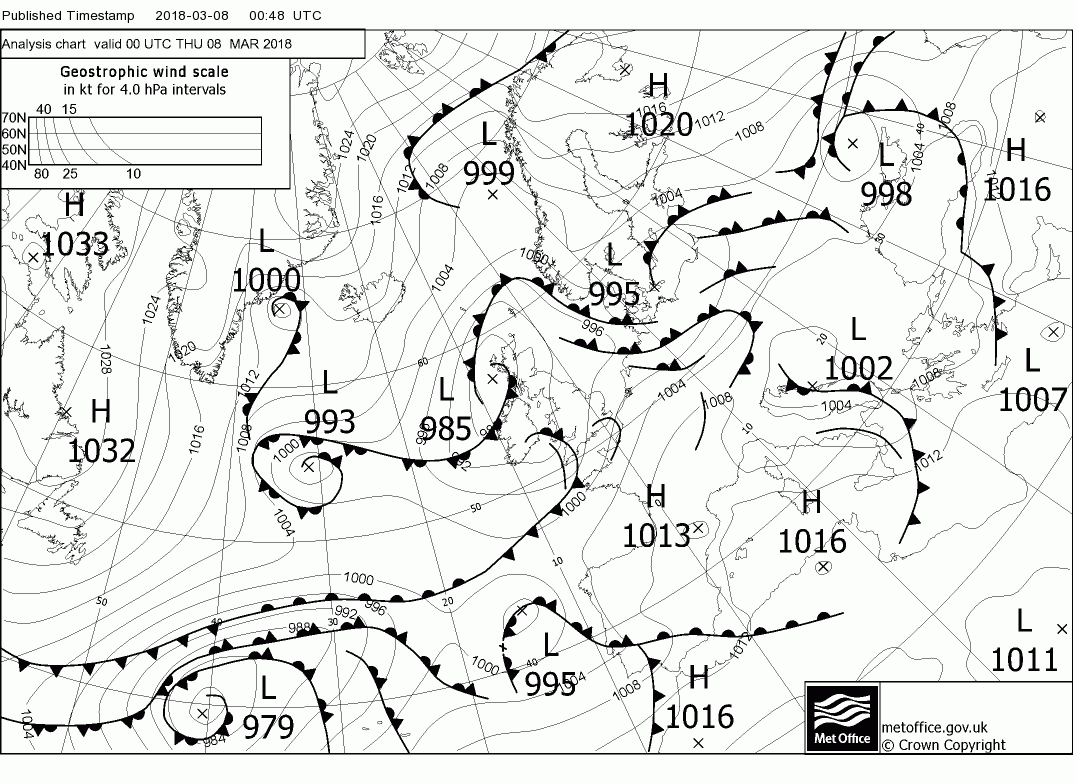
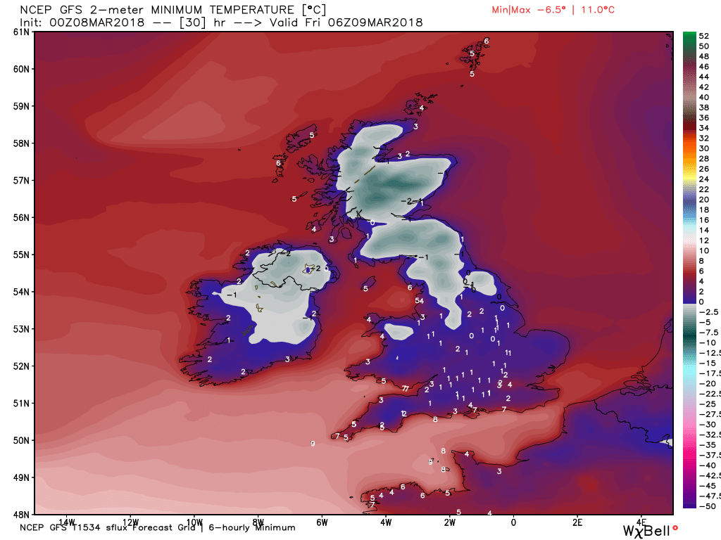
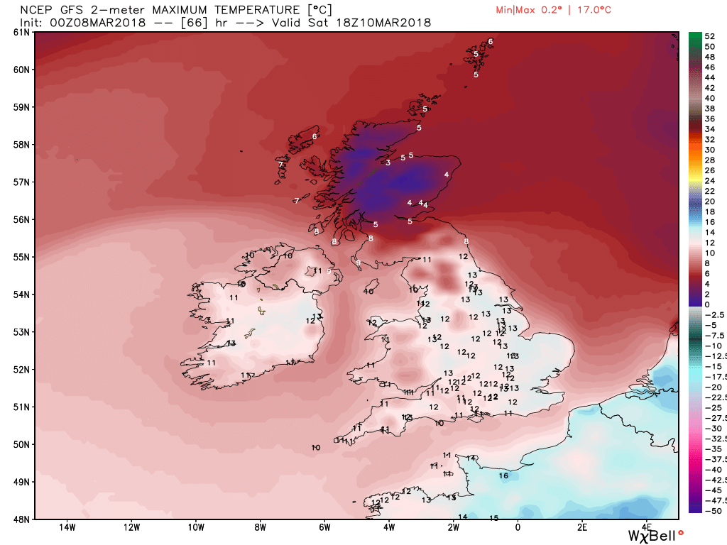
Scotland will be quite chilly with outbreaks of snow, sleet and rain depending on location and these will continue through to tomorrow morning. Further south not unpleasant with broken cloud and plenty of sunshine as the temps creep up but showery rain will move into the south west late in the morning and consolidate and move north during the day By morning this will have cleared southern England and Wales and thus much drier. The sat. image is for 0400.
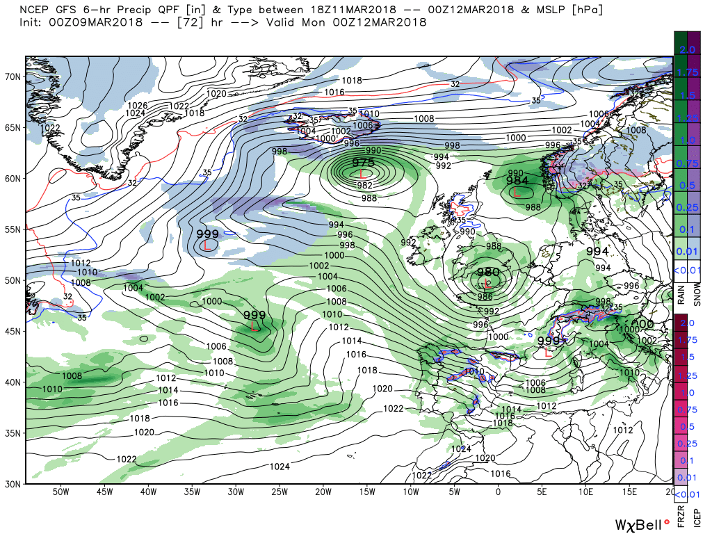
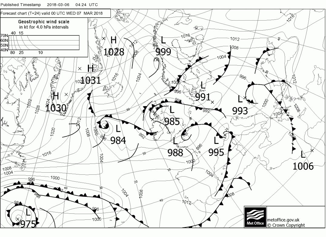
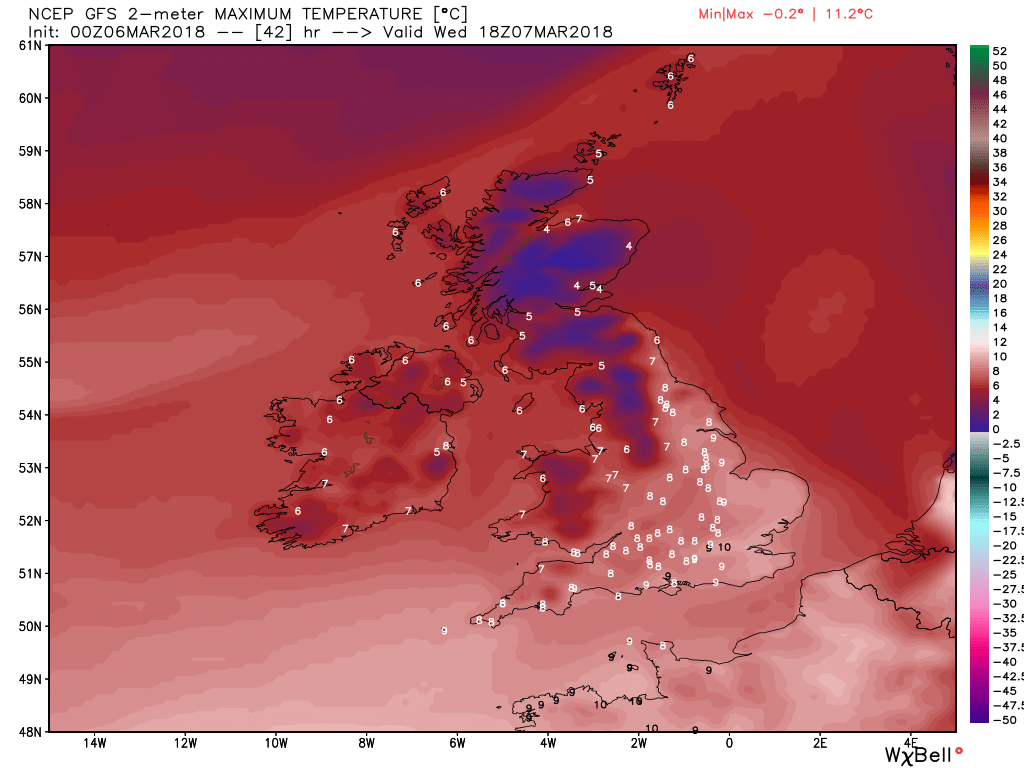
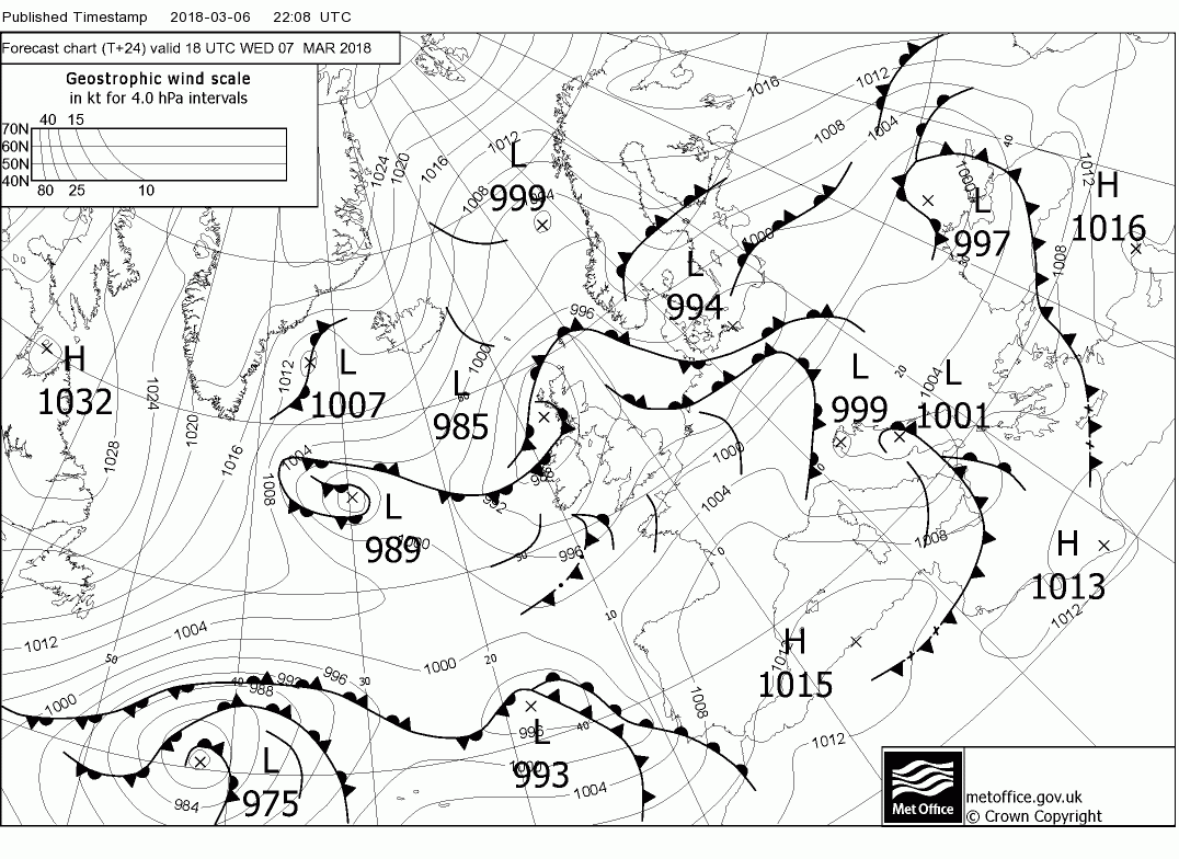
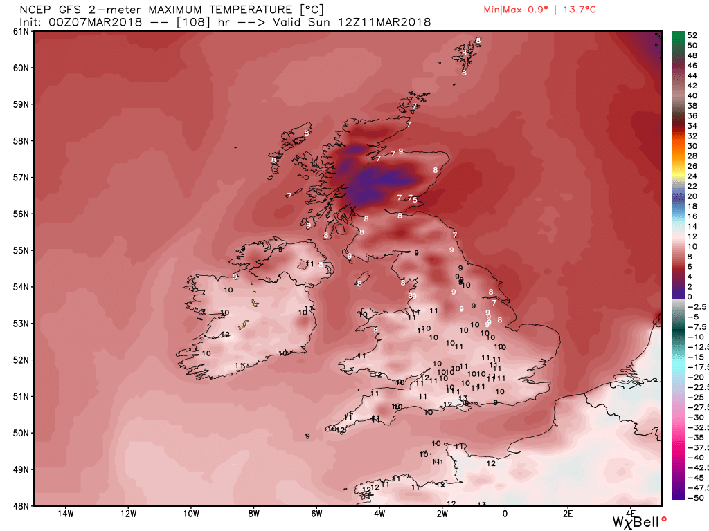
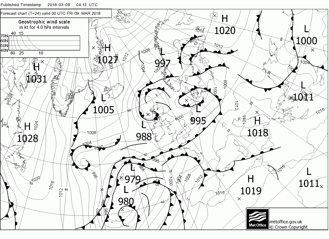
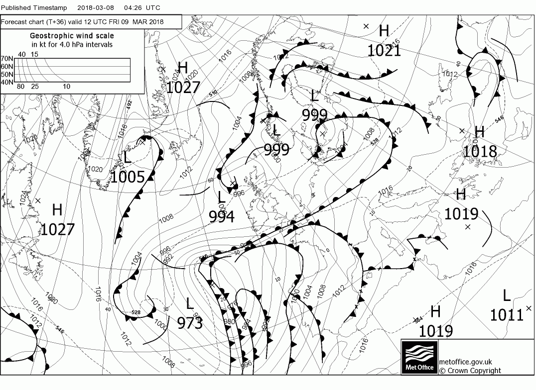
Much the same story for Tuesday with Wales and the south remaining dry with sunny spells whilst the north, N. Ireland and Scotland outbreaks of showery snow, sleet and rain will continue, the former restricted to high ground. Still quite a latitudinal temp variation.
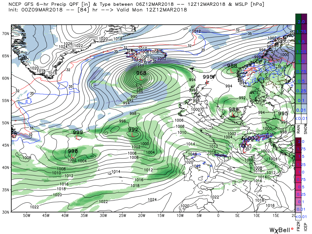
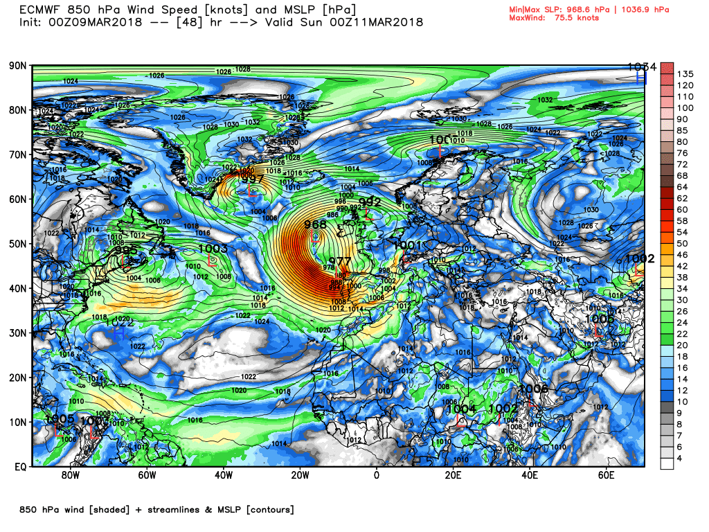
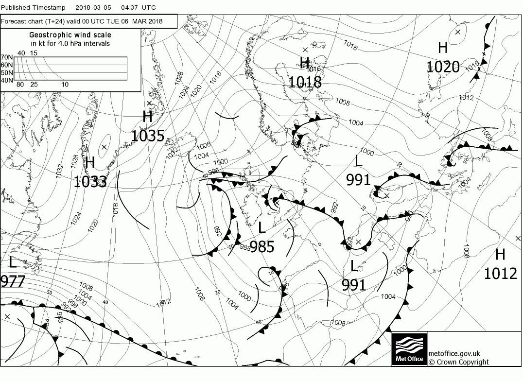
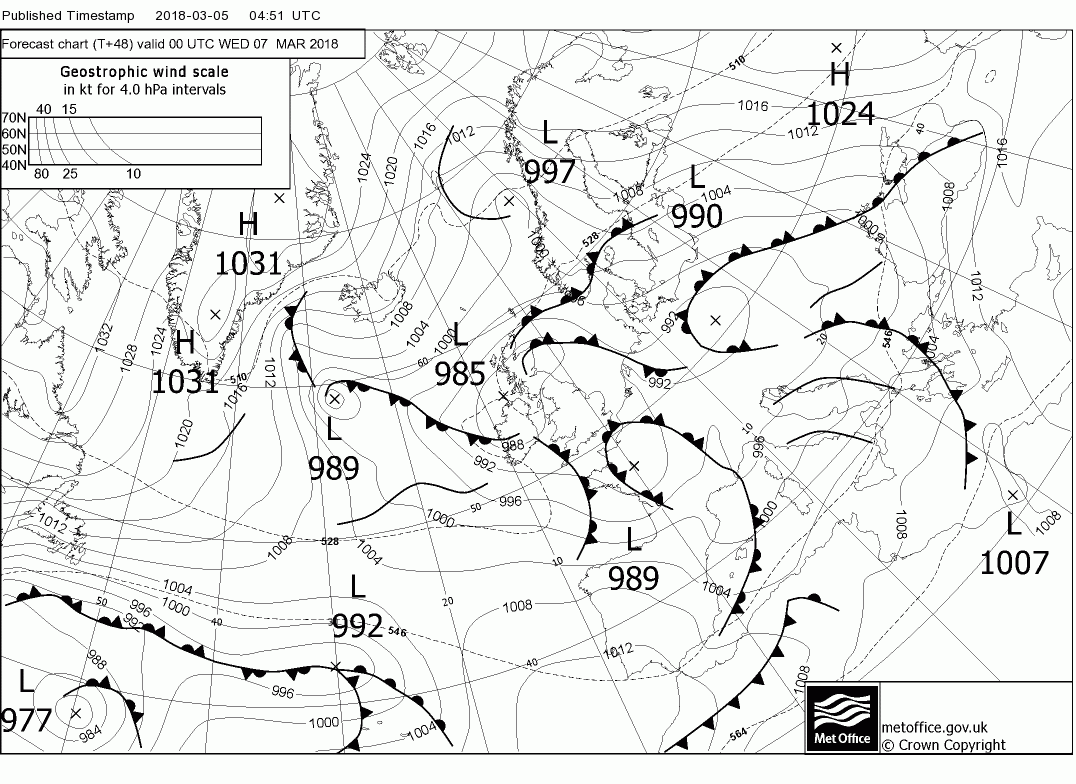
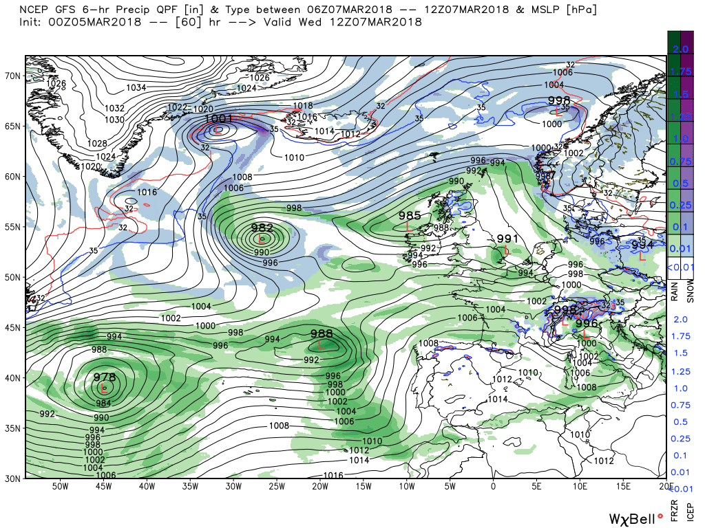
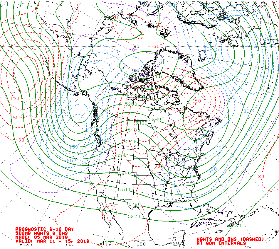
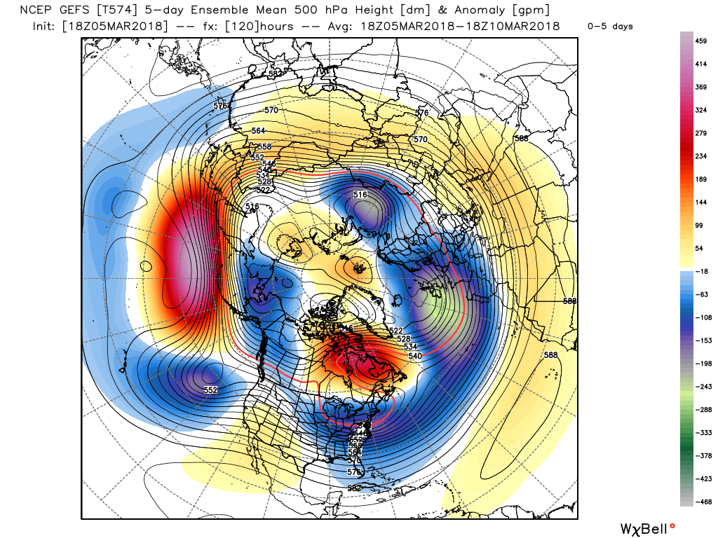
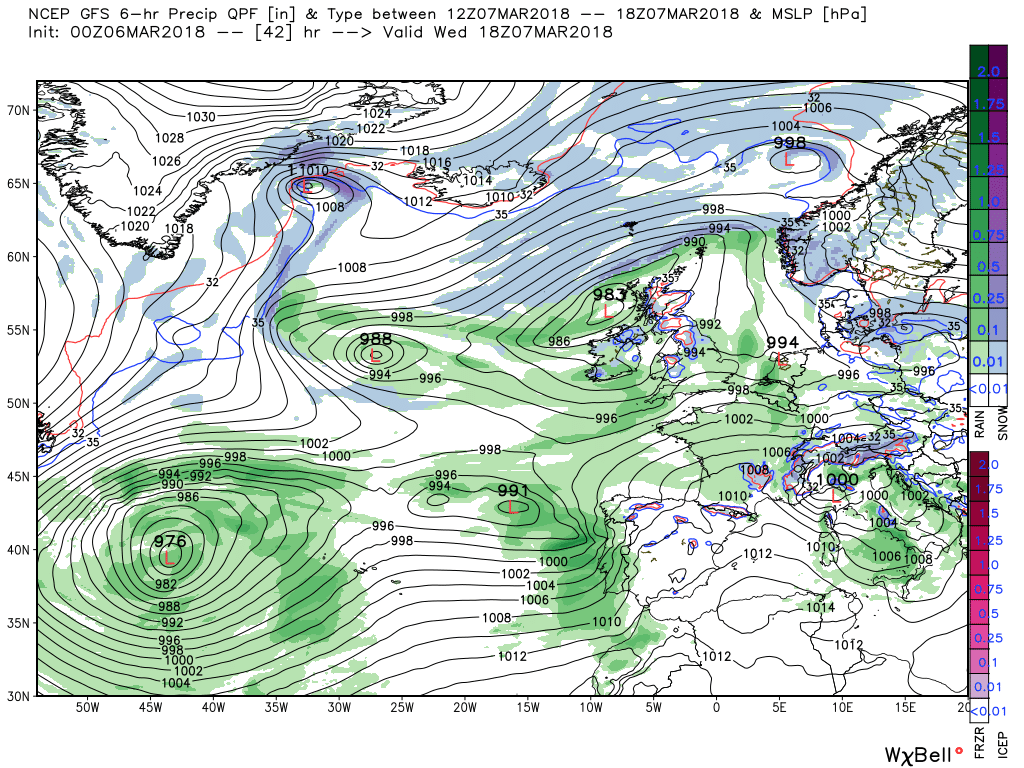
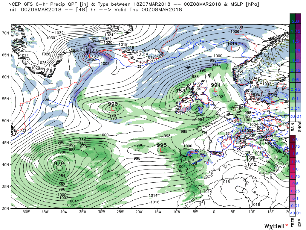
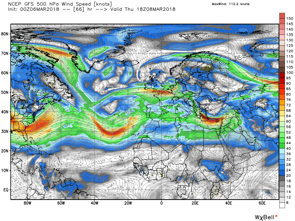
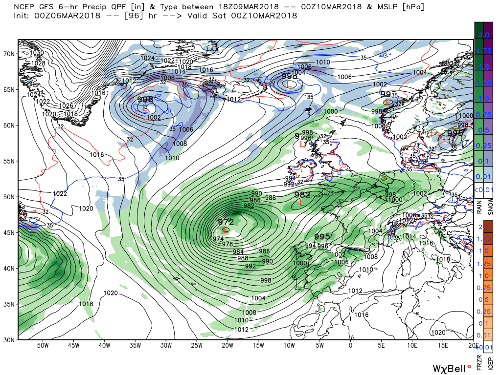
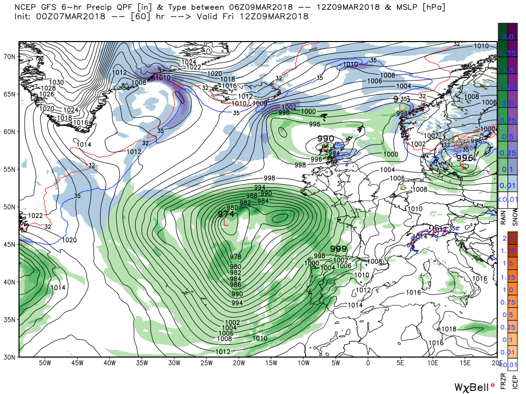
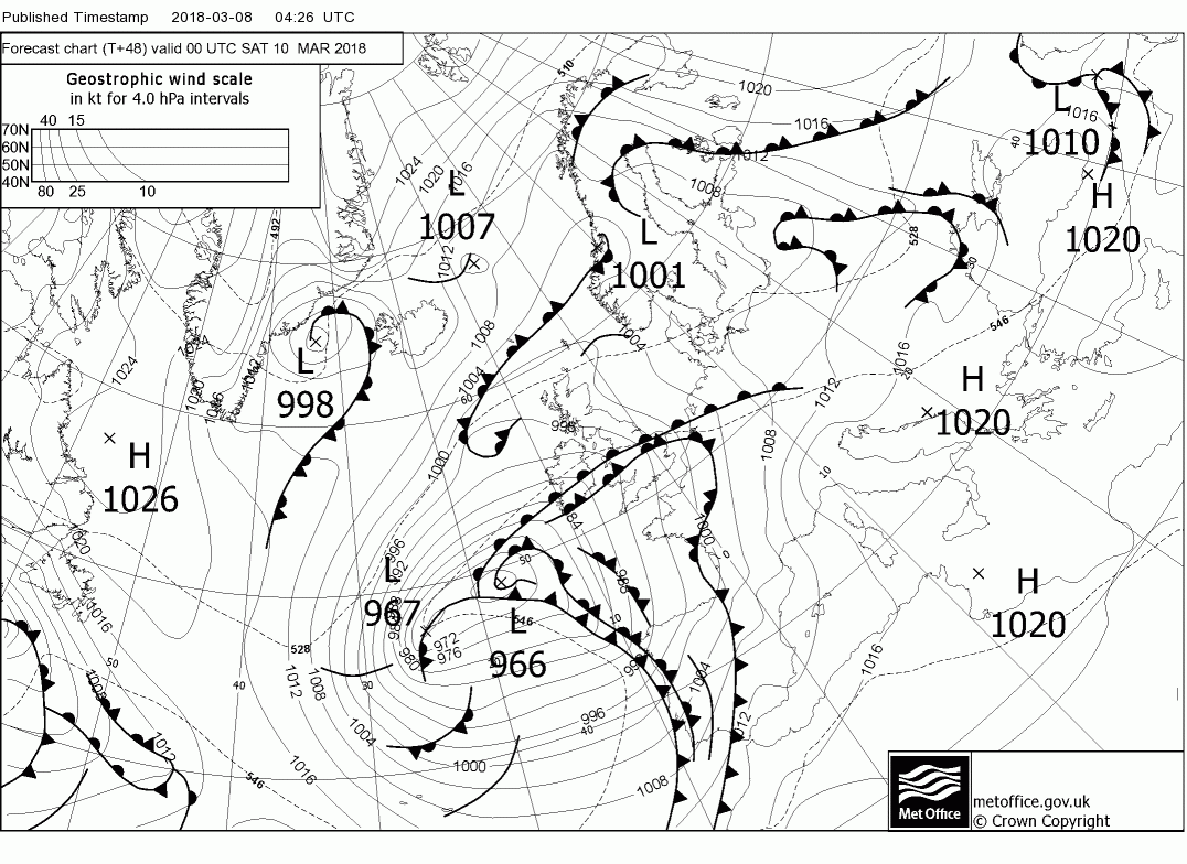
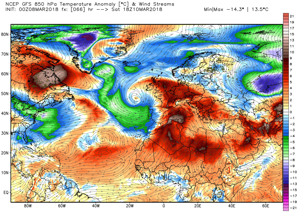
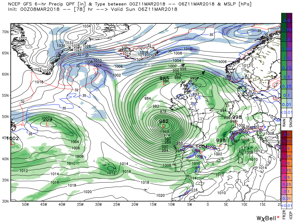
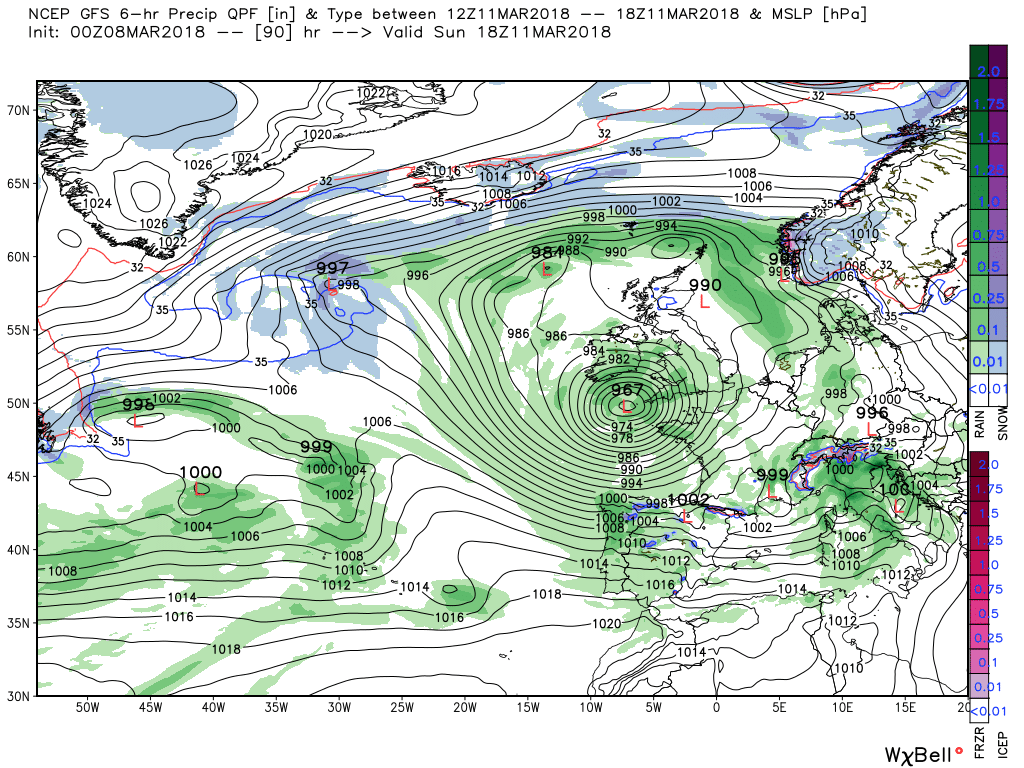
By midweek low pressure continues to be the controlling influence with the upper trough and associated surface lows dominating the Atlantic and points east. Ergo the unsettled weather with outbreaks of showery rain, perhaps thundery, will continue interspersed by sunny intervals and as the temps creep nearer average albeit still cold at night with ice and patchy fog in the north
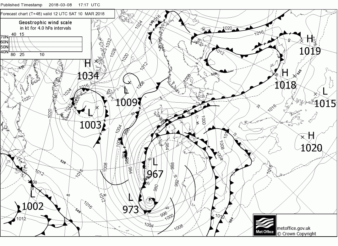
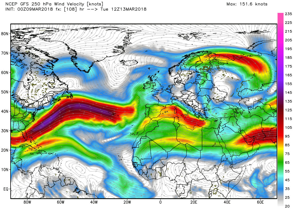
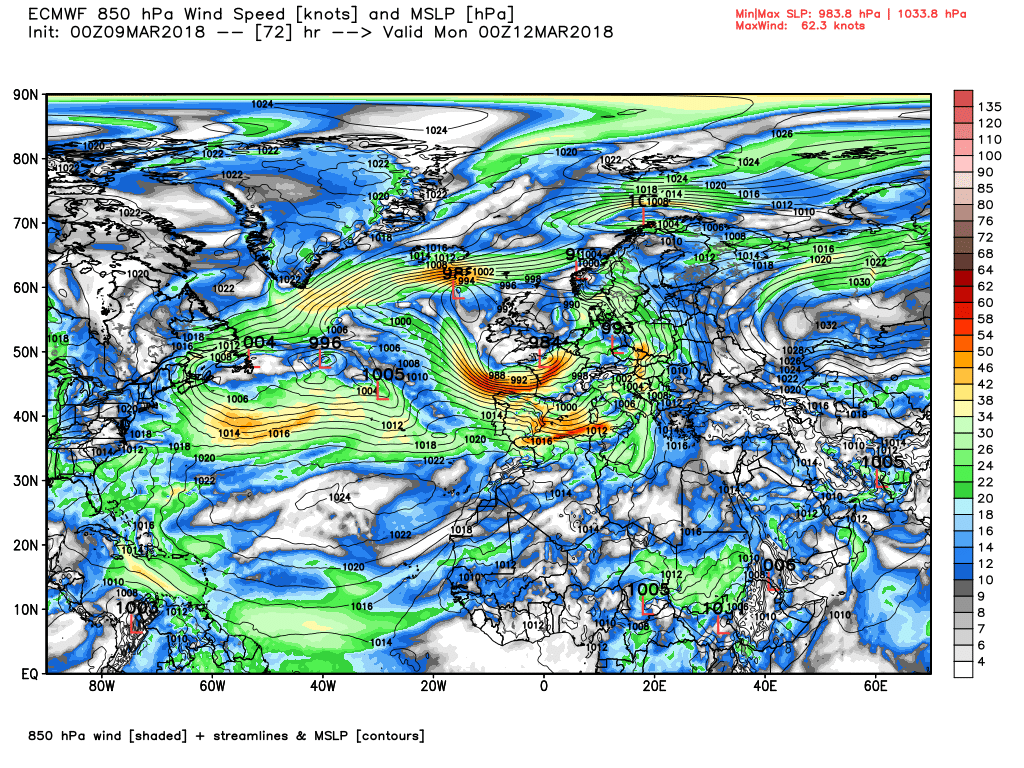
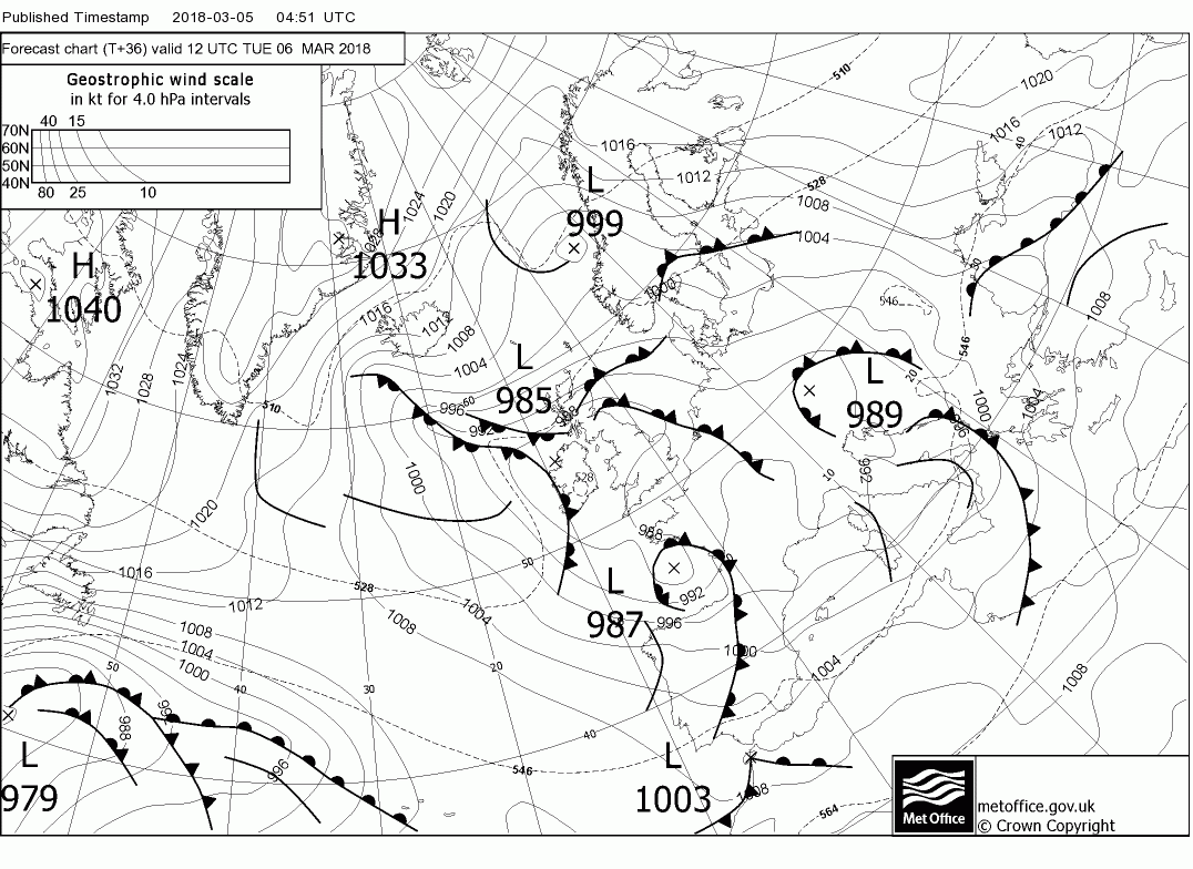
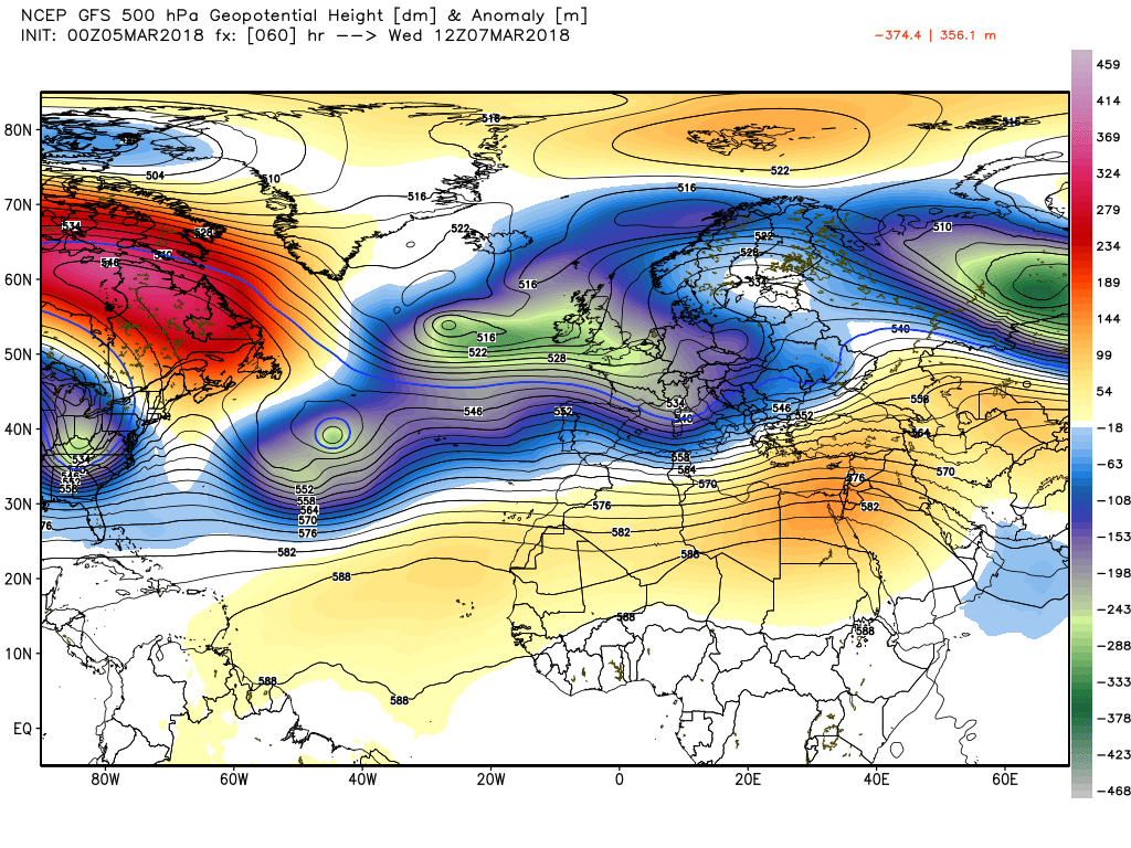
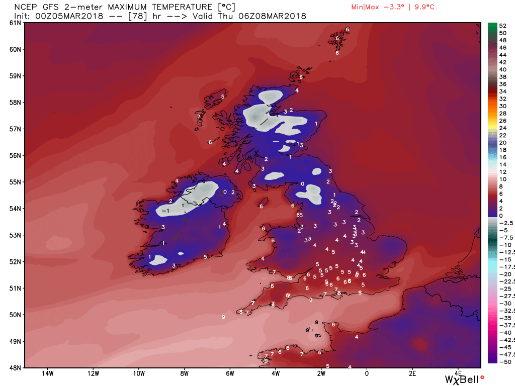
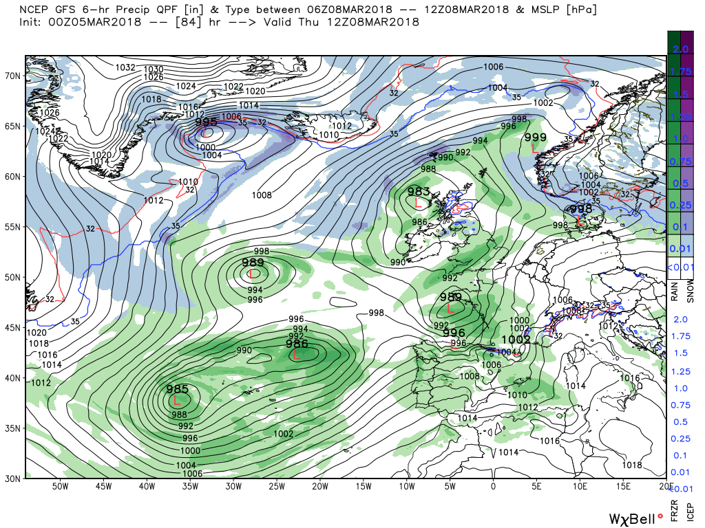
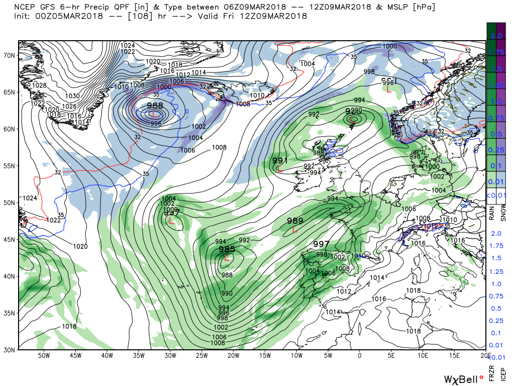
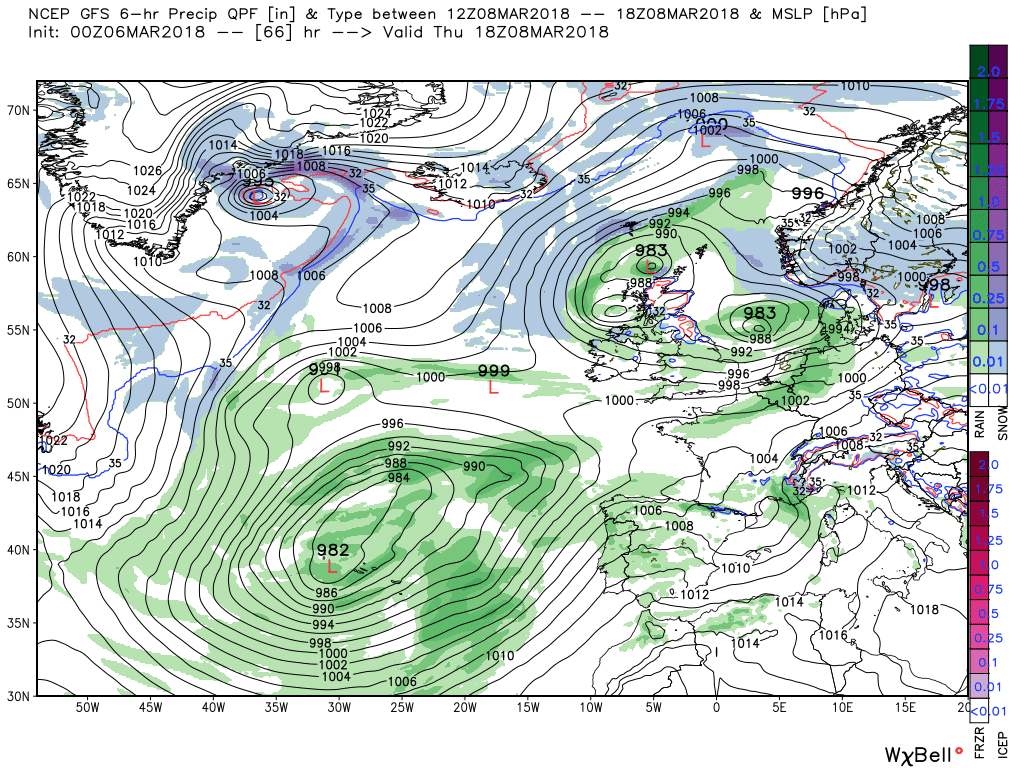
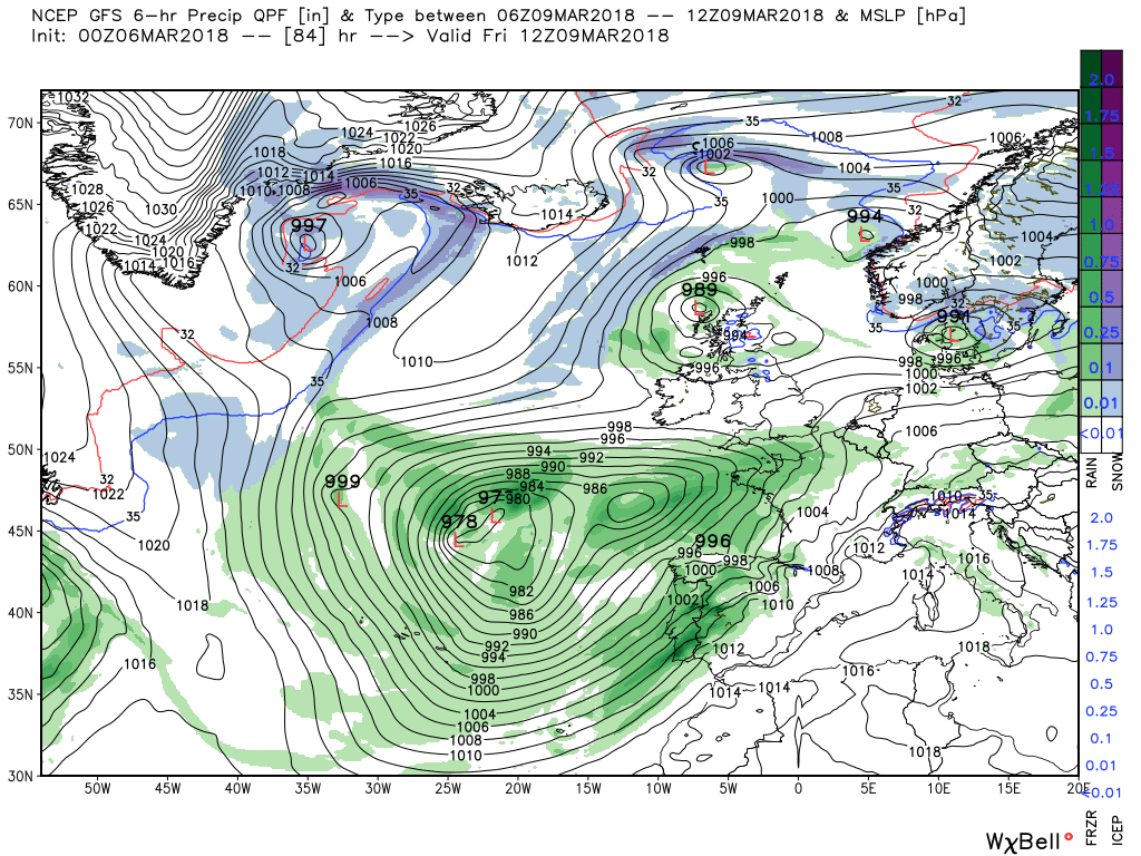
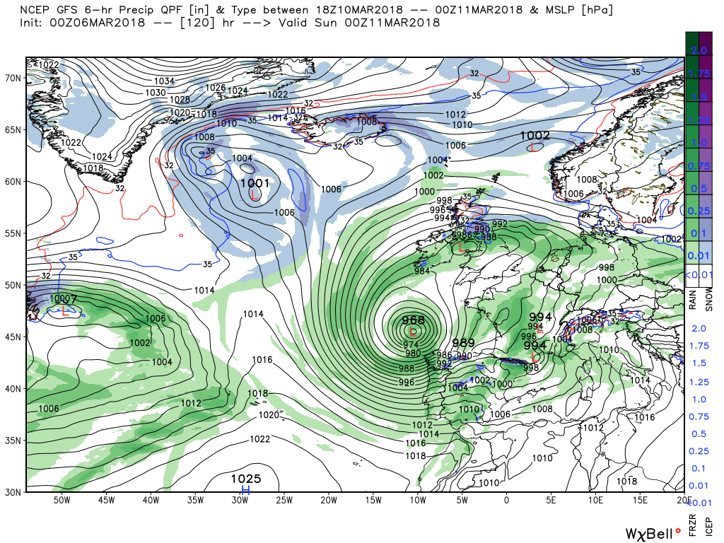
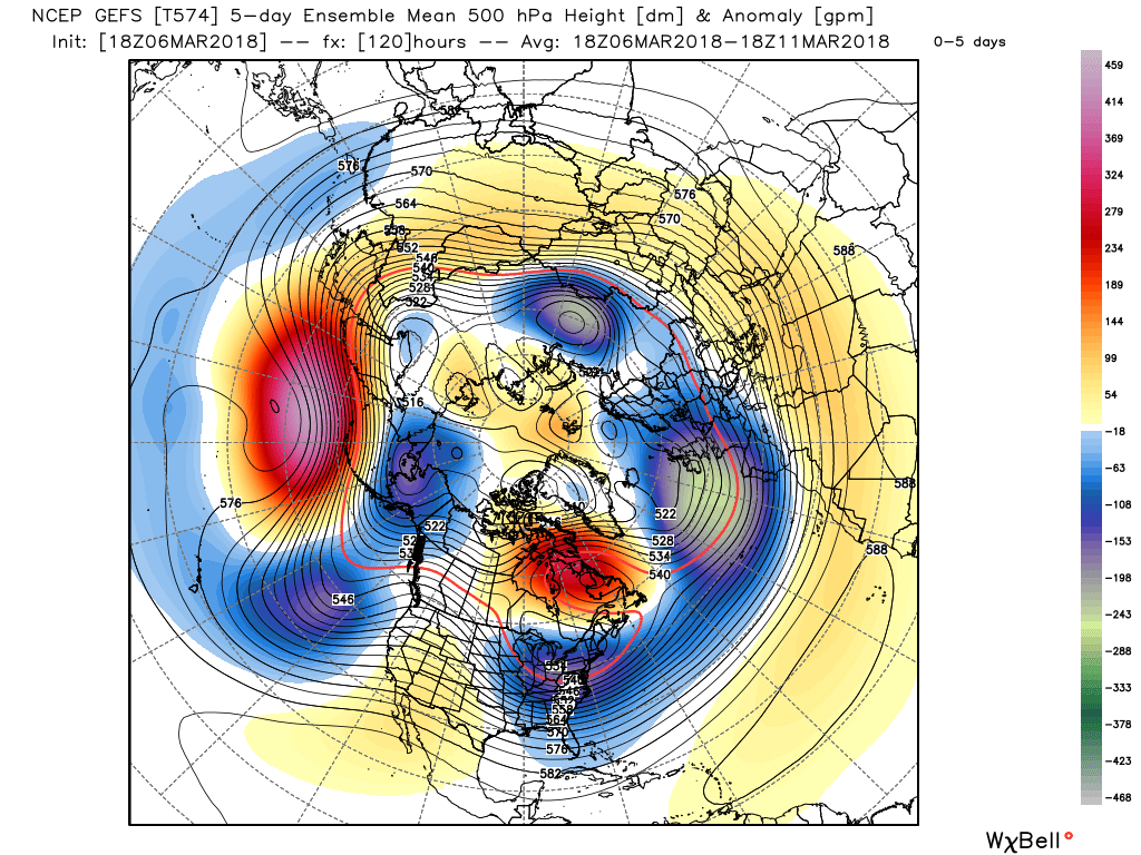
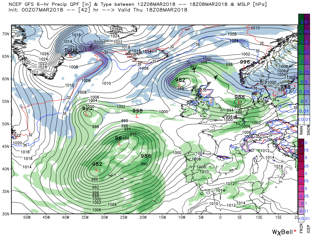
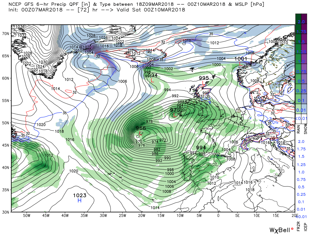
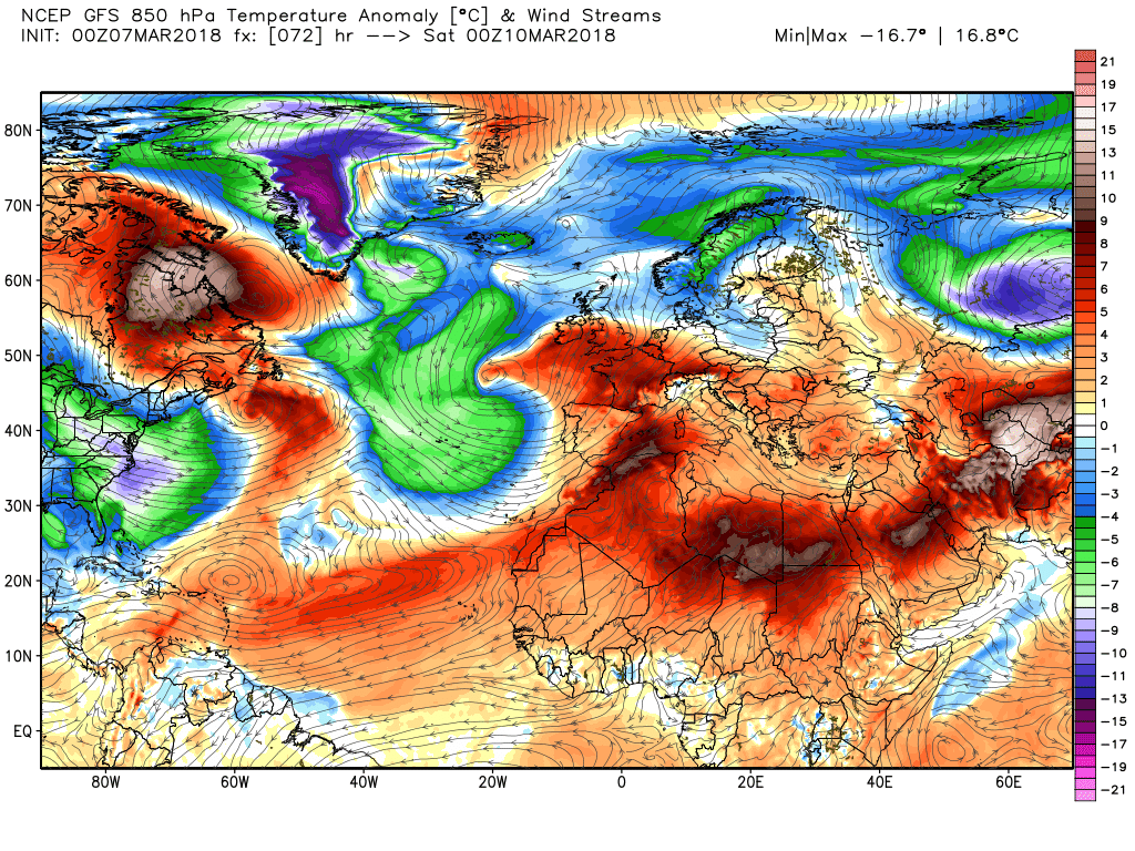
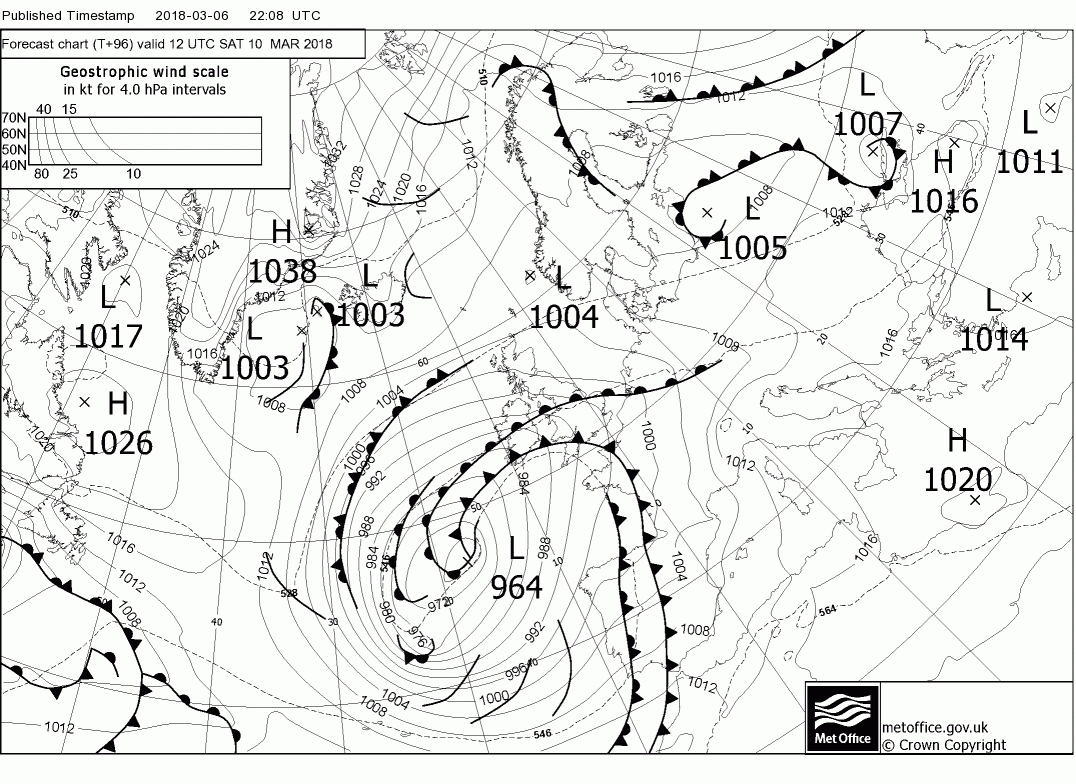
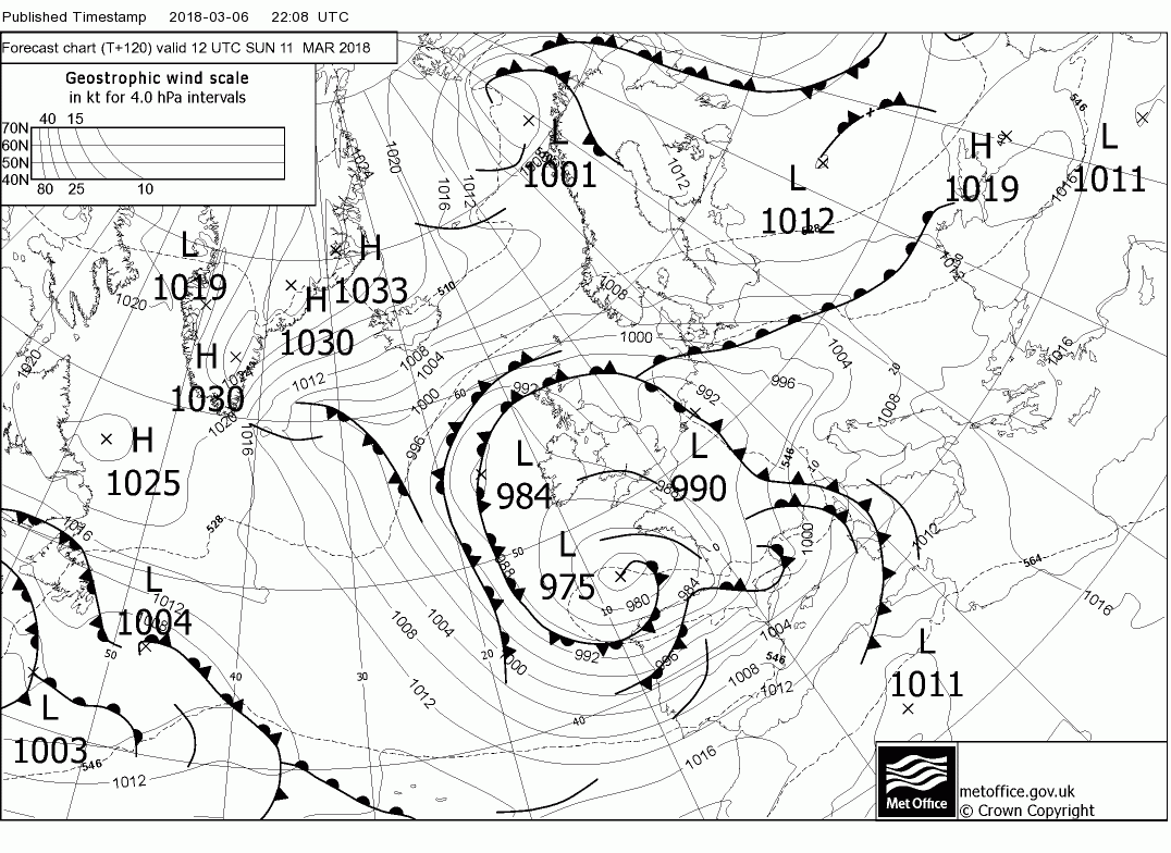
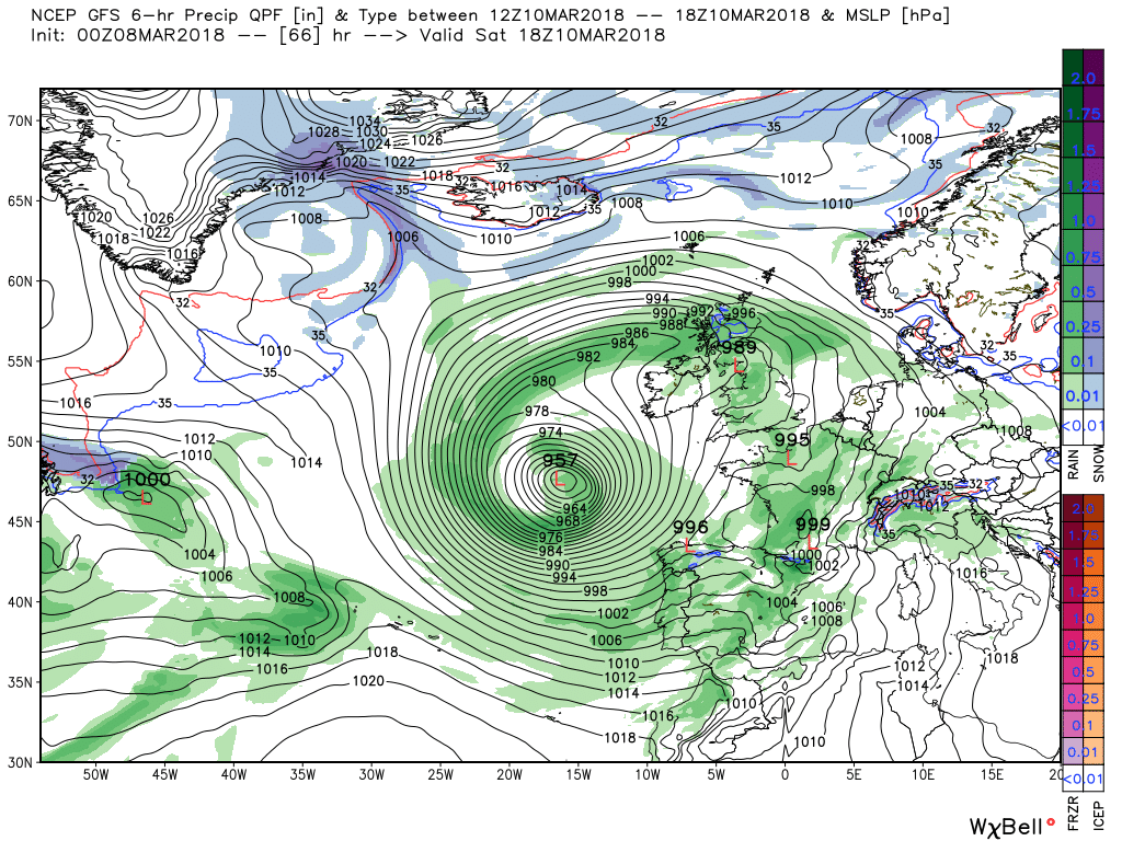
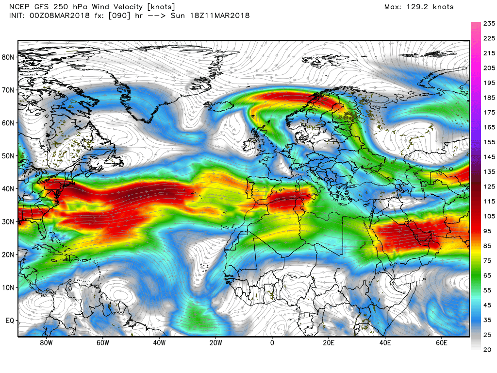
This scenario continues over Thursday and Friday with low pressure still dominating the eastern Atlantic with the two upstream energy flows coalescing in mid Atlantic. I notice the METO referred to this yesterday as a cyclonic block


") P.
P.