OP
- Messages
- 6,299
- Location
- Norfolk, England
- Thread Starter
- #1,537

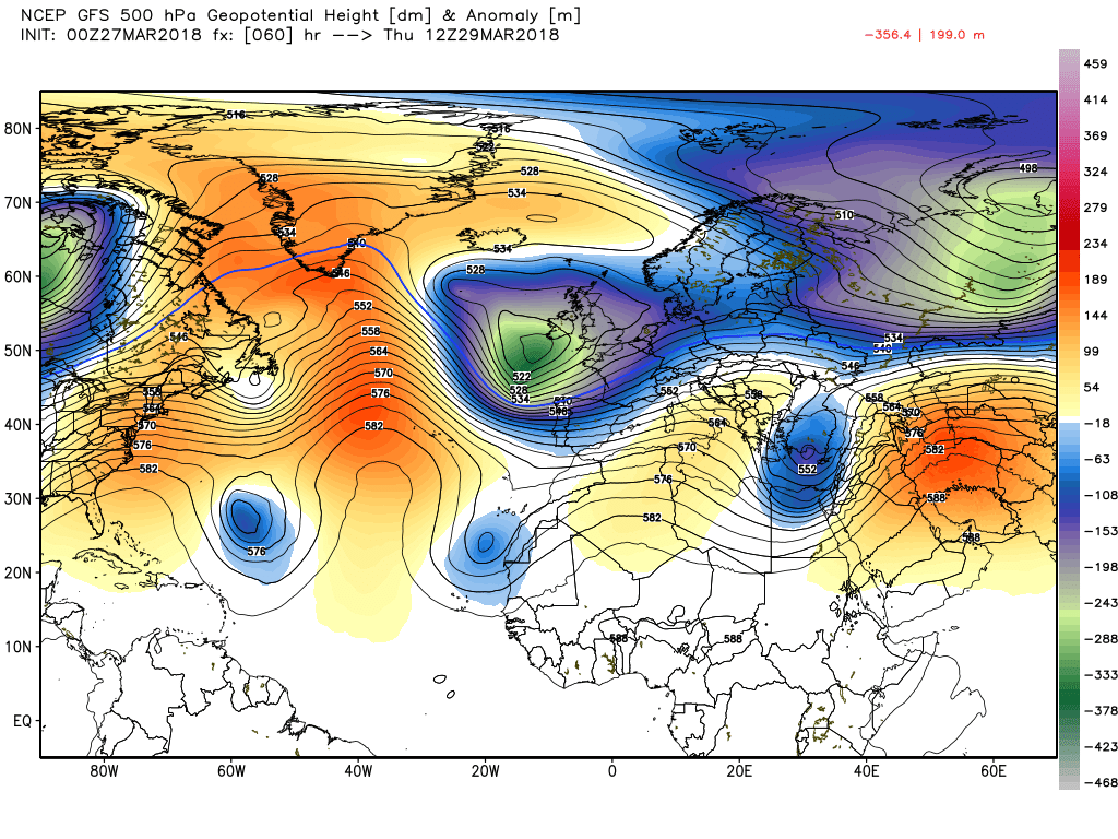
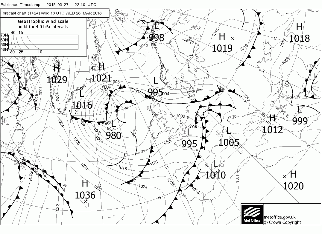
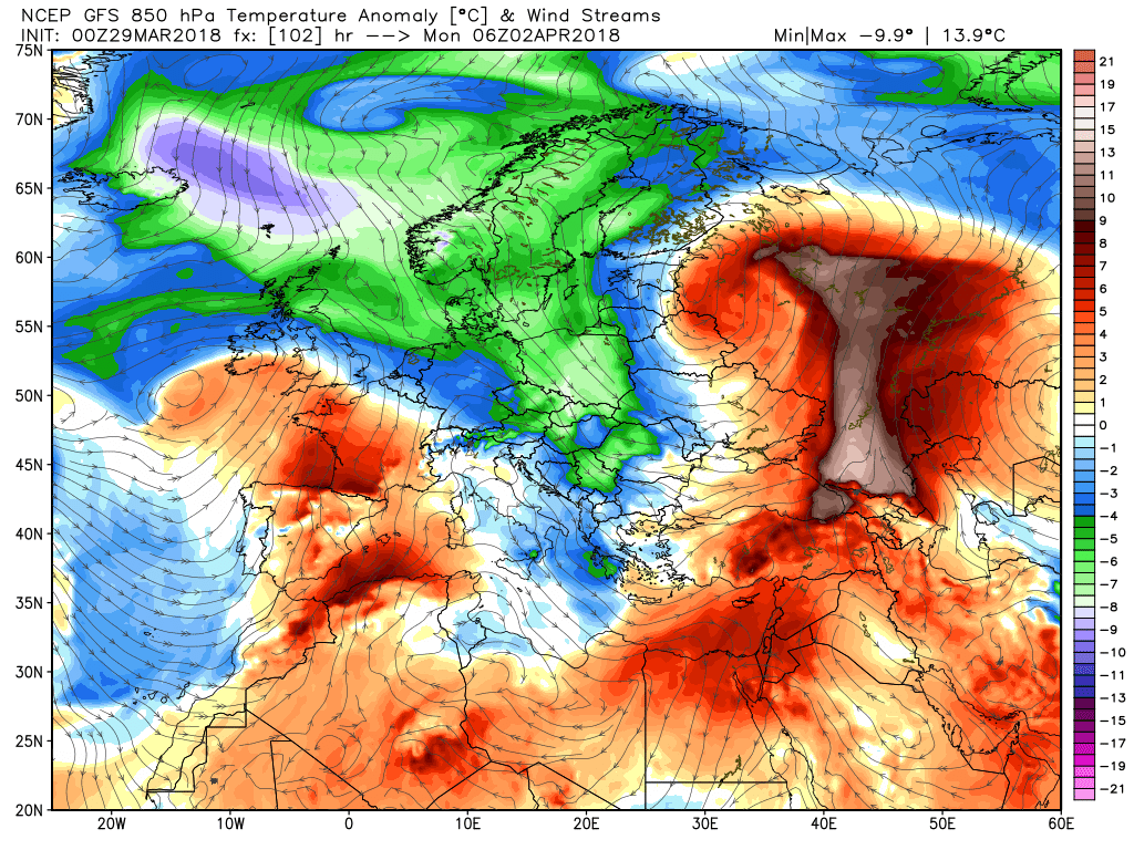
Today heralds the next stage of the evolution which sees the upper trough, currently separating from the Canadian vortex, dominating the UK weather for the rest of the week with some help from the Russian vortex/trough and Atlantic ridging.
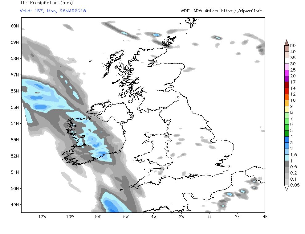
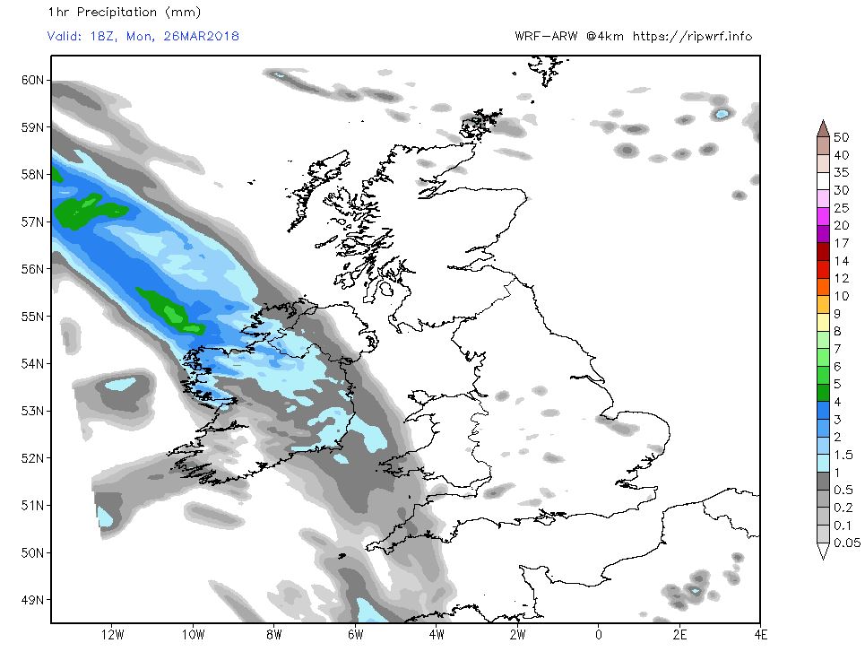
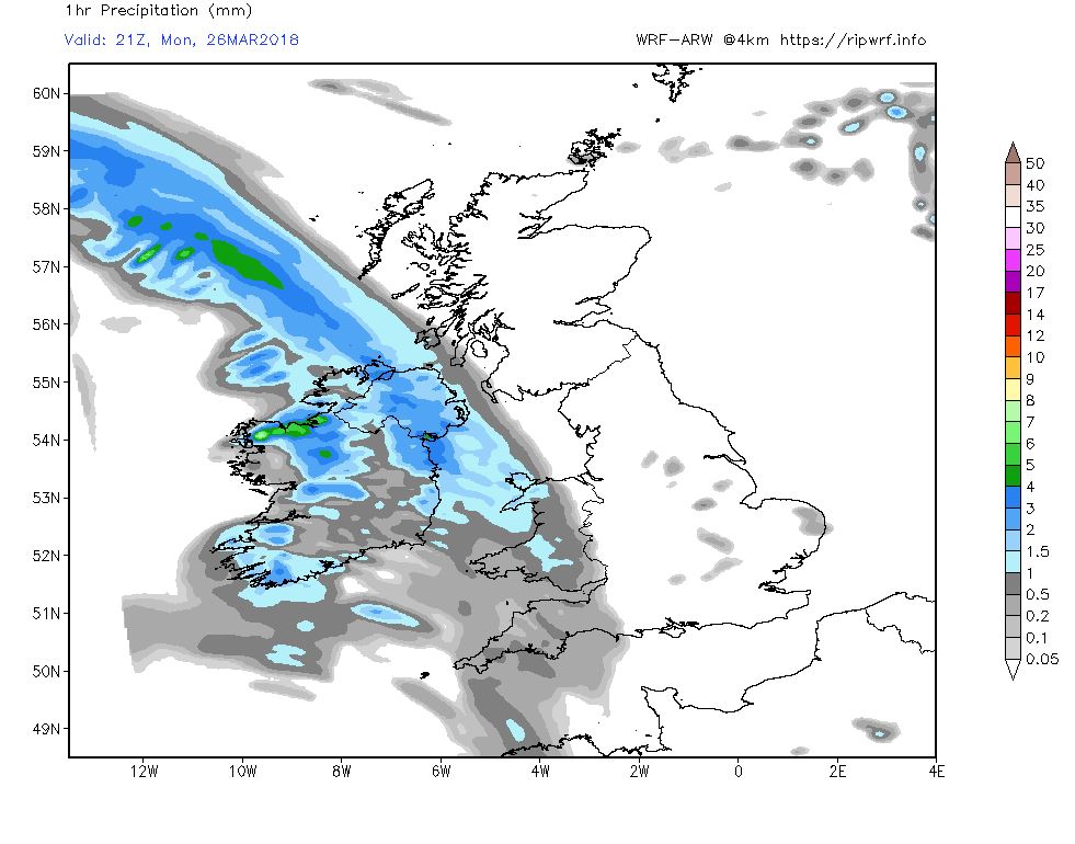
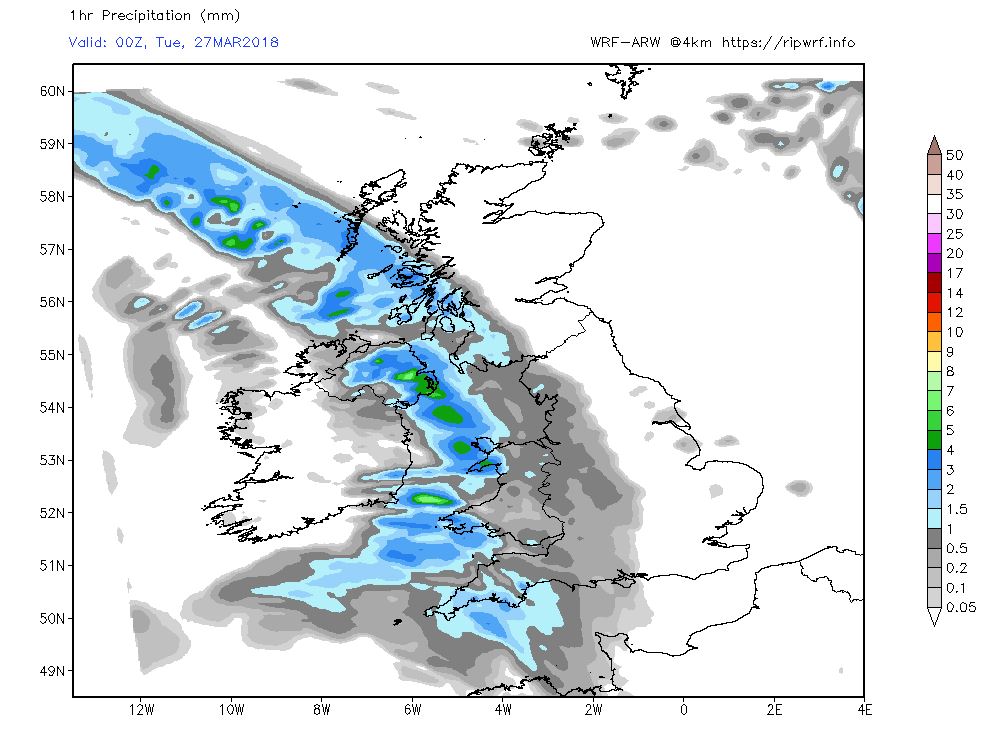
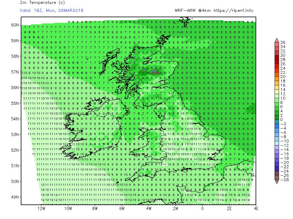
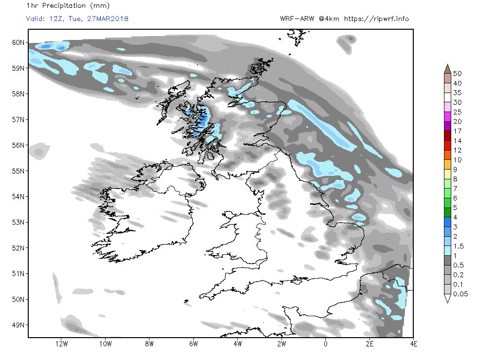
The current surface analysis has a transient ridge over the UK with plenty of sunshine and light winds today with a few light showers building during the afternoon. But a low to the west is moving east and the associated front and rain will affect Ireland by mid afternoon and then move east through this evening and overnight, bringing some snow to the high ground in Scotland, before clearing the west by morning leaving showery conditions in it's wake. Thus temps holding up pretty well and frost free in the morning.
Through Tuesday the front clears to the east leaving sunny intervals and the odd showers but still windy with snow on the hills in northern Scotland with the low in close attendance near the Hebrides. But further south a wave is forming south of Ireland and is about to track east
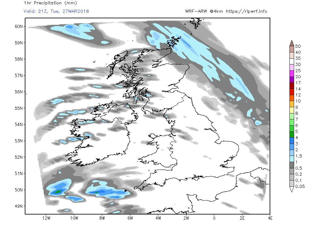
This it duly does through Wednesday bringing rain to the south with the rest of the country now in a cooler, showery and quite windy westerlyregime, particularly in Scotland, where snow showers will persist over the high ground.
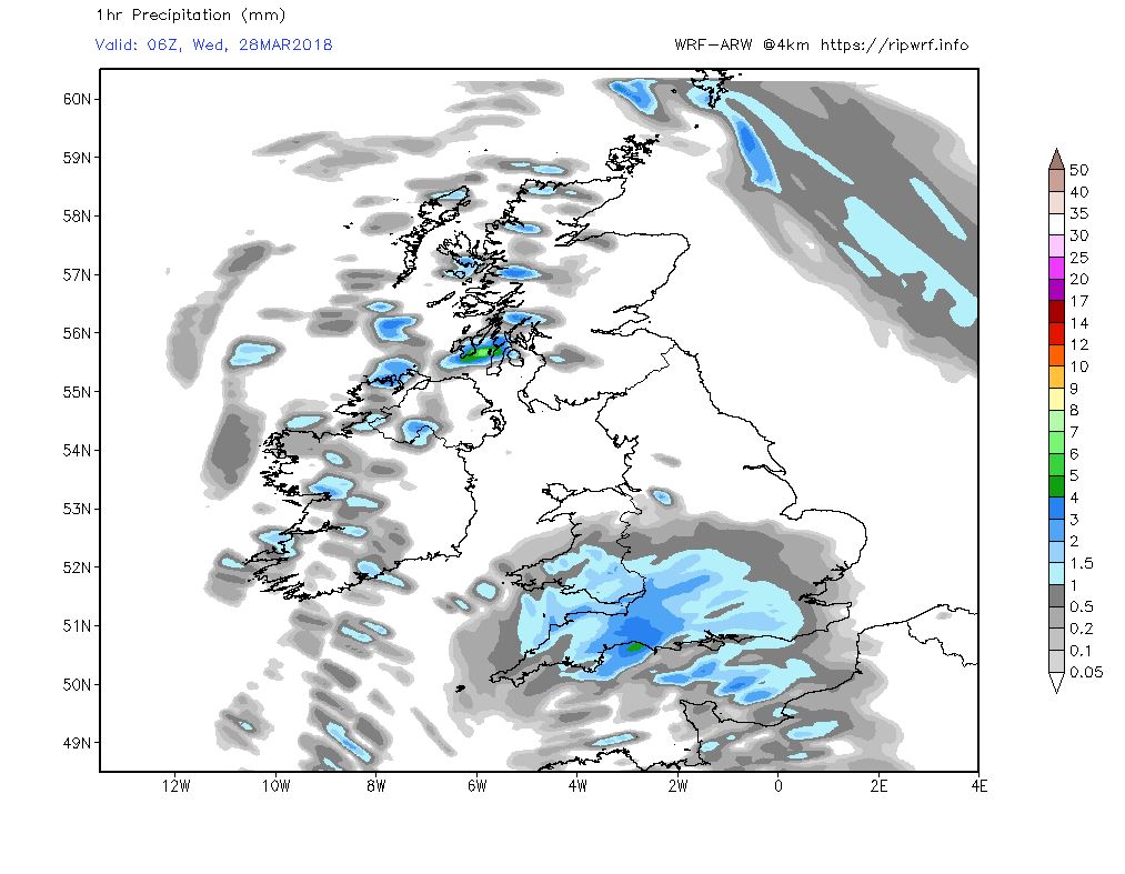
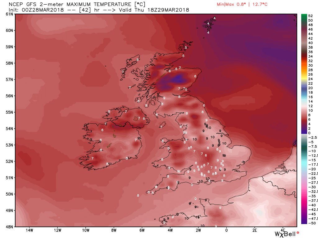
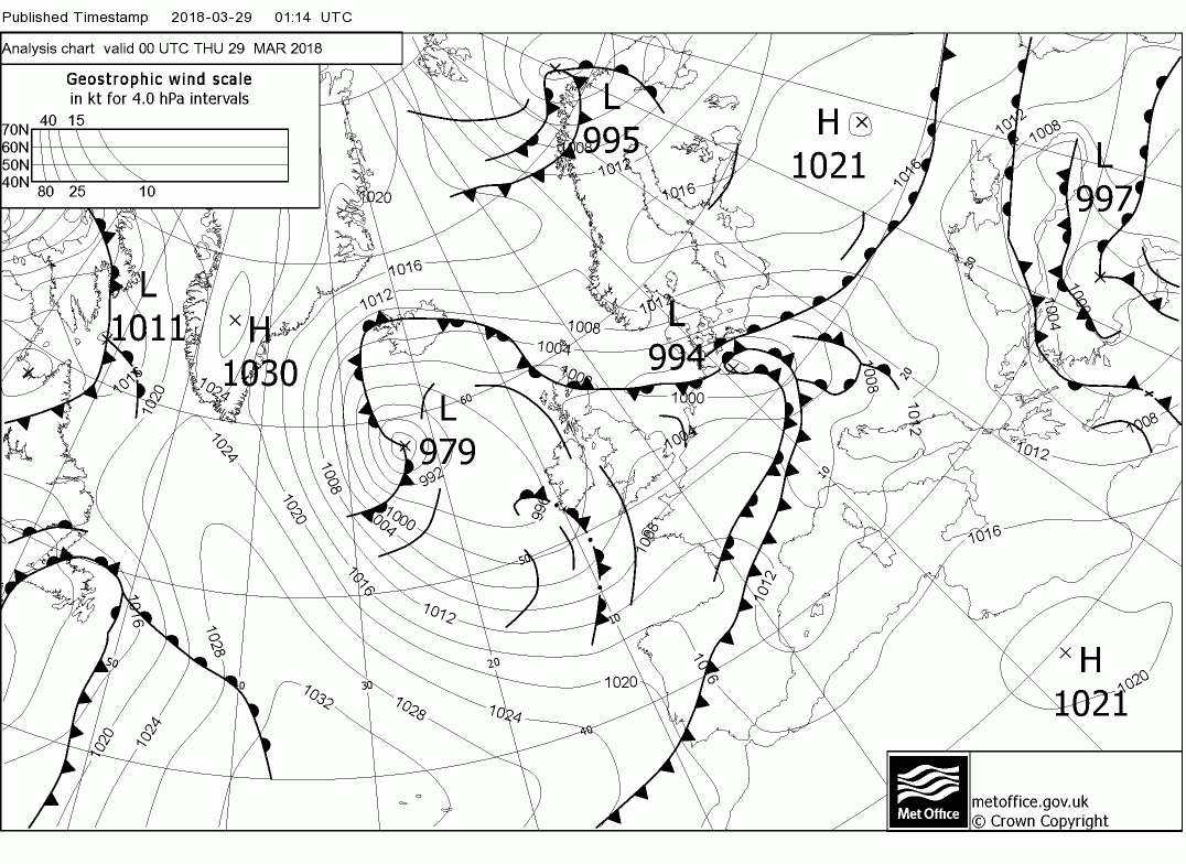
Thursday sees the high pressure amplify in the western Atlantic which forces a realignment of the upper trough south east over the UK with a surface low near south west Ireland and associated fronts pushing north east over south west England and Wales. Generally with low pressure now to the fore quite unsettled albeit temps are only a little below average.
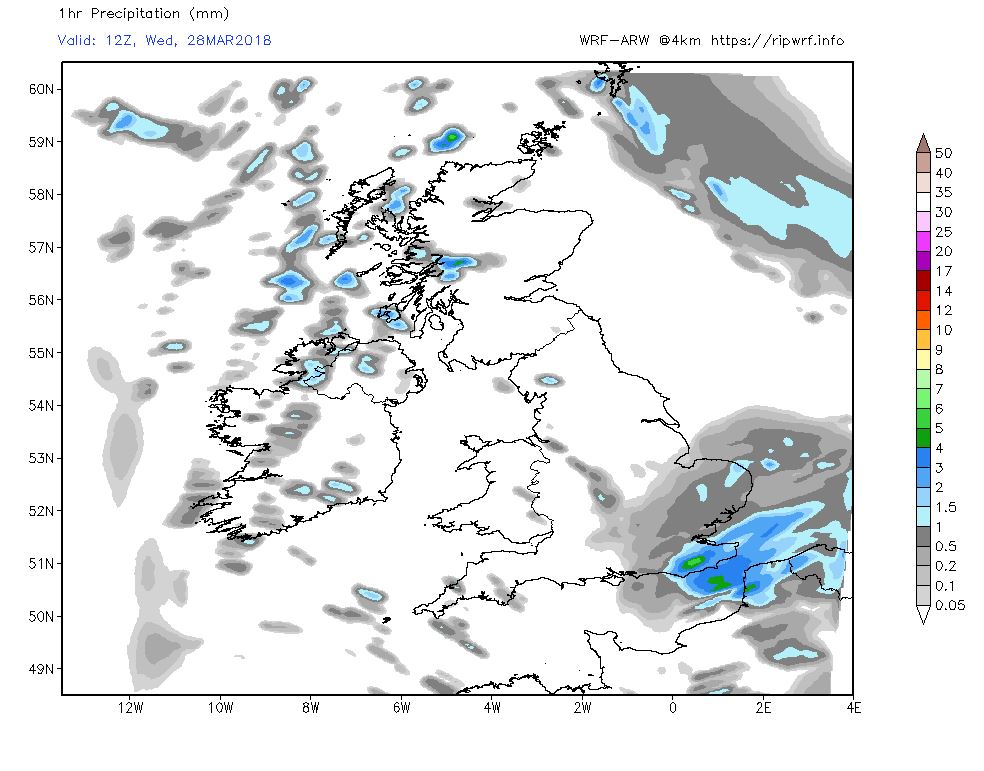
Not a huge change to this scenario on Friday with the low drifting around in the south west approaches and fronts/troughs circulating within the general circulation bringing showery outbreaks so still unsettled with quite a diurnal temp variation,.
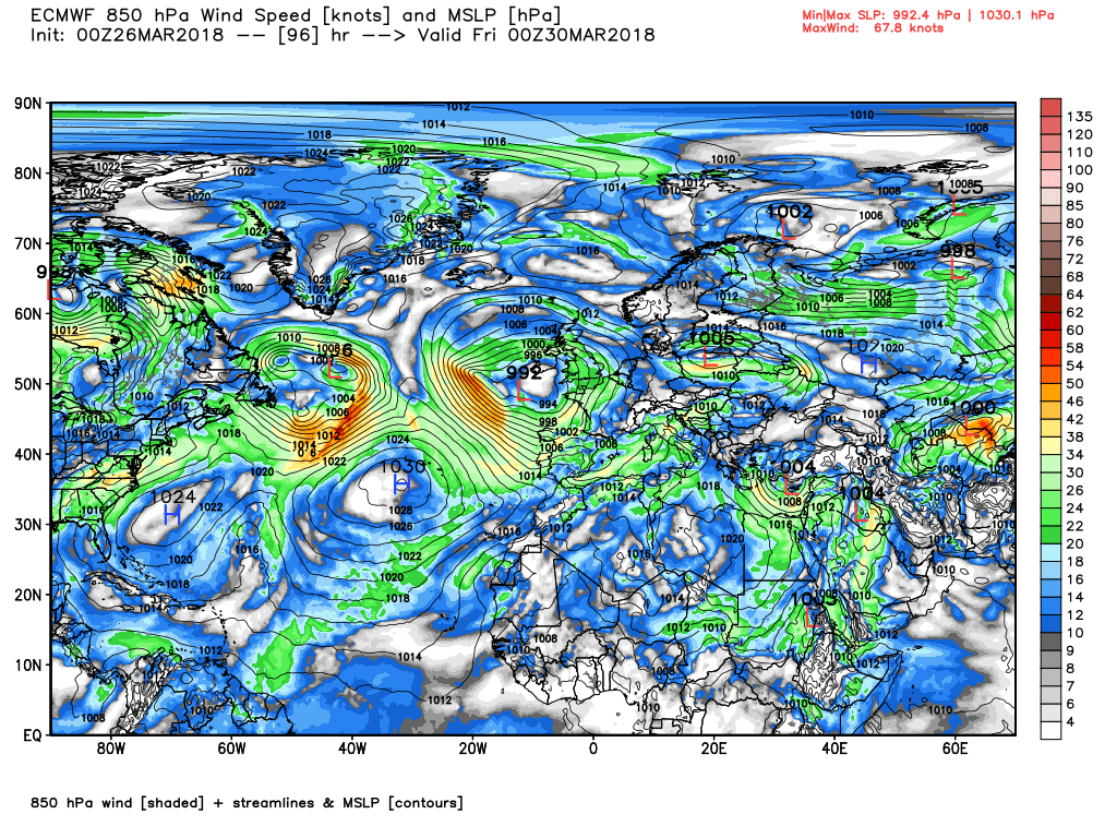
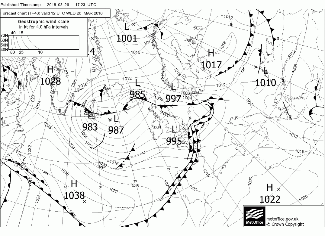
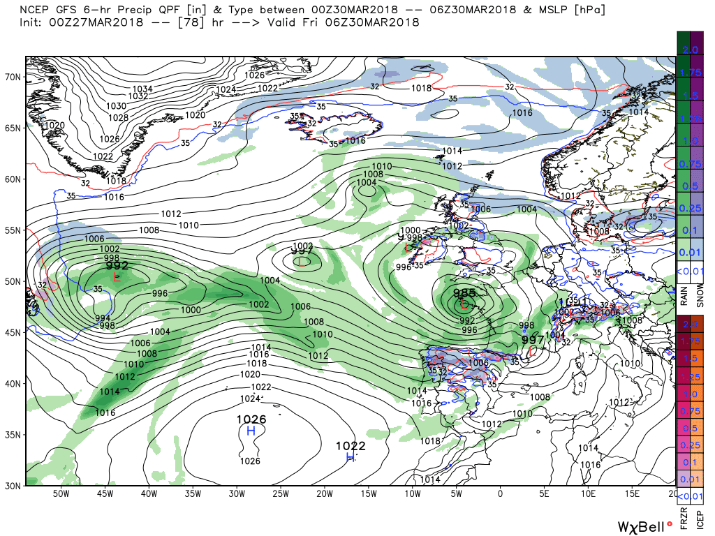
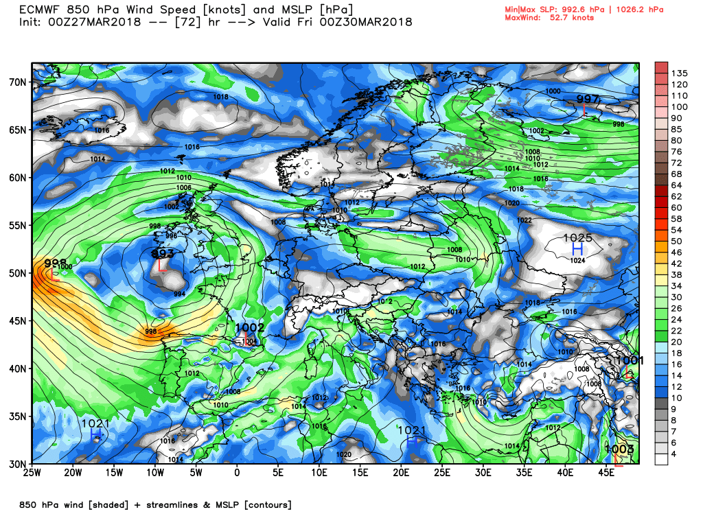
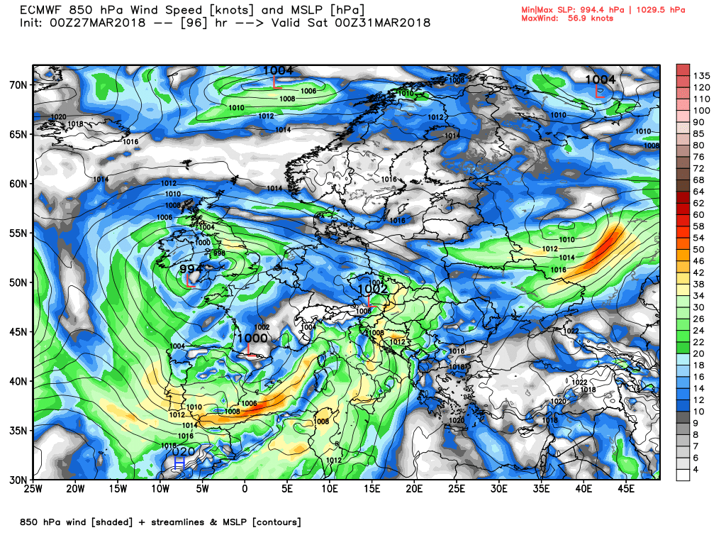
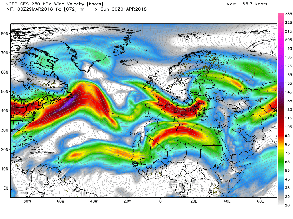
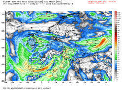
The ecm at T72 with the trough on the cusp of moving SE and the surface wave that had nipped across N. France now en route for Poland and the at T96
The weather vis the wave on Weds still not pinned down, Possibility of snow on high ground?
Just when I thought it was safe to put my snow gear away!Evening post from Malcolm on prospects for the next couple of days:
") P .
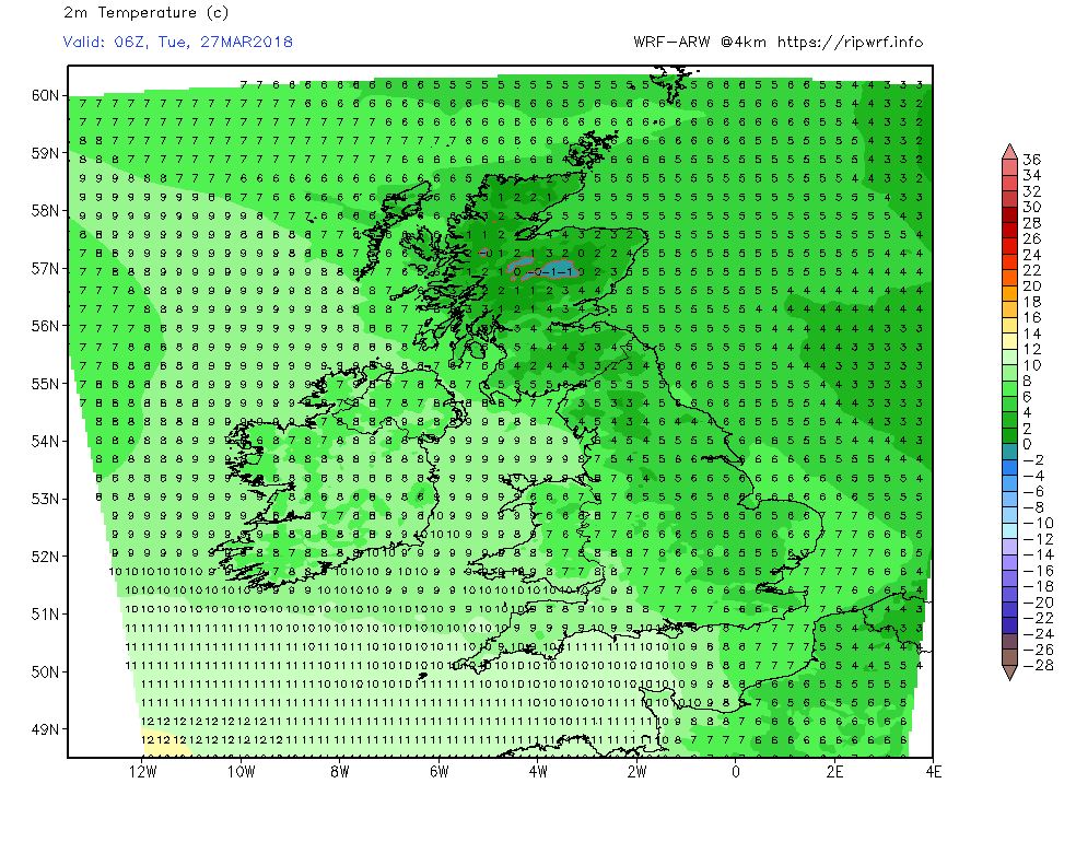
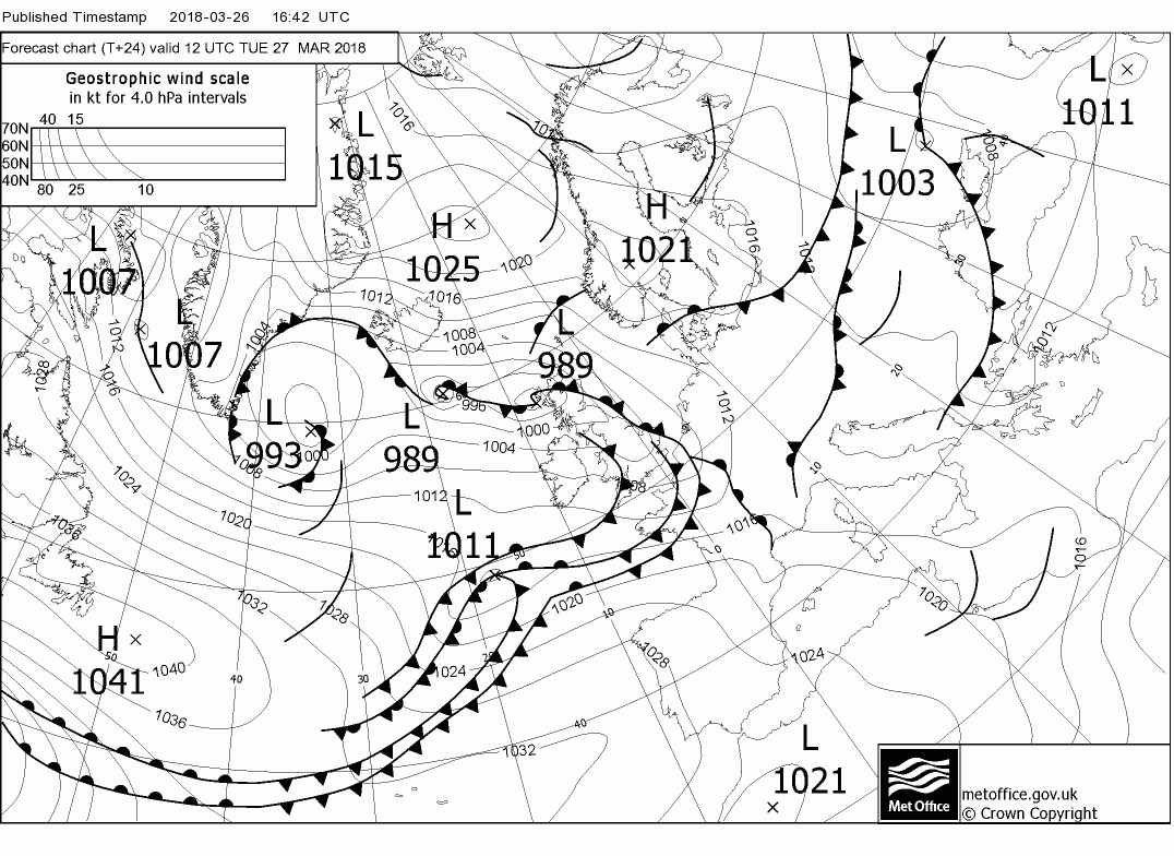
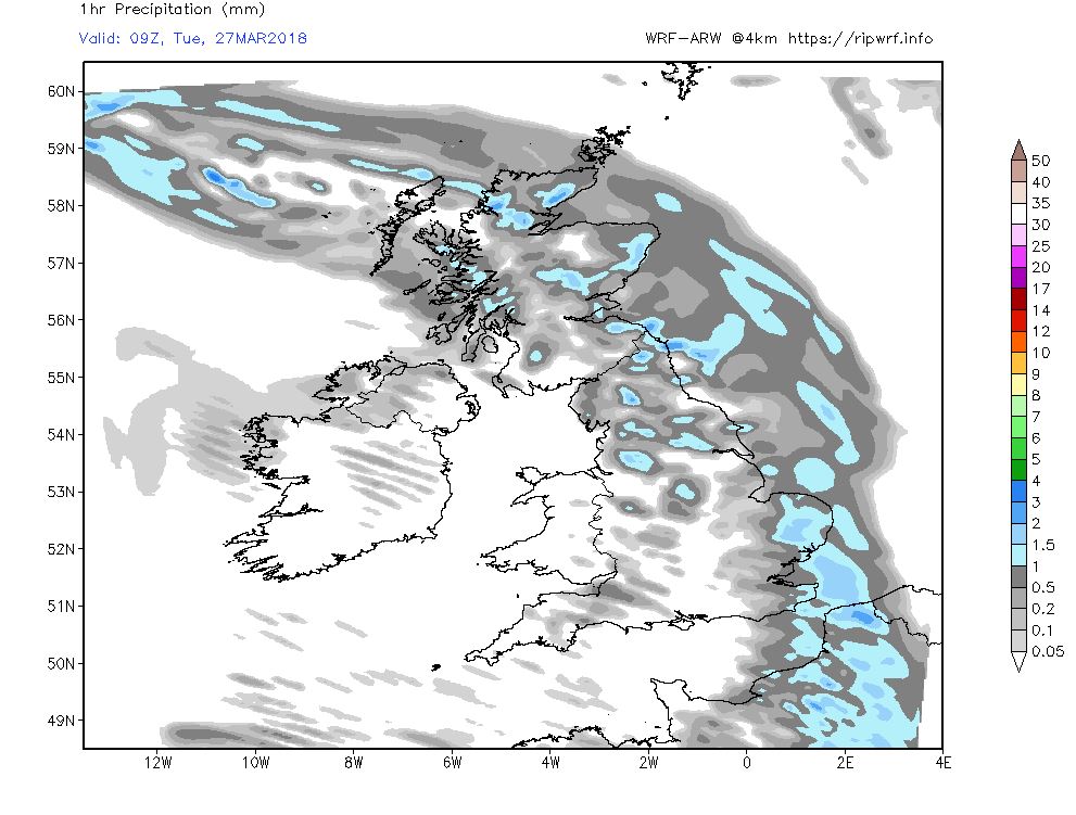
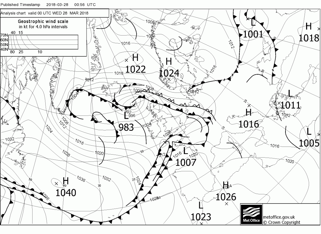
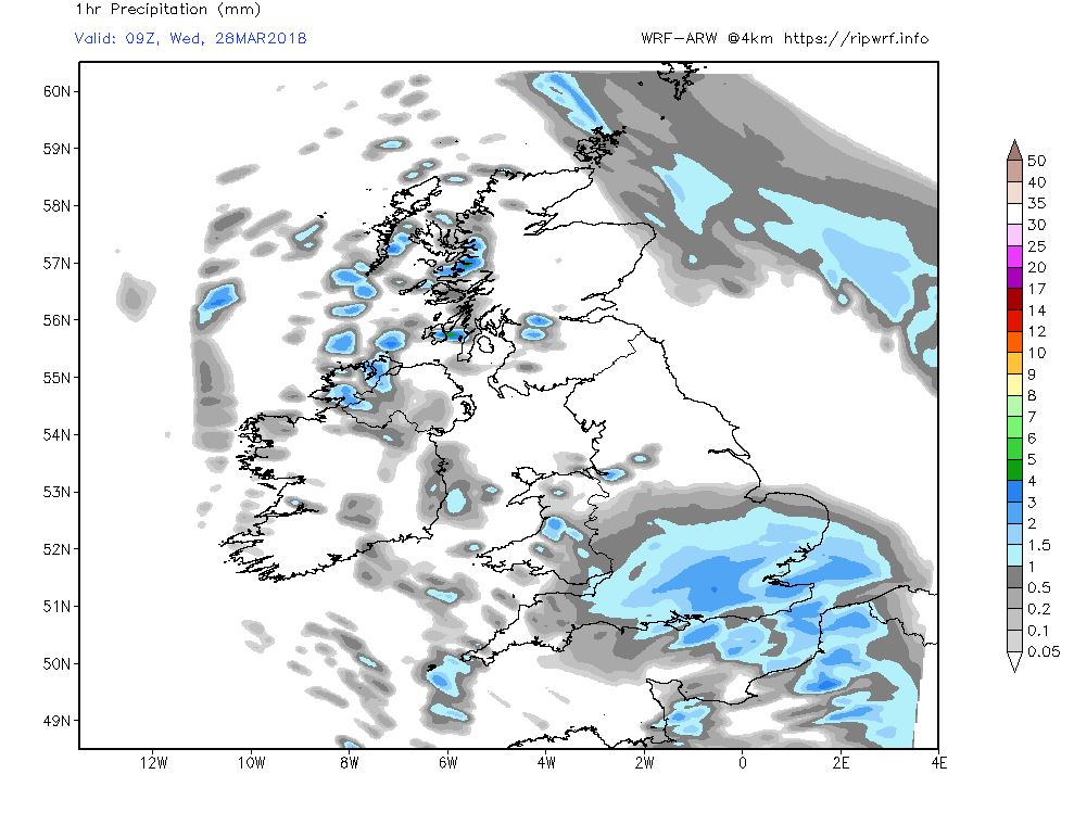
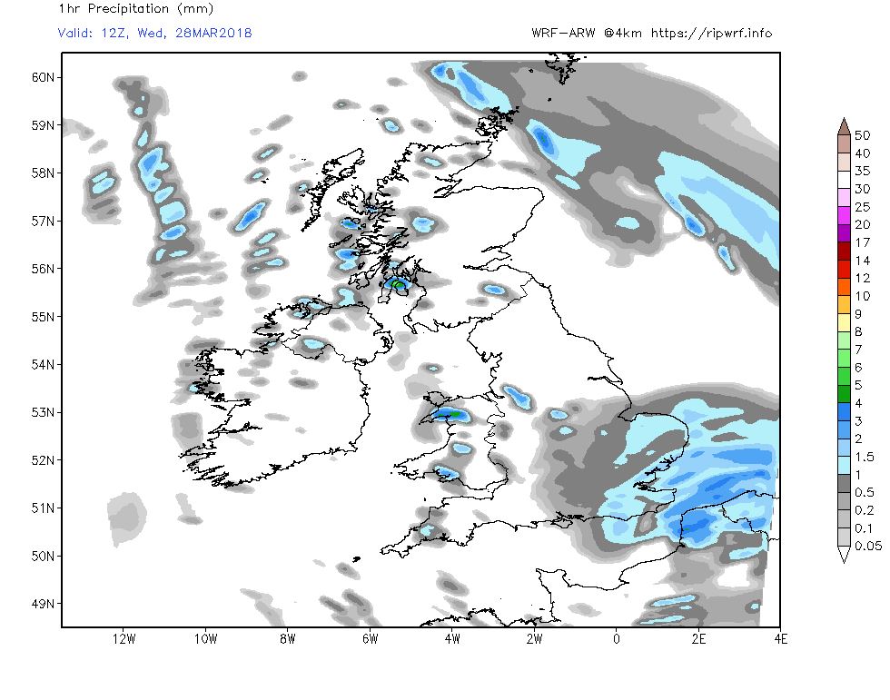
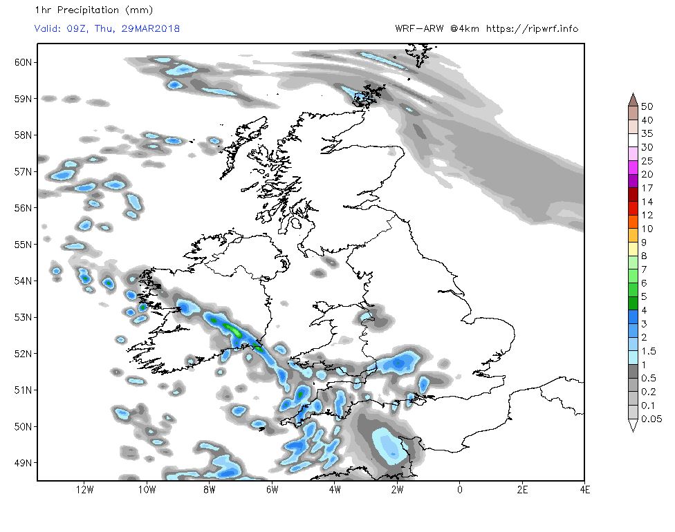
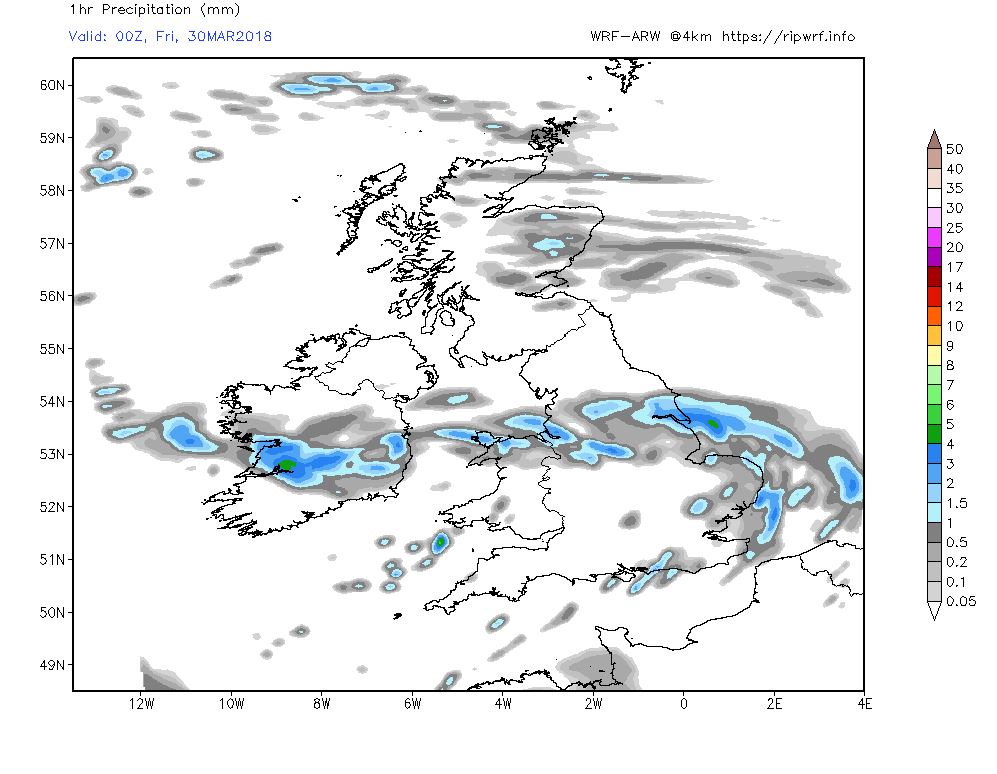
P .The fronts and rain associated with the low west of Scotland will continue to move east across the country this morning clearing the east coast around midday although the rain and hill snow will hang around in northern Scotland. Elsewhere clearer behind the front although there could well be some heavy rain showers in places.
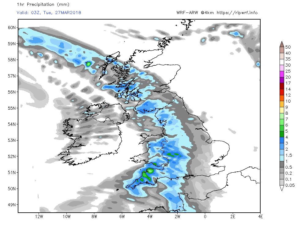
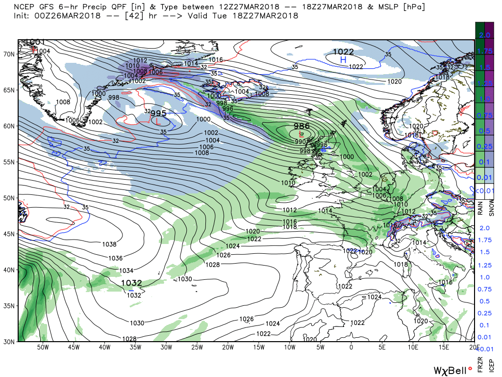
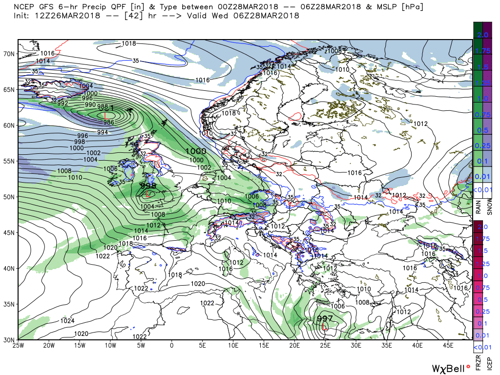
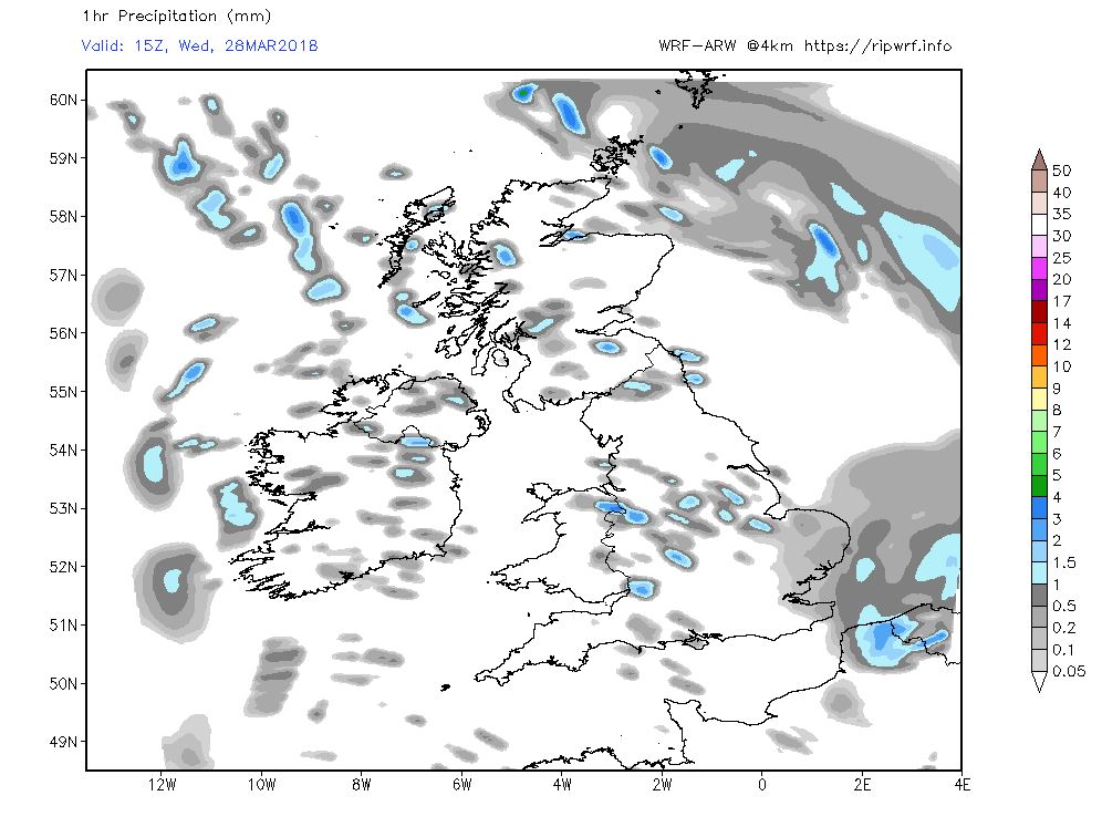
By 1800 the wave depression is forming west of Cornwall and this continues to evolve and track east overnight and through tomorrow morning bringing rain, and possibly some sleet/snow to the south west and south, before clearing in the afternoon.
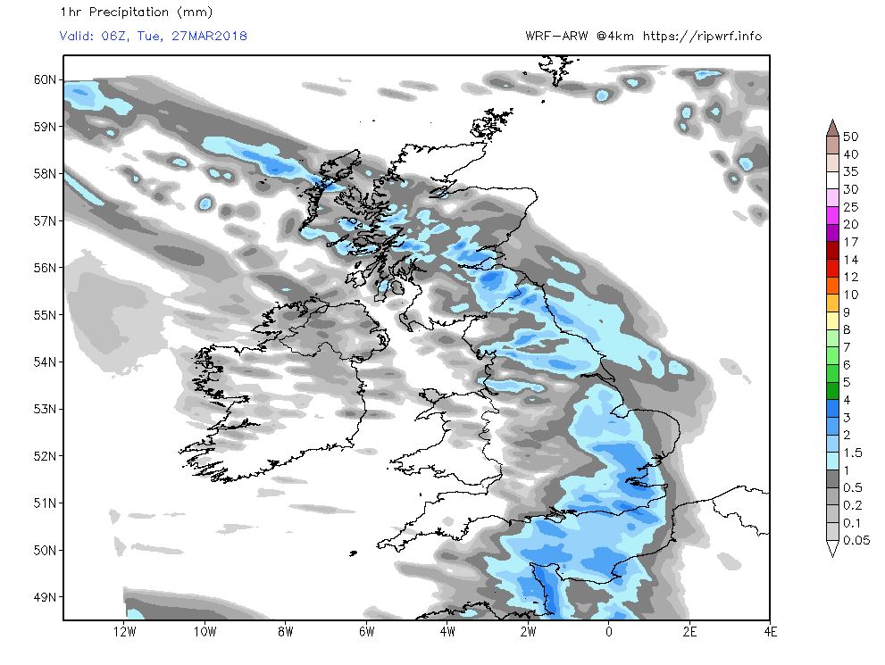
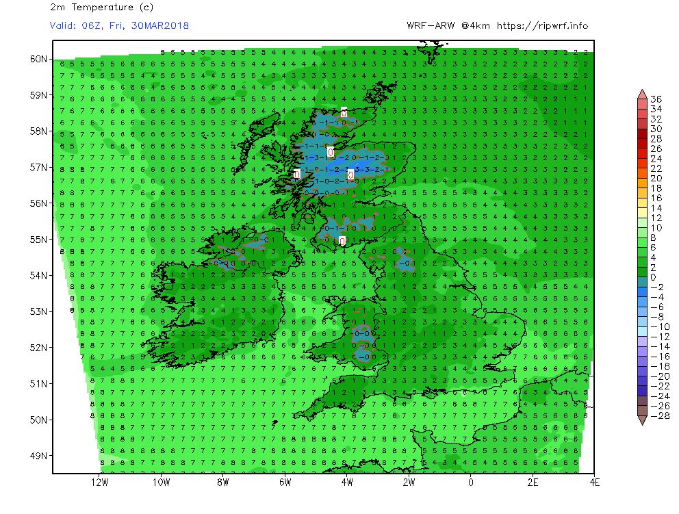
Thus by 1800 the low is over northern Germany and the front has finally shifted a little NE away fro Scotland with the centre of the large low to the west just south west of Iceland 978mb. Temps a little below average.
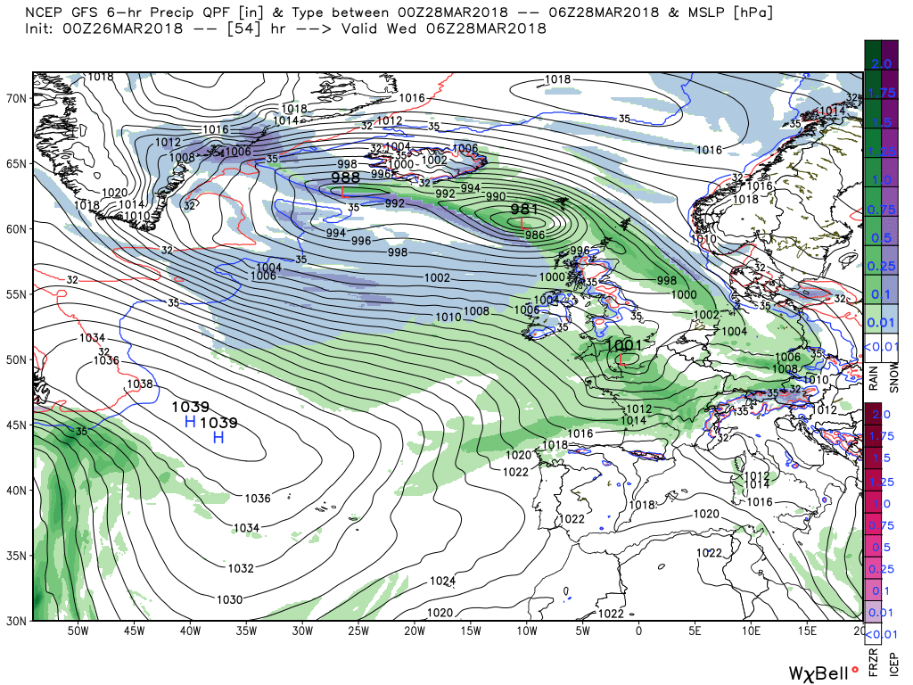
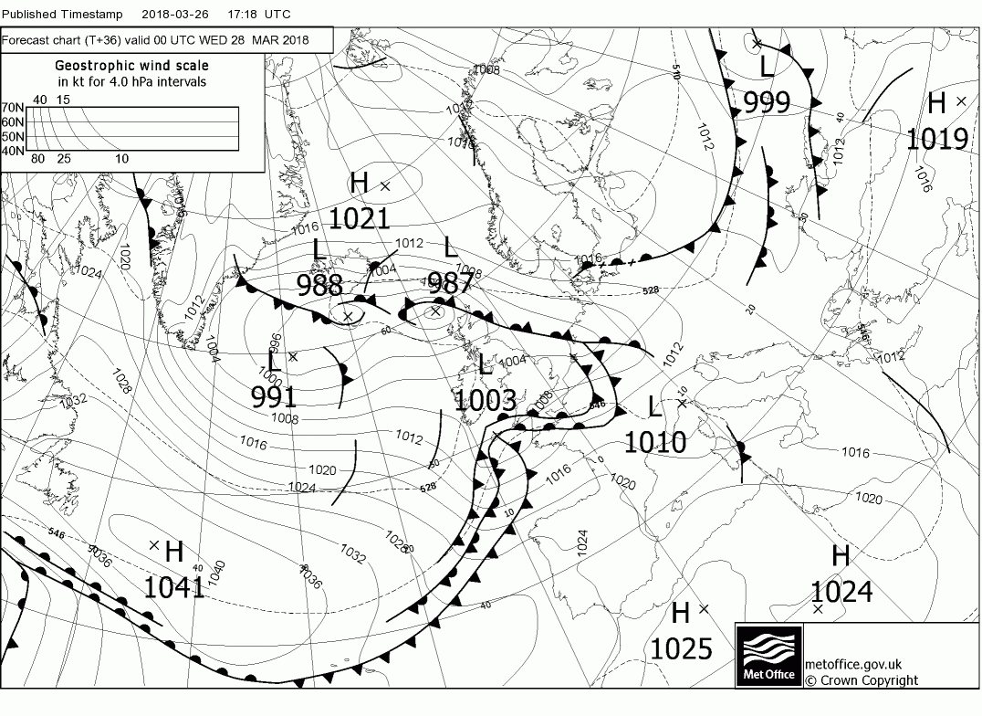
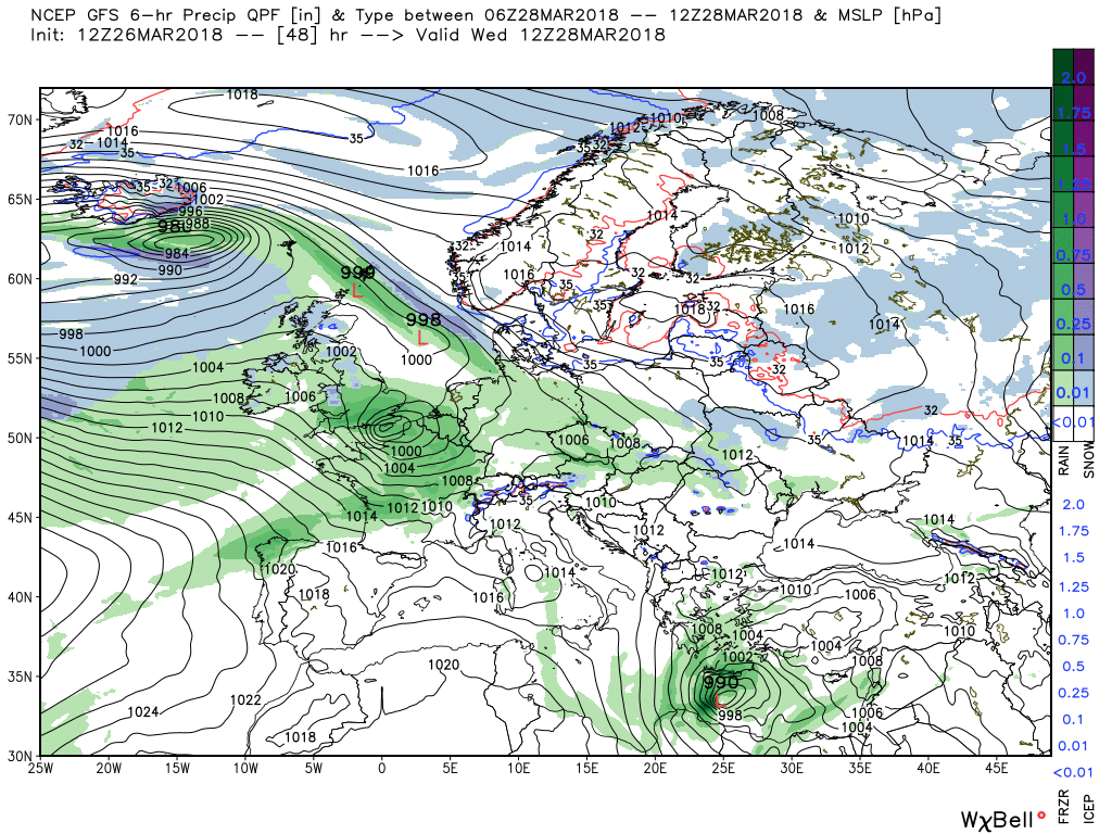
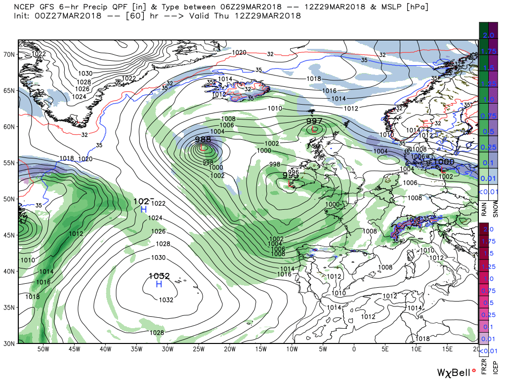
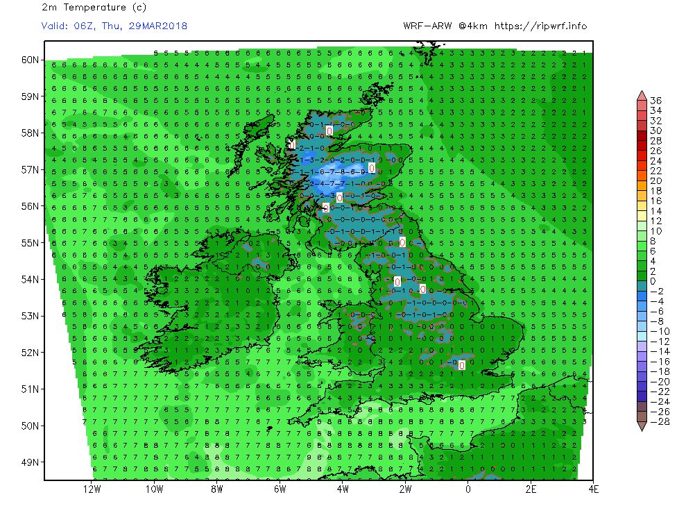
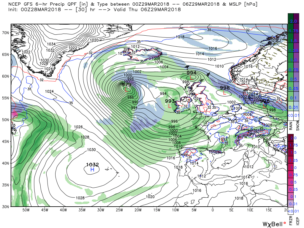
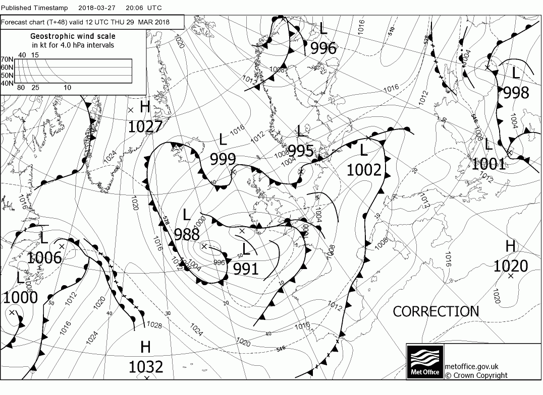
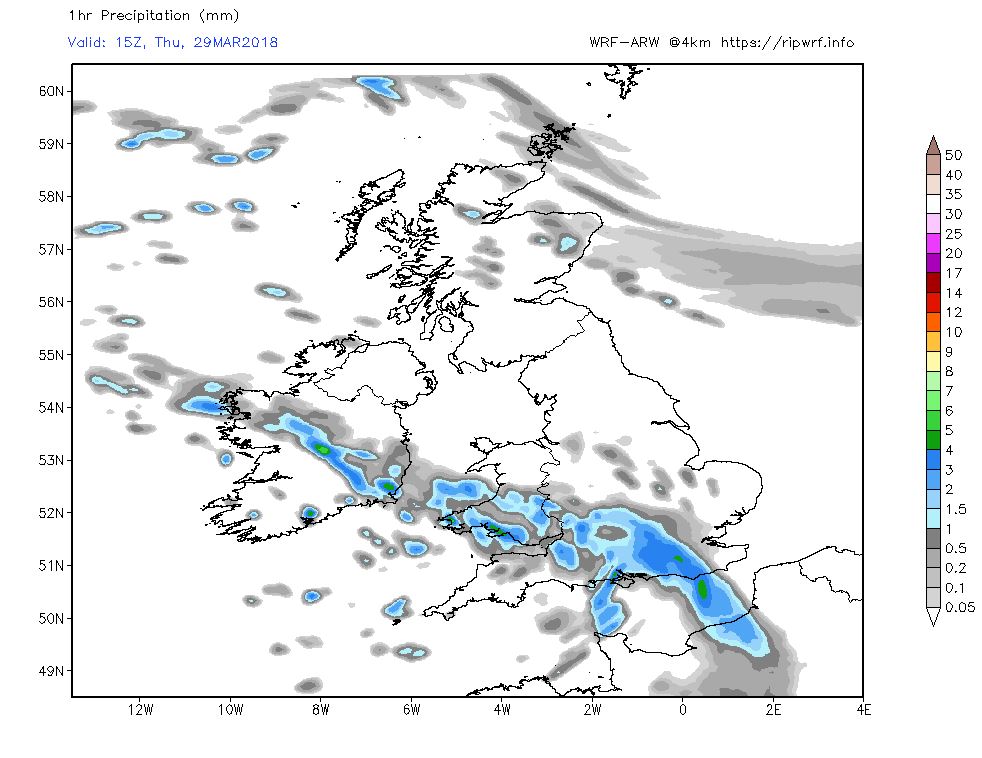
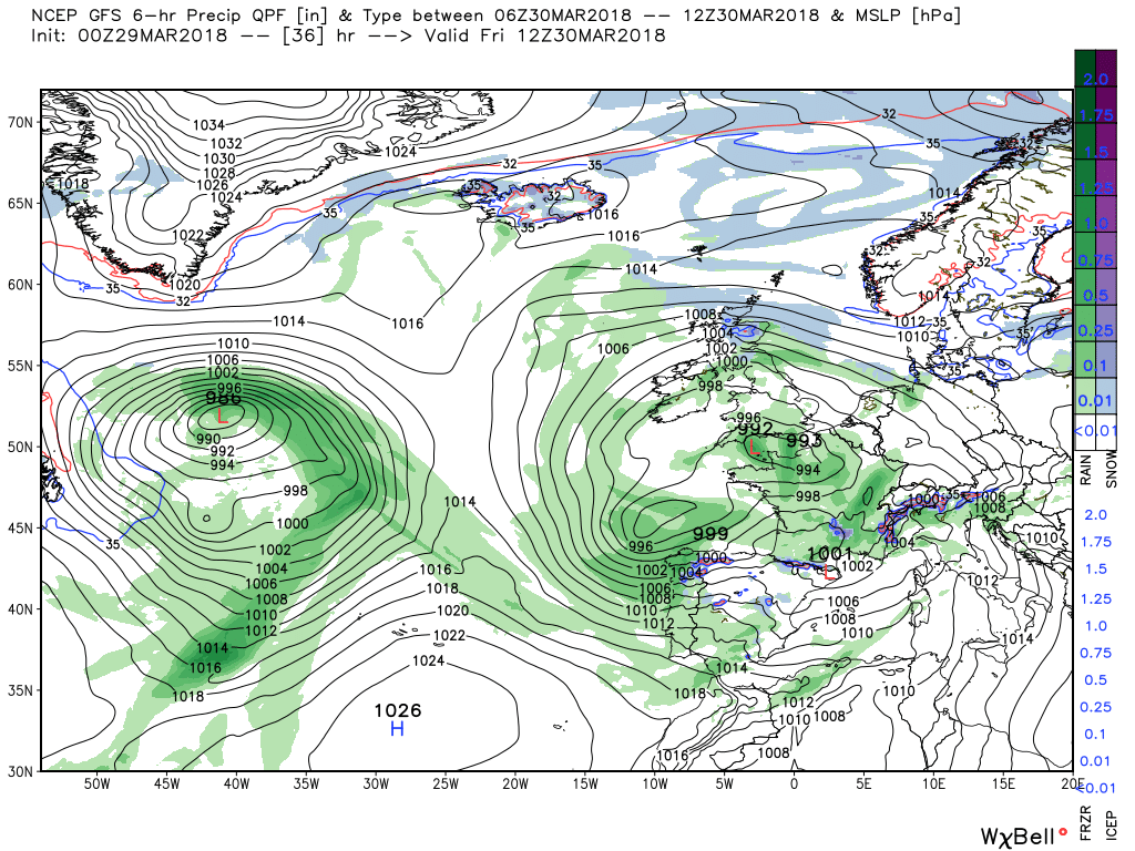
Thursday midday sees the upper trough and associated surface low centres sliding south east as the high pressure amplifies to the west with the main low centre over south west Ireland and the associated front and rain impacting the south and Wales, The other active front is still not far from northern Scotland with waves continuing to form on it. Temps still a little below average.
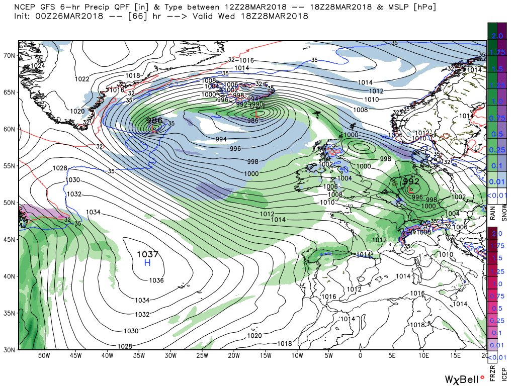
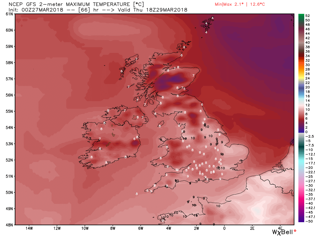
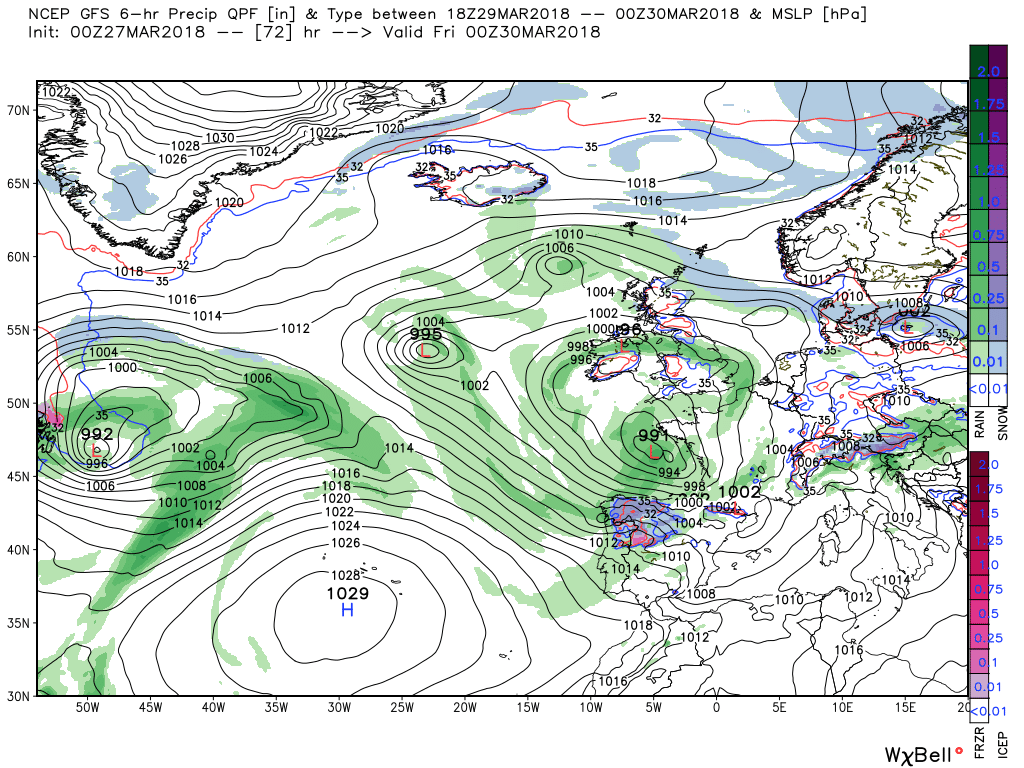
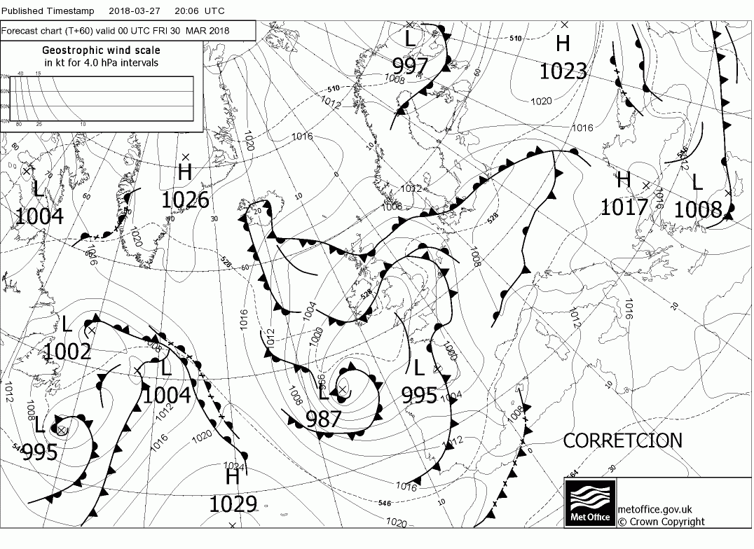
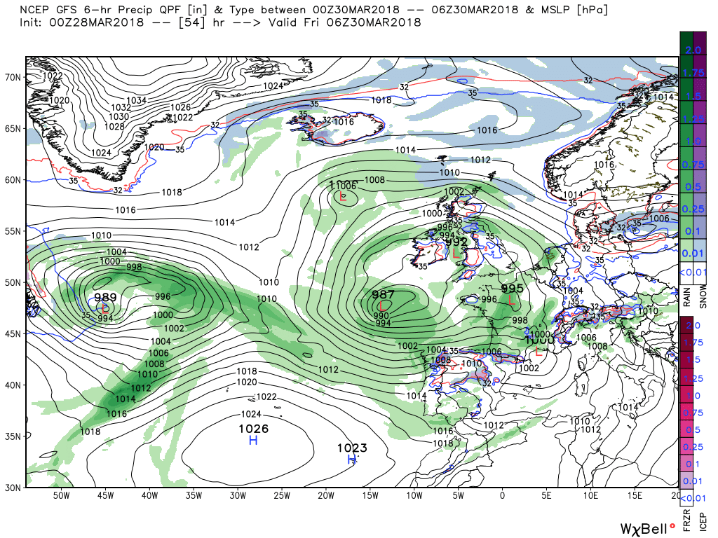
According to the GFS another low forms near the center of the upper trough to the SW of the Uk and the surface feature deepens and tracks into northern France though Thursday evening and Friday which will affect the south of England bringing some rain whilst at the same time initiating an easterly wind component over the rest of the UK.with showers which may fall as snow on the high ground. further north, albeit temps in general are holding up.
No significant changes to this scenario on Saturday
The ecm broadly similar to the GFS Thursday/Friday with the low centred to the south west with fronts/disturbances running around the circulation over the UK so unsettled is the name of the game with occasional longer periods of rain.
The occasionally heavy rain belt, perhaps some snow on the hills, currently over south Wales and the south west will track east during the morning clearing the south east coast by mid afternoon. Elsewhere and behind the passage of the rain scattered showers and sunny intervals. The showers will die out over night leaving a clear night with a frost in many areas and even some freezing fog. The exception may well be NE Scotland as the low and the occlusion are still in the vicinity producing snow showers.
Early Thursday, with the large area of low pressure to the west, the next frontal system swings in from the south west and through the day tracks north east bringing a broad area of patchy showery rain , perhaps even thundery, on it's journey. Over northern Scotland the waving occlusion still hasn't moved very far so still some snow showers which may even reach lower levels.
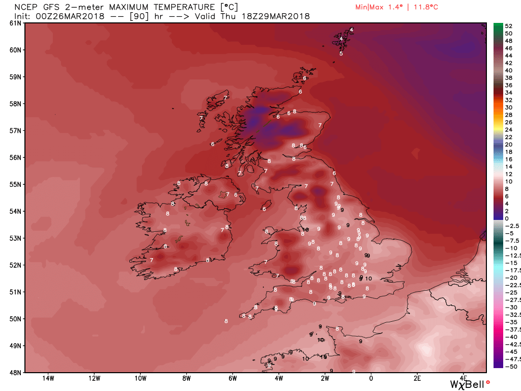
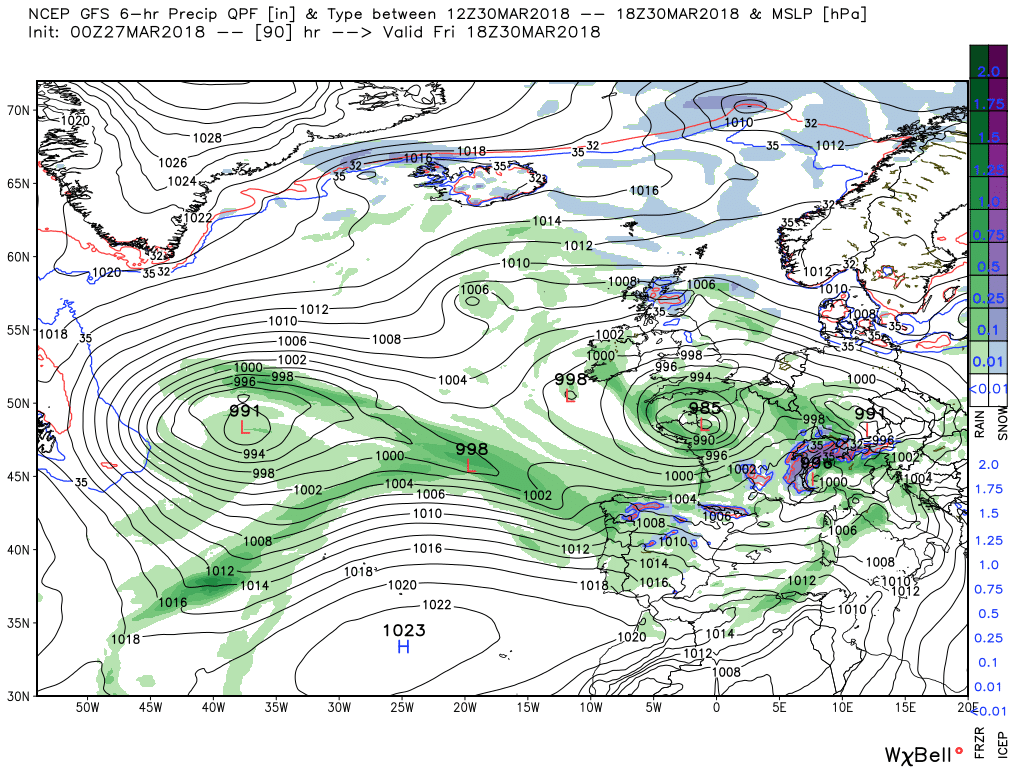
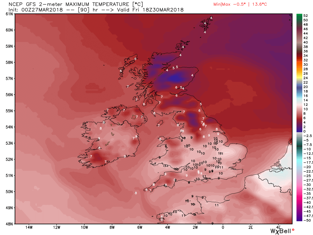
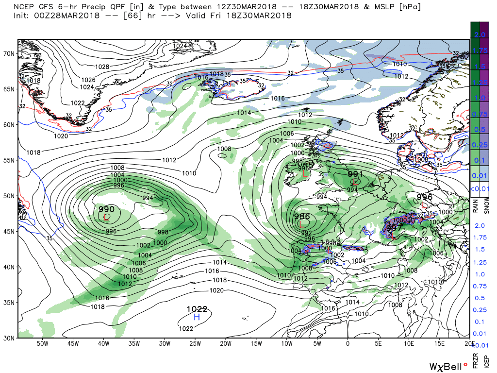
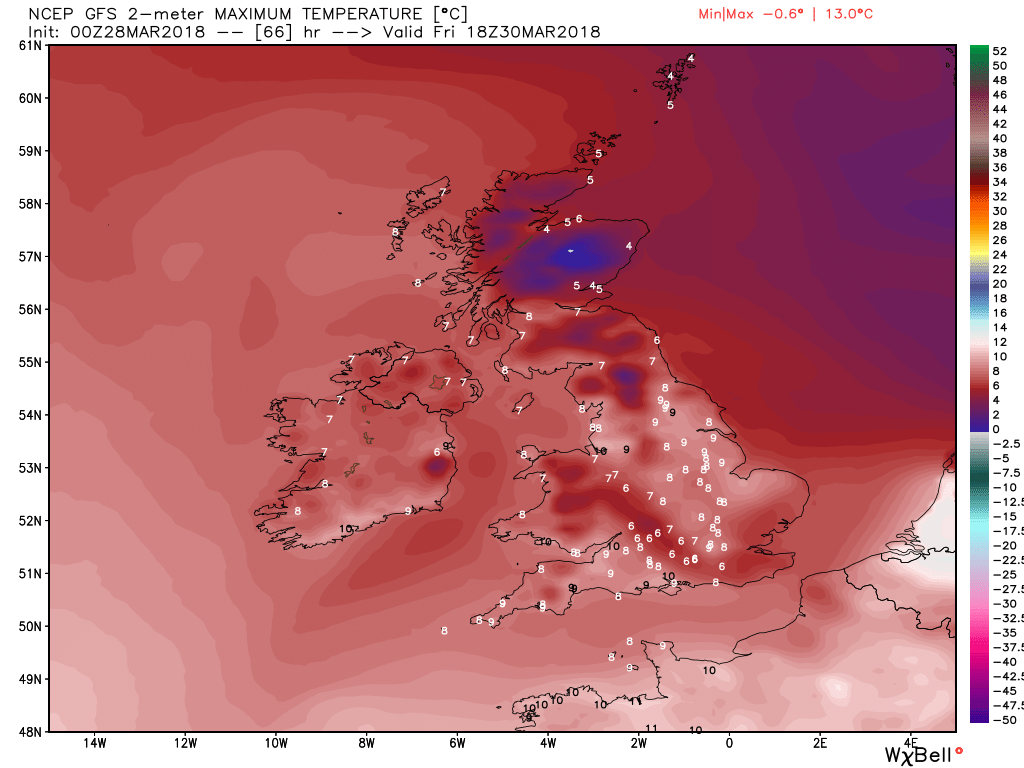
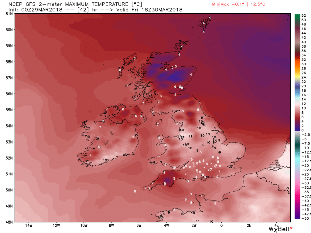
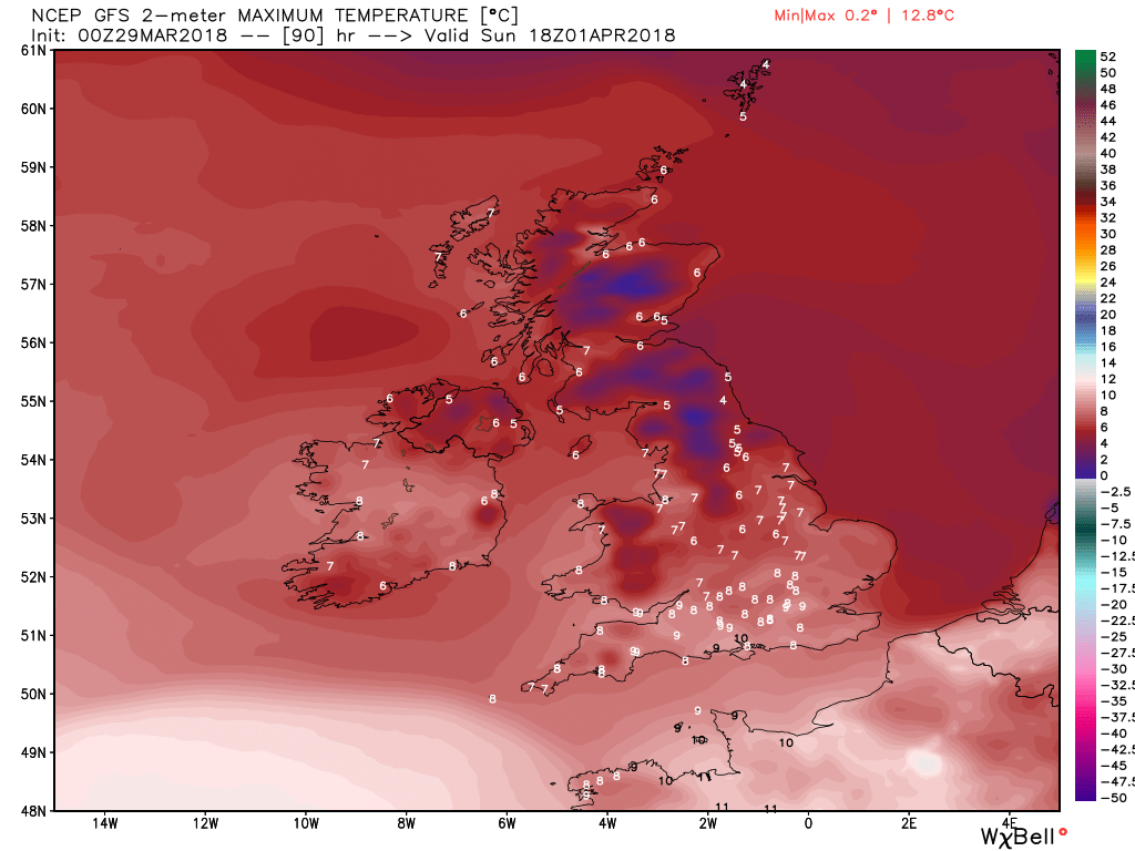
By Friday the main center of the low pressure area has slipped to the south west with the UK in the northern quadrant thus a brisk showery north easterly in the north and generally unsettled elsewhere with disturbances running around in the circulation.giving out breaks of rain interrupting the sunny intervals. Temps still in the 5-8C range.
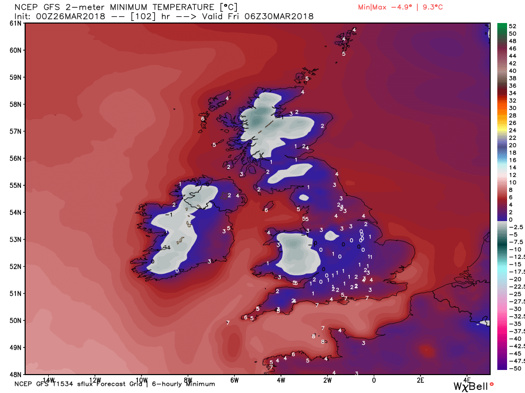
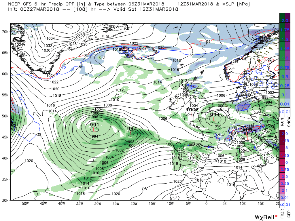
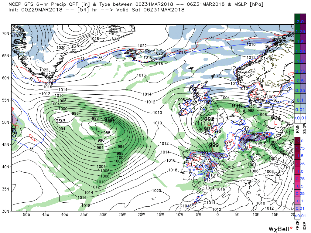
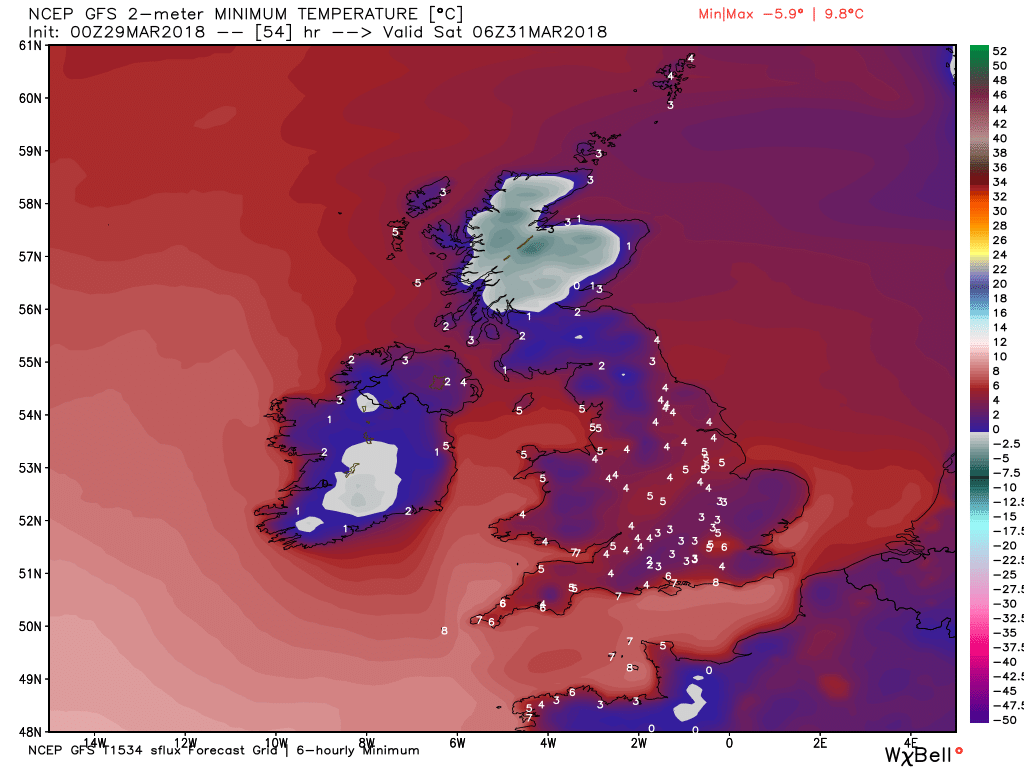
Still much the same early on saturday but changes are afoot. The main area of low pressure is filling and moving south east thus the surface wind backs initiating the ingress of colder air in the north with wintry showers as can easily be seen on the temp spread at 1800.
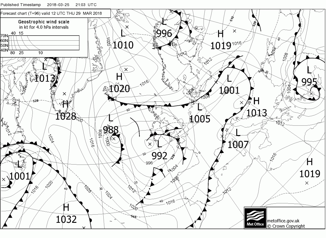
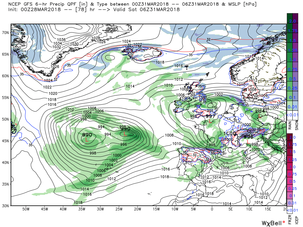
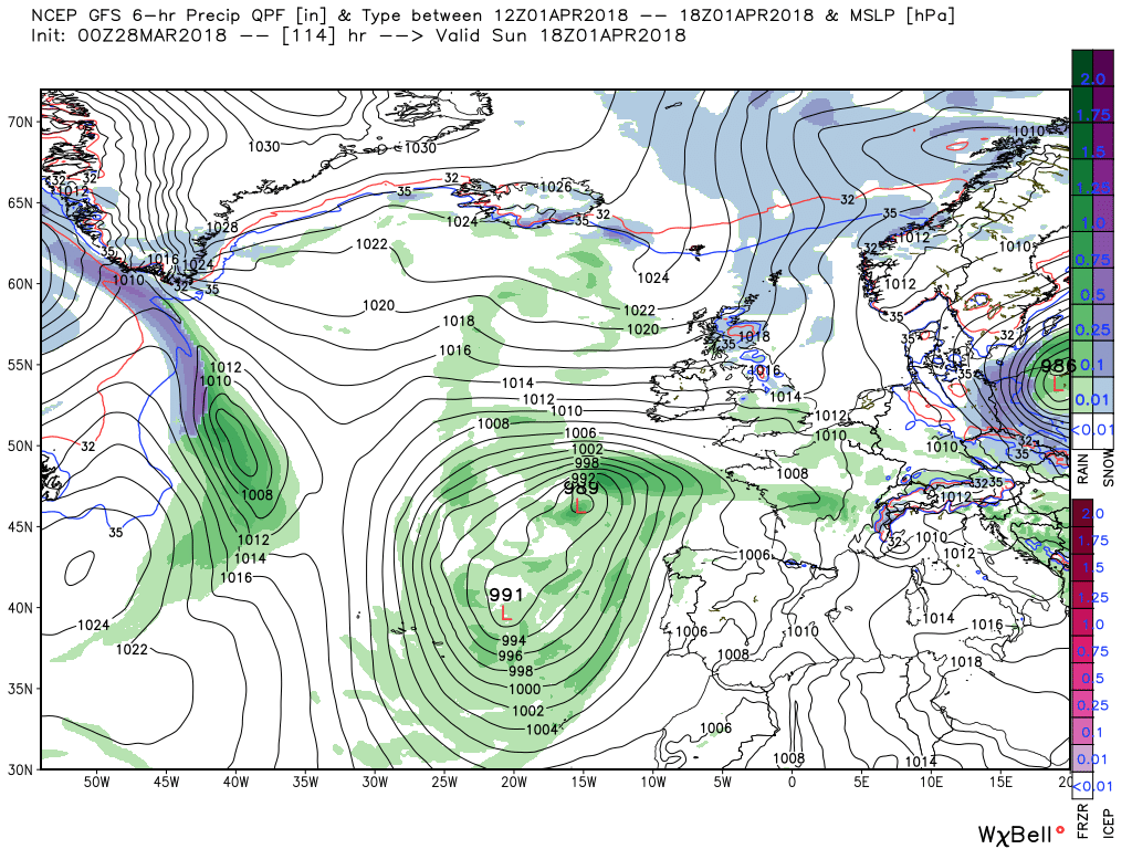
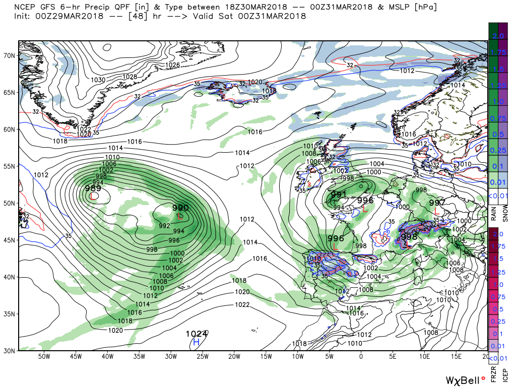
Meanwhile whilst this has been going on another upper trough has exited North America and is being forced south east by further ridging in the Atlantic so that by 1800 on Sunday the large surface low with associated fronts is situated south west of Ireland and the latter are poised, so to speak, to track north east over the UK where the colder air has slipped much further south.
This detail is of course according to the GFS
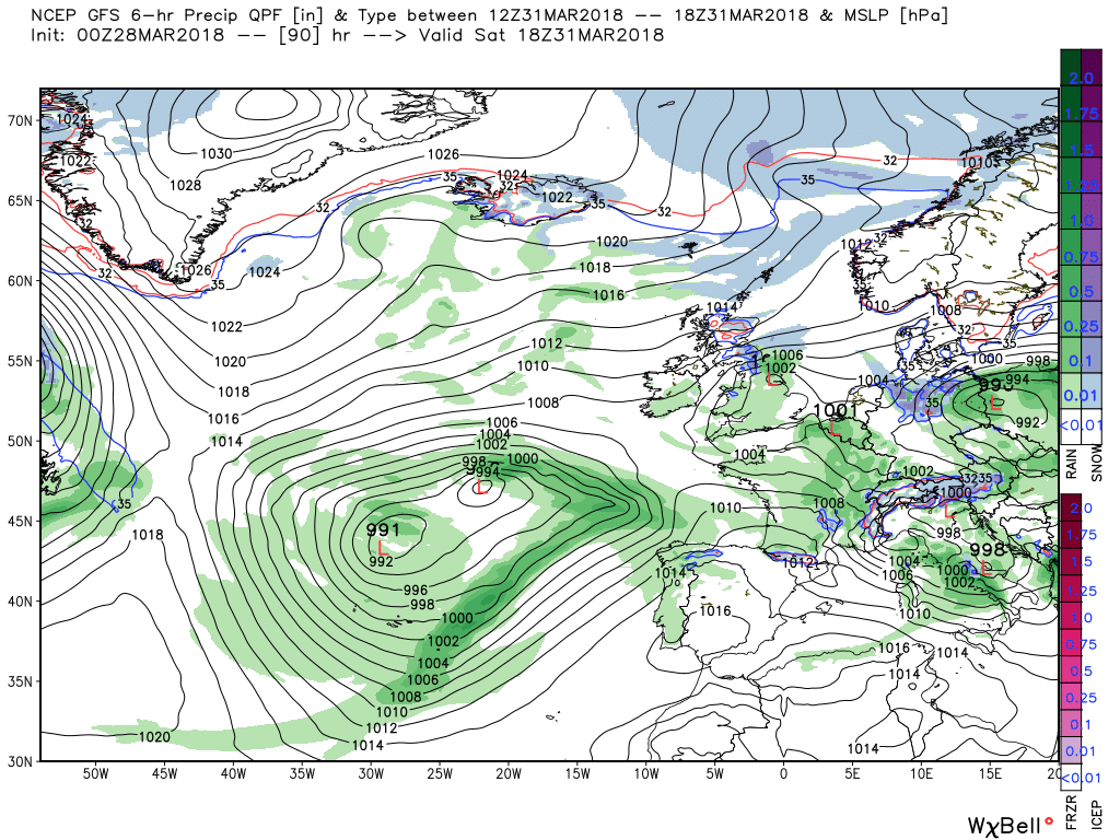
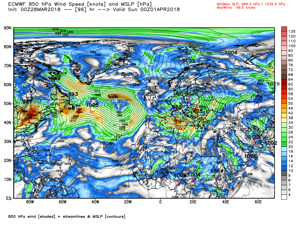
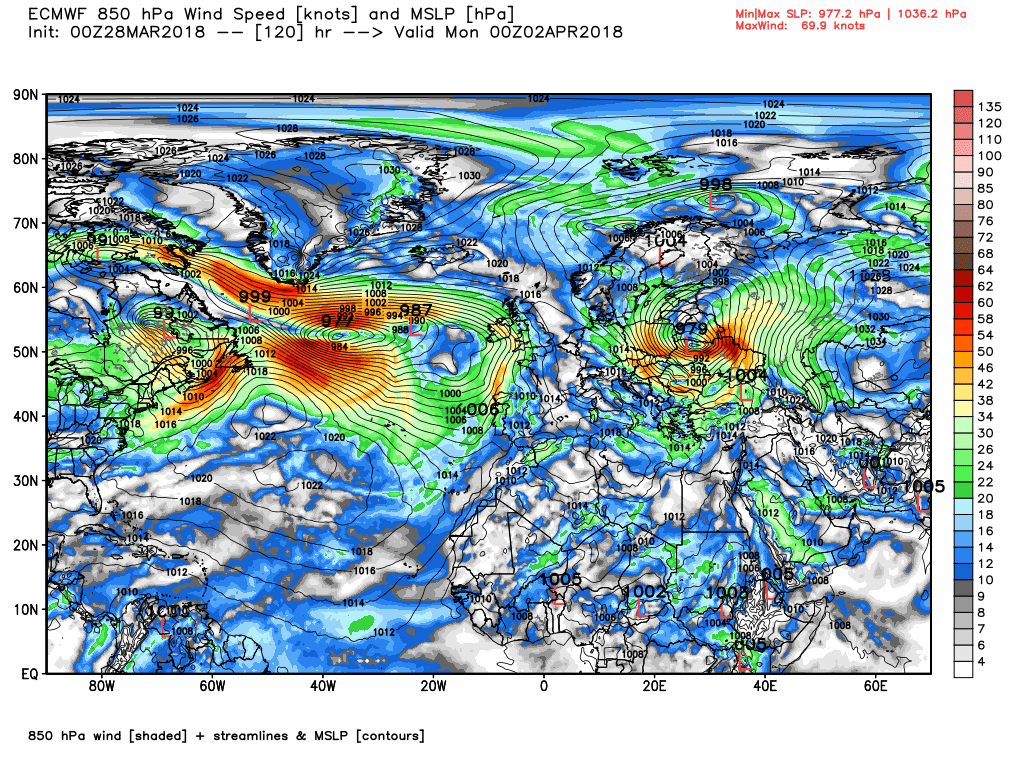
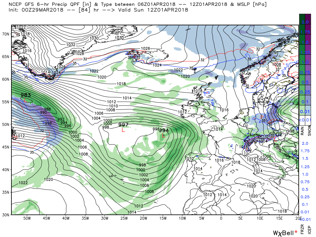
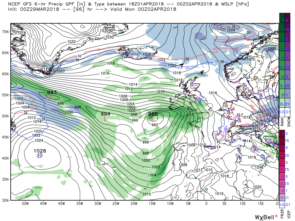
The ecm is still differing from the GFS vis the main low to the south west and associated front over the weekend. It has the front aligned SW of Ireland at T96 and tracks it steadily NE through the next 24 hours to portend a very wet and Windy day on Monday.
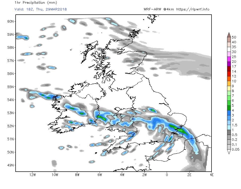
The main feature of the current analysis is a large area of low pressure to the north west/west which is in the process of swiveling south.and then south east and will be a major player in the UK weather over the next three days. At the moment within the circulation of this there is a stationary, waving occlusion, still bringing snow showers to north east Scotland and a front over the south west of England currently producing rain showers that will travel north east during the day to bring similar to the rest of southern England, Wales and the Midlands.
Similar story overnight in Scotland and the rain band, snow on the high ground, will edge further north in England Quite a chilly night in northern regions with frost in many places.
Through Friday the front continues to track north but further south a small low has formed in the circulation of the main low and has tracked north, along with associated front, to bring heavy rain to southern England and south Wales. The front and rain continue to move north overnight into Saturday morning but by then another wave has formed and is over the south west bringing more showery rain. All of this initiates a much cooler south easterly/easterly flow over northern England and Scotland with frequent wintry showers.
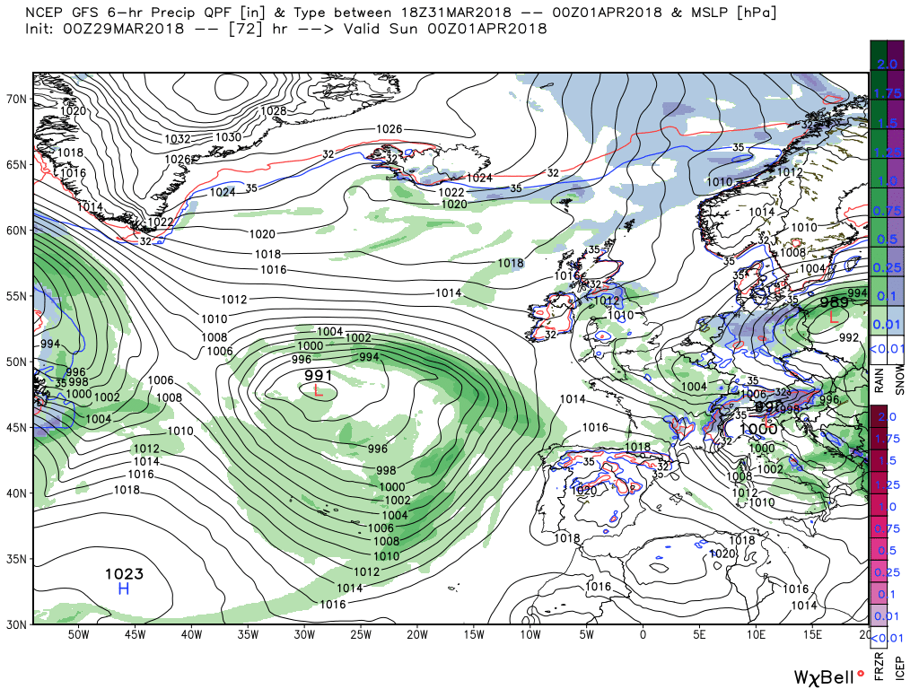
This unsettled scenario continues through Saturday but the main low pressure area is slipping south east and by 00 Sunday the surface wind has backed a tad and allowed ingress of colder air in the north of the UK. Whilst at the same time a new upper trough has formed in th Atlantic and is situated to the south west.as there is still a fair amount of energy exiting the eastern seaboard.
All of this sets Sunday up to be the best day of the weekend with far fewer showers, light winds and temps not too far below average. But by 1800 fronts from the system to south west are fast approaching bringing rain, and who knows, perhaps some snow as they track north east.