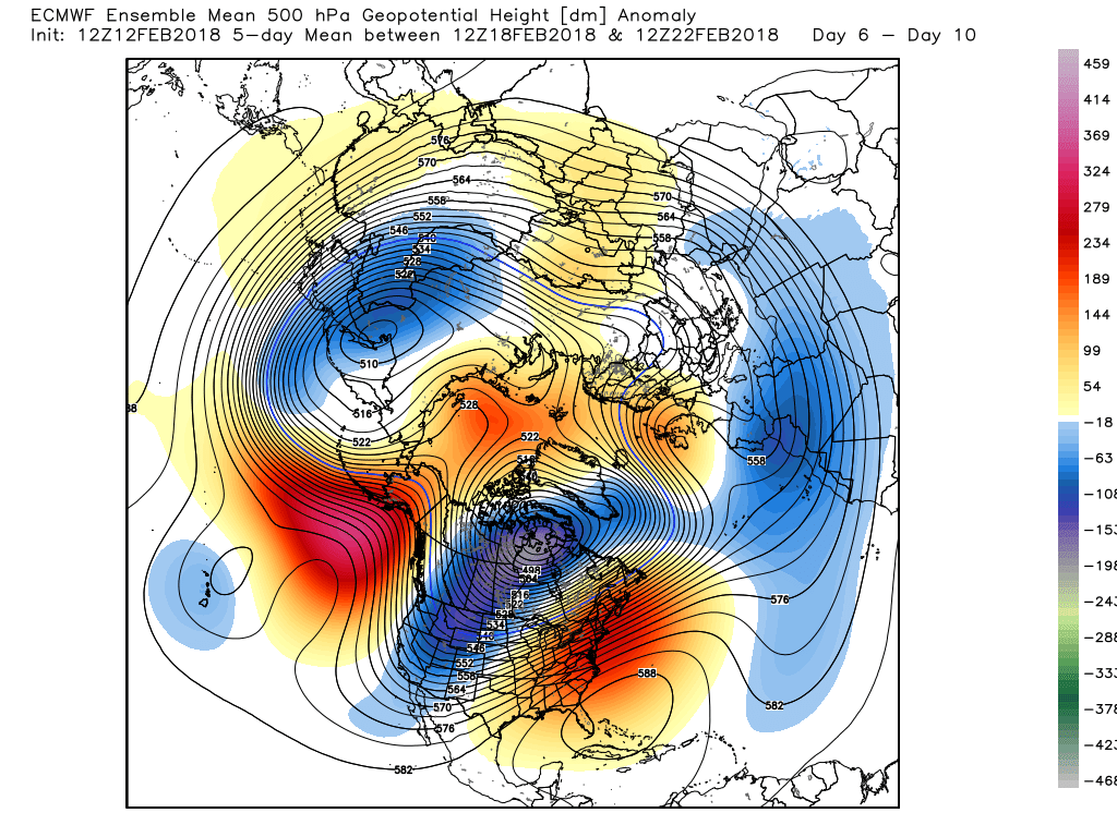
For one reason and another I couldn't do the usual medium term anomalies up date last evening so for the sake of conformity and because of the interesting times and recent major pattern changes just a quick run through this morning.
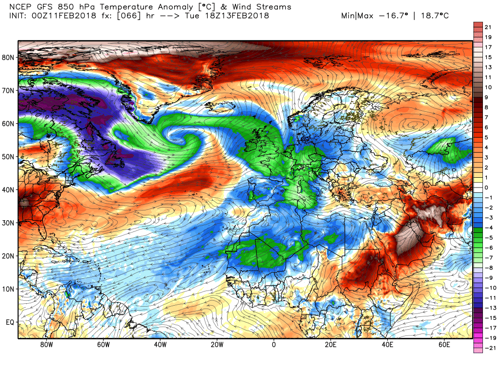
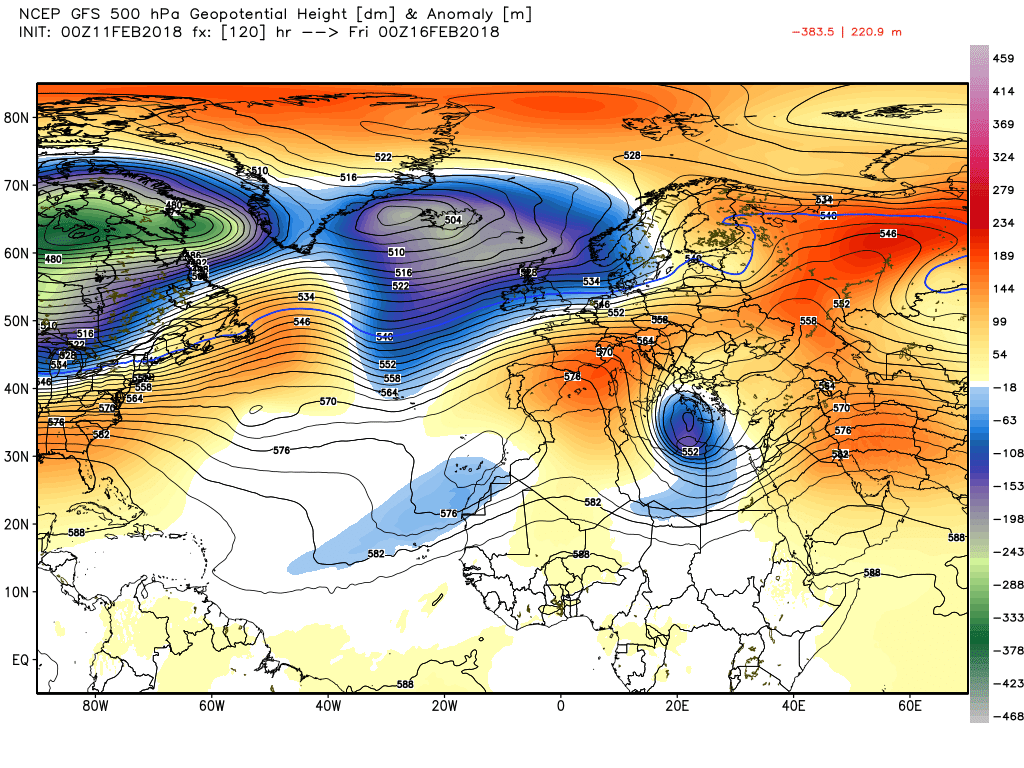
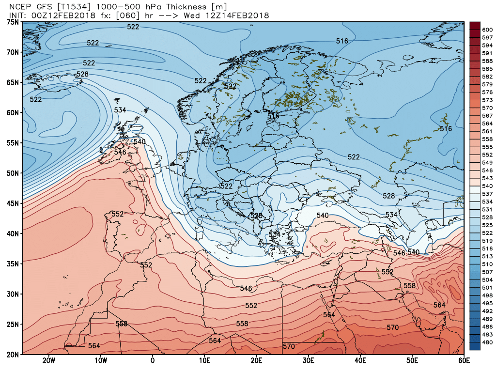
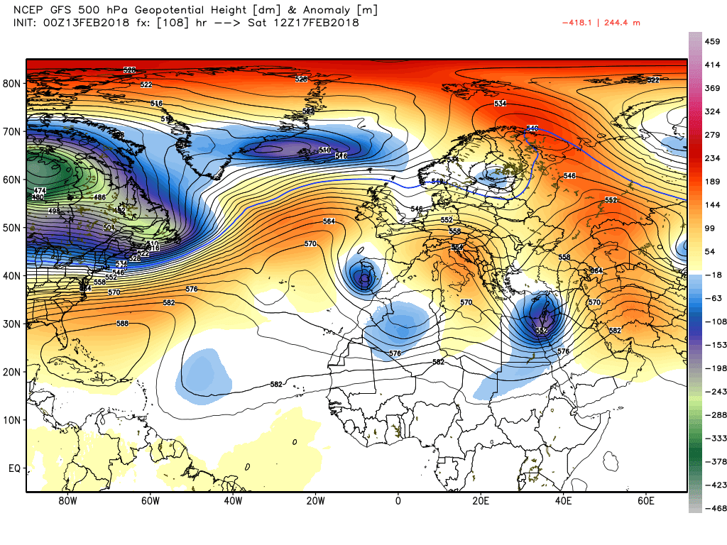
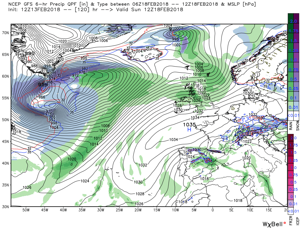
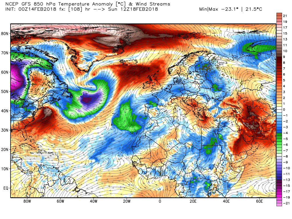
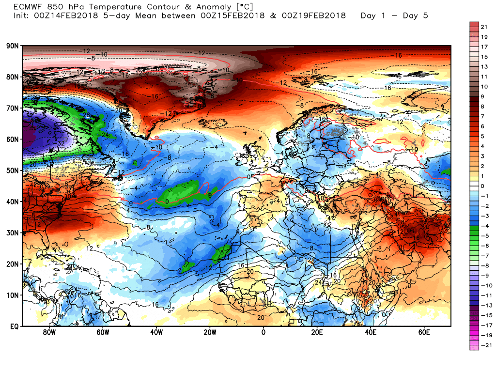
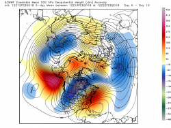
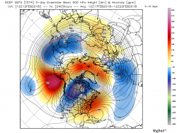
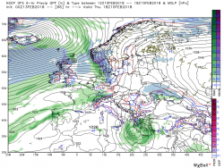
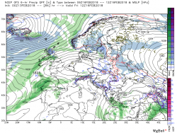
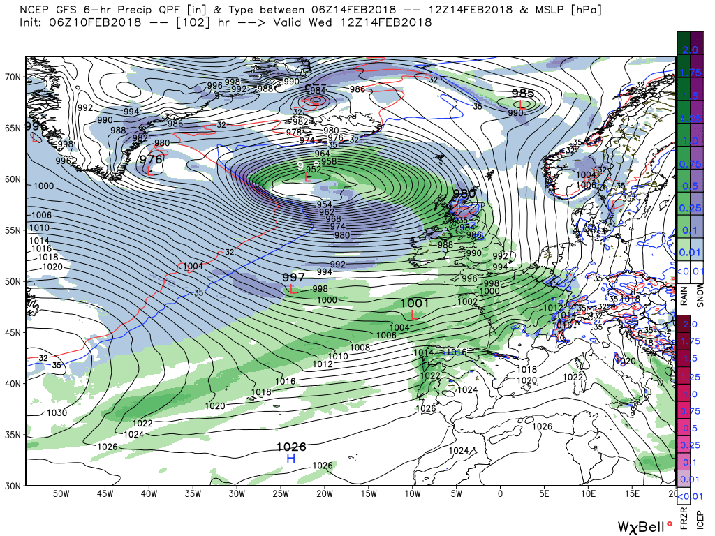
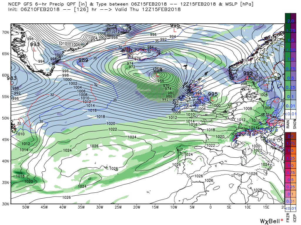
Everything is now more amplified and upstream still a Siberian vortex lobe (
blue are top left in the Northern Hemisphere images below), strong Aleutian ridge into the Arctic (
red/pink area between Alaska and eastern Russia, bottom left) and still an active Canadian vortex (
blue lower section of the same two images) with a trough running SW through central canada to the SW United States and still with a strong westerly flow leaving NE North America. So far so good but not so downstream where there is disagreement as to the the orientation of the Atlantic trough/ridge duo (
bottom right corner of the images, in mid-Atlantic) and consequently the trough to the east/south east as well. This will obviously impact on the det (
deterministic) runs and the subsequent surface analysis so I'll just leave it here for the time as it will be updated today.
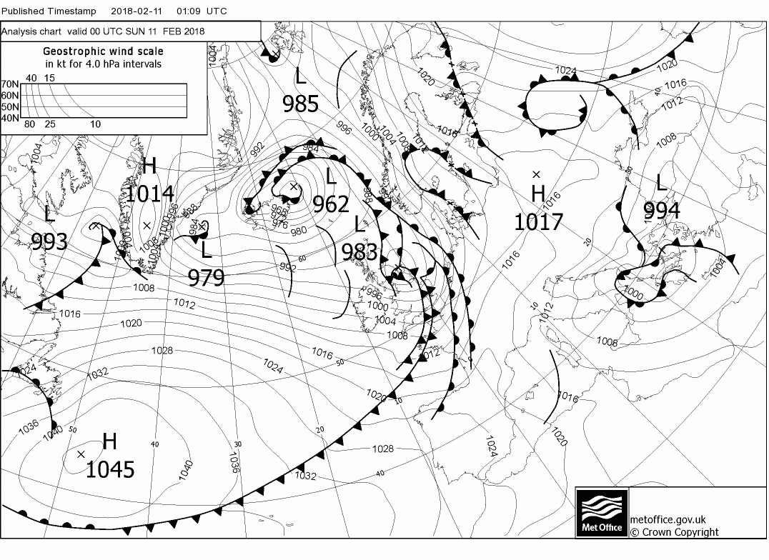
Back to the here and now.
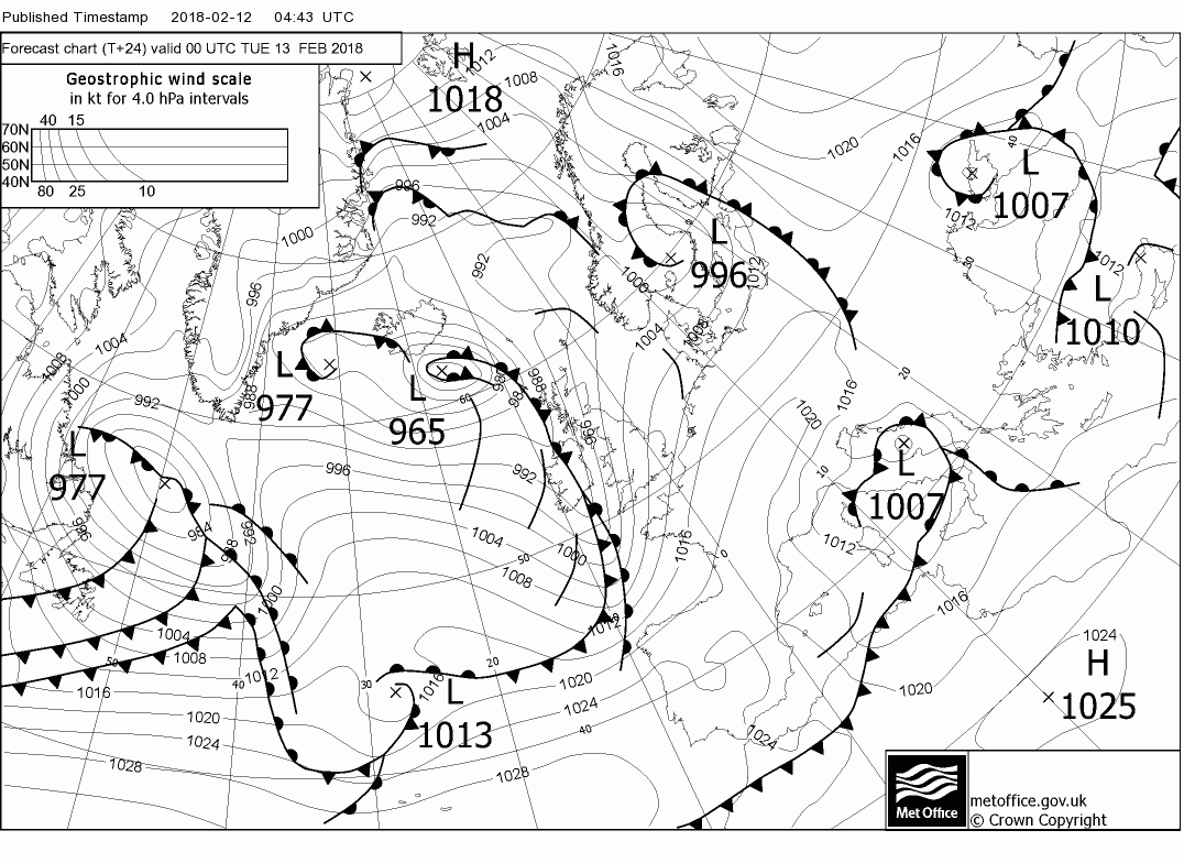
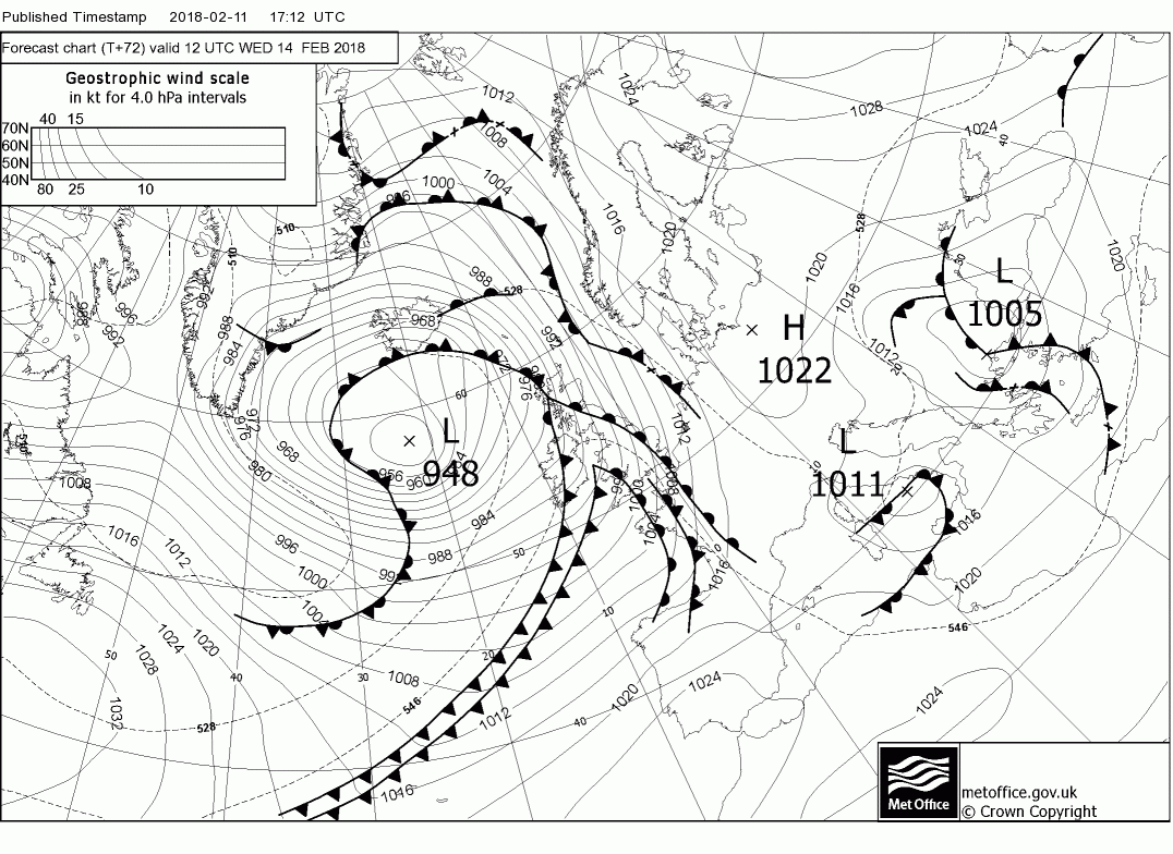
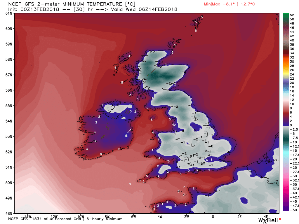
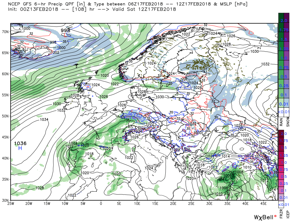
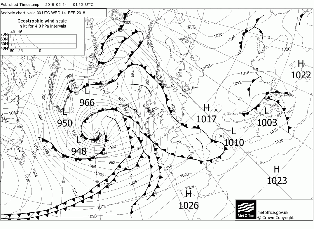
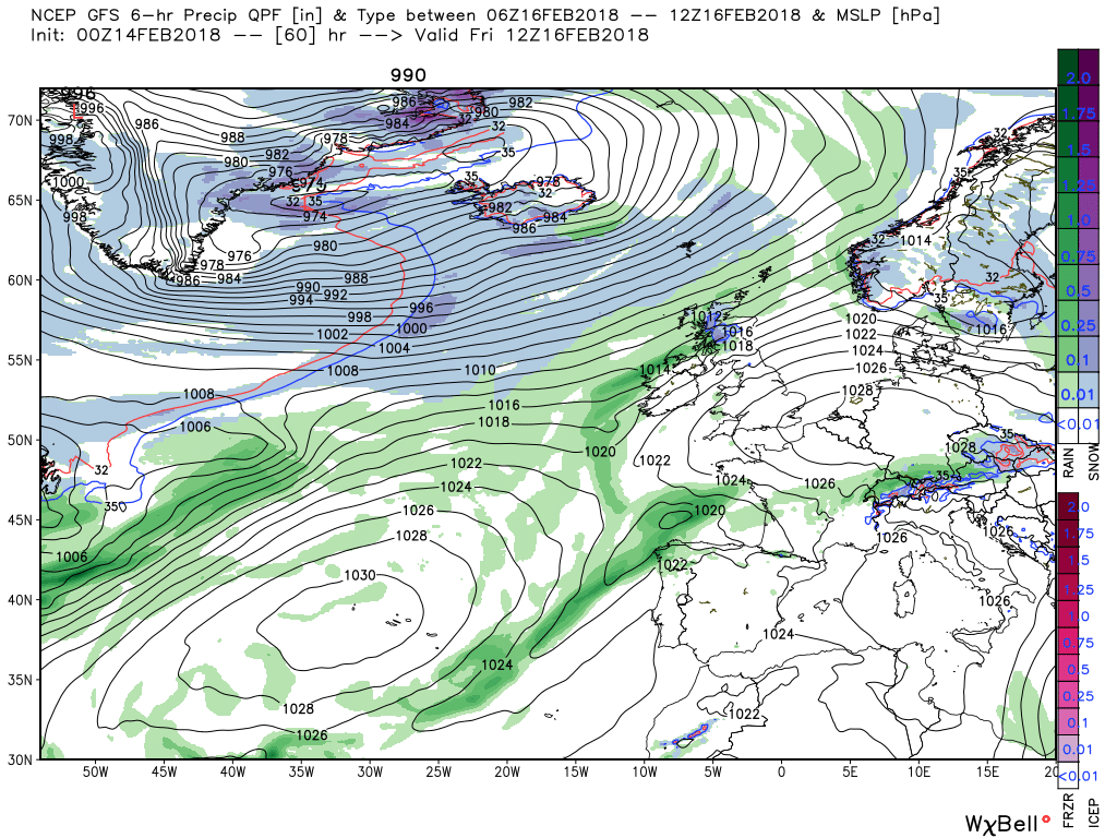
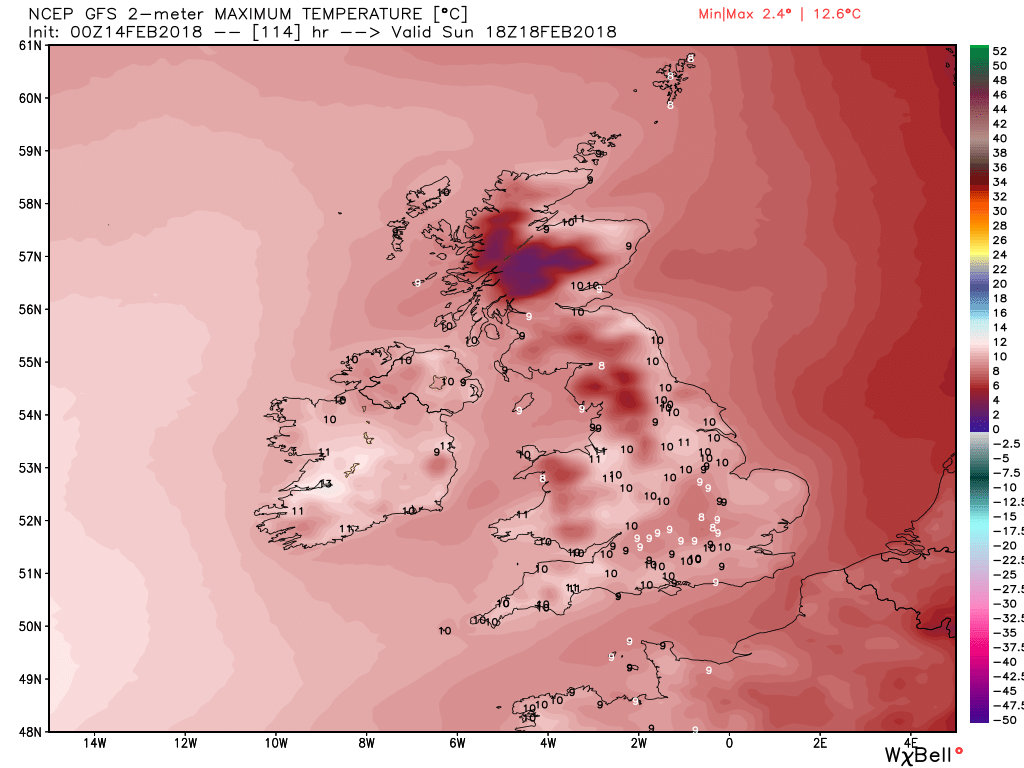
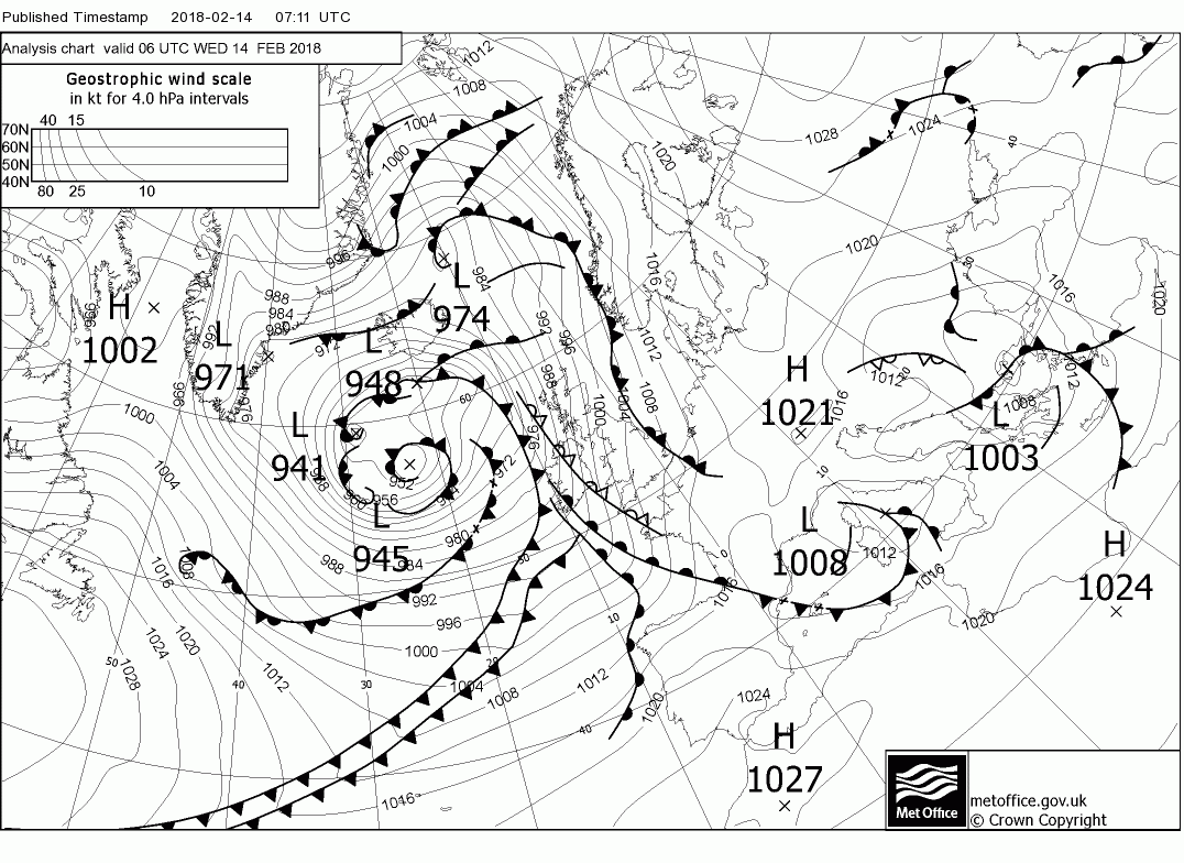
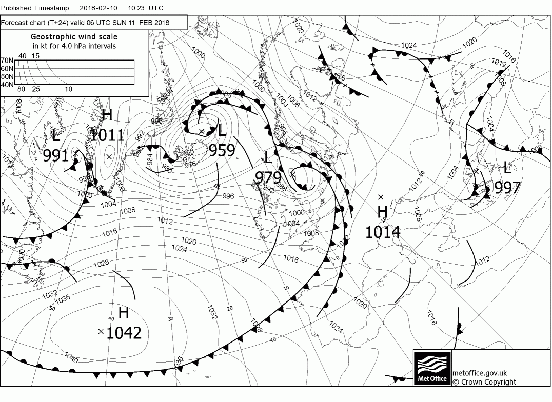
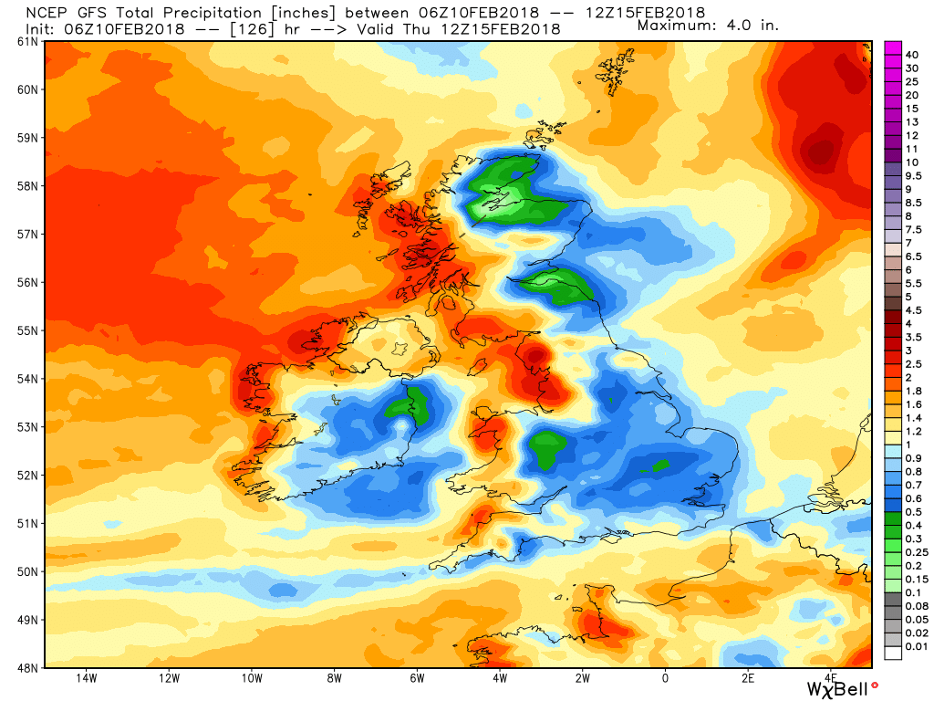
The occlusion is currently over western parts (moderate rain here) and it and the developing wave will move east during the morning bringing with it strong winds, snow sleet and rain. Fairly significant snowfall in central and southern Scotland even at low levels and perhaps down to the north of England and higher ground further south but here it will essentially be rain. A case of radar watching. behind the front still windy in the north and wintry showers, particularly in the north west but everything will die down later with a quiet night ensuing with a widespread frost by morning.

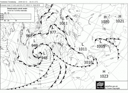

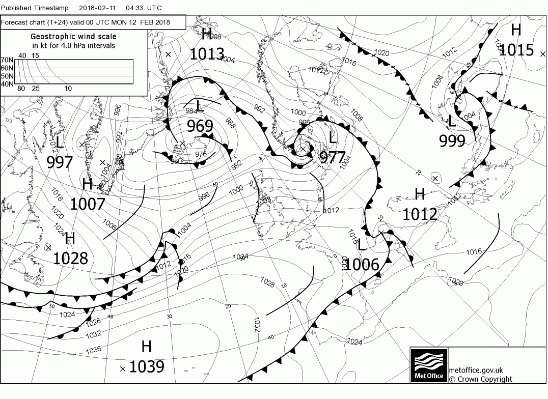
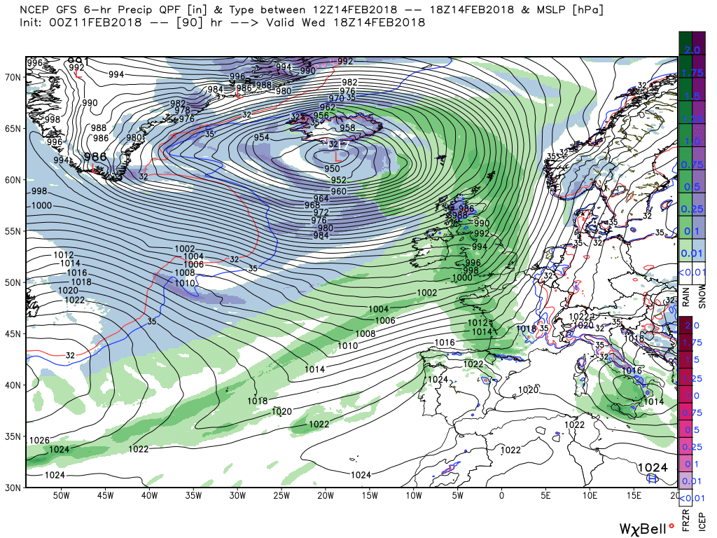
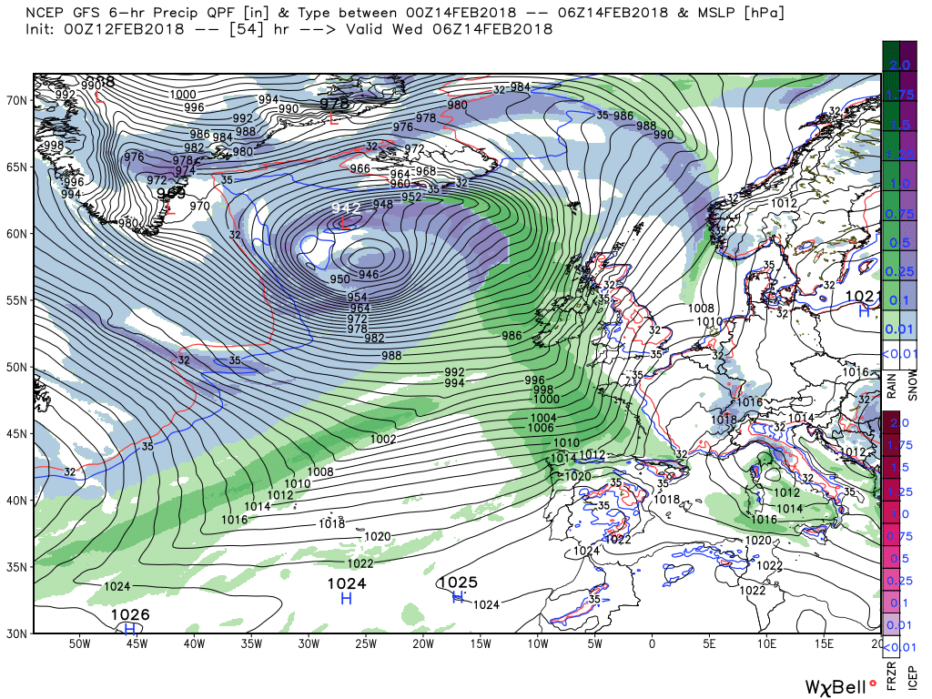
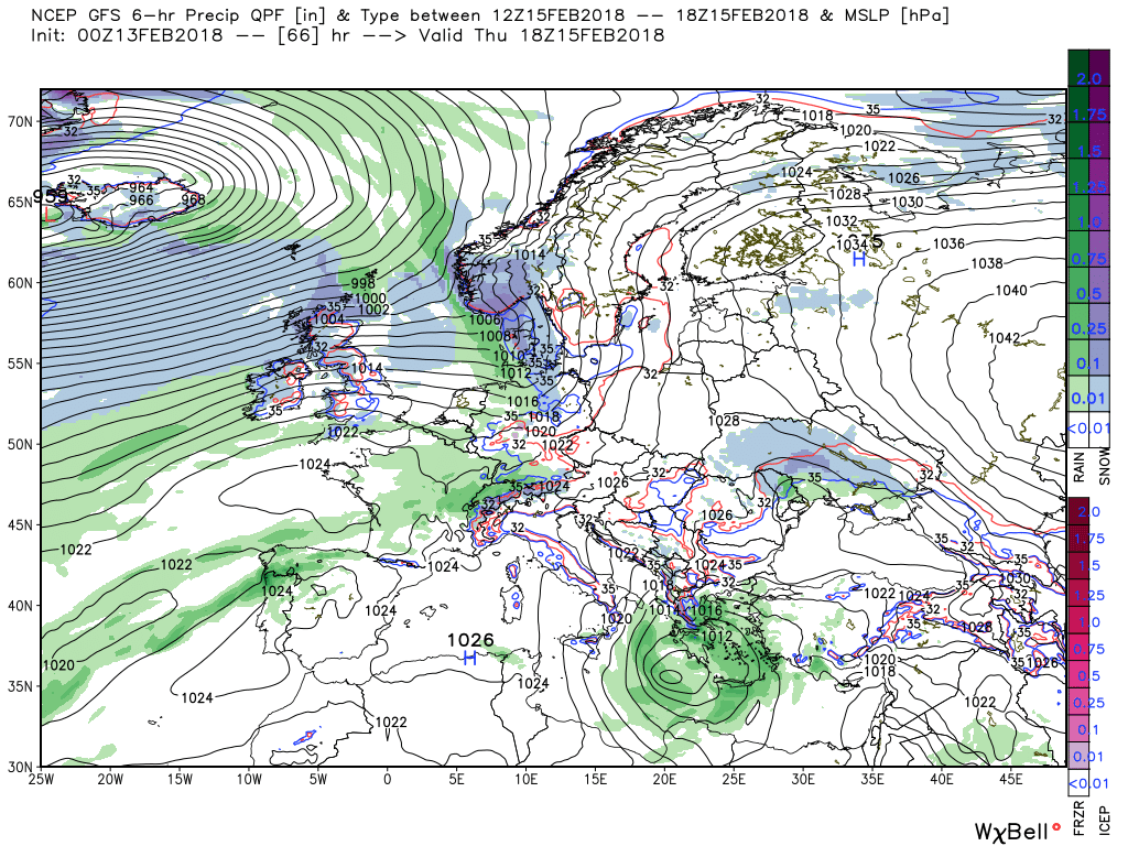
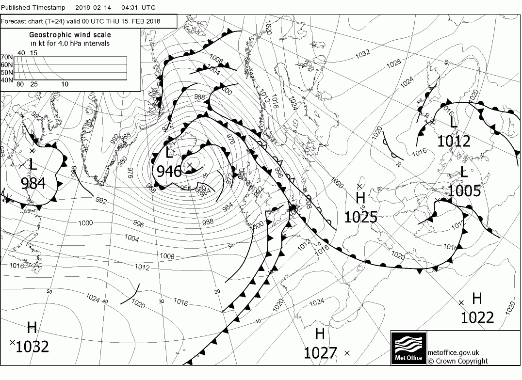
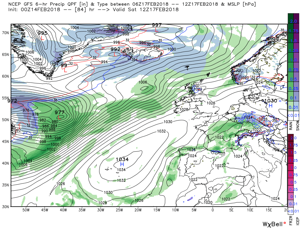
so a quiet start to Wednesday but by 1200 the next frontal system has arrived over Ireland, SW Wales and Cornwall heralding very much a replay of today with strong winds and rain, sleet and snow tracking east The snow is again likely to be in the north and favouring the higher ground but as always this doesn't rule out some further south and again probably down to radar watching


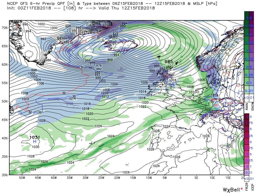
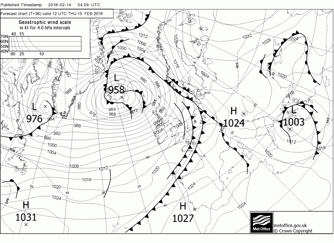
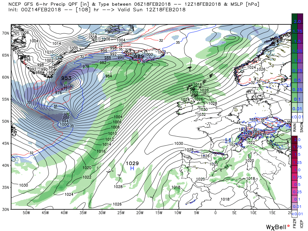
The occlusion will have cleared the east coast by 00 Thursday leaving most of the UK in a fresh, west/south west airstream with frequent wintry showers, particularly in the north but the triple point is still over east Anglia so the rain will persist in the south east for a while

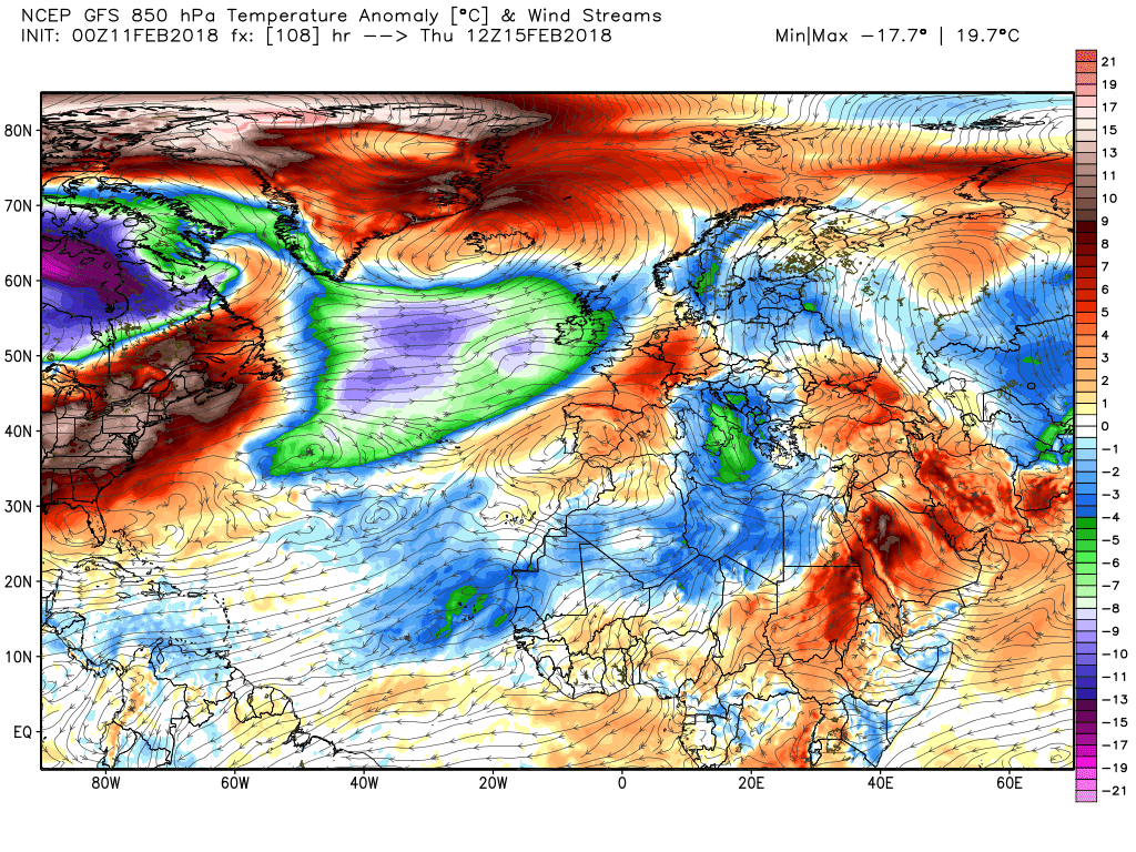
The westerly showery routine continues through Thursday and Friday but ridging in the Atlantic is becoming more influential
And by the weekend a more settled and drier regime is on the cards with temps around average albeit quite a diurnal variation.

") P.
P.