UK meteorology

I know this is lengthy, but I thought I'd post this as a currently-relevant 'lesson' post. I didn't understand the mechanism it discusses until I now read it, so this is one of those lessons where I'm passing-on something I've just learned rather than explaining something I was already familiar with. It was posted in the El Nino Southern Oscillation (ENSO) thread on Netweather in response to a question of why strong La Nina ENSO phases tend to make for zonal Atlantic flows and hence mild unsettles winter conditions in the UK:
Very well explained Chris, even I could understand that. Well done. :) P.
 
Although the weekend and early next week should be milder and fairly dry away from the far north-west, models seem to be hovering between a renewed Northerly and mild zonality beyond the middle of next week, with a powerful area of low pressure possibly moving in from the Atlantic next Friday (8th). Until the models find agreement for this period, I'm not going to post much here as I've already made confusing posts trying to keep you updated on the changes in model output.
 
I will,however, post this comment from the poster I usually quote, on the subject of the European model ensemble mean anomaly (in other words, when the ensembles are run, they produce many outputs, each with a slightly different set of initial data, and this is discussing how the areas of higher and lower geopotential heights differ from normal in an output that is the mean average of the individual ensemble members):
The EPS 7-12 mean anomaly is not significantly different to last evening.The dominate features vis downstream are still the active Canadian vortex with the cold trough down the east of N. America and the channel to the trough to our east over N. Greenland There are very strong upper winds leaving the south of the eastern seaboard which swing around some mid Atlantic ridging south of Greenland to descend from the NW over the UK. This ties in with this morning's deterministic (ECM) run which has 160kt jet south of Greenland towards the end of the run, It's difficult to see this period not being unsettled although there may well be a N/S split
 
Saw a few flakes of snow in London today.
Quite a few heavy snow showers earlier here in Norfolk, but dewpoints are increasing so showers are more rain and sleet now. Fortunately, temperatures will increase from tomorrow.

I ought to use this as an opportunity to mention that my posts on model discussion might be rather sparse for now, as I'm not sufficiently knowledgeable to be able to accurately interpret all the output, nor am I wealthy enough to subscribe to all the sites needed to view operationals, control runs, ensembles, anomalies, long-range probabilistic models, short-range high-resolution models etc., so I rely on the discussions on Netweather to guide my interpretation and enable me to view esoteric charts. Unfortunately, despite setting around 150 members on "Ignore" there, the quality of discussion is awful at present, with Moderators unable to delete posts or move them to the threads they should be in quickly enough to keep up with the rate at which these posts are made. Most posters at present seem to be idiotic snow obsessives who are posting rants that the models refuse to promise them the conditions they expect. This, in turn, is putting-off the serious posters whose analysis I use to guide my own perspective. I should, however, be able to post the daily views of the chap I usually quote in here - he's one of the few who prevents his preference (in this case for mild weather at this time of year) from clouding his analysis.
 
Last edited:
Heavy snow in York apparently none here, cold but clear.
It's mainly an east coast event, Colum, due to the northerly flow. You may see snow late next week given that the most likely outcome is that the south will be mild and wet, with the north drier and cold; where those airmasses meet, someone will probably get significant snowfall.
 
I thought I'd post this rare evening analysis of the ECM model from my usual contact:
According to this evening's ecm by Monday midday the High cell to our west is coming under increasing pressure from the usual sources, the Canadian vortex lobe and the eastern seaboard and is being realigned, albeit the UK remains in the north westerly airstream,

By T120 This battle between the upstream forces and the high pressure results in very complex trough in mid Atlantic at the interface with various surface low pressure centers with the main two being phased together west of Ireland and over Iceland whilst the high cell is still in situ adjacent to the UK

The complex low pressure to the NW does eventually get more organised (more or less) and by Thursday 00 is centred over Iceland with a strong WNW flow south of Greenland east pushing fronts south east across north west UK as the high pressure is eventually worn down.

From this point we see once again a resurgence of the Bermuda high pressure courtesy of the plunging cold trough in eastern N. America which results in a very strong thermal gradient across southern Greenland, a 170kt jet, and a very strong north westerly over the UK bringing rain and gales.

A good place to leave it.
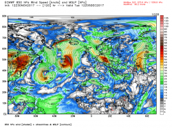


A summation of the temp contour and anomaly and as I type I can hear the strains of, The Hills are Alive to the Sound of Music, emanating from the country park.
 
Well, although we were around 2C most of the daylight hours and the temp dropped dramatically as soon as it darkened we've avoided snowfall here on the west coast, apart from our nearby crags and munroes. On the other hand, it didn't rain today or yesterday, which is always a result !

JohnnyO. o/
 
It's mainly an east coast event, Colum, due to the northerly flow. You may see snow late next week given that the most likely outcome is that the south will be mild and wet, with the north drier and cold; where those airmasses meet, someone will probably get significant snowfall.
I can live with mild and wet, normal for down here! P.
 
Back
Top Bottom