UK meteorology

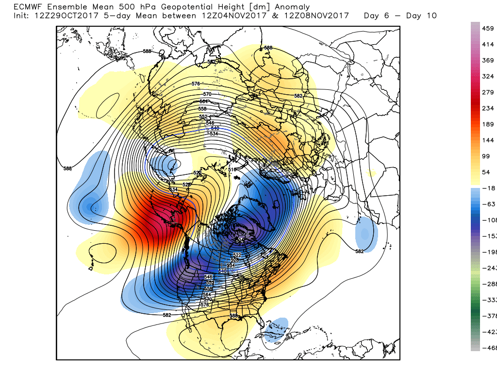
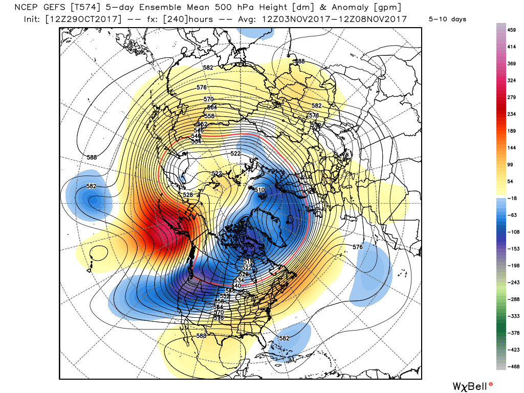
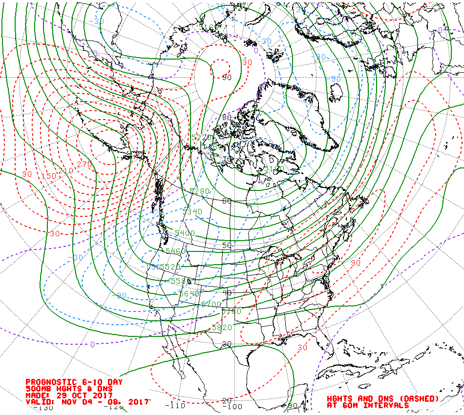
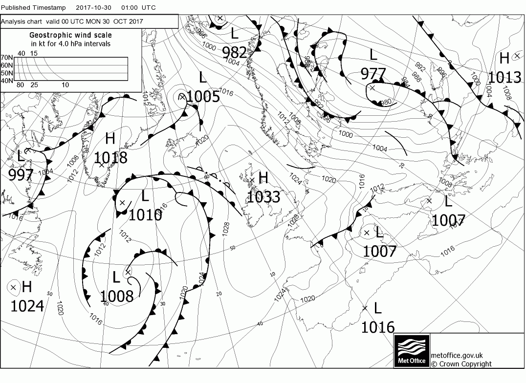
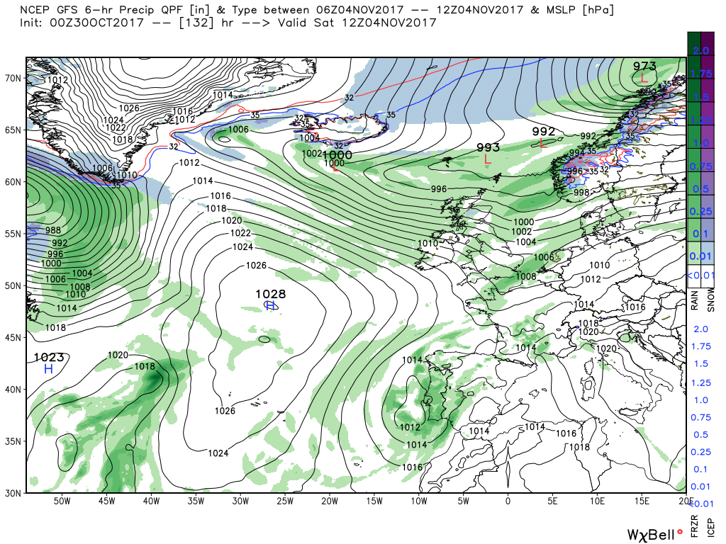
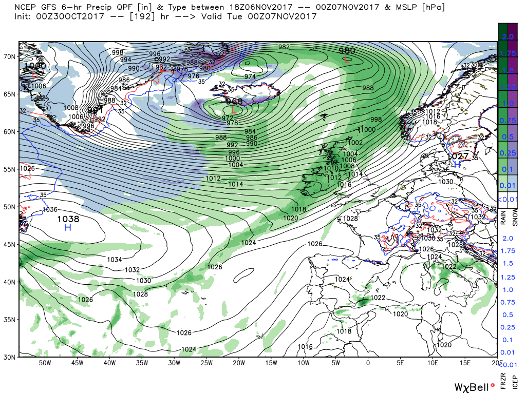
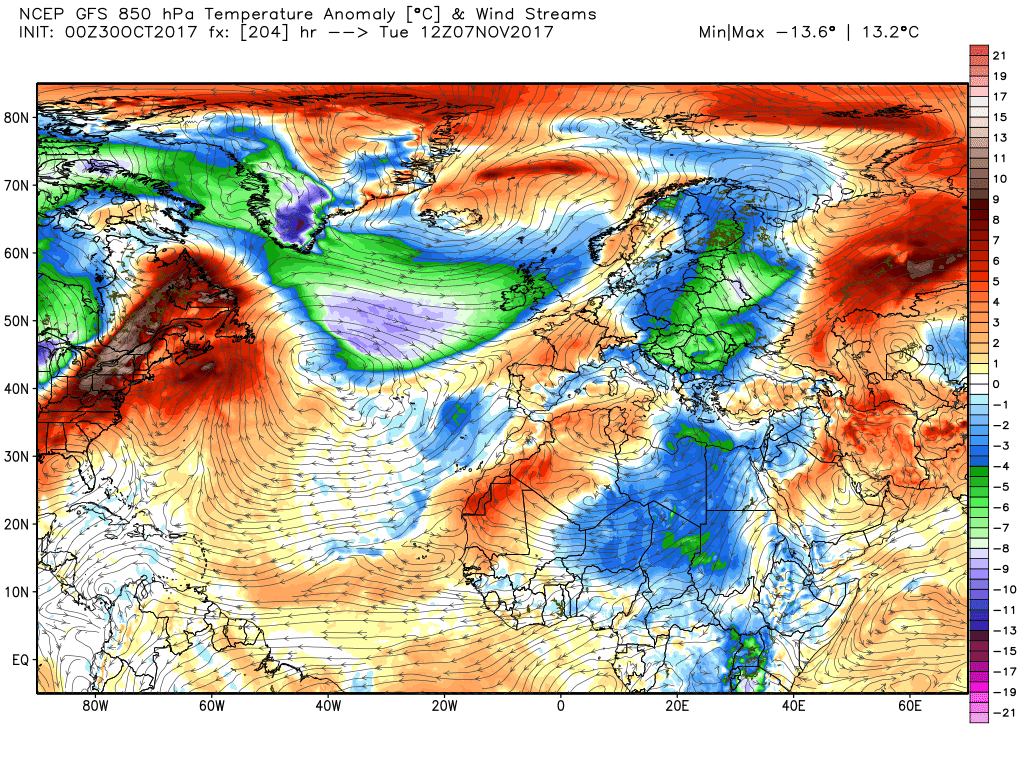
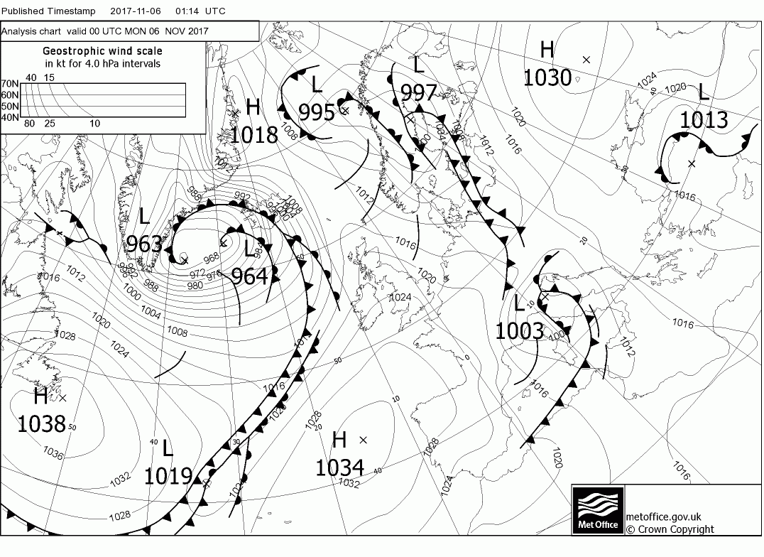
I think it's likely to alternate between mild-ish conditions (12-14 C for your area, or around average) and cooler than average (possibly 8-10 C in Cornwall), though, as always, accuracy after 4-5 days is never certain.
As soon as the temp reaches 10 C or below (wind chill to be taken into consideration ) my long Swandri smock comes out and I'm as snug as a bug :) happy days!
 
Another model summary from the Netweather model discussion thread (don't worry about not being able to understand the charts as yet, I'm leaving them in purely because I can't be bothered to delete them):
Nothing in last night's anomalies would suggest anything other than changeable/unsettled weather in the 5-14 day period with temps dipping a tad below normal quite likely.

The overall pattern remains the same as previous with an Aleutian ridge, A lively vortex lobe N. Canada with associated positively tilted trough down N. America and, importantly as far as are are concerned, another low pressure area east/ south east over Greenland/Iceland. Thus a strong westerly upper flow across the US and the Atlantic,possibly alleviated to some extent in the east as the trough to the south west may have some influence in the south. Of course as ever the detain will need to be sorted by the det. runs and this surely will not preclude a the odd wintry spell as systems track east, particularly in the north.


With high pressure moving in today and tomorrow it will be dry and quite sunny in albeit after a frosty start in many places this morning. But this doesn't apply to N. Ireland, Scotland and perhaps the far north of England as cloud will increase later this morning and this will hang around through the day and tomorrow accompanied by patchy rain later. And perhaps also becoming a little windy


By midday Thursday the major trough to the north has slipped south east into the Baltic States leaving the UK in a ridge of high pressure sandwiched between the troughs to the north west tracking east and the cut off low to our south west with the strong thermal gradient running between Iceland and Scotland. But over the next 48 hours, as the trough to the NW tracks east to be north east of Scotland the ridge is forced to retreat south west as weak fronts cross the country south east in the ensuing north westerly flow.


The trough continues on it's journey east and the surface wind veers northerly over the UK as a transient ridge moves in from the west over Sunday.Monday (giving ideal conditions for bonfire night) before a deep low tracks just south of Iceland 968mb with it's associated fronts already impacting N. Ireland and Scotland bringing rain and gales for many areas. And with the jet pushed further south an example of Pm air sweeping across the country perhaps bringing the a spell of the aforementioned quite wintry conditions.


Best left there but again it's worth noting that much of the UK remains very dry throughout this period the exception again being western Scotland and parts of NW England.
 
Liam Dutton has been fairly quiet of recent, but I thought I'd post the following video which is quite interesting both for those who like snow and those who'd prefer to never experience it again:
I like the snow but that's probably because I get to see so little of it down here in Cornwall, when it does fall it's quite an event! :) P.
 
Netweather's chief forecaster has produced a blog post giving initial thoughts on winter prospects:
https://www.netweather.tv/weather-f...-20172018---a-colder-winter-than-recent-years
What's worth bearing in mind is that not only has it taken until early November for him to want to produce such a blog post, but also, even now, it's only a general early indication of the most likely trend. Details are still impossible to predict at this point, and any so-called forecaster who produced a winter forecast a few weeks ago, particularly a detailed one, is, in my opinion, making rather too much of pretty vague early patterns and indications. Such a forecast is likely to be very unreliable and detail (for example, predicting a cold spell in early January or a wet and windy period over Christmas) is probably not worth paying attention to, despite the apparent confidence of certain people who are quoted in the popular press.
I think it's safe to say I won't be topping up my tan on the beach in January but that's as far as it goes! :) P.
 
I think it's safe to say I won't be topping up my tan on the beach in January but that's as far as it goes! :) P.
I think that's a better synopsis than you'll get from several newspapers!:D As a matter of personal opinion, I suspect that much of the UK will see a moderate, average winter, but, after a sequence of mild and/or stormy winters, even average might seem rather cold.
 
I think that's a better synopsis than you'll get from several newspapers!:D As a matter of personal opinion, I suspect that much of the UK will see a moderate, average winter, but, after a sequence of mild and/or stormy winters, even average might seem rather cold.
I shouldn't moan but it's been awhile since we have had a really cold winter down here and the summers haven't been all that, it seems like we have just two seasons now, spring and autum. The weather has changed somewhat over the years.
 
Latest post from the knowledgeable Netweather member on what the models are showing for the week ahead:
Today and tomorrow.

Broadly speaking you can divide Britain south of the Borders down the middle into west and east. All will start fine and bright with frost in many places but the west will quite quickly cloud over as fronts approach from the north west. This process will be a tad quicker in N. Ireland. Scotland will also start clear with temps as low as -6C in places but rain will quickly move, heavy at times, and becoming quite windy. Overnight and Tuesday the front(s) will track SE bringing rain to all then a clearance and a showery W/NW behind.


a quick run through of this morning's ecm

Wednesday sees a low track east south of Iceland bringing rain and quite strong westerlies to Scotland whilst a ridge encroaches NE further south This attempts to consolidate but by 00 Friday a frontal system with associated waves orientated SW>NE has tracked around the HP to the south west and is already impacting north west Scotland. This sees the start of renewed amplification of the Azores to the west resulting in the front tracking south , with sporadic rain, over the UK in the next 24 hours

With the amplification continuing apace 48 hours later, 00 Monday, there is a broad trough area to the east from N. Scandinavia to N. Africa (with the colder air well into the latter) and the Azores ridging well north just to the west of the UK. Thus the latter in a cool, showery (wintry in the north) northerly airstream

From this point normal service is resumed with the eastward tracking energy suppressing the ridge with fronts impacting the north west early Tuesday.
 
Back
Top Bottom