OP
- Messages
- 6,299
- Location
- Norfolk, England
- Thread Starter
- #913
It's all those tears he weeps when you tell him how nice the weather is in civilised places.


It's all those tears he weeps when you tell him how nice the weather is in civilised places.
Has it been that much wetter this year than normal, Johnny?
Anyway, it seems that Dutton has stopped doing forecast videos, but he has done a short video on the likely effect of a weak La Nina this winter. This is a subject that has been considered at length on the Netweather forum, and the opinion there is pretty much as Dutton suggests:
It's all those tears he weeps when you tell him how nice the weather is in civilised places.
It's a very dry Gothic novel though...Says the guy who lives in a place Mrs Radcliffe wrote a gothic horror novel about !
JohnnyO. o/
and windy conditions in Scotland.Just an FYI for Johnny; there's a chance that midweek could see very wet
I think details of the exact southern extent of the stormy and wet area are uncertain, but he could be. By "dangerously stormy"I wasn't thinking once-in-a-lifetime, but it could be risky in terms of trees being uprooted etc.Am I right in thinking that @JohnnyO is in the " dangerously stormy with copious rainfall " area of the country?
Am I right in
thinking that @JohnnyO is in the " dangerously stormy with copious rainfall " area of the country?
Bit like mine then, I'm halfway up the side of Wharfedale with a hill in front to help funnel the wind, clearing branches off the lane is an occupational hazard.
It's frosty and sunny here as well, Colum. Make the most of it, however, as here's the model discussion from the usual Netweather chap I quote:Nesh this morning, frosty fields and brilliant sunshine.
The front that was hanging around in southern parts yesterday has cleared away and today will be fine and quite chilly in most of the UK after a frosty start.The exception will be the west and north of Scotland which is still under the influence of the low to the north which is tracking east to the Norwegian basin, Here gales, perhaps severe, will persist with squally showers of snow on the higher ground. Tonight similar that the winds and showers will abate and become far less frequent whilst cloud will move in from the west in the south of England
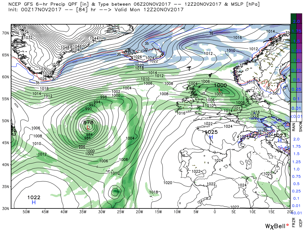
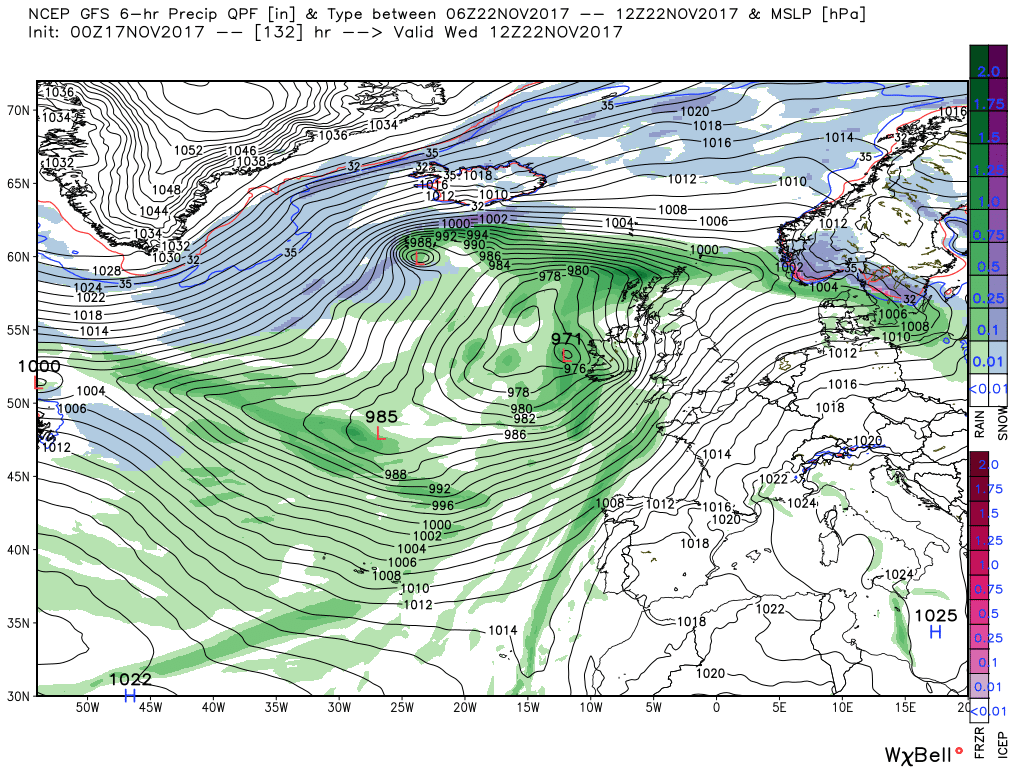
So to this morning's gfs. Saturday a quiet day under the ridge but some cloud and rain in the south and Sunday much of the same but by 18 a surface low that has broke away from the main upper trough in the western Atlantic and is 994mn south of Iceland with the associated front and rain just impacting north west Scotland From this point it runs quickly easy across Scotland, where it could well dump some snow on the high ground, and by 12 Monday is in the North Sea.
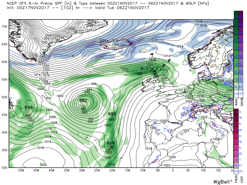
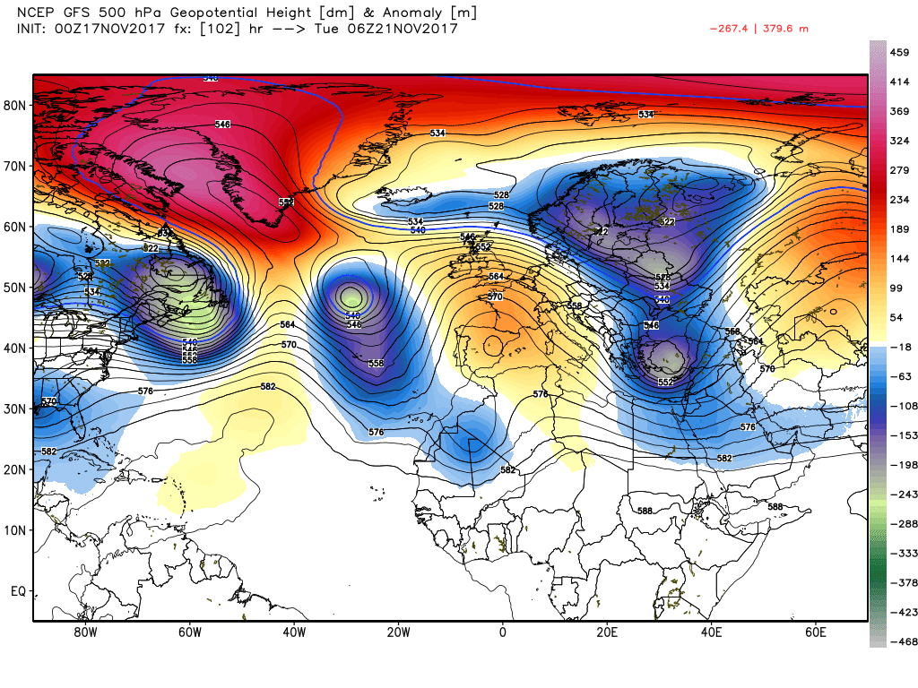
Meanwhile another frontal disturbance has formed in the main trough to the west and has tracked quickly east to impact Scotland by 06 Tuesday whilst at the same time a trough has slipped south east of Greenland to join the fray dragging down the colder air with it. Worth a closer look I feel as it illustrates quite well I feel the energy flows (that i previously wittered about vis the anomalies) and the sharp delineation between the cold/warm air.
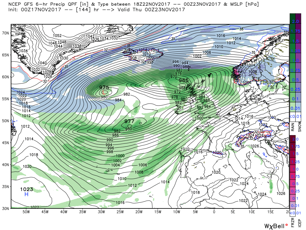
The shallow low moves quickly east whilst the main trough to the west moves in a similar direction and by 12 Wednesday there is a complex area of low pressure just to the west of the UK and more fronts have pushes NE into Scotland There is a lot going on in this main trough including some fairly rapid cyclogenesis and 12 hours later an intense low 965mb is adjacent to the Hebrides with the UK in a strong, squally, south westerly airstream with gales in the west and possible severe gales in Scotland and N. Ireland. It follows from this that the colder air to the north has made no further ingress south with the energy flow from the eastern seaboard east having the upper hand.
There is absolutely no point in going into further detail from this point as a) it is obviously subject to change and b) there are too many little lows floating about. Suffice it to say the intense low clears quickly east leaving the complex area in situ to the west with more fronts encroaching on Friday. So in summation. Becoming very unsettled next week with gales, perhaps severe, and some wintry weather in Scotland.
The ecm is still tracking the front on Monday a tad further south, Liverpool to the Wash at 06, so still the possibility of snow along the northern edge over high ground I would have thought. After that a front and strong winds impact the north west late Tuesday leading to a very grotty 24-36 hours as an intense low crosses the UK bringing heavy rain and severe gales in places This clears to the north east by 12 Thursday leaving, surprise, surprise, a complex area of low pressure to the W/SW although the colder air has moved closer